Go West Again! The Sacramento Valley and California’s North Coast
Freedom Voyages — Life in the United States
June 25, 2021
Hello everyone and welcome to another Freedom Voyage! These trips give me the chance to see the country — its landscapes, its small towns, its cities, and its courthouses. Along the way I take and share photos of what I see and what I eat — and whatever I’m thinking.
Although I visited California just last month (the link to that travel log is here), once again the weather forecast for northern California was just too good to be ignored. No road trip through Utah and Nevada this time — instead I decided to expend some of the gobs of airline miles I’ve saved up these fast few years while staying home and working.
Want to live out a Freedom Voyage vicariously? Here’s a photo log of the eight days of clear skies and cool temps spent in the Sacramento Valley and along some of California’s north coast. Nothing better than sunshine and a road trip! Enjoy!
Saturday, June 5, 2021. Day 1: Colorado Springs to Sacramento, California
My free travel took off from Colorado Springs airport around noon, connected in Denver, and arrived in Sacramento in the early evening. I watched from my window seat as the plane flew north from Denver all the way past Cheyenne, Wyoming before turning west, just to avoid some thunderstorms over Colorado’s Front Range. Nice views of the mountains near Elko, Nevada, and of Lake Tahoe further west.
Sunday, June 6, 2021. Day 2: Sacramento to Placerville, California
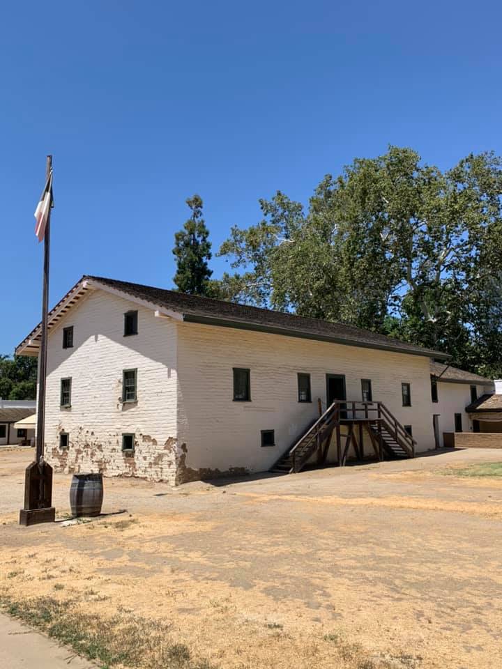
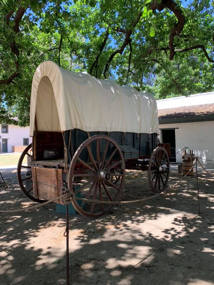
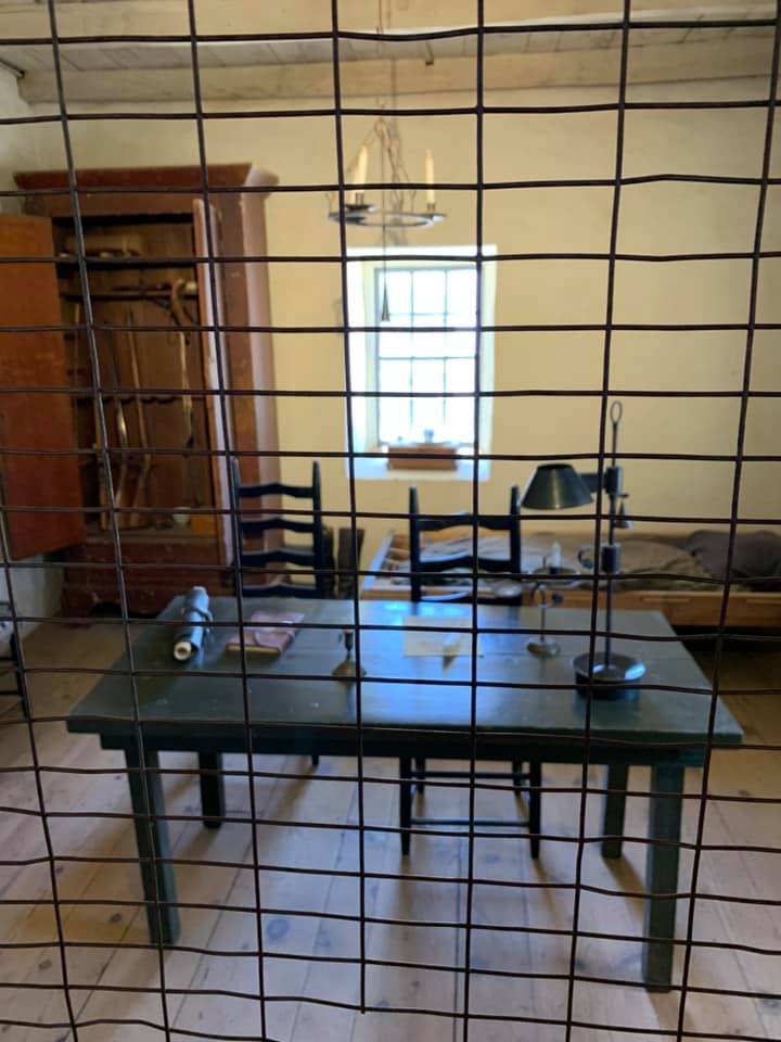
After church and Sunday breakfast at Brookfield’s (okay, it was more like lunch), I drove downtown to visit Sutter’s Fort. Although I’ve been to Sacramento many times I felt guilty about never having stopped at this truly historic place — a locus of history visited by Generals John C. Fremont and William Tecumseh Sherman, a homing beacon for California’s pioneer emigrants, and a gathering spot for its 49er gold-seekers.

Sutter’s Fort was built between 1841 and 1843 by Swiss emigrant John Sutter (born Johann August Sutter). Sutter built this Alta California outpost in the hope that it would become the cornerstone of New Helvetia (or New Switzerland), Sutter’s empire in the New World. His efforts might be said to have become the centerpiece of a new empire, but it wouldn’t be Swiss.
This is the central building within the fort and one of the few parts of the original structure that remain.
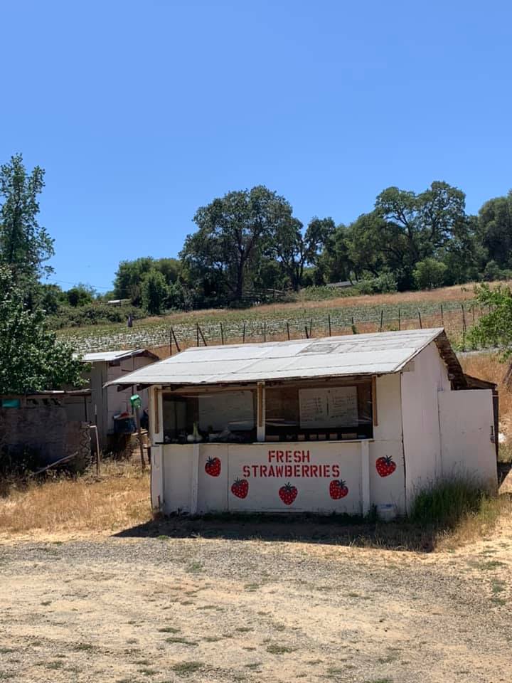
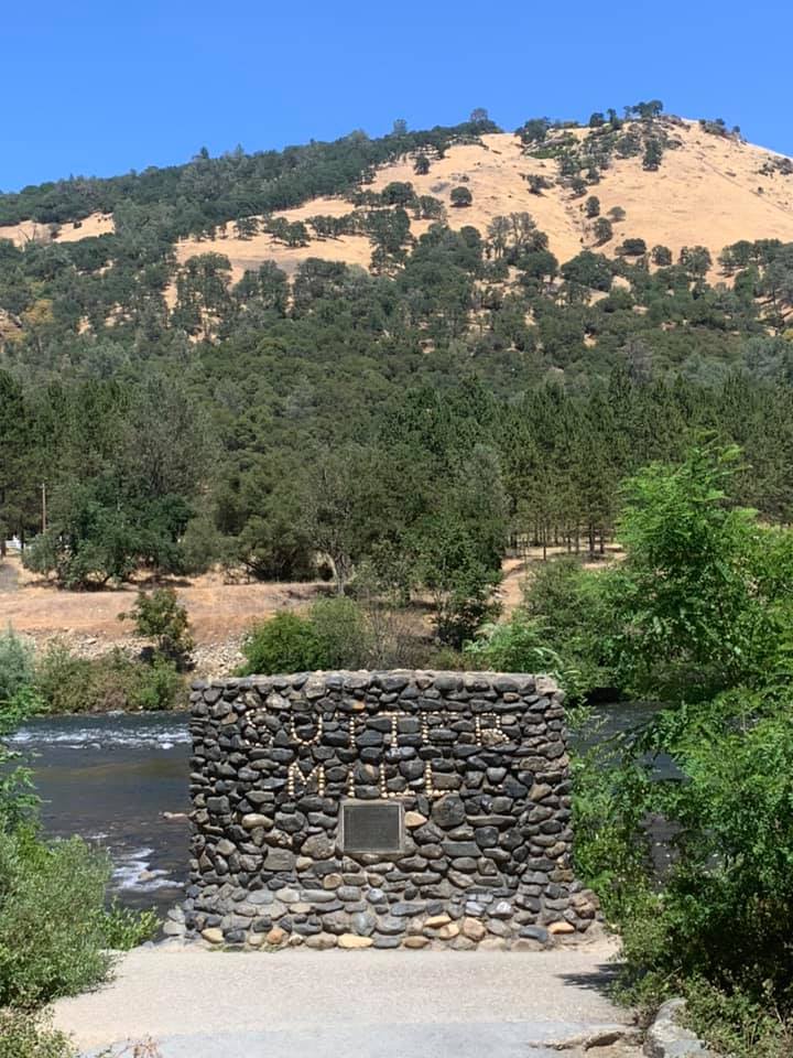
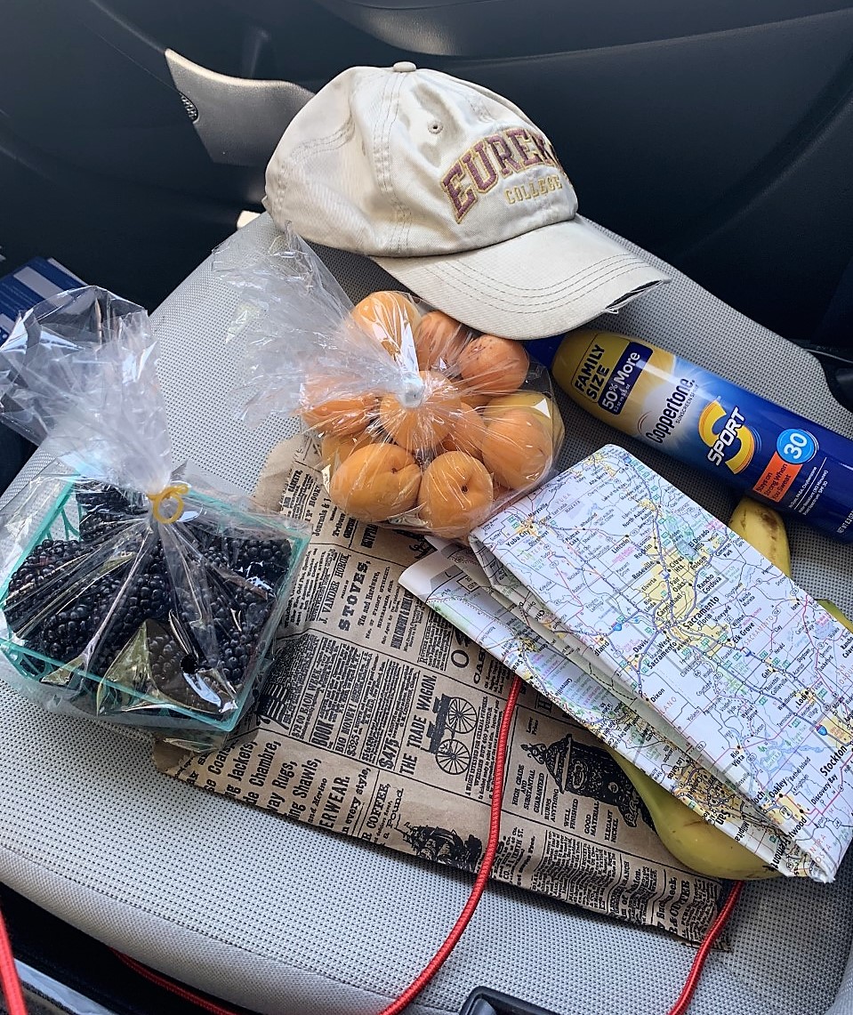
After visiting Sutter’s Fort I was off into the foothills to see Sutter’s Mill in Coloma, famous for being the site of the discovery of gold in 1848, leading to the famous California Gold Rush. But first, taking all the back roads on a beautiful summer’s day, I stopped for some blackberries at a strawberry stand:
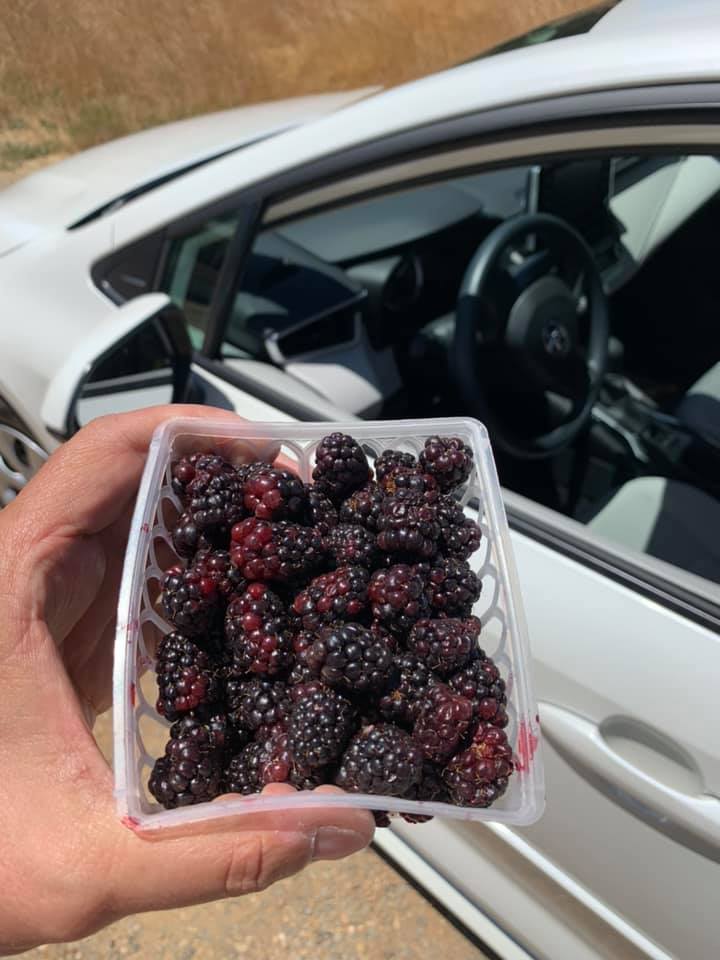
I paid four bucks for the pint of blackberries, and so I’m somehow reminded of that scene from the Field of Dreams movie: “they’ll pay $20, Ray, and they’ll hand it over without even thinking about it, for it’s money they have but peace they lack.“ I found the movie clip on YouTube (link here). I wasted a good half hour eating those berries and taking photos of the area, and it was time well-wasted.
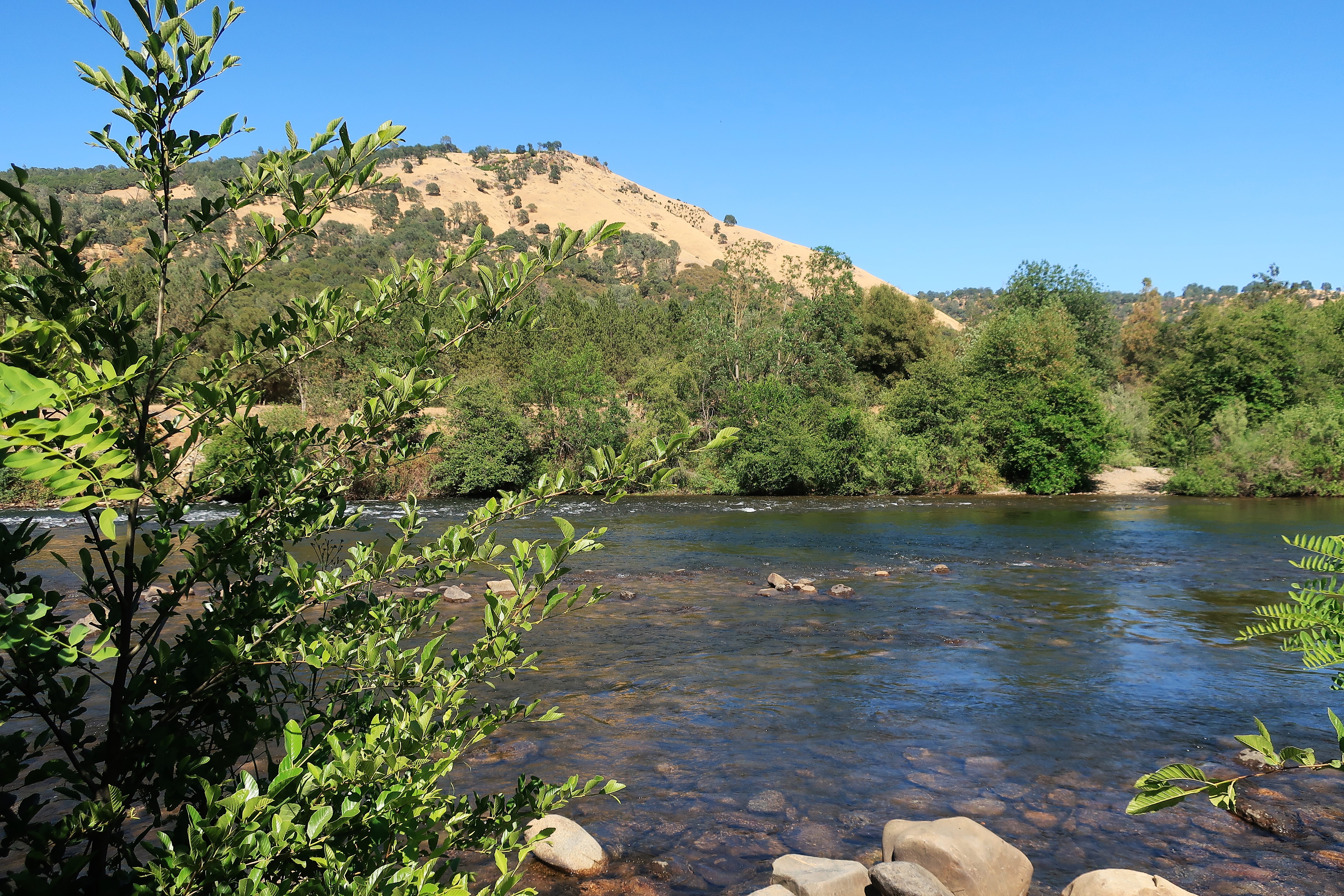
I’ve long thought that California’s gold country was some of the prettiest country in the world. Here’s proof:

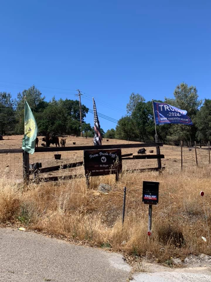
I found several old Trump signs on my way through those hills to Coloma. The green flag on the left is for the proposed new State of Jefferson, to be made up of breakaway counties in northern California and southern Oregon that are disgusted with their state governments.
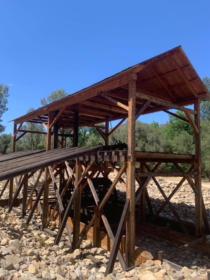
This is Sutter’s Mill, built by carpenter James Wilson Marshall who accidentally discovered gold here in January 1848. The mill was a sawmill, meant to provide timber for sale and use at Sutter’s Fort. Marshall and his boss, John Sutter, tried to keep the gold discovery a secret but they failed. The aura of California as the “Golden State” started here.
This is an example of the kind of landscape which I find so attractive in California’s Sierra foothills. The gold hillside grasses provide a perfect contrast to the sporadic green of the oak trees. The human eye appreciates contrast — a bright red tie with a dark gray suit for example. These hills would be less attractive if they were monochromatic tree-covered hillsides.

The Sutter’s Mill site is only a short distance from Placerville, California, where I had dinner and spent the night. Here’s carne asada & tortilla soup to complement a margarita and chips at Cascada Restaurant and Cantina, Main Street, Placerville. You just hafta love a Mexican restaurant that brings you three types of salsa with your chips (actually two types of salsa and one bean dip.)

Every Mexican dinner should include Kahlua flan for dessert, right?

Monday, June 7, 2021. Day 3: Placerville to Redding, California
Here’s a monument in a Main Street Placerville traffic circle. It’s pretty rare to find a monument to Druids in America. Good Monday morning from Northern California.


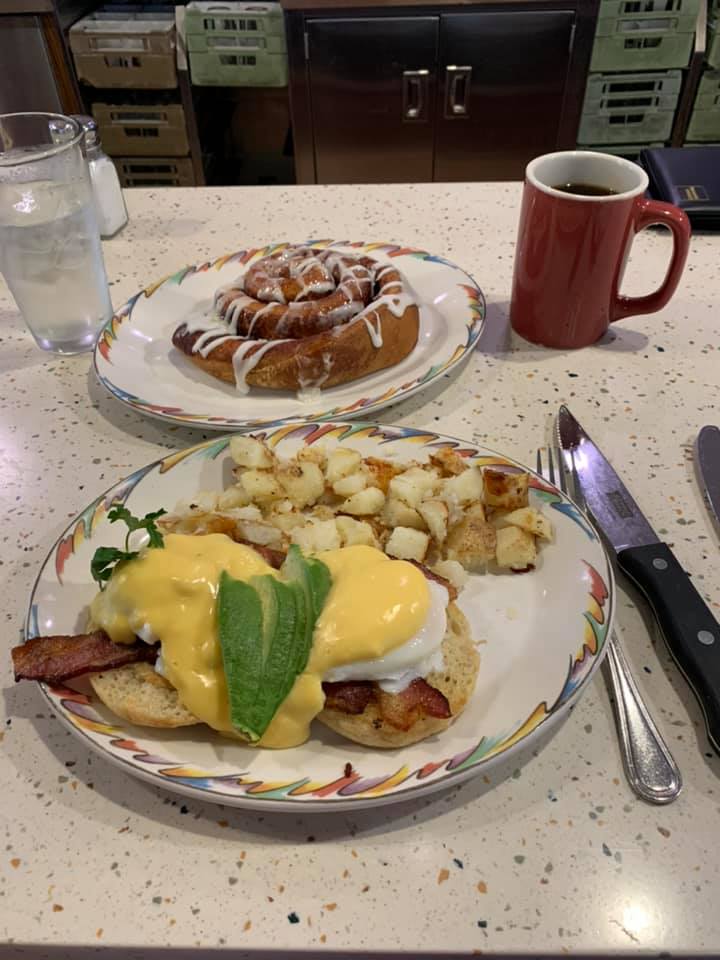
I tried breakfast at Sweetie Pies Restaurant and Bakery on Main Street, Placerville. I checked the menu for odd and unusual items and settled on the spinach & bacon scramble covered in Parmesan cheese with a side of cheese blintzes covered in blueberries and olallieberries. (I had to look up “olallieberry” in the dictionary. It’s like a blackberry. And it’s good.)
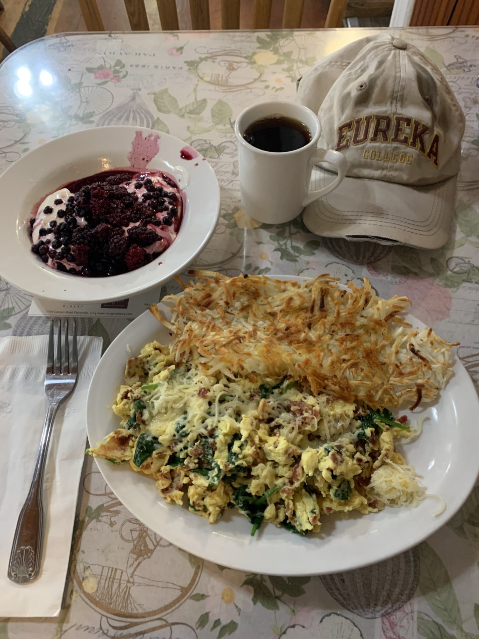
Between dinner the night before and this breakfast this morning — Placerville is a big win.
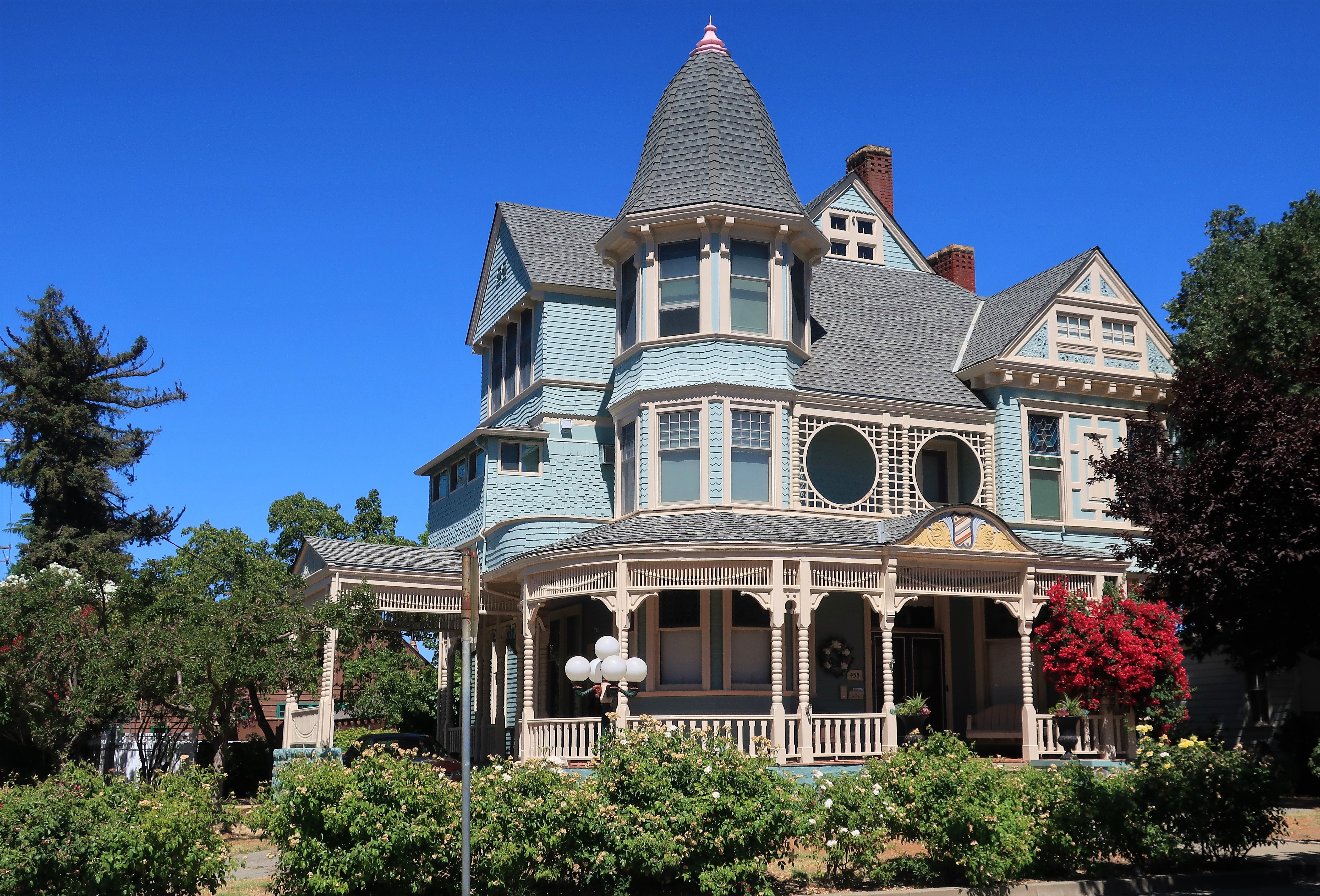
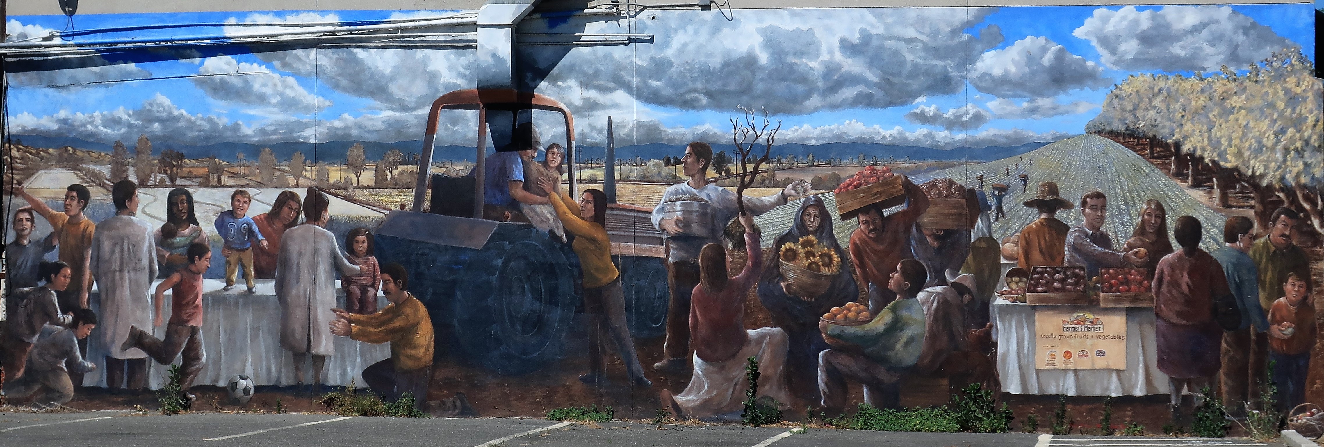
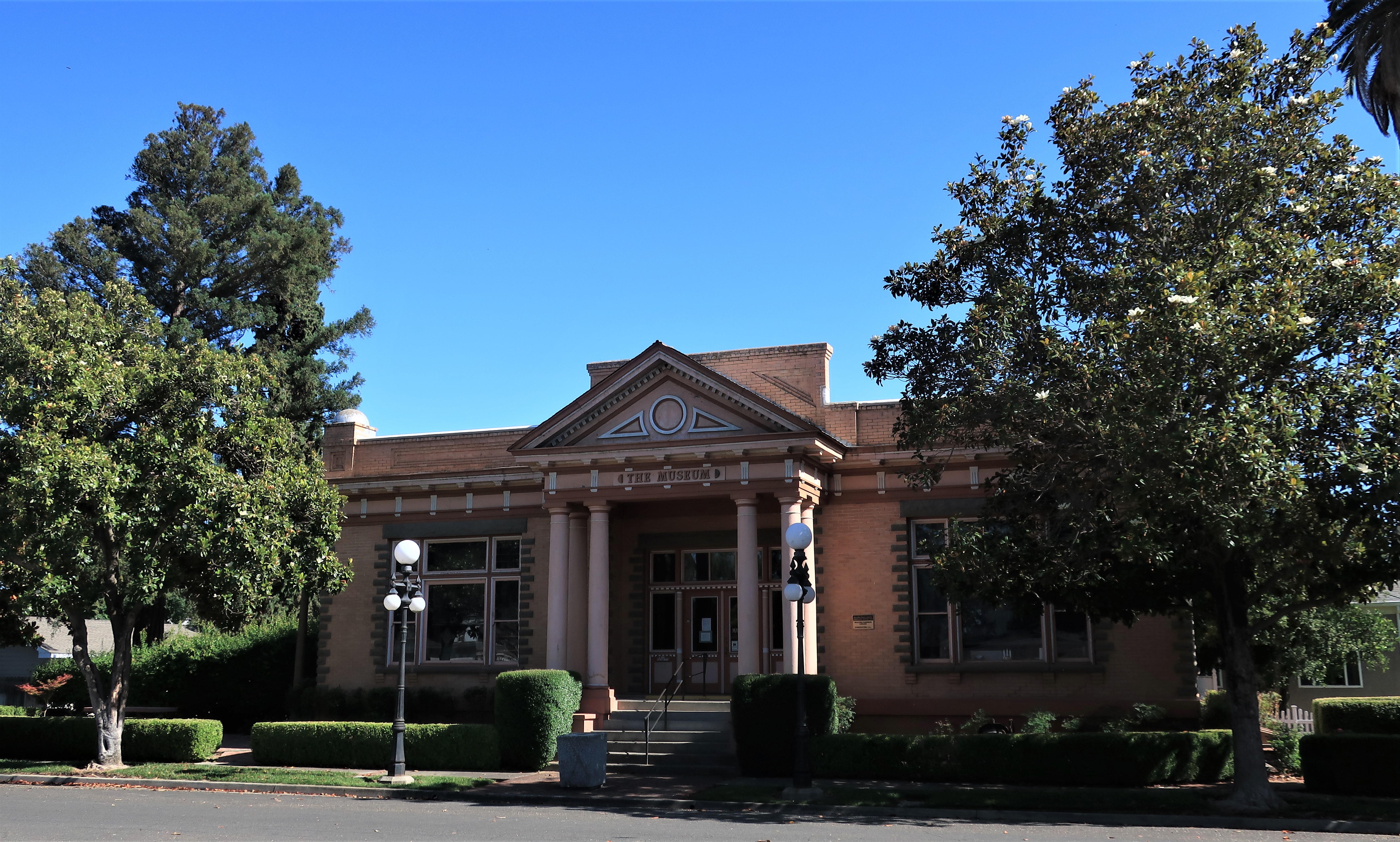
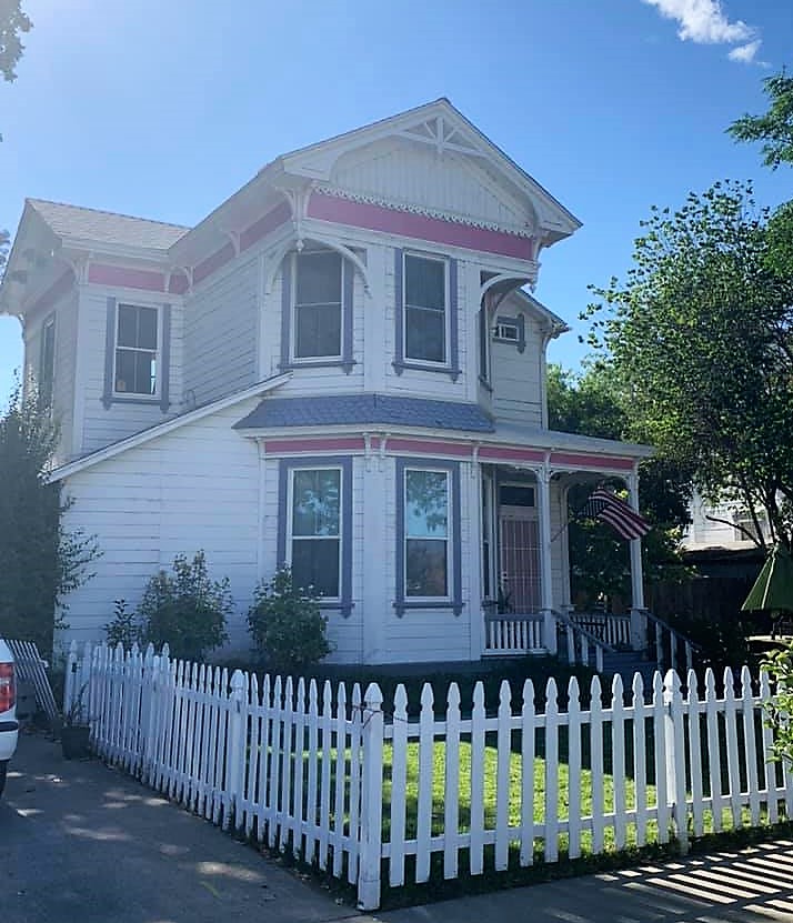
On to Woodland, California, the county seat of Yolo County. Woodland is a farming town but influenced by the nearby UC Davis campus.
Below: A Victorian house off Main Street, the Yolo County Courthouse, and a street mural in downtown Woodland.

I’m back on the road heading northeast. Here are the Sutter Buttes — an island of mountains rising up from the middle of the Sacramento Valley. Some call them the “world’s smallest mountain range.” A set of Titan I missile silos was installed here in the early 1960s; they’ve since been decommissioned and the land sold back to private ownership.
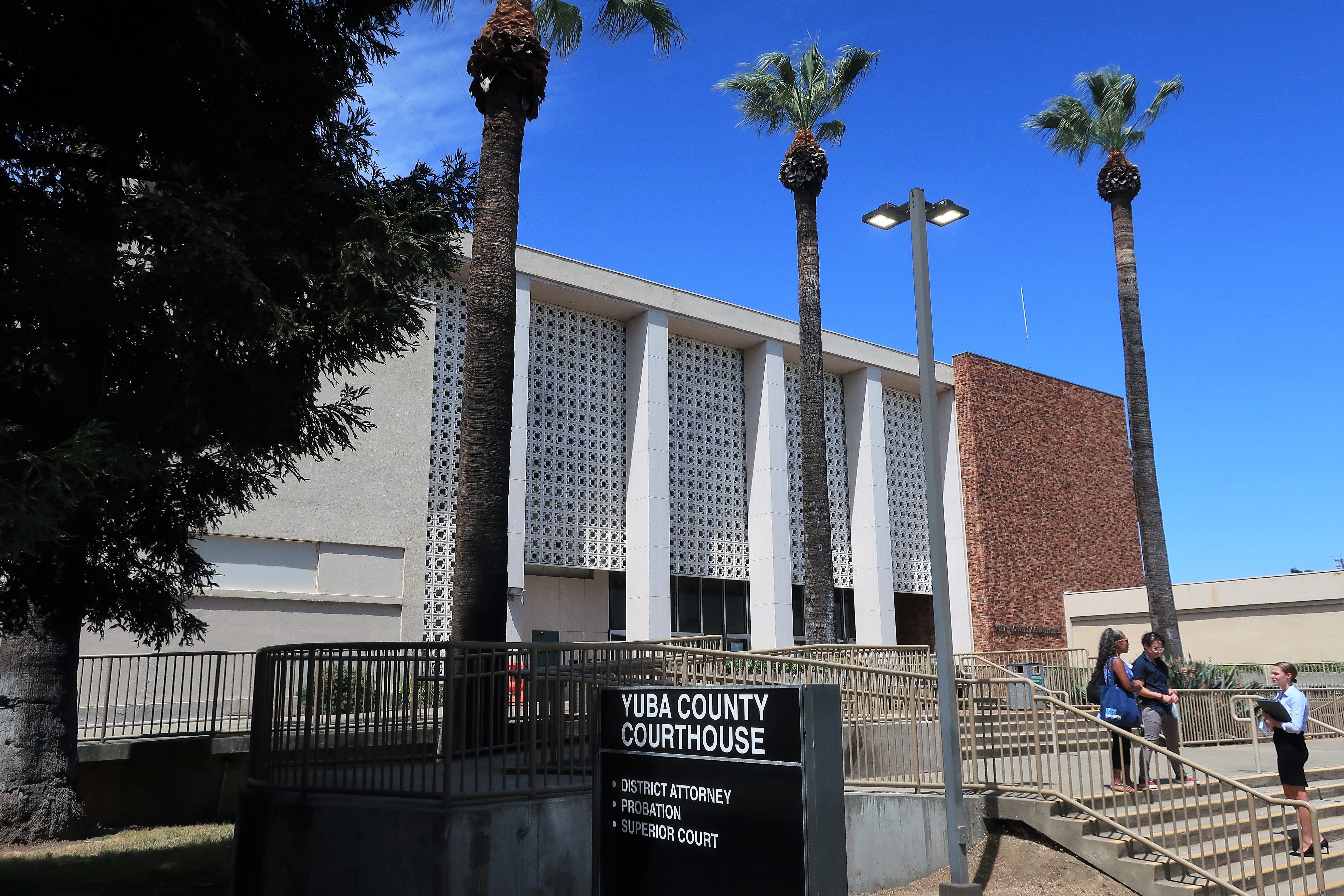
The next stop was Yuba City, the county seat of Sutter County. The Sacramento Valley can get pretty hot in the summer and so palm trees can be found throughout.
More Yuba City photos: Sutter County Courthouse (left); palm trees galore in a downtown square (right).

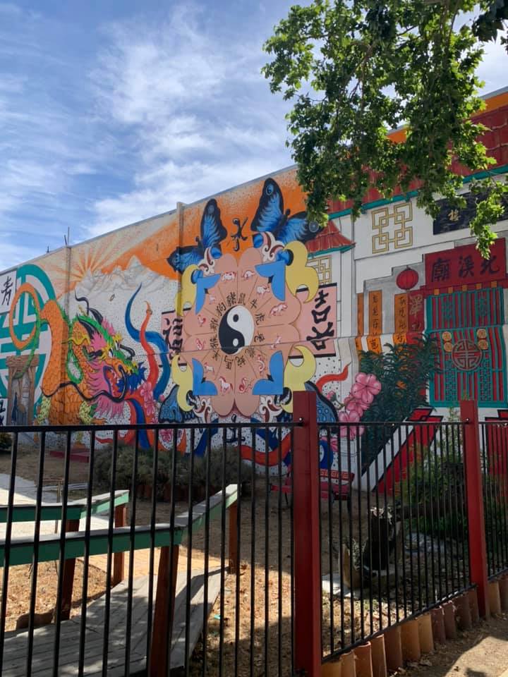
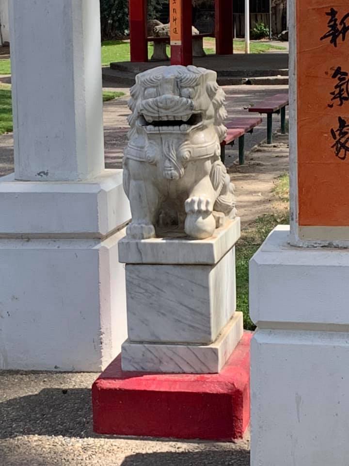
Across the Feather River from Yuba City, the town of Marysville lies at the place the Yuba River joins the Feather River. These two rivers drain much of the northern Sierra goldfields, and during the mid-1800s the combination of railroad construction and gold mining brought large groups of Chinese laborers to Marysville. The town known as the “Gateway to the Goldfields” was eventually named for Mary Murphy Covillaud, a survivor of the disastrous Donner Party.
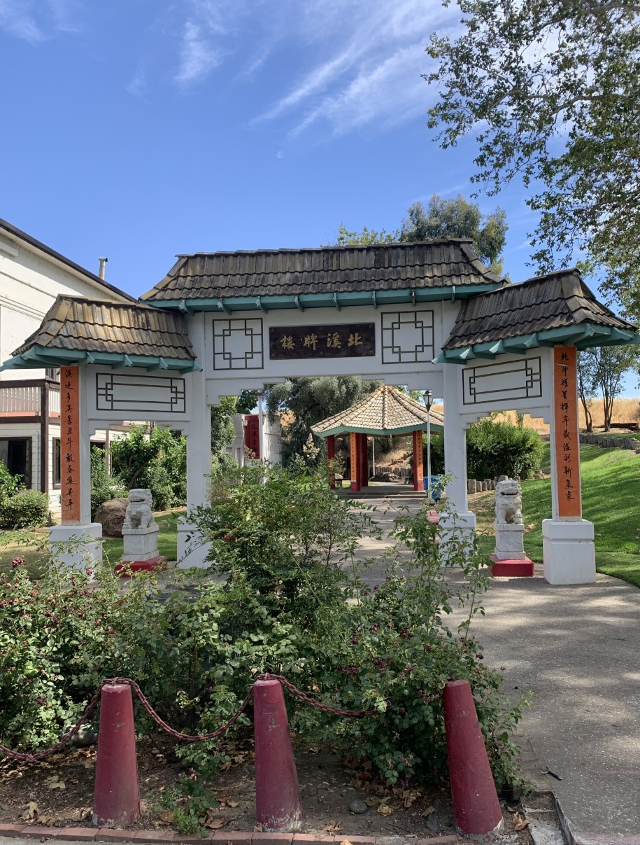
Some more photos from the Chinese section of Marysville, California:

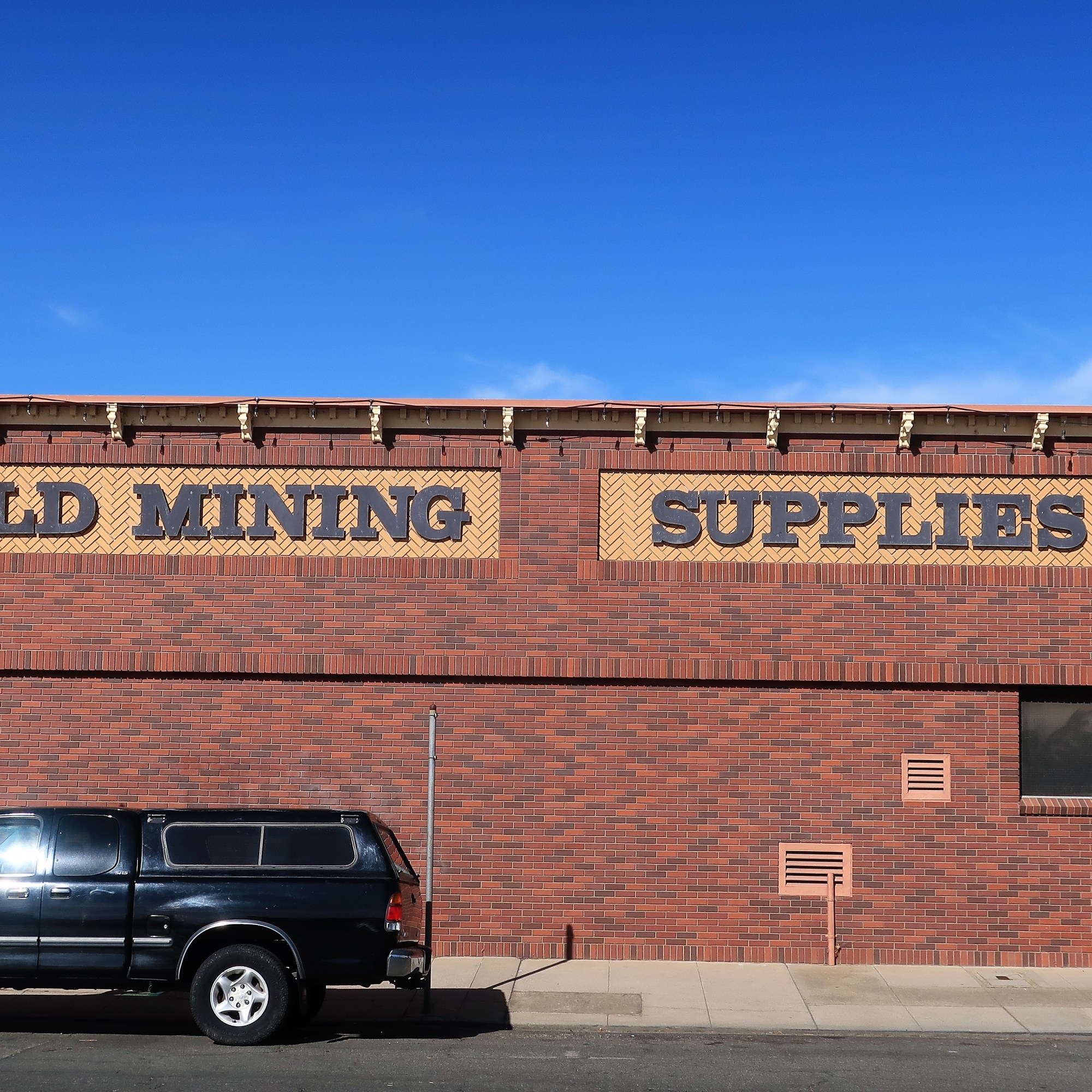
By this time it was getting late into the afternoon and I drove north an hour or so to the town of Oroville. Oroville, built during the gold rush days, lies along the Feather River near its exit from the mountains.
The photos below show downtown Oroville, a gold mining supply store still in business, and the Feather River as it passes through town.


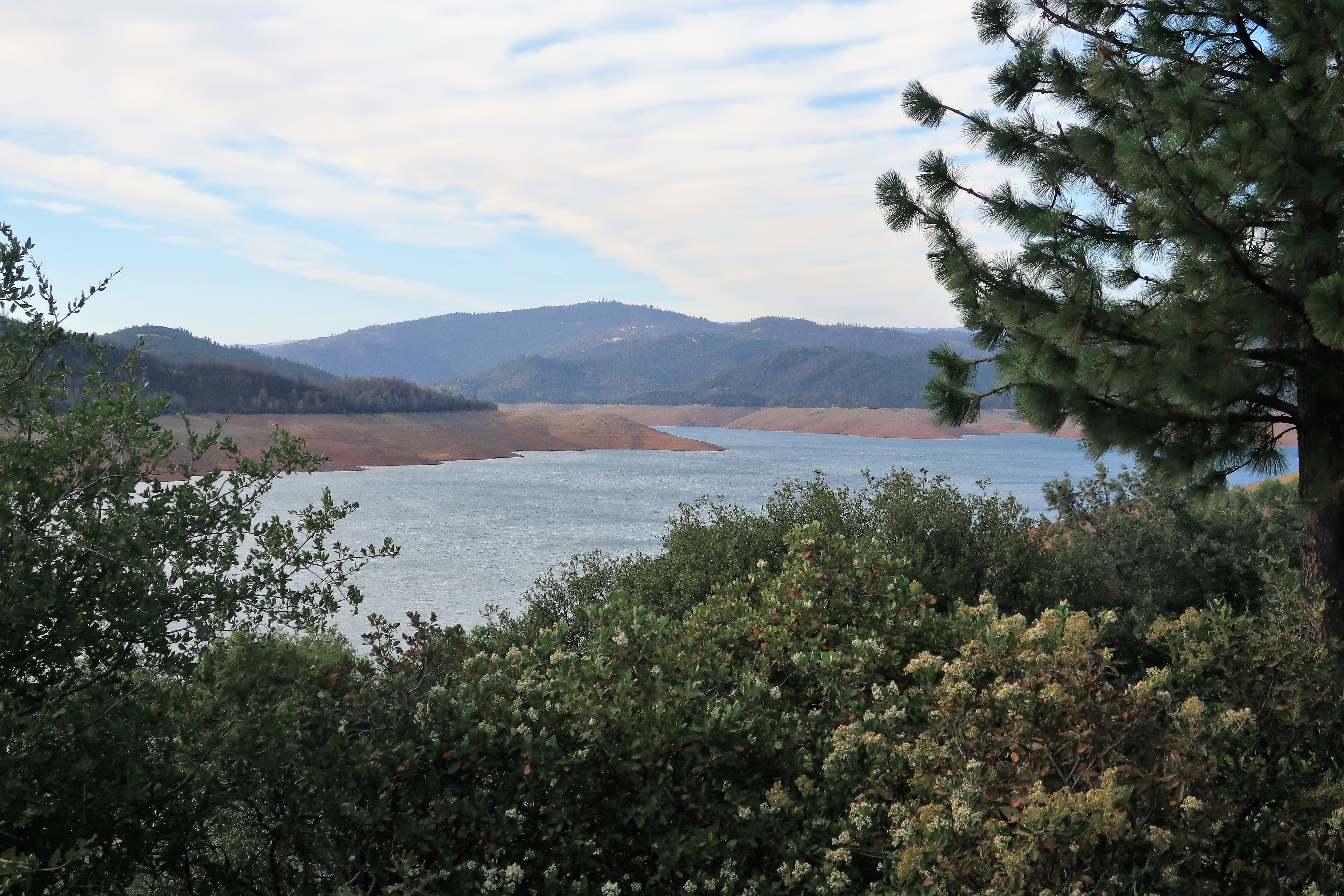
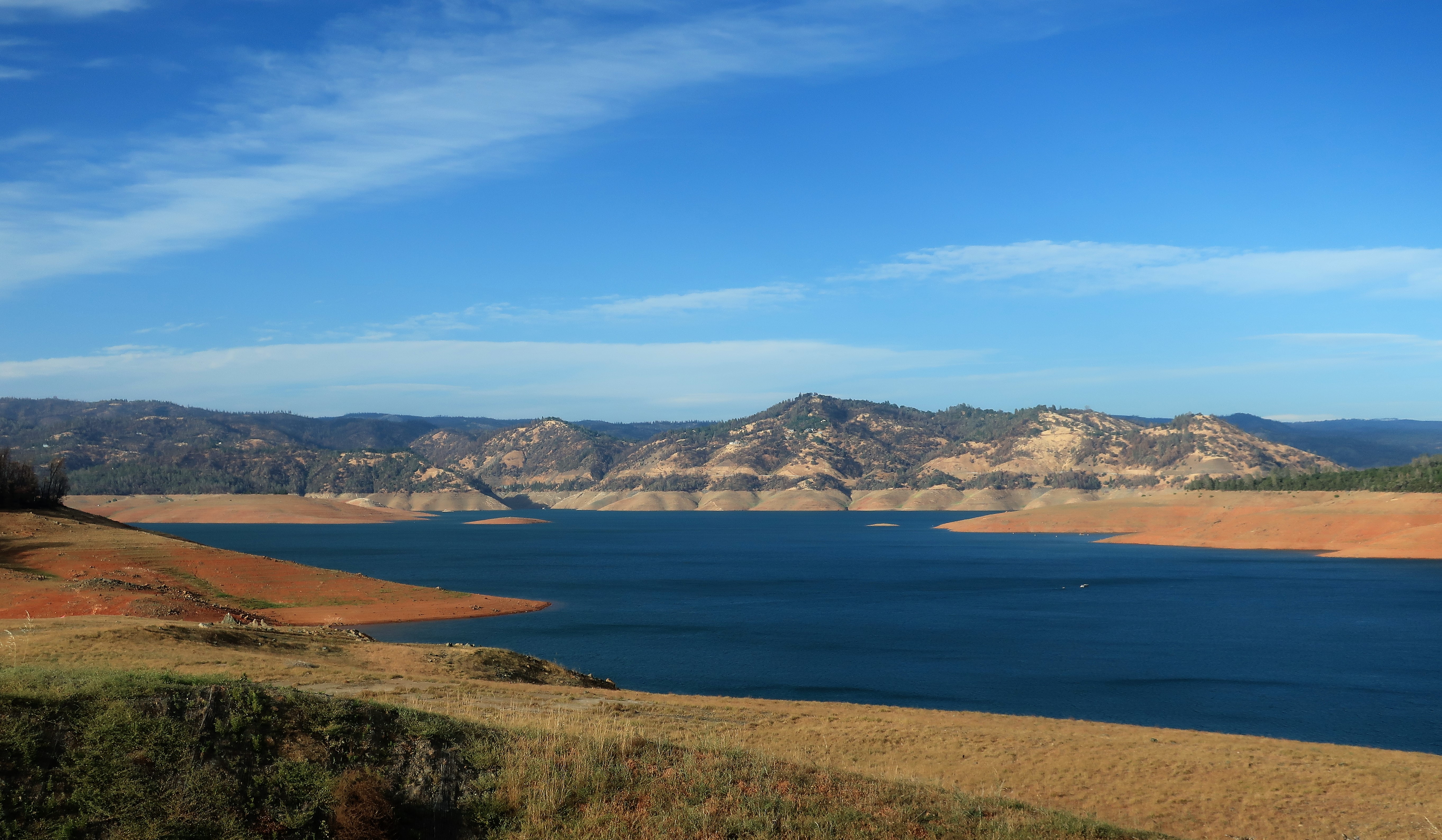
I left myself just enough daylight to see Oroville Dam, about 15 miles upstream from Oroville:

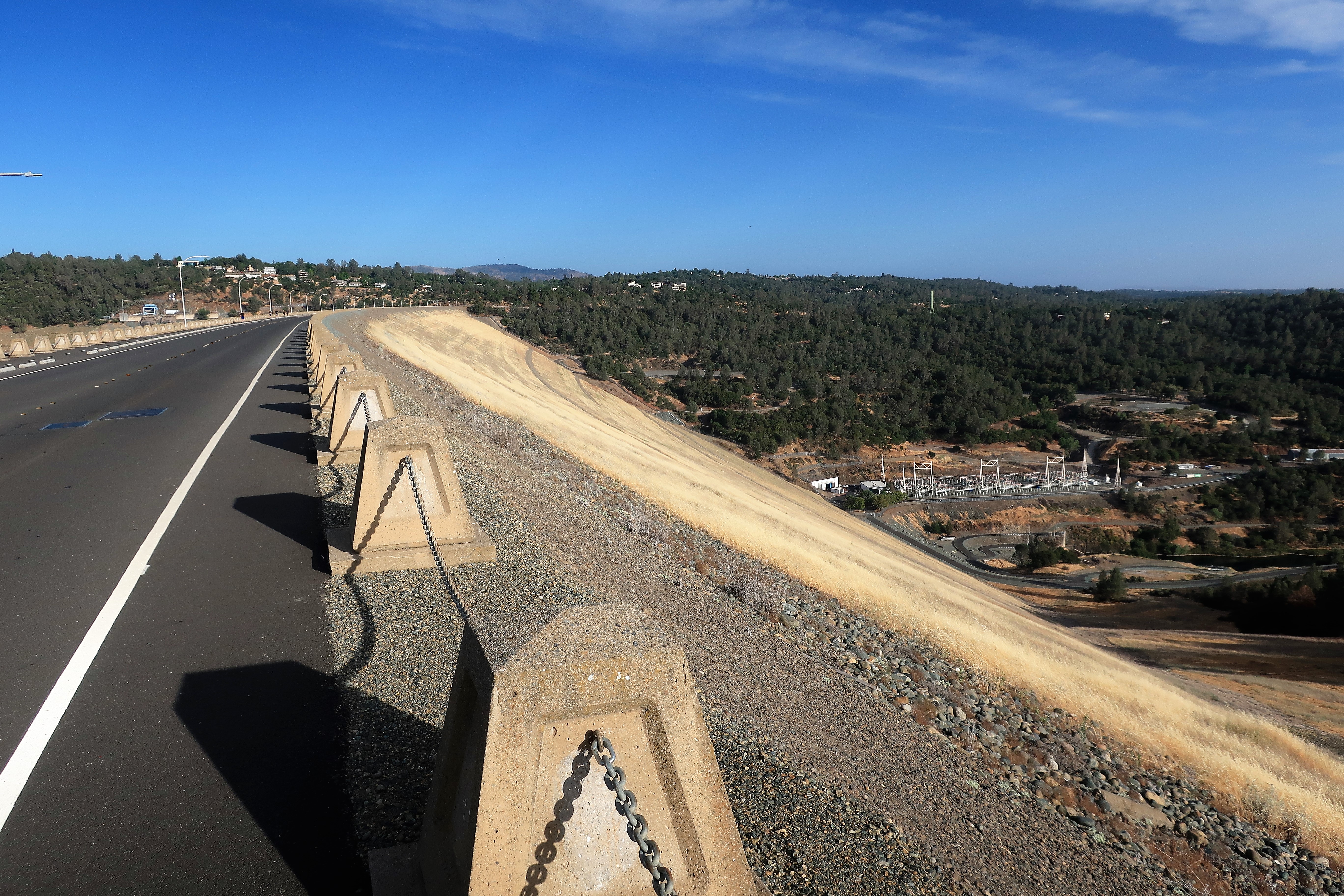
Here are views of Lake Oroville and the reservoir behind the dam:
Oroville Dam’s spillway was severely damaged by heavy rains in February 2017 and nearly collapsed. If it had actually collapsed, the town of Oroville and many others would likely have been destroyed by flooding. See this link to a YouTube video from Practical Engineering explaining the crisis, its ultimate causes, and resolution. (Hint: there was a fundamental engineering failure underlying the spillway damage which can’t be blamed on the rains.)
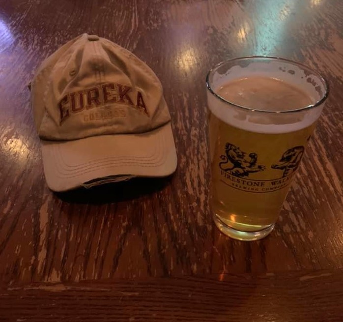
Today was a great day and I made it to Redding for the night, so I’m celebrating. I really wanted to celebrate with a margarita but the hotel bar closed at 9:00. I’ll settle for an IPA instead at the Alehouse Pub. Cheers!
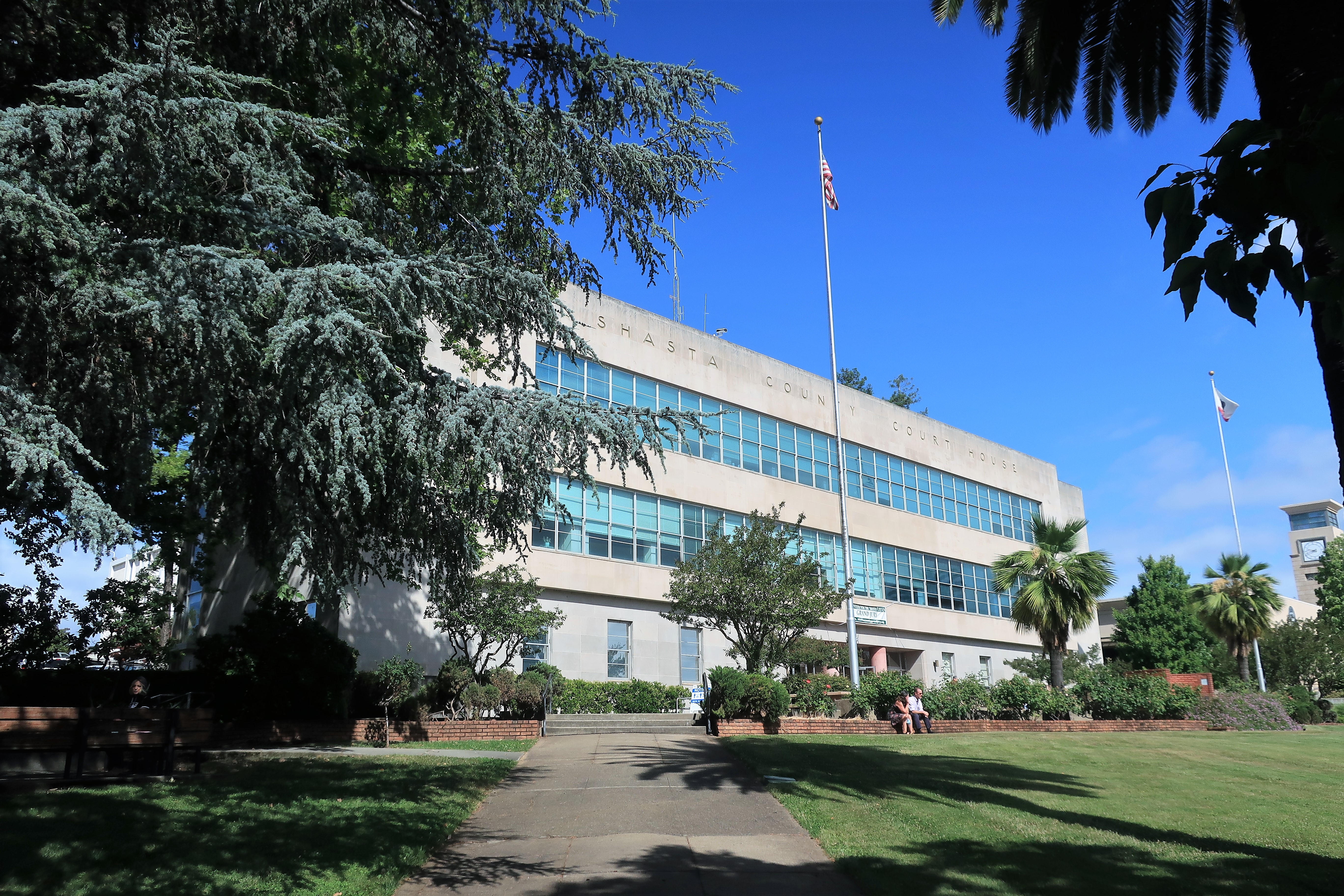
Tuesday, June 8, 2021. Day 4: Redding to Colusa, California
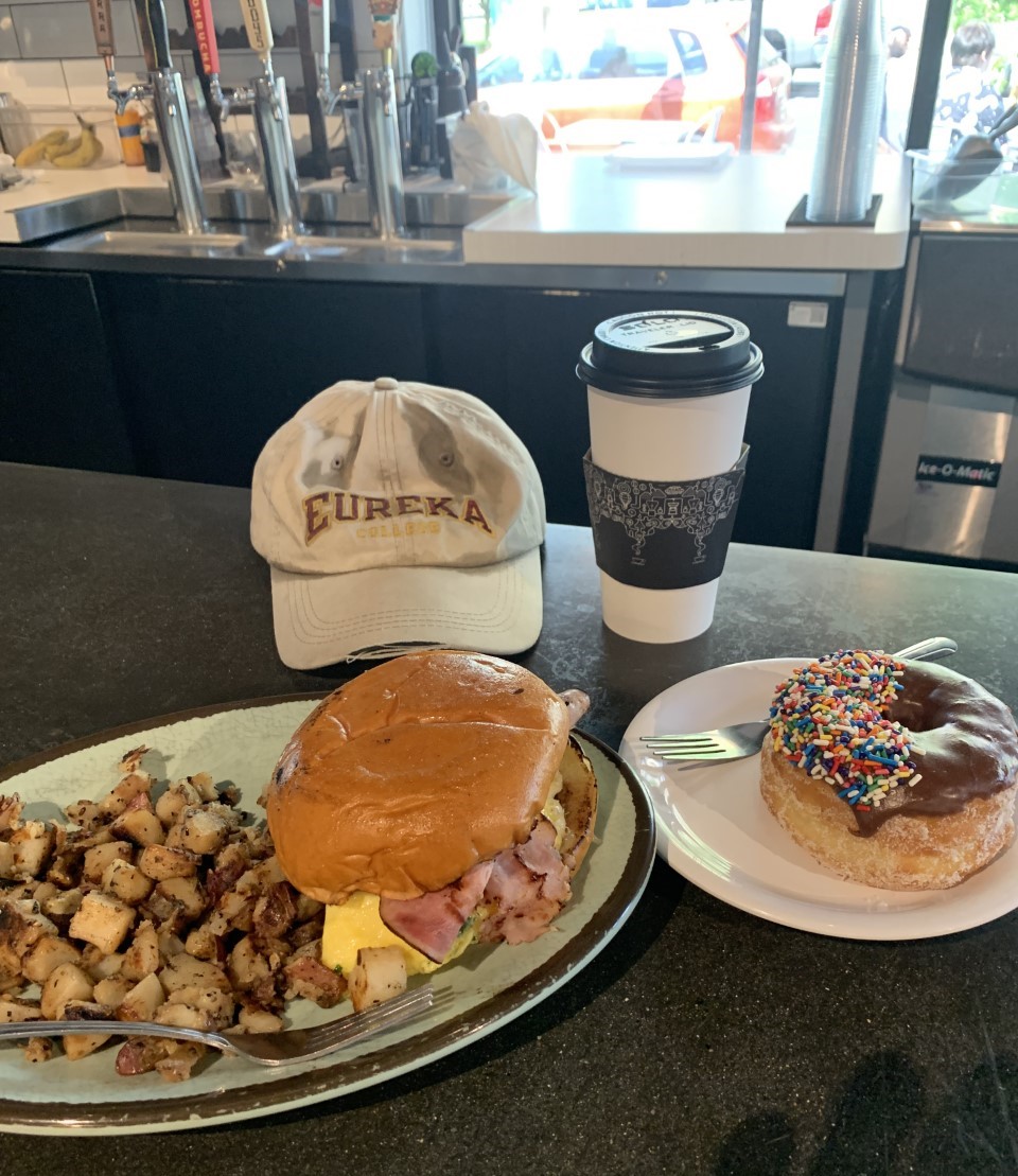
Here I am in Redding, California. Since the breakfast at the Best Western wasn’t enough, I had to supplement it with some downtown eats at the Hearth Cafe and Bakery:
Almost everywhere I look in Redding see a combination of Douglas fir trees and royal palm trees. I think the city fathers are trying to communicate that Redding is the transition point between the rainy Pacific Northwest to the north and the sunny central valley of California to the south.
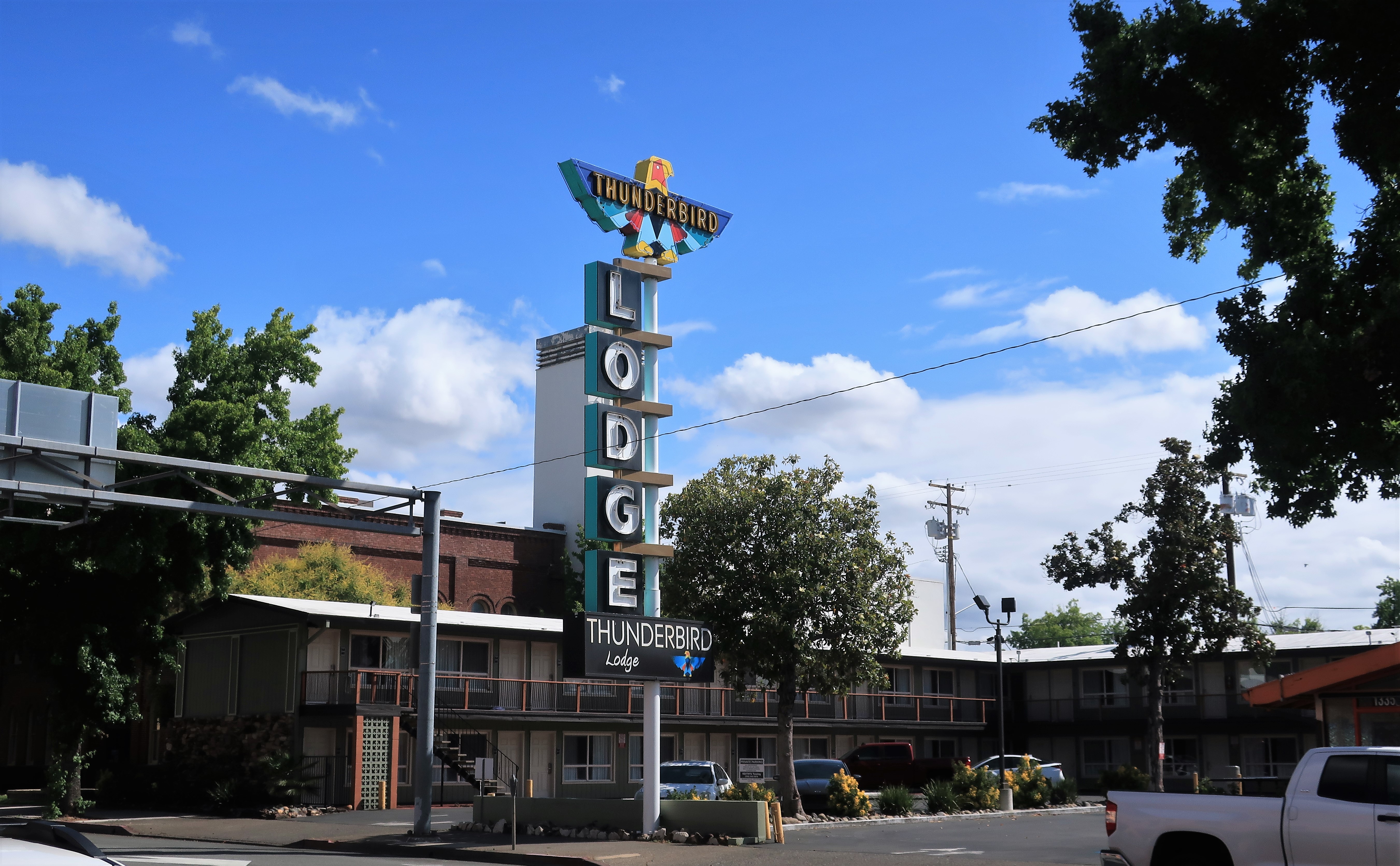
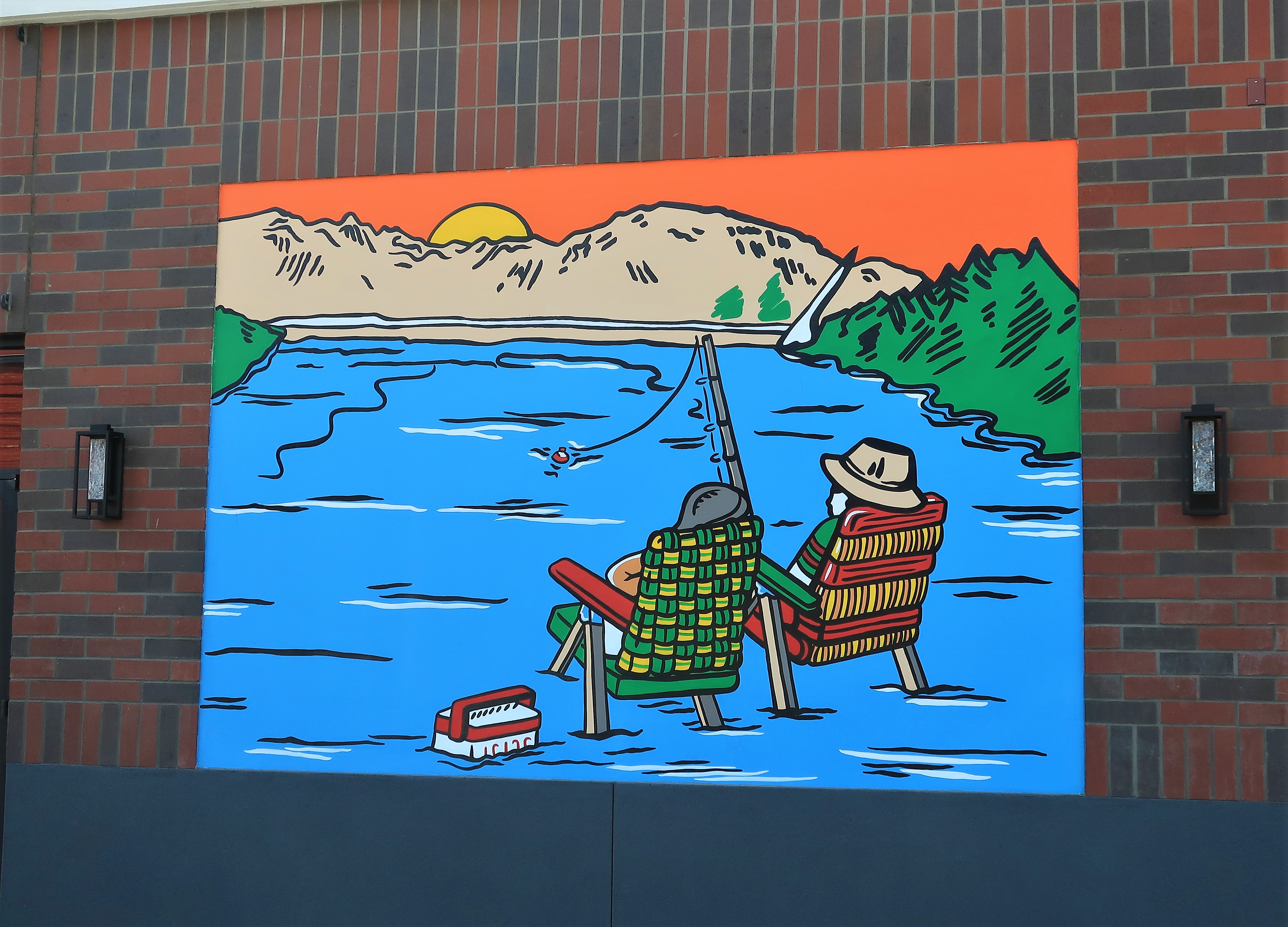
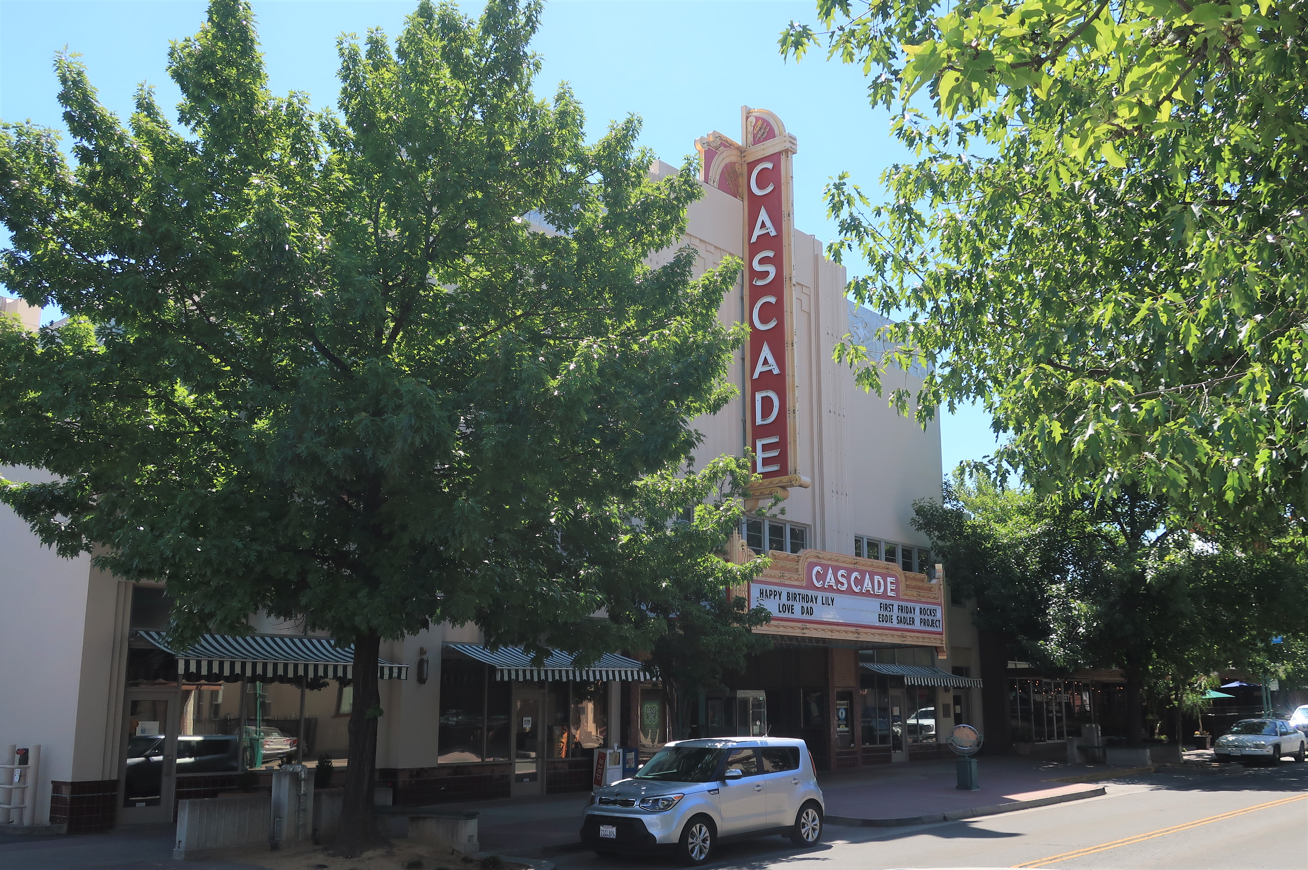
The wall mural downtown demonstrates what the local retirees do in Redding every day. Then there’s the old-style Cascade theatre here and a family-style motor hotel, a throwback to the kind of a place where families driving vista cruisers would stop for the night during their summer vacations.
I started driving south out of Redding but purposely avoided Interstate 5 for whatever back roads Google Maps could find for me. That’s a great use of Google Maps if you don’t know it already — use a setting called ‘avoid highways’ to stay on the 2-lane roads and (occasionally) off-pavement as well.
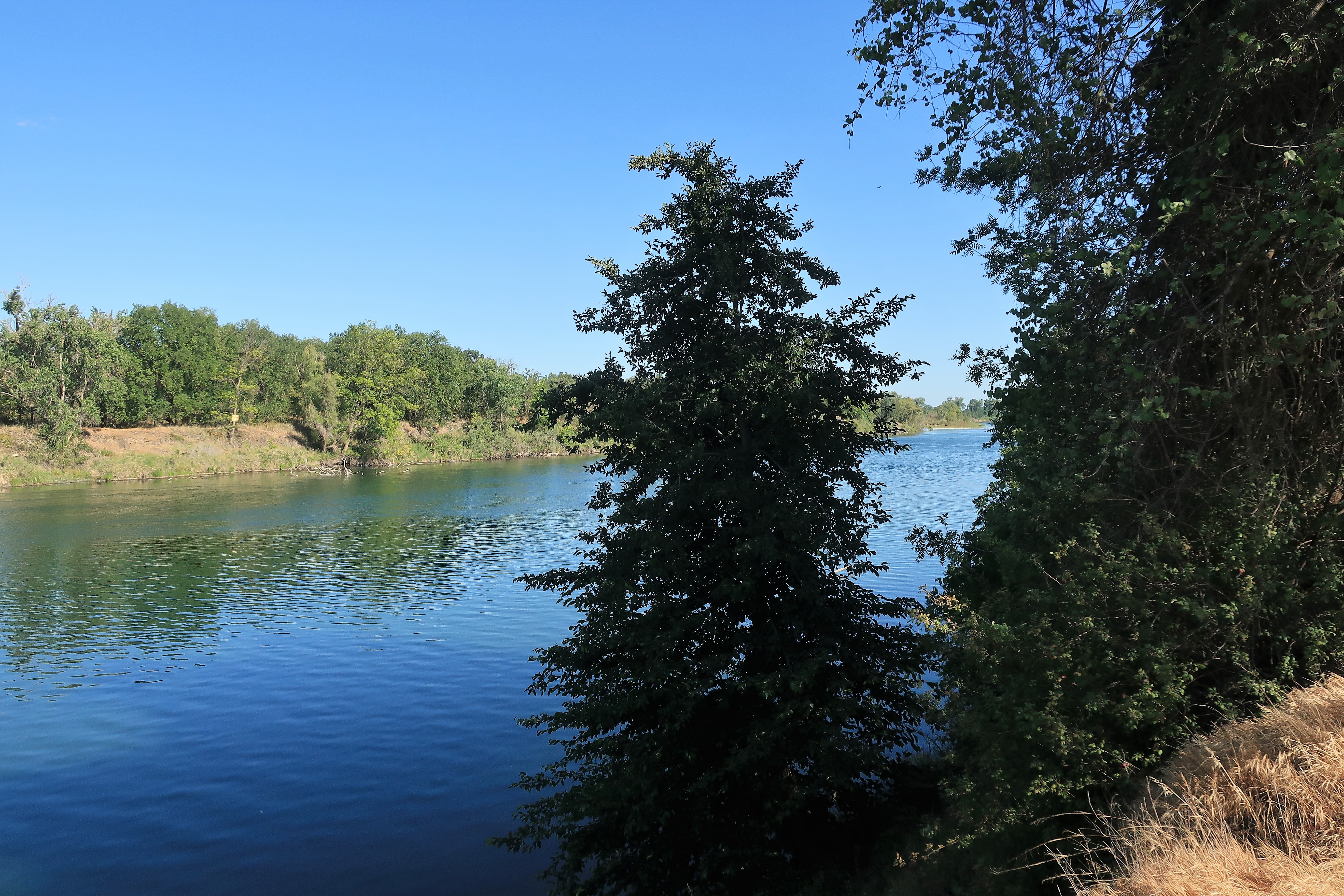
About a half-hour south of Redding, the valley town of Red Bluff lies at the head of navigation on the Sacramento River.
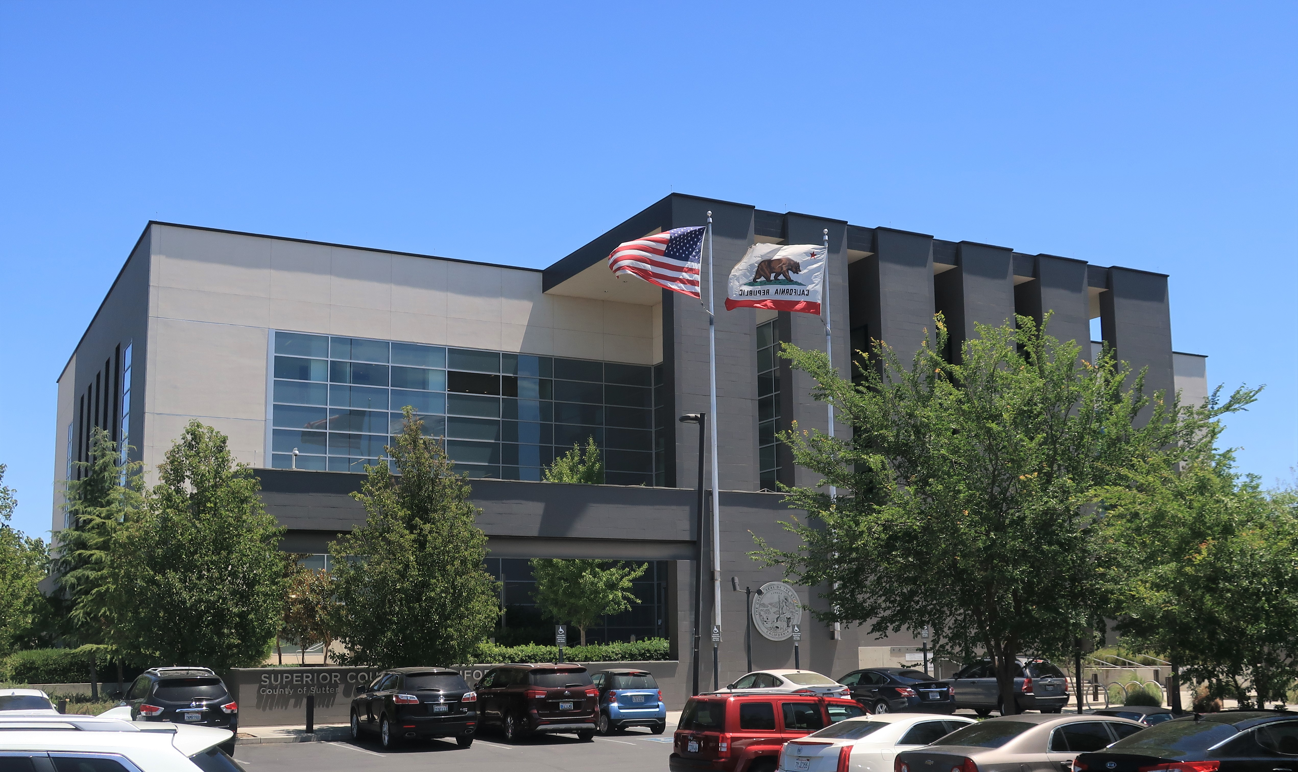
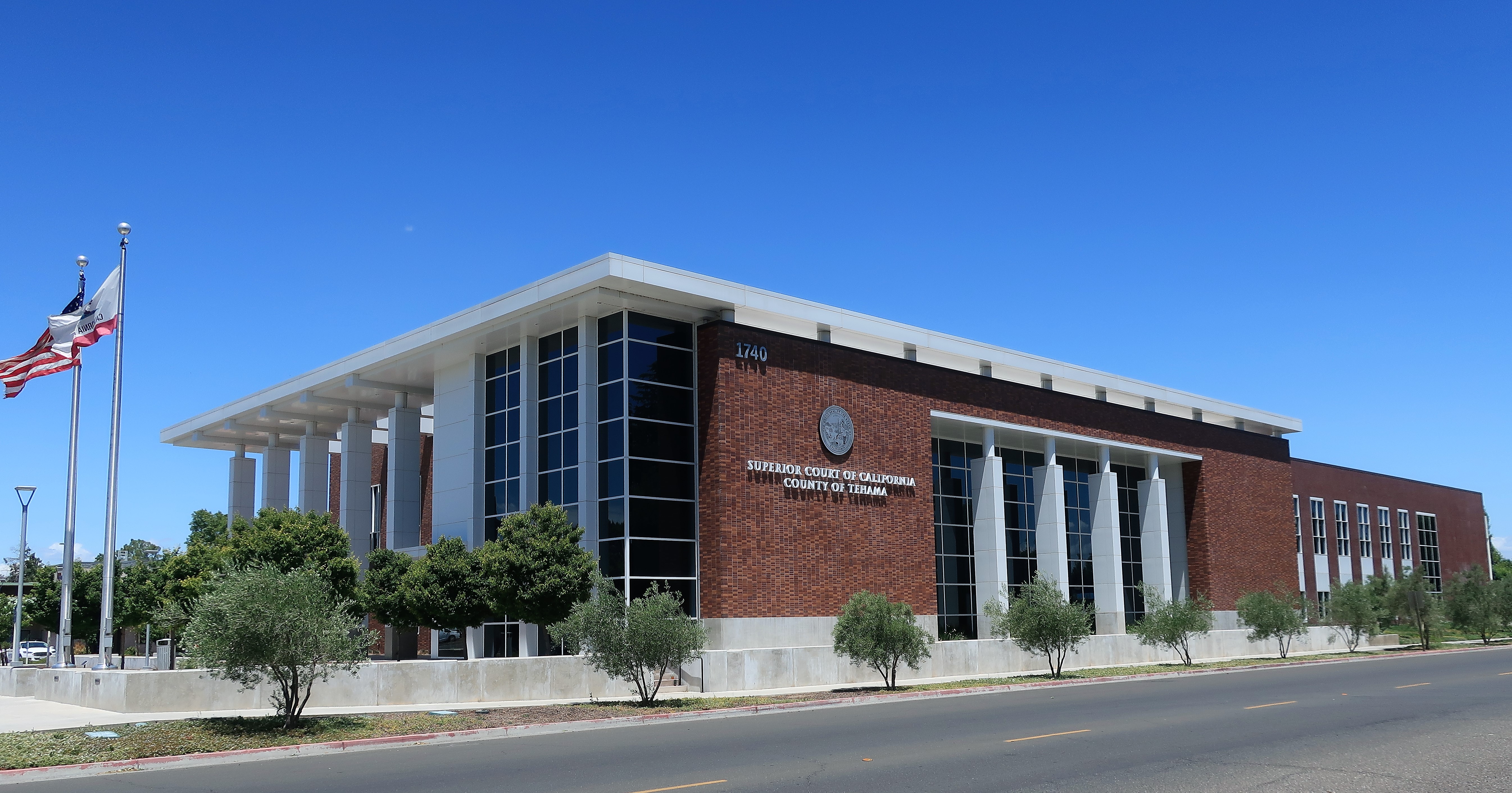
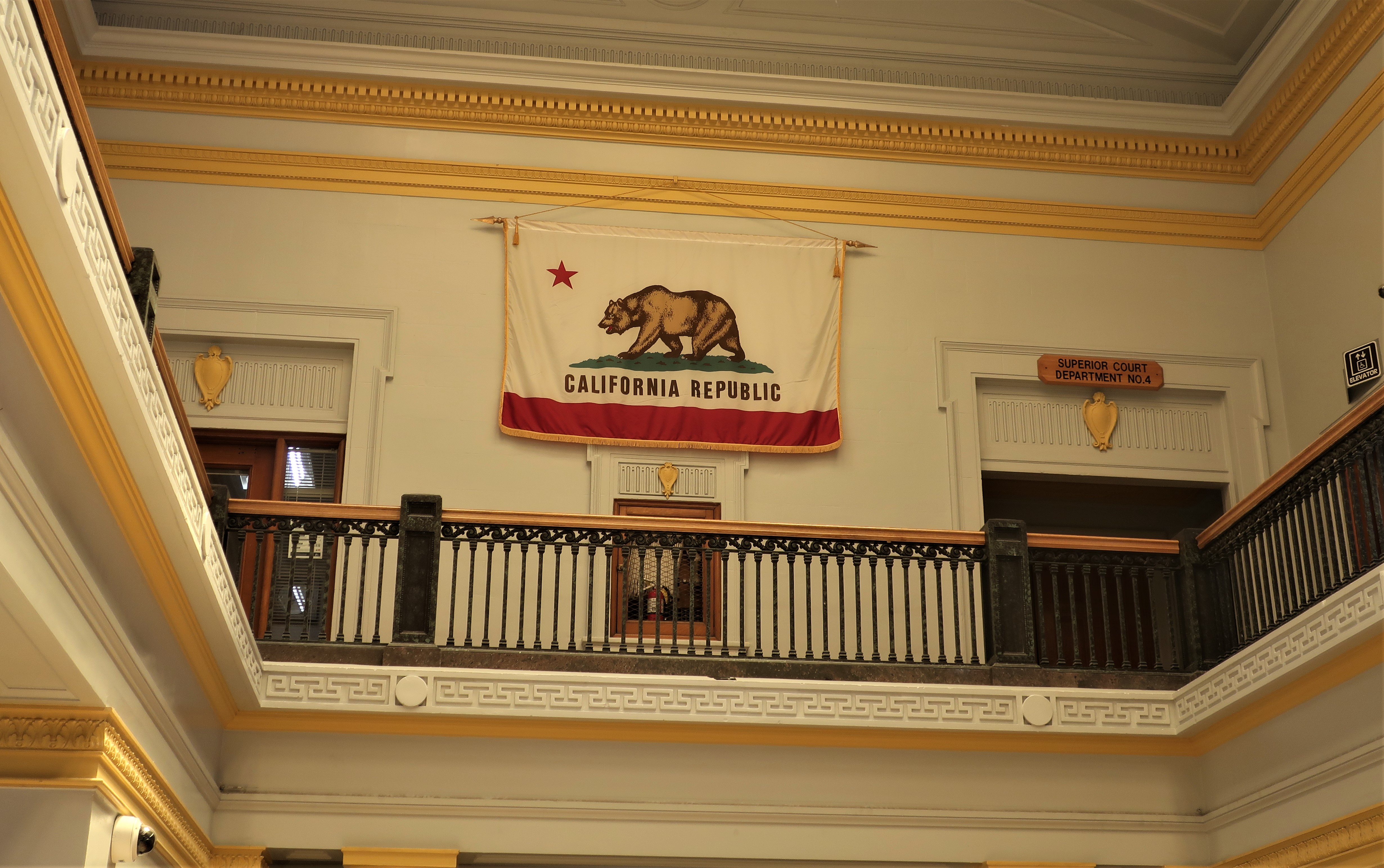
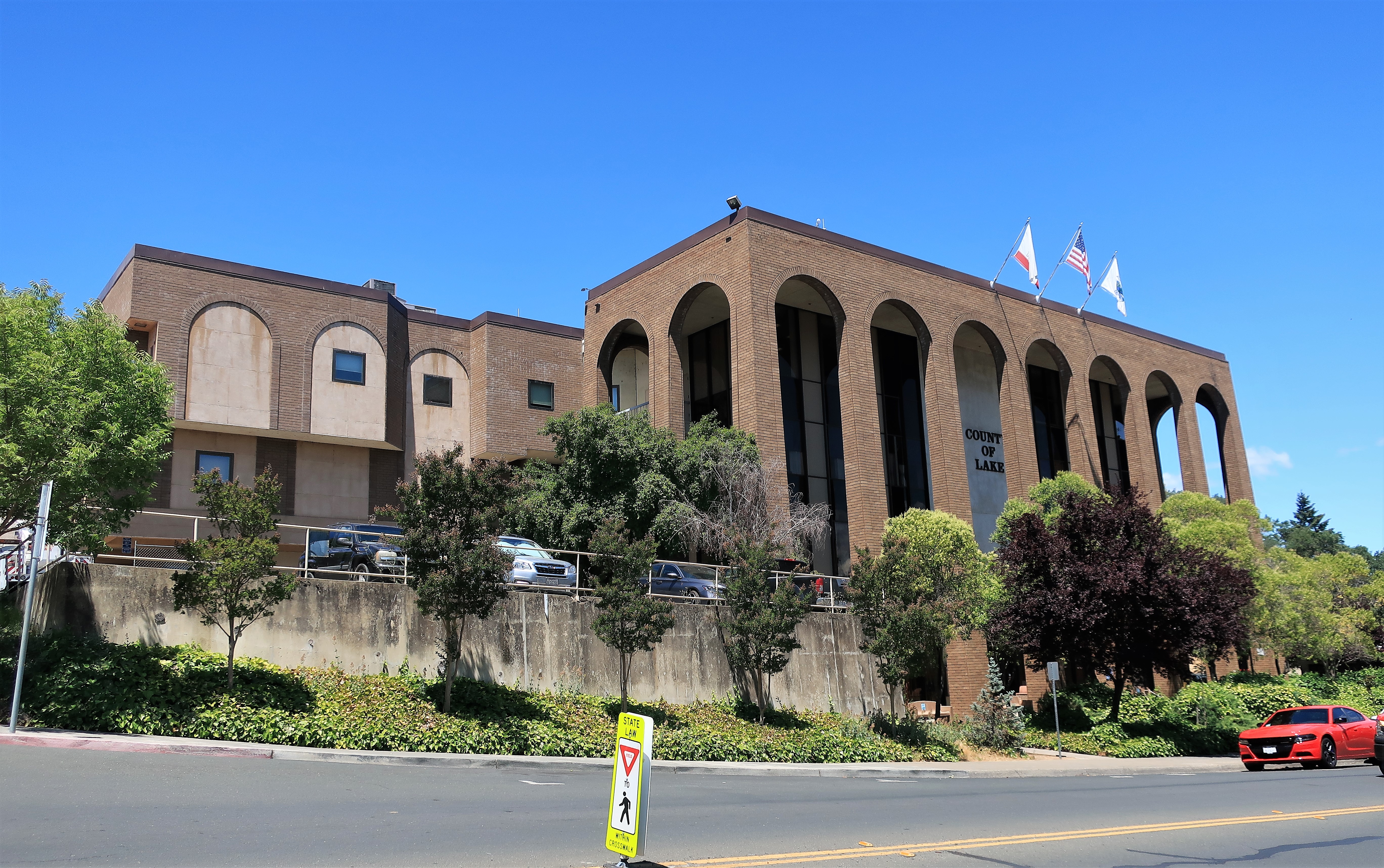
Red Bluff is the seat of Tehama County. The new county courthouse stands at the edge of town.
I understand the need to modernize public buildings, to allow for additional security features and the like. But couldn’t they build new courthouses to look as stately as the old ones? Below are photos of the old Tehama County Courthouse and its central atrium. The courthouses from the 19th and early 20th Centuries were usually built with a sense of grandeur; the new courthouses are built to be merely human processing centers.

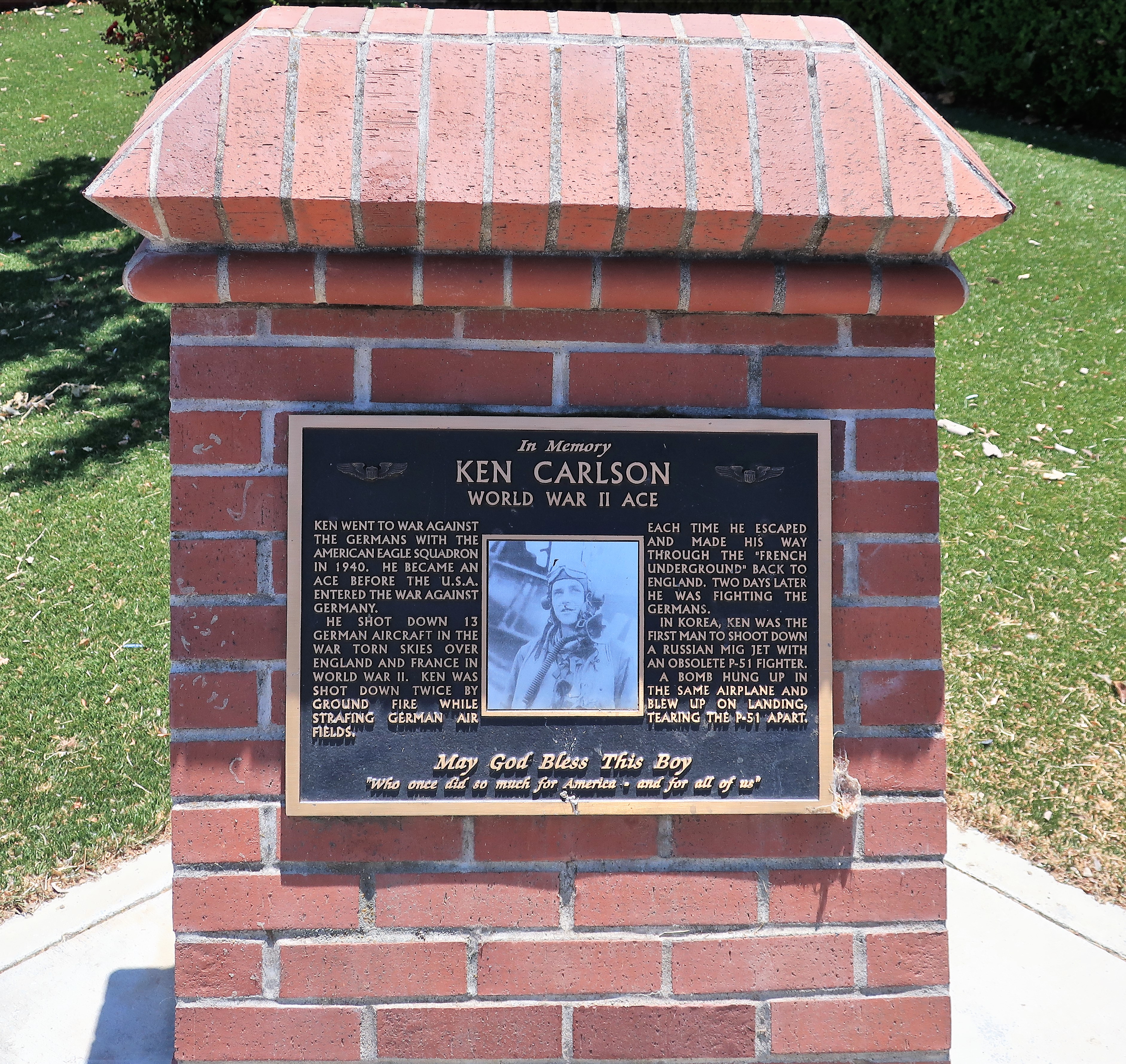
Red Bluff does remember its hometown heroes though. The memorial for World War II ace Ken Carlson is an incredible story.
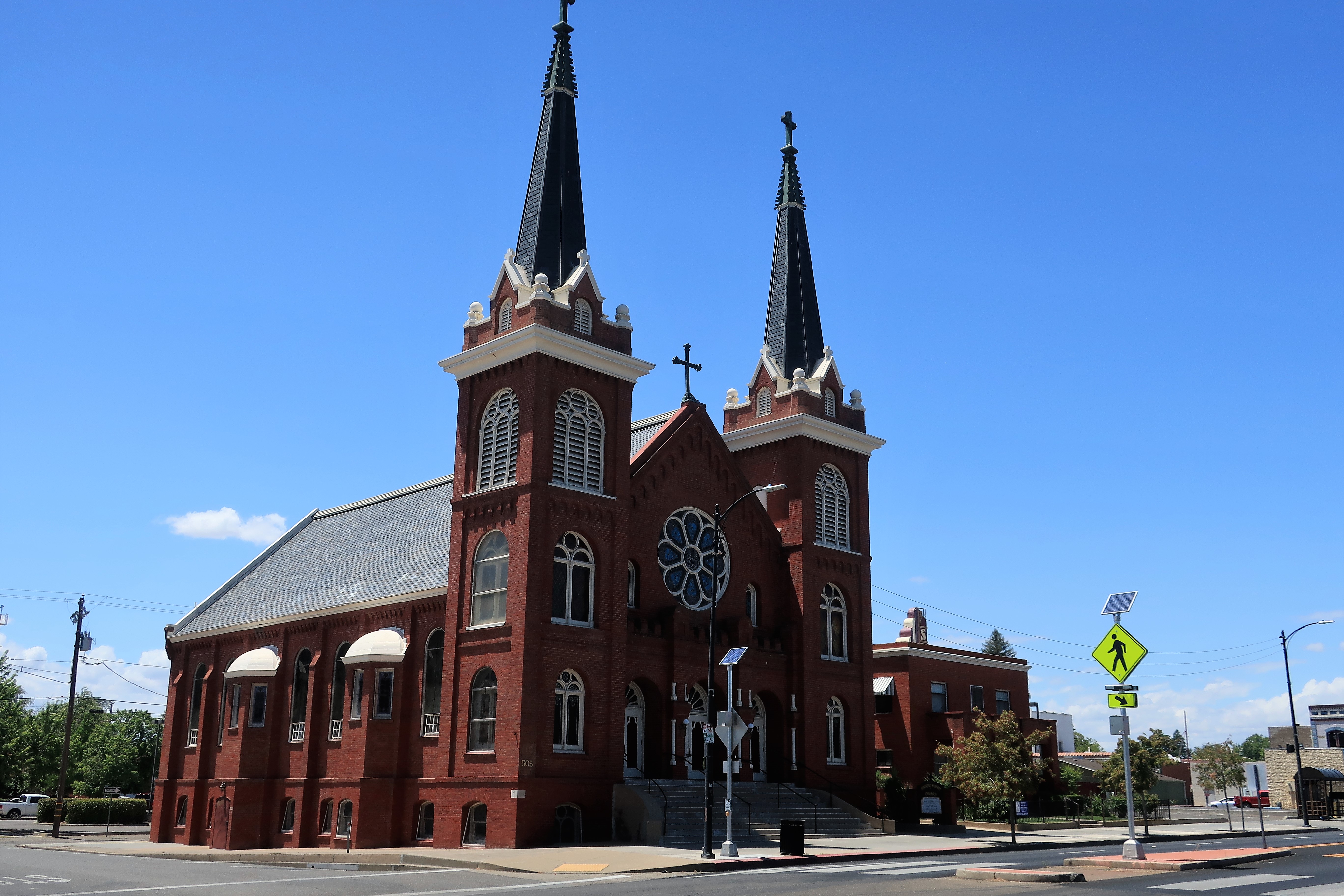
Here are some photos around Red Bluff: Sacred Heart Catholic church (dedicated 1906 and listed on the National Register of Historic Places), the Sacramento River near downtown (the head of navigation in the steamboat era), and an old-style neon sign for Elmore Pharmacy (Elmore’s has been in continuous operation for over 150 years).


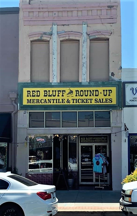
I would be remiss if I didn’t mention Red Bluff’s historic claim-to-fame — the annual Red Bluff Round-up. Maybe Red Bluff is still a cowboy town after all?
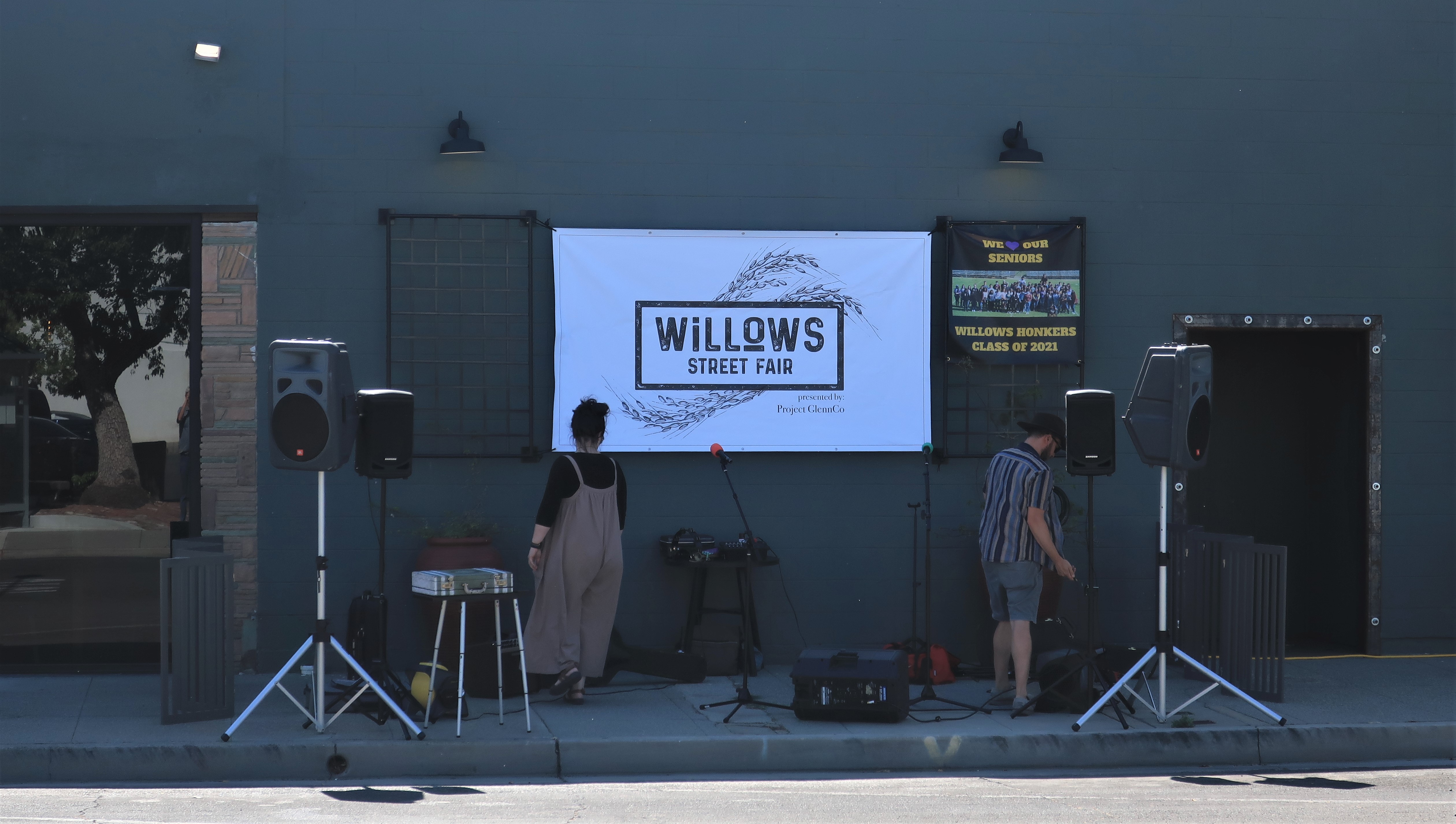
Since starting this morning in Redding, I’ve been mainly following old US Highway 99W south through the Sacramento Valley. The next stop today is the farming town of Willows, California. They’re setting up for a Monday night street fair to honor the graduating seniors, the ‘Honkers’, Class of 2021.
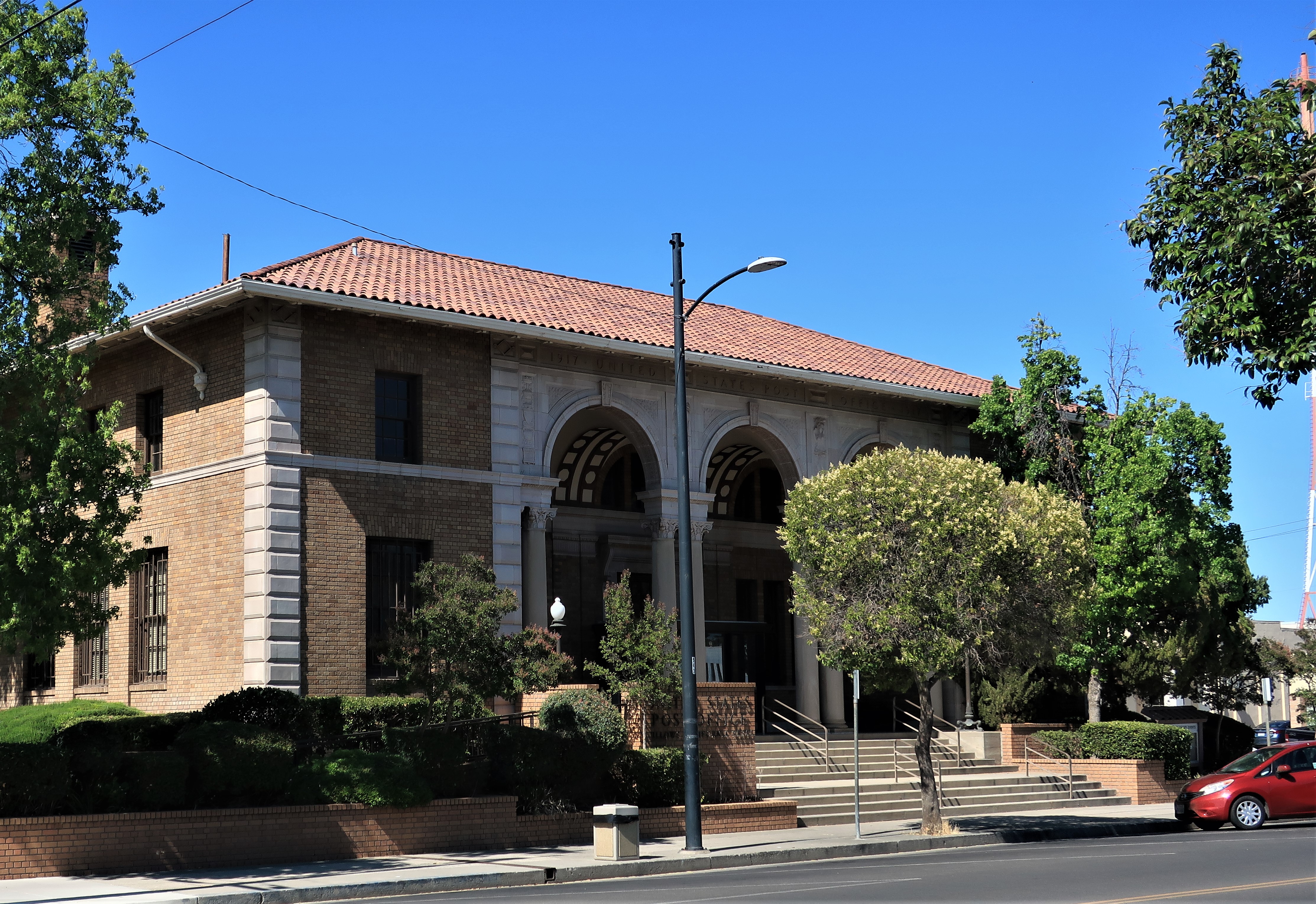
This is the Willows Post Office building, constructed in 1917 and still in operation. Notice the detail in the classical columns and the Roman-style carvings in between the arches. Willows never was a large town; its population was only 1,139 in 1910 and 2,190 in 1920 — but you didn’t need to be large to think you were special. Back then, California public buildings reflected a common perception that the Golden State was a worthy heir to the grand tradition of Western Civilization, and their architecture is proof of that.

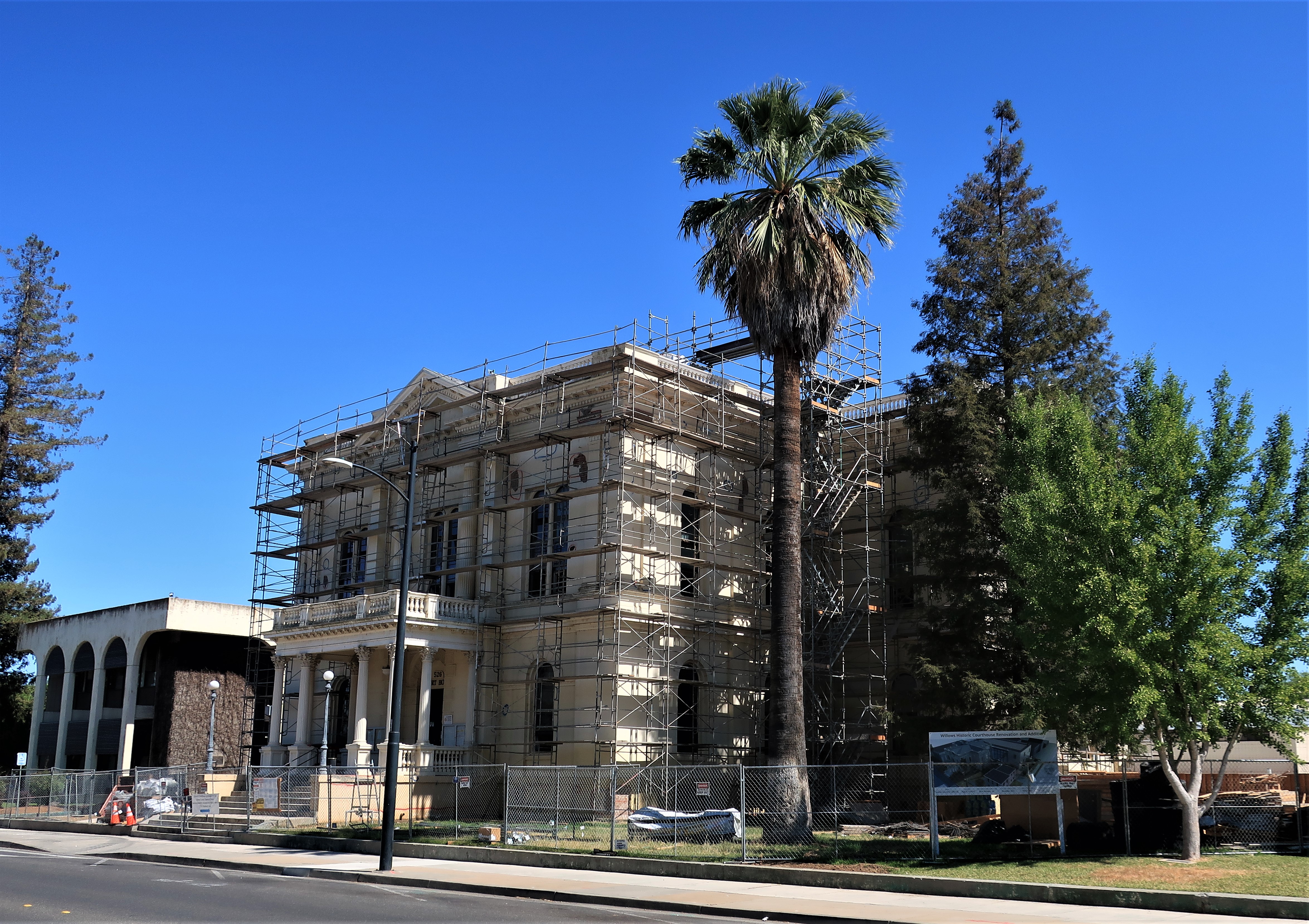
The Glenn County Courthouse is currently under renovation. By its style, I’d say it was probably constructed in the same era as the post office.
Many of the homes around town are well-preserved, even stately. I was wondering why this little town became so prosperous, but my research could not uncover a reason except for hard work and good land. Many of the homes were flying American flags, and I found another house with its flag flying upside down, signaling that the country is in distress.
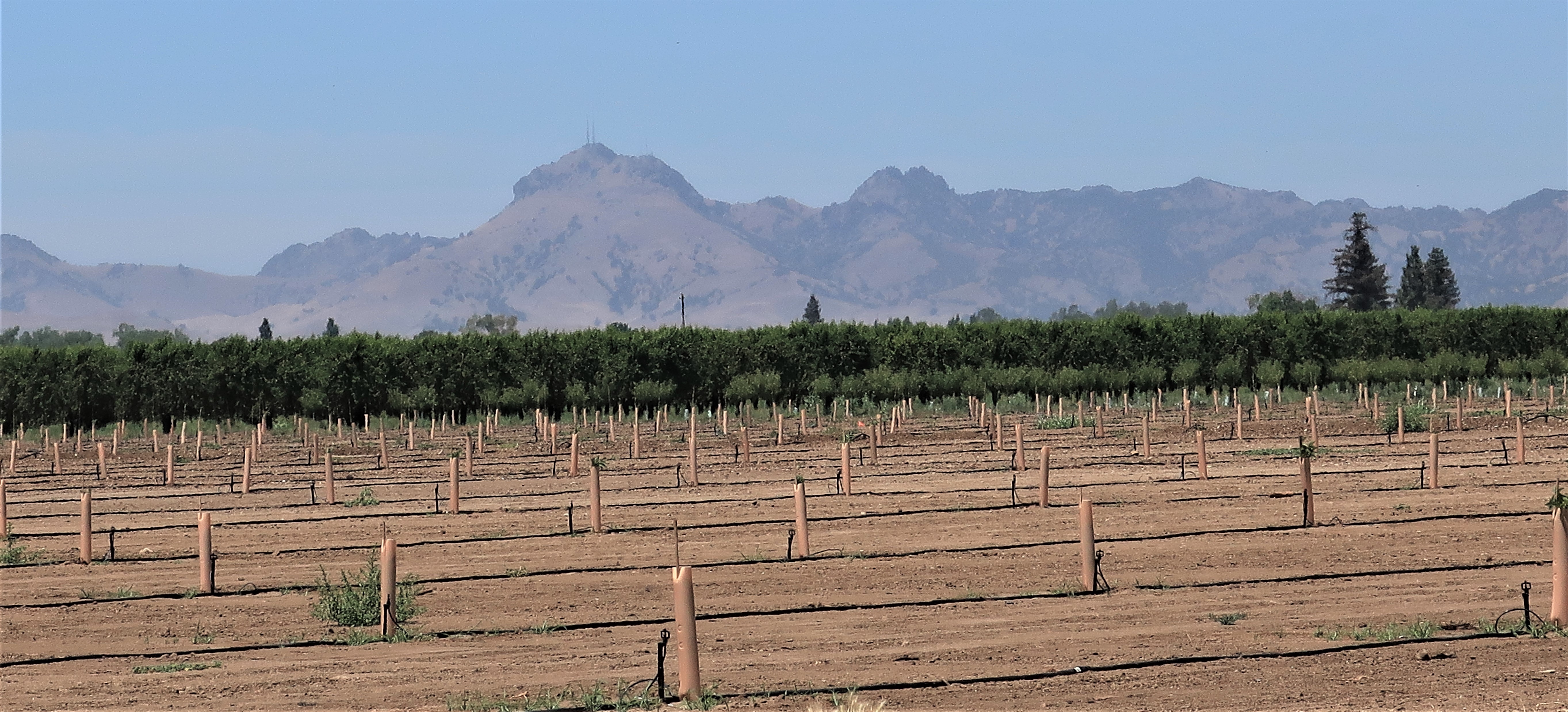
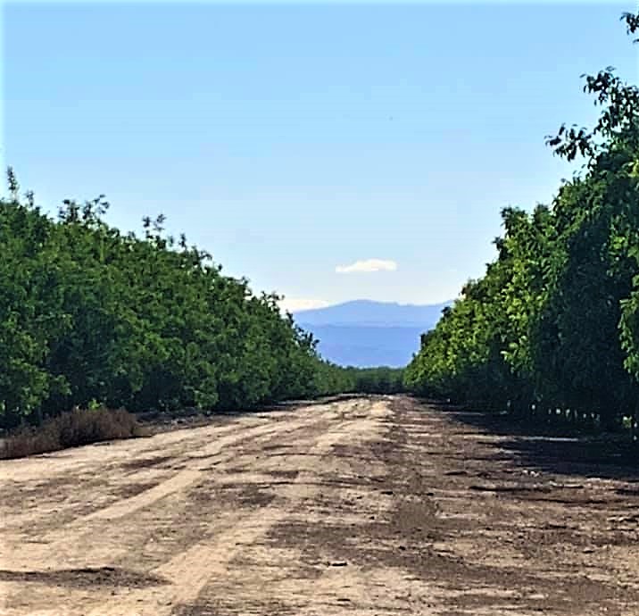
Continuing south, I drove east to meet the banks of the Sacramento River. This area boasts a simply unbelievable wealth of agriculture.
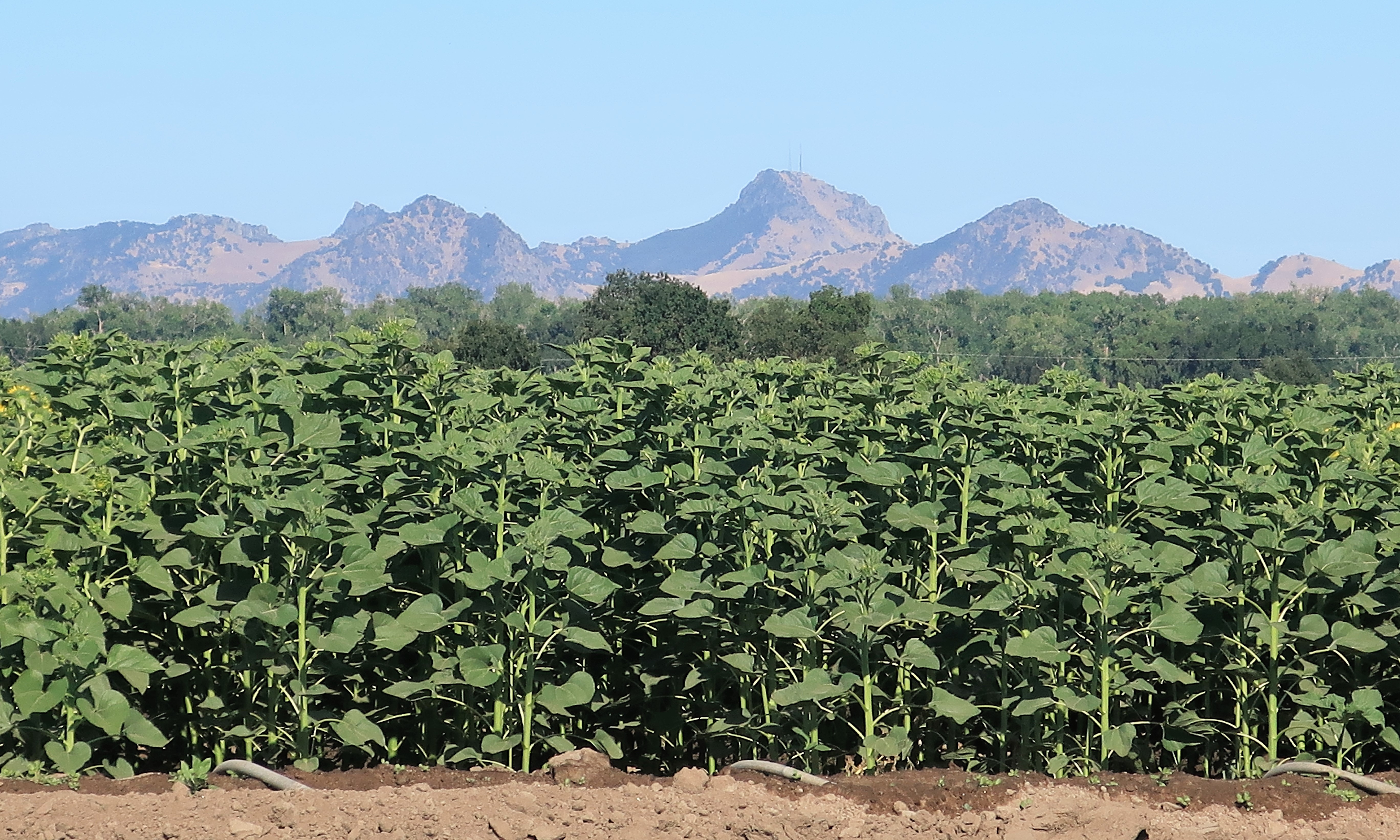
Walnut groves with the Coast Range mountains in the distance.

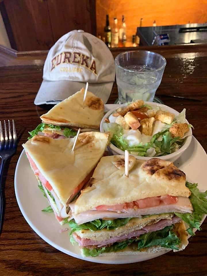
Driving further south, I stopped in Colusa, California for the night. I’m keeping it simple for dinner—bar food. Here’s my club sandwich on pita bread with a side salad and a gin & tonic at Rocco’s Bar & Grill in Colusa. Easy choice — Rocco’s is the highest-rated dining choice in tiny Colusa! The bar is packed; it seems like all the locals are here tonight even though BBQ night isn’t until Wednesday. The women’s college softball championship is on tv, and after dinner and drinks, I stroll just 3 blocks to my motel room at the Riverside Inn. Happy Tuesday night everyone!

Wednesday, June 9, 2021. Day 5: Colusa to Fort Bragg, California
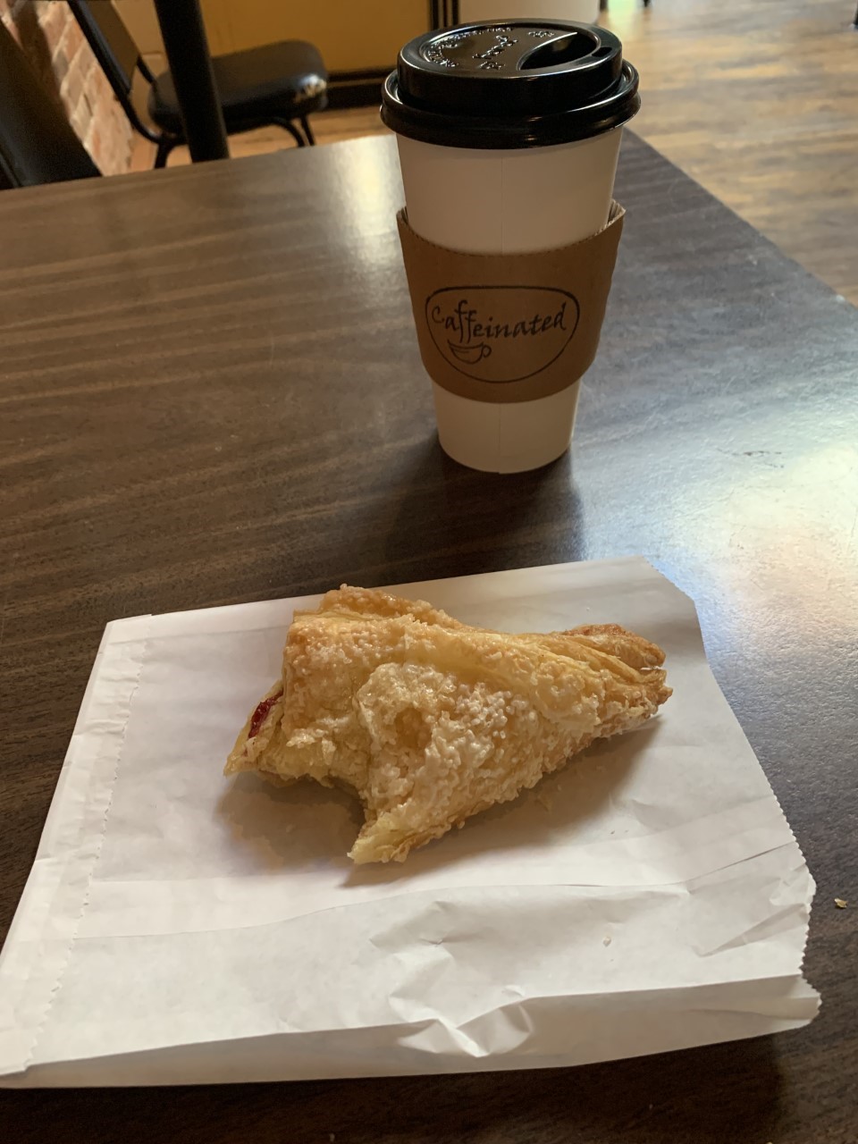
Question: What’s the best name for a coffee shop? Answer: Caffeinated!
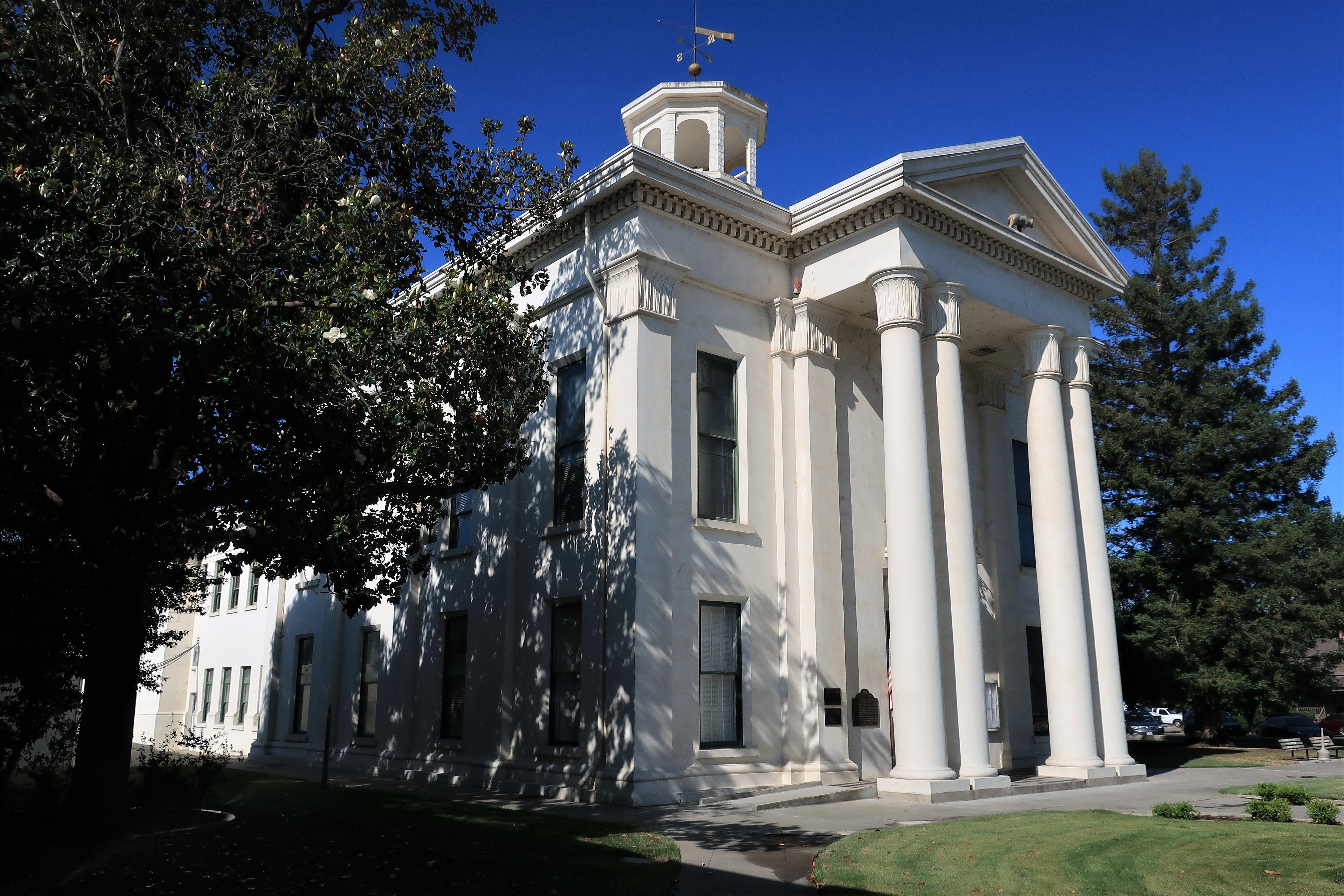
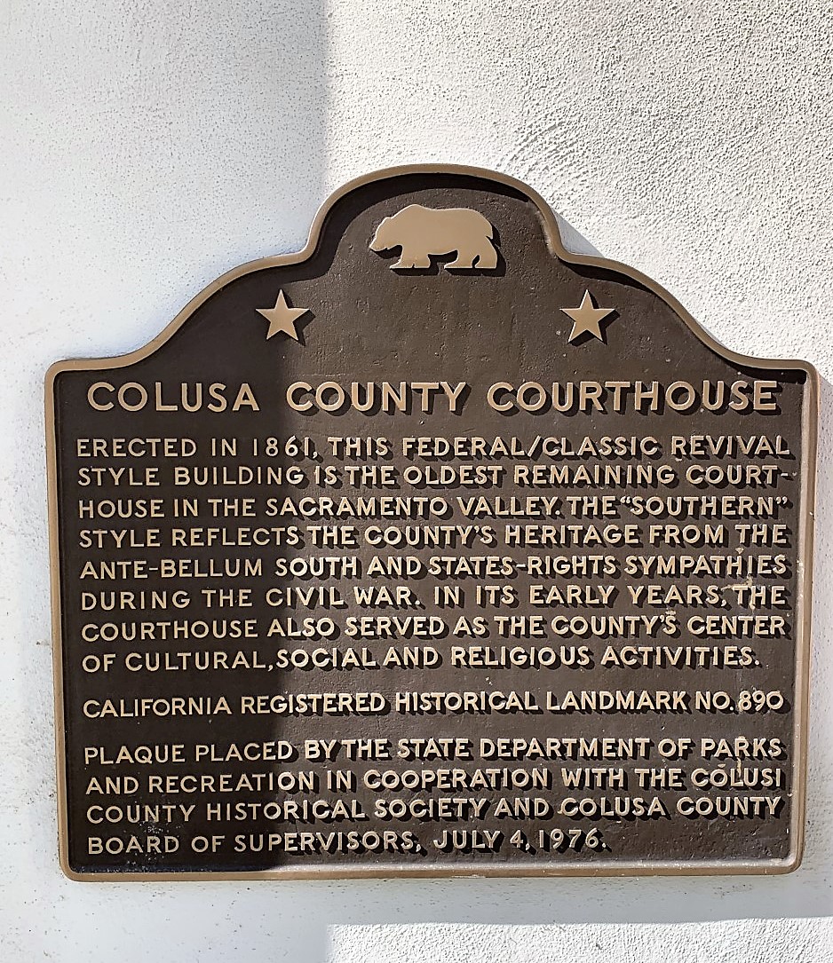
Here I am in the town of Colusa, California, and here is the Colusa County Courthouse. Built in 1861, the courthouse looks like a southern manor. This is no coincidence since most of the settlers in this particular area arrived here from southern states. Flowering magnolia trees are planted all around the grounds, making the grounds feel like a courthouse in Mississippi or Louisiana. The old statue of George Washington is now kept inside the courthouse for preservation.


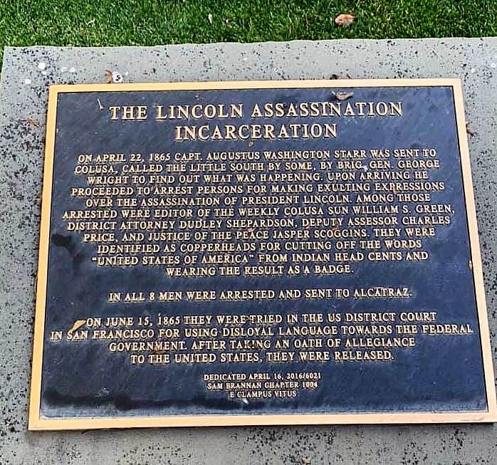
Although California remained a Union state during the Civil War, the town of Colusa had many southern partisans. Upon hearing of the assassination of Abraham Lincoln in April 1865, several persons in Colusa were reported to have made “exulting expressions” and so forth at the news of the President’s death. Fearing rebellion (but probably motivated by anger), a contingent of Union troops was sent to Colusa to investigate. The troops arrested eight persons, held them in Alcatraz for two months, and ultimately convicted them of “disloyal language” or something akin to that. Their punishment was similar to that given to surrendering Confederate soldiers back east — take an oath of allegiance to the United States. After doing so, they were released.
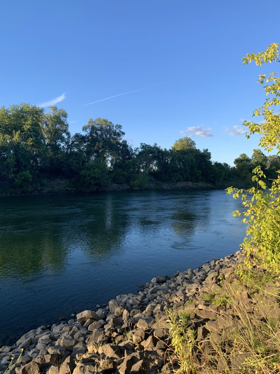
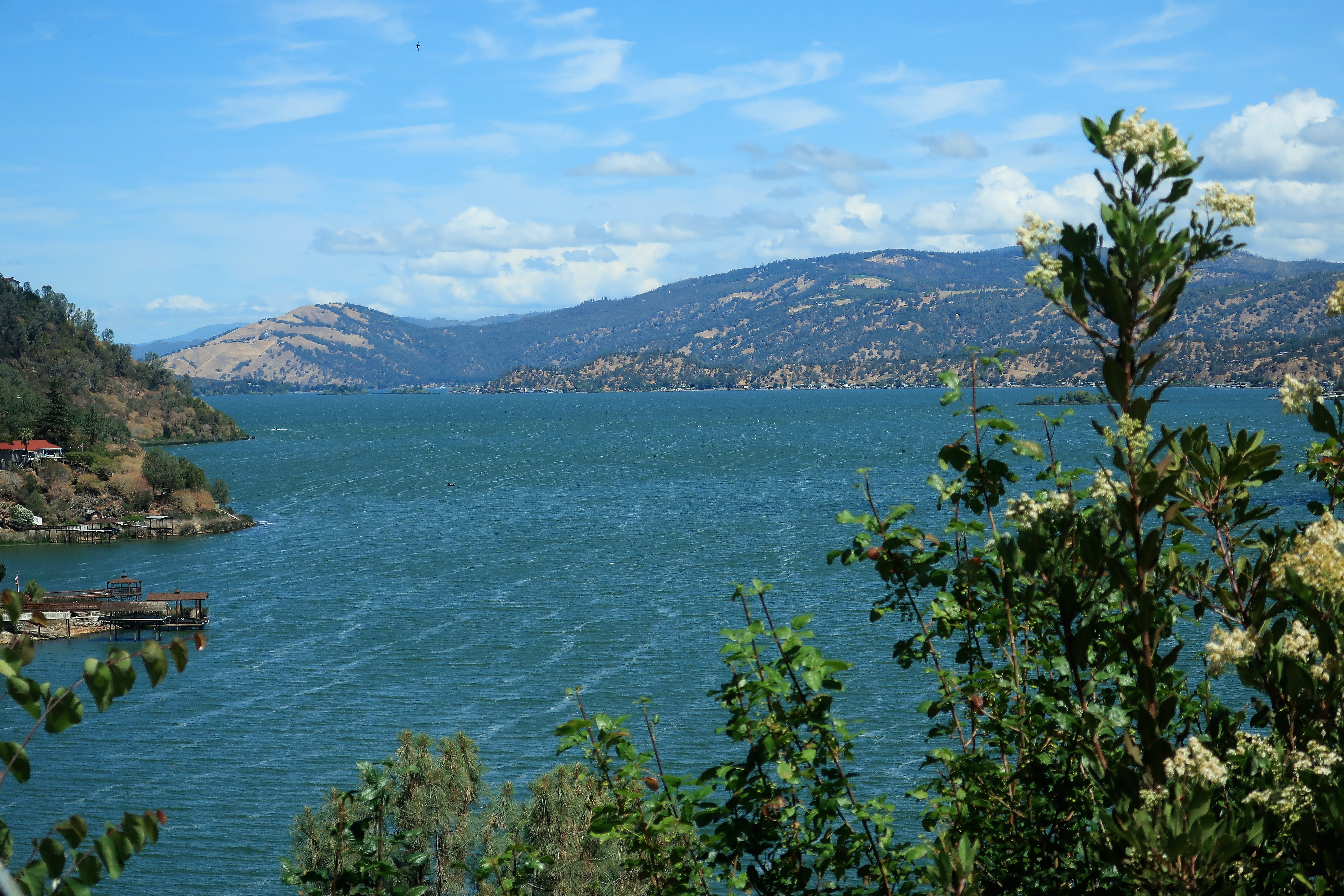
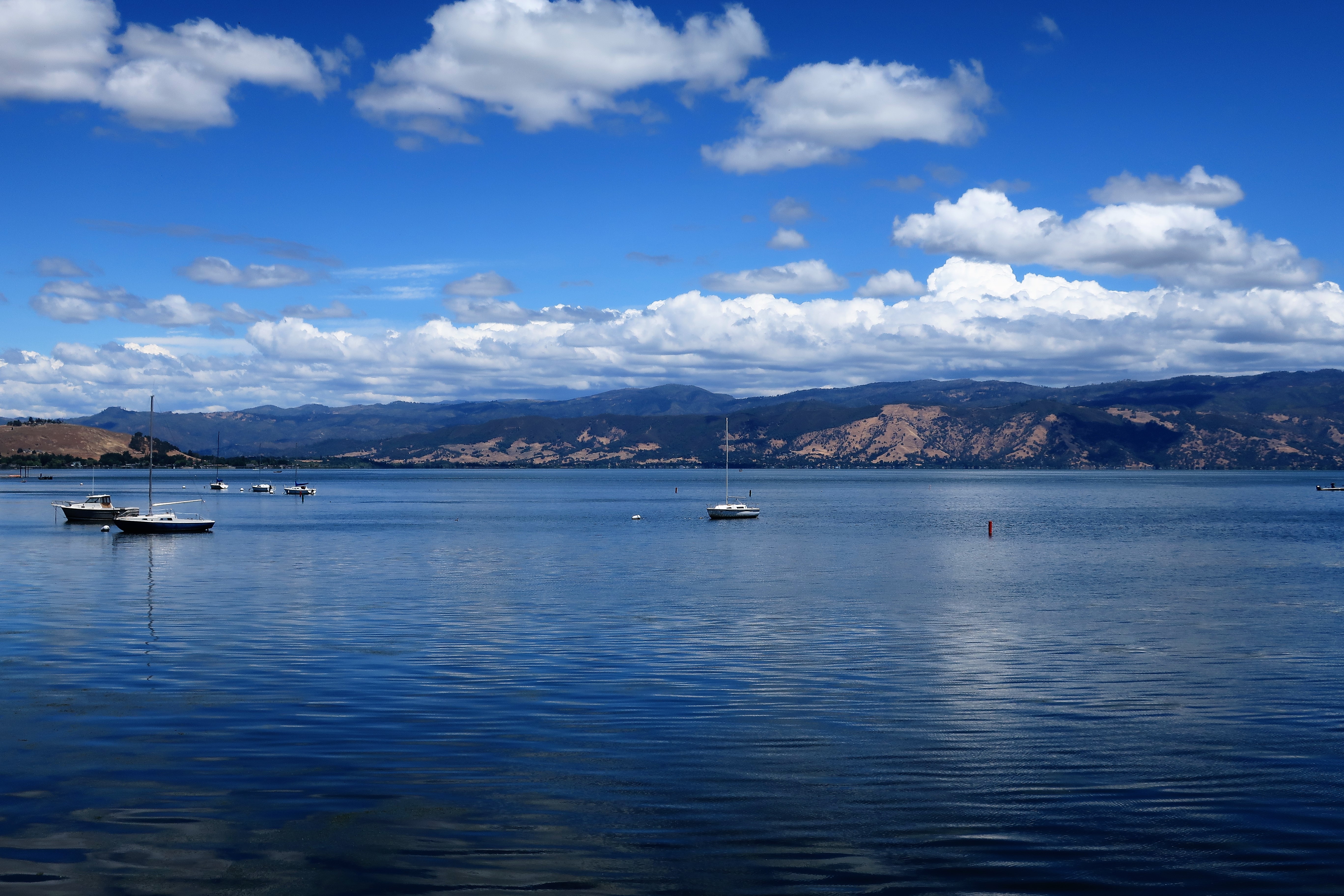
After leaving Colusa, I turned west toward the Coast Range mountains and Lake County, California. Lake County is named for Clear Lake, a large natural lake nestled in the mountains in between the Sacramento Valley and the Pacific Ocean. Here are views of Clear Lake from the highway approaching Lakeport:
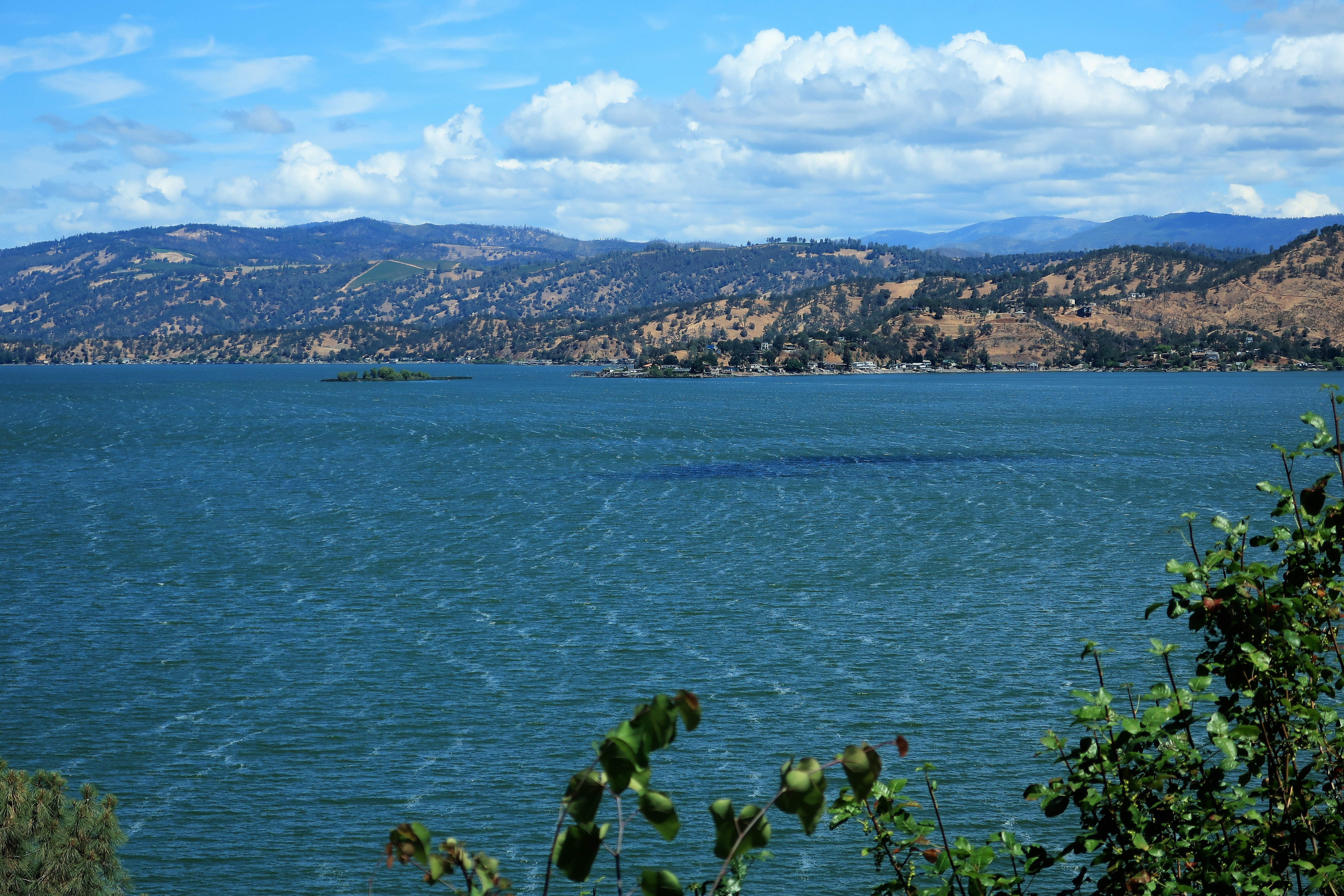
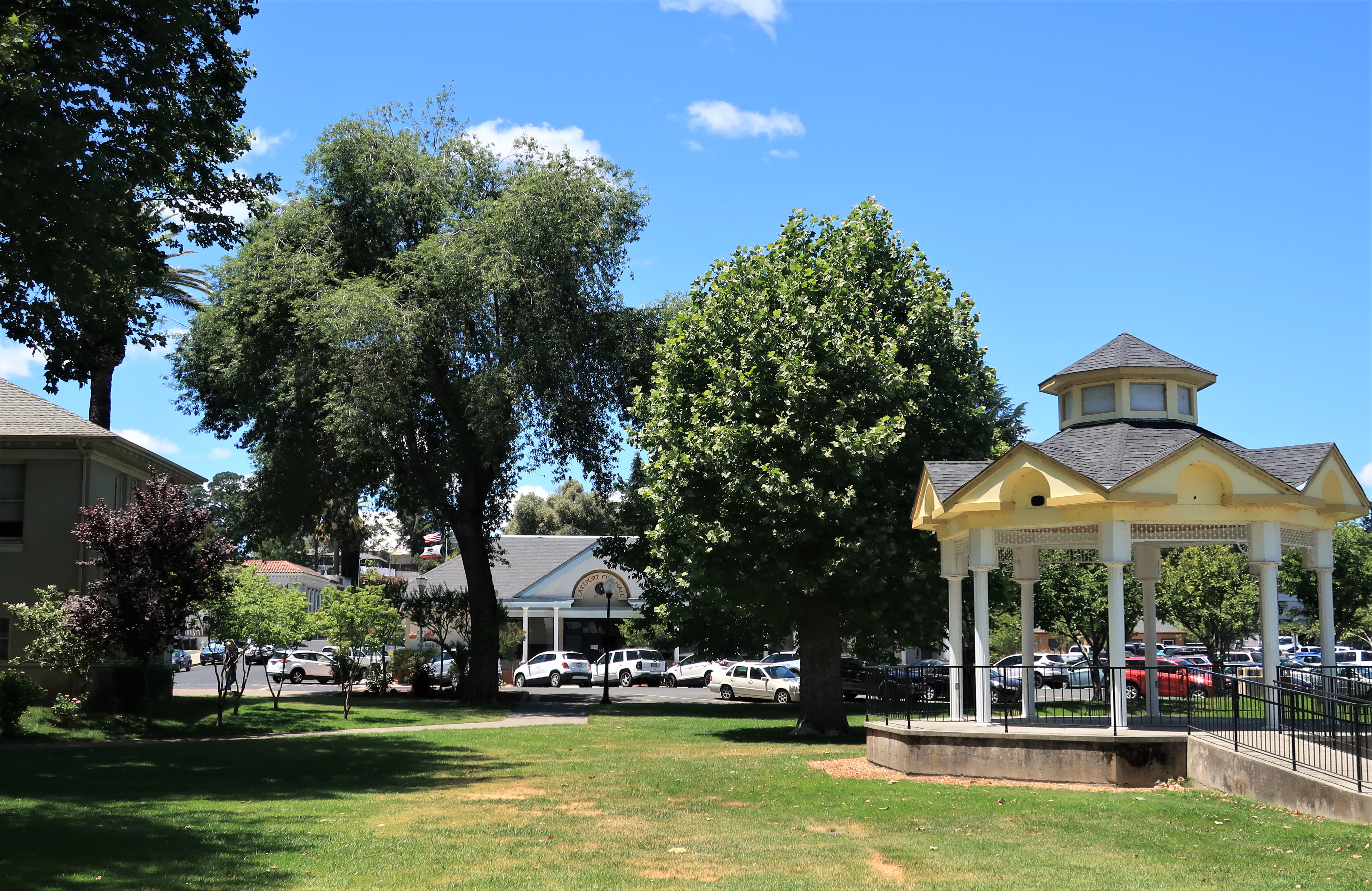
The town of Lakeport is the county seat for Lake County. It’s a picturesque little place on the shores of the lake with some old business blocks, pleasure boats, and a few good views.
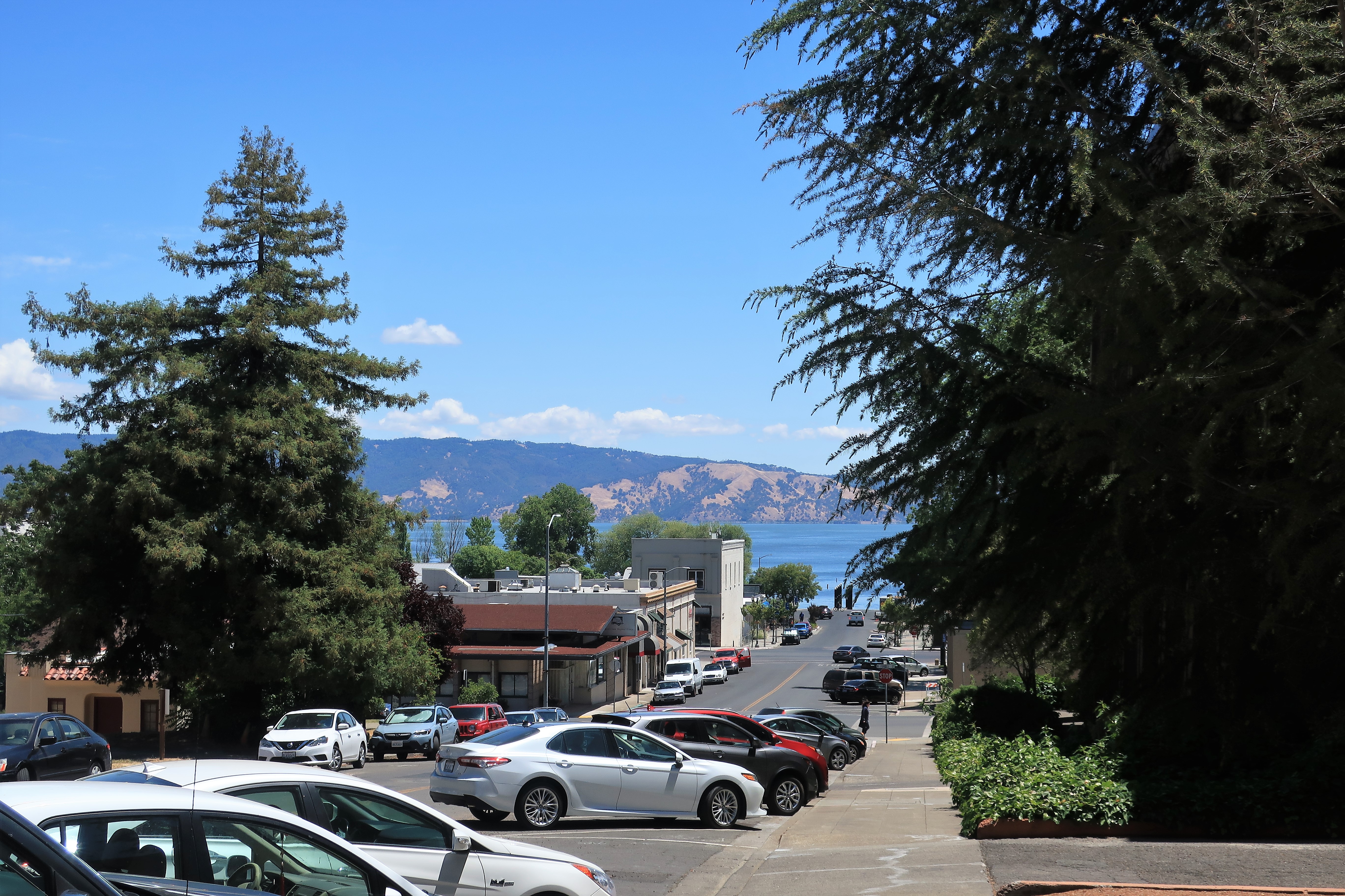
Here are some photos around Lakeport (town park, docks, gazebo, and old business block):

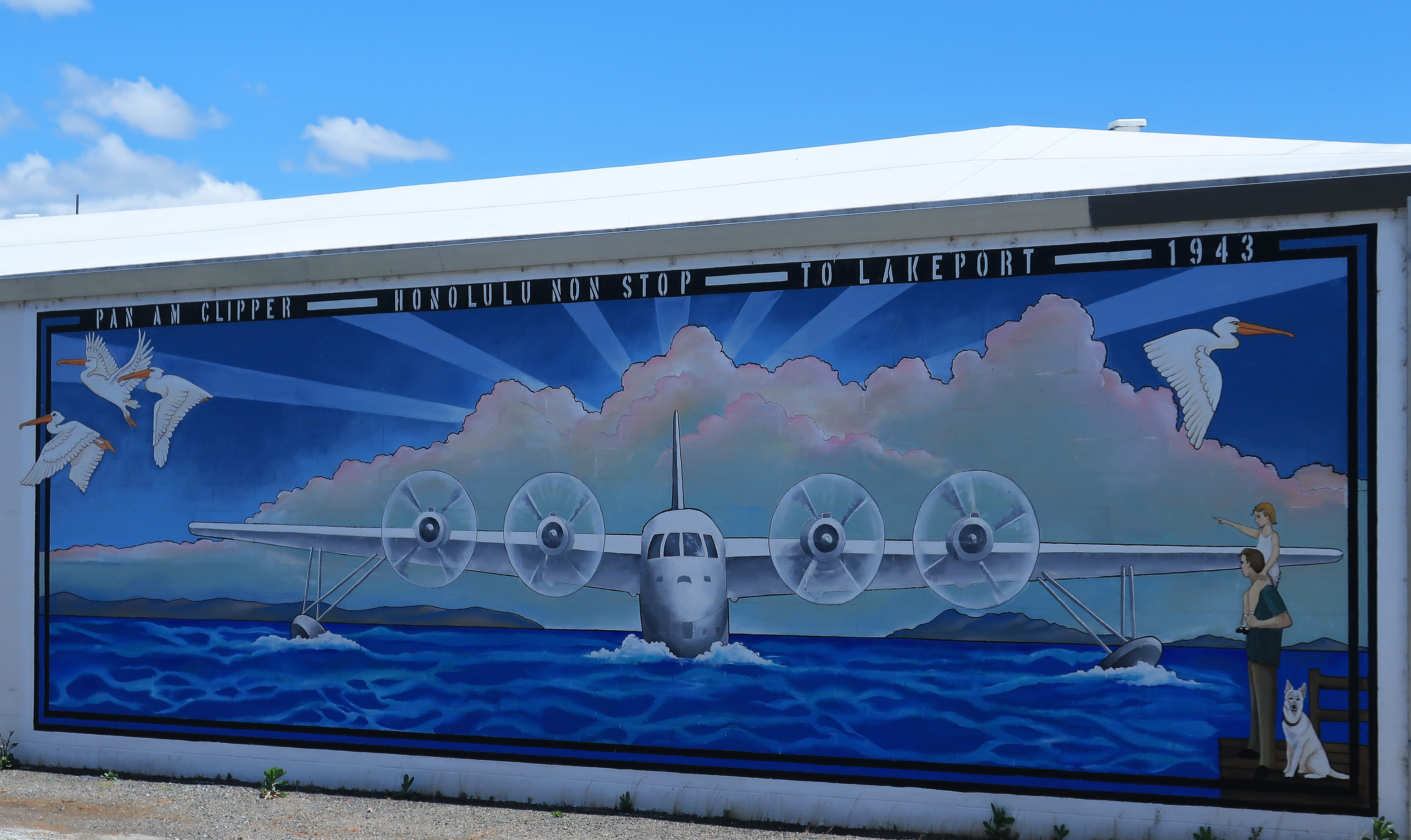
Pan Am clipper service from Honolulu to Lakeport in 1943? I wonder if the flight ever actually existed, or if it was just a flight of someone’s imagination?
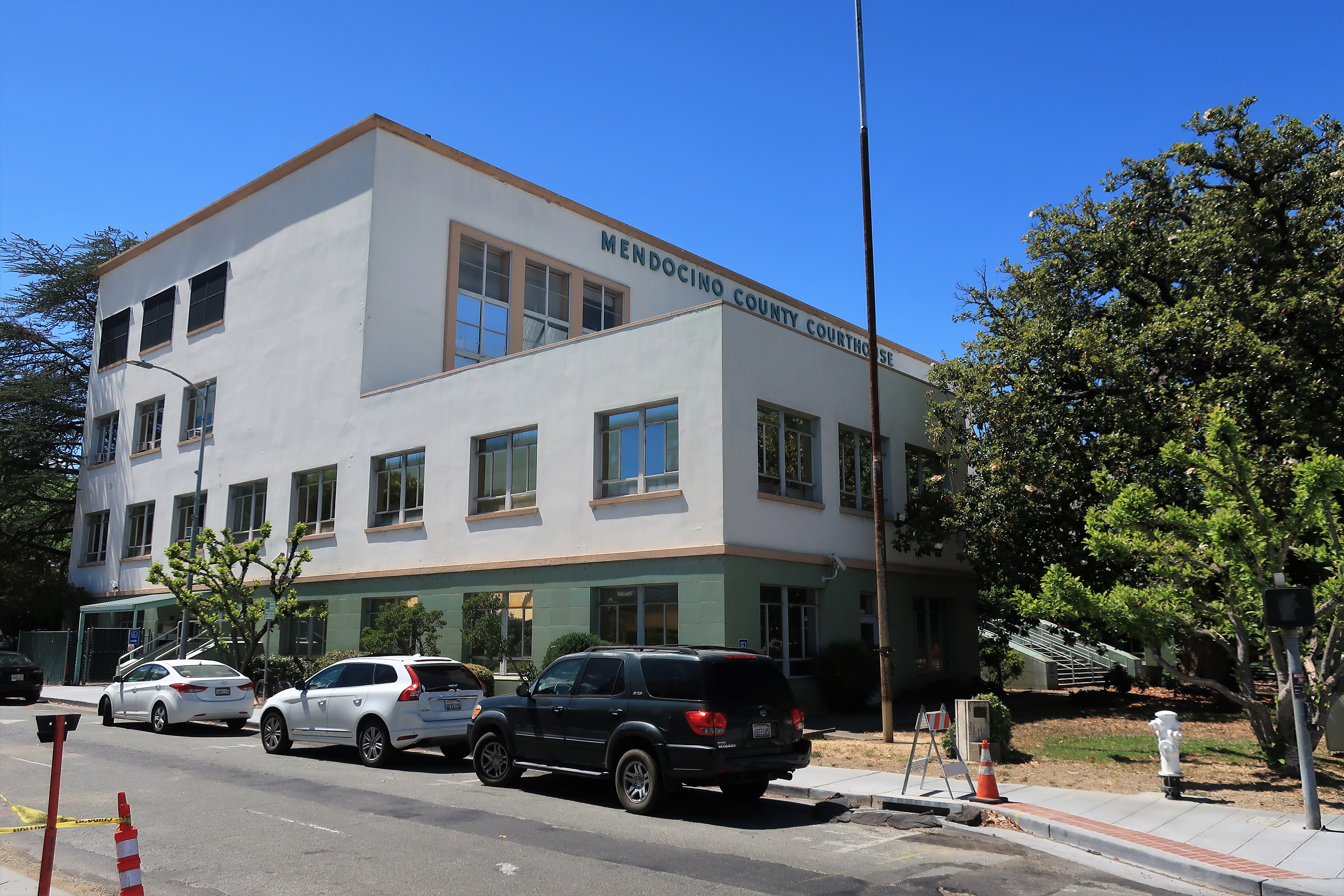
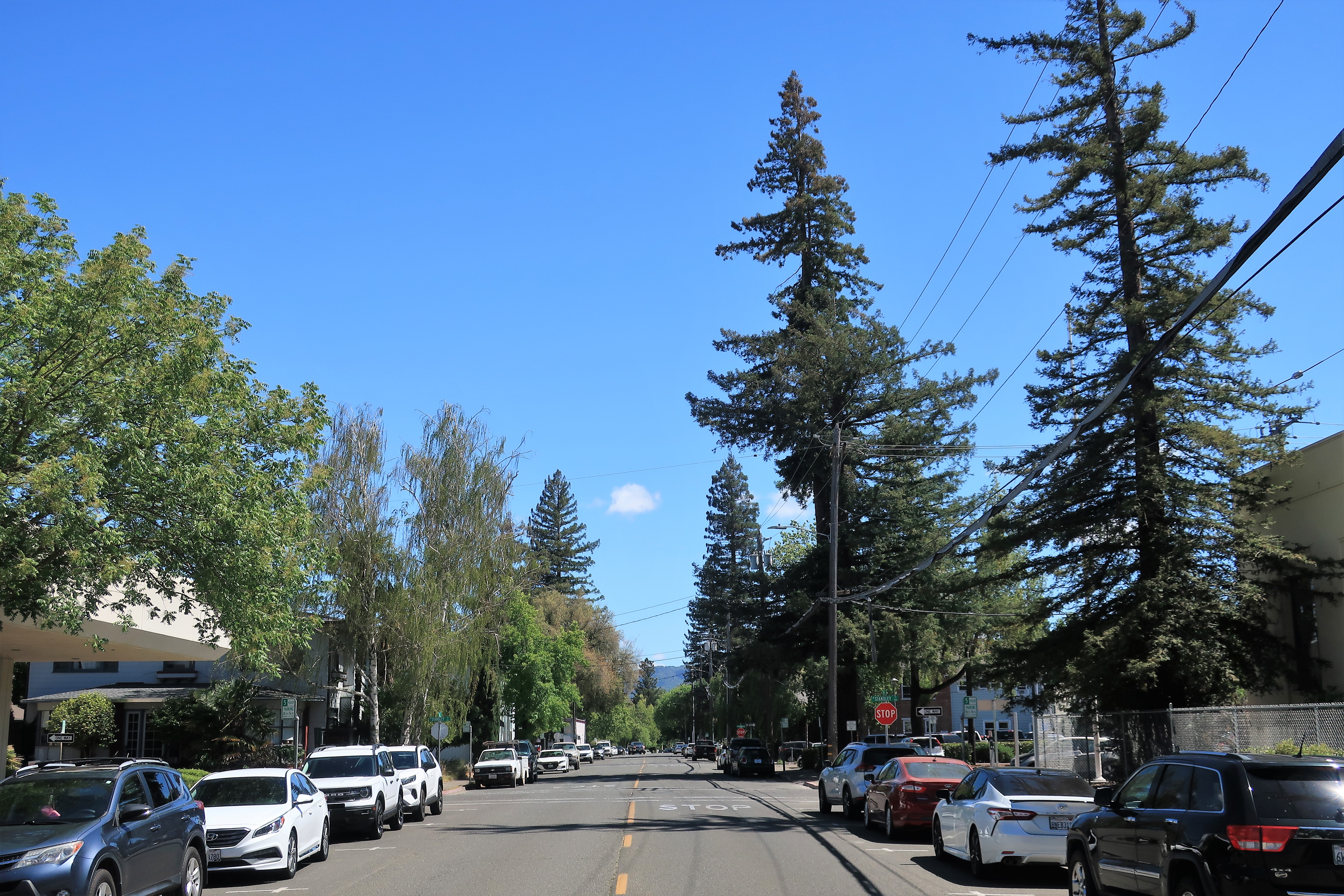
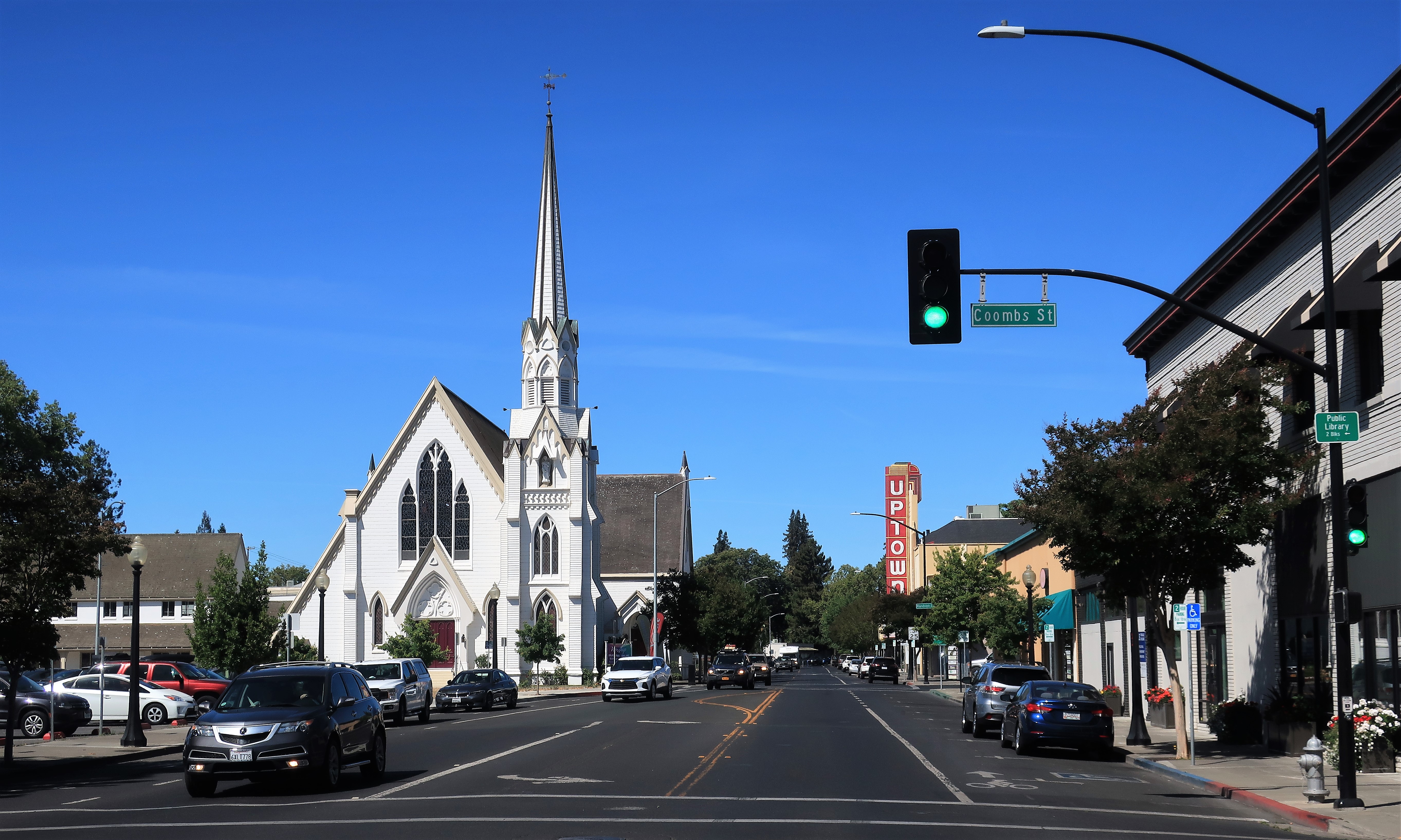
Heading west from Lakeport, I crossed some more mountains to reach the town of Ukiah, the seat of Mendocino County and part of California’s North Coast. This area, along with Humboldt County/Eureka to the north, has long been known as a “hippie hangout” even before marijuana was legalized in California. Even here though, among the “long-haired, maggot-infested, dope-smoking FM types” (as the late Rush Limbaugh used to call them), some are with us!
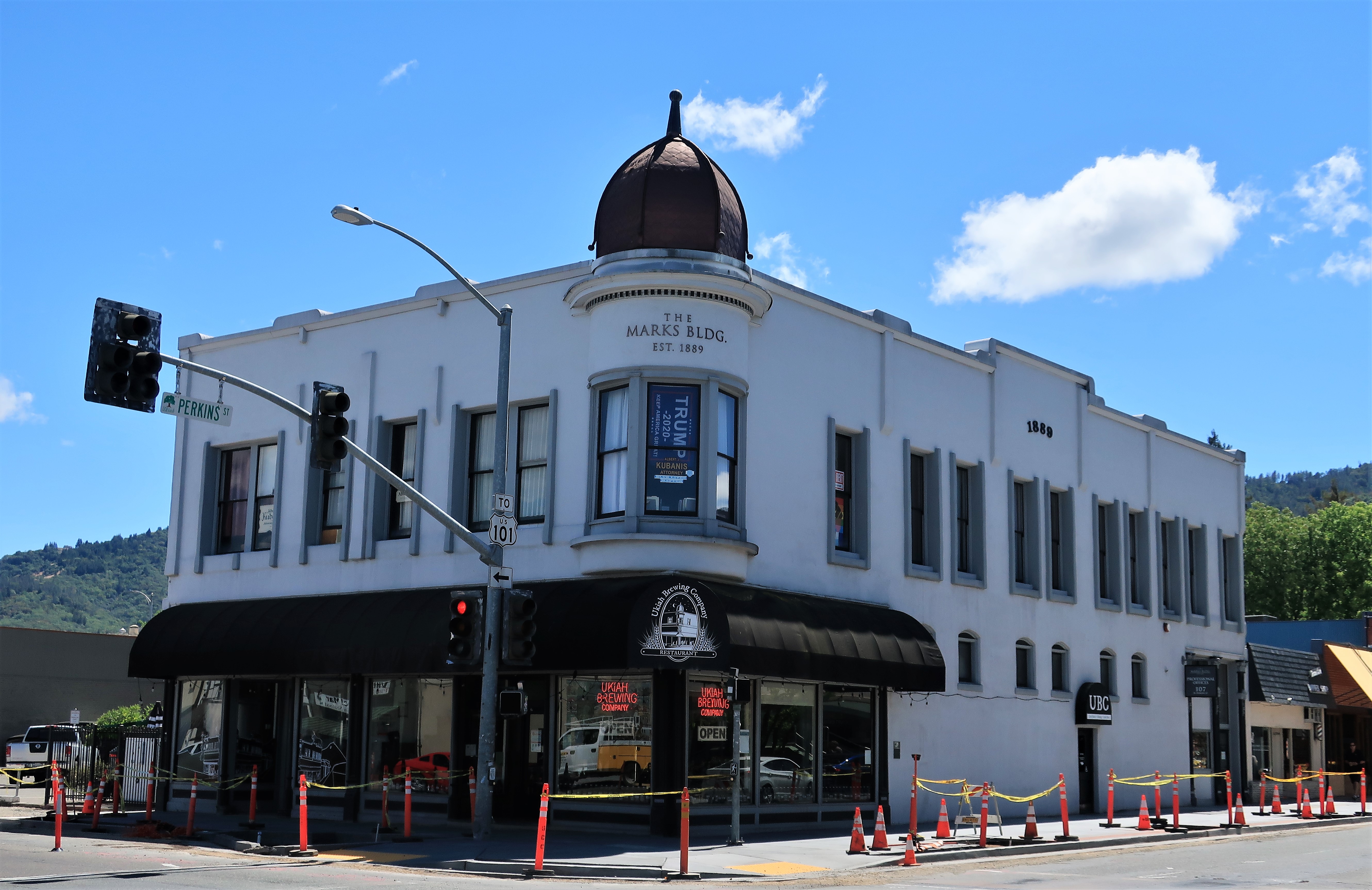
The Mendocino County Courthouse is across the street from the Marks Building. The mural of Lady Justice is from an interior stairwell:


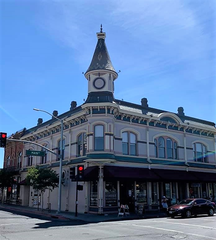
Ukiah began as a timber town, and there must be millions of dollars of timber surrounding this valley. The sawmills and lumber yards are still here, just not prominent.
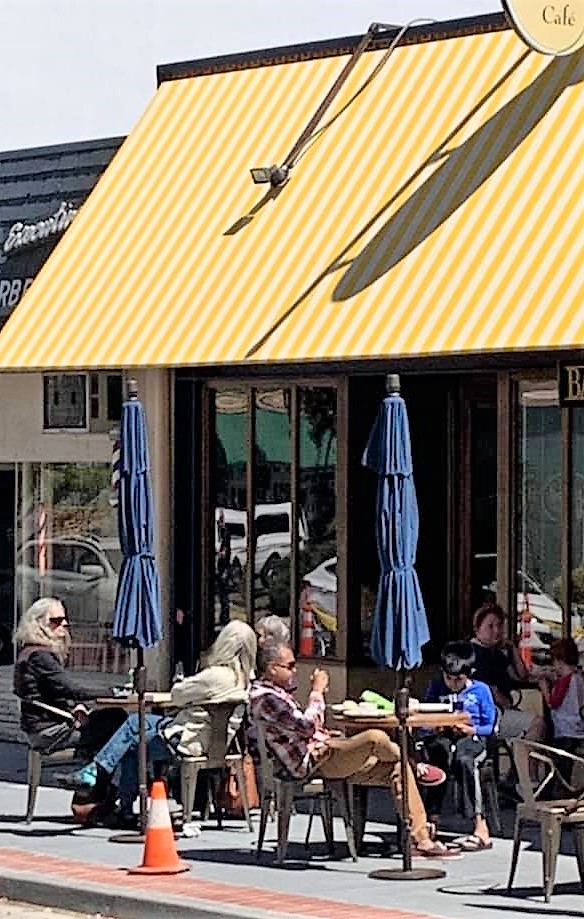
Time for an afternoon snack at Schat’s Bakery Cafe, also across the street from the courthouse and behind the Marks building. This is an old Dutch bakery, and I went for the triple-berry cheesecake & coffee. I also snuck (sneaked?) a photo of some typical locals.

Seeing from Facebook that I was in Ukiah, Mike Donovan pointed out that the Doobie Brothers (of course) wrote a song called “Ukiah.” It’s from their album “The Captain and Me,” released in 1973. Although 1973 is ancient history and therefore before the age of MTV, someone has put together a YouTube video for the song. Here’s the link.
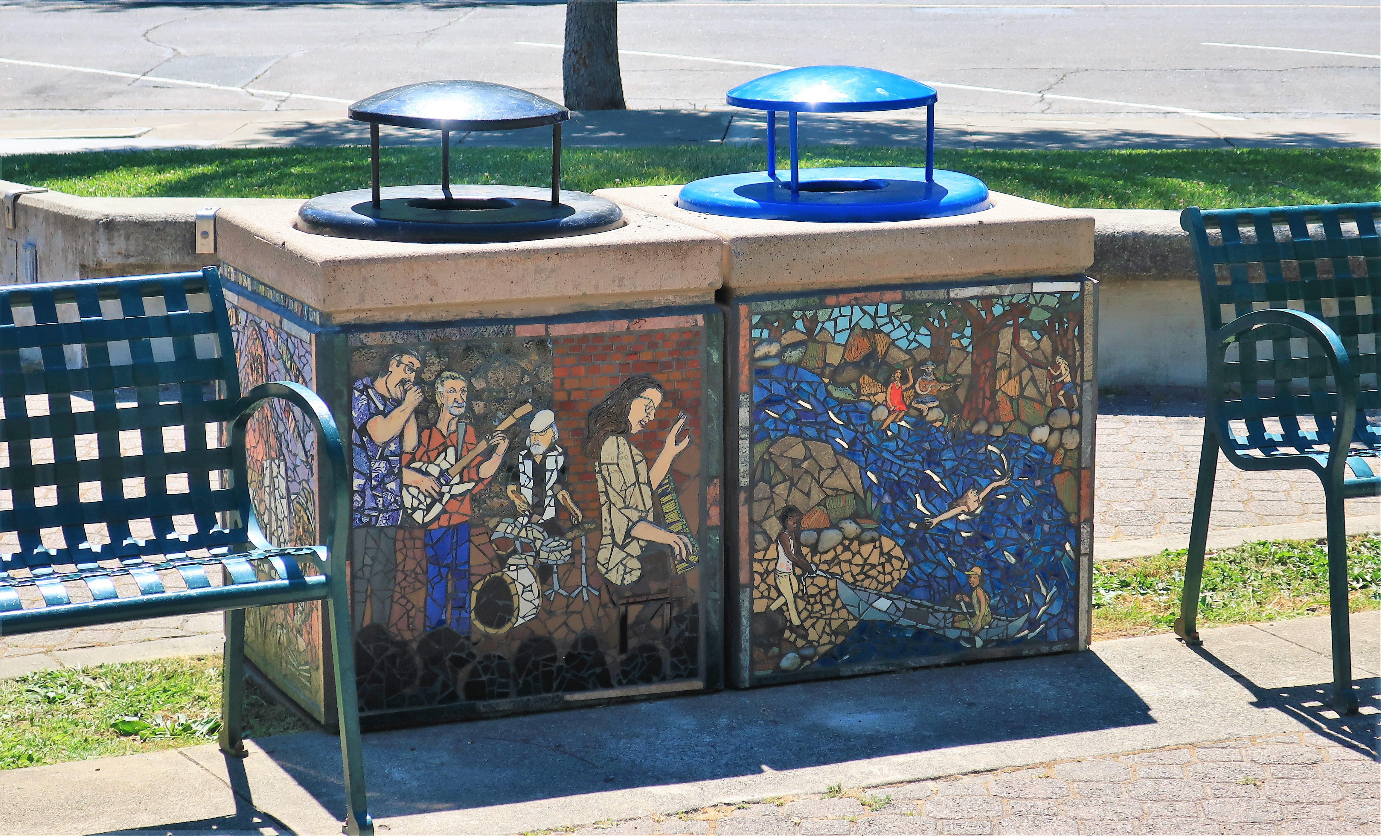
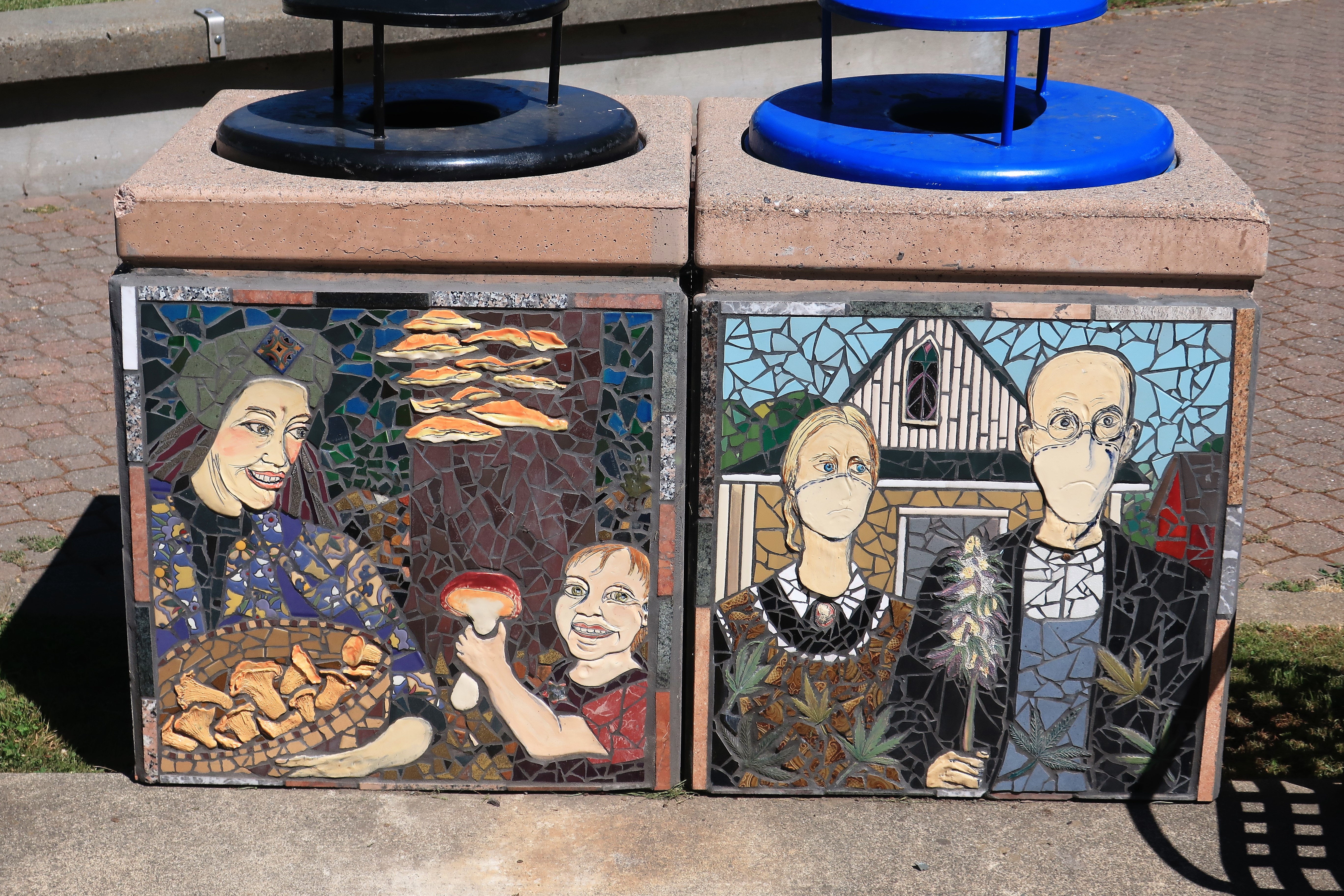
Hippie mosaics in Ukiah’s town park seem appropriate for the area, as do the mushrooms, but check out what they did to American Gothic!
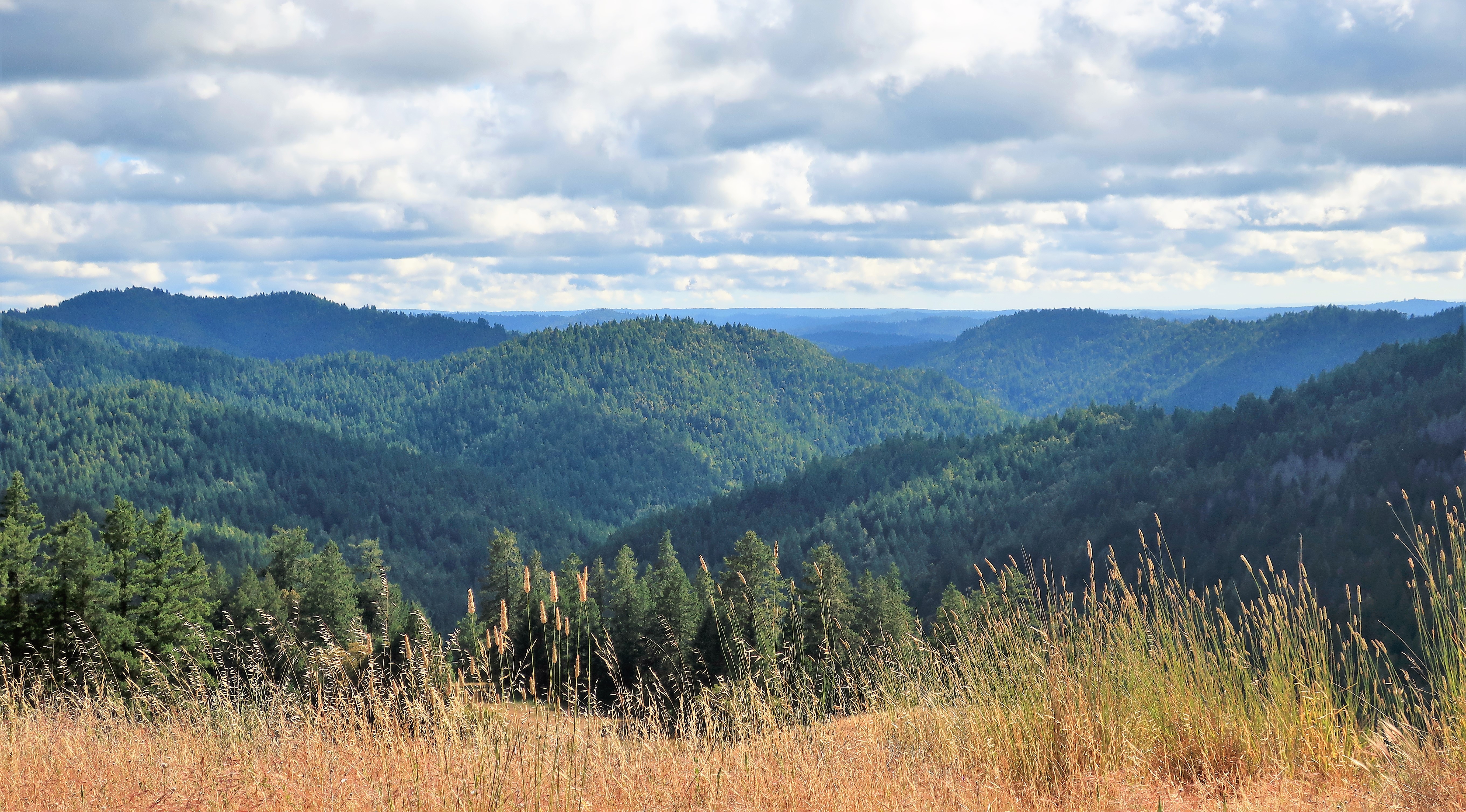
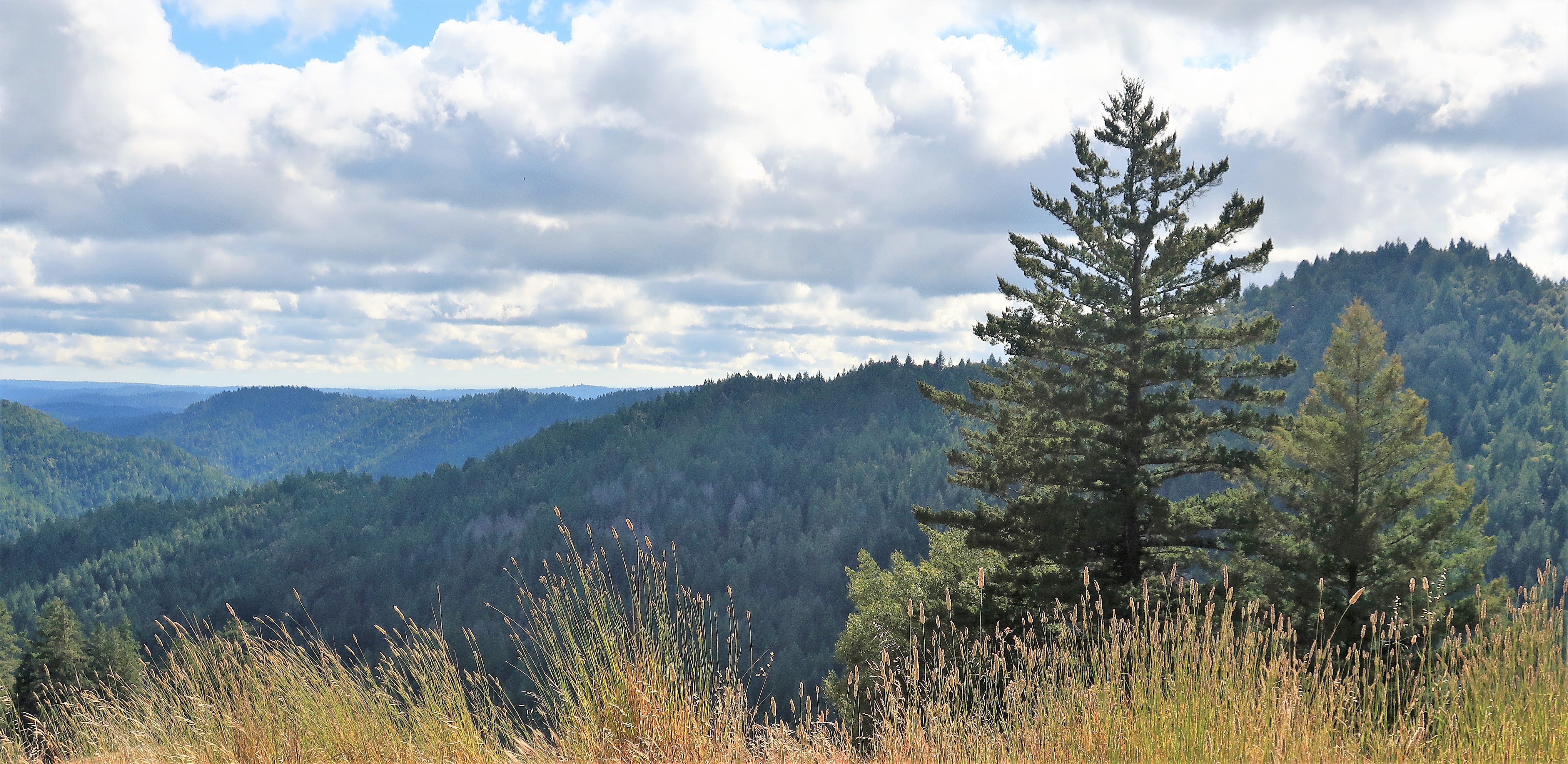
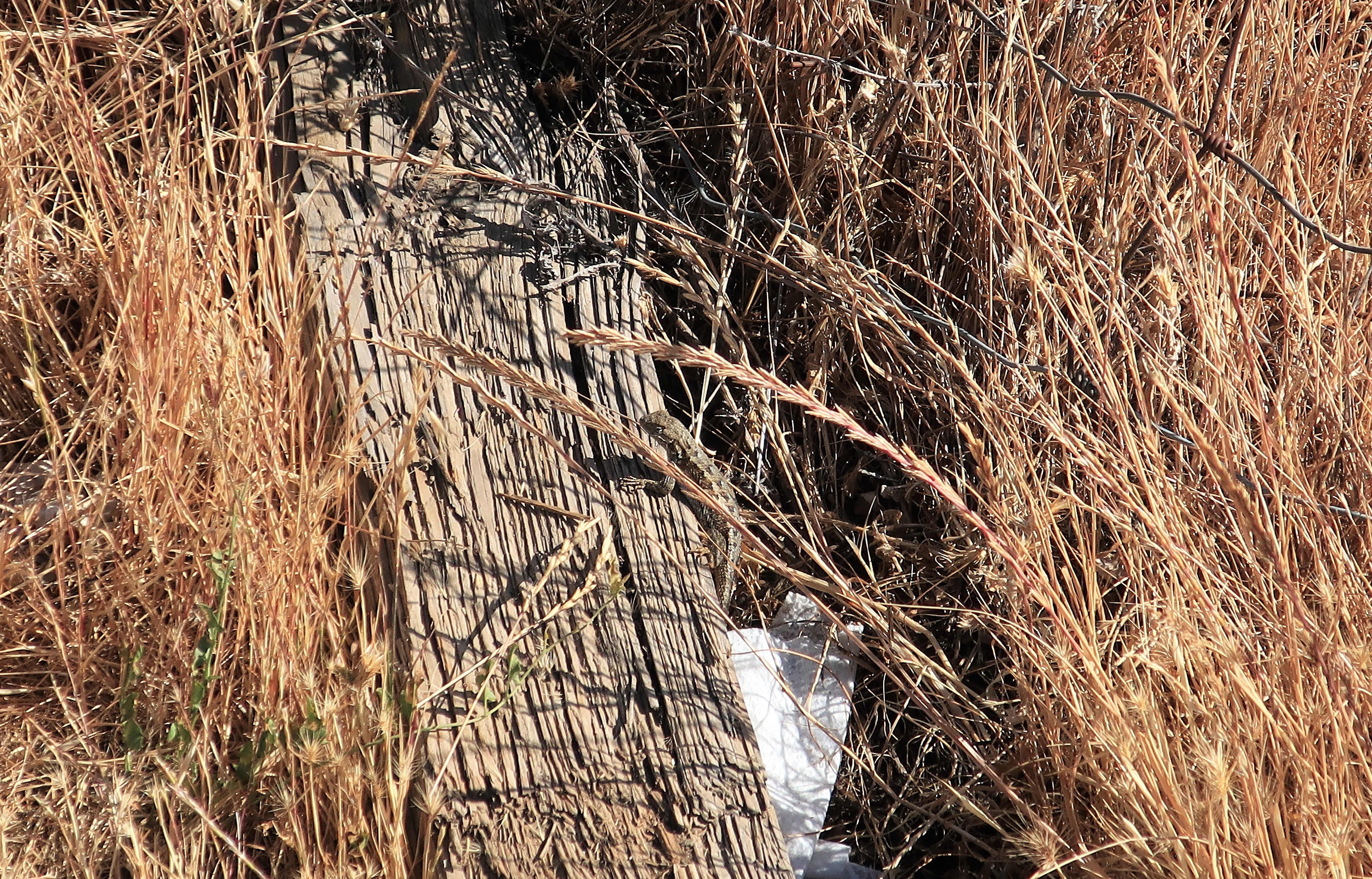
Now I have just one more set of mountains to cross until I finally reach the ocean. There’s no hurry, however. Hurry and you might miss scenes like these, and little critters at your footstep. These were taken on a hilltop along California Highway 20, just west of the town of Willets:
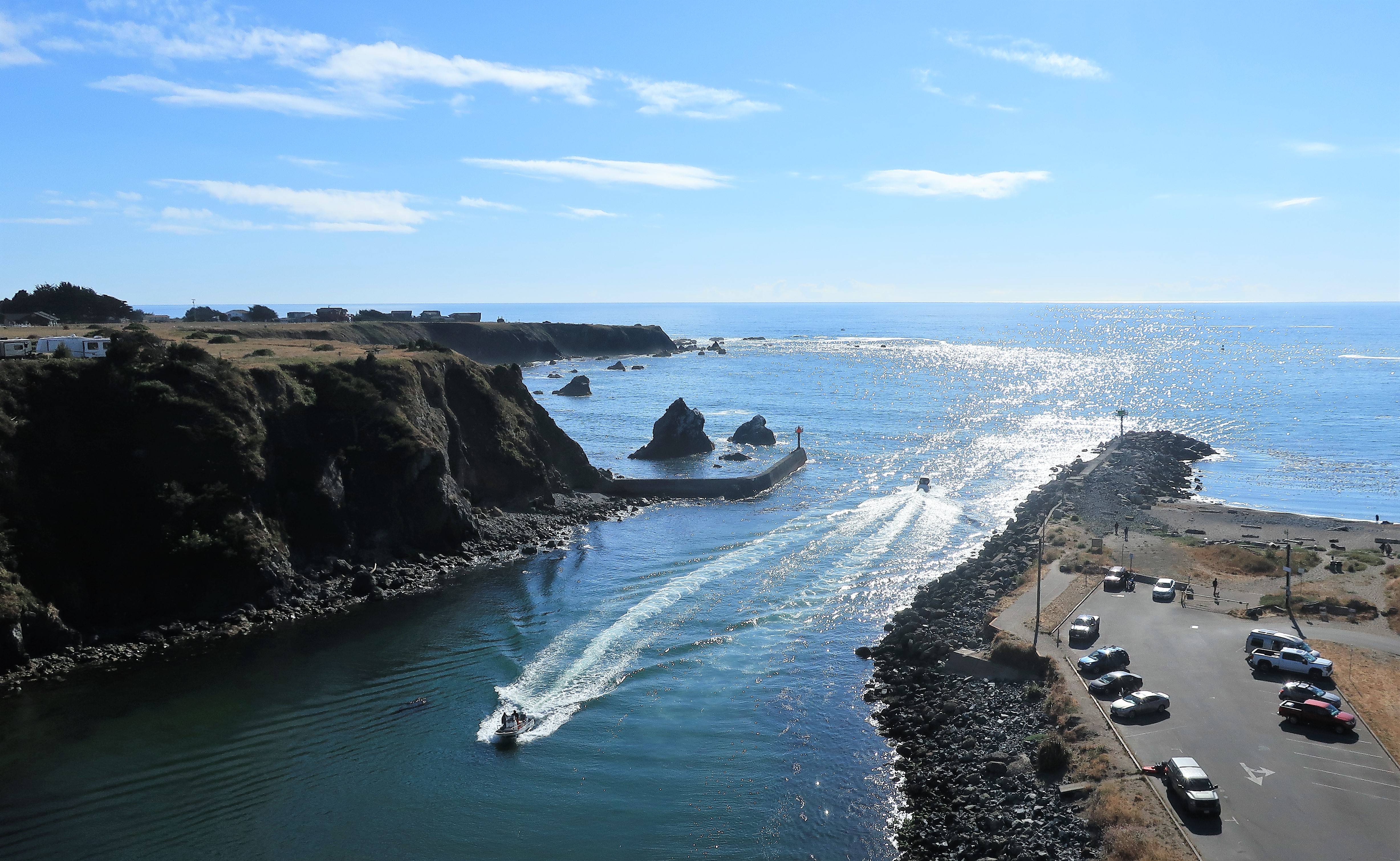
Finally, I reached the coast at Fort Bragg, California. This is not to be confused with Fort Bragg, North Carolina; the military here is the Coast Guard. Fort Bragg is a small harbor town at the mouth of the Noyo River. It boasts about 7,000 people and a wharf where those who enjoy catching and eating sea creatures/monsters can enjoy themselves. (I don’t like fish–can you tell?) It’s a small, beautiful place nevertheless.
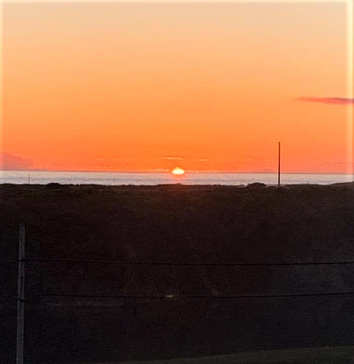
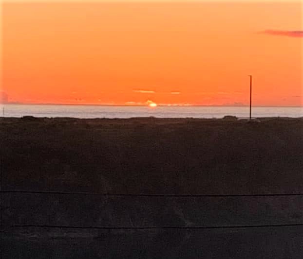
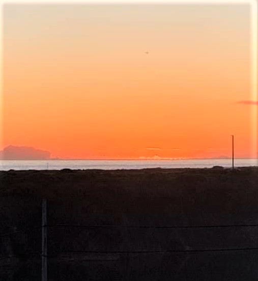
Sunset over the Pacific Ocean at Fort Bragg, California. The photos are from my balcony at the Beach House Inn on Pudding Creek. I can heartily recommend this place — a short walk to the beach with great ocean views, yet affordable.
Not many good dining options here in this little seaside town (unless you like seafood) so I went with a simple triple cheeseburger and fries with hot chocolate. Hot chocolate because it warms the belly — temperatures get down into the 50s here.
Thursday, June 10, 2021. Day 6: Fort Bragg to Sonoma, California
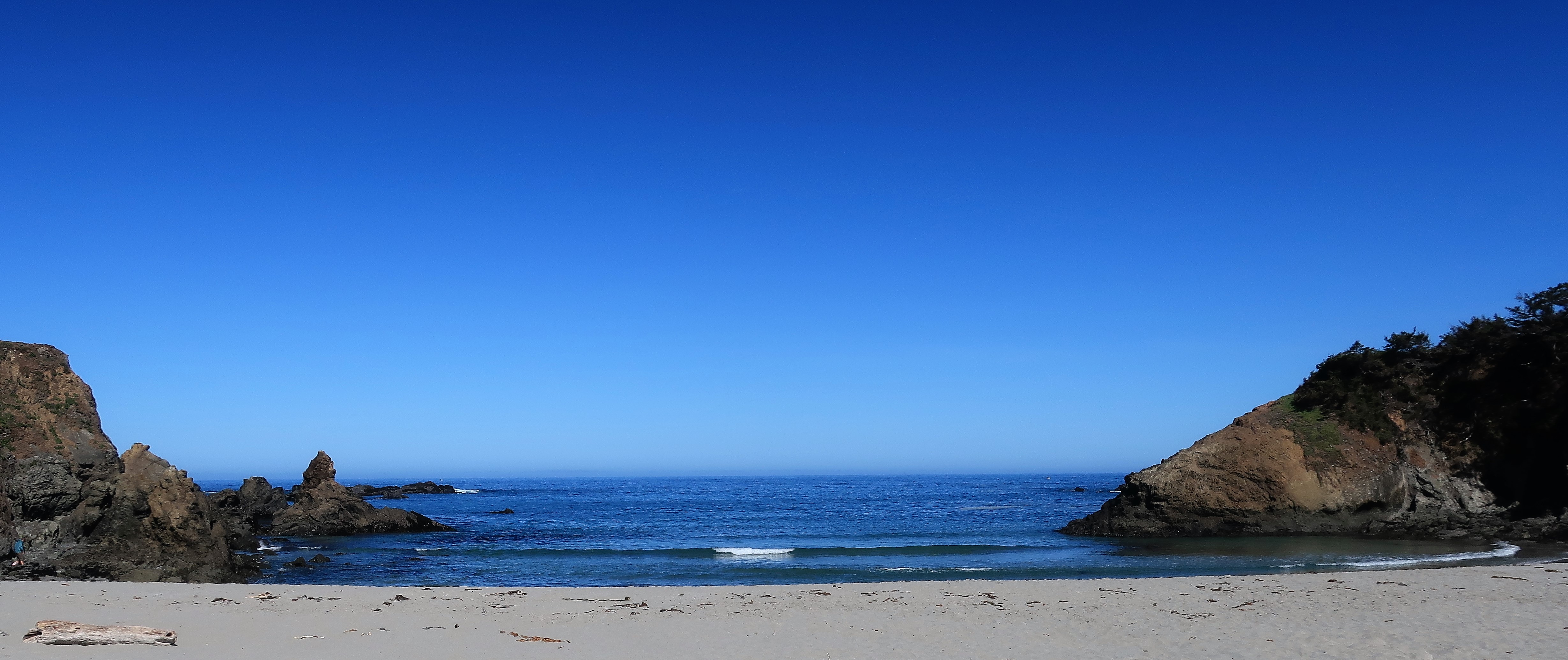
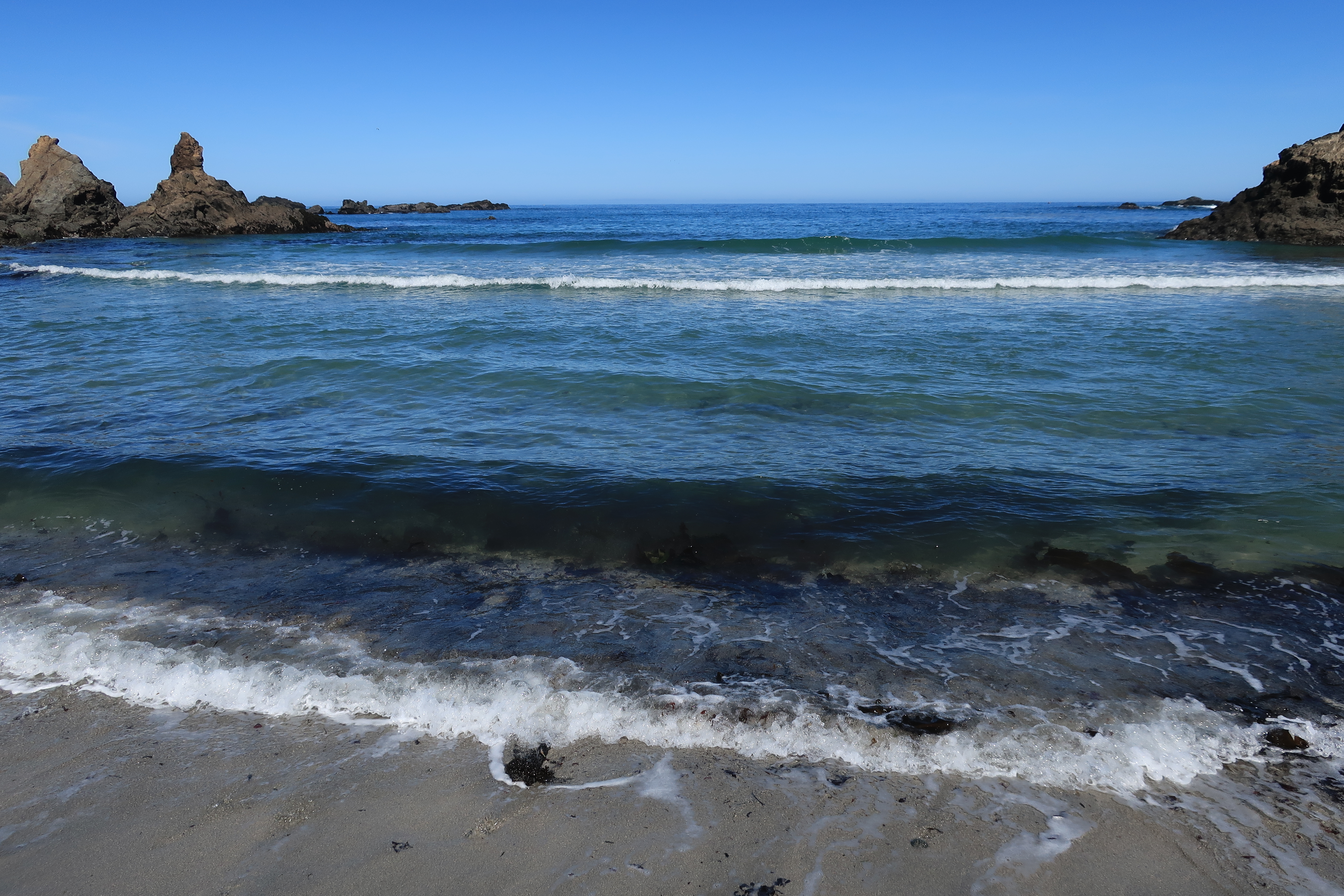
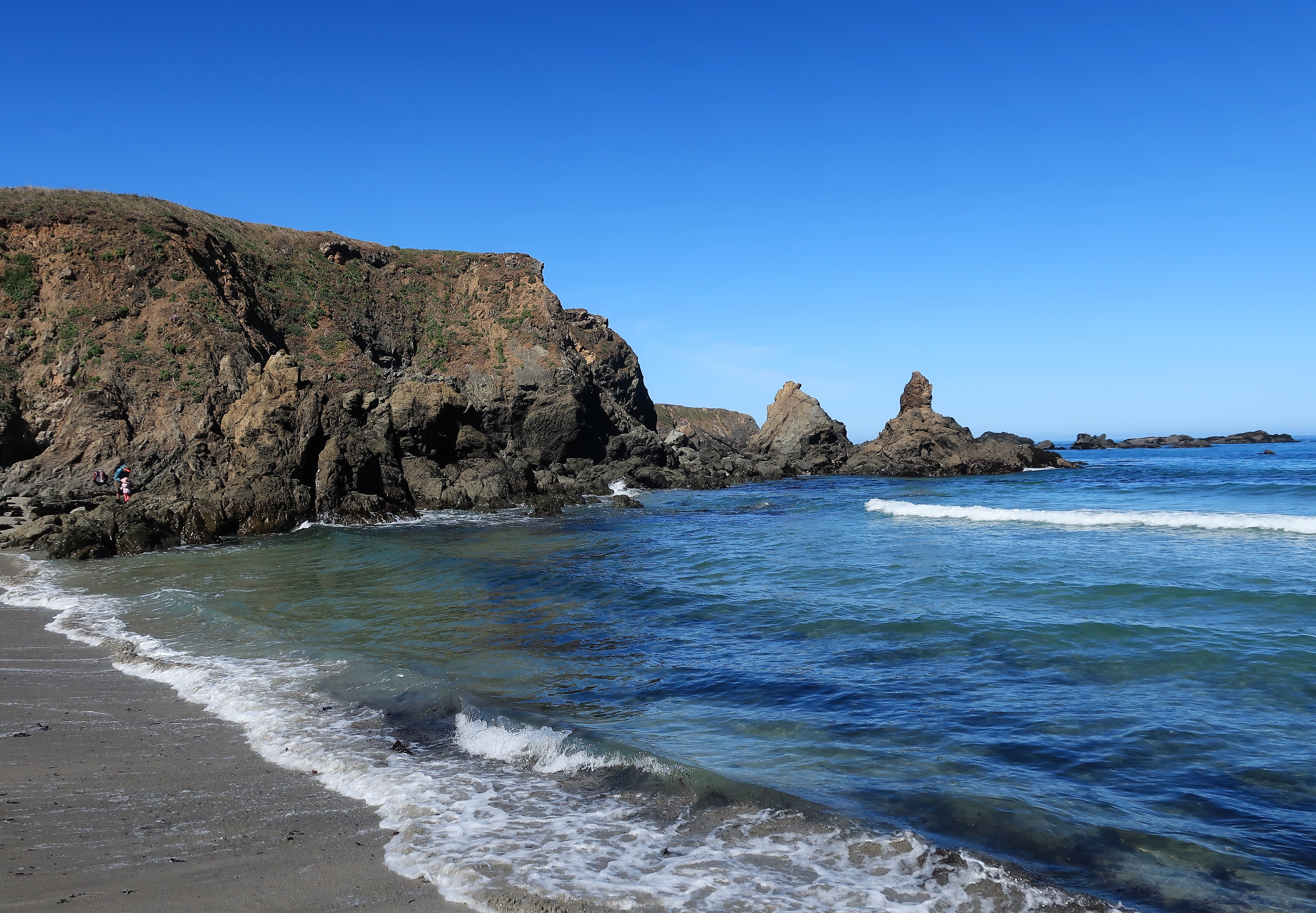
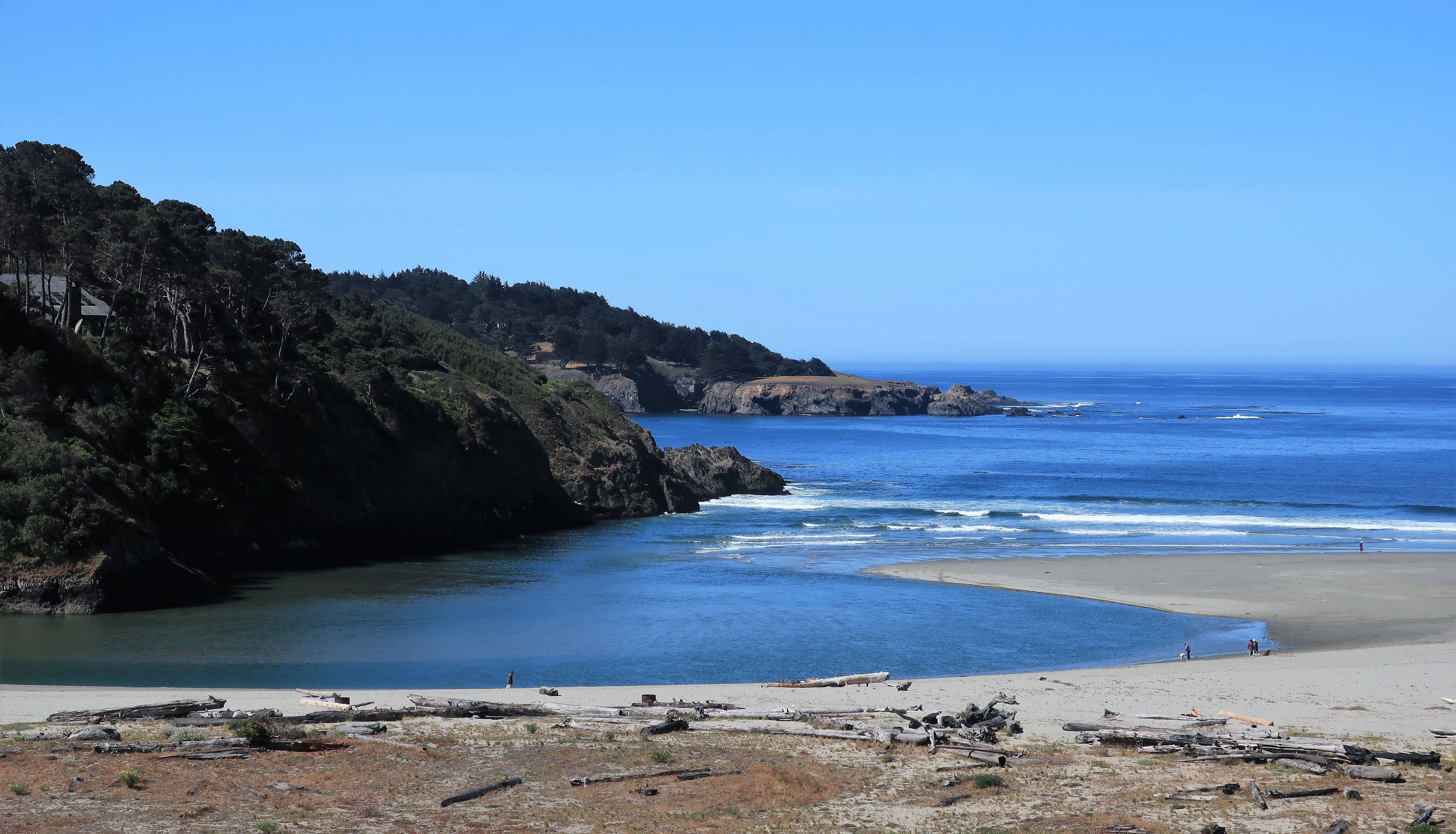
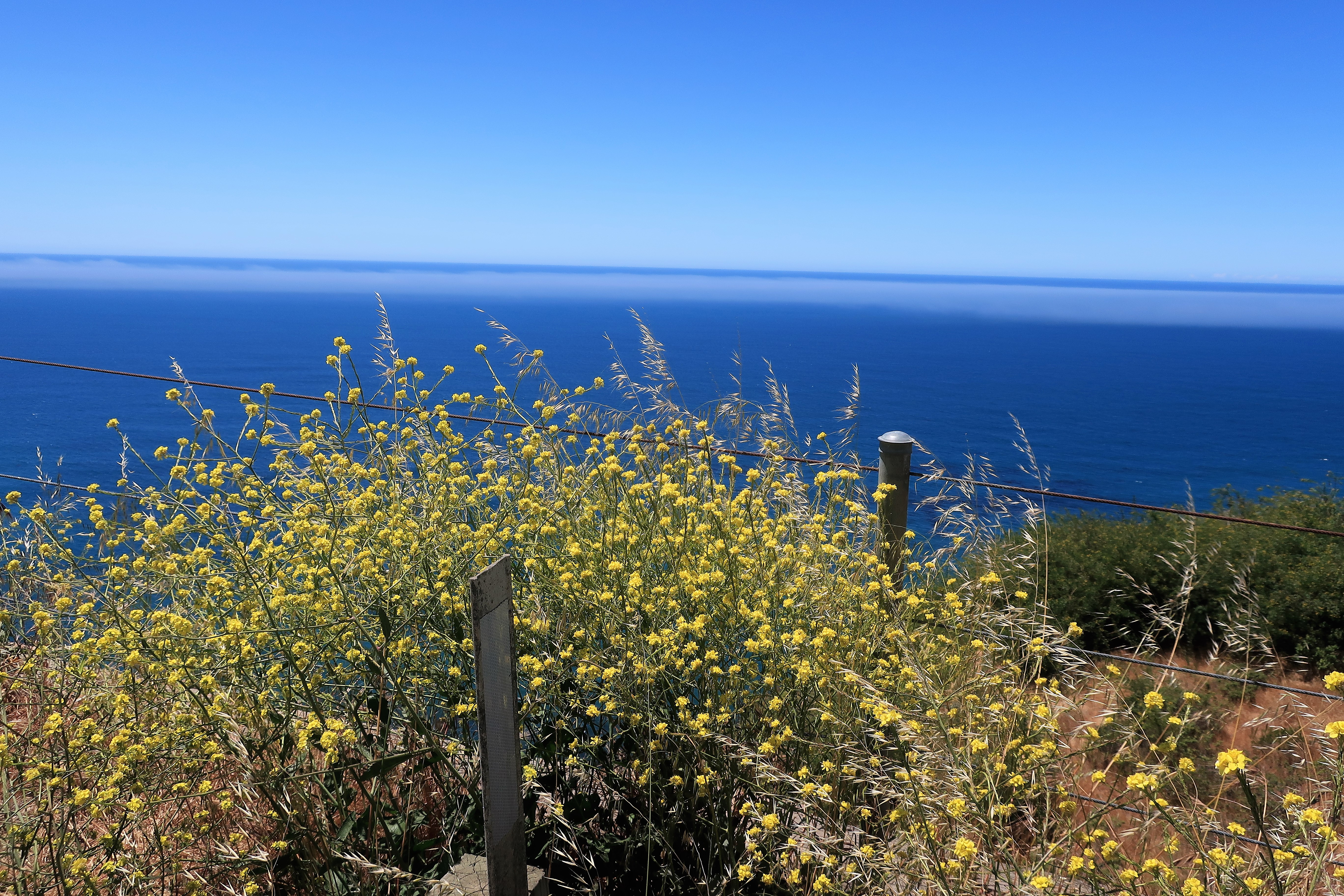
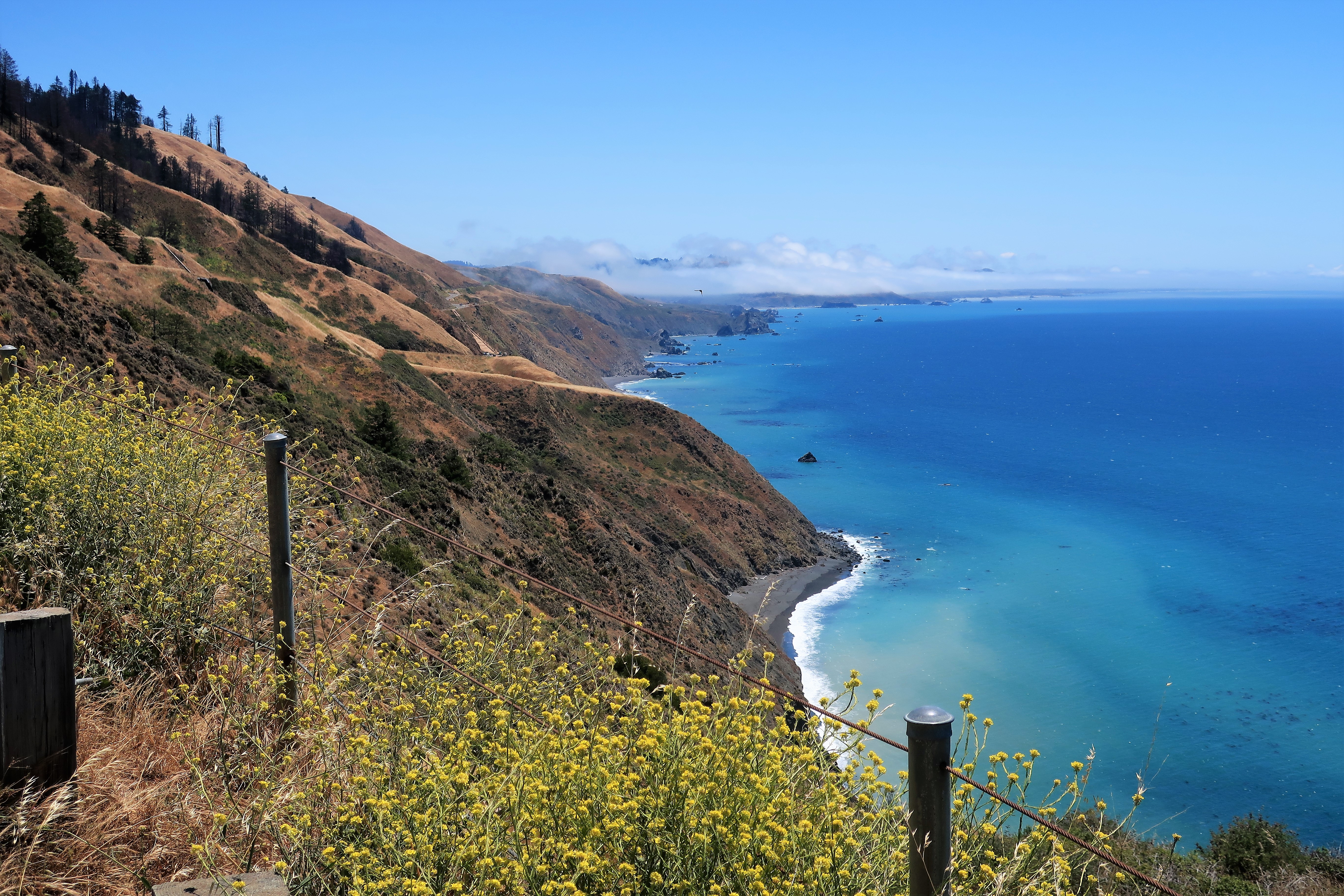
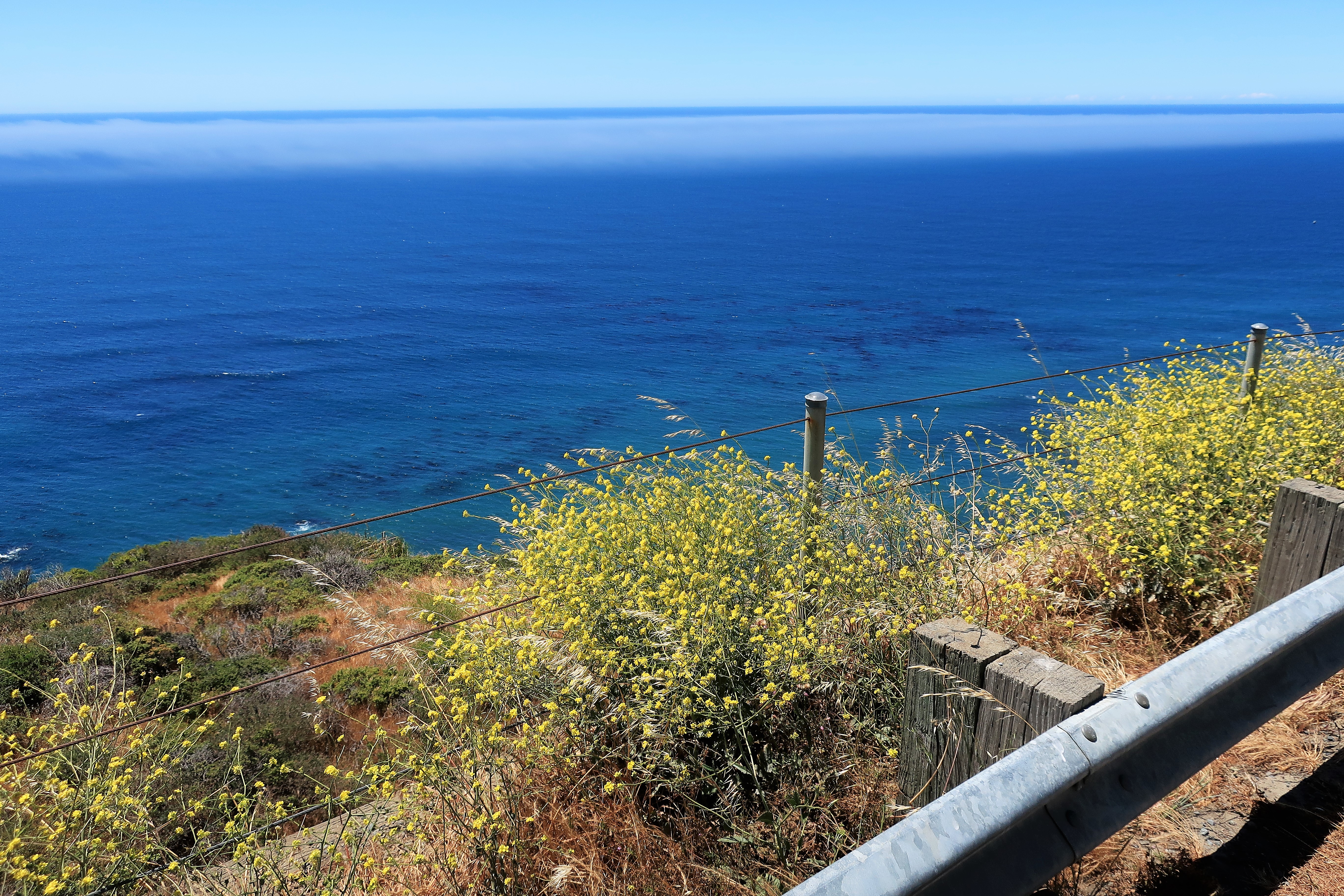
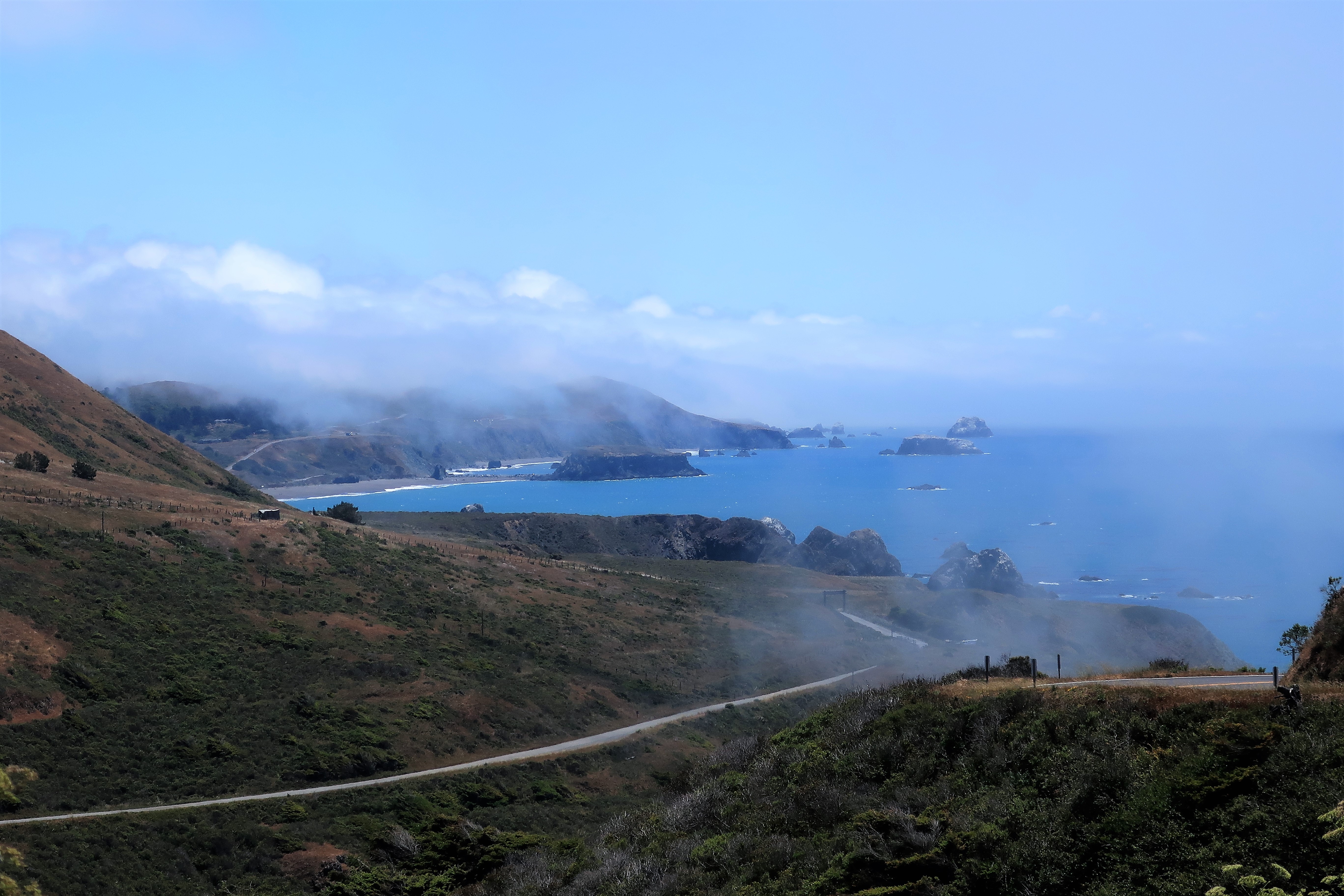
I planned this part of the trip as a day of driving down the coastline along California Highway 1, known as the Shoreline Highway. This route hugs the ocean while Highway 101 runs through the valleys further inland. Today will be mostly a day of driving and stopping for a few photographs until I reach Bodega Bay and head inland toward the towns of Santa Rosa and Sonoma. So here we go. I’m using the second photo in this set as my computer desktop image; help yourself to a copy of your favorite:

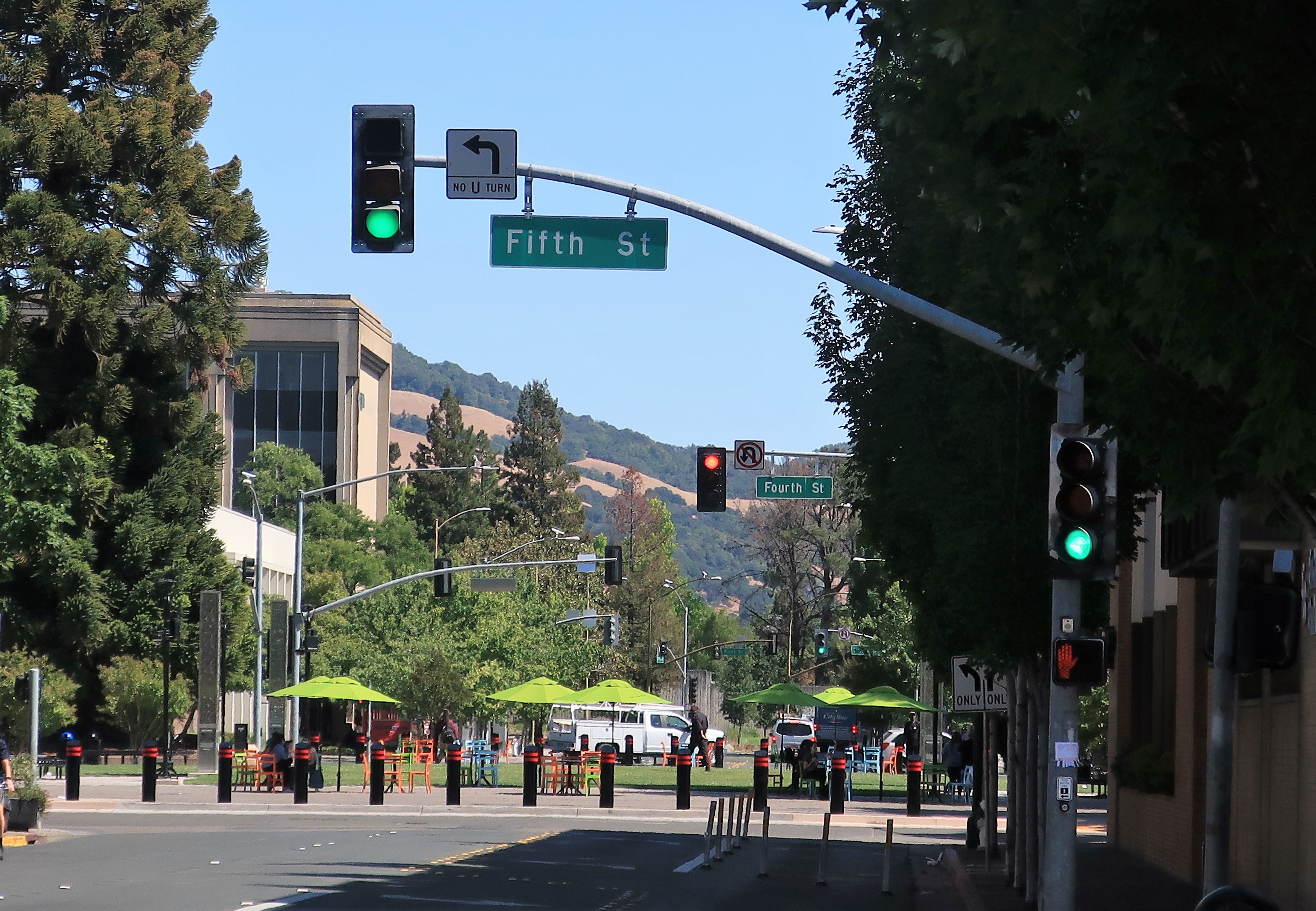
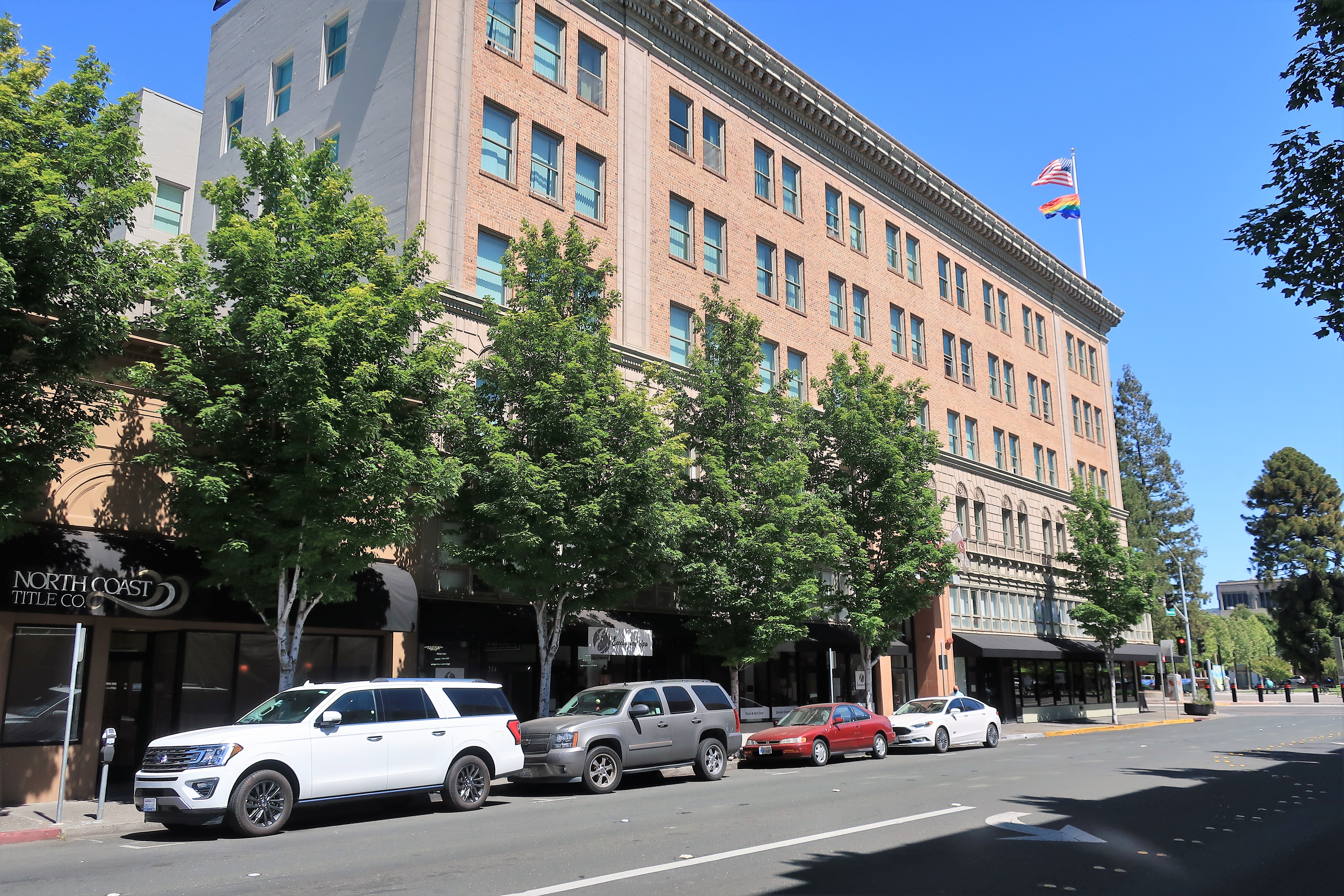
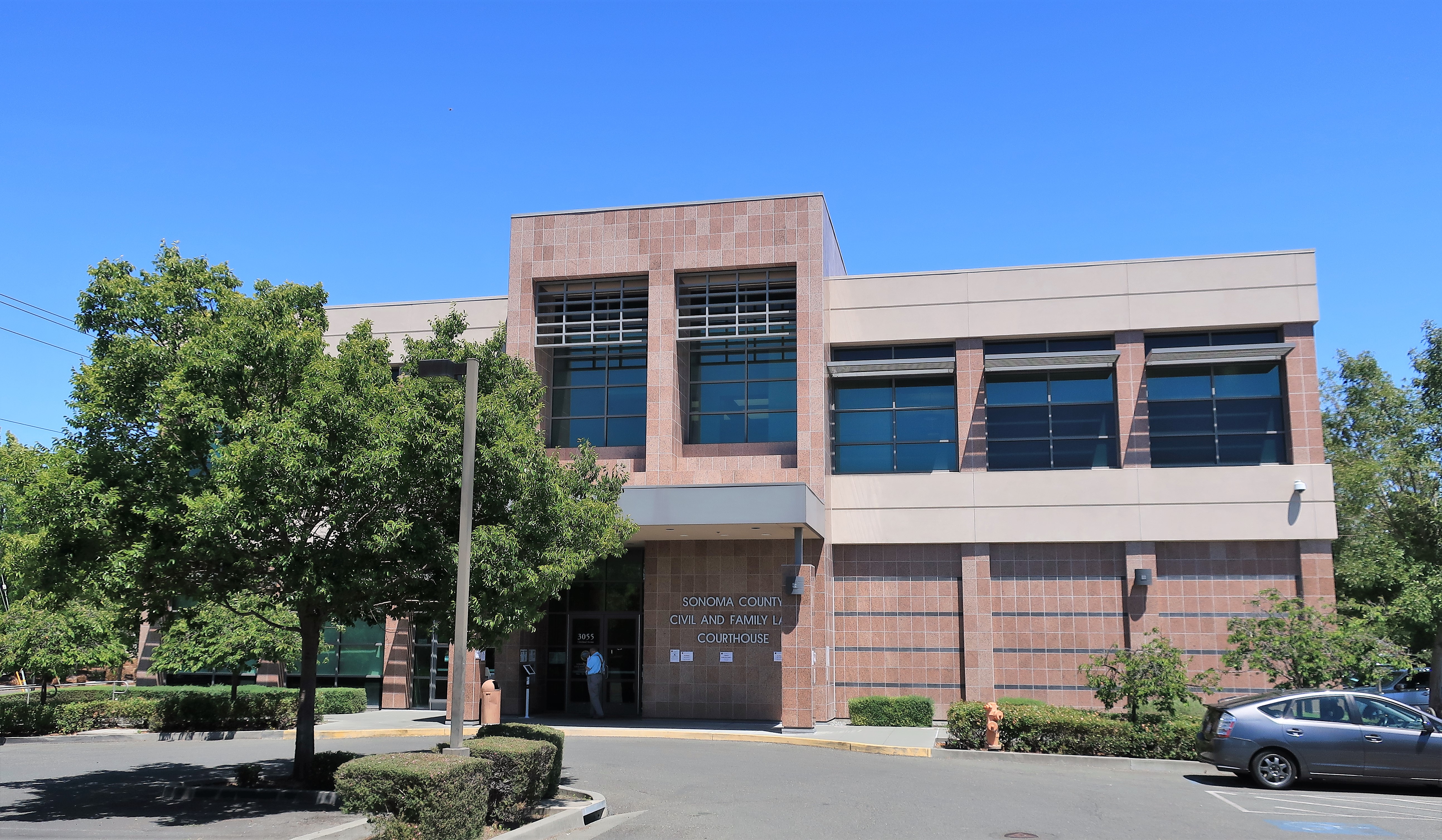
After a long day of driving the coast, I turned inland and arrived at the city of Santa Rosa, the county seat of Sonoma County, around 4:00. Santa Rosa might be said to be a northern suburb of San Francisco, very affluent and quite “woke”.

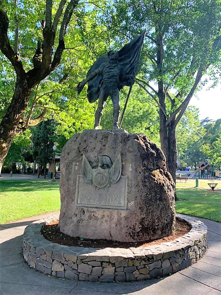
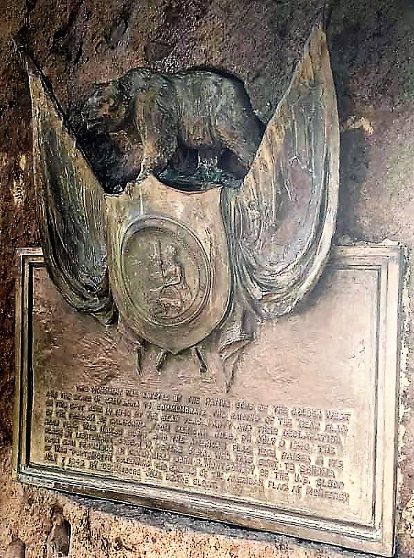
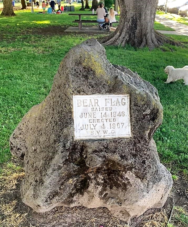
I drove on to the town of Sonoma to stay at the Best Western Sonoma Valley Inn for the night. This is a decent place a few blocks from the Sonoma Plaza — a historic place where in 1846 Californians (back when they had testosterone) raised the Bear flag and proclaimed California a republic free of Mexican rule. A statue known as the Bear Flag Monument marks the event, and I ran into some Cub Scouts being shown the monument by their scoutmaster/father.
The old Sonoma Barracks is across the street from the Plaza.
Fighting a cold I picked up last night, I avoided all the busy restaurants around the plaza for some good, hot, Thai curry in my hotel room. “Feed a cold, starve a fever” is still good advice.
Friday, June 11, 2021. Day 7: Sonoma to Colusa, California
I had a good, quiet sleep in Sonoma so I skipped the hotel breakfast and drove off toward Downtown Joe’s Brewery and Restaurant in the nearby town of Napa.
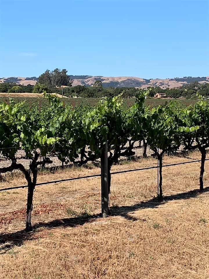
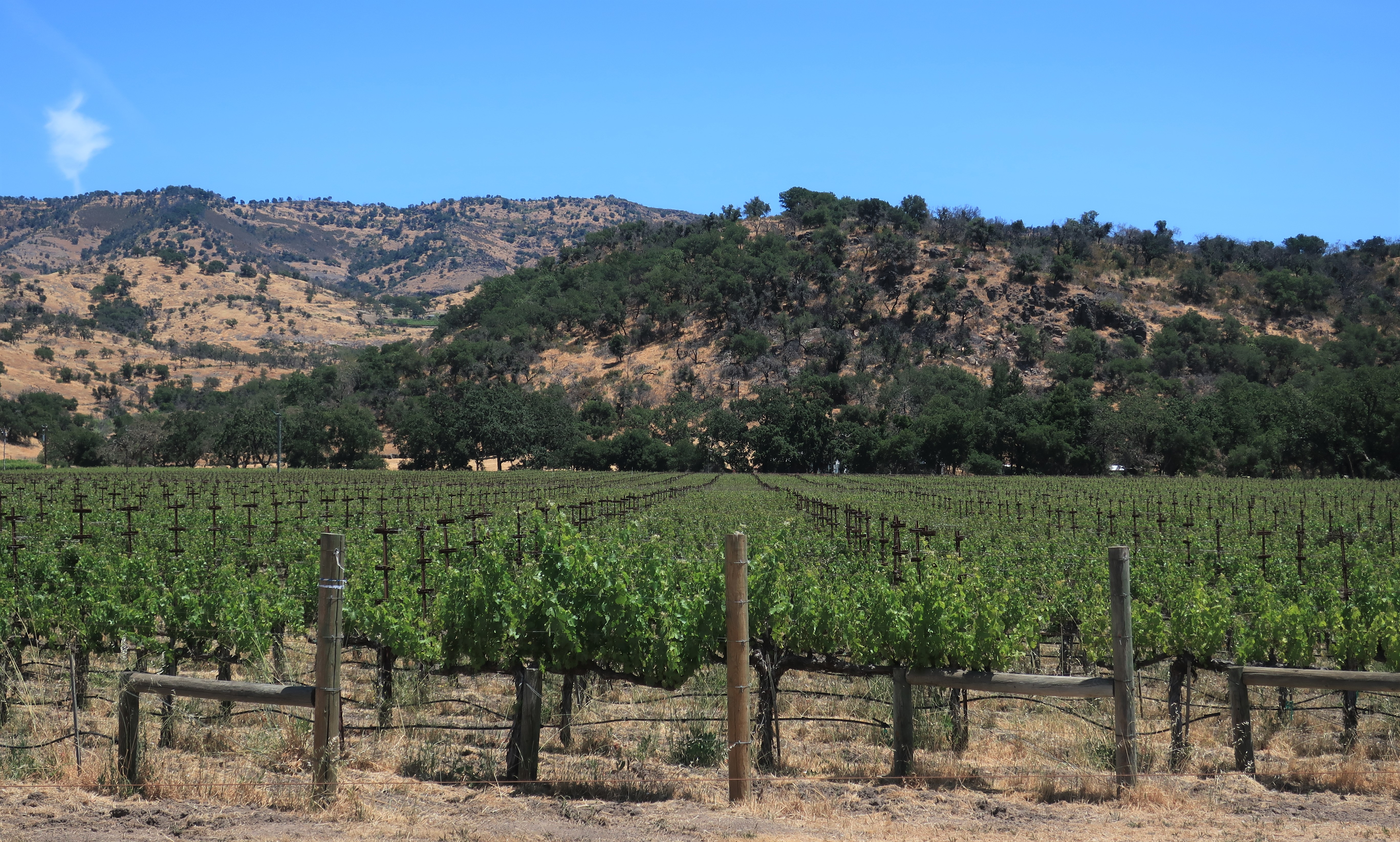
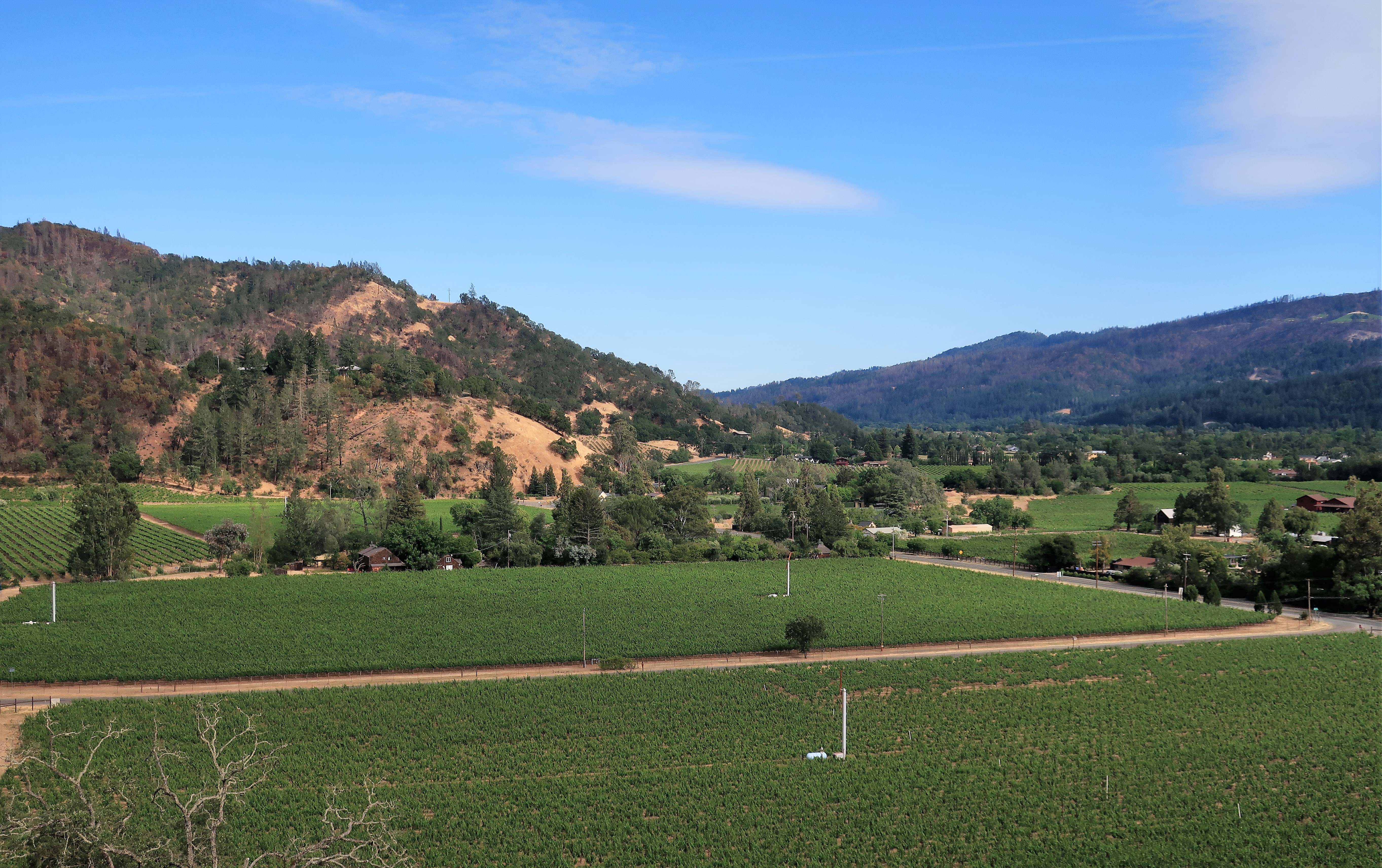
But first…but first…I had to stop and take some photos of the Sonoma Valley vineyards where the California wine industry truly began.

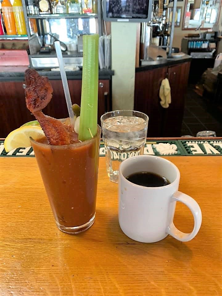
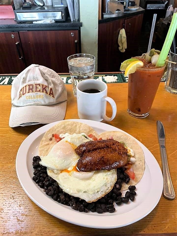
Now on to Napa. When I walked into Downtown Joe’s in the heart of Napa I was greeted by the bartender with a friendly “don’t bother with the mask” and a recommendation that I should try “the best bloody Mary in town.” So it was suggested, so it was done.
Bloody Mary with Huevos Rancheros at Downtown Joe’s — yes that’s 2 strips of bacon in the Mary:
Conveniently, the Napa County Courthouse was almost across the street from Downtown Joe’s. I guess lawyers always attract the best restauranteurs.
Here are a few photos of downtown Napa. Nice place.
Of course, nearly every shop is wine-related — a paradise if you’re an oenophile.

Enough of the wine business, I’m off to see a Mountain Man.
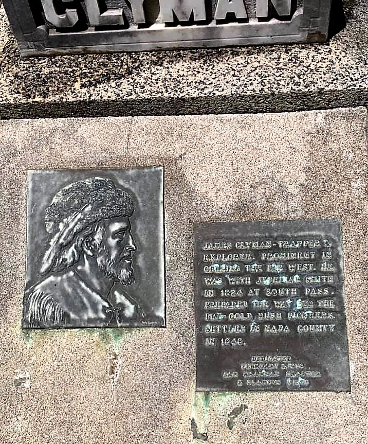
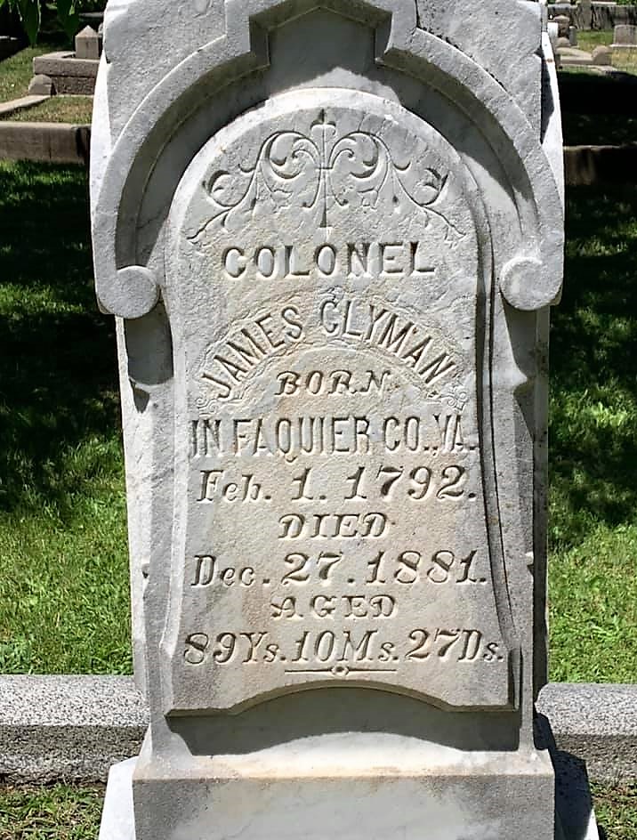
After searching for nearly an hour, I found the grave of mountain man Jim Clyman in Tulocay Cemetary, Napa.
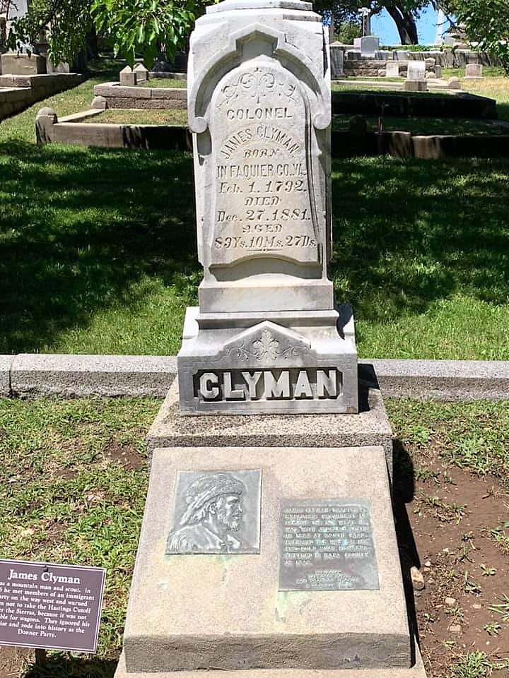
This man had a rich life. It traversed great excitement, crossing the paths of George Washington to Abraham Lincoln to the Oregon Trail to the California gold rush, and ended as good as any life with a quiet 40-year retirement raising walnuts on a Napa Valley farm.
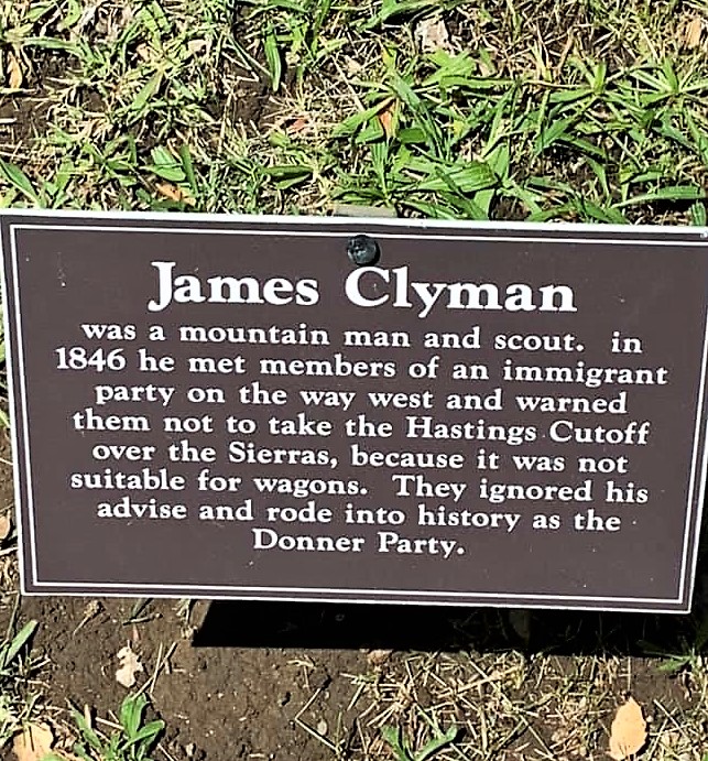
Clyman was born on one of George Washington’s farms in Fauquier County, Virginia in 1792. His family moved to Pennsylvania before settling in Stark County, Ohio. When Clyman became of age he joined the army to fight against the Shawnee during the War of 1812. After the war he farmed in Indiana and Illinois before becoming a surveyor, surveying lands along the Sangamon River in Illinois. When he went to St. Louis to collect his pay for the work, he met and joined Ashley‘s fur-trapping expedition, which became the Rocky Mountain Fur Company. During that time, he witnessed Hugh Glass’ ordeal with the grizzly — the story is still retold today — See “The Revenant” and my own blog post “Keep Calm and Look Far.” He also discovered the famous South Pass along with Tom Fitzpatrick. The discovery of South Pass made possible the later wagon roads across the continent and ultimately, American western emigration itself.
After leaving the fur-trapping life Clyman returned from the mountains to try a stint at farming in Wisconsin, but his partner was killed by Indians there. He then joined the military once again during the Blackhawk War, possibly beside a young captain of volunteers named Abraham Lincoln. After that short war was over Clyman decided to become a guide for wagon trains heading west on the Oregon Trail. After reaching the Oregon country he found the place unsatisfying (too rainy) and traveled down to California. Afterward, he returned east to the United States, backtracking along the California Trail, and met the Donner Party on their way west. He warned the Donner Party not to take the dangerous Hastings Cutoff but the Donners did so anyway, and the rest is history.
Back in California, Clyman learned of the discovery of gold at Sutter’s Mill before the rest of the world did. But, eschewing the hard work of gold mining, Clyman chose instead to settle down on a quiet spot in the Napa Valley and began an orchard. For 40 years he faithfully attended to his fruit trees before passing away in 1888, nearly 90 years old, with his family by his side. R.I.P.
Jim Clyman kept a diary of his travels and published it after retiring to his farm. The book served as a significant basis for Bernard DeVoto’s famous history “1846: the Year of Decision.“ You can buy Clyman‘s book on Amazon. I did and enjoyed it greatly (as well as DeVoto’s).
I suppose everyone except the hardened atheist wonders exactly what heaven is like. For Renaissance painters, heaven is seraphim and cherubim singing the glories of God. For Billy Joel, it’s a place less desirable than hell since he sings “I’d rather laugh with the sinners than cry with the Saints.” For me with regard to heaven, I have another one of my pipe dreams (like the pipe dream that only certain persons actually have souls, the rest are mere biological zombies). My pipe dream is this: should I make it to heaven I hope to be allowed to choose a past earthly life to relive as it happened, sort of like piggybacking inside some favored historical figure without them knowing that I am there. If I get that chance I’d like to live Jim Clyman’s life, and maybe John Coulter as well. These men lived adventure, they bravely strode to places where they knew not what lay beyond the next hill or tree branch. They lived their lives to the very fullest. For me, I’m doing the best I can with my rental car and Google maps.
Now I’m off to visit Peanuts.
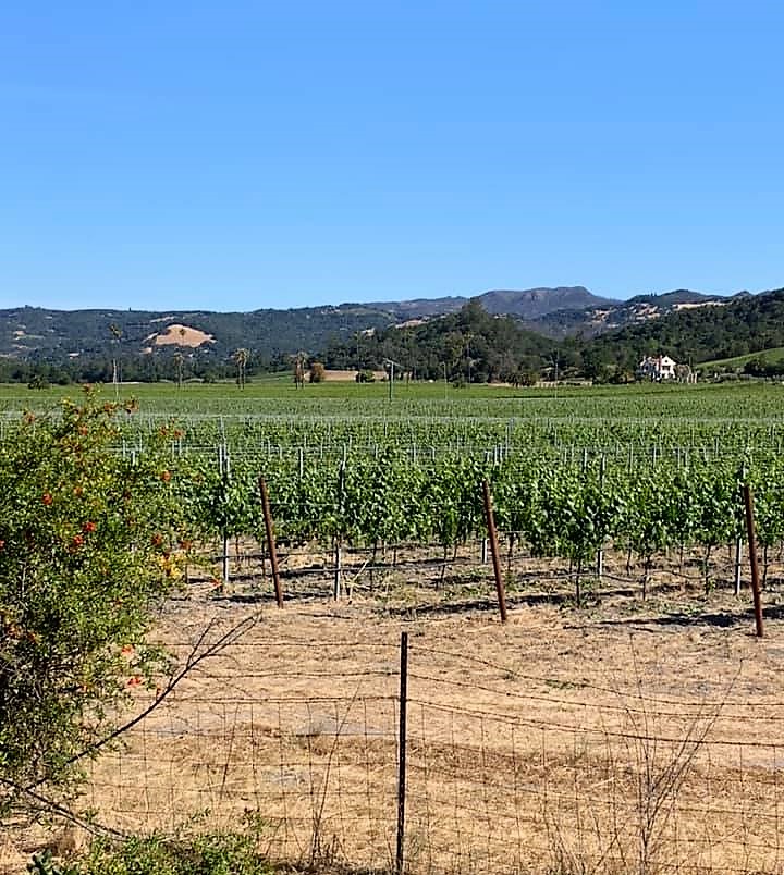
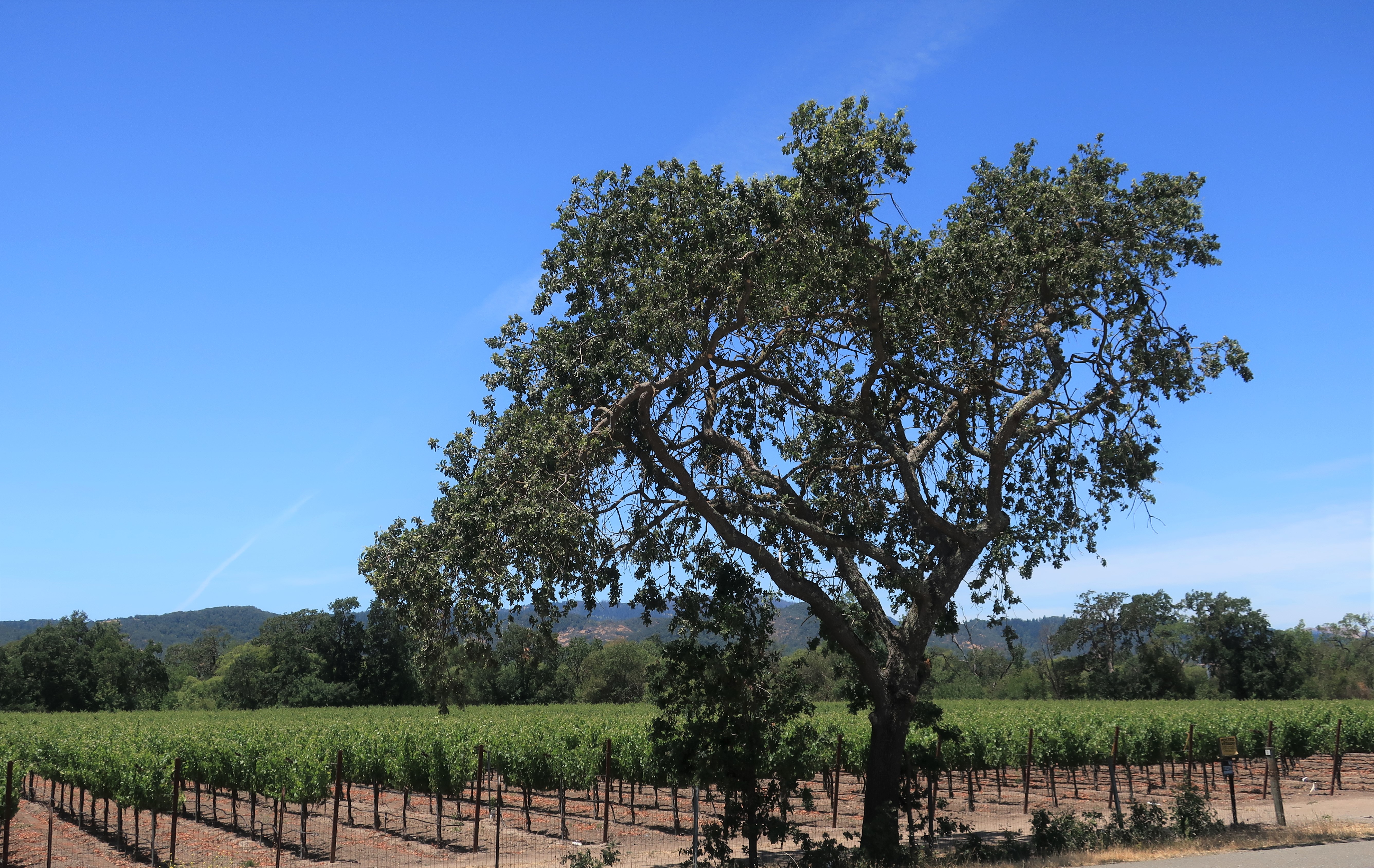
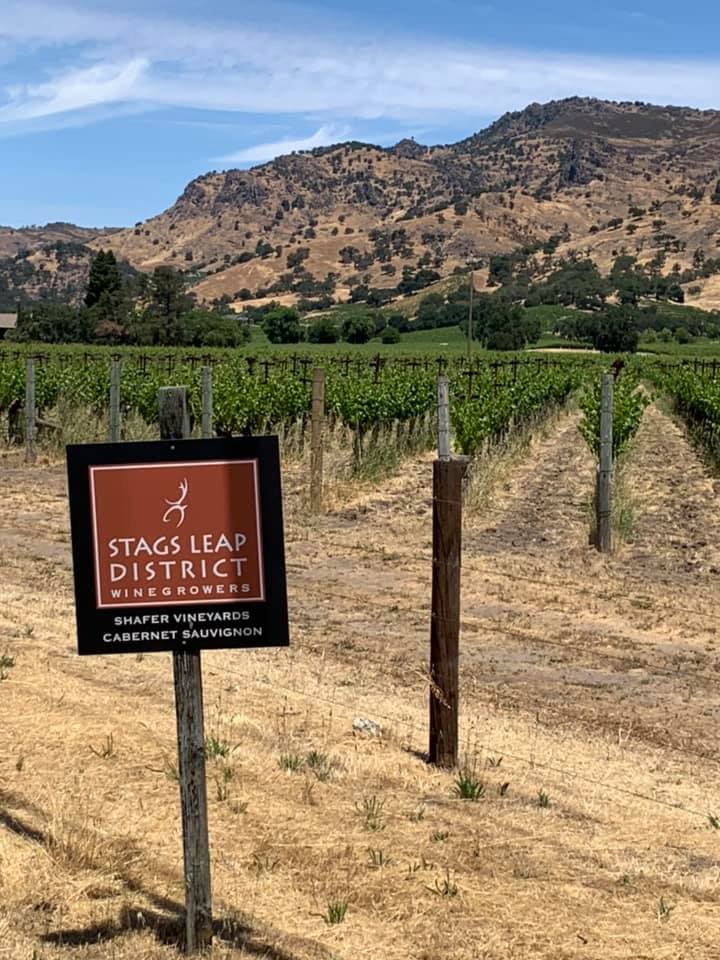
I passed through the famous Napa Valley Stags Leap Wine District. I’m not that much into wine so I won’t be stopping and doing any wine tasting. I’m living dangerously here; I’ll be disowned if my old graduate school roommate ever finds out that I was in both Napa and Sonoma valleys and didn’t stop at any wineries at all.

Now back to Santa Rosa to see the Charles M. Schulz Museum, aka “Peanuts.” I’ve been waiting for this moment all week!
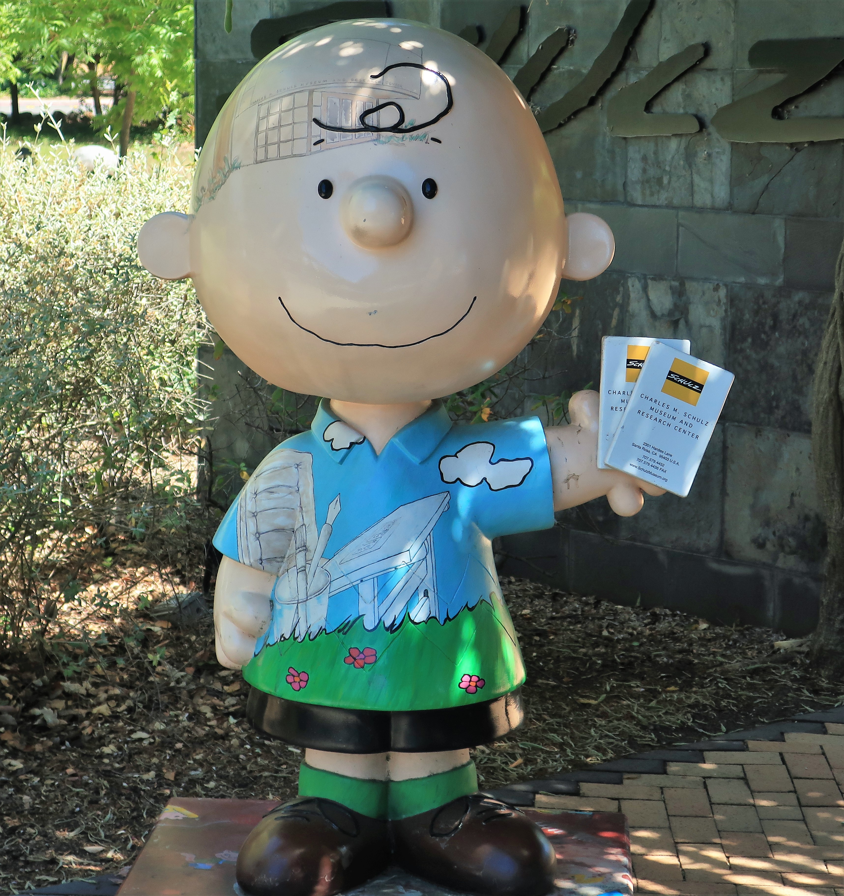
I grew up with these characters. I read the comic strip in the paper nearly every day and the weekly colored Peanuts strip was always on the outside of the Sunday newspaper. Every year I measured the start of the Christmas season from the night “A Charlie Brown Christmas” was aired on CBS. I can replay the song “Linus and Lucy” in my head. I never missed “It’s the Great Pumpkin Charlie Brown” either. Childhood during the 1960s nearly revolved around those Peanuts characters.
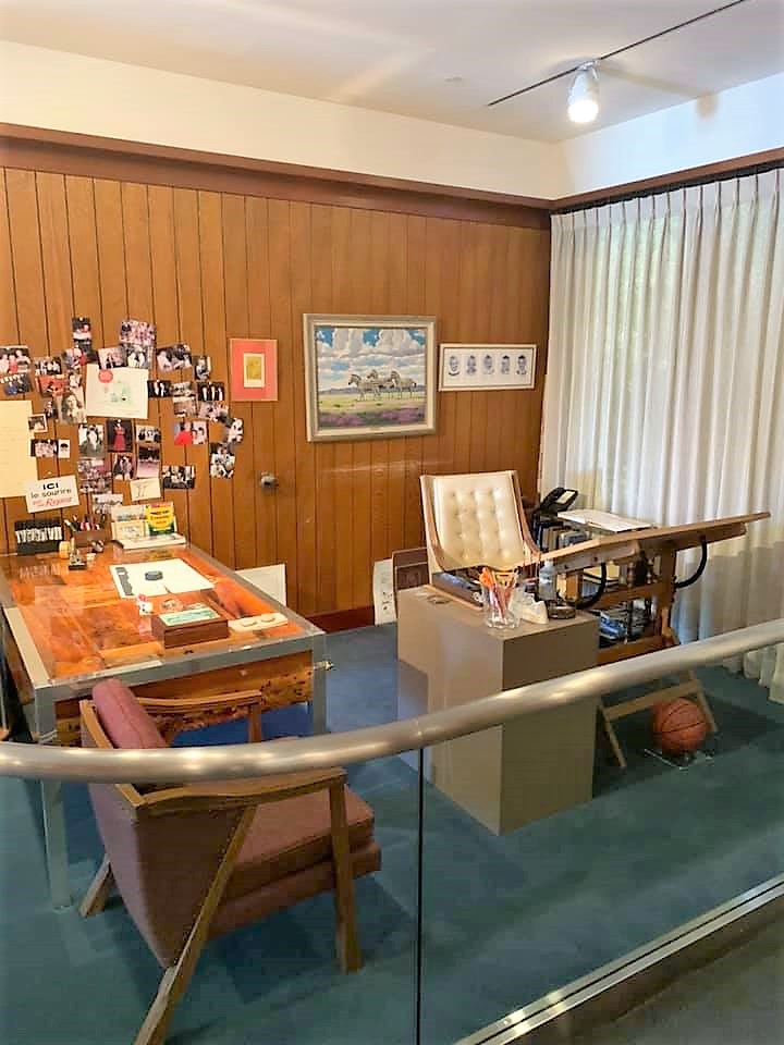
Here are some photos from within the museum, including a re-creation of Schulz’s drawing studio in his home. Put the museum on your own bucket list. You’ll thank me.

By now it was time to find a place to lay my head for the night. It being Friday night, accommodations anywhere near the Wine Country were being offered from between $300 and $500 per night. Who pays such prices? (Government officials on expense accounts HA HA!) Certainly not I, so I decided to make the two-hour drive back to friendly Colusa for the night before my plane trip home Saturday. The drive would take me from Santa Rosa, back through the Napa Valley, through the Clear Lake area, and then finally into the Sacramento Valley and Colusa.
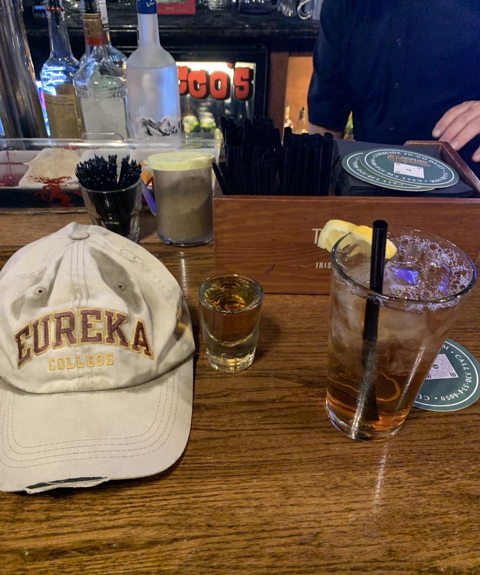
I made it back to Rocco’s Bar & Grill in Colusa for the night, first imbibing a shot of Jack Daniels to put the final nail into this cold. Rocco’s is packed tonight. This is a town of only 5,000 and this bar has a lot of seating, but it’s still packed. A 10” pizza is on its way.
Meanwhile, some sort of parade was going on in front of the Colusa high school. I asked the guy at the bar sitting next to me what the parade was all about. He said they have the parade every year together with the county fair, but this year they’re only having the parade and not the fair.
“Why no fair this year?” I asked.
“Because Governor Newsom {unintelligible},” he answered.
“So you mean no one has any testosterone anymore?”
“Not a drop,” he said.

Saturday, June 12, 2021. Day 8: Colusa to Colorado Springs
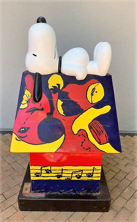
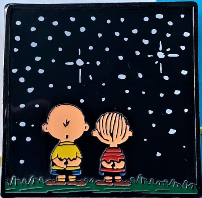
End of an epic week. Here’s my souvenir from the Schulz Museum.
No words.
All photos were taken by the author in June 2021
A list of all Freedom Voyage posts in TimManBlog can be found here.
I do this as a hobby and not for a living (yet). Donations are happily accepted if you’d like to help defer my costs.
Thanks,
The TimMan
Donations are NOT tax-deductible under U.S. law…but you knew that.
Make a one-time donation
Make a monthly donation
Make a yearly donation
Choose an amount
Or enter a custom amount
Your contribution is appreciated.
Your contribution is appreciated.
Your contribution is appreciated.
