Silverton (often slurred to ‘Sillton’) is the home of Jerry Baker, proprietor & curator of the old Briscoe County Jail Museum. As I was taking photos of the county courthouse and the old county jail, Jerry found me and introduced himself. Jerry can always spot the tourists, he says, and he told me, “Sillton is such a small town I know everybody here already and can easily pick out the strangers.”
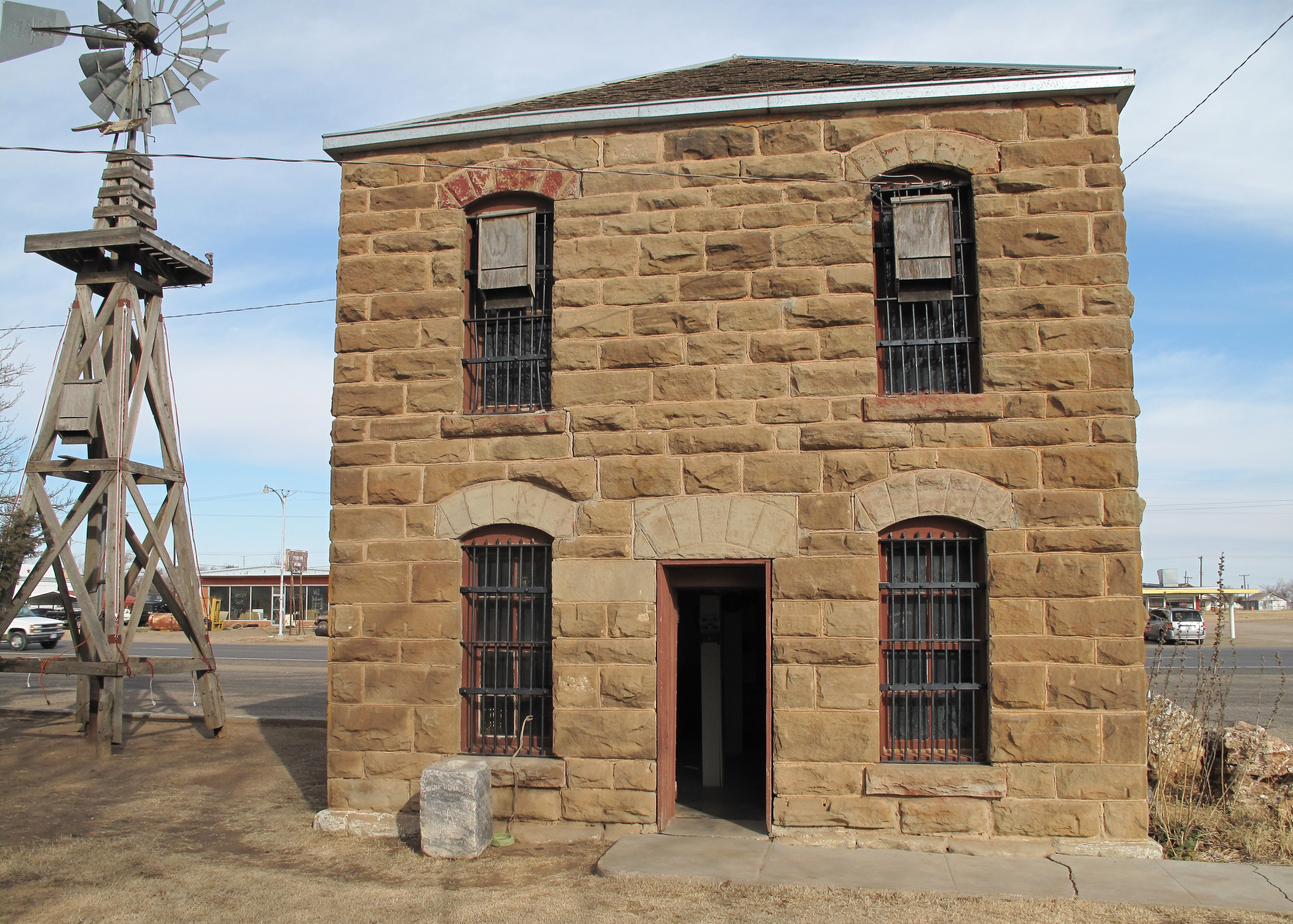
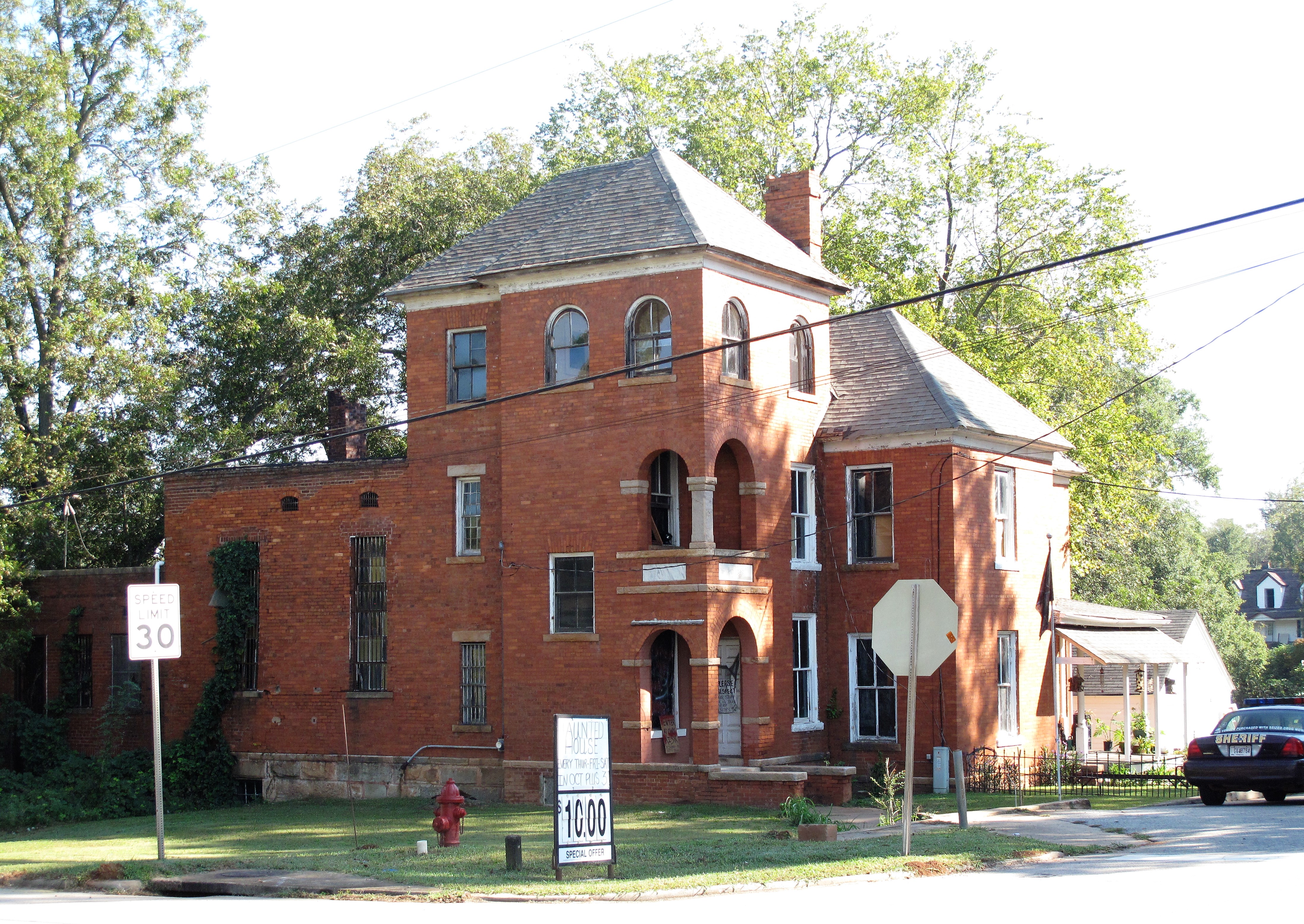
Jerry Baker of Silverton, TexasThe old Briscoe County Jail, now a museum. Jerry Baker, curator.
Jerry was born in Silverton, lived in larger towns and cities for a while, sold drugs, did drugs, got medication for bipolar disorder, then came back home to enjoy life. He’ll tell you all this while showing off the old jailer’s bottom floor cot and the stairs up to the two jail cells on the second floor. Jail capacity was 8 prisoners. The jailer stayed on the ground floor so that prisoners would have to go past him if trying to escape.
The jailer’s quarters on the ground floor of the old Briscoe County Jail Museum
Outside the jail, Jerry will point out the hand-made bat houses on the upper floor jail cell windows. Building bat houses on the old jail kept bats from making homes in the nearby courthouse.
Wooden bat houses were built onto the second-floor windows of the Briscoe County Jail Museum
Being a jail museum curator is only a part-time job, so Jerry runs a mowing business in the summer. He’s such a good talker that he’s become pretty well-known around Texas and has been interviewed by TV stations — he has even appeared a few times giving the Texas weather on morning TV news shows. Jerry seems to like everyone and everyone seems to like him.
I searched the internet and found a link to a YouTube video of Jerry Baker discussing tornadoes with storm chasers from the Vortex2 project in 2009: Jerry Baker from Silverton, Texas talks about tornadoes. (His accent is as strong as a Texas wind!)
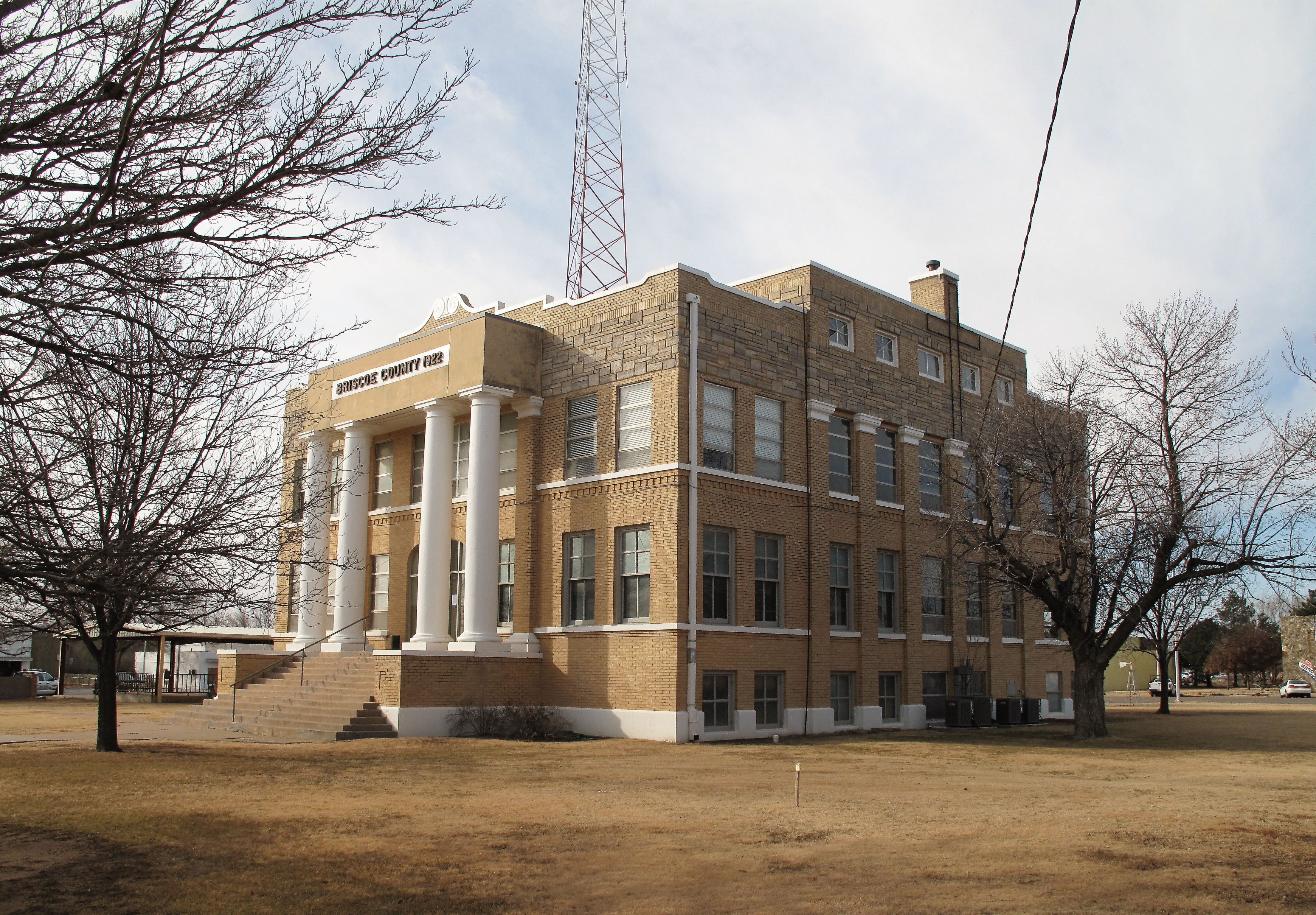
The Briscoe County Courthouse was built in 1922 and is still in use today. The old jail remains on the courthouse grounds, but prisoners are now housed in a newer facility.
Briscoe County Courthouse. Silverton, TexasBriscoe County Veterans Memorial with the courthouse in the background.
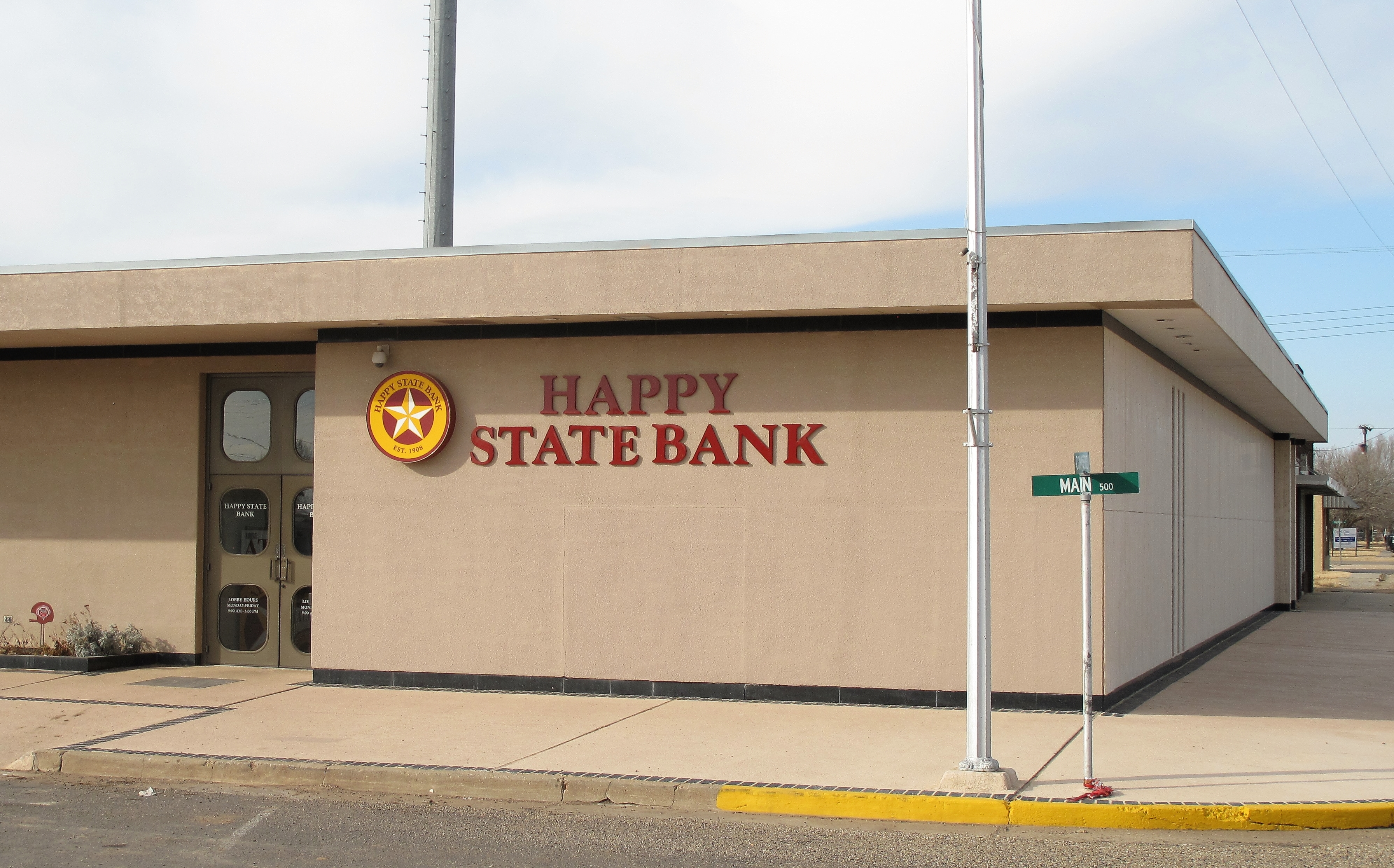
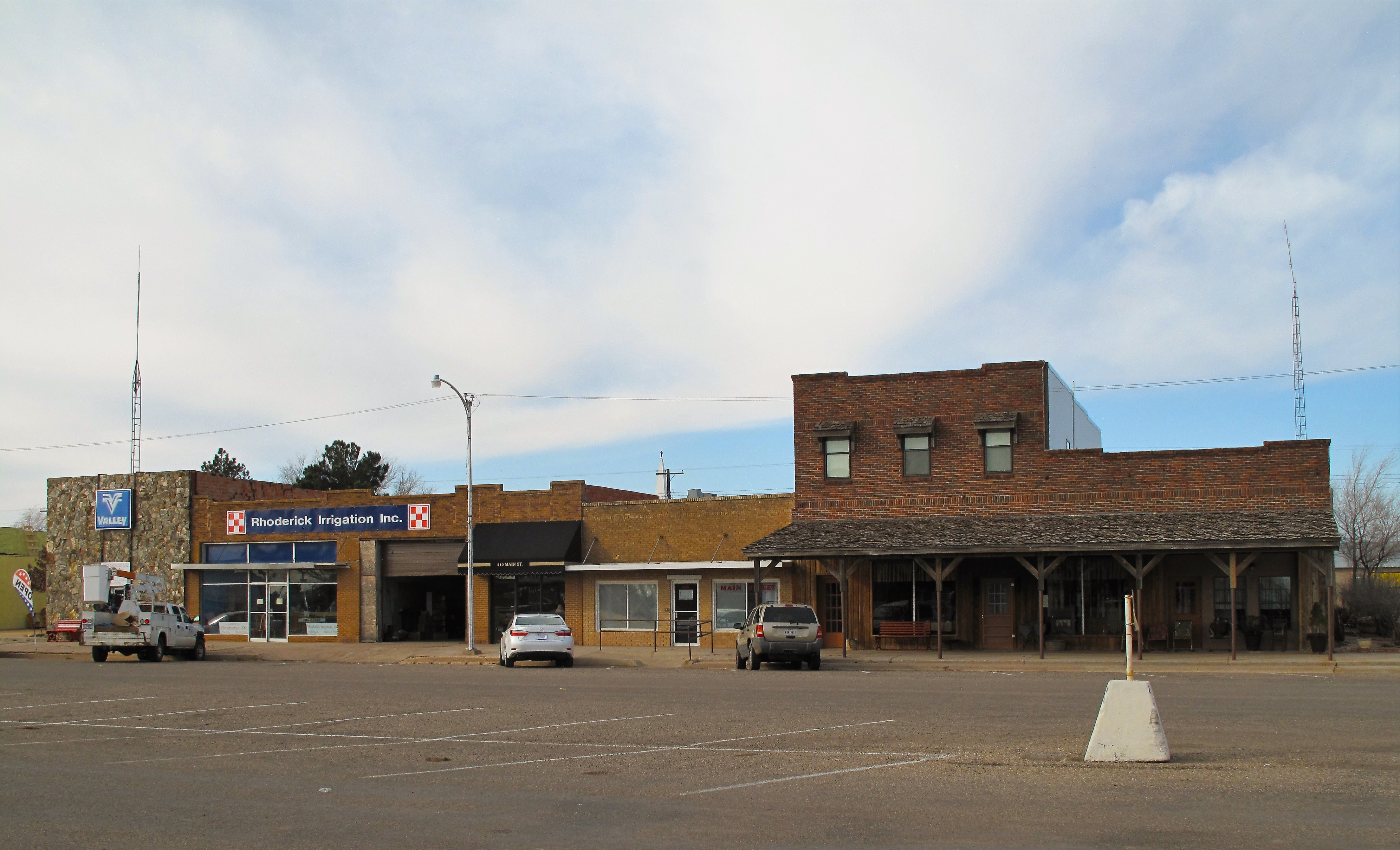
Of course, Silverton is a small place. There are a few churches, a high school, and a couple of convenience stores. The largest bank in town is the Happy State Bank — named for the town of Happy, Texas but a great name for a bank nevertheless.
Happy State Bank. Silverton, TexasShops in Silverton, Texas
In Silverton, houses line gravel streets. Only courthouse square is paved. Dogs are often found lying on front lawns. I saw one house that had two border collies, a black lab, and a gray cat staring me down as I drove past. There was another dog in the back, a brown hound dog kept in a cage. I suppose he is the mean one.
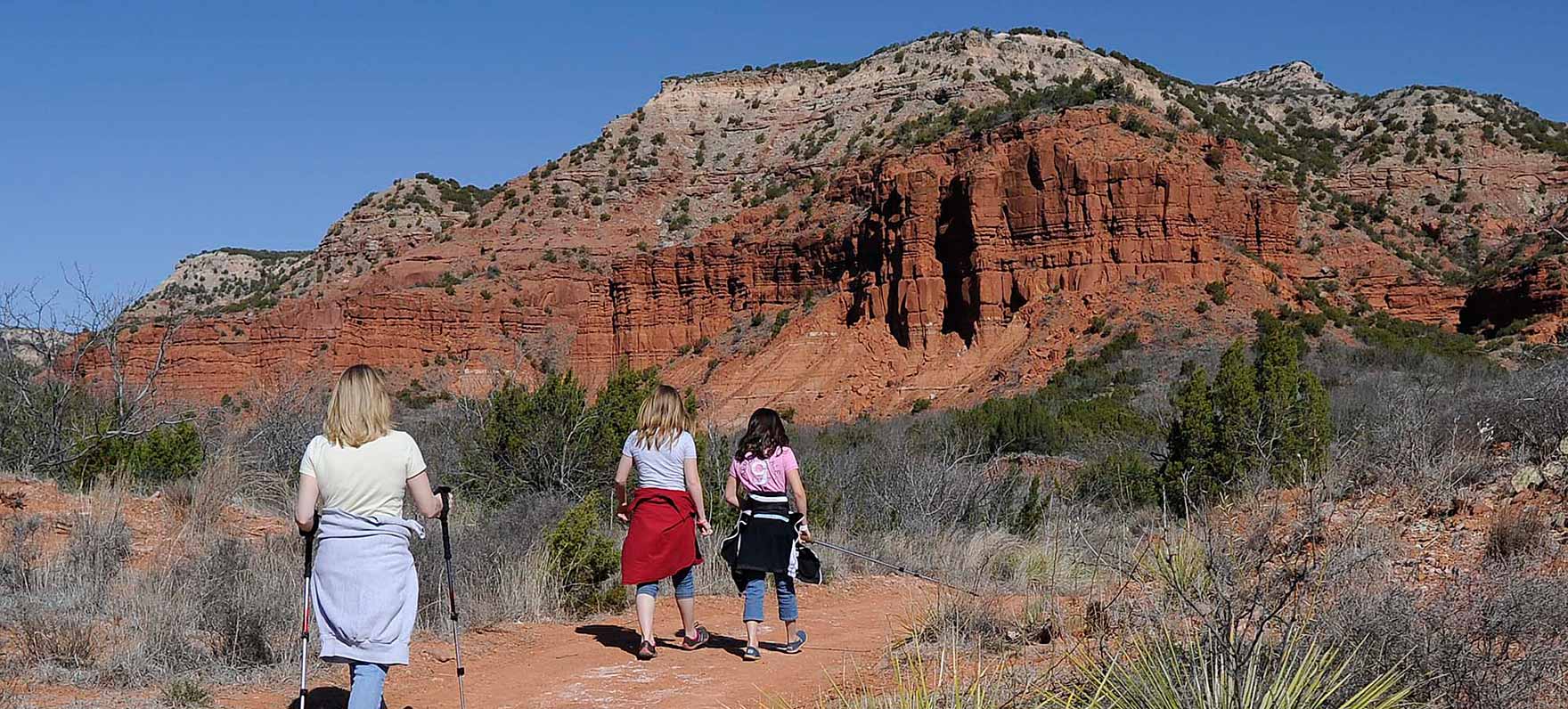
If you happen to be in the Texas Panhandle, or specifically in Briscoe County, check out the Caprock Canyons State Park along the escarpment of the Llano Estacado. The park is situated at the spot where the plateau drops off into west Texas sagebrush prairies. I copied a photo from the park website below. A gallery of brilliant photos of the park can be found here: (photos of Caprock Canyons State Park).
Caprock Canyons State Park. Briscoe County, Texas
So, if you’re on a road trip, escaping the northern winter’s cold with a warm and dry sojourn in the Texas Panhandle, do stop by Silverton if you have a chance. Jerry Baker will find you if he is able, and you’ll add him to your list of friends.
A list of all photo posts from the American County Seats series in TimManBlog can be found here.
All photos were taken by the author on January 15, 2013.
I’m trying to travel to all of America’s county courthouses, and each month a post about my visit to the most interesting county seats. It’s only a hobby — but donations are greatly appreciated to help defer my costs. Thanks, Tim
December 31, 2021 (photos and memories of Coldspring, Texas from June 2000 and December 2021)
We’ve reached New Year’s Eve, an appropriate day for reflection. For many, the year 2021 has been a deadly year, an awful year, as bad or worse than its predecessor. There is much to consider.
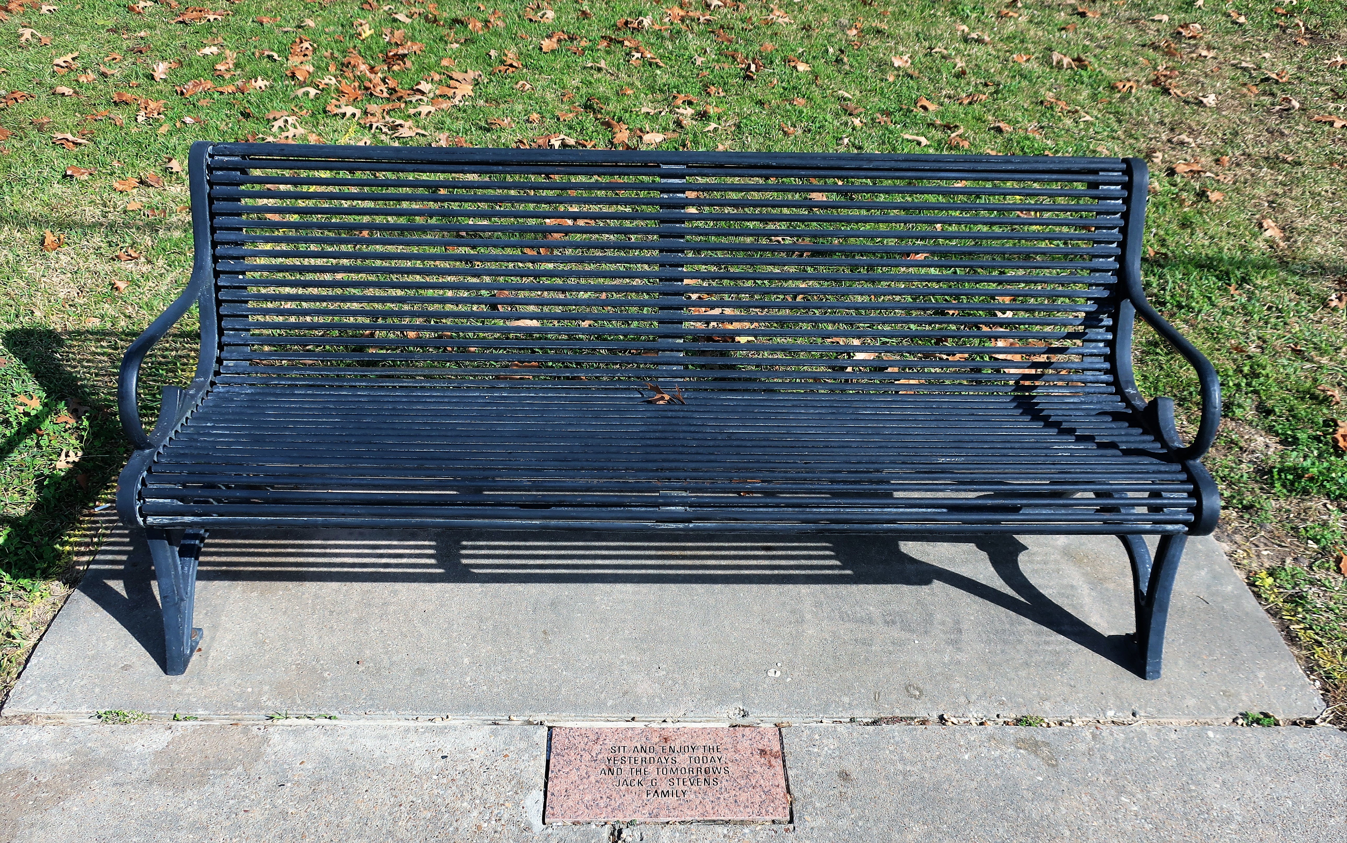
In the quiet sunshine of Coldspring, Texas, a park bench offers you a place for reflection with (literally) an engraved invitation:
SIT AND ENJOY THE YESTERDAYS, TODAY, AND THE TOMORROWS
Jack G. Stevens Family
A park bench outside the San Jacinto County courthouse offers an engraved invitation in marble
Good advice and I took it.
Coldspring, Texas has a population of 853, so it’s an excellent place to do as the Jack Stevens family suggests. I was here in June of 2000, and when I returned 21 years later in December of 2021 I looked for the old park bench. I found it. It looks the same as does the whole town. So I sat down and wrote my notes just as I did back in 2000, except this time I spoke into an i-phone instead of scribbling them into a notebook with a ballpoint pen.
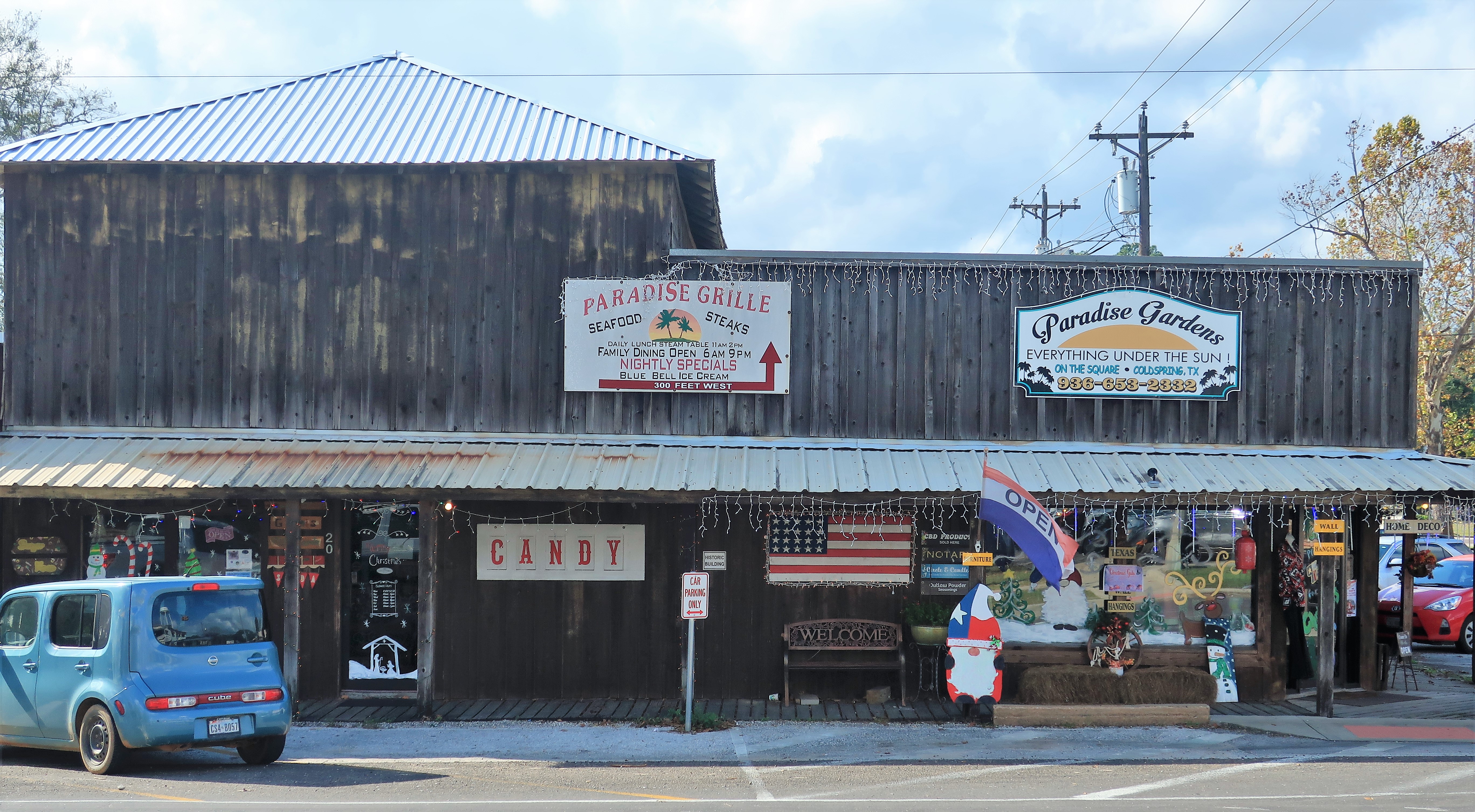
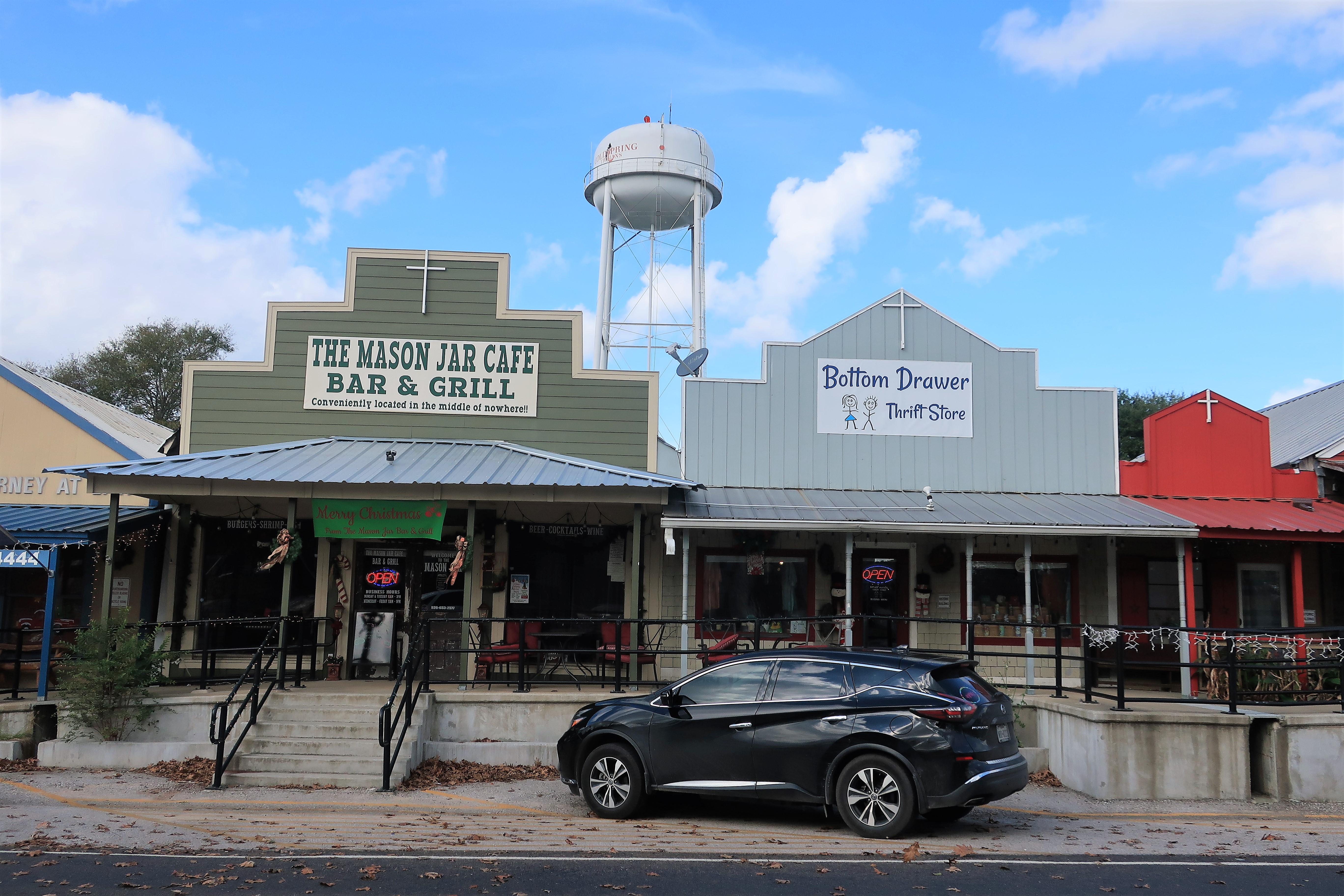
Coldspring is a little crossroads town near a lake on the Trinity River in southeast Texas. Storefronts are built in an old-west style behind wooden sidewalks and have flags draped from their awnings.
Byrd Avenue faces the courthouse and includes the Mason Jar Bar and Grill. Coldspring, Texas
Many of the buildings are bedecked in festive Christmas decorations.
Church street across from the courthouse, where businesses are ready for Christmas. Coldspring, Texas
Coldspring is the seat of San Jacinto County, Texas, and was named for the Battle of San Jacinto which won Texas independence. The battle actually took place well south of this area, near Houston, so there are no battle sites nearby.
San Jacinto County in the state of Texas
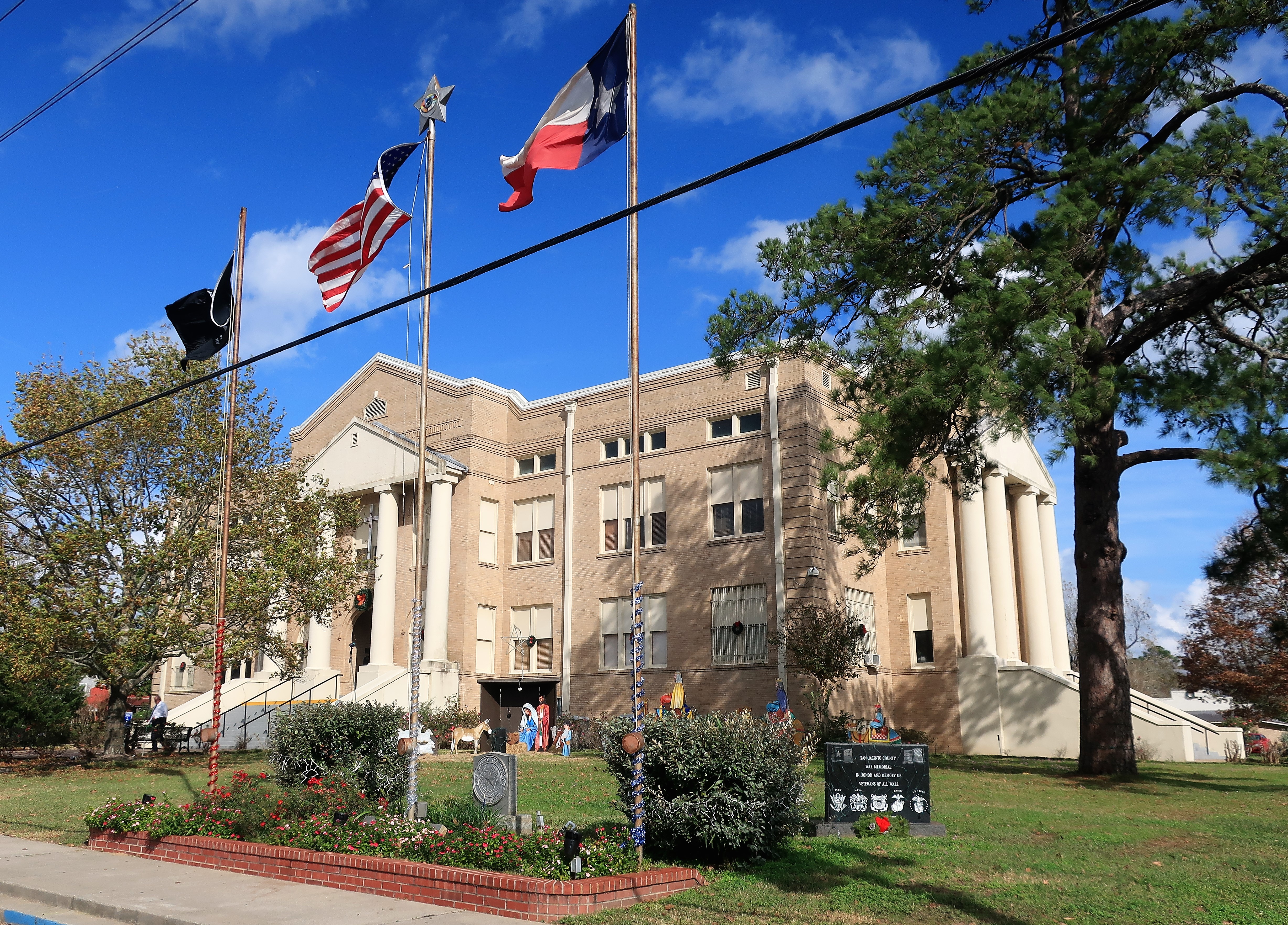
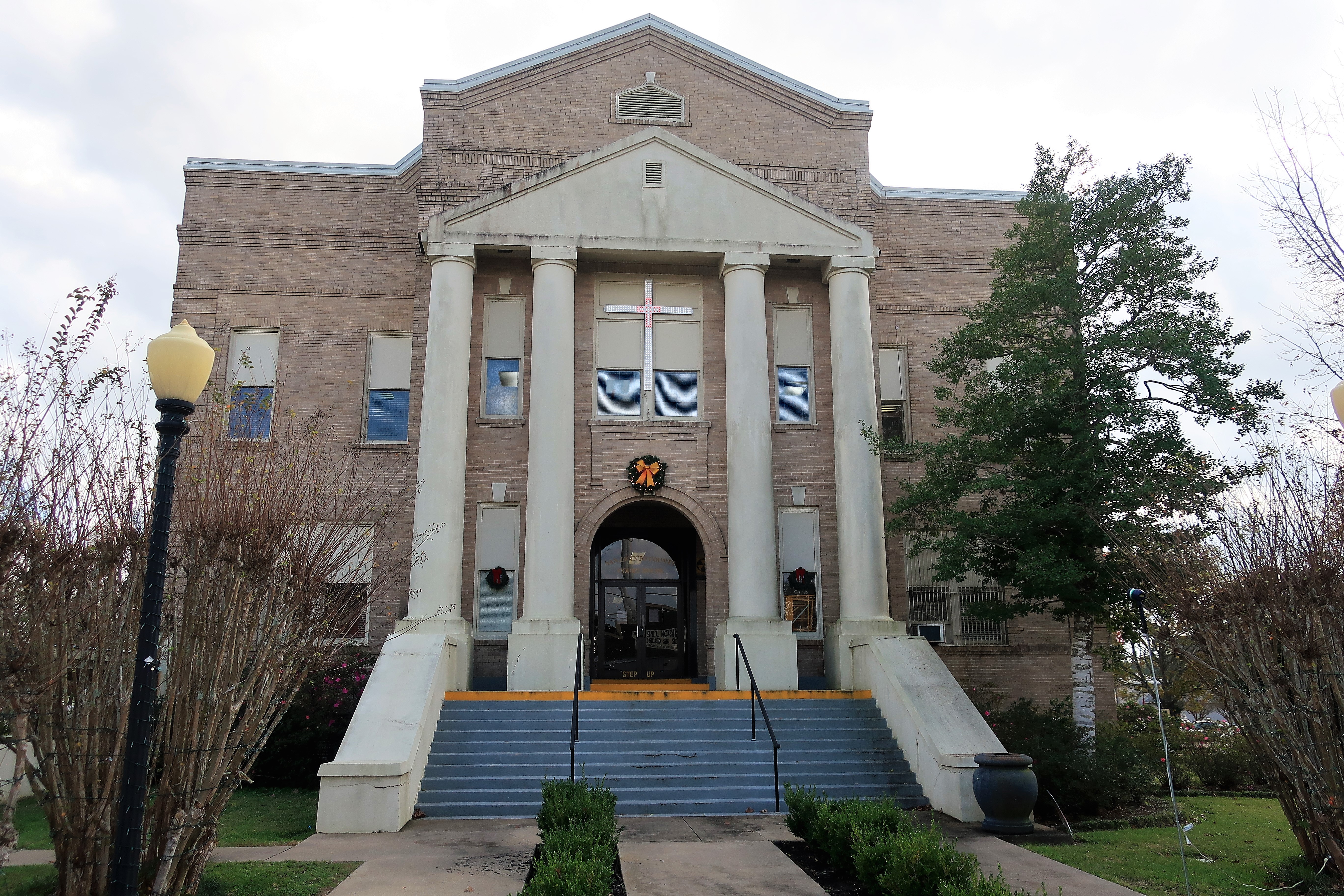
The three-story yellow-brick San Jacinto County courthouse was built in 1917 at Coldspring’s main intersection. The four pillars guarding each entrance remind me of a typical American courthouse, as might be seen on a Hollywood movie set.
San Jacinto County courthouse. Coldspring, Texas
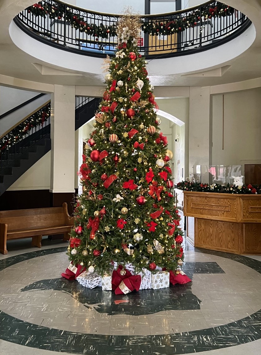
Inside the courthouse, a central atrium has been decorated for Christmas with the courthouse Christmas tree peeking into the second floor. The floor tiles underneath the tree illustrate San Jacinto County’s location within the state.
Christmas tree in courthouse atrium. The floor tiles outline the state of Texas with San Jacinto County in red.
Local girl made famous:
Photo of Rhonda Morrison of Coldspring, Miss Texas 1991, displayed inside the San Jacinto County courthouse.
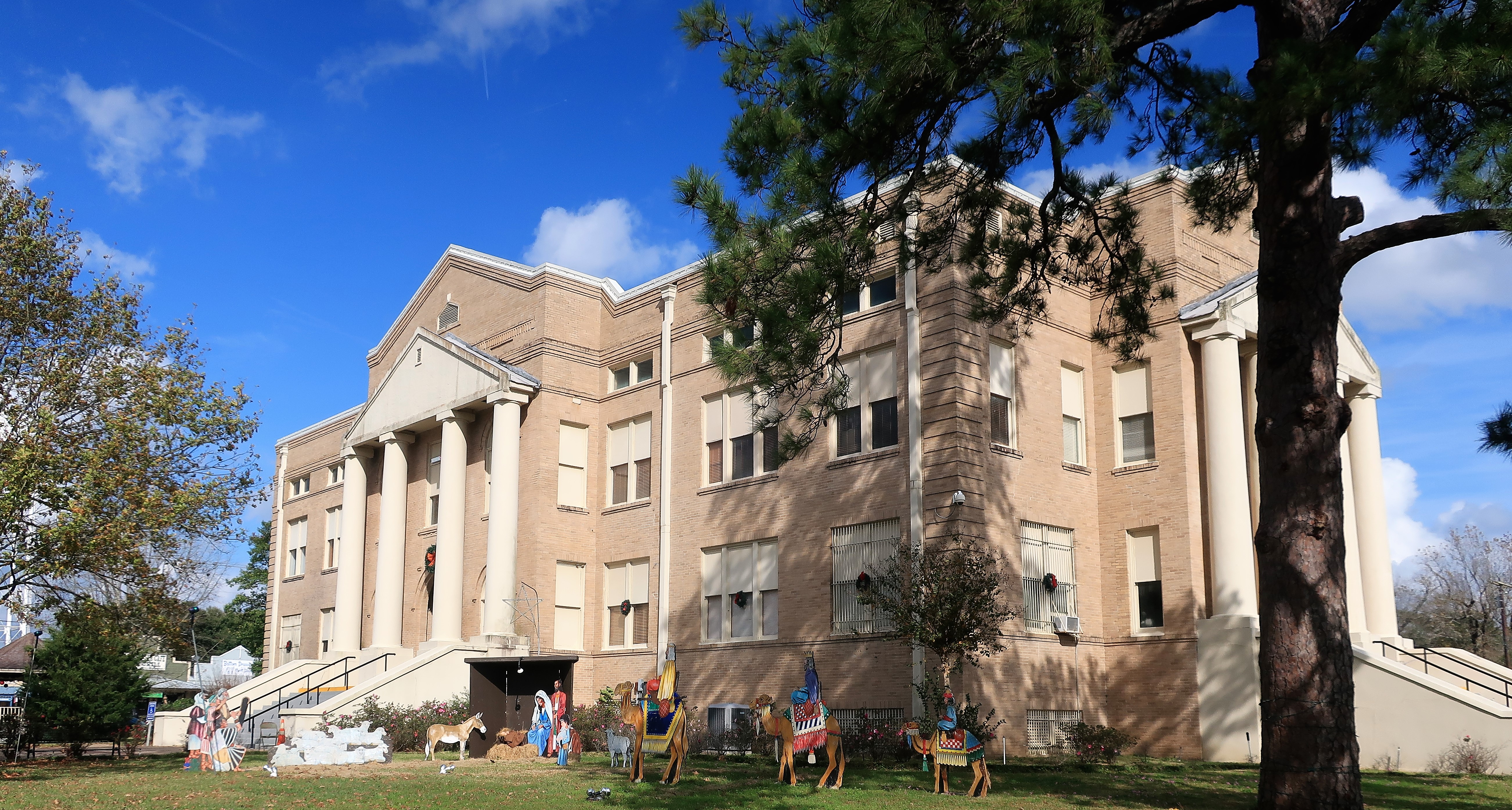
In my journeys visiting courthouses throughout the country, no state’s courthouses more commonly feature a Christmas manger scene than those in the state of Texas. The threat of lawsuits doesn’t seem to bother the local residents.
San Jacinto County courthouse with Christmas manger scene and Wise Men. Coldspring, Texas
Going beyond the common Manger scene for Christmas decorations, the residents of San Jacinto County have placed lighted crosses above each of the four entrances to the courthouse. The crosses are adorned in red and white lights for the holiday season.
An ornamental cross hangs above the side entrance to the San Jacinto County courthouse for Christmas
In American, placing religious symbols on government property invites controversy and sometimes leads to lawsuits. The basis of the controversy is the First Amendment to the U.S. Constitution, which begins with a prohibition against an “Establishment” of any religion:
Congress shall make no law respecting an establishment of religion, or prohibiting the free exercise thereof; …
Allow me to stand on my soapbox, briefly. Seasonal religious decorations, such as Christmas Manger scenes on county courthouses, in no way “establish” Christianity as the county religion. Such things “establish” nothing. They force no one to accept any religion or belief whatsoever. I see nothing unconstitutional about such decorations and festivities so long as their costs do not derive from the public treasury, which in San Jacinto County they do not — the plywood manger figures are marked as “property of the Victory Gospel Church,” of Coldspring.
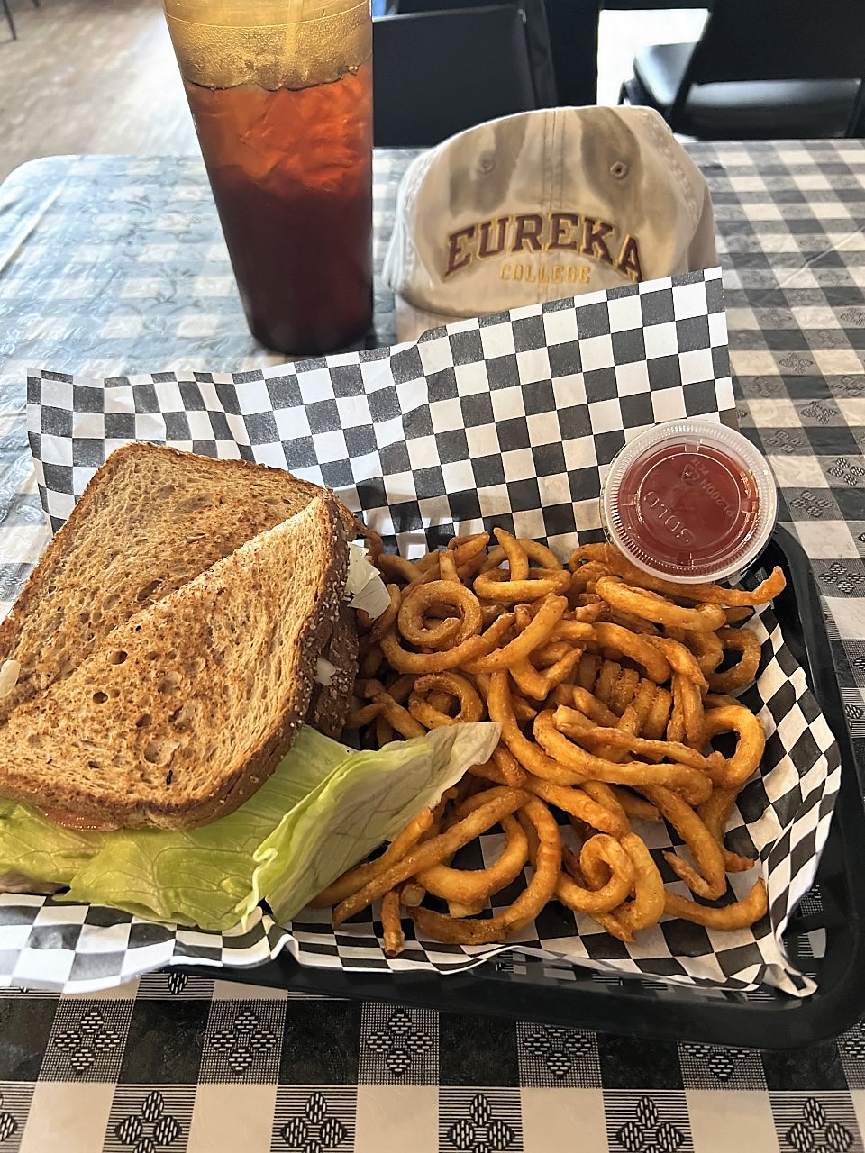
A good meal deservedly follows a good reflection, and the Mason Jar Cafe Bar & Grill, across from the courthouse, can provide such a meal.
Lunchtime — an excellent turkey, avocado, and swiss sandwich with curly fries and sweet tea:
Lunch at the Mason Jar
Time well spent indeed!
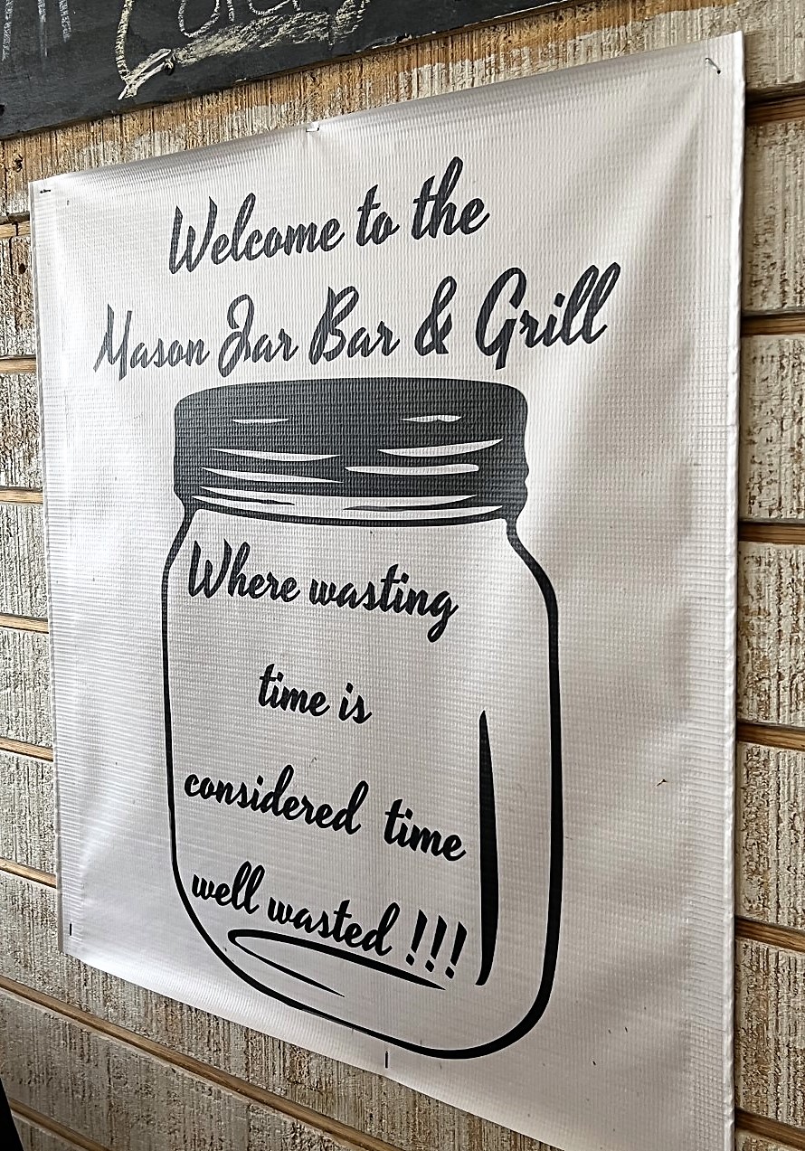
The Mason Jar: “where wasting time is considered time well wasted!!!”
A Merry Christmas and a Happy New Year to All from Coldspring, Texas!
A list of all photo posts from the American County Seats series in TimManBlog can be found here.
All photos were taken by the author on December 15, 2021.
I’m trying to travel to all of America’s county courthouses, and each month a post about my visit to the most interesting county seats. It’s only a hobby — but donations are greatly appreciated to help defer my costs. Thanks, Tim
Donations are NOT tax-deductible under U.S. law…but you knew that.
I was singing Chuck Berry’s classic song “Memphis, Tennessee” as I drove into Memphis last week:
Long distance information, give me Memphis, Tennessee Help me find the party trying to get in touch with me She could not leave her number, but I know who placed the call ‘Cause, my uncle took the message and he wrote it on the wall…
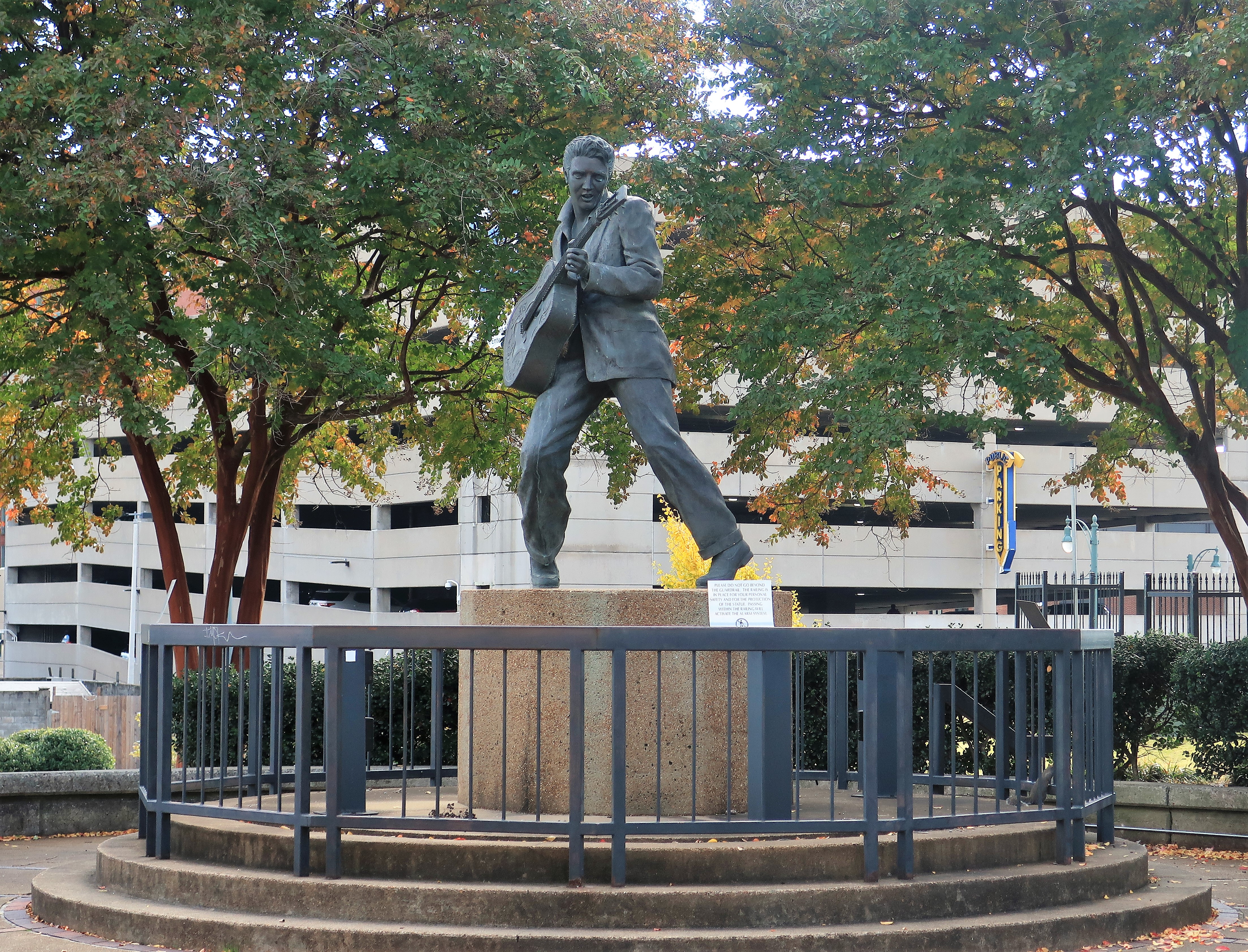
Y’all will be singing this song too driving into Memphis. I think everybody does. The funny thing about that though is it’s Chuck Berry’s song, and he was from St. Louis, not Memphis. Memphis is the home of this guy, the King:
Statue of Elvis Presley, the King of Rock and Roll. Beale Street, Memphis, Tennessee
Never mind that — you can hear Elvis doing his version of the Chuck Berry classic right here: Elvis – Memphis Tennessee (YouTube version).
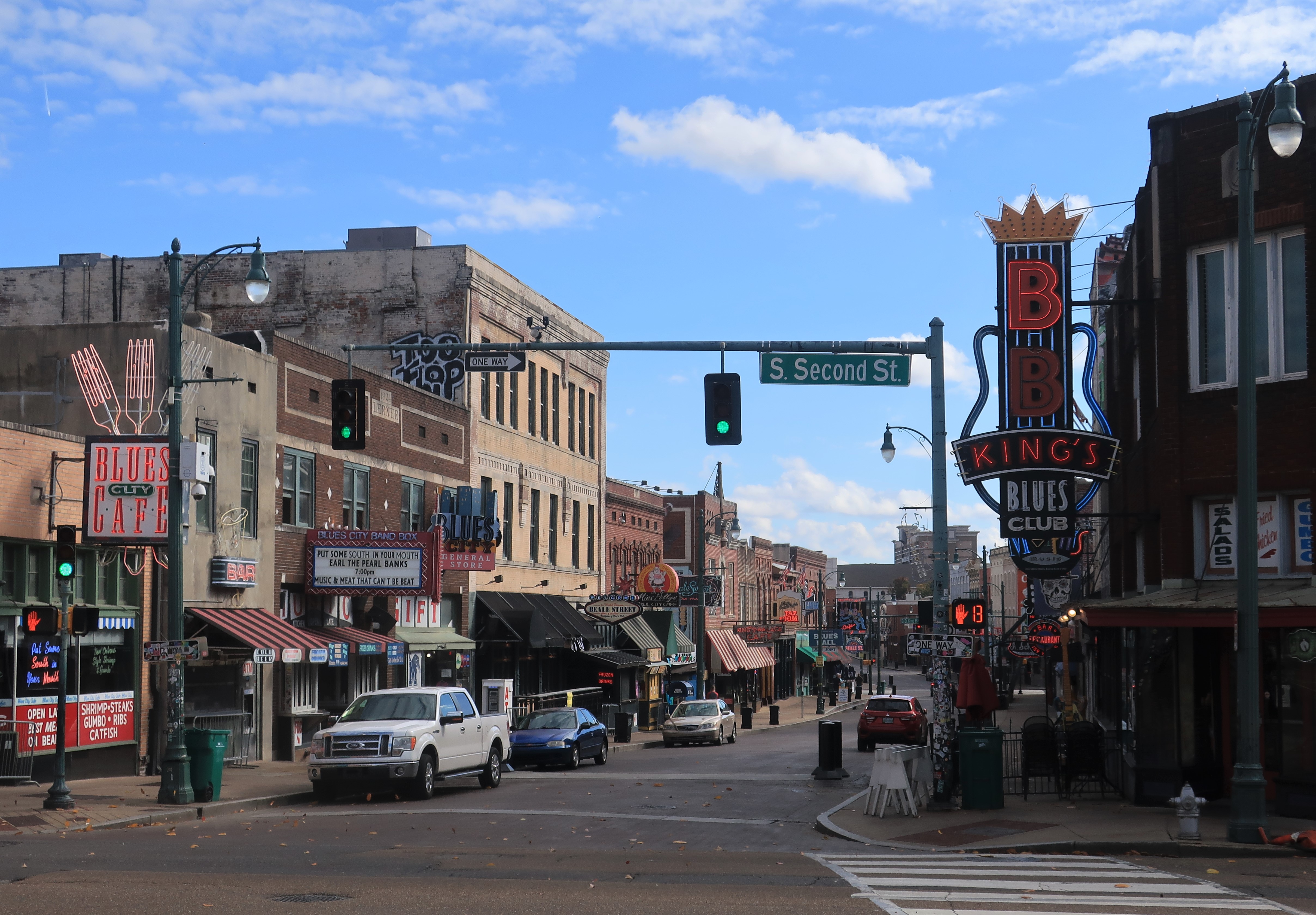
With that introduction, welcome to my wander through Memphis, Tennessee on a mid-November day, going roughly from the north end of downtown to the south end near Beale Street, and then on down to Graceland.
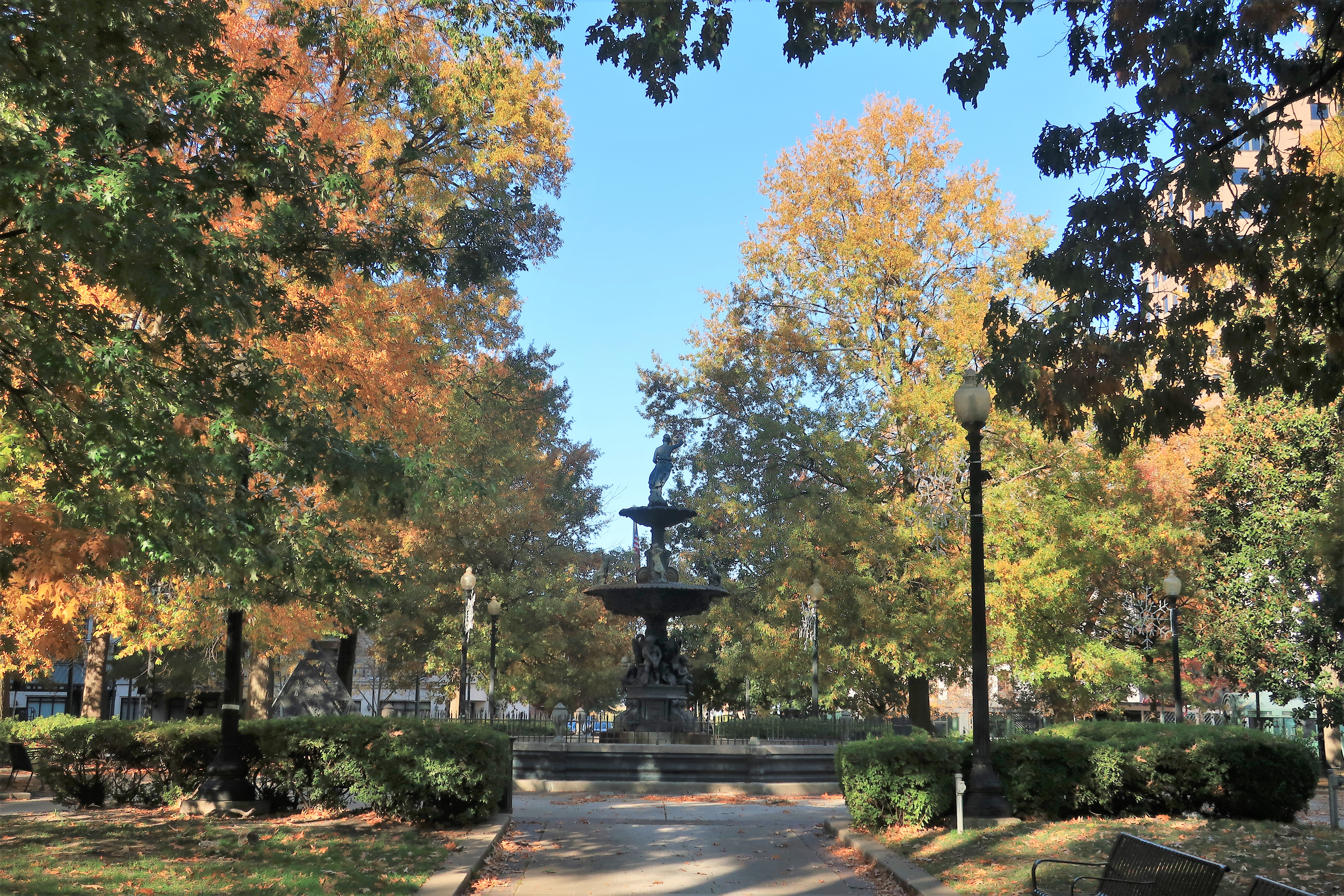
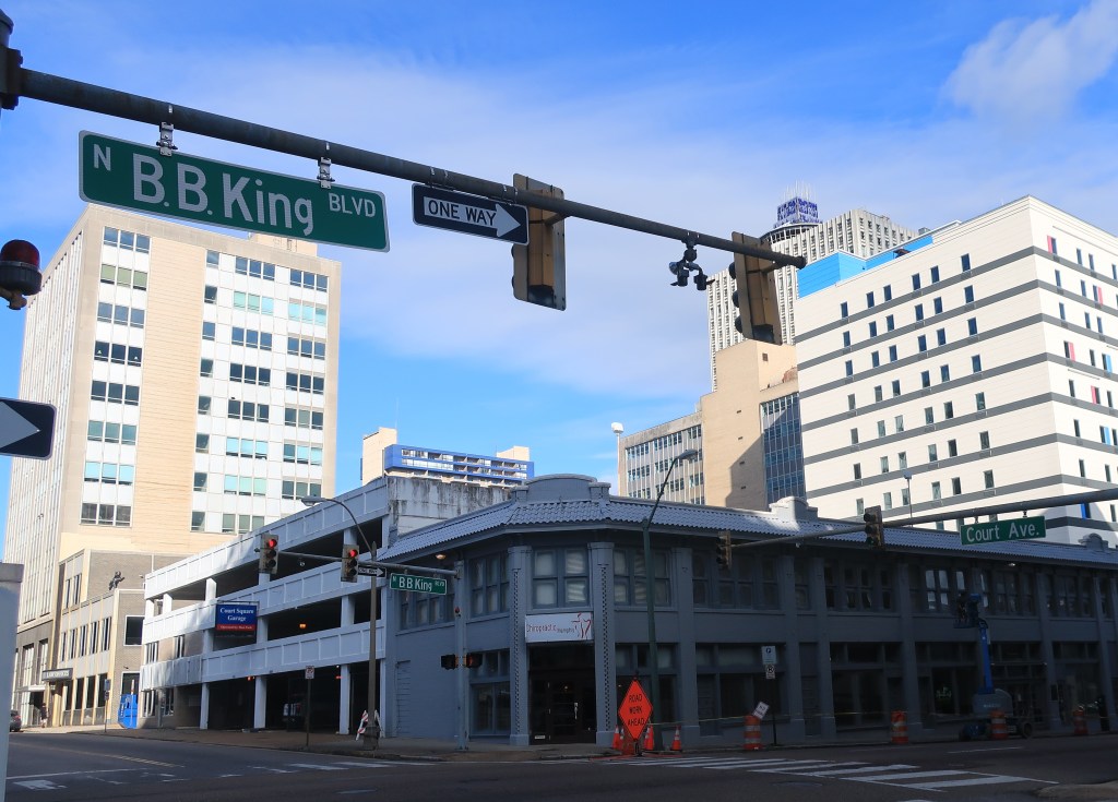
Court Square Park. Memphis, TennesseeB.B. King Boulevard (left) and North Second Street (right)
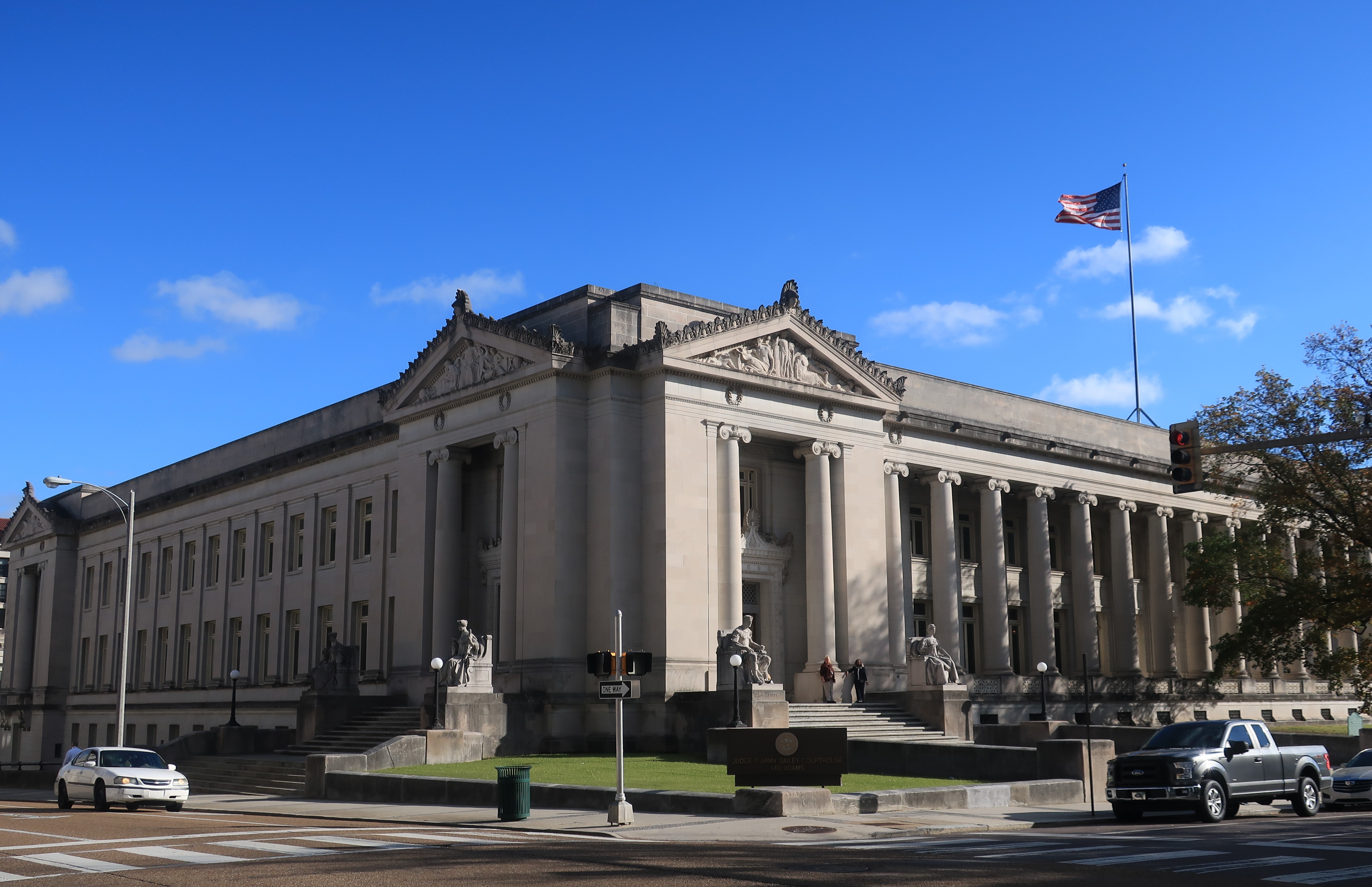
Memphis is the seat of Shelby County, Tennessee. The courthouse in Memphis is a grand two-story limestone structure dedicated on January 1, 1910. The historical sign claims it is the largest and most ornate courthouse in Tennessee.
Shelby County courthouse. Memphis, TennesseeShelby County courthouse. Memphis, Tennessee
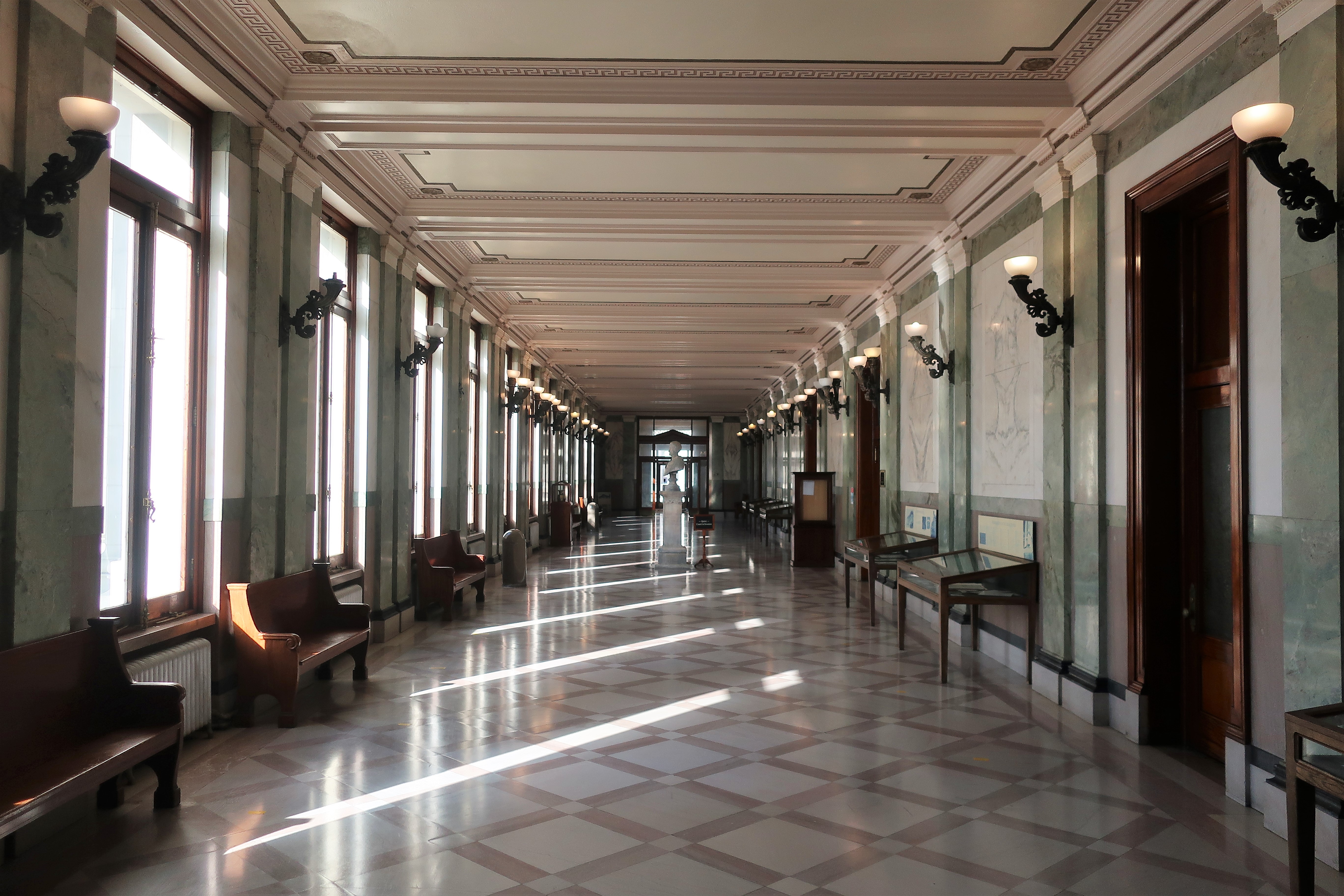
The courthouse interior includes “mahogany doors and paneling, brass doorknobs embossed with the county seal, and flooring comprised of seven varieties of marble.
Interior of the Shelby County courthouse. Memphis, Tennessee
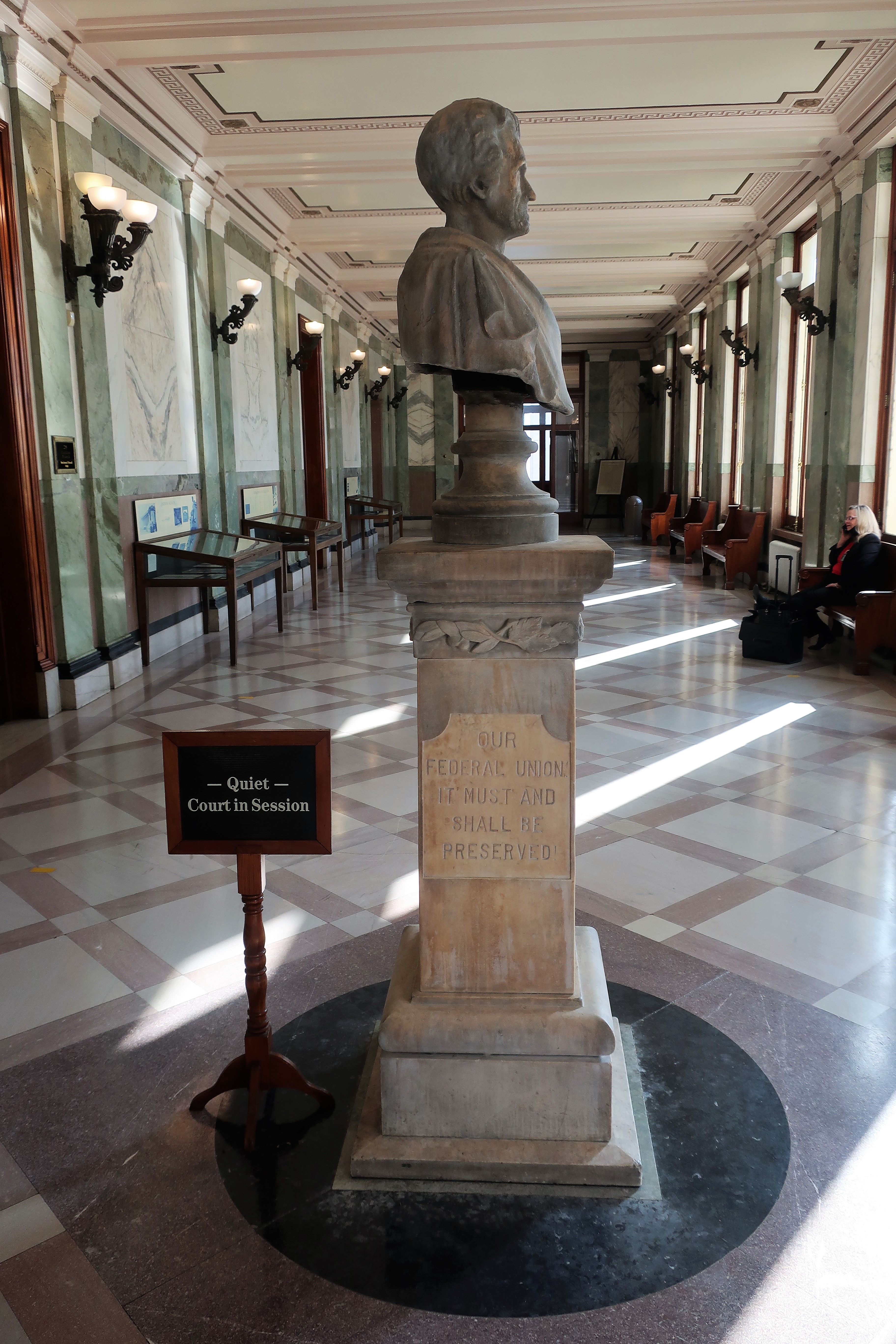
Inside the courthouse, the Statue of Andrew Jackson, 7th President of the United States and the first from Tennessee, dominates the main hallway. Jackson was born in the colonial Carolinas but lived most of his life in Tennessee. The inscription on the statue reads “Our Federal Union must and shall be preserved.” The inscription is ironic in that Tennessee seceded from the Federal Union during the Civil War sixteen years after Jackson’s death in 1845.
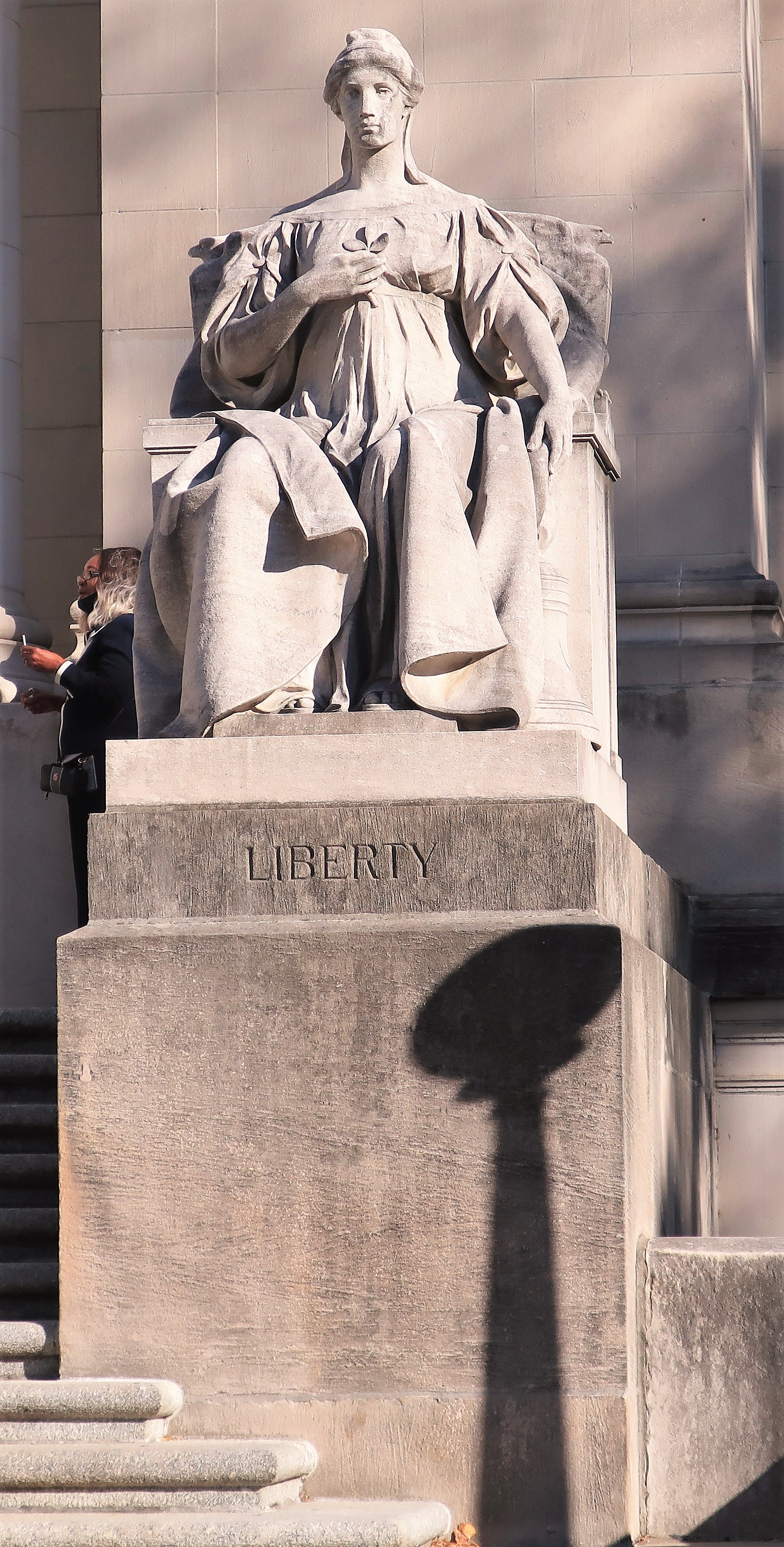
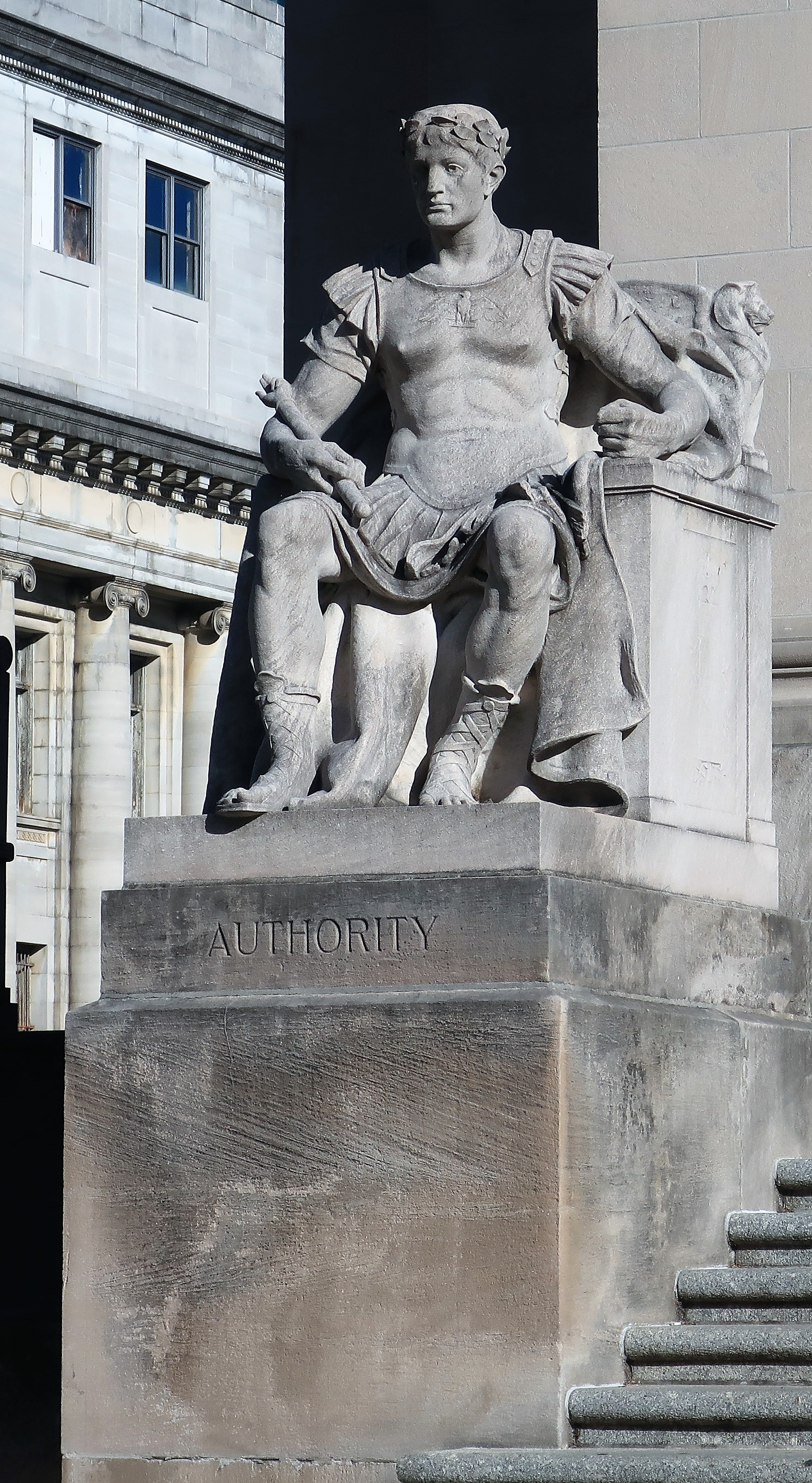
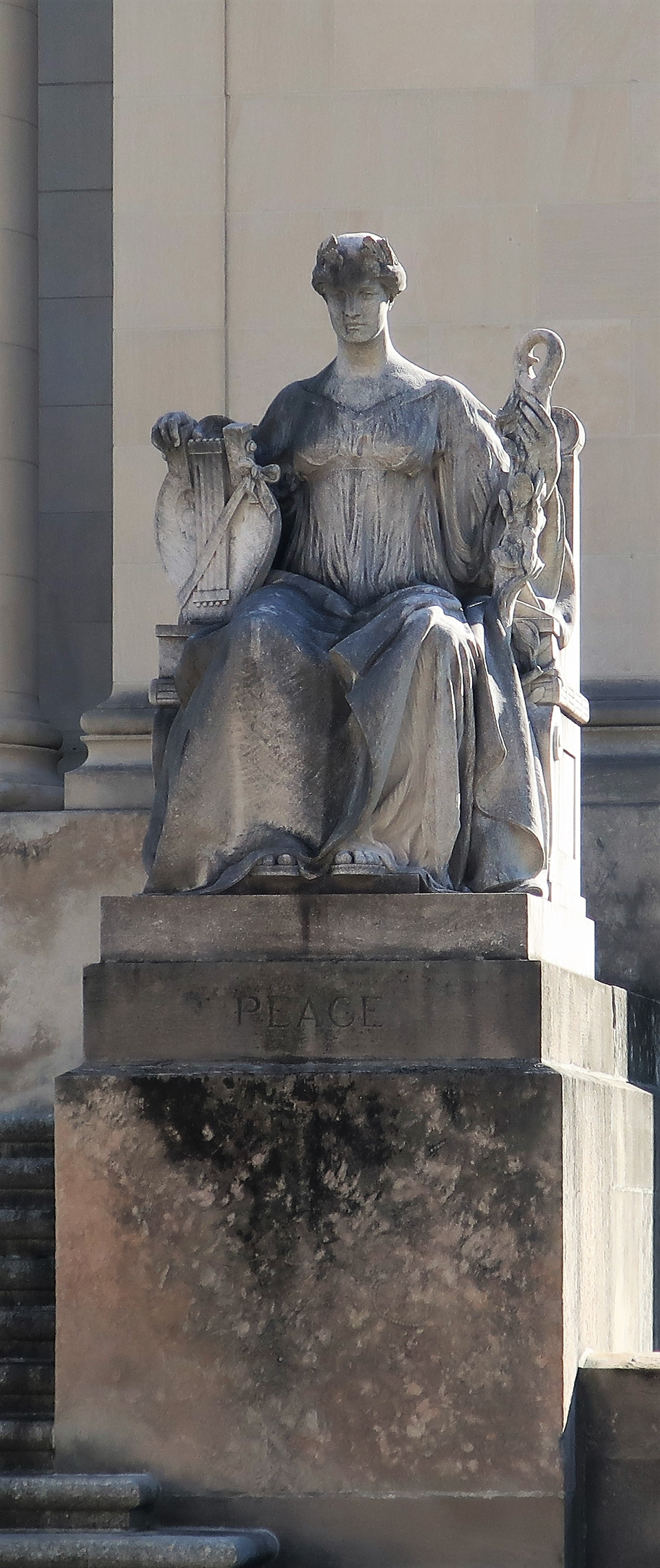
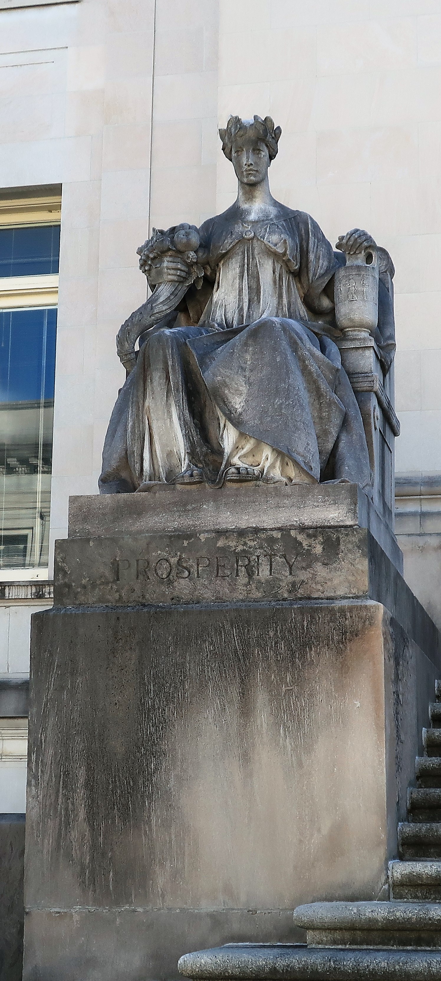
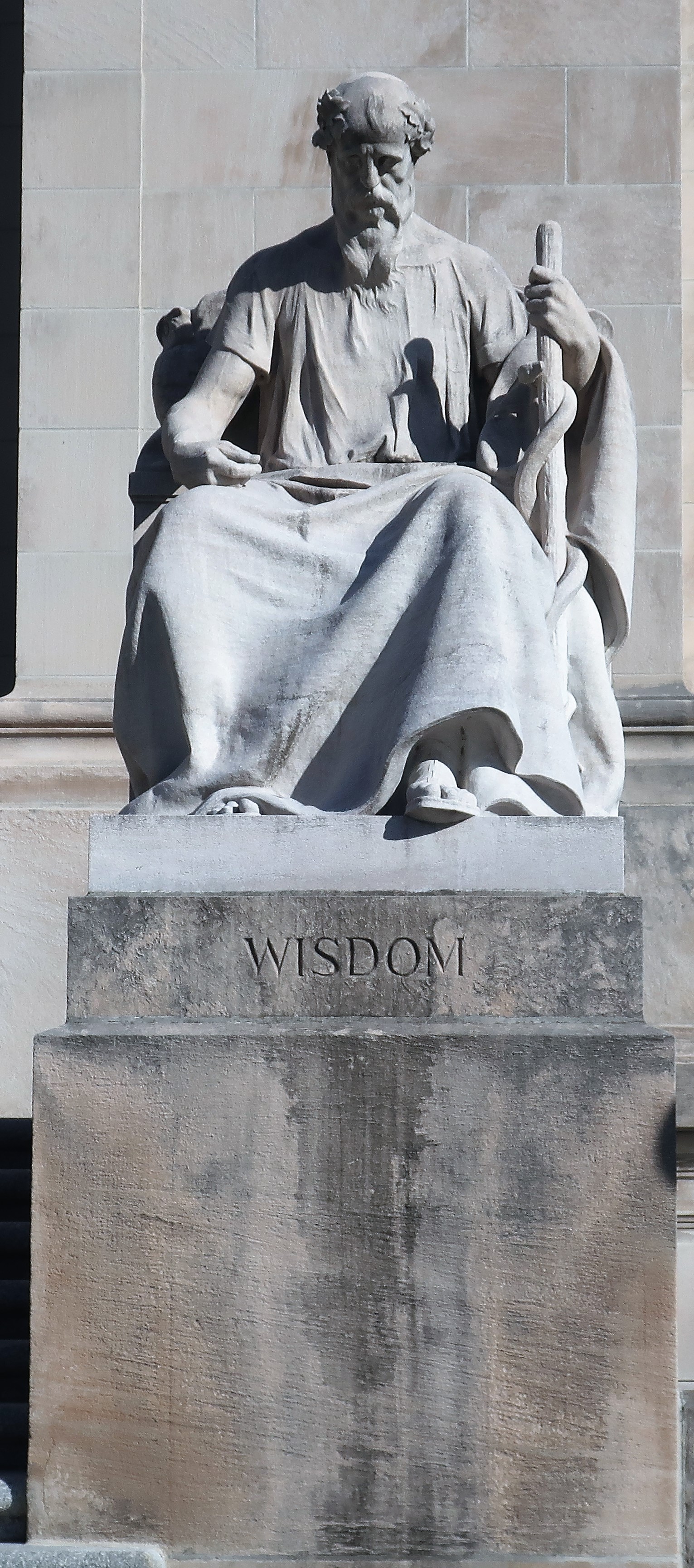
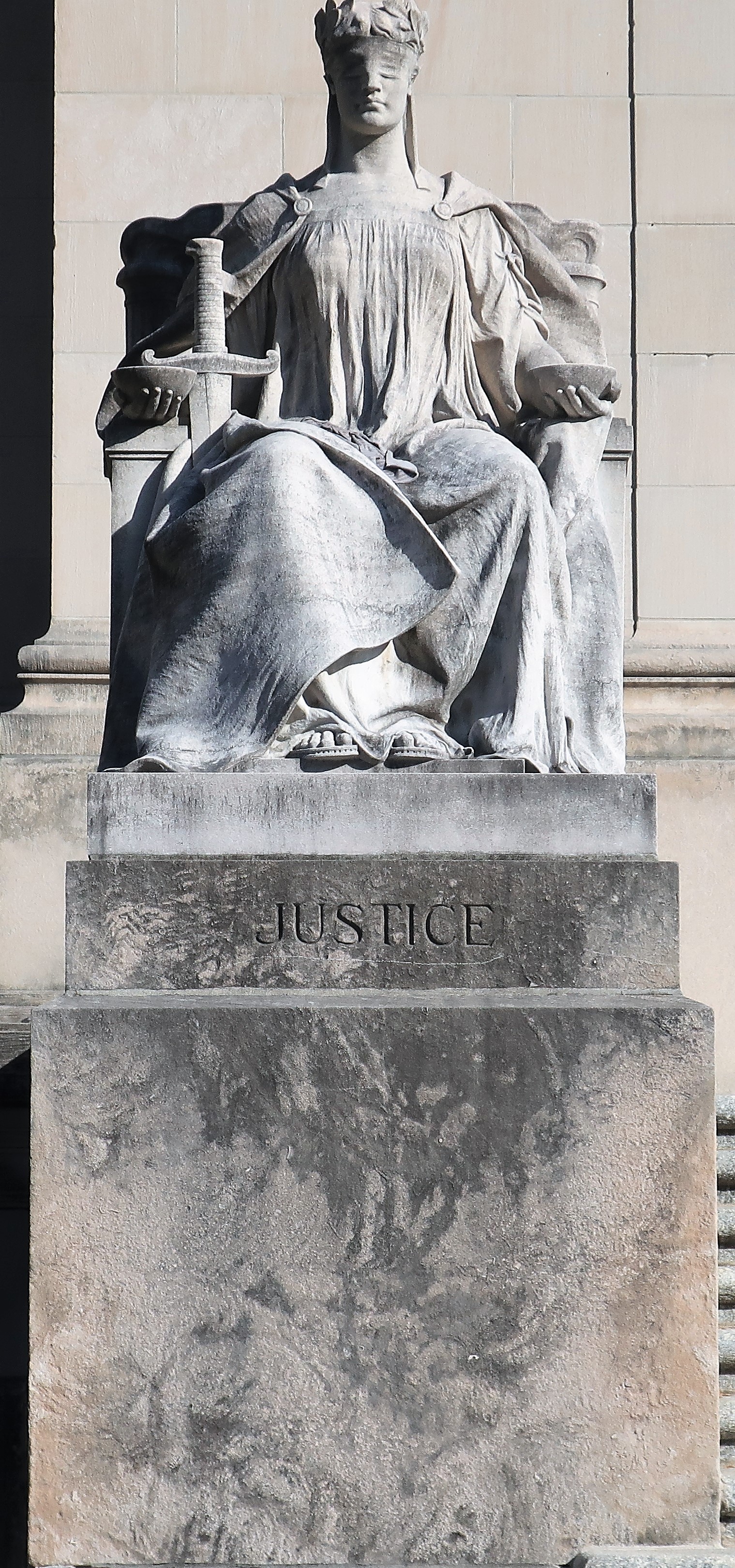
Carved from single blocks of Tennessee marble, six statues surround the entrances of the Shelby County courthouse. The six are titled: Liberty, Authority, Peace, Prosperity, Wisdom, and Justice.
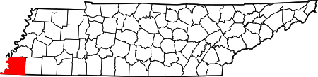
Shelby County in the state of Tennessee
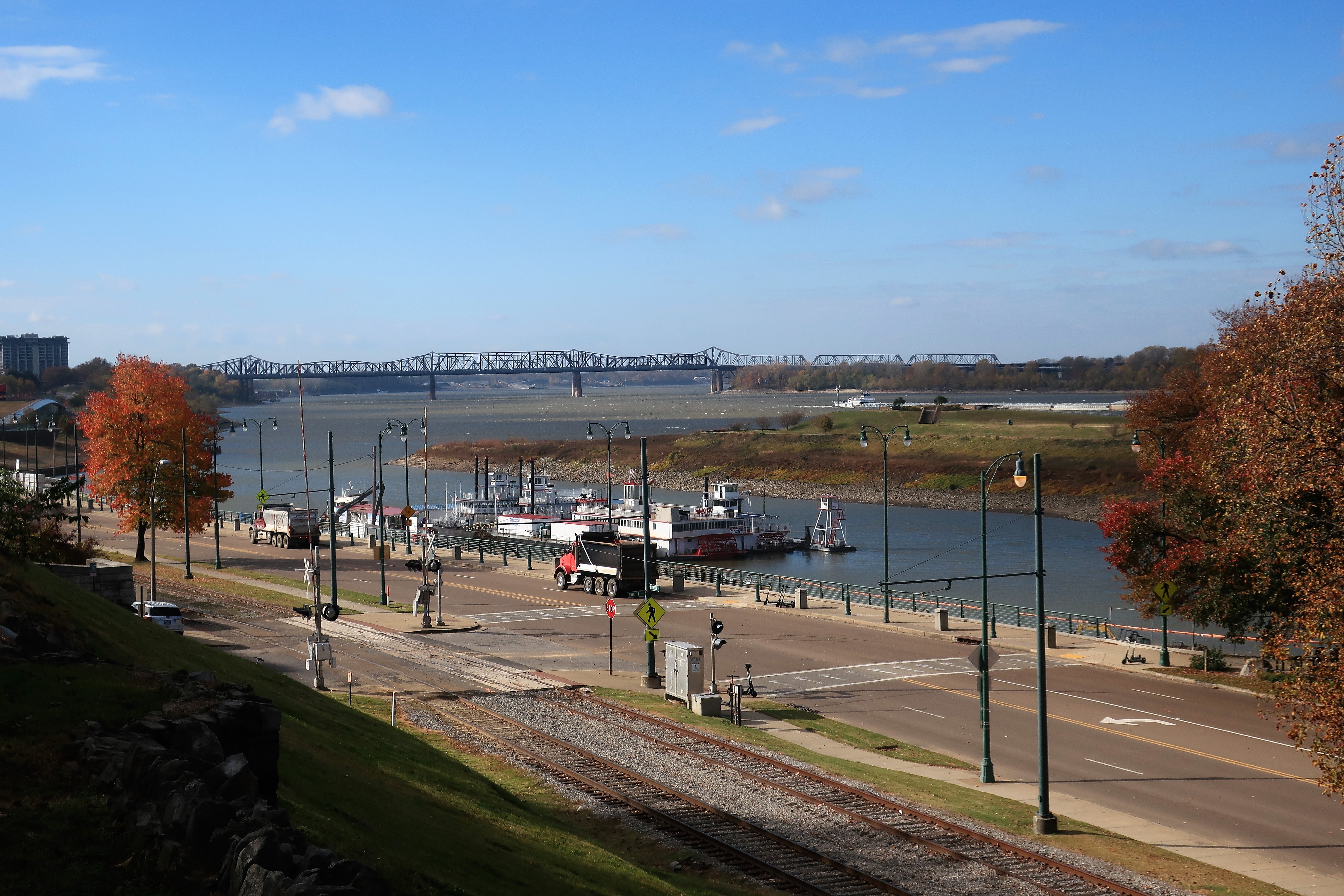
A few blocks to the south and west of the courthouse, Fourth Bluff Park marks the founding spot of the city — high on a bluff overlooking the Mississippi River. “Fourth Bluff” refers to the 4th of a series of bluffs along the east side of the river collectively known as Chickasaw Bluff, providing high ground safely above the Mississippi’s flood plains.
Taken from Fourth Bluff Park overlooking the Mississippi River and Mud Island. Memphis, Tennessee
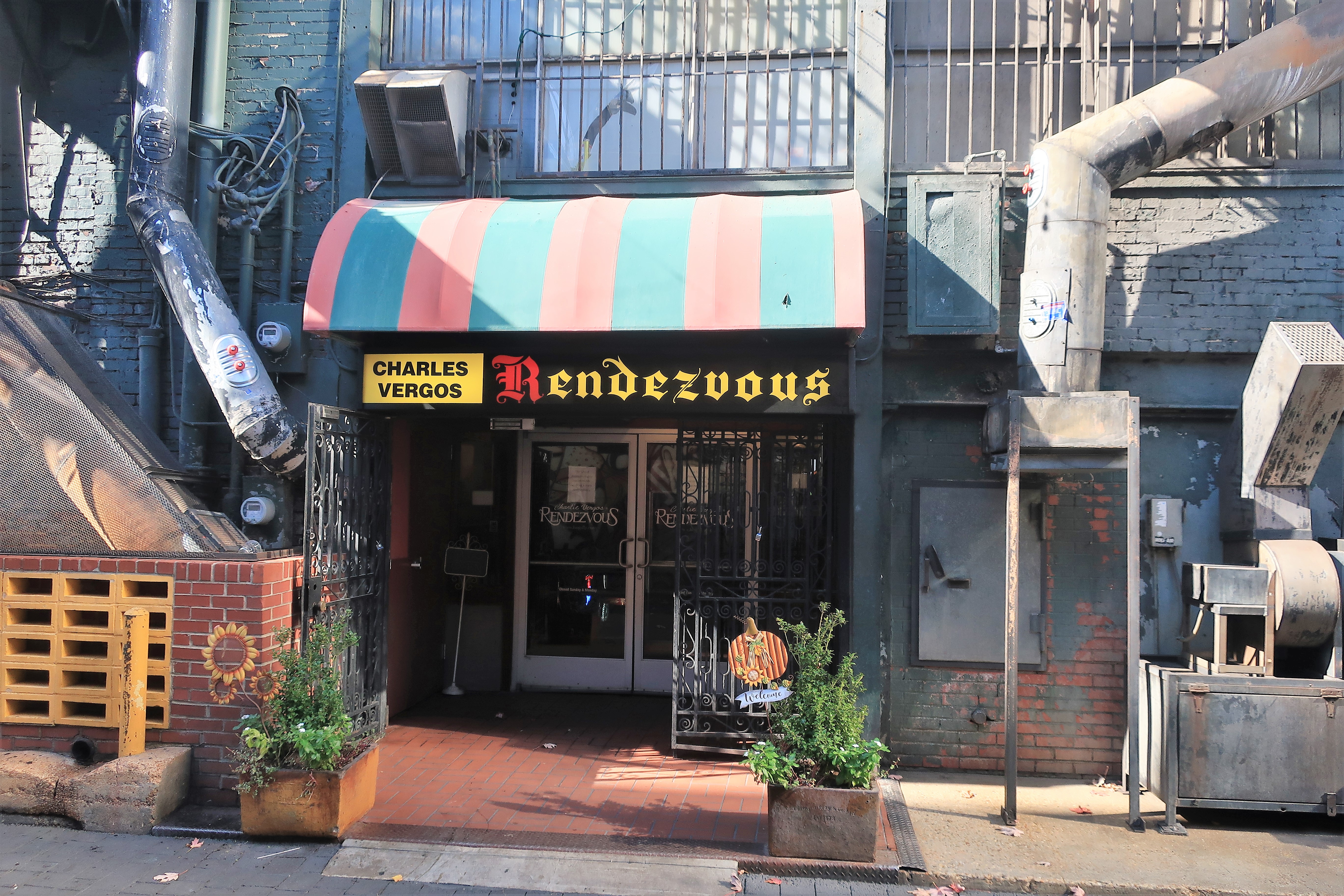
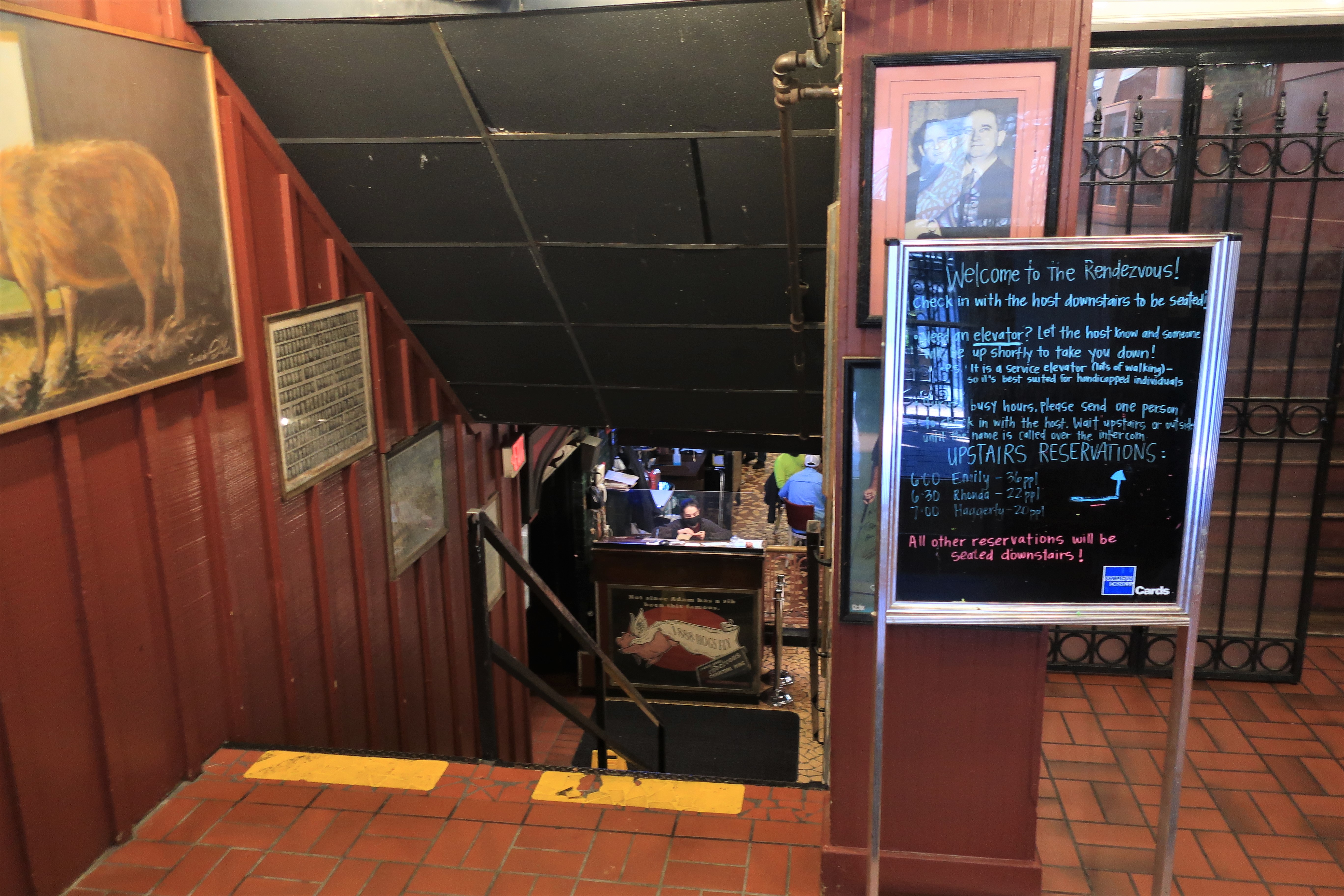
Memphis means barbeque, and Charles Vergos Rendevous is one of the best places for barbeque in town, especially for ribs.
The Rendezvous. Entrance from Rendezvous Alley. Memphis, TennesseeDownstairs at the Rendezvous. Memphis, Tennessee
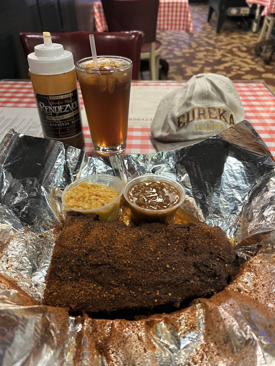
The Rendezvous and Corky’s in Memphis have always been my favorite two barbeque joints in Memphis. (Corky’s is on East Poplar and not downtown.) Both establishments are known for their dry rub ribs, dry rub is the way to actually the way to go — barbeque sauces tend to cover up the taste of the meat while dry rub brings out its taste. Also, Rendezvous’ mustard-based coleslaw is unique and worth taking home by the quart.
Lunch at the Rendezvous; half-slab of dry rub ribs, mustard-based slaw, and bbq beans. Memphis, Tennessee
A block from the Rendezvous, stands the massive and massively luxurious Peabody Hotel, known for the famous Peabody Duck March, a daily tradition since the 1930s.
The Peabody. Memphis, Tennessee
From Wikipedia’s description of the daily Peabody Duck March: “Every day at 11:00 a.m., the Peabody Ducks are escorted from their penthouse home, on the Rooftop, to the lobby via elevator. The ducks, accompanied by the King Cotton March by John Philip Sousa, then proceed across a red carpet to the hotel fountain, made of a solid block of Italian travertine marble. The ducks are then ceremoniously led back to their penthouse at 5:00 p.m.”
People waiting in the Peabody Lobby for the Peabody Duck March. Peabody Hotel, Memphis, Tennesse
Today was a bright but windy weekday. I didn’t see many people walking the downtown streets, perhaps due to Covid restricting office use. It also may be so because Memphis is a night town. Beale Street is an institution here.
B.B. King’s Blues Club and many other live music venues line Beale Street. Memphis, Tennessee
Beale Street is known as the birthplace of the Blues. The street is lined with blues venues and nightly becomes one big block party, rivalling New Orleans’ Bourbon Street for music and fun.
Beale Street. Memphis, TennesseeStatue of Elvis Presley, Beale Street. Memphis, Tennessee
I spent most of the afternoon at Graceland, Elvis Presley’s home. Tickets were $75 for a combined tour of the Graceland mansion, Elvis’ aircraft, and the many exhibits. I thought $75 was steep when I bought the tickets but found it well worth the price at the end of the day. Tickets to tour Graceland can be purchased online here.
The tour of the mansion came first.
Graceland, Elvis Presley’s home. Memphis, Tennessee
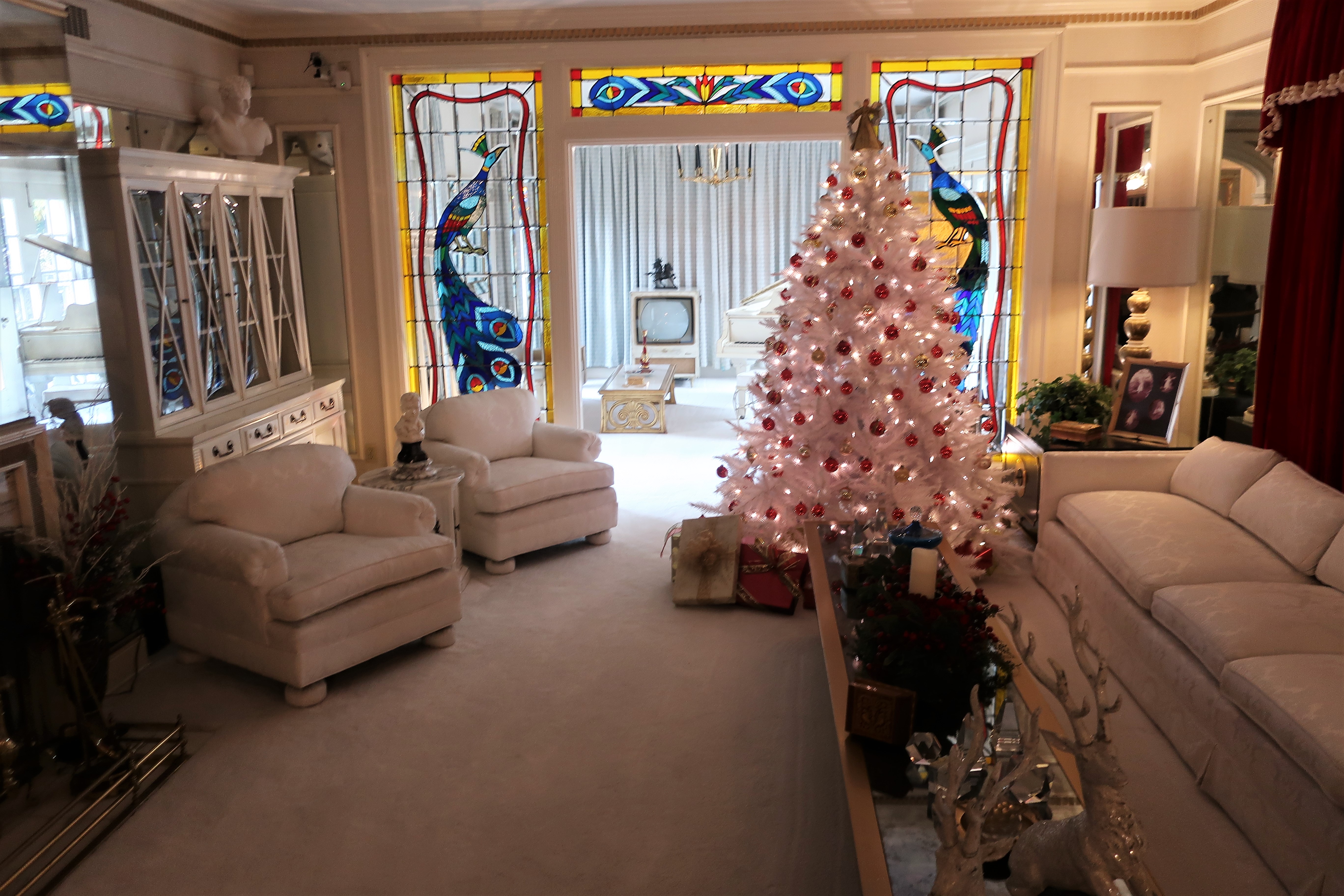
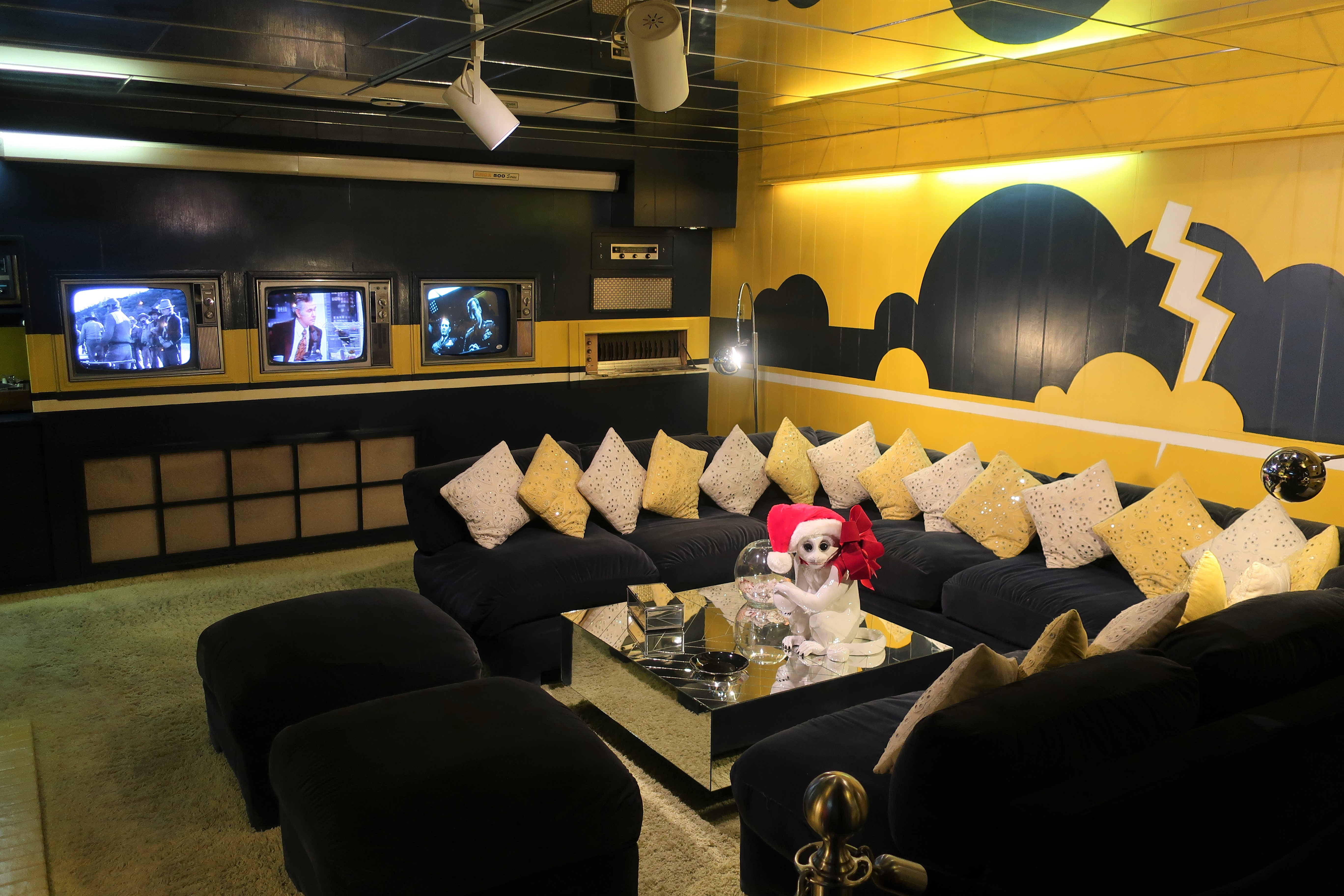
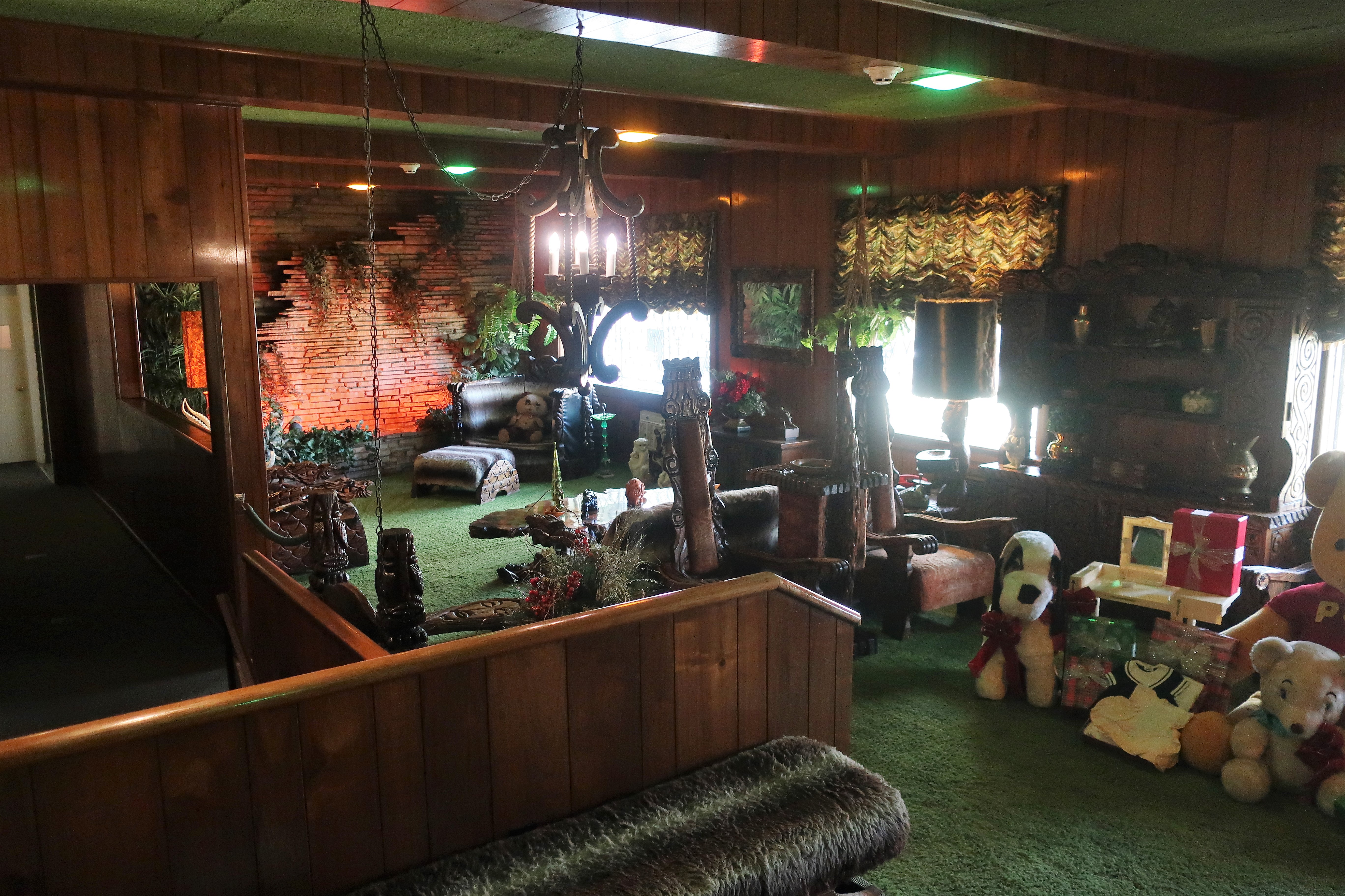
We were given a tour of the ground floor and basement rooms. What surprised me was how small the home was compared to what I am expecting. As you can see from the photos below, rooms within the house are only a little larger than what one might find in a typical middle-class American home.
Rooms within the Graceland mansion, decorated for Christmas (clockwise from top left): living room, dining room, downstairs media room, and the famous “Jungle Room,” known to Elvis as the den.
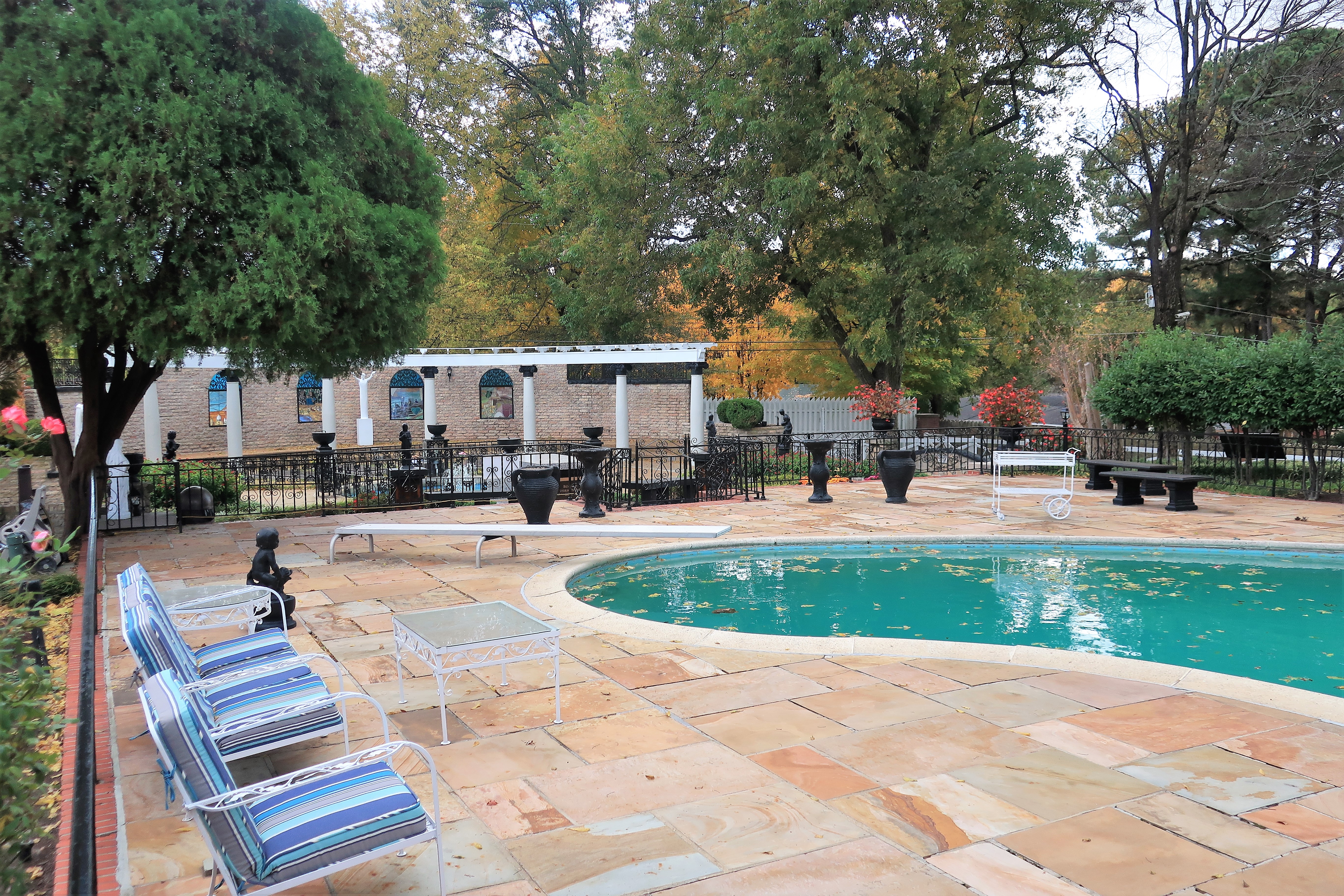
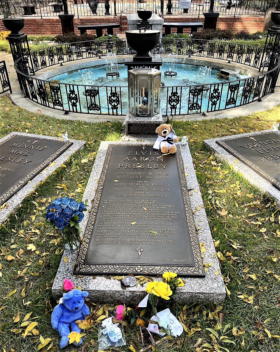
Through the back door of the mansion, the tour continued into the backyard area where we saw Elvis’ swimming pool and, next to the pool, the graves of the King, his parents, and his grandmother.
Graceland swimming pool. Memphis, TennesseeThe grave of Elvis Presley at Graceland. Memphis, Tennessee
One of the backyard buildings contains some photo exhibits and artifacts from Elvis’ life. The photo shown below is my favorite shot of the whole day, it shows a very young Elvis Presley with his father Vernon and his mother Grace, taken in Tupelo, Mississippi during the Great Depression. The young family was dirt poor; Vernon supported them on whatever odd jobs he could find. After becoming a star and buying Graceland, Elvis moved his parents into a bedroom suite on the main floor.
Young Elvis Presley with mother Grace and father Vernon. Graceland, Memphis, Tennessee
I didn’t consider myself a big Elvis Presley fan before visiting Graceland, but I consider myself a bigger fan now.
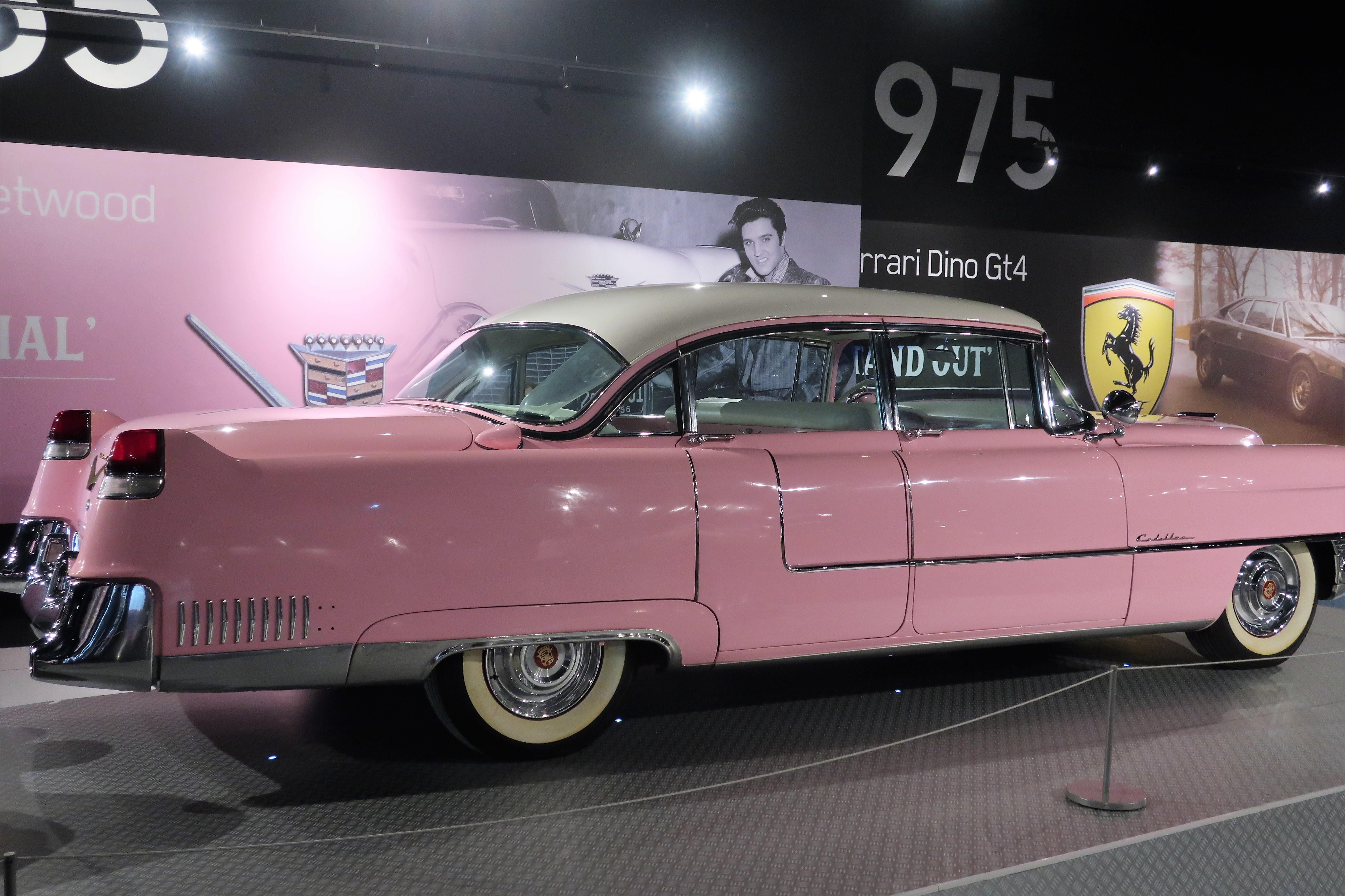
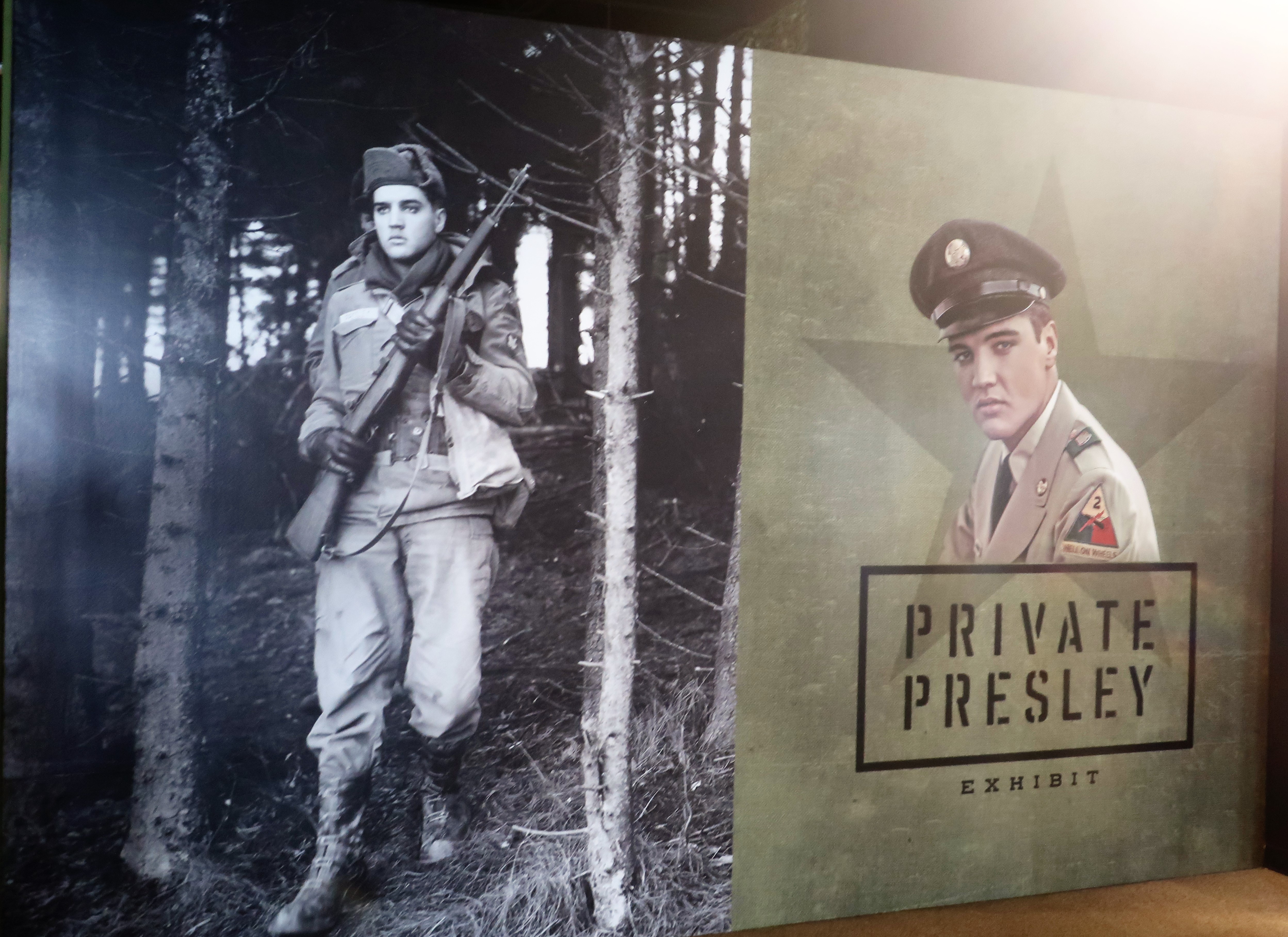
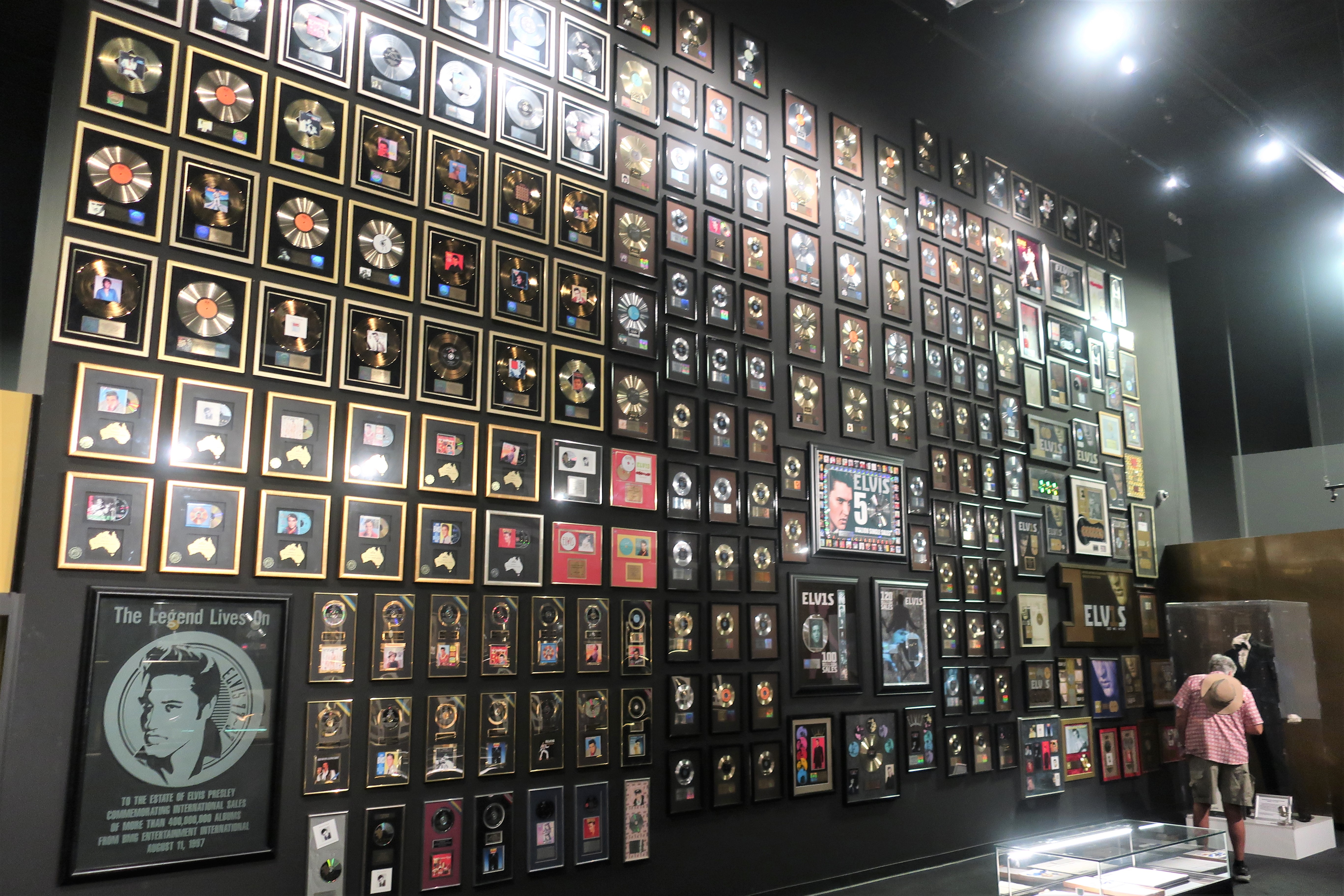
The Graceland tour includes a wide variety of exhibits — everything from Elvis’ vehicles to his gold records, housed in display venues across the street from the mansion. Below: Elvis’ famous pink Cadillac, a photo of Elvis serving the Army in Germany in the 1950s, and a wall full of recording achievements.
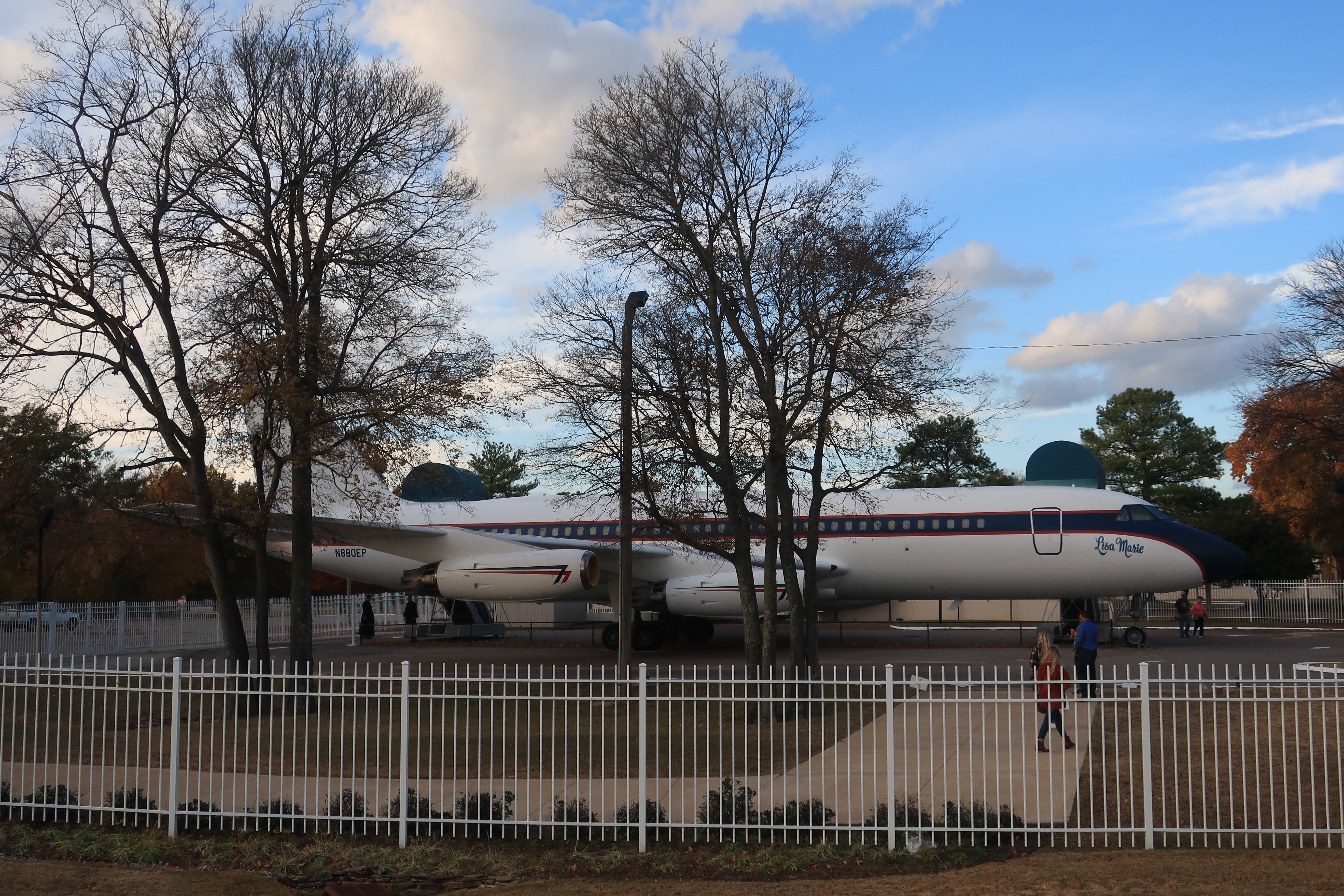
Finally, Elvis’ airplane, the “Lisa Marie”:
The Lisa Marie, Elvis Presley’s 707 parked across the street from Graceland. Memphis, Tennessee
A list of all photo posts from the American County Seats series in TimManBlog can be found here.
All photos were taken by the author on November 17, 2021.
I do this as a hobby — but donations are happily accepted if you’d like to help defer my costs. Thanks, The TimMan
Donations are NOT tax-deductible under U.S. law…but you knew that.
October 31, 2021 (photos and memories from October 2012)
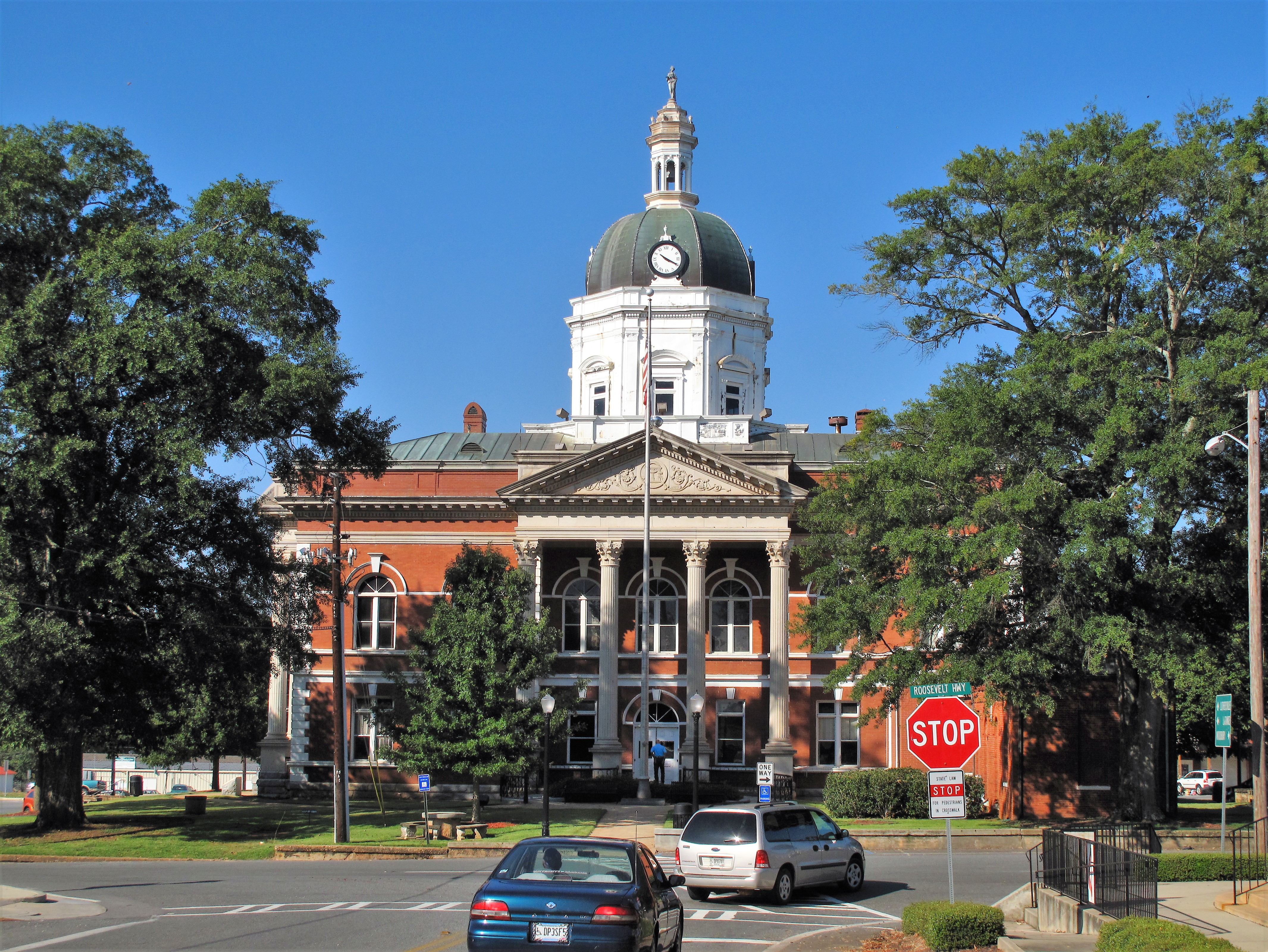
Meriwether County courthouse. Greenville, Georgia
In early October nine years ago I came upon the town of Greenville, Georgia. This is a small place, population 800 or so, but only about 50 miles southwest of Atlanta. Like so many other “Greenvilles” in the United States, this town was named for Revolutionary War General and hero Nathaniel Greene, the man who drove the British army out of the deep Southern states and toward its ultimate surrender at Yorktown, Virginia. Although Greenville is the county seat, Meriwether County is best known for the town of Warm Springs, which was President Franklin Roosevelt’s vacation home, the site of his polio therapy, and the place of his death in 1945.
Meriwether County historical sign. Greenville, GeorgiaMeriwether County in the state of Georgia
The courthouse here is strikingly grand — a two-story red brick structure with a white cupola. It was built in the late 1800s, suffered fire damage in 1976, and was then refurbished. The grand building dominates the little town of 800, sitting in the middle of the town’s central square and traffic circle.
Greenville’s central traffic circle surrounds the grand courthouse
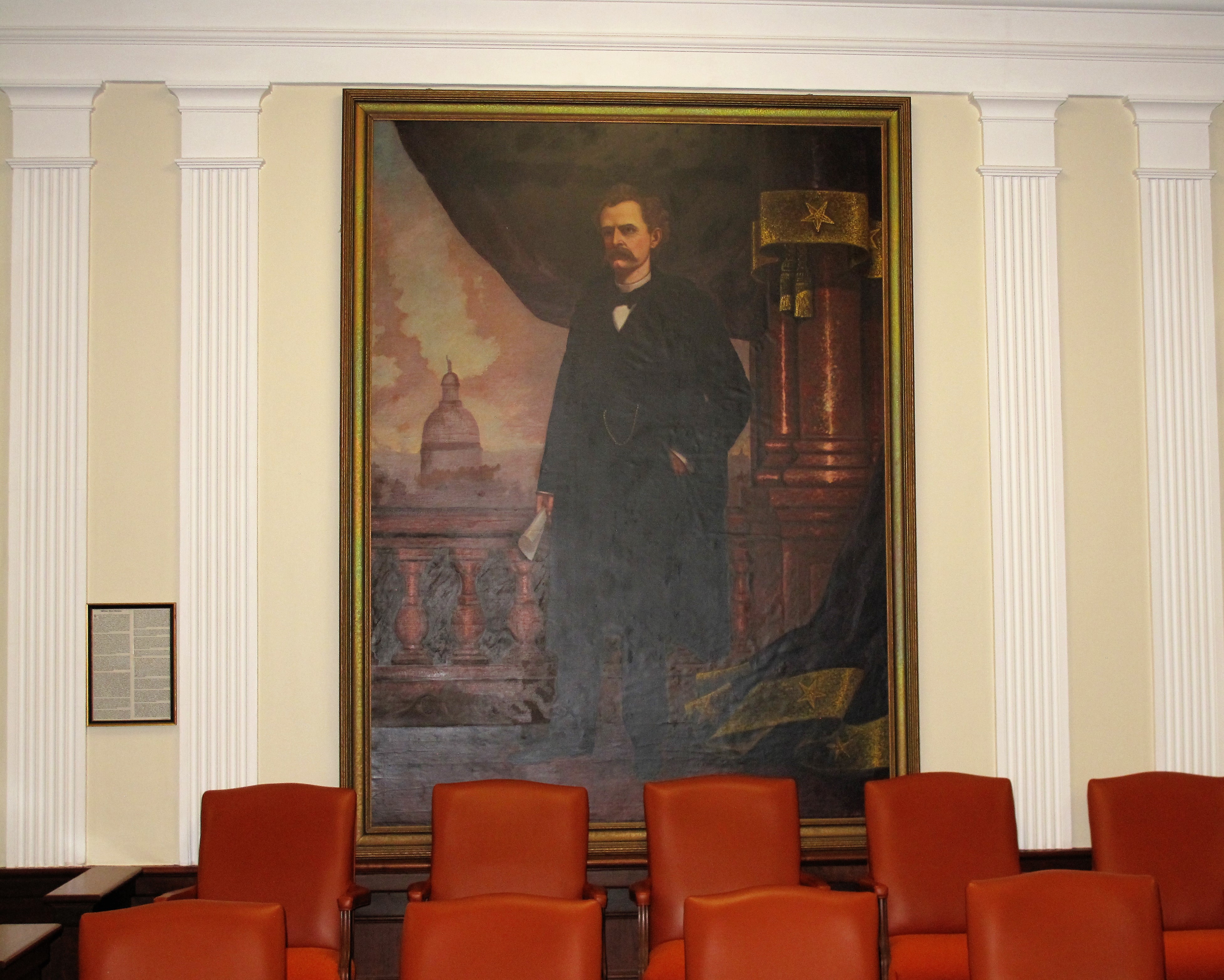
When I went inside, the security chief volunteered to give me a tour of the courthouse. The first stop on the impromptu tour was the top-floor courtroom and a wall-sized portrait of William Yates Atkinson, Meriwether county native and former Georgia governor.
William Yates Atkinson. Meriwether County courthouse. Greenville, Georgia
The second stop on the tour was a personal introduction to the local DA (district attorney) and assistant DA — a youngish black man in a dark gray suit, and a youngish woman in a purple dress. These two were standing in the DA’s office telling jokes when the security guard and I arrived. They both greeted me warmly, and their relaxed attitude gave me the impression that this small, rural county didn’t suffer from the scourge of rampant crime and violence.
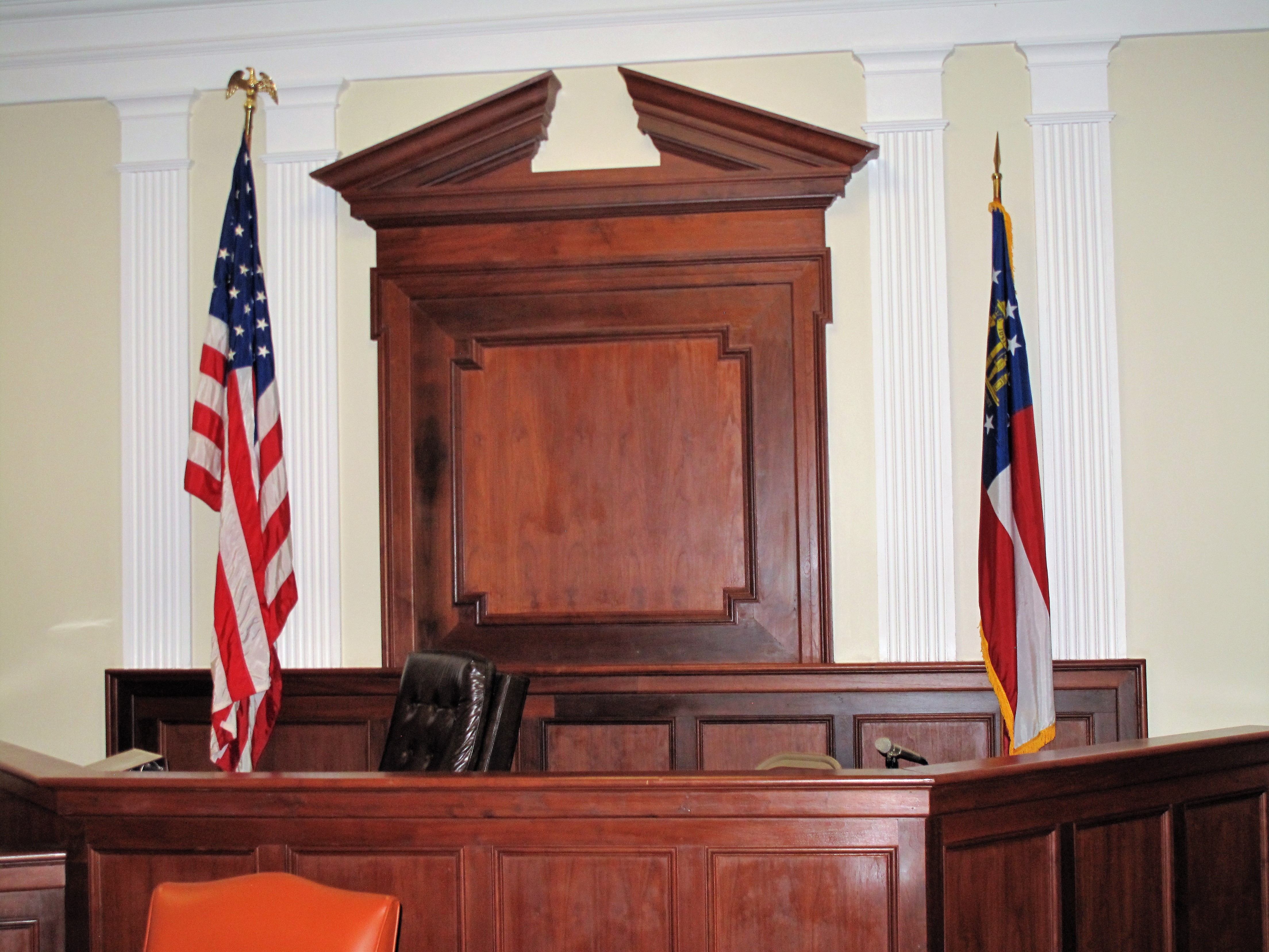
For the third stop, I was taken to meet the Judge of Magistrate Court, whom the security guard told me was a full-blooded Cherokee. Unfortunately, the judge was attending to some cases at the jail and so wasn’t in her office. Her assistant greeted me and showed me her photo and some hand-made Cherokee paraphernalia hung on the walls.
Judge’s bench. Meriwether County courthouse. Greenville, Georgia
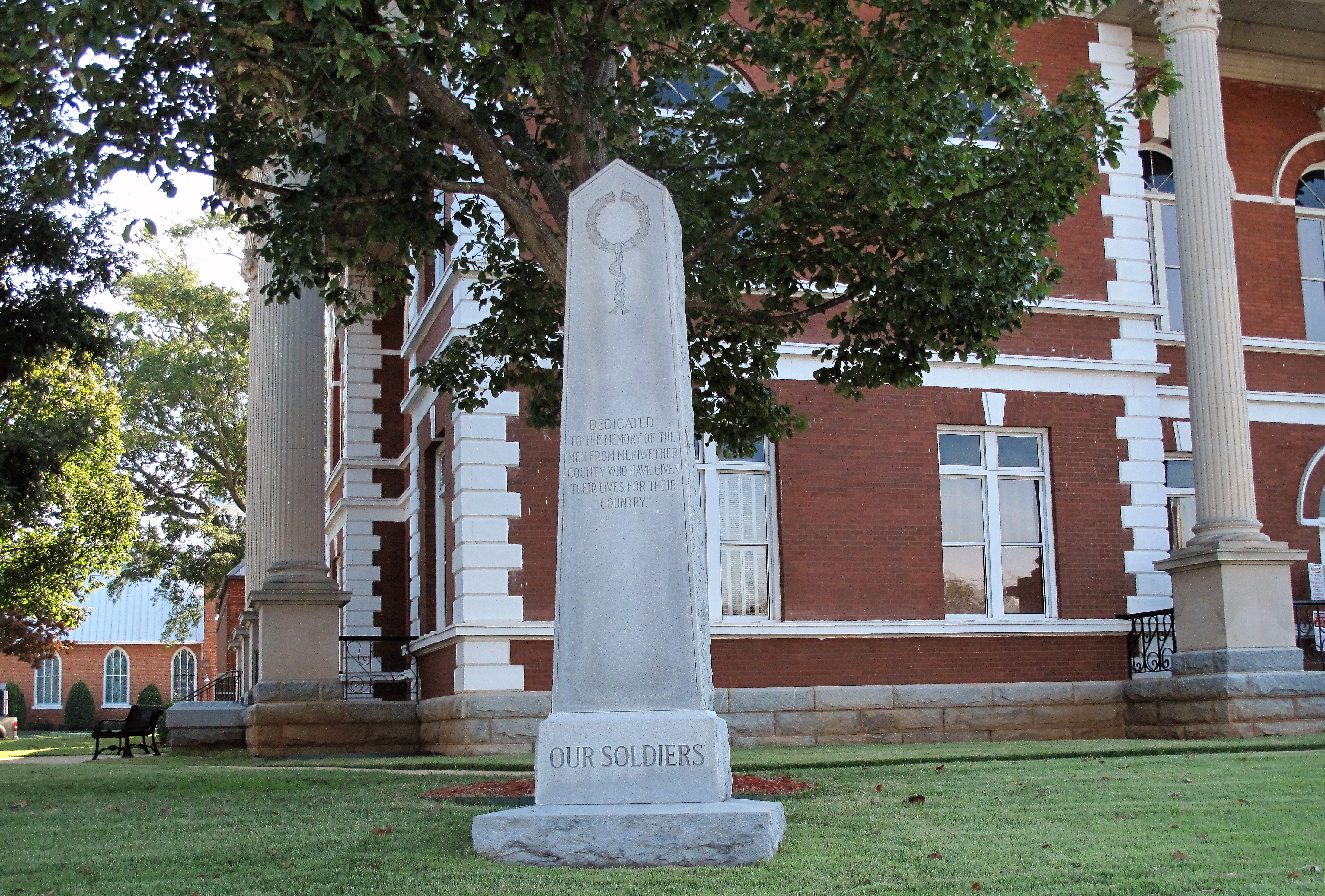
The courthouse tour ended there. I thanked the security guard for his time and let him get back to his station at the front entrance. Here’s a final photo of the courthouse, with the town’s Methodist church on the right.
Meriwether County courthouse. Greenville, GeorgiaSoldiers’ memorial on the courthouse grounds. Greenville, Georgia
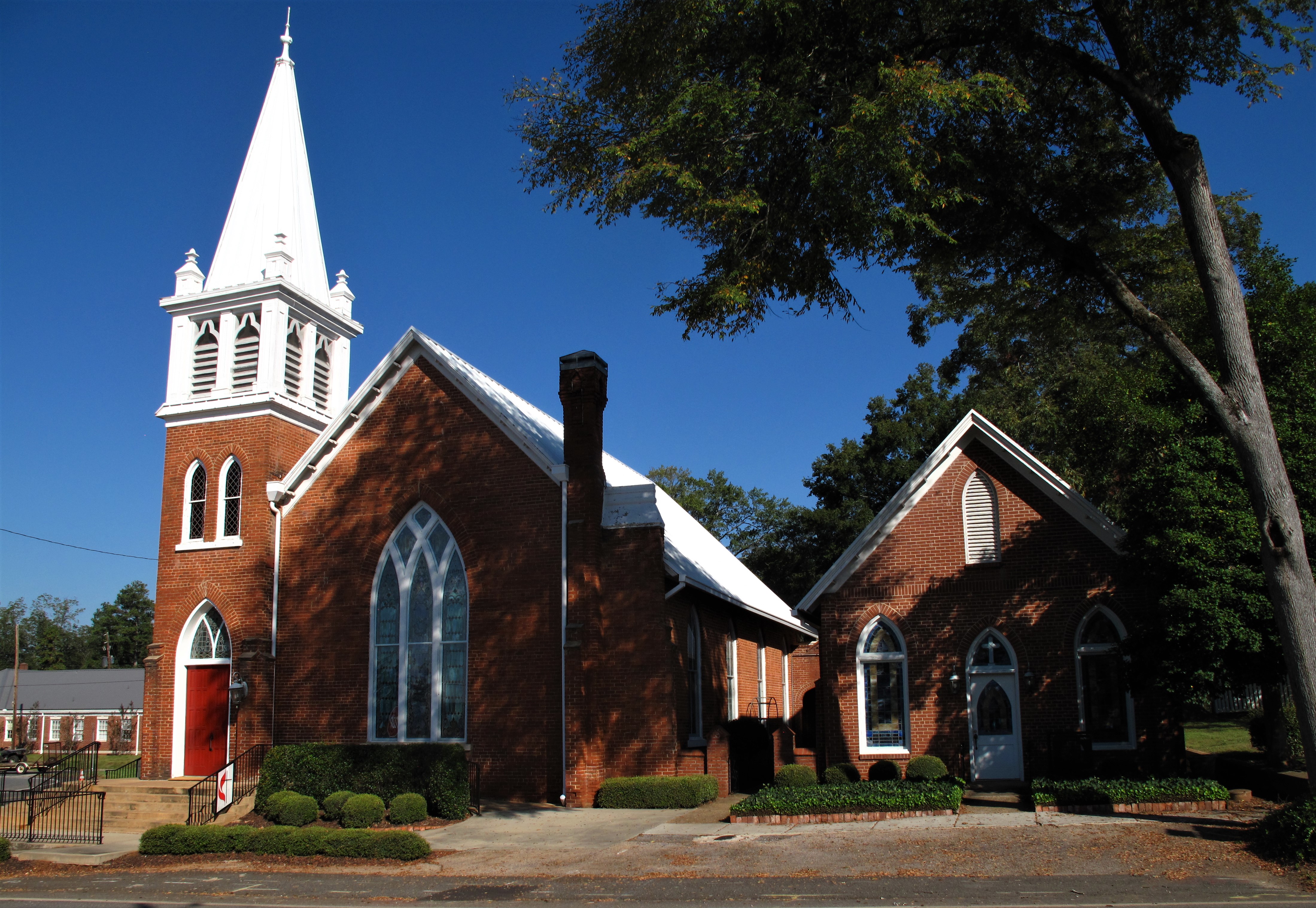
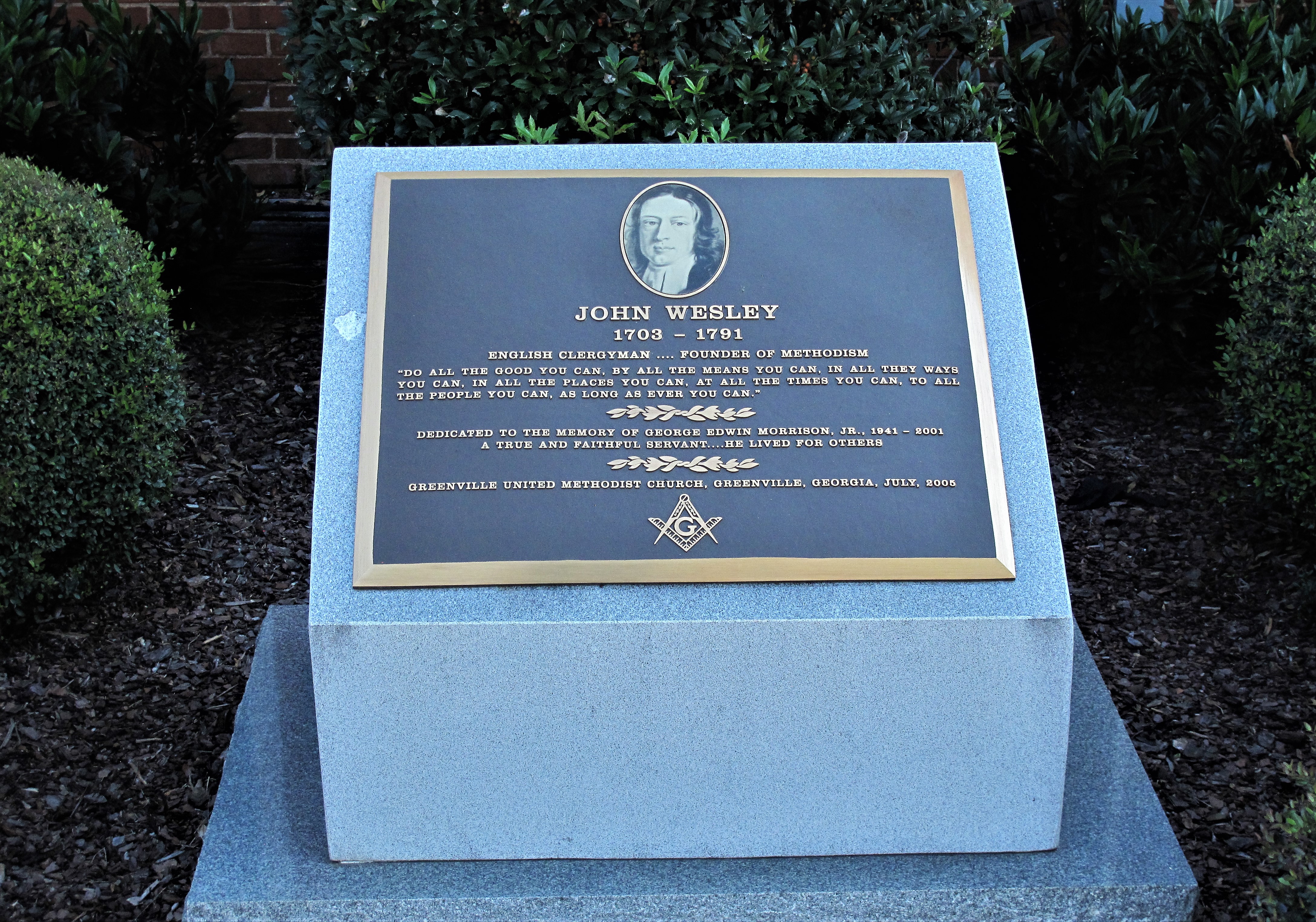
Generally speaking, in most Southern towns the Baptist denomination is the most prominent religious sect. In Greenville however, the town’s Methodist church, next to the courthouse, seems most prominent.
Greenville United Methodist Church. Greenville, GeorgiaMemorial to John Wesley, founder of Methodism. Greenville, Georgia
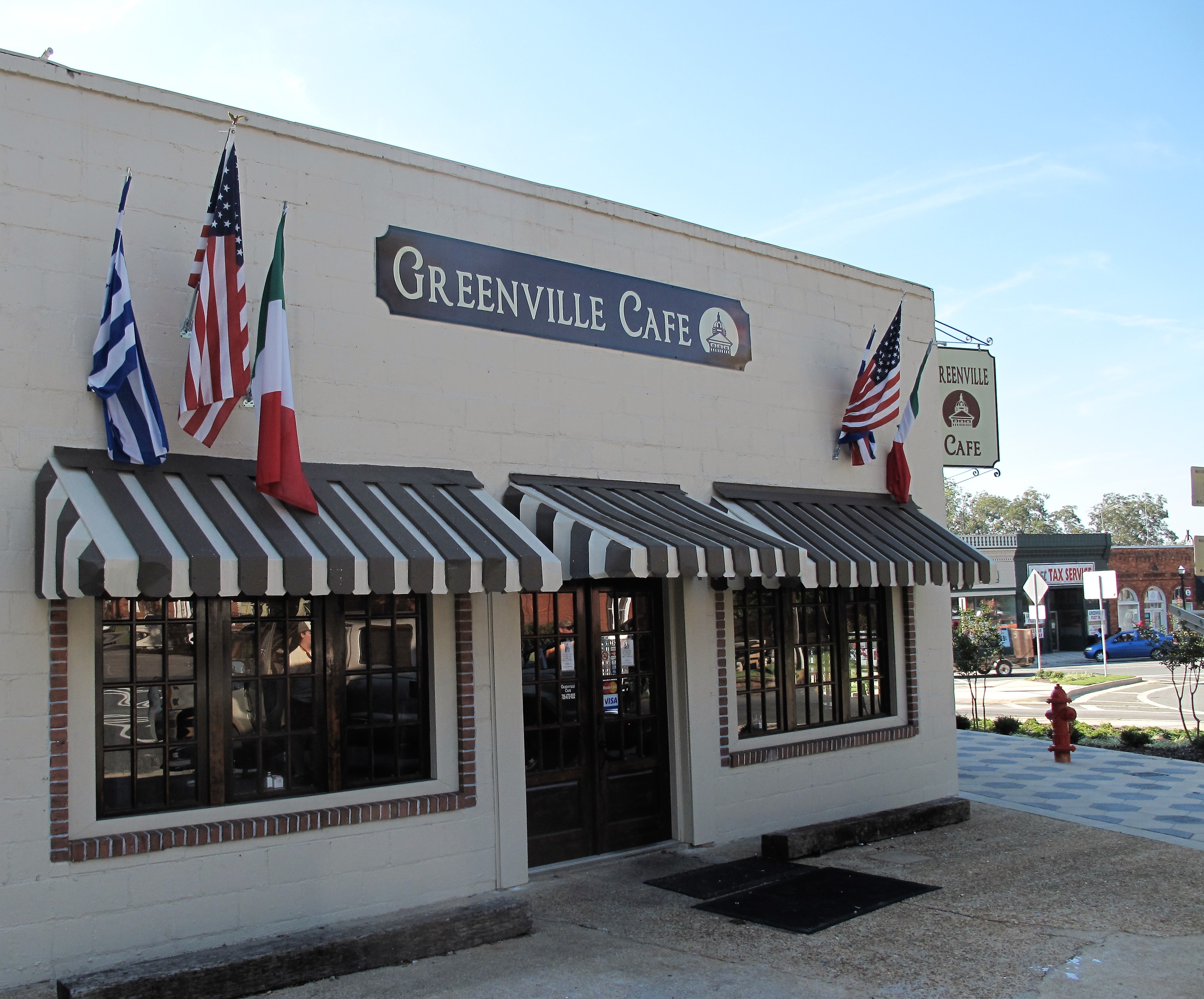
Greenville is a small town of 800 residents, so the “business district” consists of the shops along the outer side of the traffic circle that goes around the courthouse. It seems vibrant enough though:
Shops across from the courthouse. Greenville, Georgia
These photos were taken in October 2012. The Greenville Cafe is now the Willows Eatery. Their Facebook page (at the link) includes a few short videos to welcome your visit.
Greenville Cafe, now the Willows Eatery. Greenville, GeorgiaSouthern Charm Realty, across from the bell and the courthouse circle. Greenville, Georgia
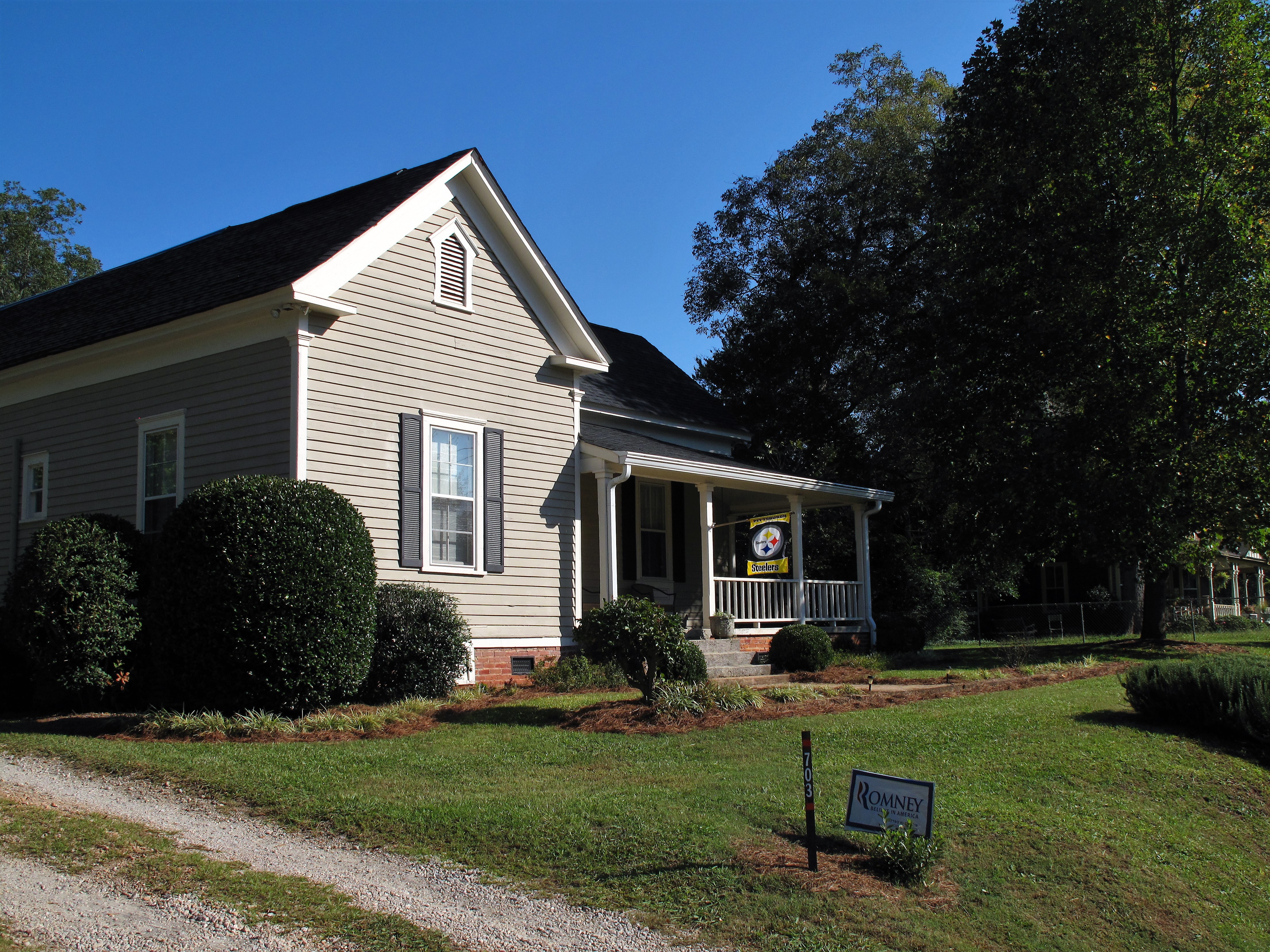
Perhaps the owners of this fine home in town bought their castle from the realtor in the photograph above. They seem to be northern transplants — notice the Pittsburgh Steelers sign.
Pittsburgh Steelers and Mitt Romney supporters. Greenville, Georgia
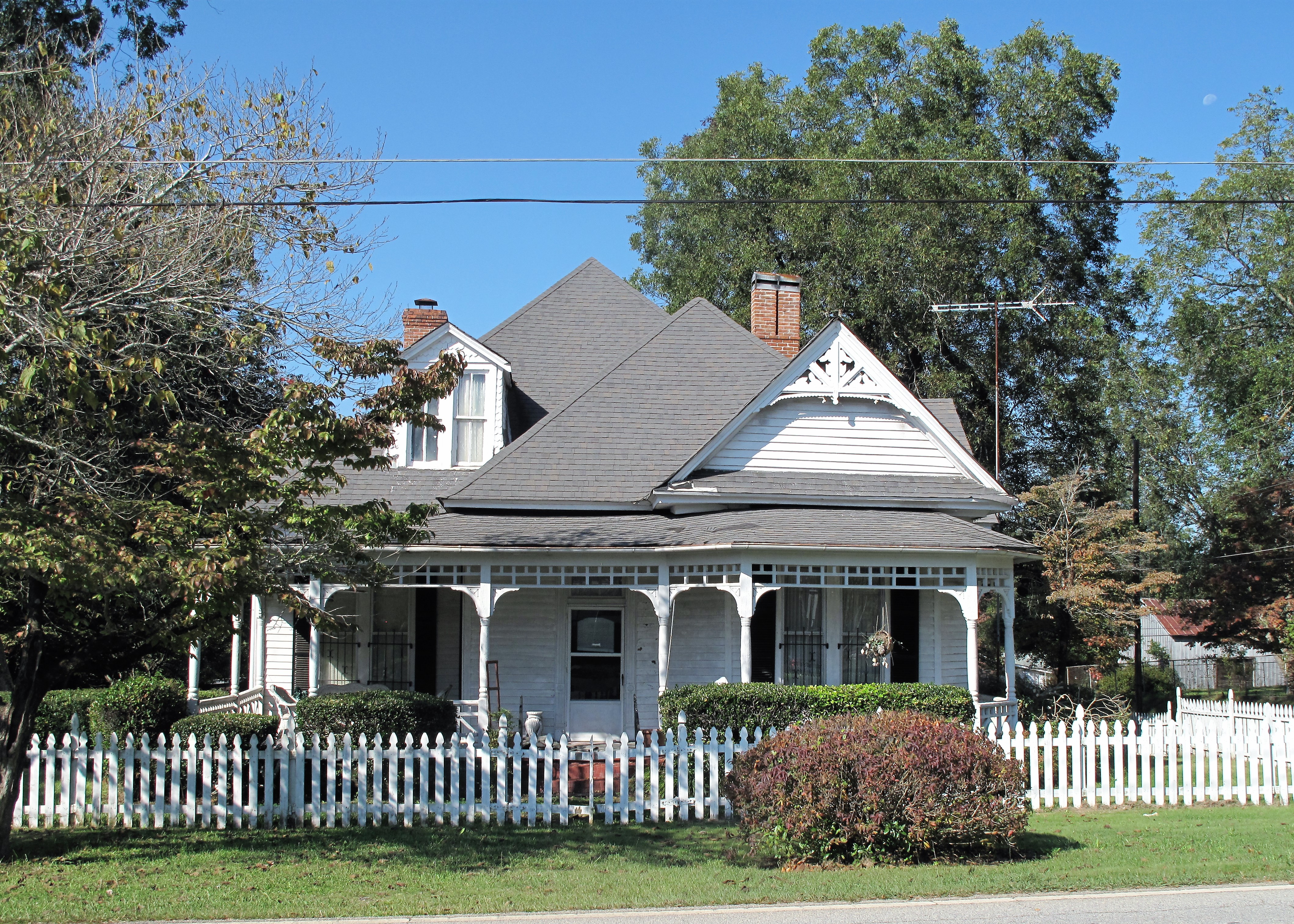
Here are two more fine homes I saw in Greenville:
Home in Greenville, GeorgiaHome in Greenville, Georgia
The old county jailhouse is now the county sheriff’s office. Perhaps the Magistrate Court Judge was inside when I was touring the courthouse?
Sheriff’s office and old jail. Greenville, Georgia
A list of all photo posts from the American County Seats series in TimManBlog can be found here.
All photos were taken by the author on October 5, 2012.
I do this as a hobby — but donations are happily accepted if you’d like to help defer my costs. Thanks, Tim
Donations are NOT tax-deductible under U.S. law…but you knew that.
September 26, 2021 (photos and memories from August 1997 and September 2010)
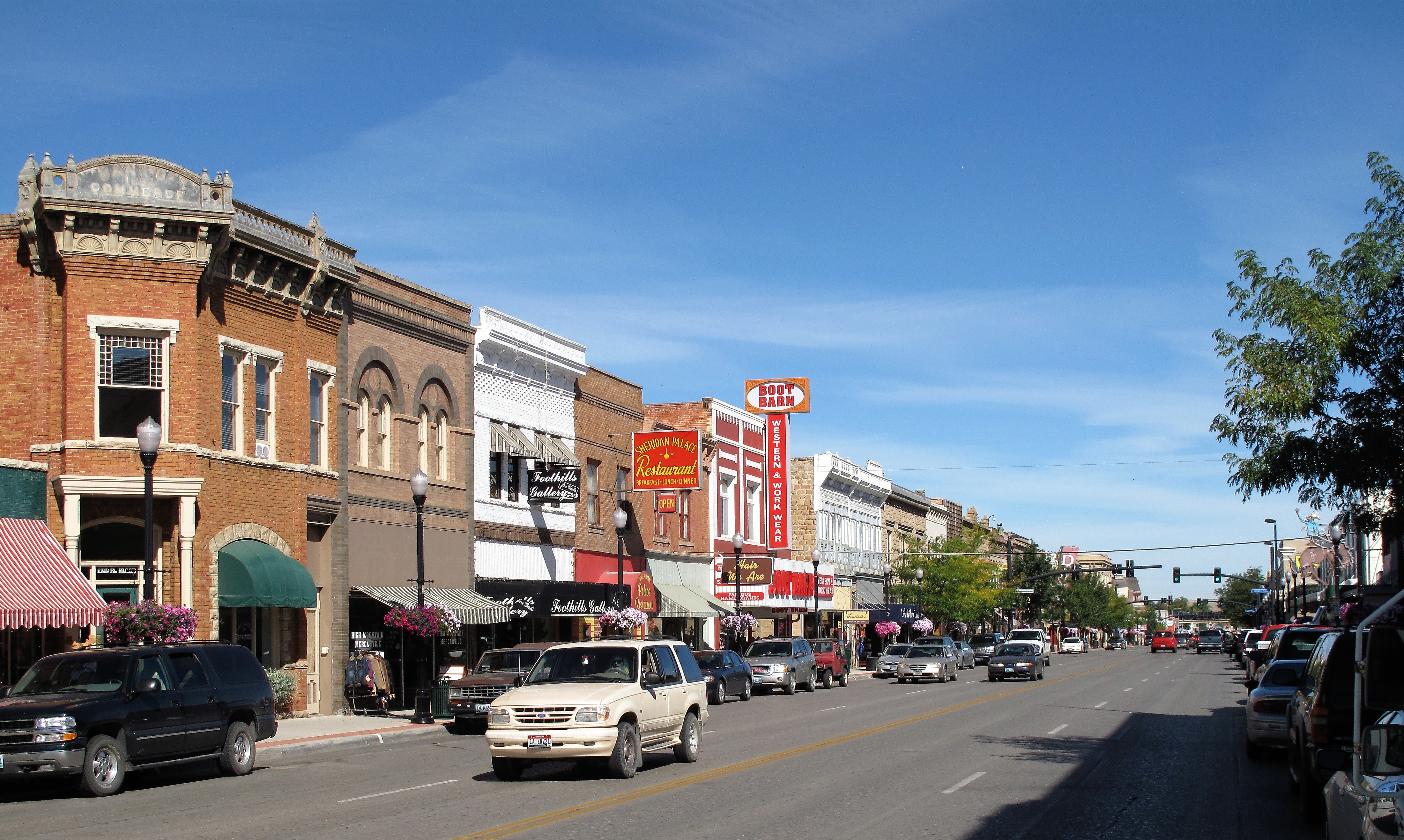
Main Street Sheridan, Wyoming, looks just like the Old West town that it is.
Sheridan, Wyoming seems perfectly happy with its current size and situation. This north-central Wyoming town of 17,000 lies at the eastern edge of the Big Horn Mountains. Runoff streams provide ample water for nearby tree-lined pastures.
Sheridan has both a hometown feel and a retirement feel, and the combination complements both groups. Main Street would not be five blocks of bustling shops without the workers from the surrounding farms and ranches.
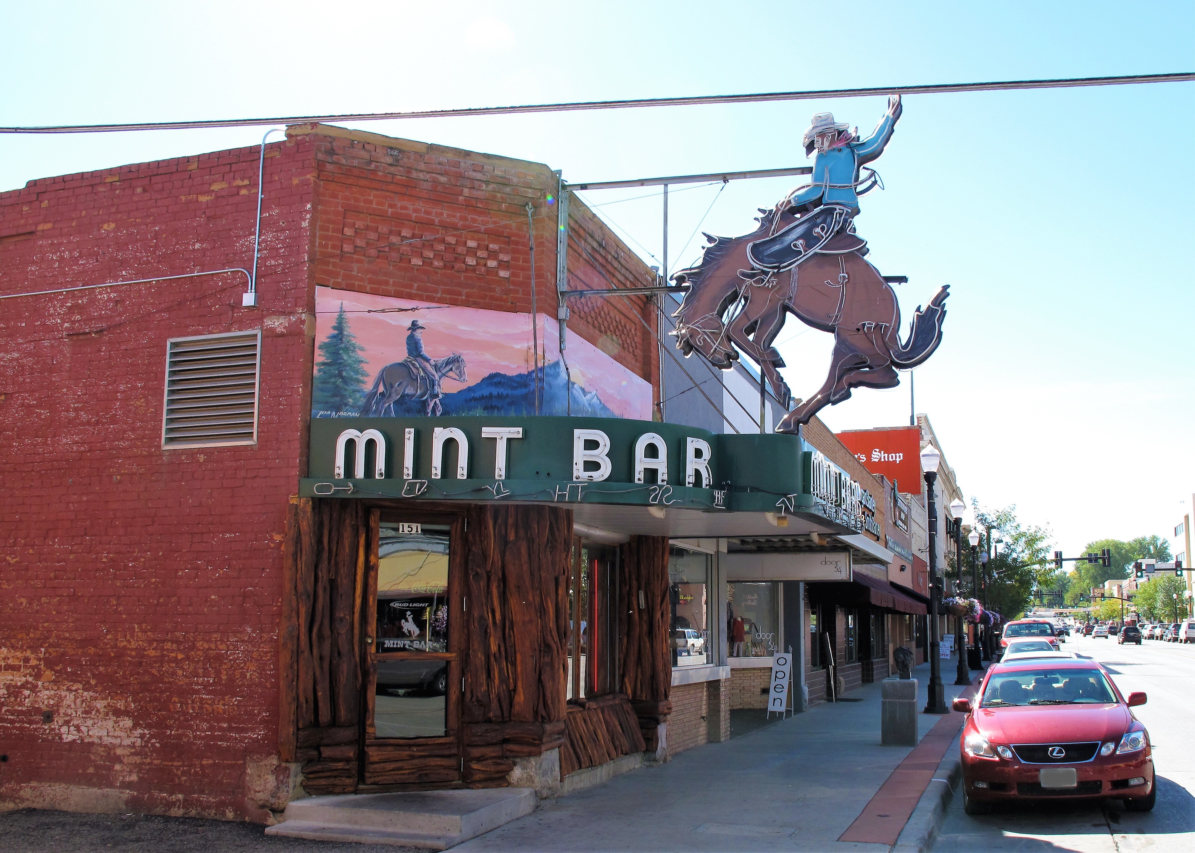
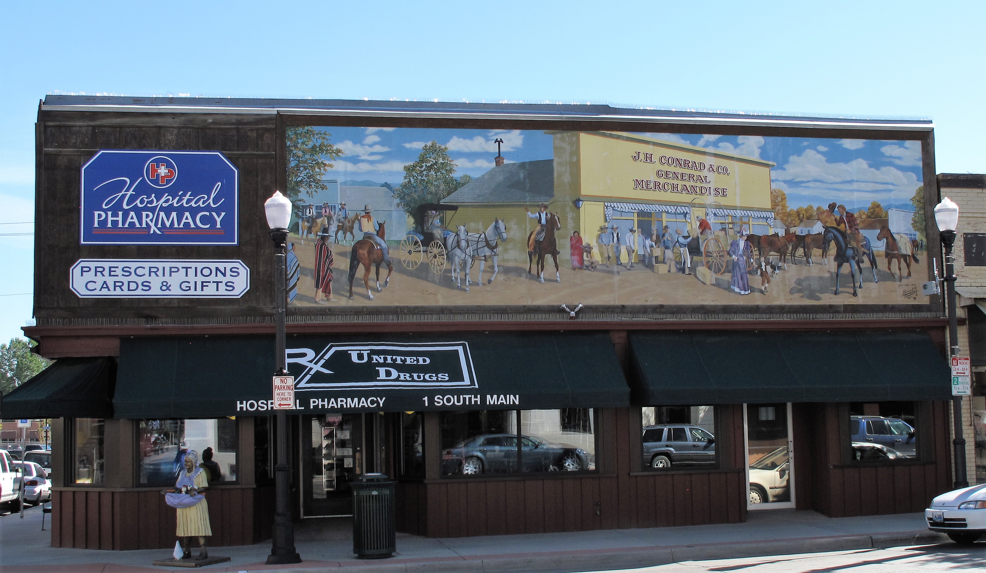
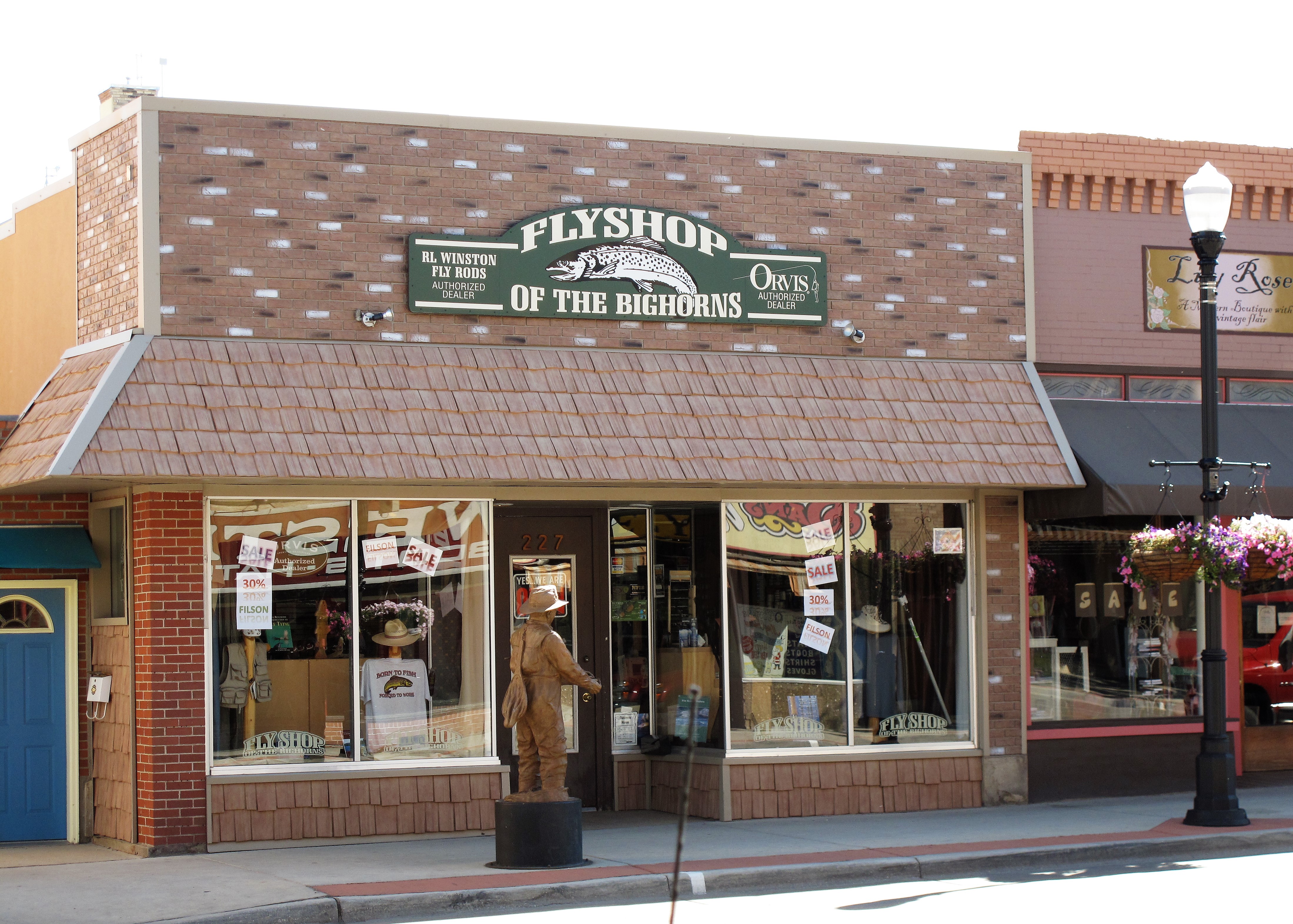
The Mint Bar, a cowboy bar. Main Street Sheridan, WyomingDan’s Wyoming western wear and workwear. Sheridan, WyomingDowntown pharmacy, formerly J.H. Conrad General Merchandise. Sheridan, Wyoming
Alternately, Main Street would not be five blocks of bustling shops without the retirees supporting the merchants. I came across retirees seated on Main Street benches who offered me advice on which buildings to photograph.
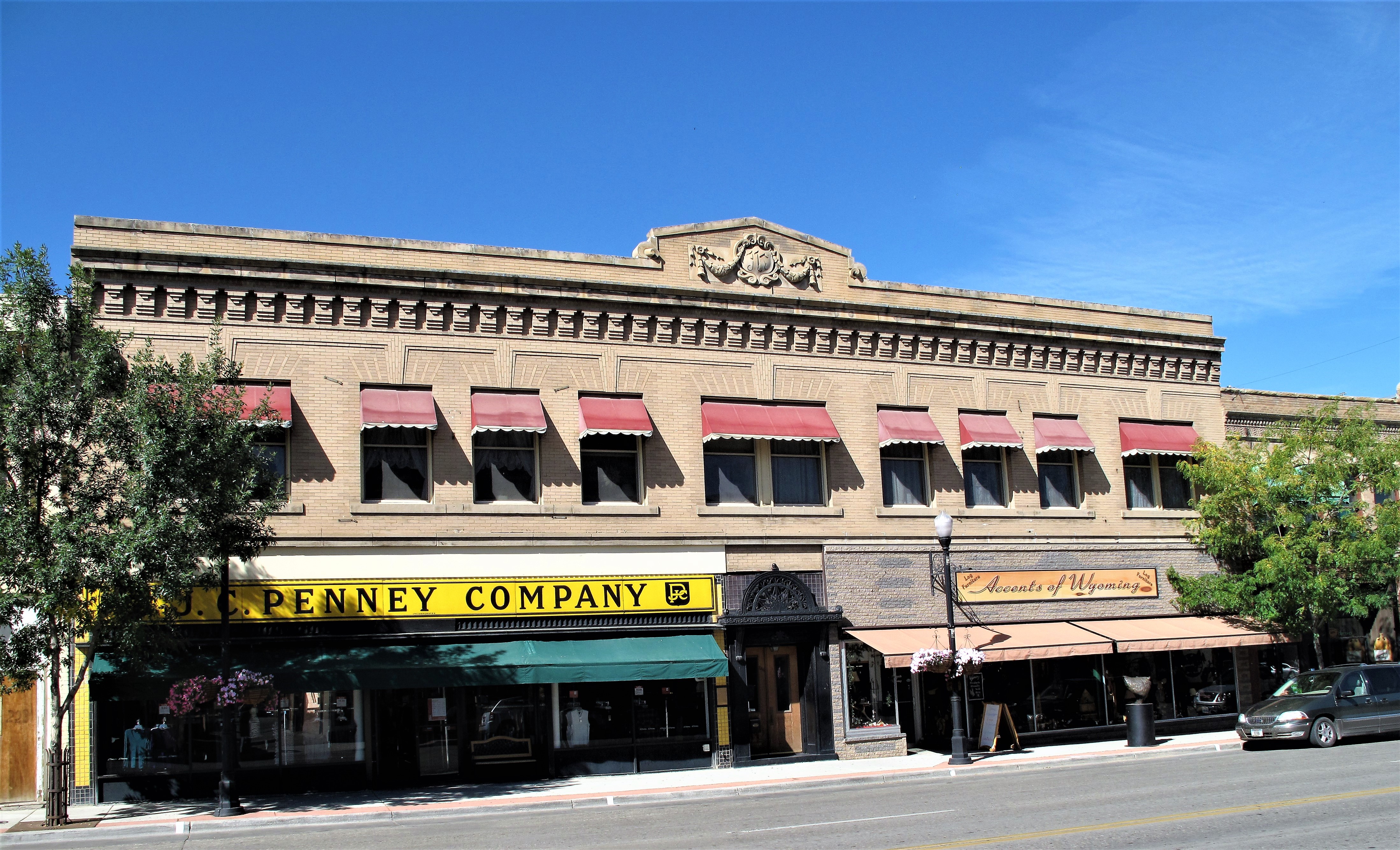
J.C. Penney’s building. Sheridan, Wyoming
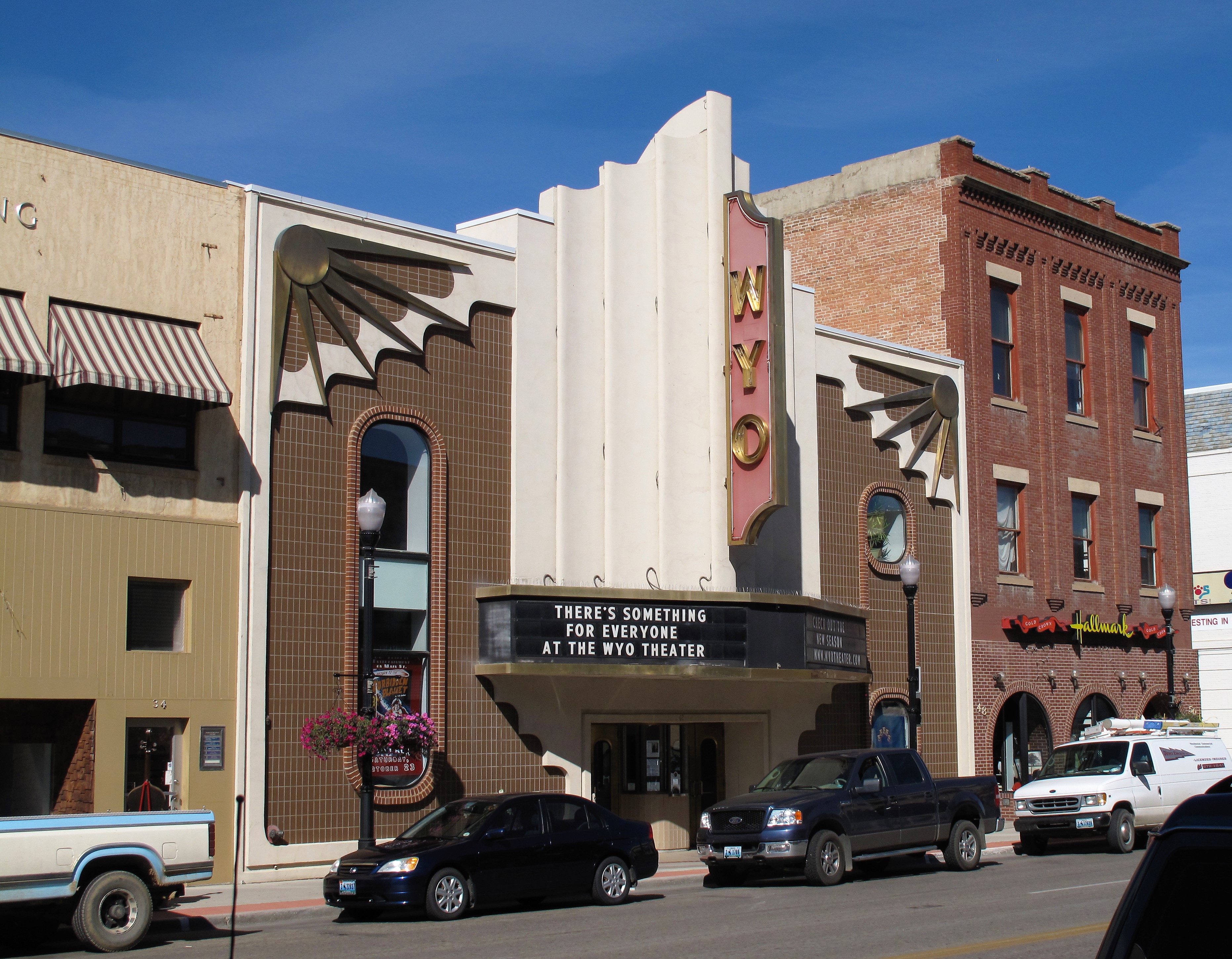
The retirees also support the arts — the old WYO theatre has been converted into a playhouse to serve this demographic.
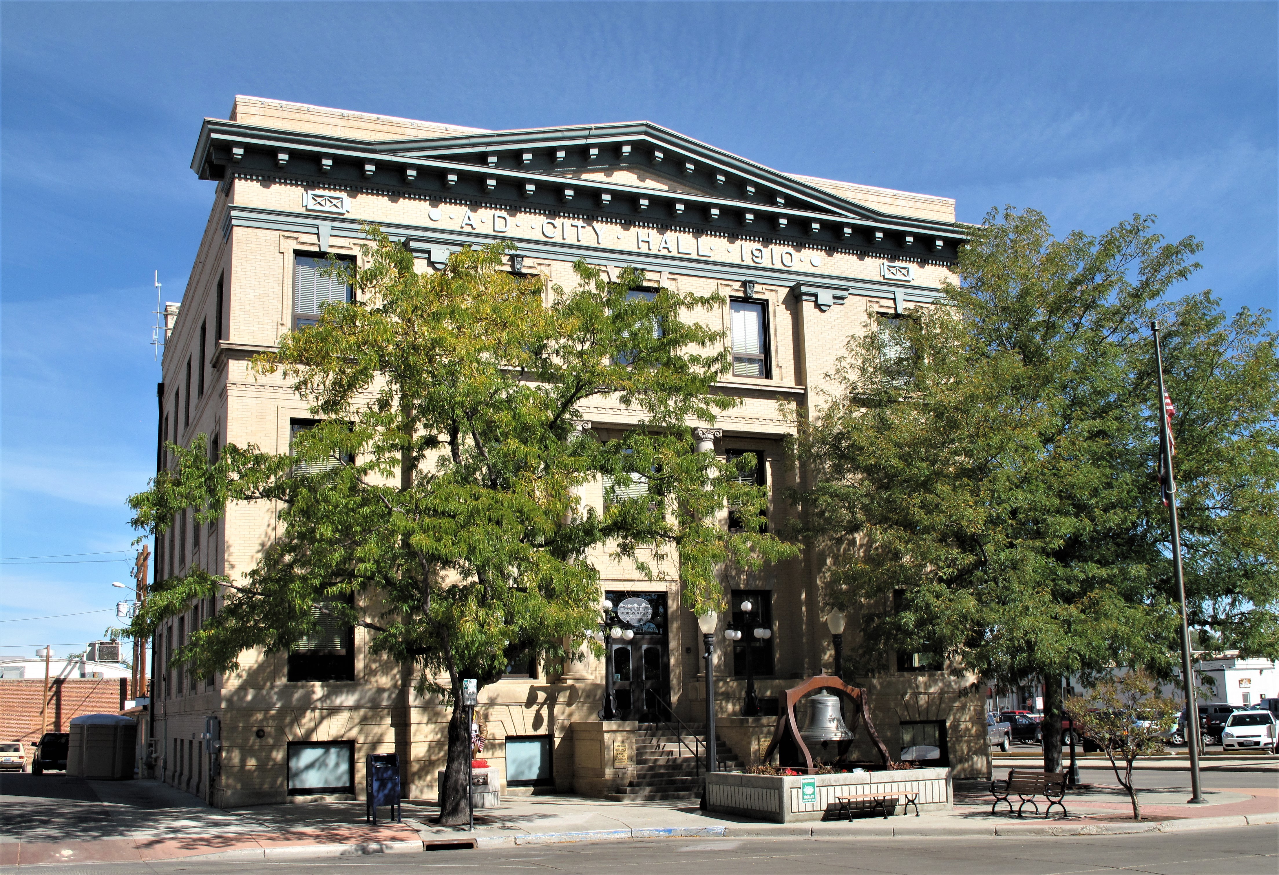
Named for Union Civil War General Philip Sheridan, the town was founded in the 1880s. Eventually, the railroad came through town and nearby coal deposits were mined to provide coal for the locomotives. By 1910 Sheridan was prosperous enough to build a 3-story, well-ornamented City Hall building.
City Hall. Sheridan, Wyoming
Wyoming vies with other western and midwestern states as the most Republican state in the Union. Sheridan is a Republican town.
GOP headquarters. Sheridan, Wyoming
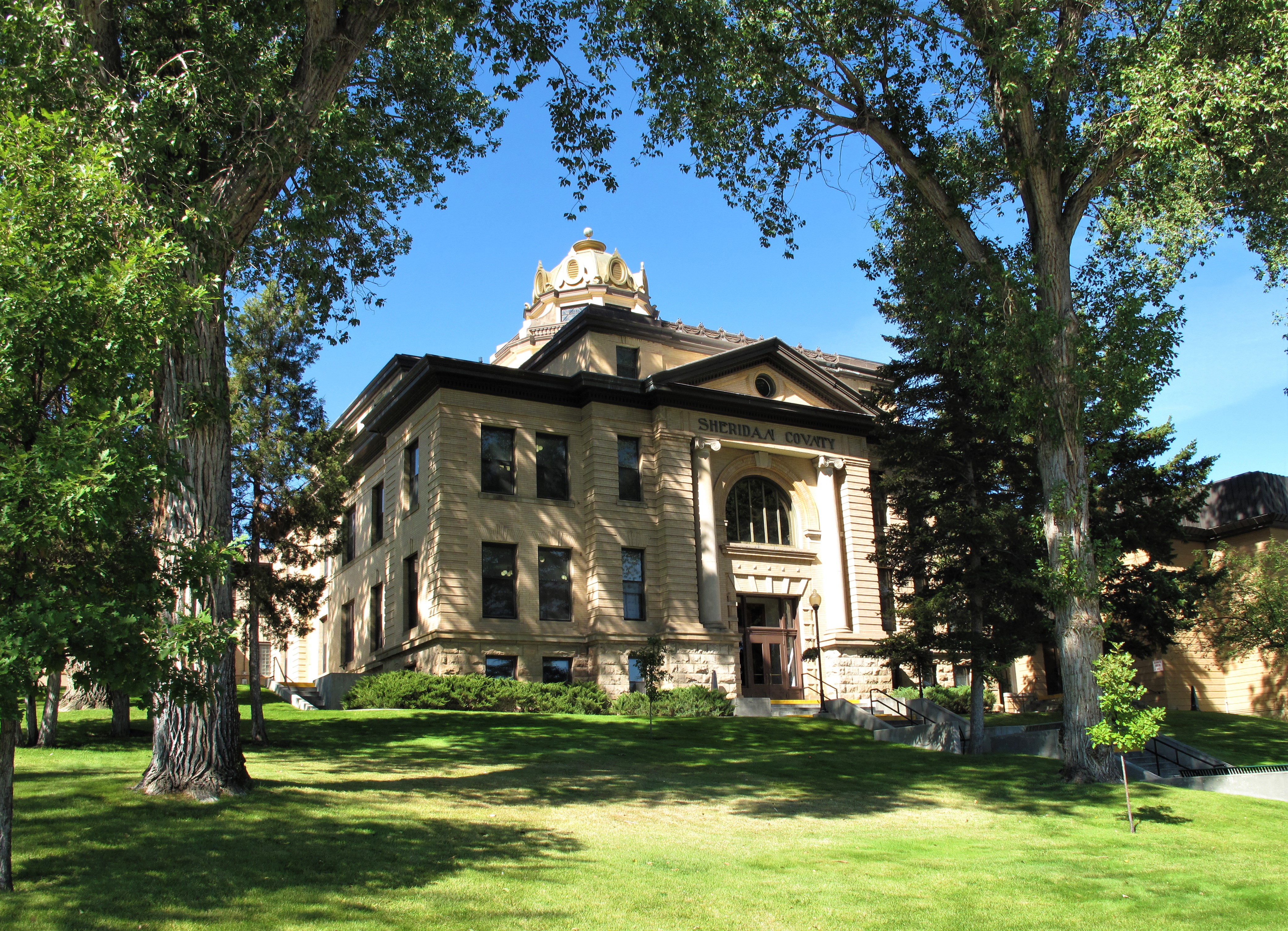
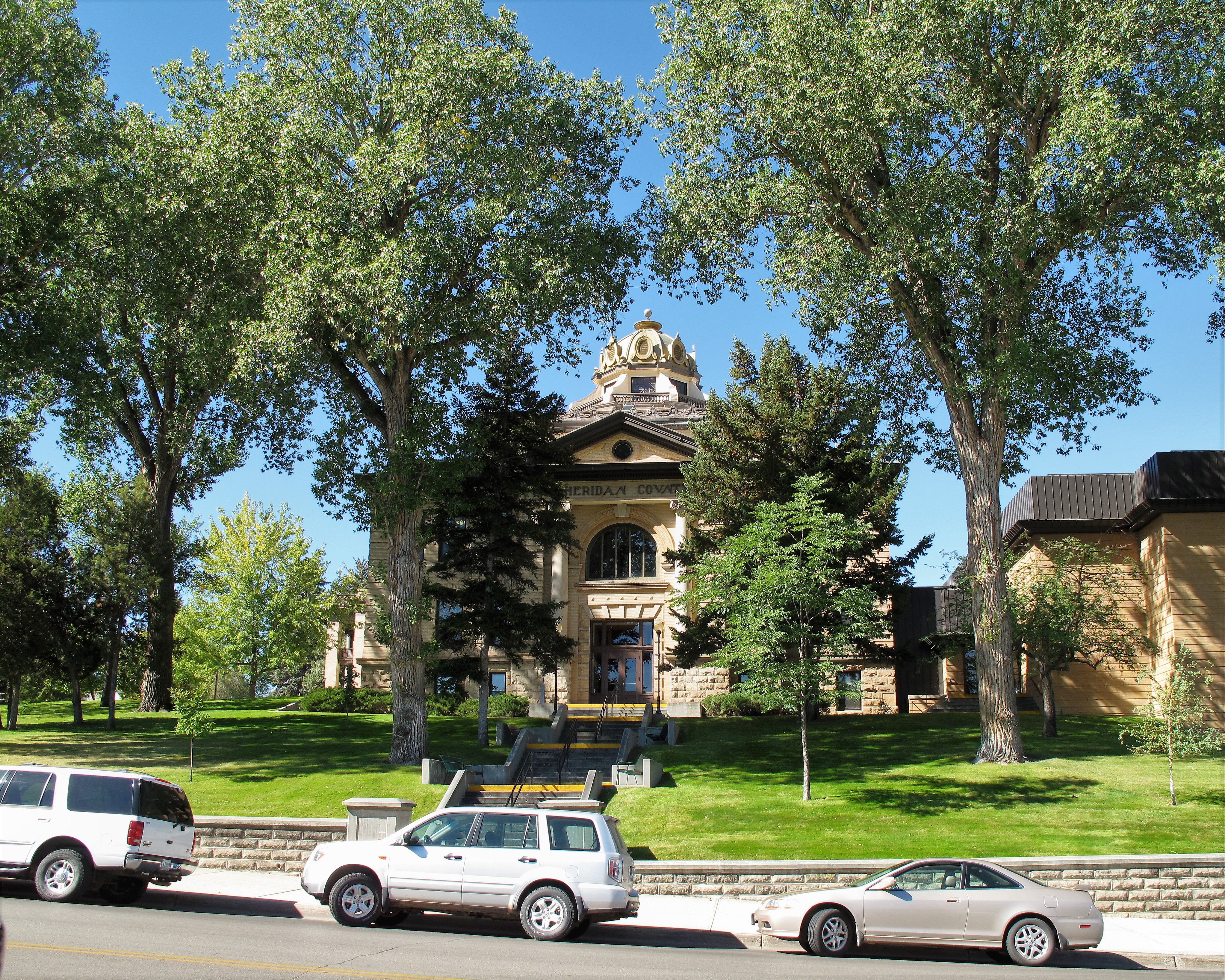
Sheridan is the county seat of Wyoming’s Sheridan County. A well-kept structure surrounded by massive cottonwood trees, the Sheridan County Courthouse anchors the south end of Main Street.
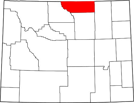
Sheridan County Courthouse. Sheridan, WyomingSheridan County Courthouse with bronze cupola. Sheridan, WyomingSheridan County in the state of Wyoming
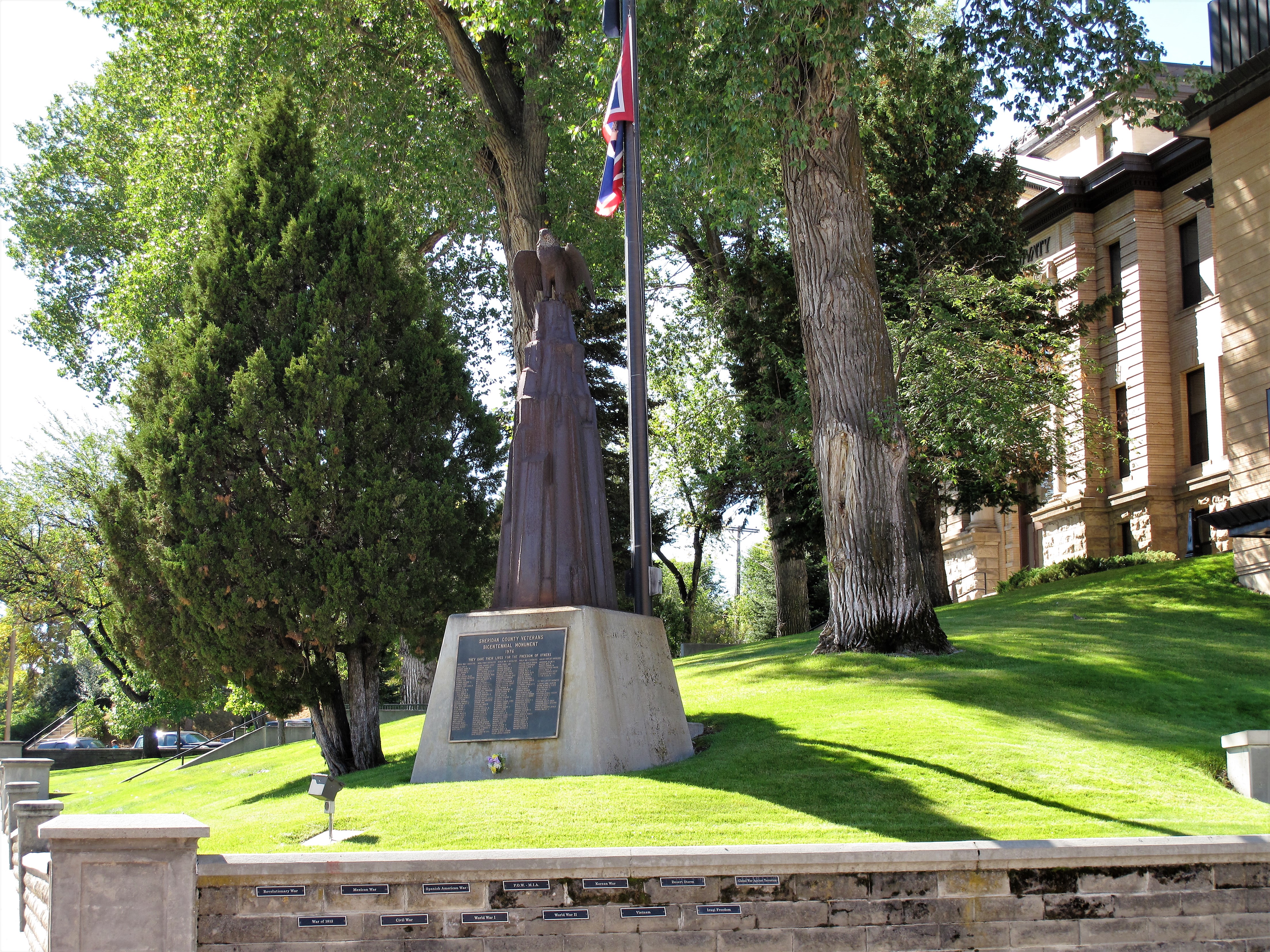
To the old-timers, cottonwood shade trees denote permanence on the northern plains. Such permanence is the ultimate satisfaction — it seems to last forever, as veterans memorials are meant to.
Sheridan County Bicentennial Veterans Monument. Sheridan, Wyoming
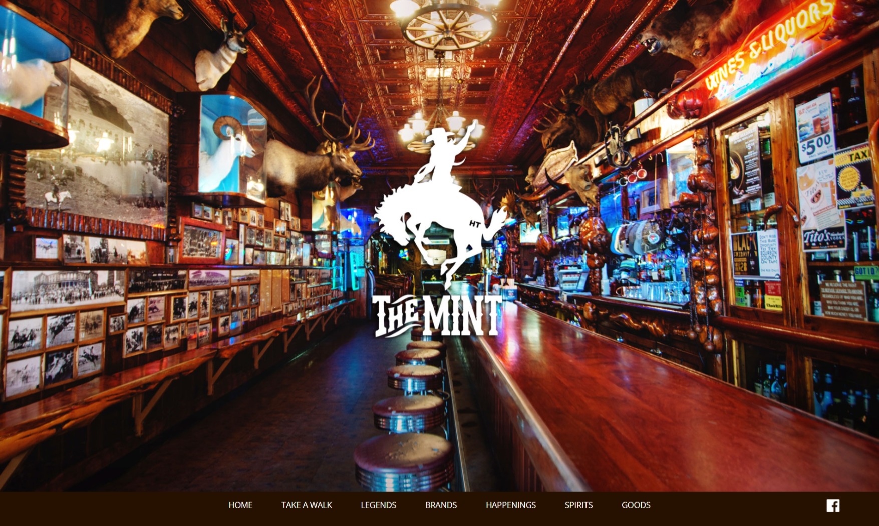
Here’s a bonus photo: I copied this photo from the web page of The Mint Bar on Main Street in Sheridan.
Interior of the Mint Bar. Sheridan, Wyoming. (This photo was copied from the Mint Bar website.)
A list of all photo posts from the American County Seats series in TimManBlog can be found here.
All photos were taken by the authoron September 21, 2010, except for the final photo showing the interior of the Mint Bar which was copied from https://www.mintbarwyo.com/, the Mint Bar website.
I do this as a hobby and not for a living (yet) — but donations are happily accepted if you’d like to help defer my costs. Thanks, Tim
Donations are NOT tax-deductible under U.S. law…but you knew that.
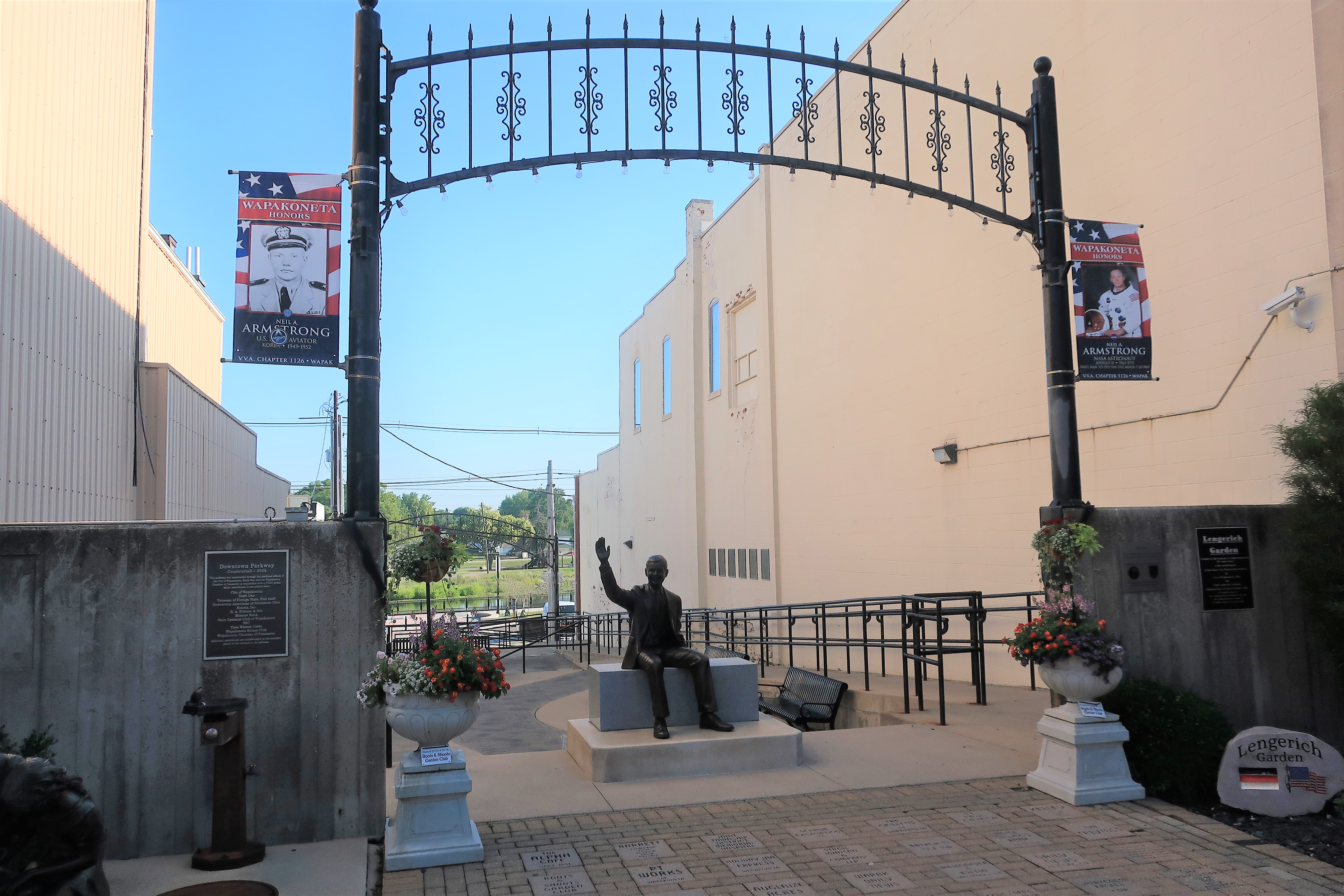
This photo was taken at the edge of town — Wapakoneta, Ohio — on August 2nd, 2021. I arrived about an hour after sunrise. Wapakoneta, Ohio, has a population of about 9,000 persons. It’s the birthplace and hometown of the first man to walk on the Moon, Neil Armstrong.
Welcome to Wapakoneta, Ohio, Hometown of Neil Armstrong
Wapakoneta follows the common custom in small towns across America of posting photos of their servicemen and women, past and present, along downtown light poles. Armstrong’s service as a Navy flyer earned him a banner bearing his Navy photo. A banner for Astronaut Armstrong is nearby.
A street banner honoring Astronaut Neil Armstrong. Wapakoneta, Ohio
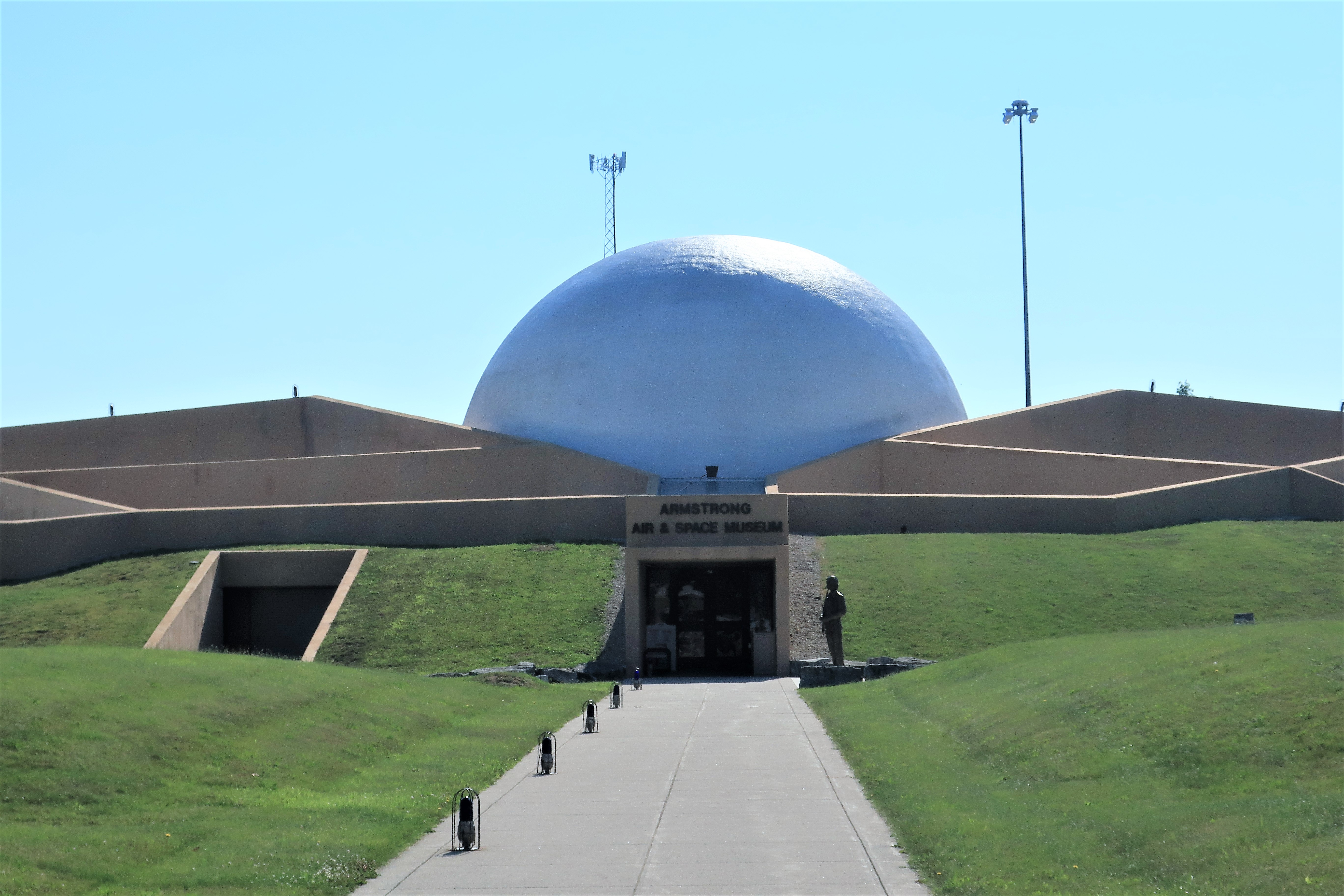
At the center of town, Armstrong is depicted in a statue waving to crowds as he rode in a convertible during the ticker-tape parade through the streets of Manhattan. The parade, of course, celebrated the return of the Apollo 11 space mission, the first instance of man landing on the Moon.
Statue of Neil Armstrong waving to the crowds. Downtown Wapakoneta, Ohio
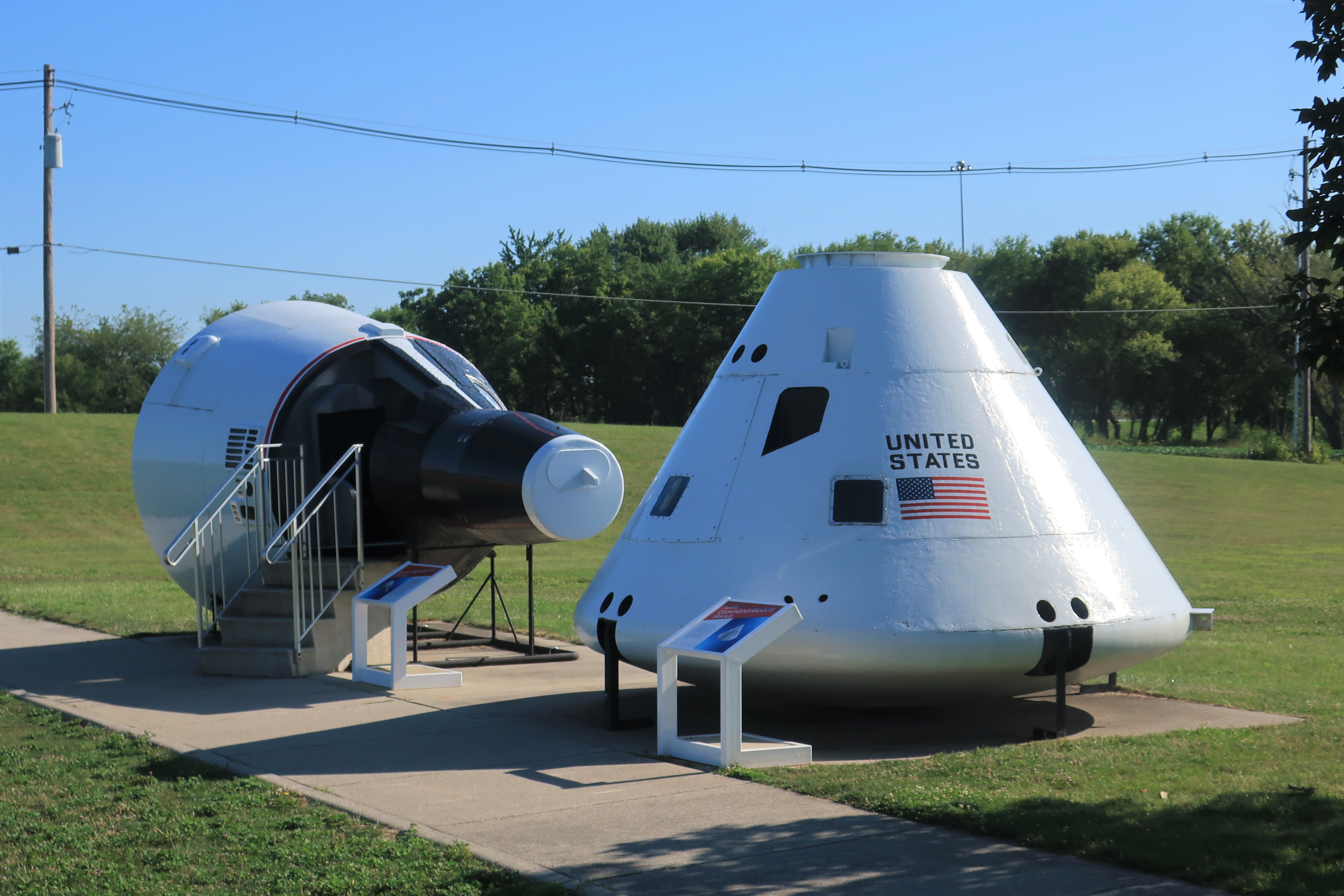
Opened in 1972, the Armstrong Air and Space Museum in Wapakoneta contains artifacts from the Apollo 11 mission and other contributions to the history of aeronautics and space flight. The museum is located at the edge of town and attracts over 40,000 visitors per year.
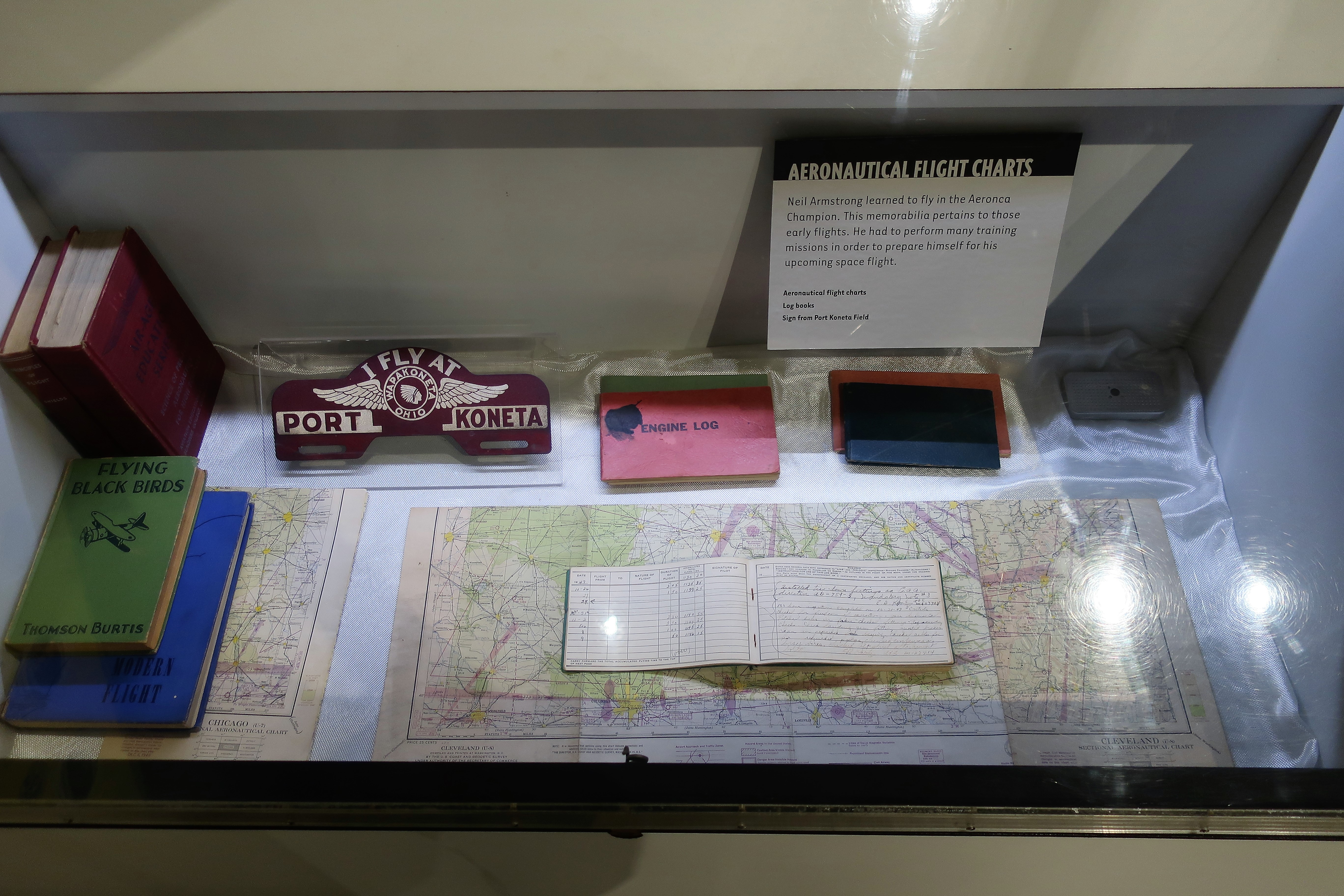
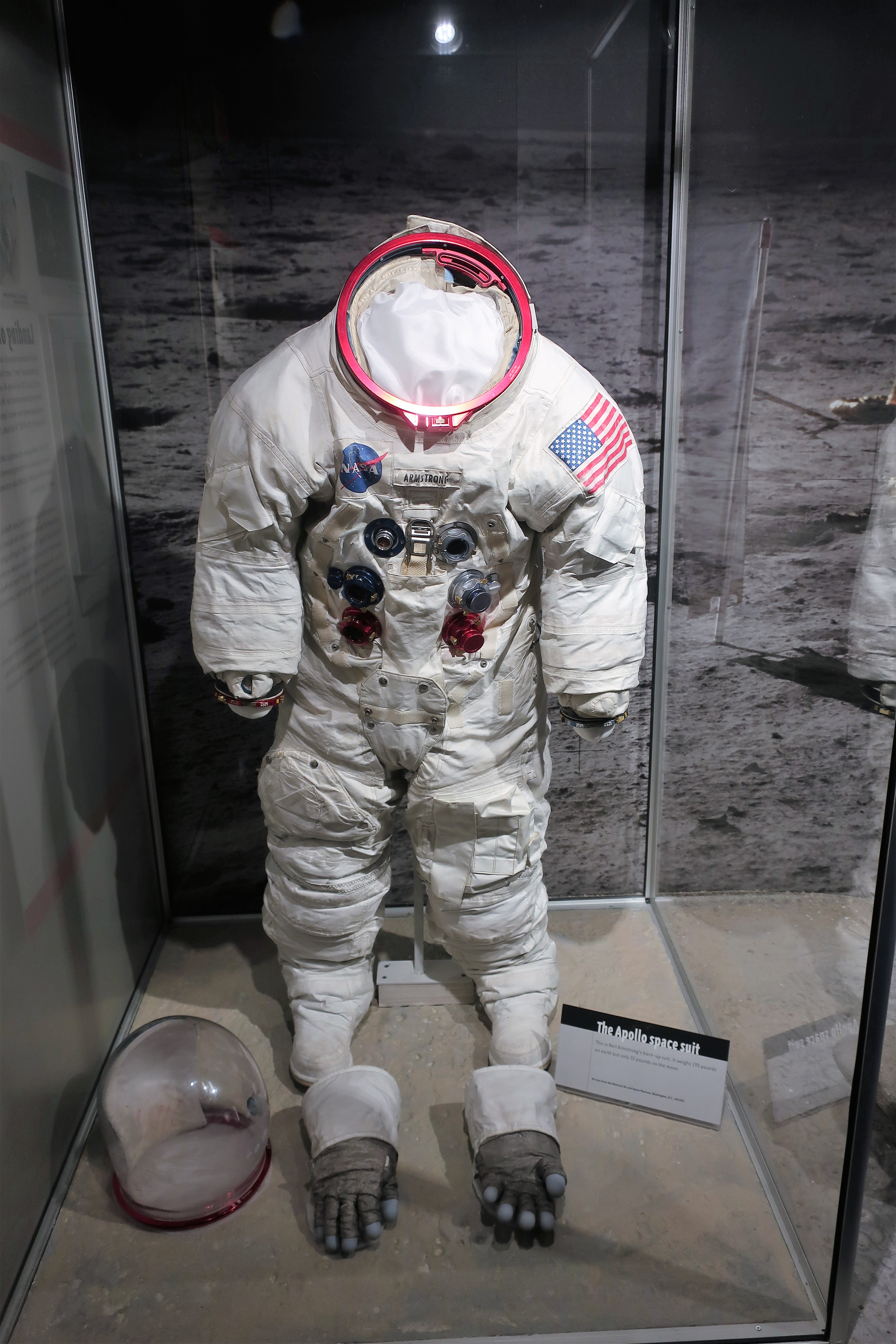
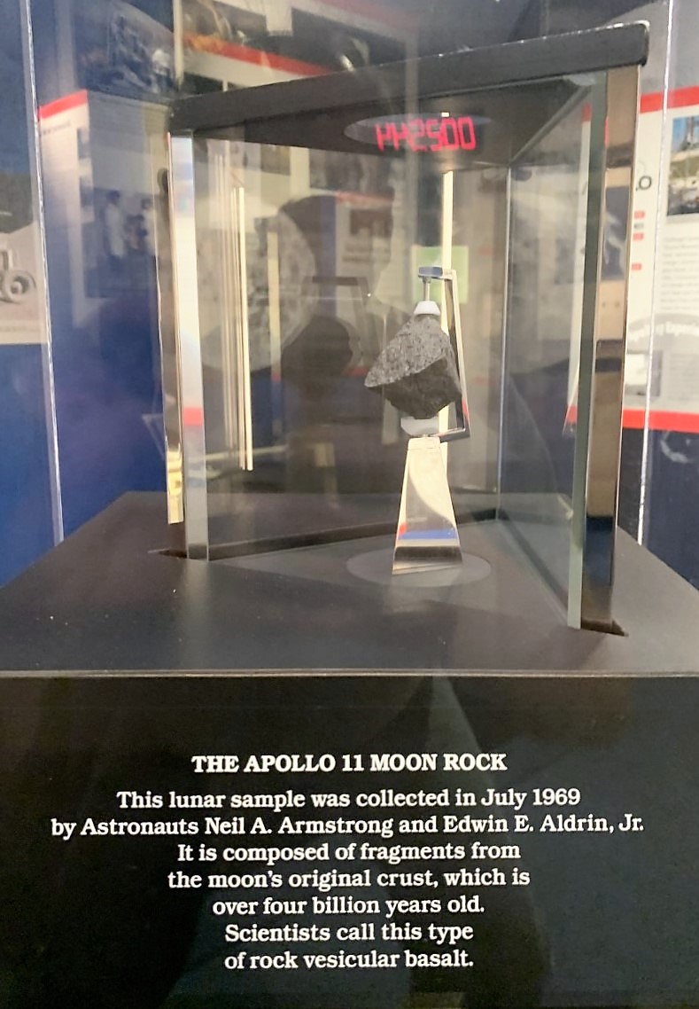
Armstrong Air & Space Museum. Wapakoneta, OhioMockups of the Gemini Spacecraft (left) and Apollo Command Module (right). Armstrong Air & Space MuseumNeil Armstrong’s old flight logs and other artifacts from his boyhood in WapakonetaAstronaut Neil Armstrong’s actual backup spacesuit. Armstrong Air & Space Museum, Wapakoneta, OhioMoon Rock. Armstrong Air & Space Museum. Wapakoneta, Ohio
Wapakoneta is in many ways a typical Ohio-midwestern small town. In the late 17th Century the Shawnee tribe settled in this area after having been driven their lands further south by white settlers and the Catawba, Cherokee, and Chickasaw nations. The name “Wapakoneta” might be from the Shawnee language for “place of white bones,” but that’s not certain.
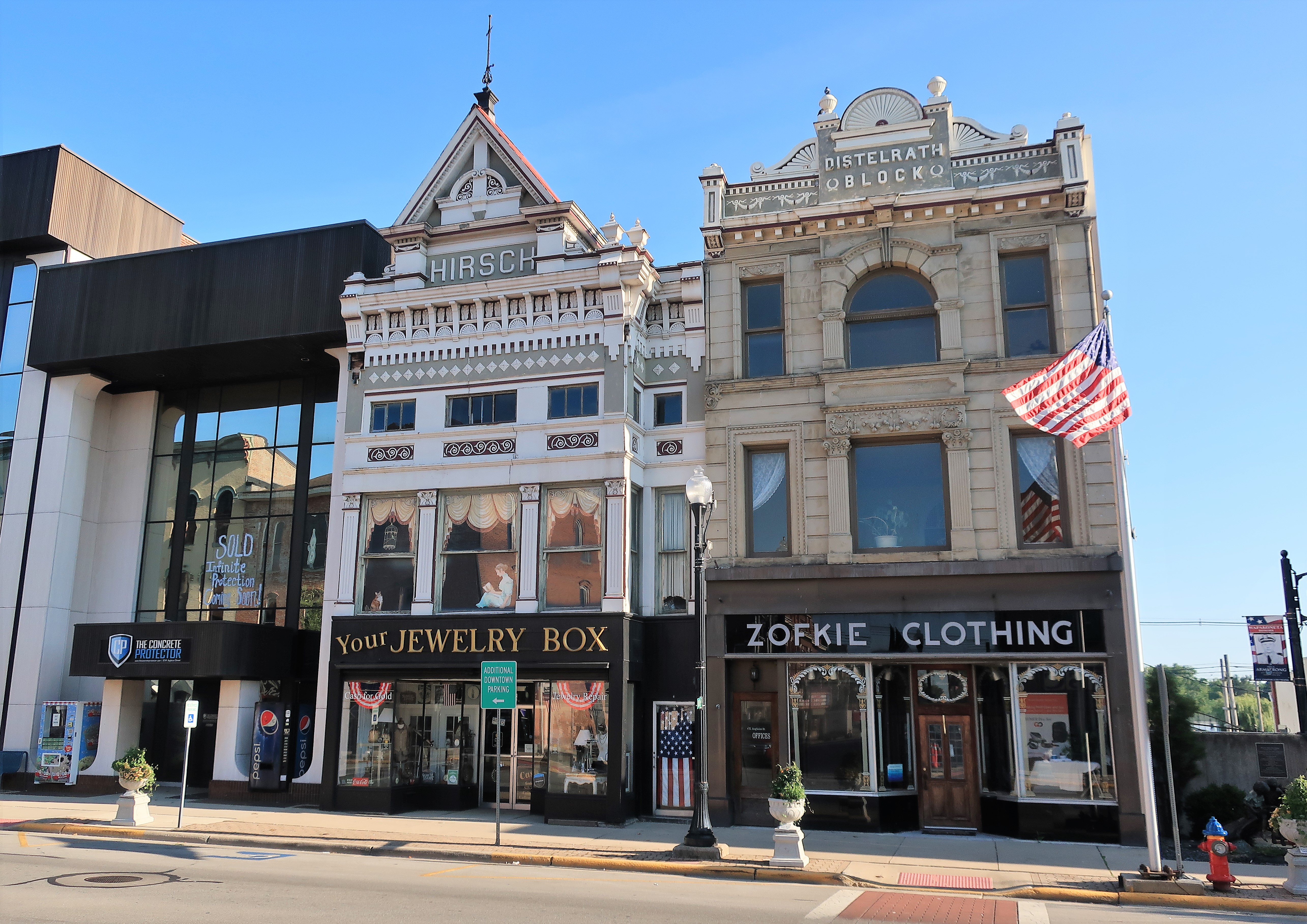
Classic buildings at the central intersection in Wapakoneta. Junction of Auglaize and Willipie Streets.
In 1748, three decades before the American Revolution, the French built a fort here called “Fort au Glaize” after the Auglaize River which runs nearby. The river flows northward, eventually joining the Maumee River to drain into Lake Erie near Toledo, Ohio. “Auglaize” is French for “river of great clay.”
In the 21st Century, the City Bakery on Auglaize Street (shown) provides a good selection of donuts.
Classic buildings and storefronts, including the City Bakery. Auglaize Street, Wapakoneta, Ohio
Happily, the town theatre, known as the “Wapa,” is not politically correct about the image displayed on its sign.
The Wapa Theatre, 15 Willipie Street in Wapakoneta
As can be imagined, many photo opportunities exist for tourists to associate themselves with the town’s main hero. This one is on Auglaize Street in front of the Chamber of Commerce.
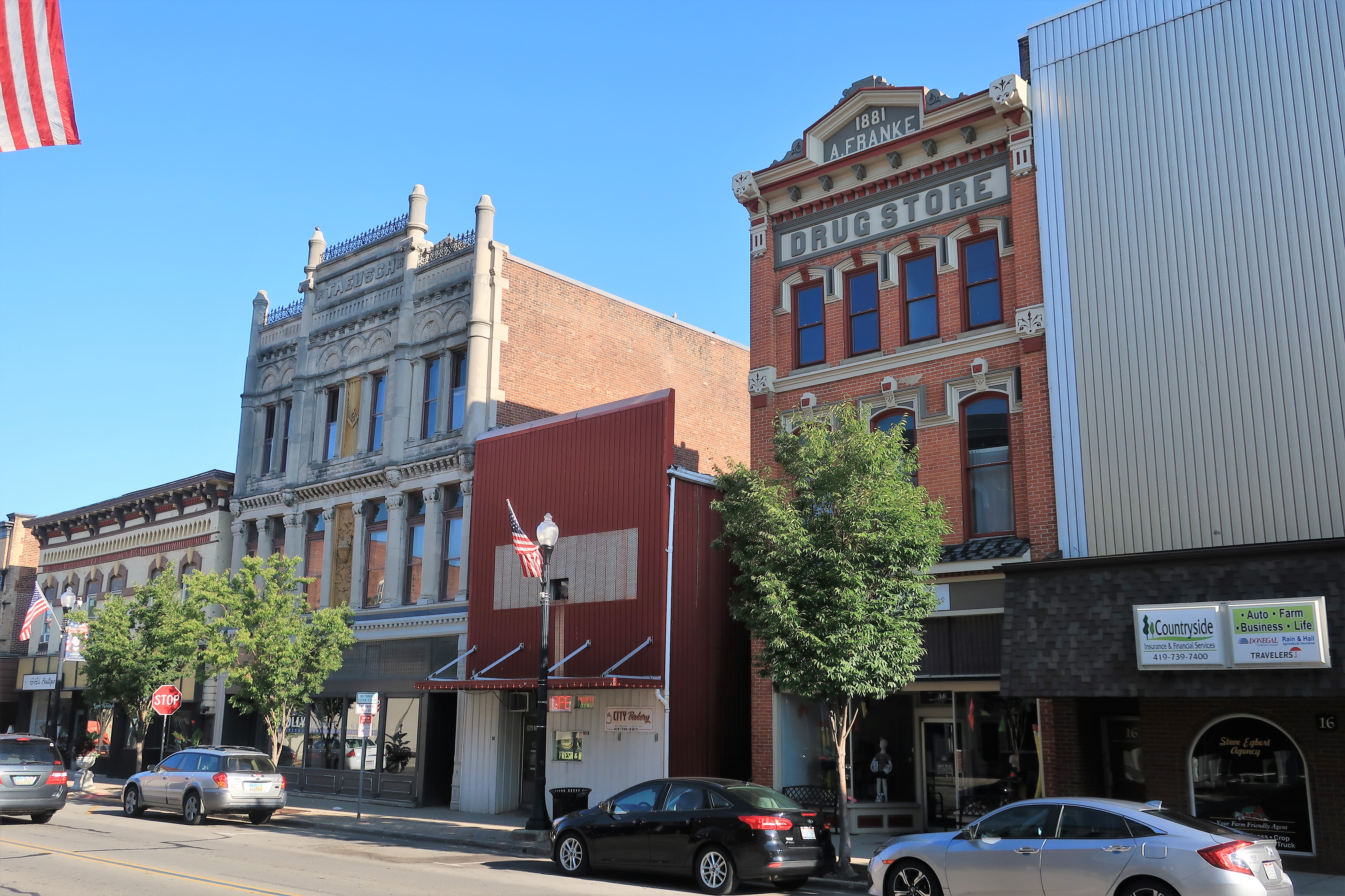
Wapakoneta is also the seat of Auglaize County, Ohio. The Auglaize County Courthouse was built in 1894 and is still in use today. The building is listed on the National Register of Historic Places.
Auglaize County Courthouse. Wapakoneta, OhioAuglaize County Courthouse. Wapakoneta, OhioAuglaize County in the State of Ohio
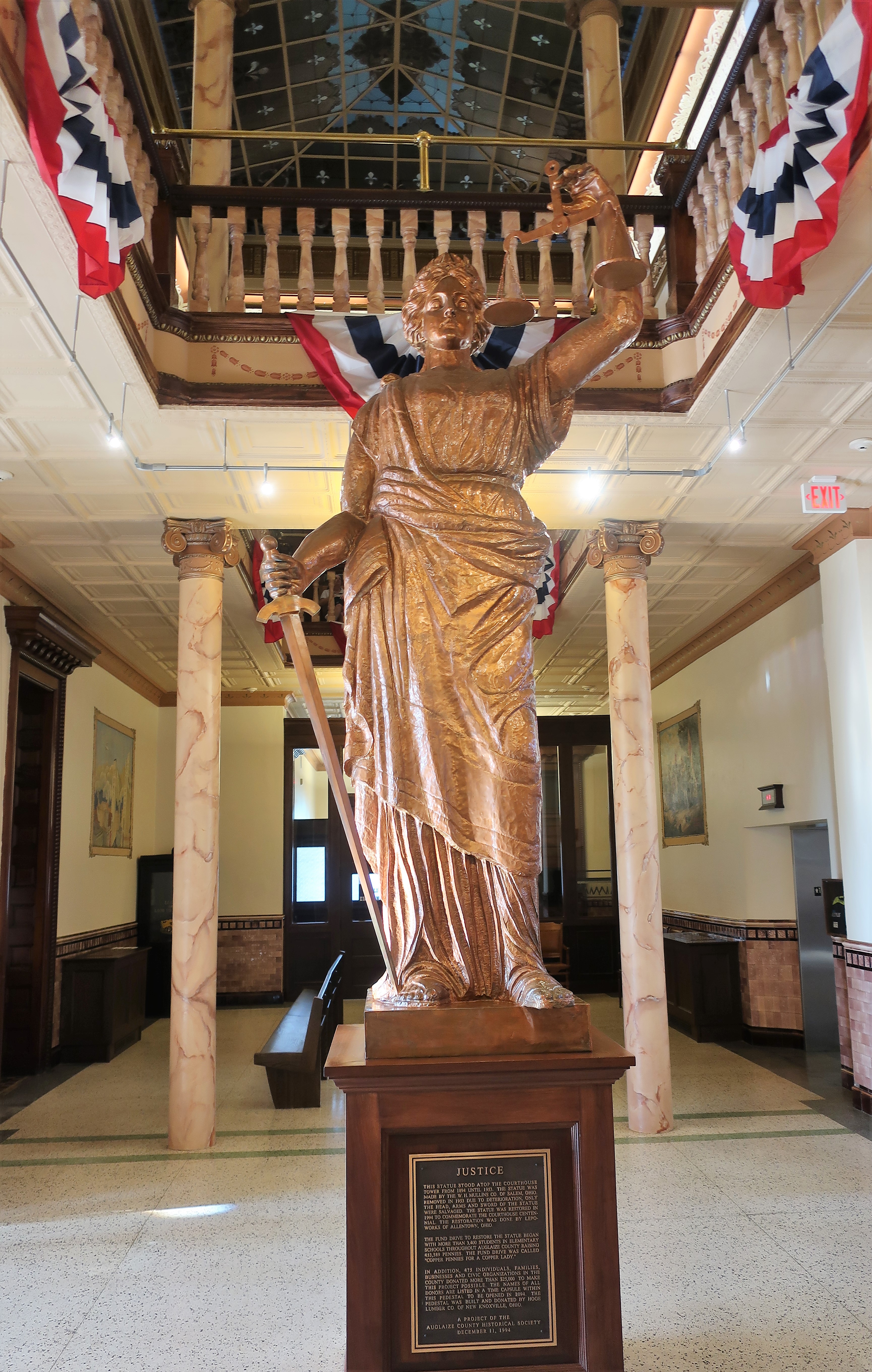
The courthouse’s statue of Lady Justice stood atop the building until 1953 when it was taken down due to deterioration. In 1994, to commemorate the courthouse’s centennial, the statue was restored and placed in the courthouse atrium, or Great Hall, on the main floor.
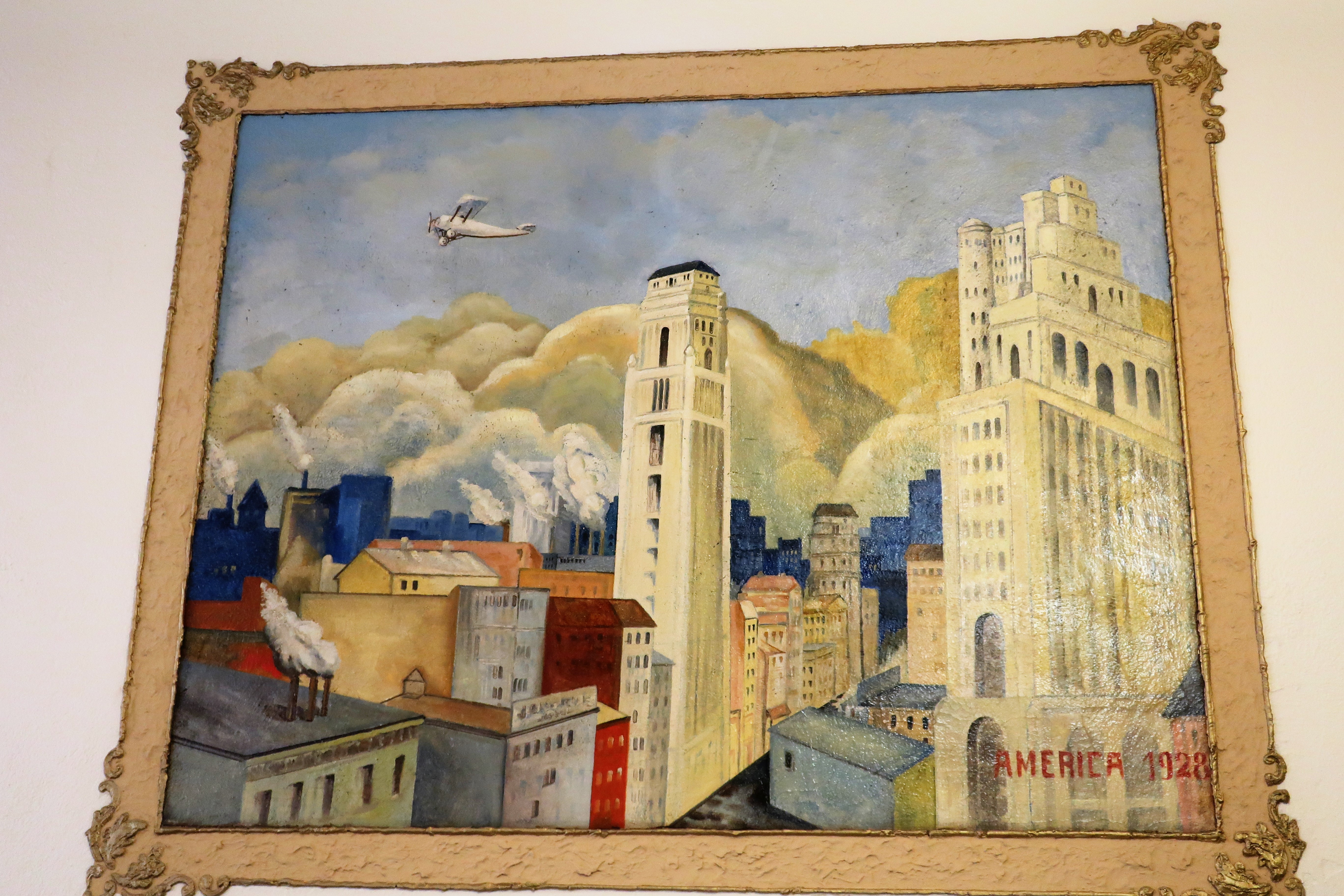
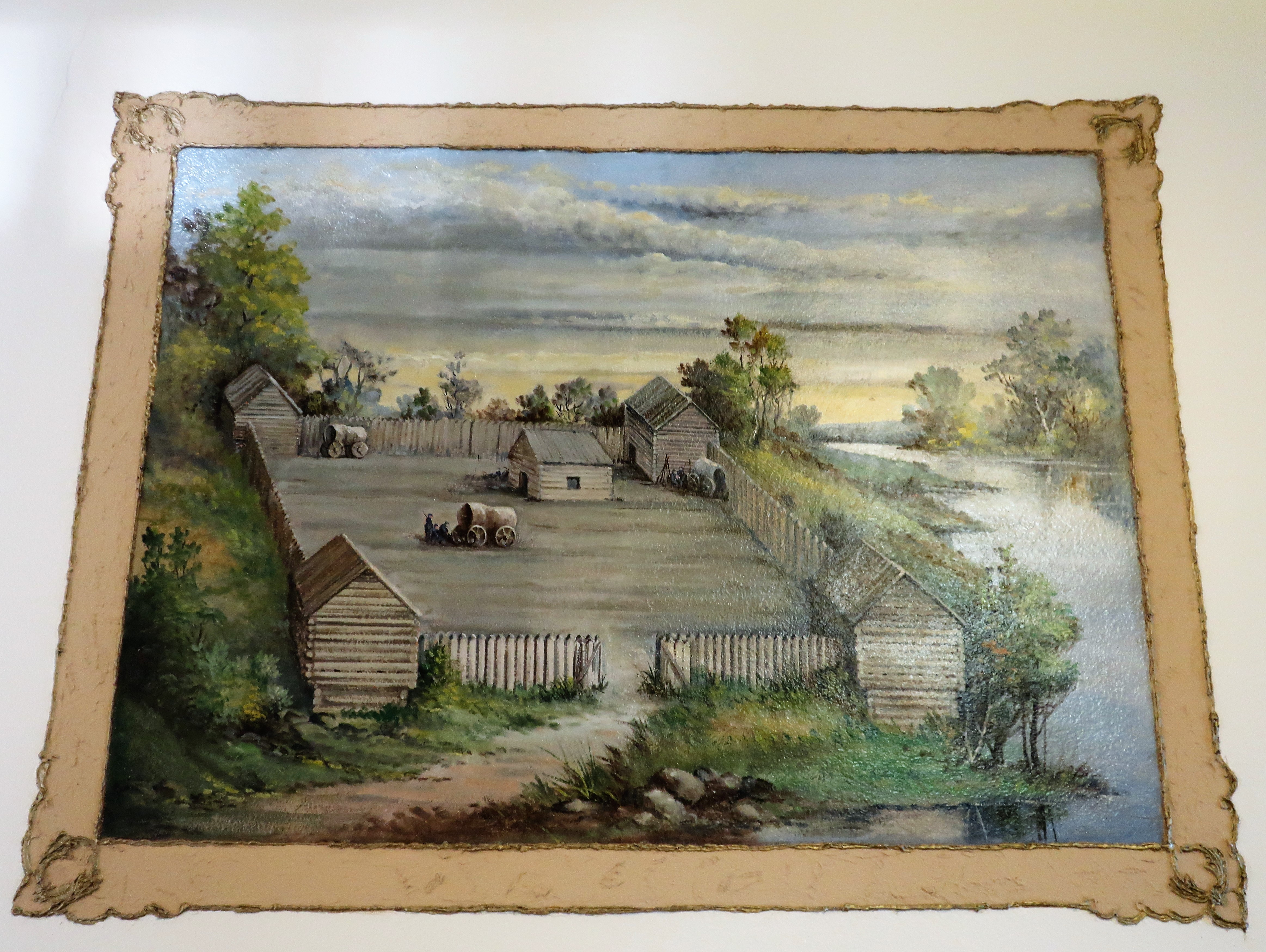
Statue of Lady Justice. Auglaize County Courthouse. Wapakoneta, Ohio“America 1928.” Artwork inside the Auglaize County Courthouse. Wapakoneta, OhioArtist’s rendering of the French-built Fort au Glaize, or the Wapakoneta Trading Post, along the Auglaize River. Auglaize County Courthouse.
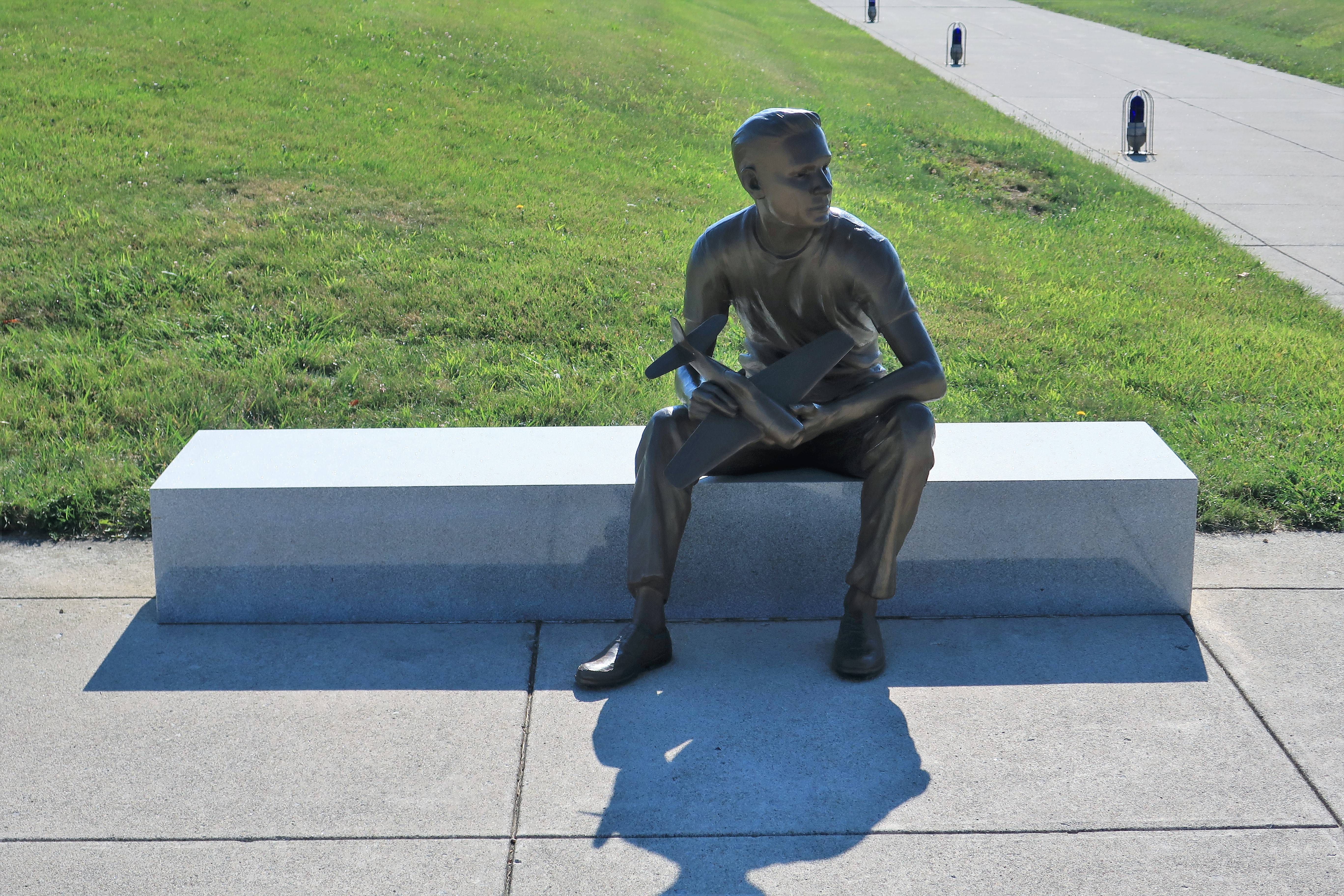
Finally, another statue of Neil Armstrong can be found in front of the Armstrong Air & Space Museum, this one of him as a boy. The story goes that Neil begged his parents to buy him a 10-cent balsa-wood glider. They did, and then the dreaming started.
Statue of Neil Armstrong as a boy. Armstrong Air & Space Museum. Wapakoneta, Ohio
A list of all photo posts from the American County Seats series in TimManBlog can be found here.
All photos were taken by the authoron August 2nd and August 3rd, 2021
I do this as a hobby and not for a living (yet) — but donations are happily accepted if you’d like to help defer my costs. Thanks, Tim
Donations are NOT tax-deductible under U.S. law…but you knew that.
The town of Rugby, North Dakota was named for Rugby, Warwickshire, England, and was founded in 1886 as a railroad town along North Dakota’s Great Northern Rail Line. The railroad had financiers from England and so several other towns along the line were also named for English country towns.
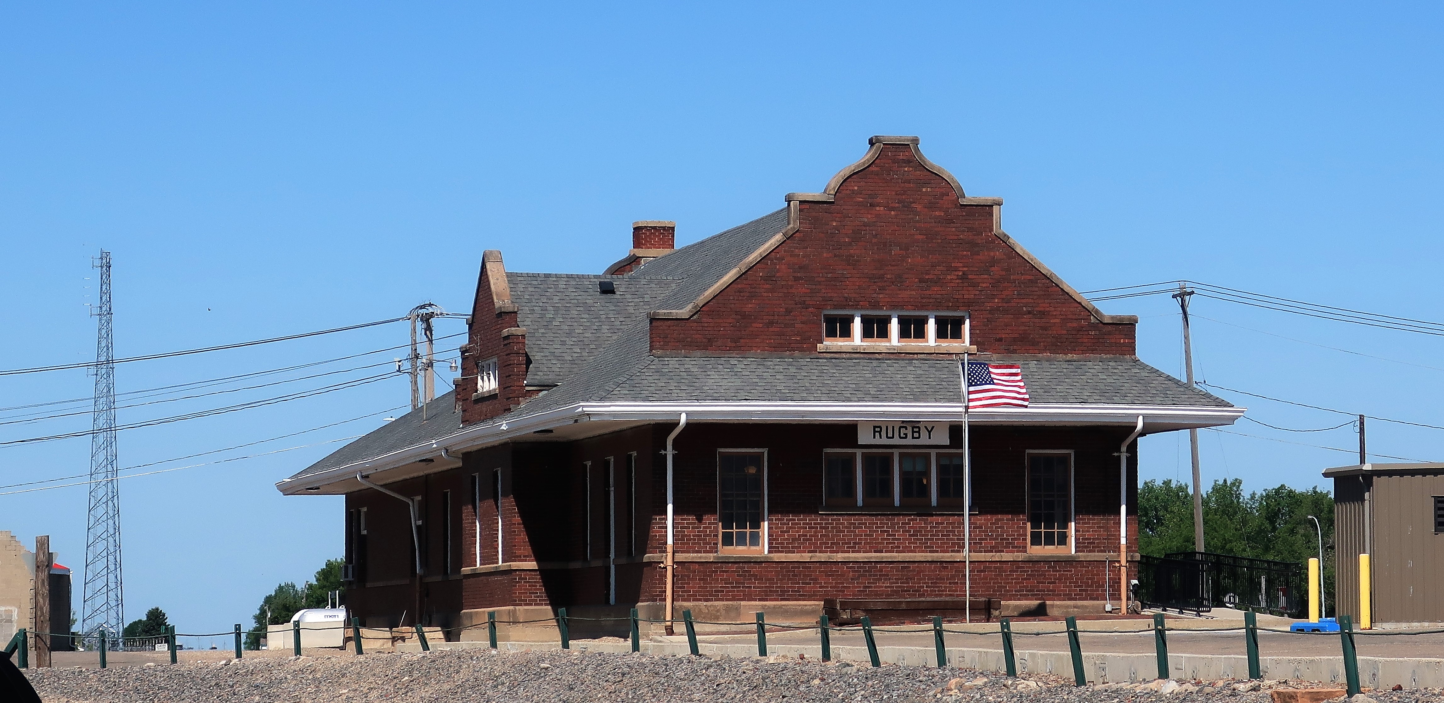
Rugby Train Station, an Amtrak stop
Amtrak stops here in Rugby. The line of giant grain elevators along the train tracks is truly impressive. From towns like Rugby, the amber waves of grain are stored and then shipped throughout the world.
Grain elevators along the railroad tracks. Rugby, North Dakota
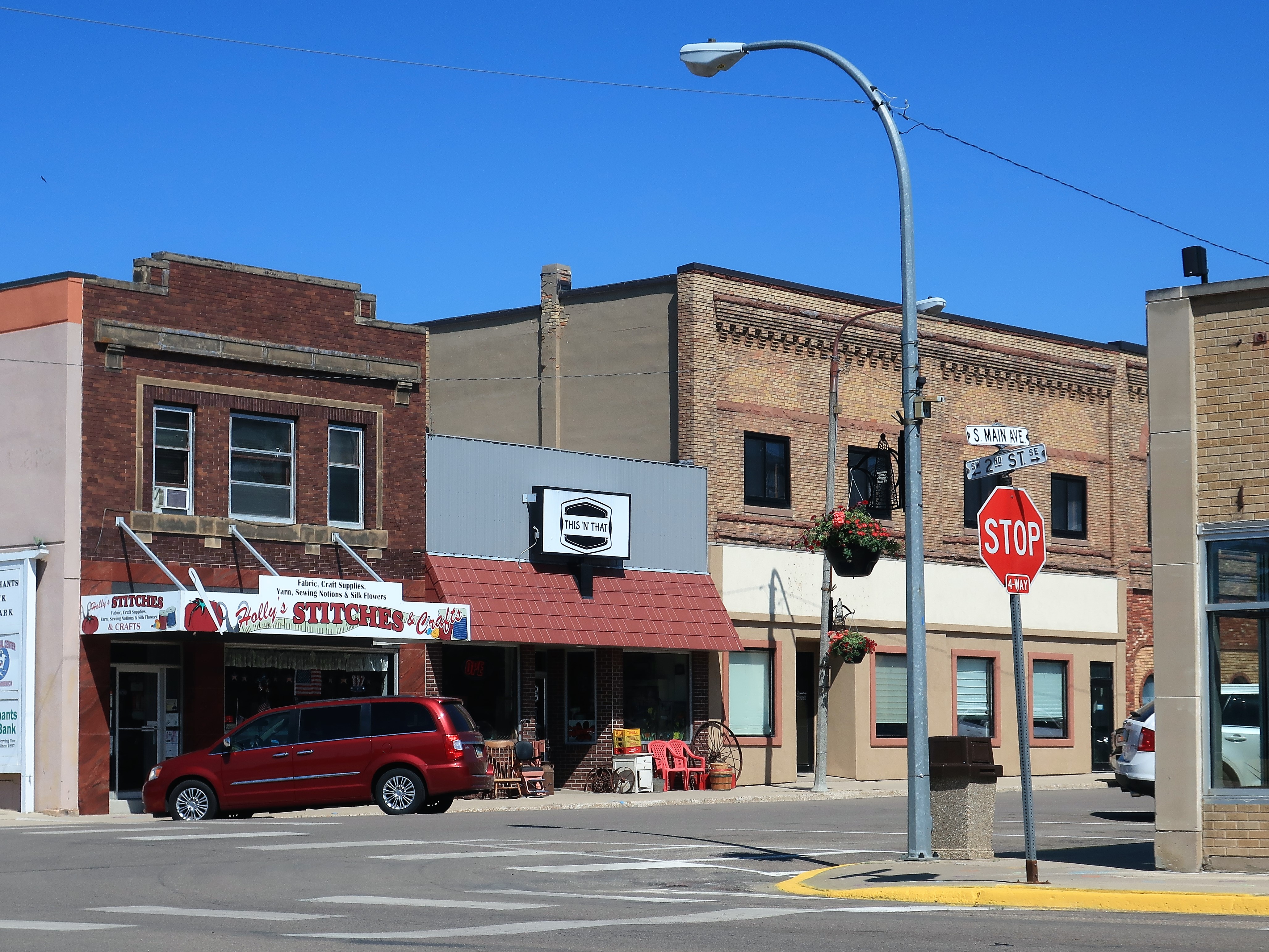
Rugby has a population of 2,800 souls — small, but to its credit, the town seems larger and more vibrant than what those numbers would indicate. Shops are open all along Main Street.
Main and 2nd Street. Rugby, North Dakota
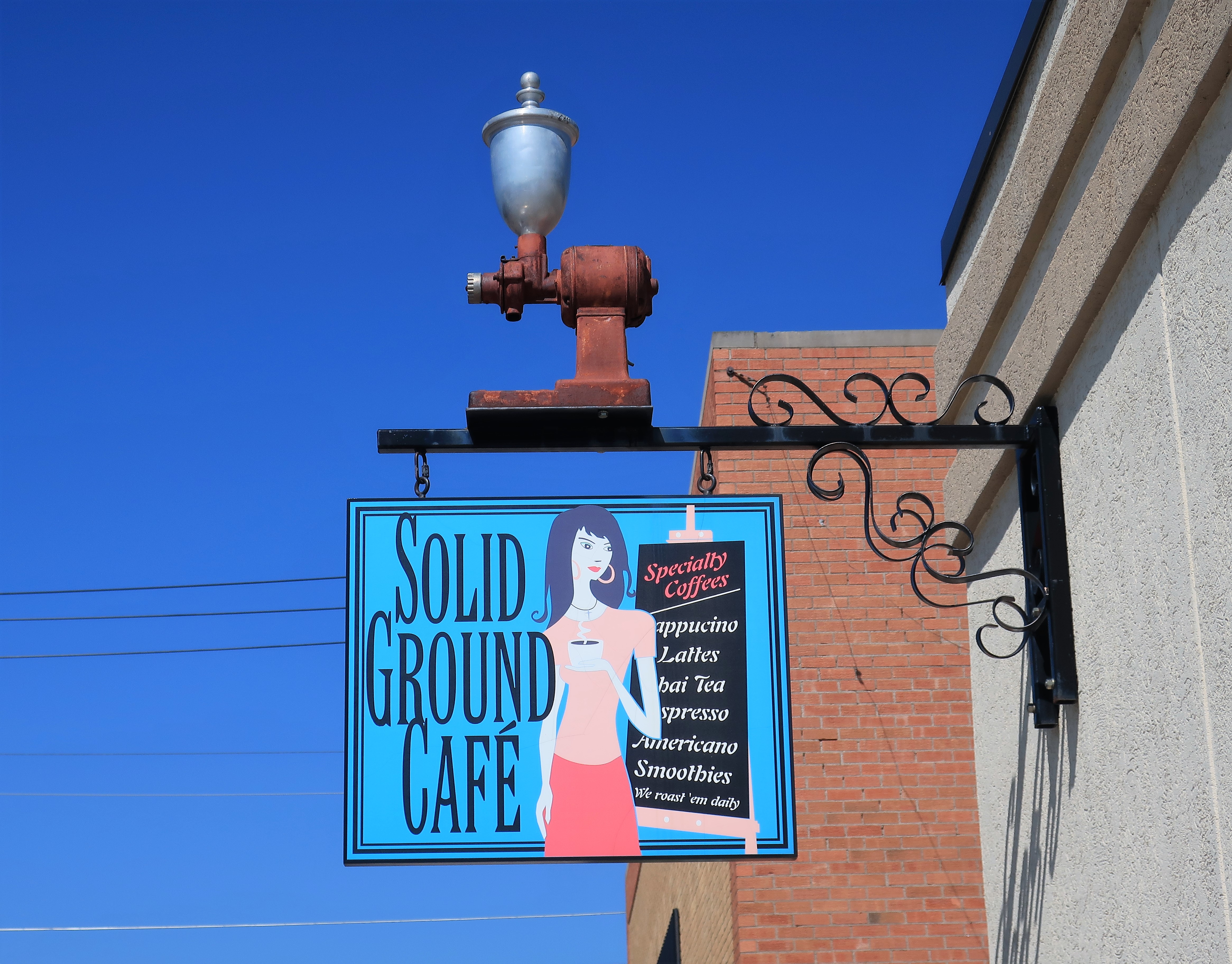
Around the corner is a combination haute couture salon and coffee shop. See the websites for Stylin You salon and spa, and the Solid Ground Cafe, which serves great coffee!
The Solid Ground Cafe (and Stylin You). Rugby, North Dakota
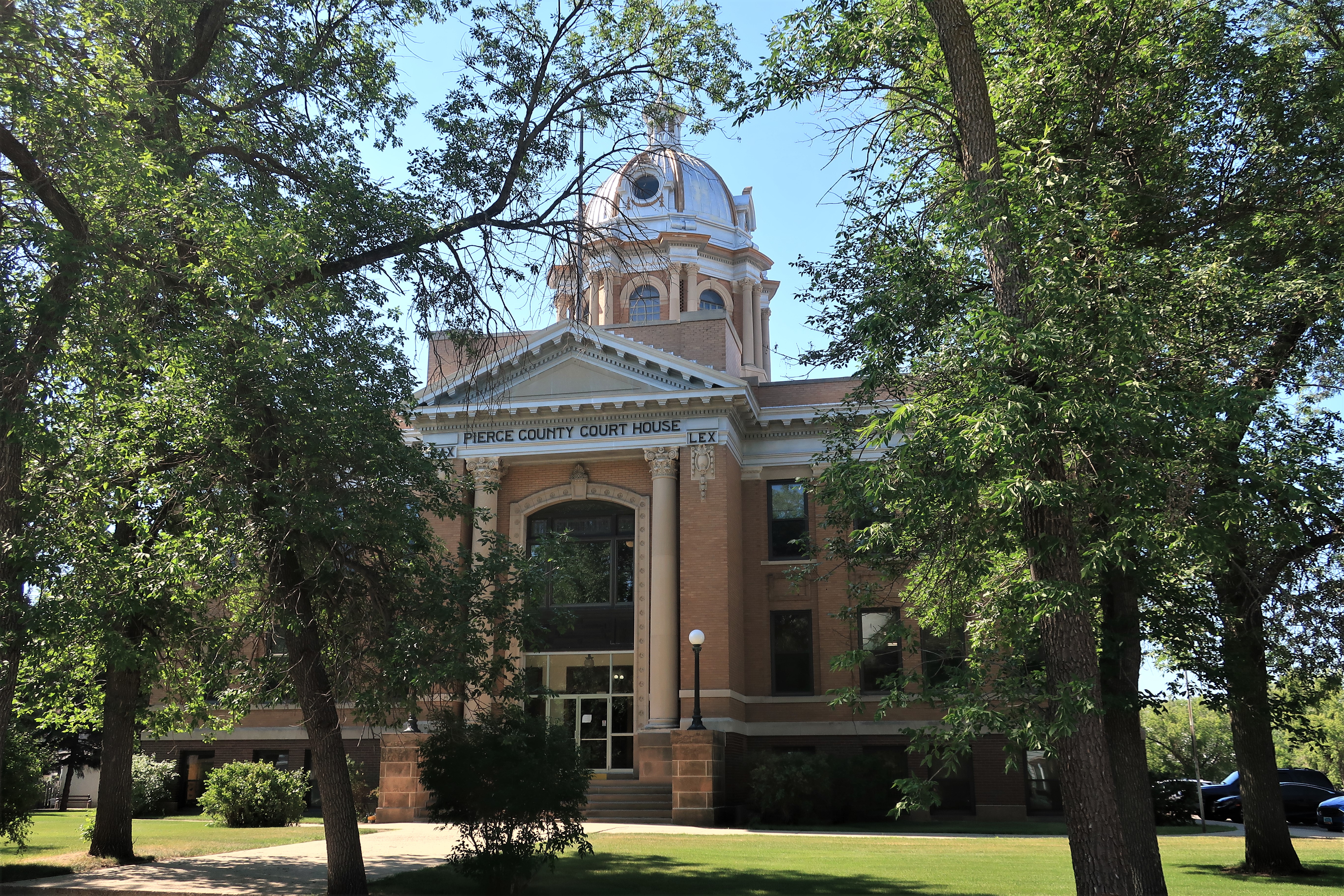
A few blocks down 2nd Street, the 1910 Pierce County Courthouse is a perfect example of proud and grand engineering. Back in the late 19th and early 20th Centuries, the new settlers to the old Dakota territories brought with them a shining optimism and love of the country, and the architecture shows it.
Pierce County Courthouse. Rugby, North DakotaPierce County Courthouse. Rugby, North Dakota
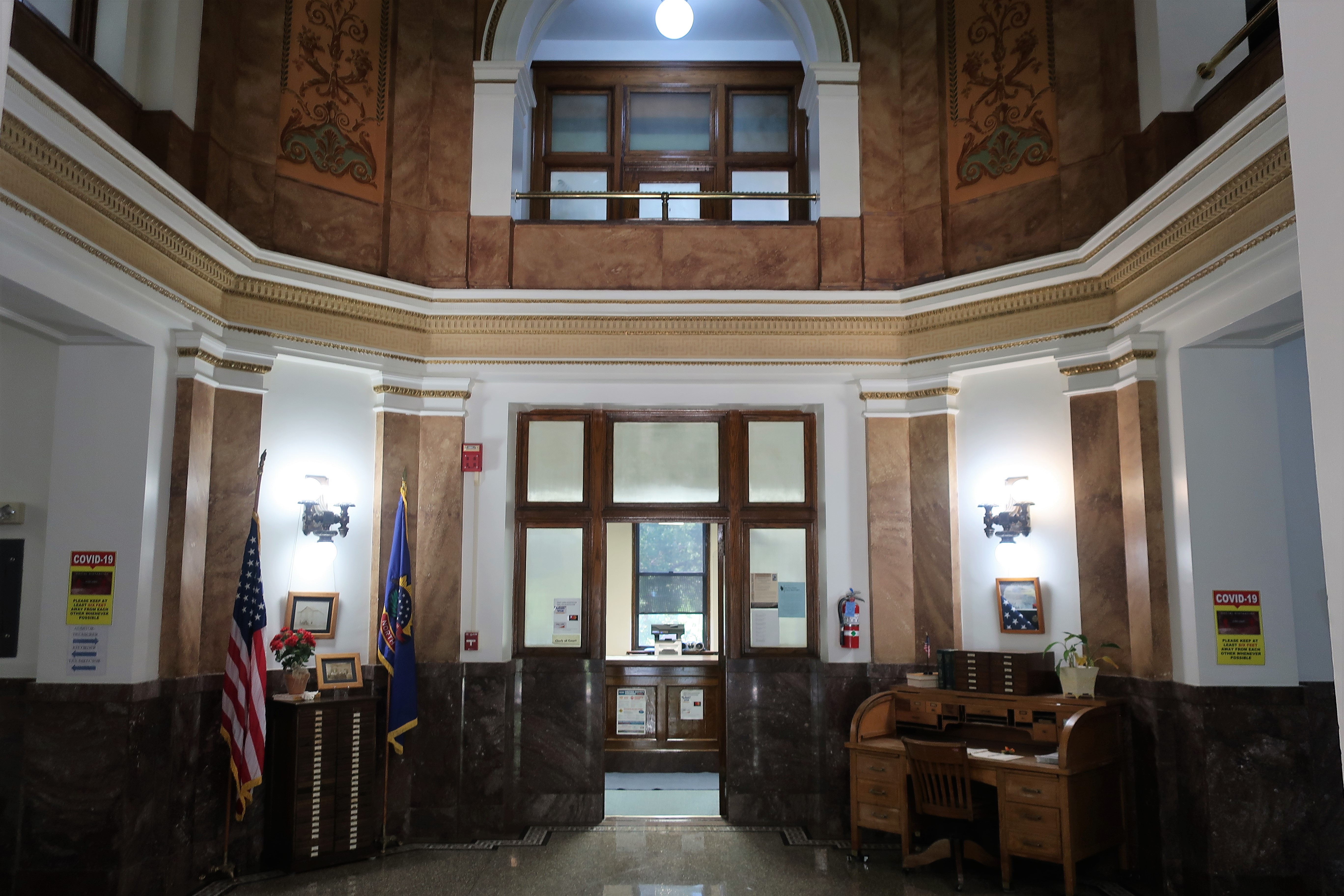
On the inside, stairways are made of brown marble and the banisters are brass. Marble slabs line the walls in all the hallways.
Atrium. Pierce County Courthouse. Rugby, North Dakota
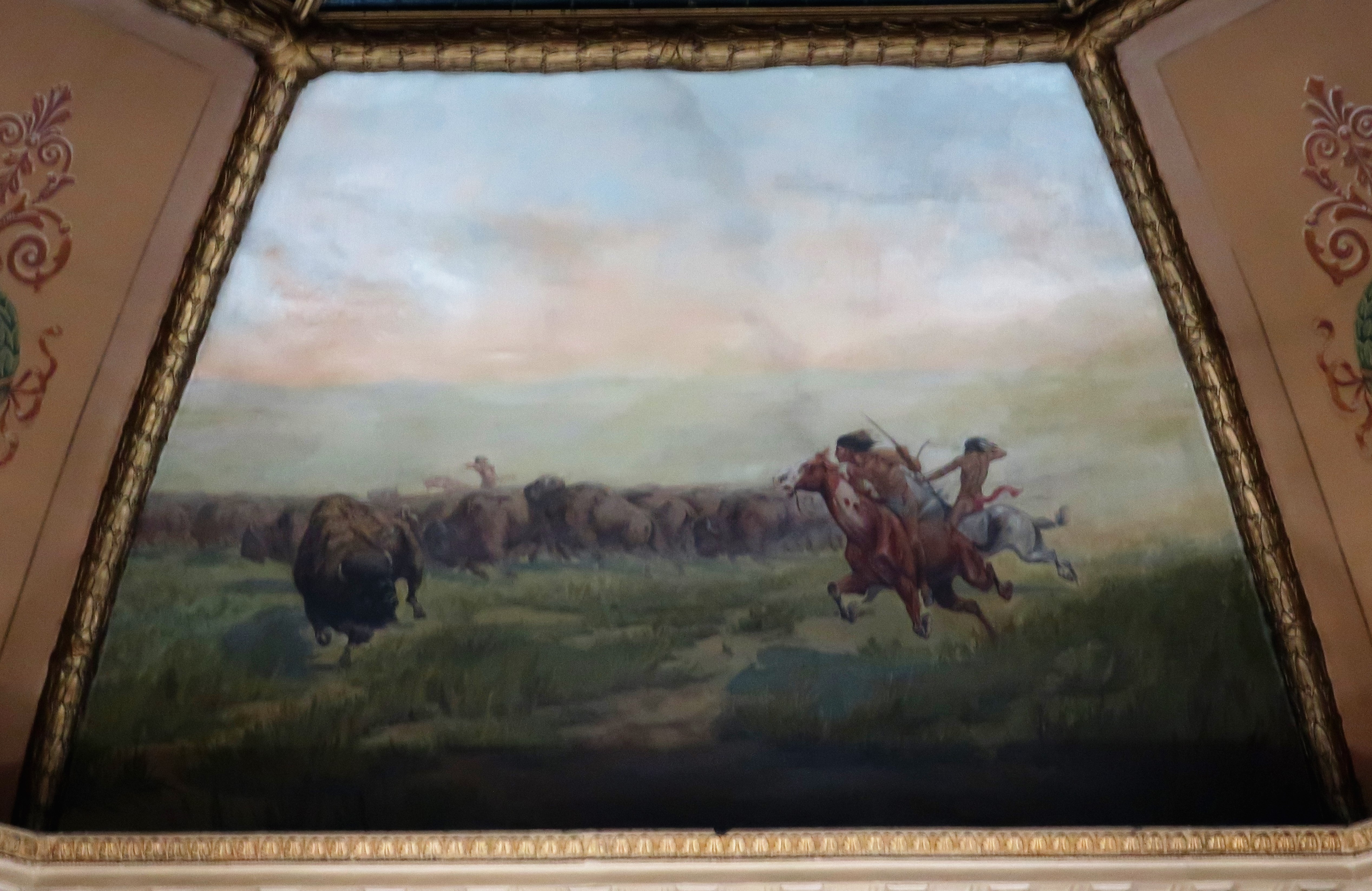
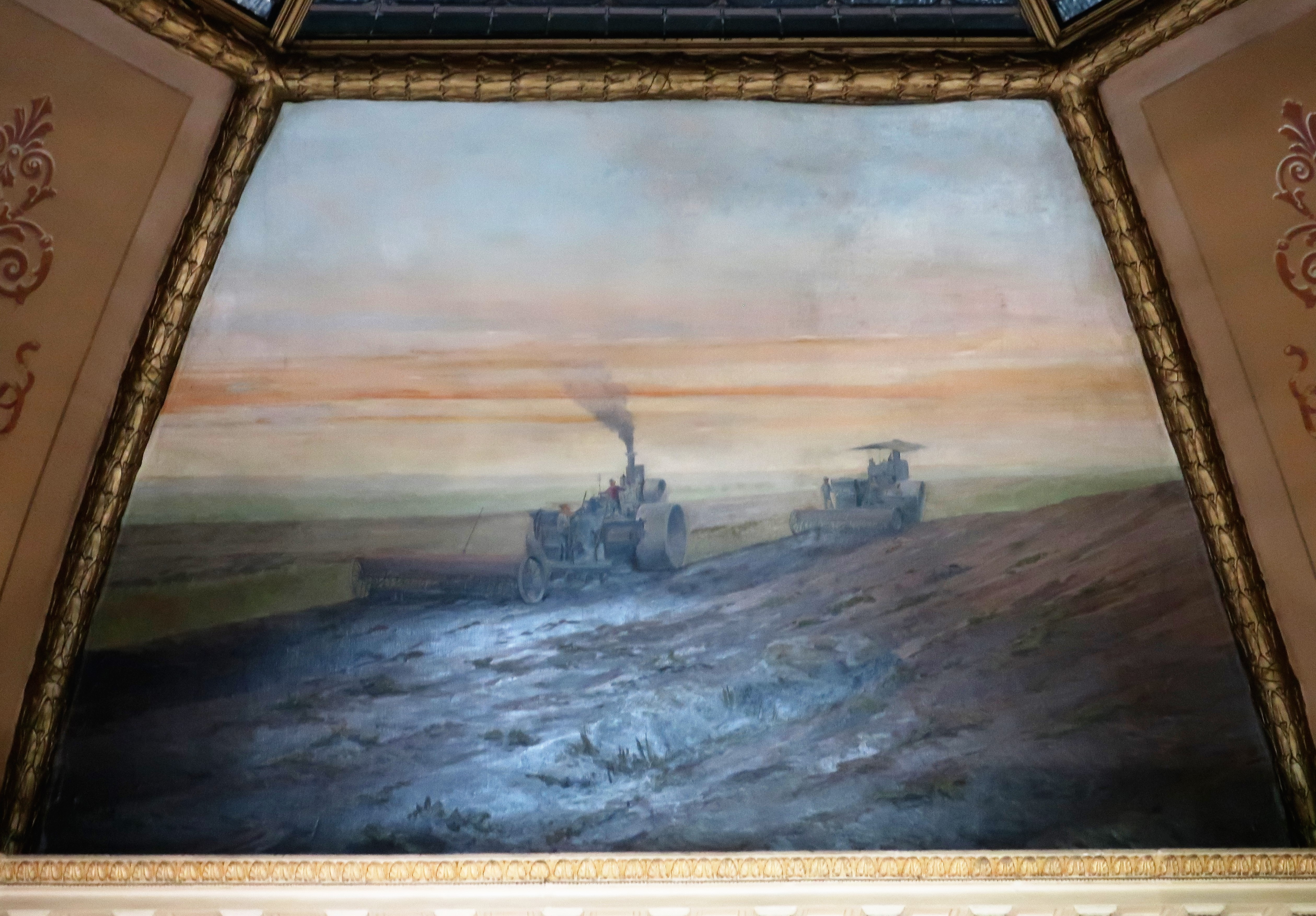
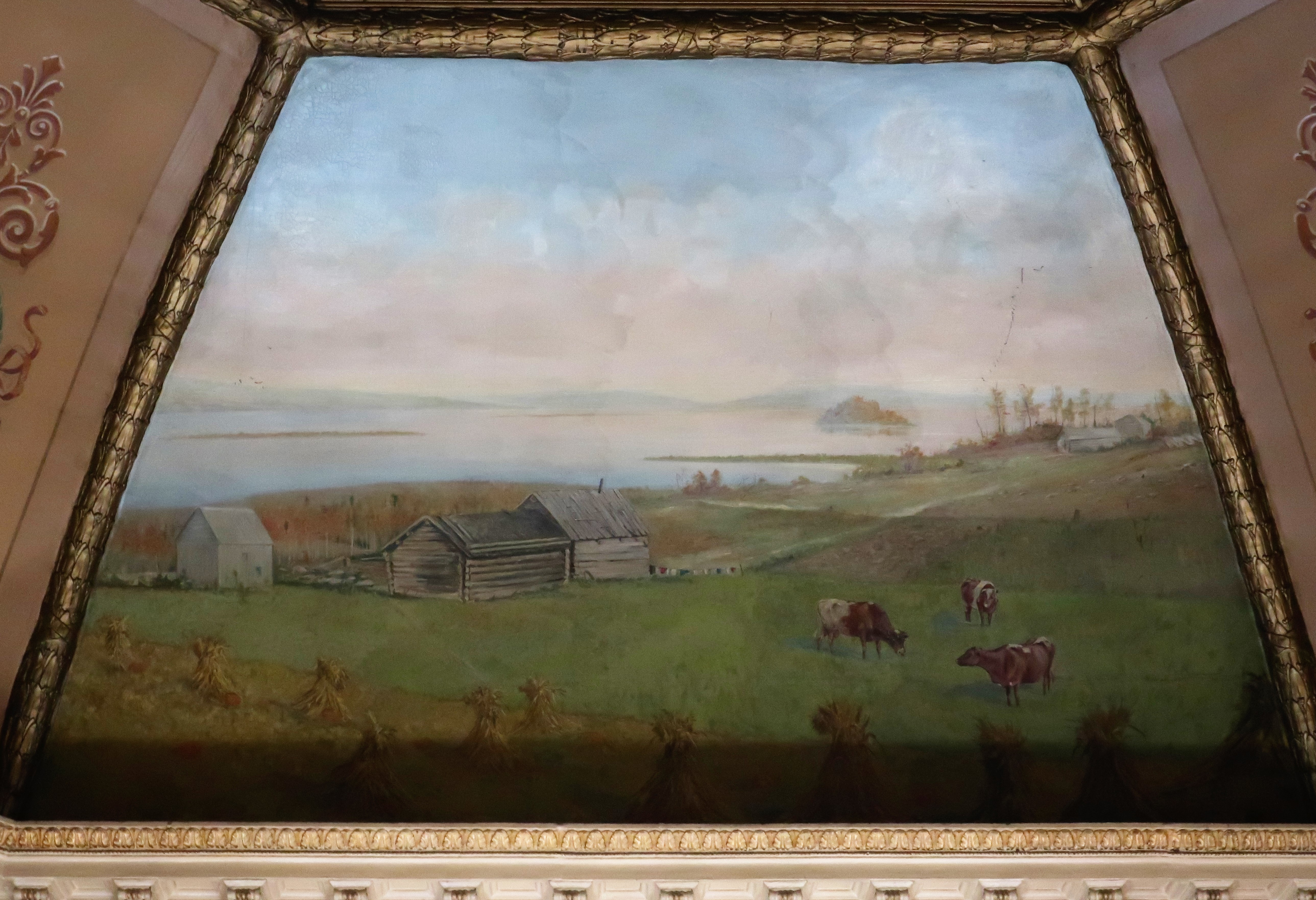
The ceiling underneath the cupola features four murals: three murals depicting agricultural activities and one of an Indian buffalo hunt.
Buffalo hunt. Mural from the Pierce County CourthouseEarly settlers. Mural from the Pierce County CourthouseEarly farm machinery. Mural from the Pierce County CourthouseAgriculture. Mural from the Pierce County Courthouse
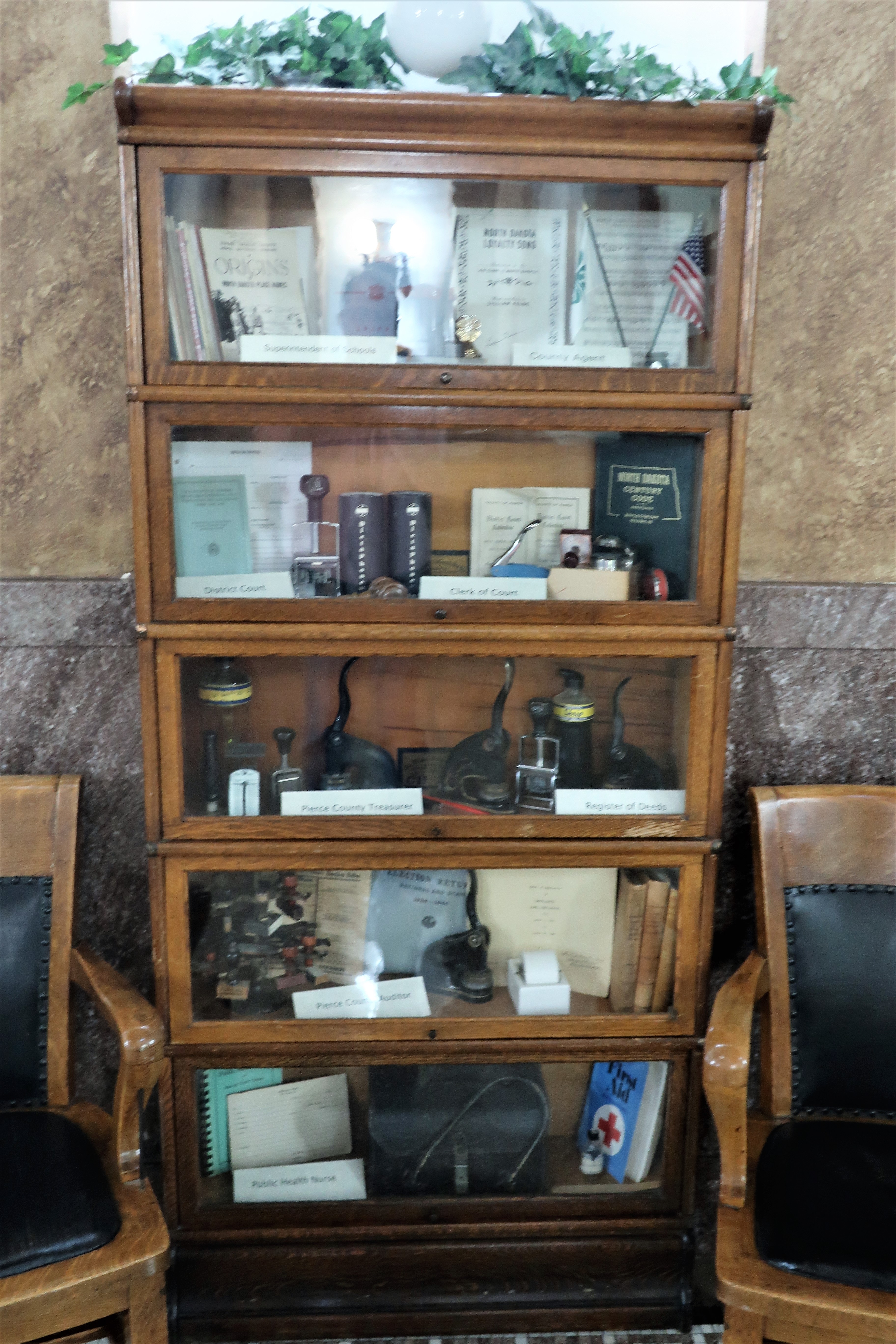
The courthouse staff gathered some old equipment into displays of the early days of the courthouse.
Display of early office machinery once used in the courthouseDisplay of old office bureau, chair, and filing system.
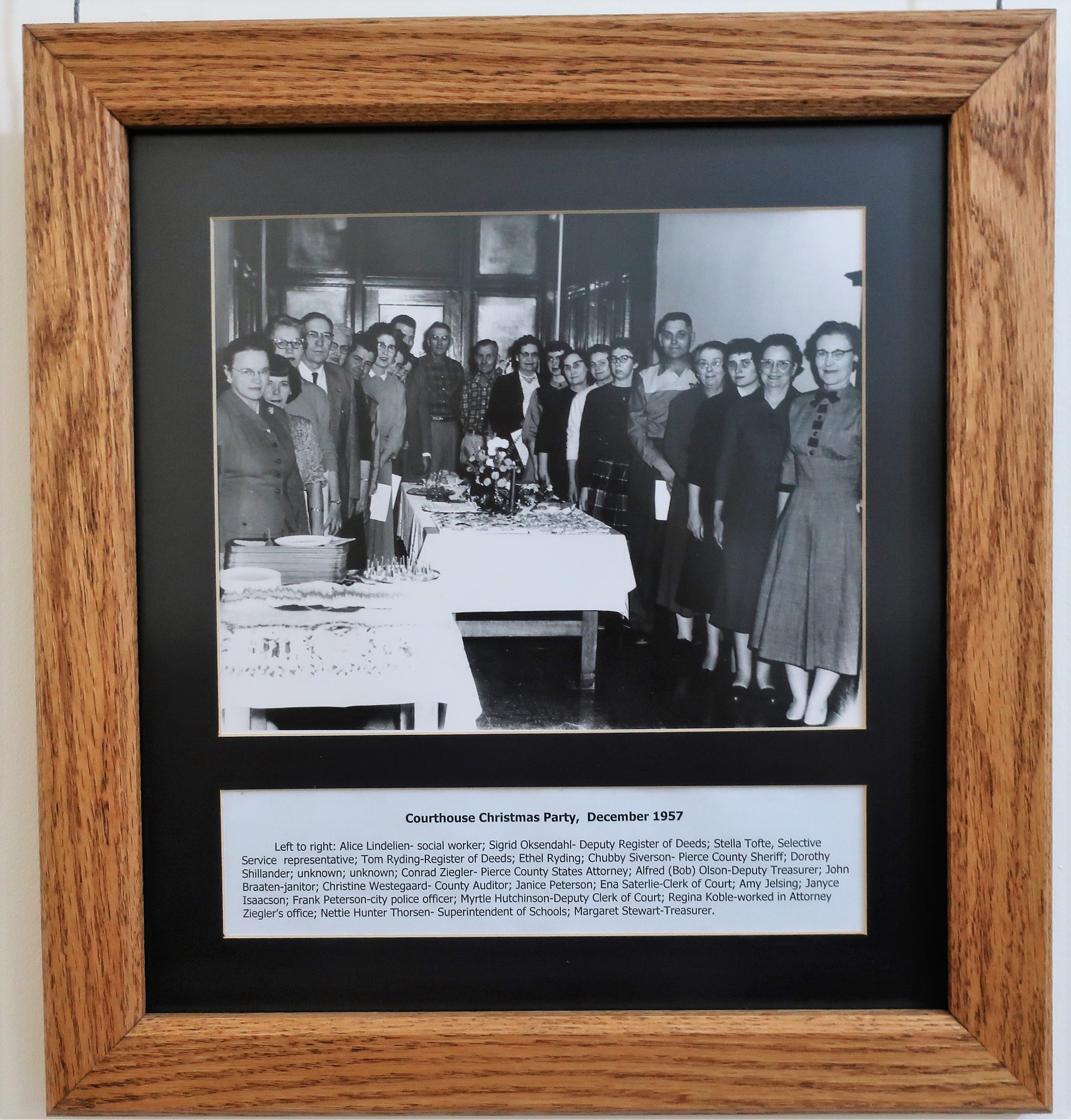
In the hallway, I found two interesting black and white photos depicting town life in the 1950s. The first is a photo of the 1957 courthouse Christmas party. The second is of a judge’s retirement party in 1950. In both cases, the employees carry a very serious demeanor, and clothing was much more formal than today.
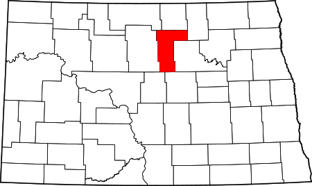
Pierce County Courthouse Christmas party. December 1957Pierce County Courthouse. Justice Grimson’s Farewell Party in February 1950Pierce County in the state of North Dakota
One house in Rugby stands out. This house stands on 2nd street in between the coffee shop and the courthouse.
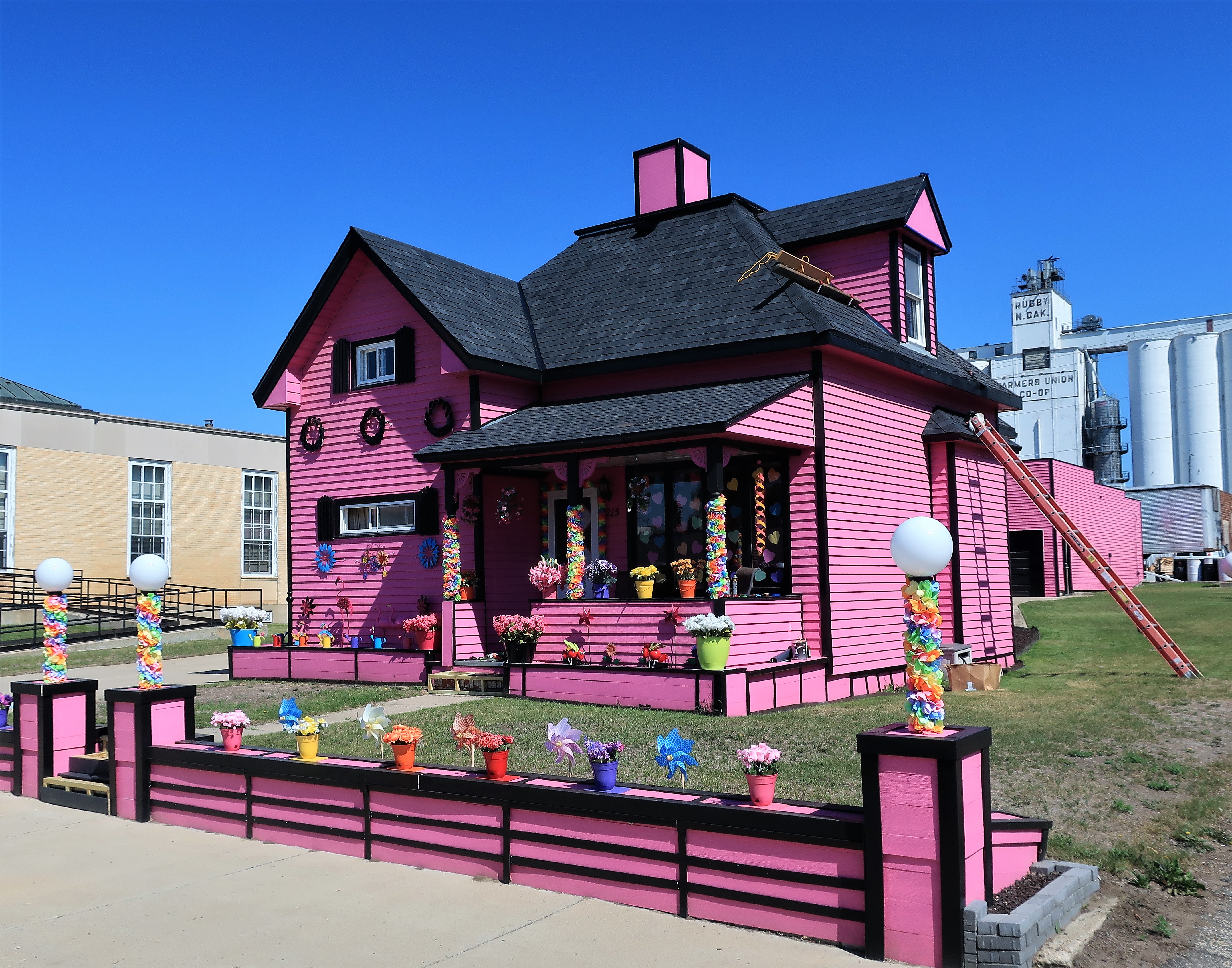
Colorfully painted house on 2nd Street. Rugby, North Dakota
Finally, a monument just outside town denotes Rugby’s place as the geographic center of North America.
Geographic Center of North America. Rugby, North Dakota
All photos were taken by the authoron July 1, 2021
A list of all photo posts from the American County Seats series in TimManBlog can be found here.
I do this as a hobby and not for a living (yet) — but donations are happily accepted if you’d like to help defer my costs. Thanks, Tim
Donations are NOT tax-deductible under U.S. law…but you knew that.
June 30, 2021 (photos and memories from August 1998 and June 2017)
What is the “Northwest?” It depends on your perspective of course. Americans of today might nod to the states of Washington and Oregon, and maybe Idaho and Alaska too. But from the perspective of American Revolutionists in the late 1770s, the new nation consisted of the 13 Atlantic seaboard states. Some visionaries also eyed the “Northwest Territory,” consisting of those lands northwest of the 13 new states, specifically north and/or west of the Ohio River.
Today this area includes the states of Ohio, Indiana, Michigan, Illinois, Wisconsin, and Minnesota. But they all might have stayed in British possession after the Revolutionary War — except for the actions of George Rogers Clark.
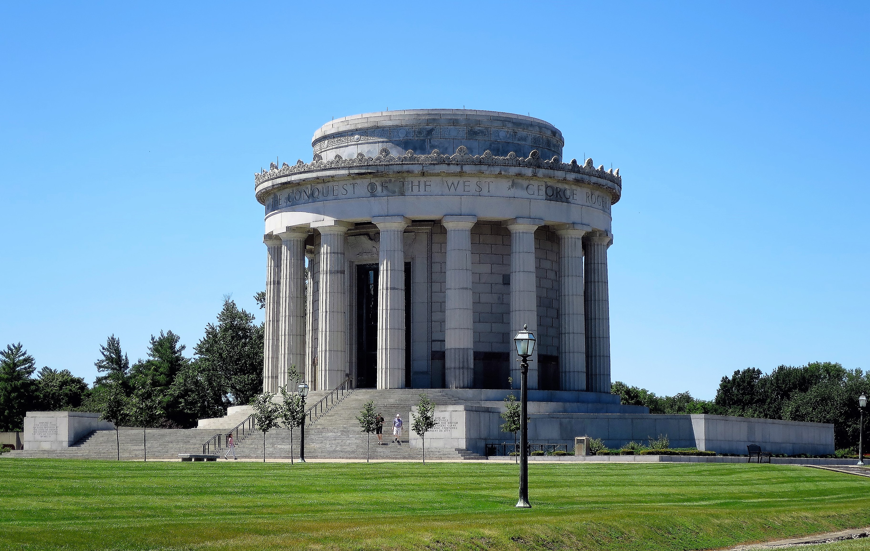
Monument honoring Revolutionary War hero George Rogers Clark. Vincennes, Indiana
In February 1779, George Rogers Clark led a company of what can only be called “backwoods Virginia badasses” across winter snows and icy, flooded rivers to surprise and capture British Fort Sackwell here at Vincennes, in present-day Indiana.
Clark’s victory ensured that America would occupy land north of the Ohio, which allowed U.S. peace negotiators in Paris to press for the boundary of the new nation to be set along the Great Lakes. Without Clark’s victory at Vincennes (and Kaskaskia), the new United States/British Empire boundary would have been set along the Ohio River. The Northwest Territory would have become part of Canada, and the Northwest Ordinance would never have been written. If the United States had been limited to territory south of the Ohio River the country would have been dominated by slave states and history would have turned out much differently, to say the least.
Without Clark, Indiana would likely be part of Canada today. Without the 5 northwestern states included in the Union as non-slave states, the history of the Civil War would have been much different.
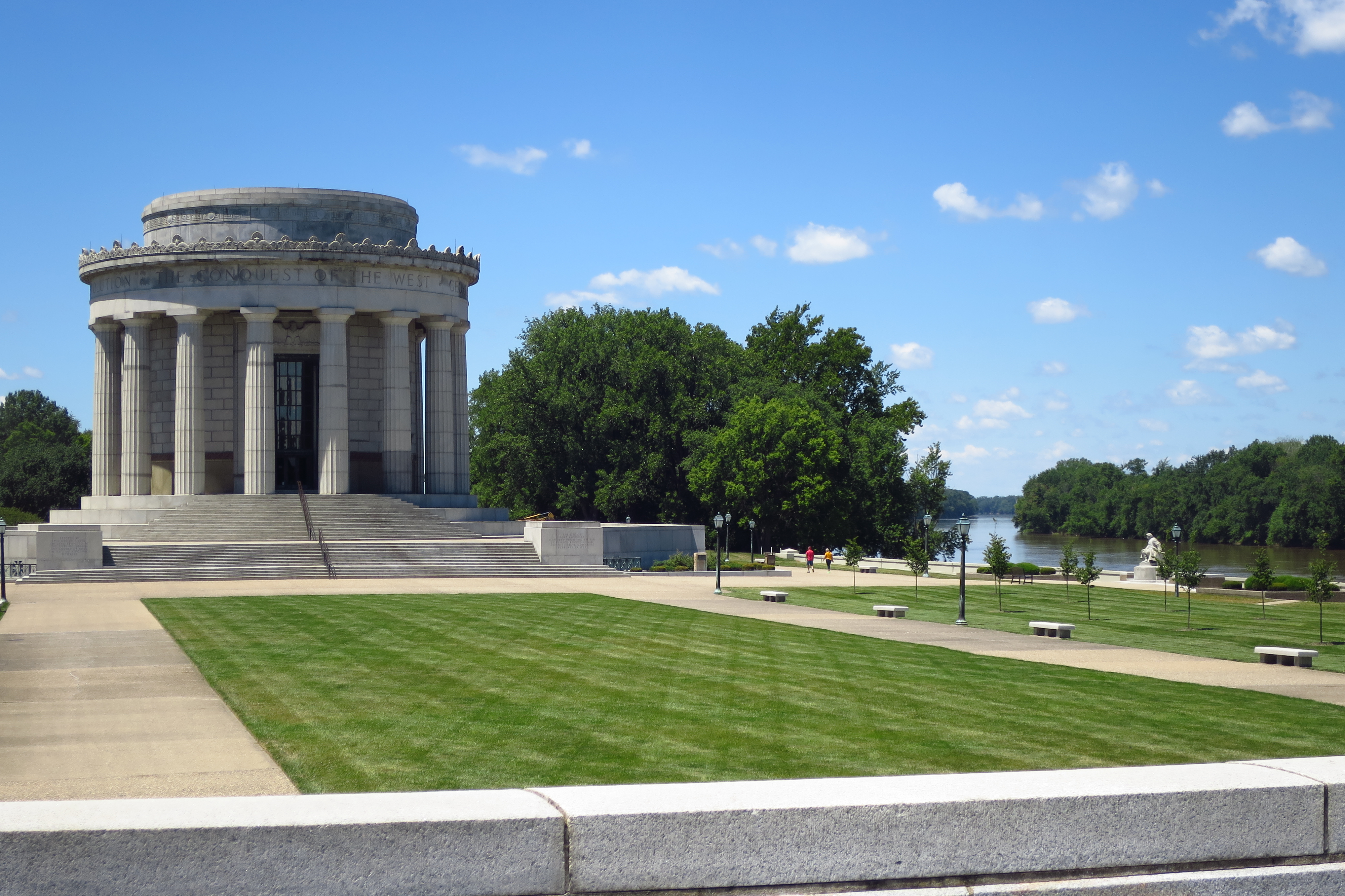
Clark’s victory at Vincennes is celebrated with memorials in the Vincennes Historic District along the Wabash River.
George Rogers Clark Memorial along the Wabash River. Vincennes, Indiana
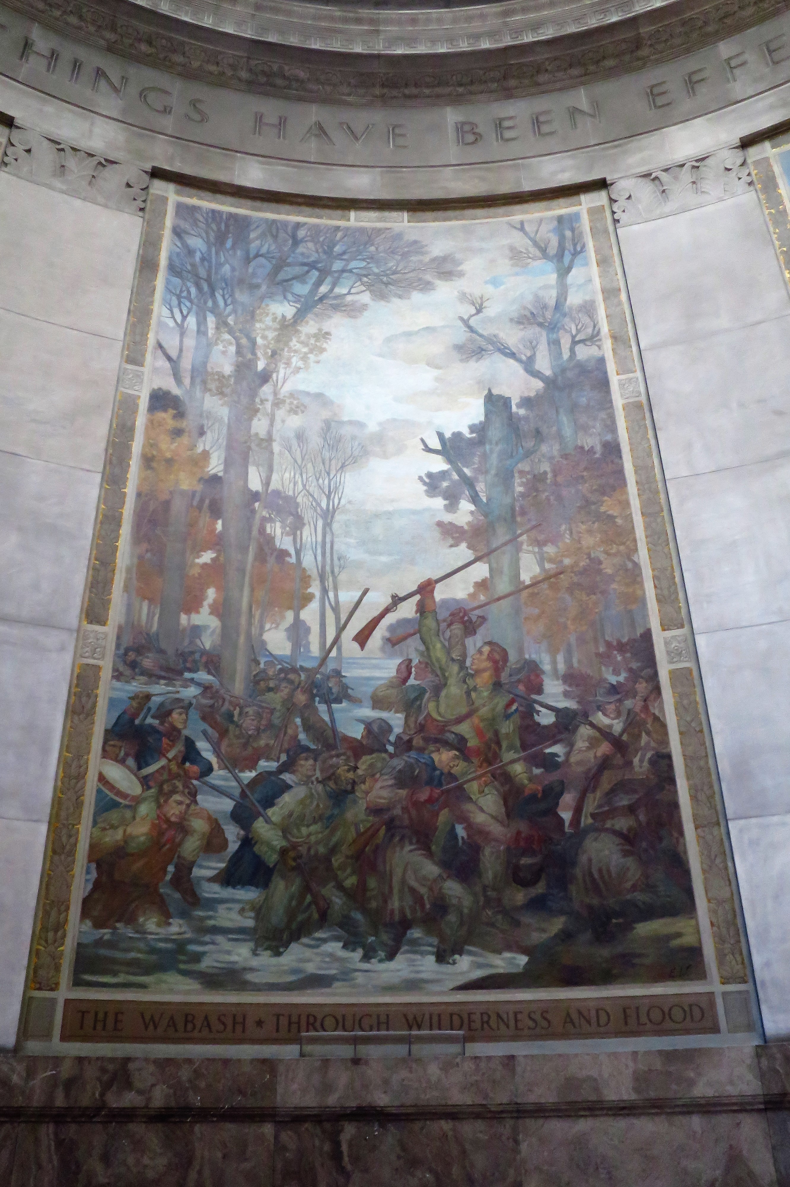
Murals inside the memorial explain the history of the region.
Mural inside the Clark Memorial. Vincennes, Indiana
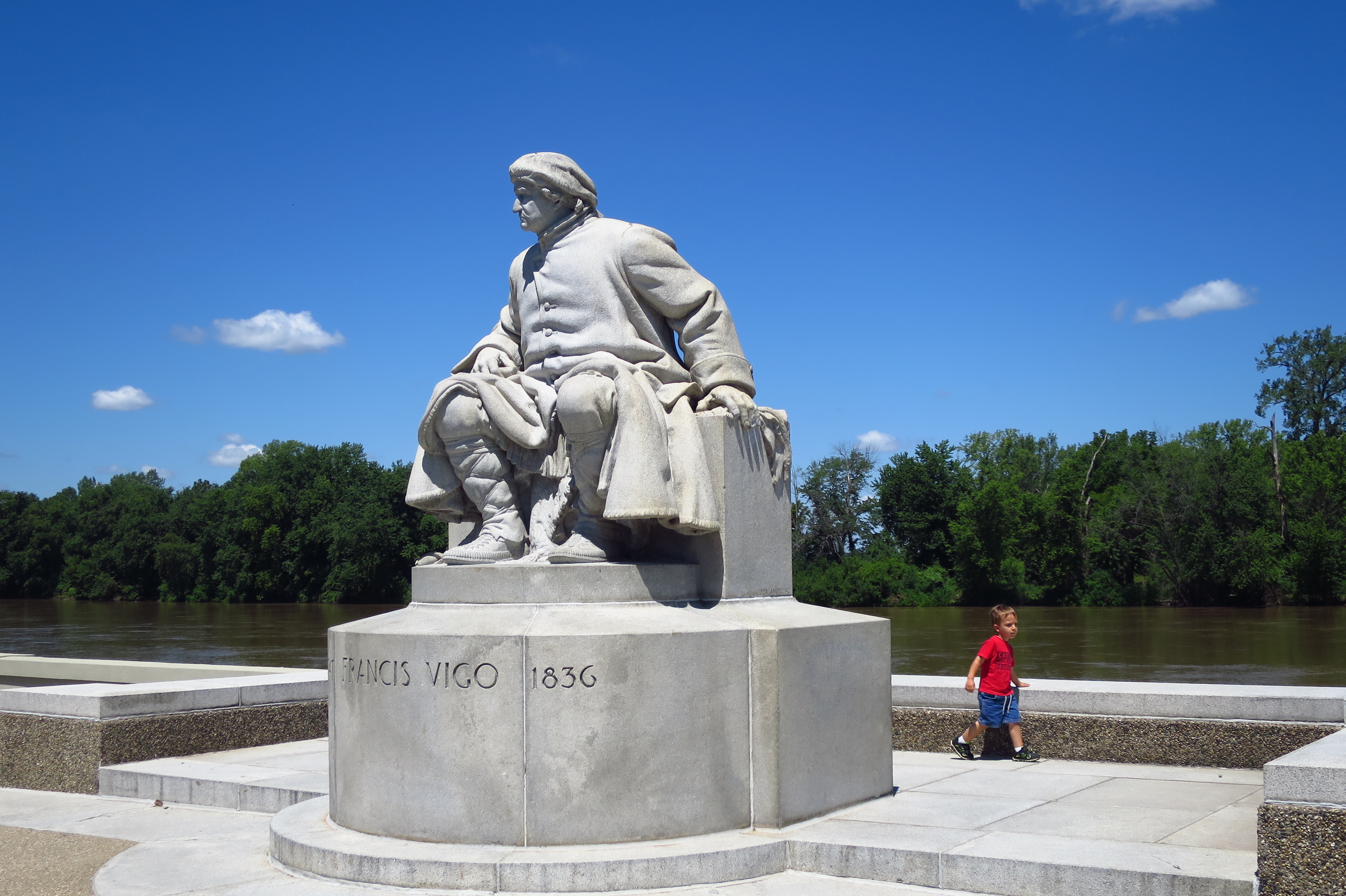
The park includes a statue of the Italian-born Francis Vigo. Vigo, a former Spanish soldier, played an important role in surveilling the British presence at Vincennes and relaying the information to Clark.
Statue of Francis Vigo and young admirer. Vincennes, Indiana
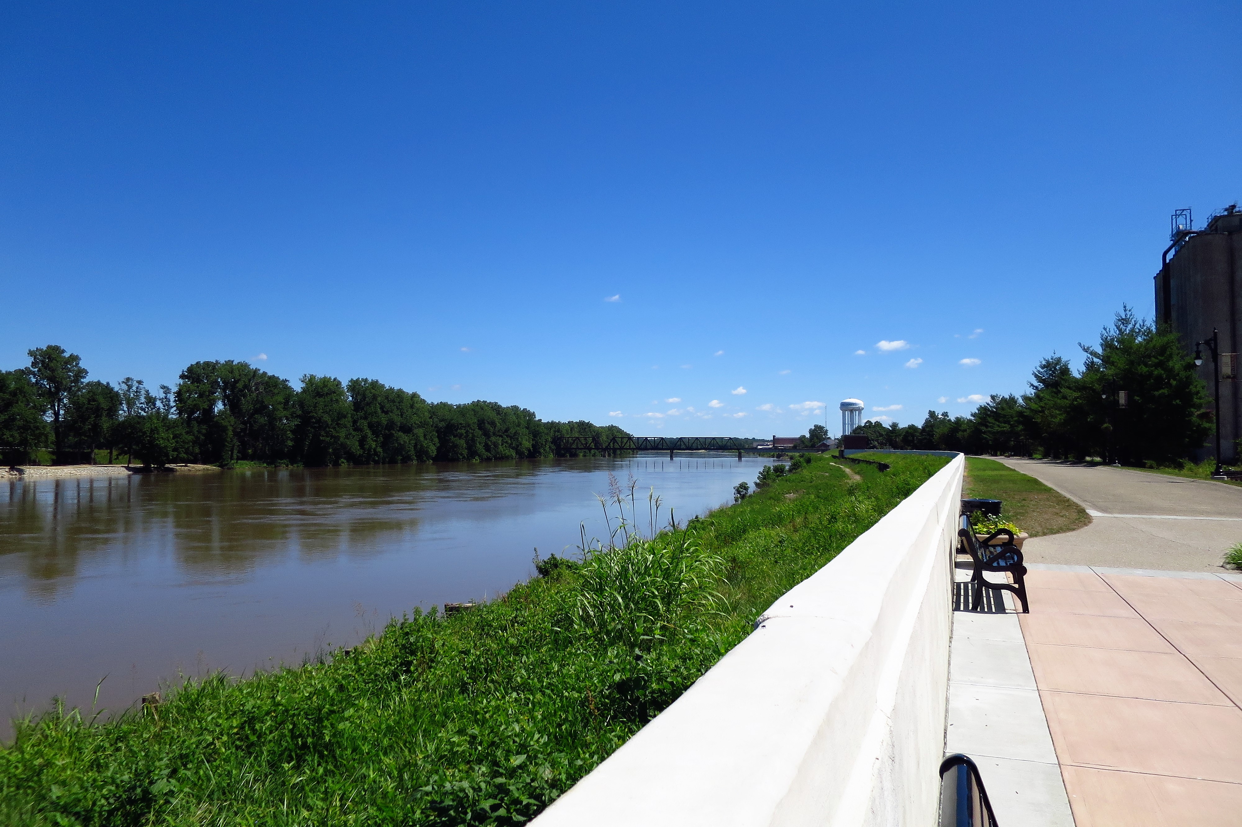
The historical area also makes a nice place for a riverside park.
Wabash River at Vincennes. Indiana
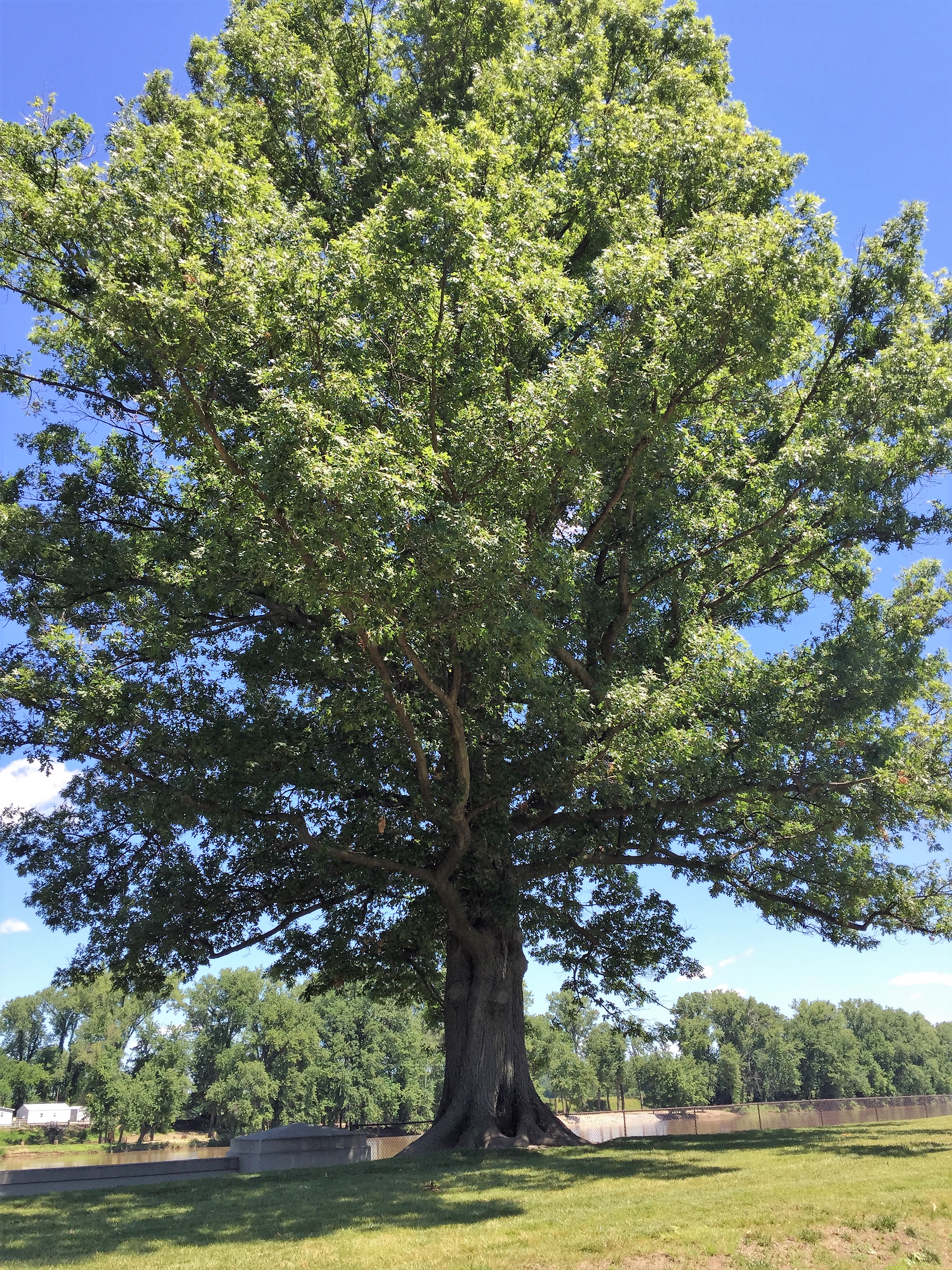
I photographed an impressive shade tree I found on the Wabash banks and asked some Indiana Facebook friends what kind of tree it was. A Hoosier replied, “the great big kind.”
Great Big Tree on the banks of the Wabash River. Vincennes, Indiana
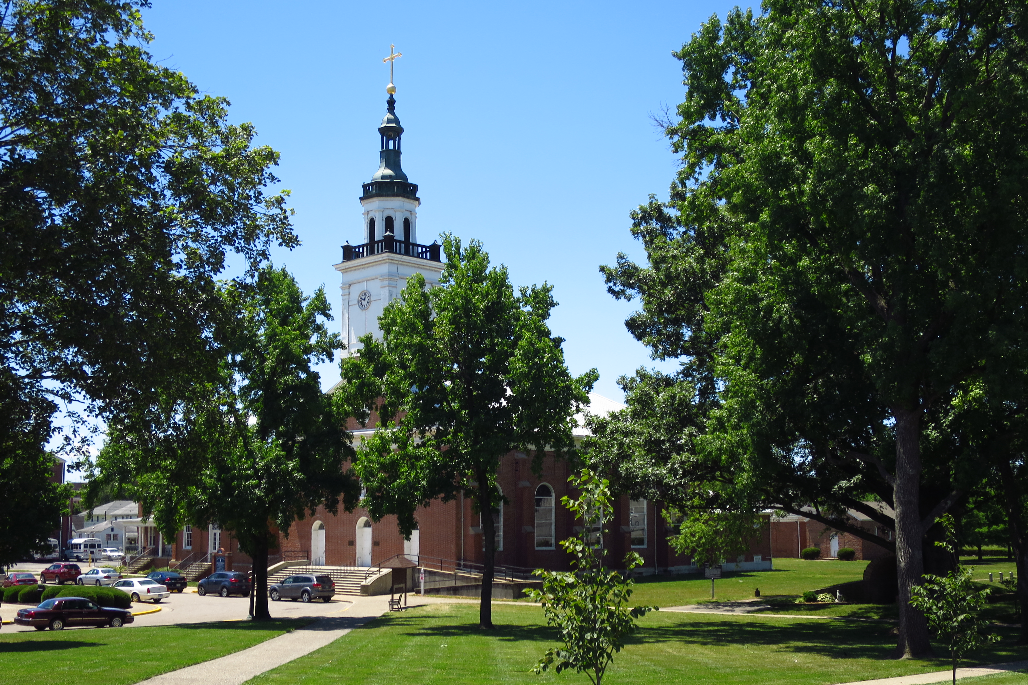
Vincennes began as a French settlement, and its French influence can still be seen today. The Old French Cathedral and Cemetary are adjacent to the Clark Memorial in the Vincennes Historic District.
The Old French Cathedral. Vincennes, IndianaCemetary at the old French Cathedral. Vincennes, Indiana
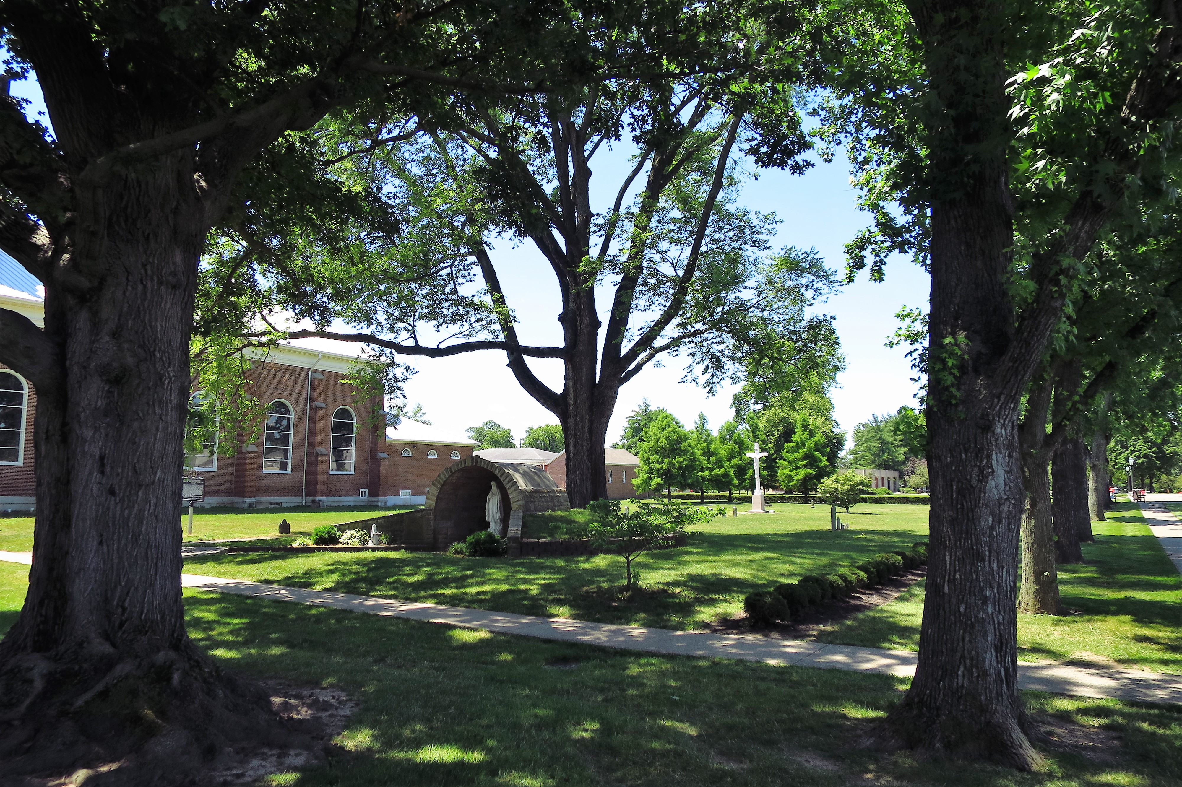
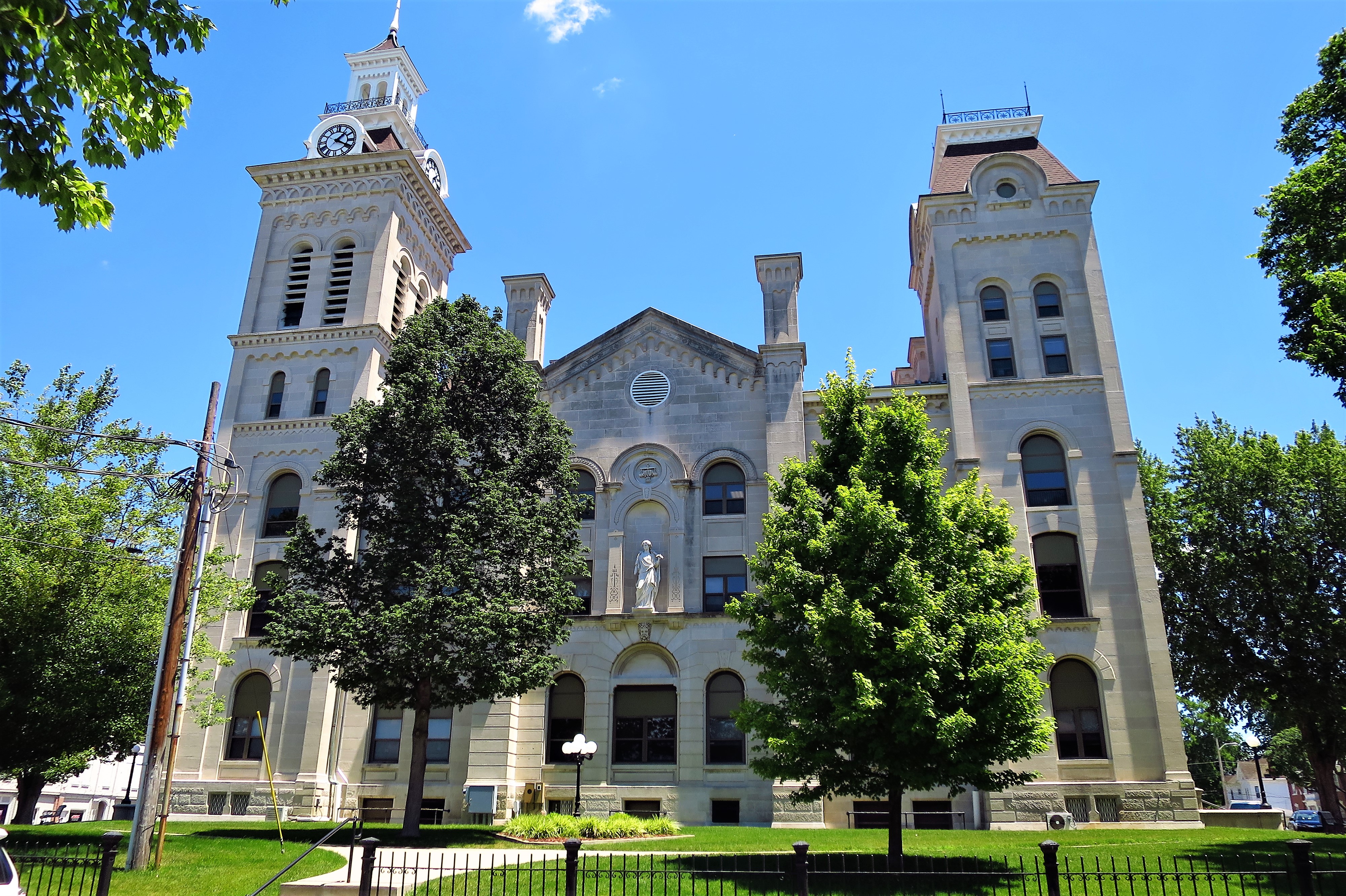
The four-story Knox County Courthouse here in Vincennes features the French style.
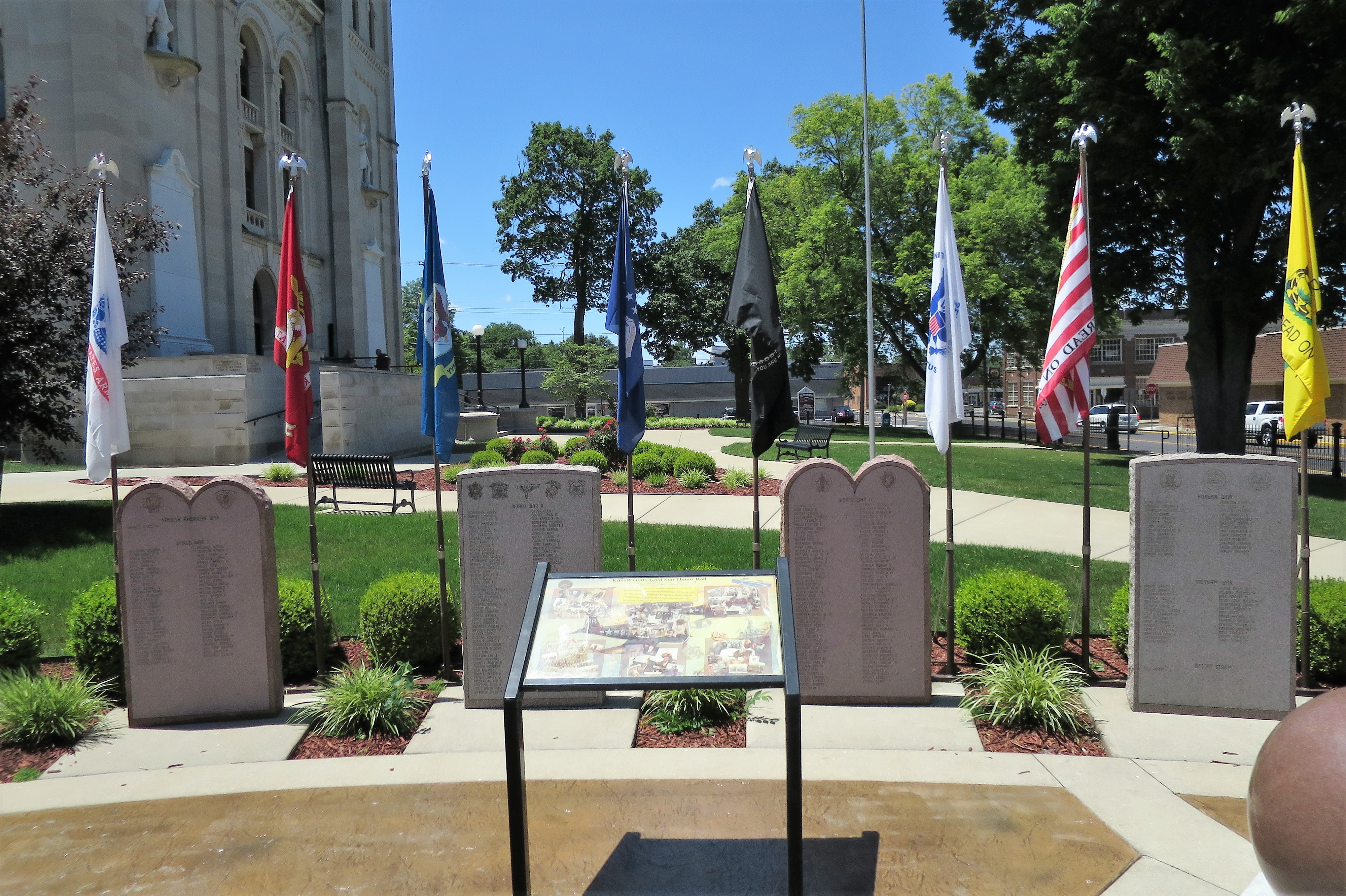
Knox County Courthouse. Vincennes, IndianaMemorial at the Knox County Courthouse with flags that have flown over Vincennes in the pastPortraits of Francis Vigo (left) and George Rogers Clark (right). Knox County Courthouse. Vincennes, IndianaKnox County in the state of Indiana
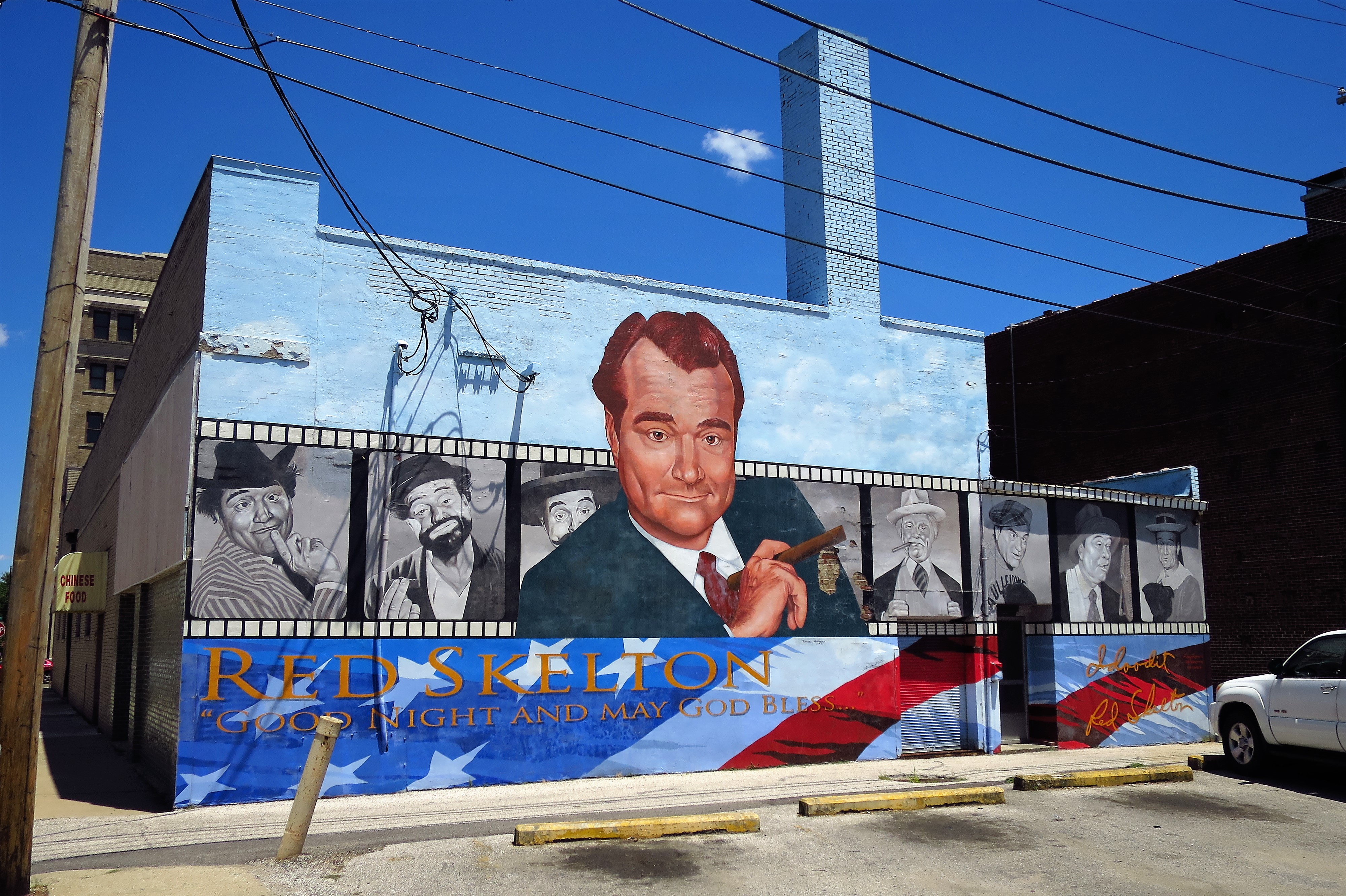
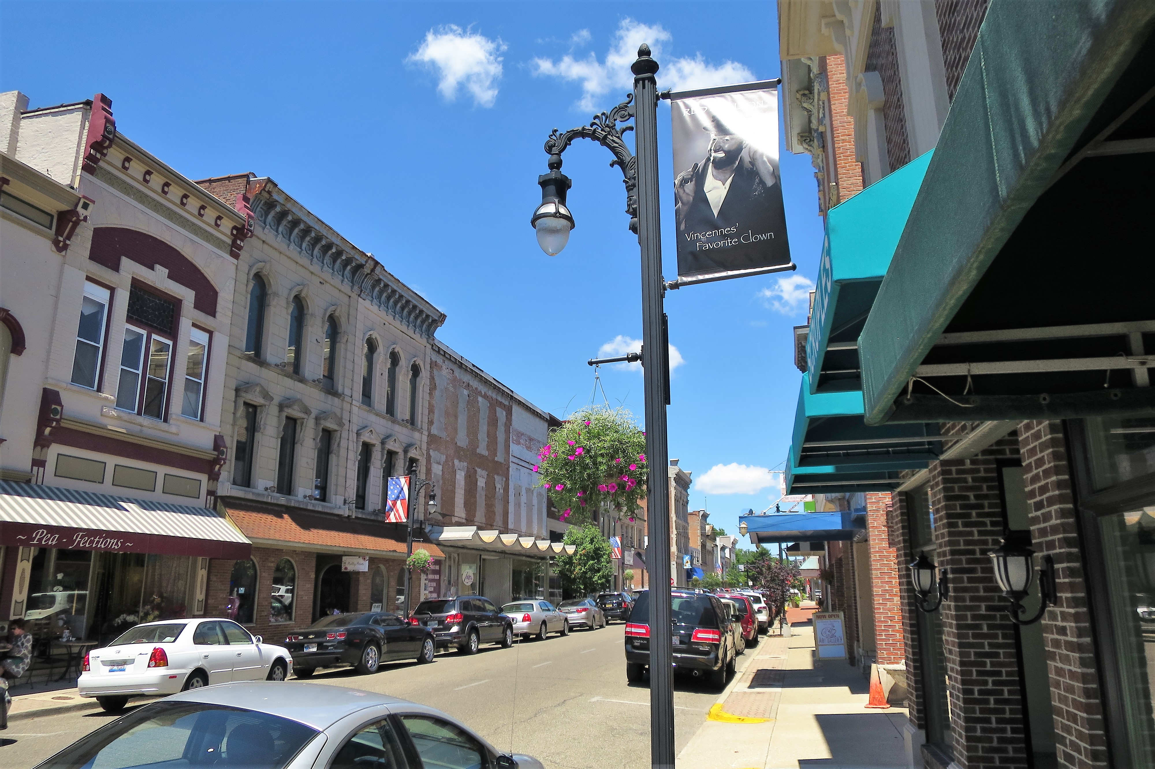
The city of Vincennes has some charming old architecture. Their local-boy-made-good is comedian Red Skelton. His likeness can be found all over downtown Vincennes, on murals and on lampposts.
Mural honoring Comedian Red Skelton. Downtown Vincennes, IndianaDowntown Vincennes, Indiana
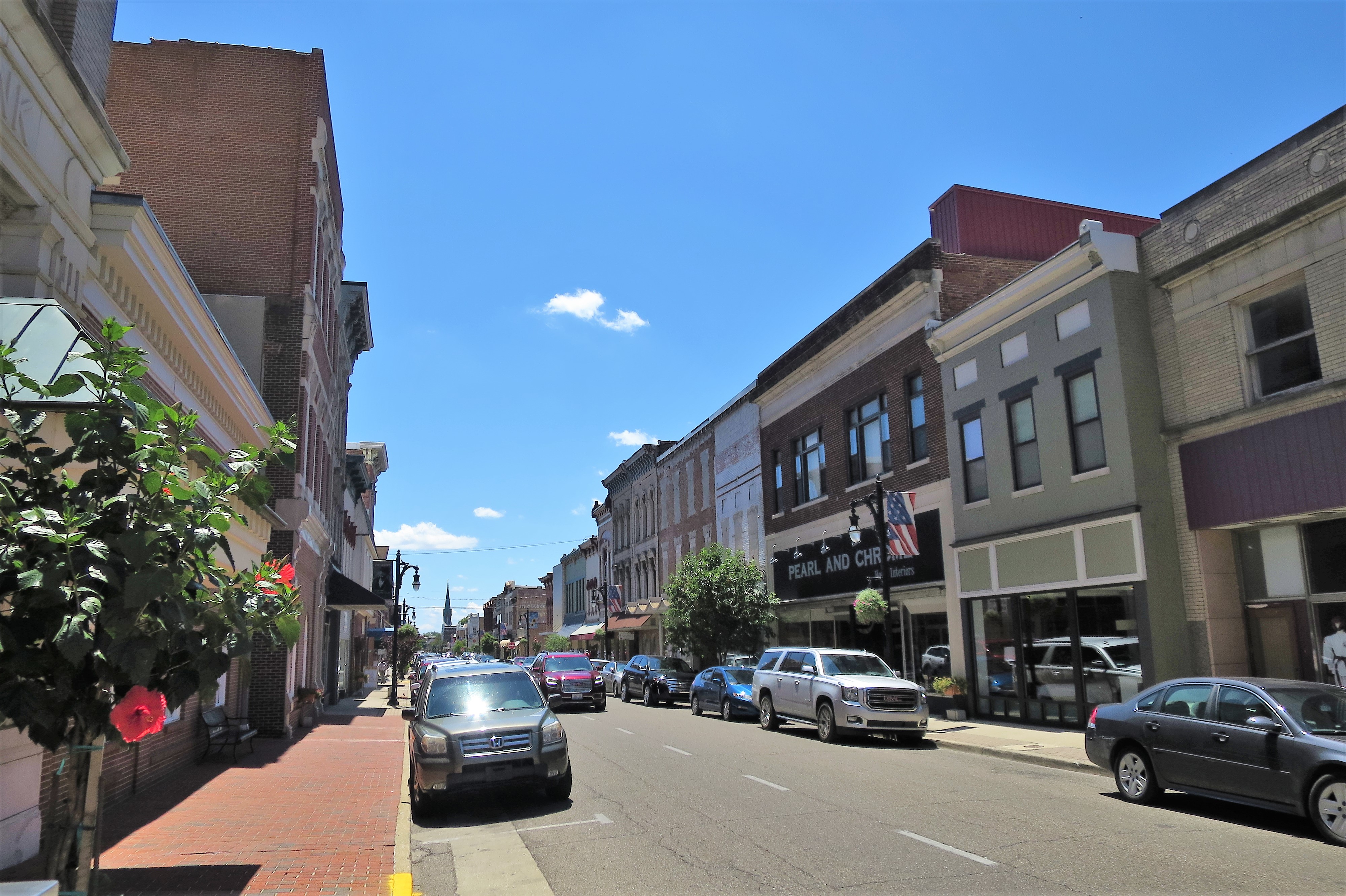
Having lunch at a sidewalk table on Main Street here feels like being in a canyon. Buildings on either side rise four and five stories using brick construction. The architecture is old, dating from the late 19th century. Although a few buildings are abandoned, most are occupied and thriving.
Downtown Vincennes, IndianaVincennes, Indiana
All photos were taken by the authoron June 27, 2017
A list of all photo posts from the American County Seats series in TimManBlog can be found here.
I do this as a hobby and not for a living (yet) — but donations are happily accepted if you’d like to help defer my costs. Thanks, Tim
Donations are NOT tax-deductible under U.S. law…but you knew that.
May 30, 2021 (photos and memories from August 1997 and May 2013)
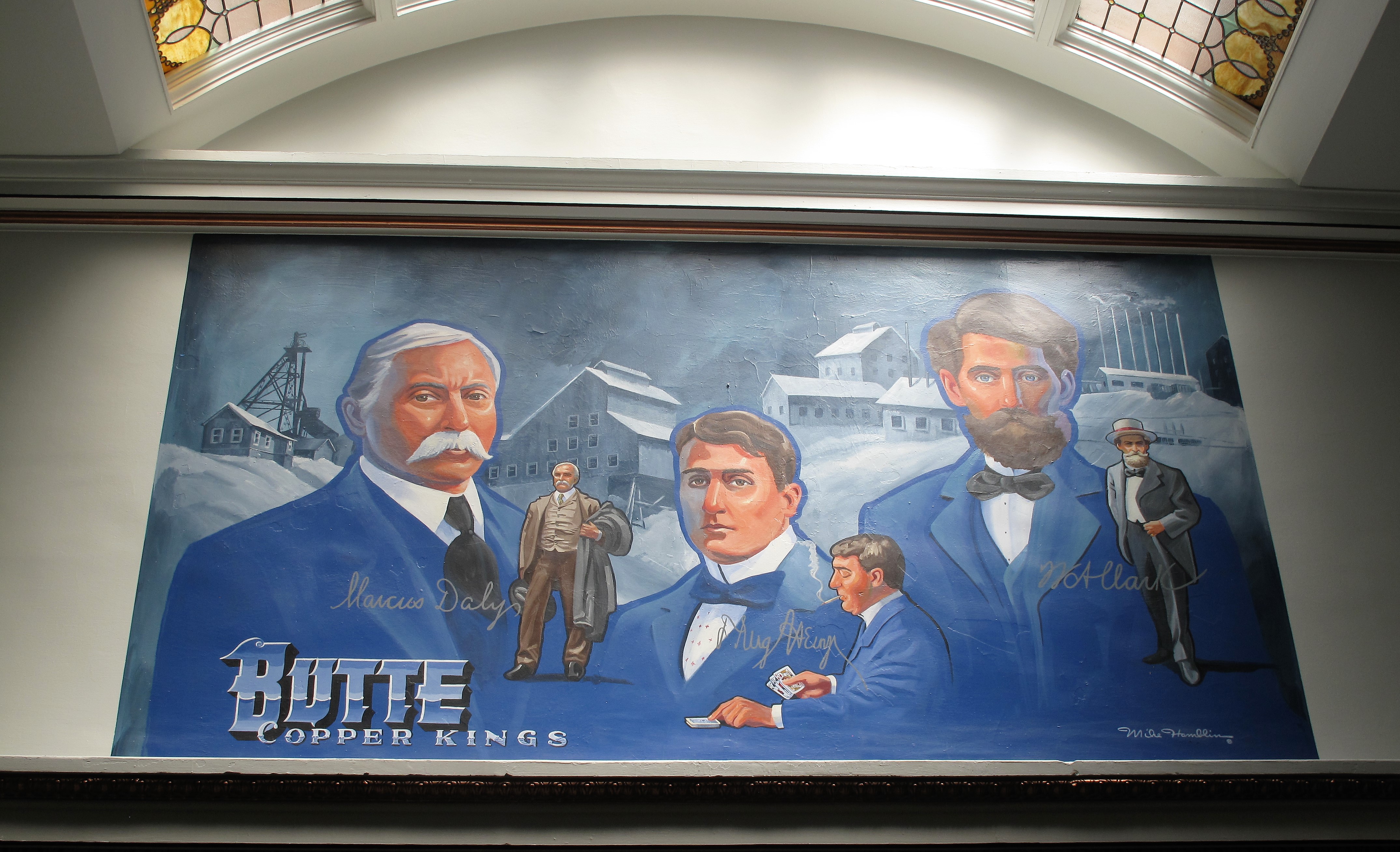
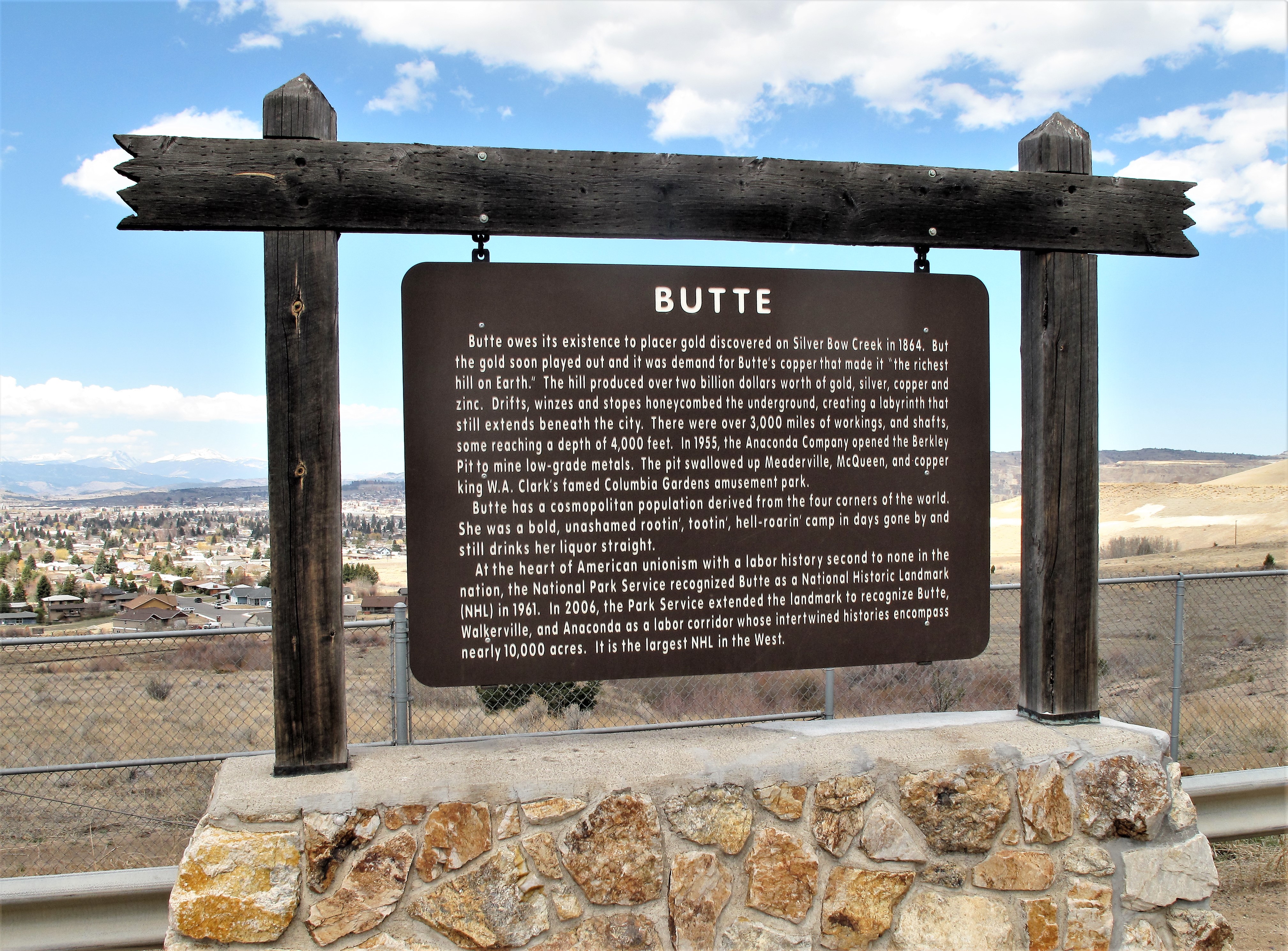
Butte is the 5th largest city in the state of Montana with 33,000 residents, but it has the most colorful history of any town in that state. During its heyday in the late-nineteenth and early-twentieth centuries, Butte was one of the largest copper boomtowns in the West. Fortunes were made for many here, especially for owners of the copper mines. They were known as the Copper Kings.
Painting of the Butte Copper Kings. Silver Bow County Courthouse, Butte, Montana
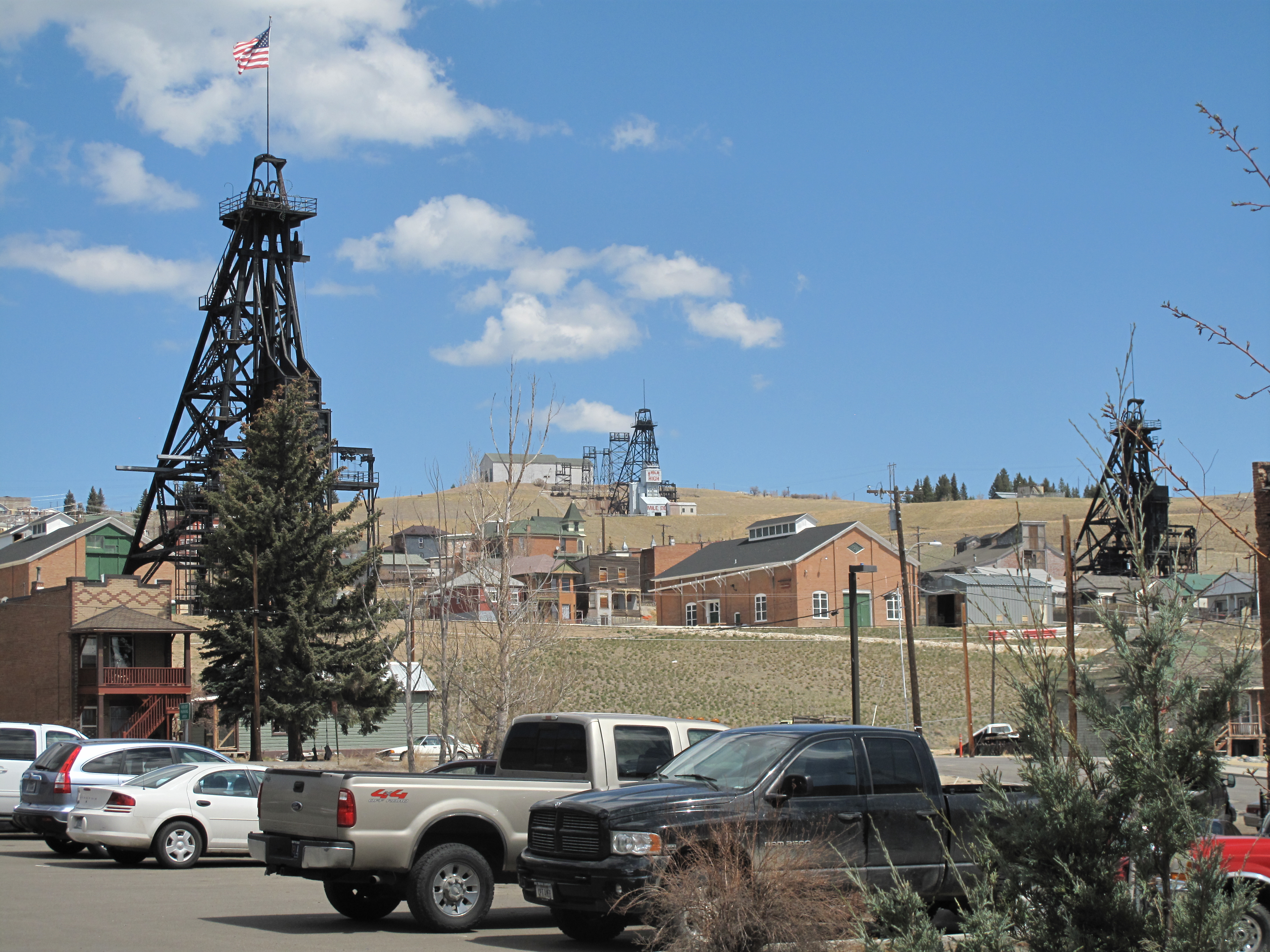
The city of Butte straddles the Continental Divide high in the Rockies and is positioned on the southwestern side of a large mass of exposed granite. The exposed granite mountain is riddled with rich veins of copper, gold, and silver ore which produced millions of dollars of precious metals during the last two centuries. Mineshafts criss-cross the earth deep below the town’s streets. A large open-pit copper mine, called the Berkeley Pit, was opened in 1955 nearly alongside the town. Although this open-pit ceased operations in 1982, several other mines still operate today extracting molybdenum ore among other metals.
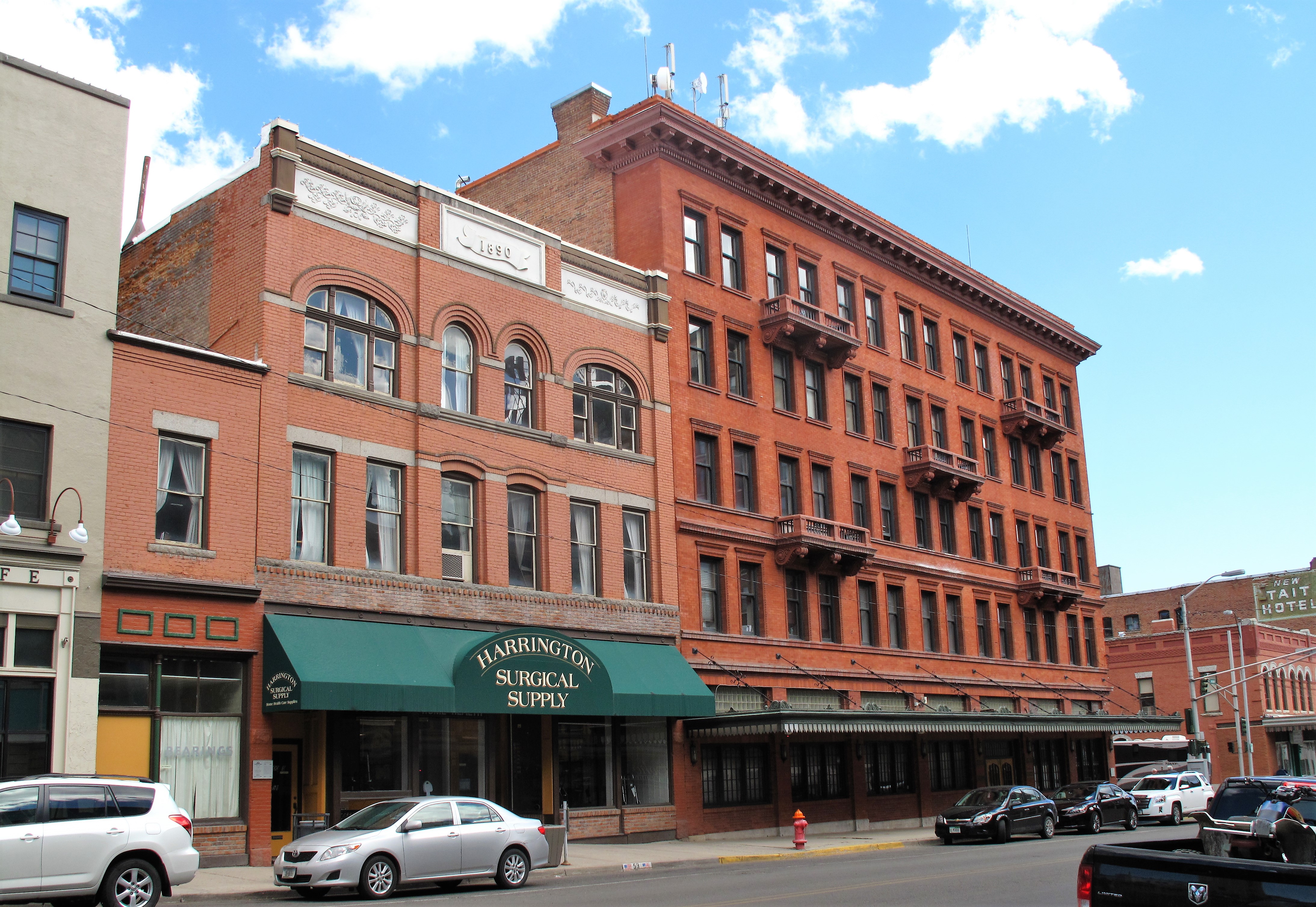
The wealth extracted from the mines in the late 1800s and early 1900s also produced a wealth of ornate buildings and architecture in the city, and the bars, ethnic foods, and wild things that accompany prosperous mining towns.
Ornate mining-era structures from the late 1800s and early 1900s in Uptown Butte, Montana
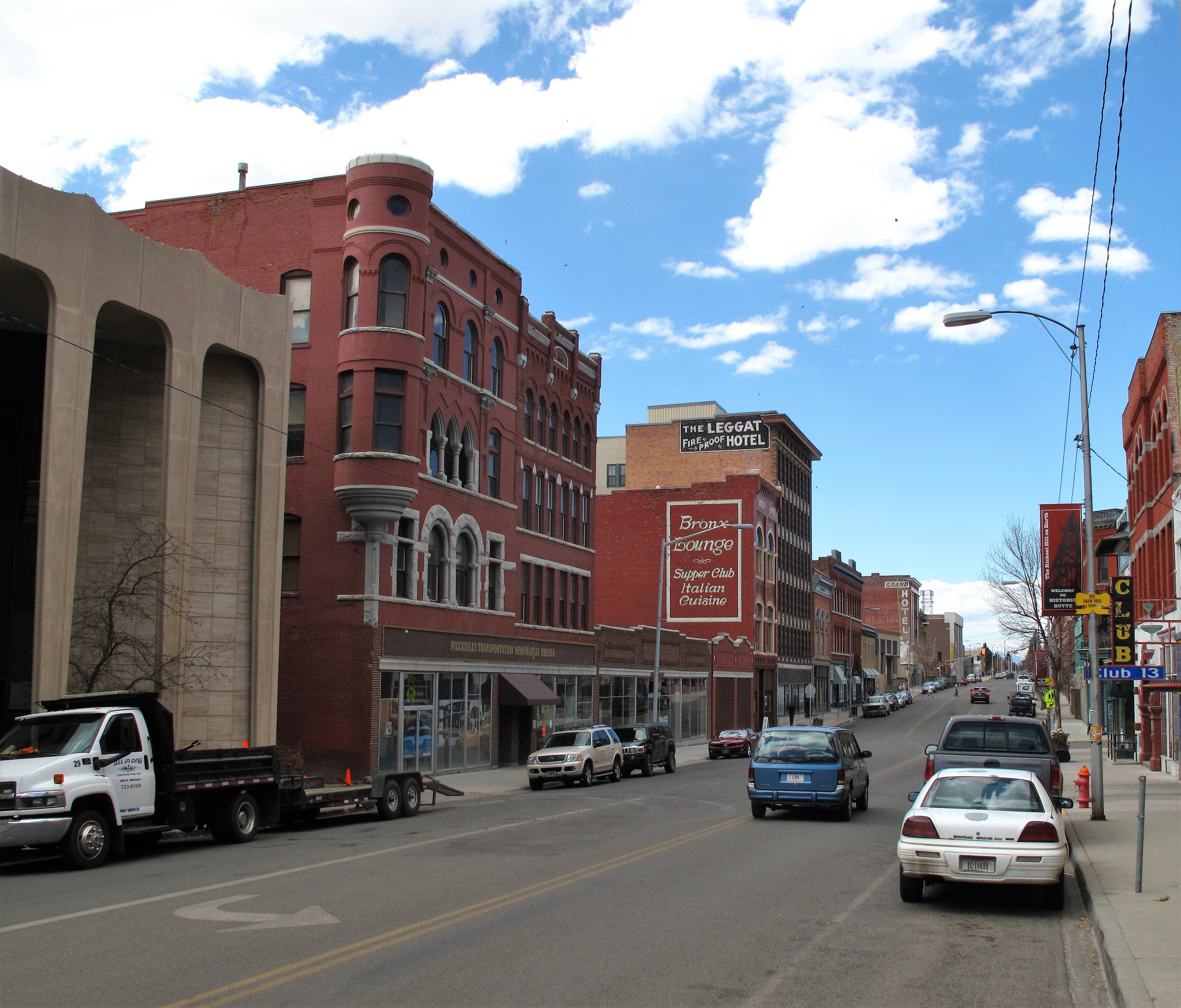
Since the city is centered at the top of a hill, the “downtown” area is uphill from the working-class neighborhoods below it. For this reason, Butte’s “downtown” is known paradoxically as “Uptown” Butte.
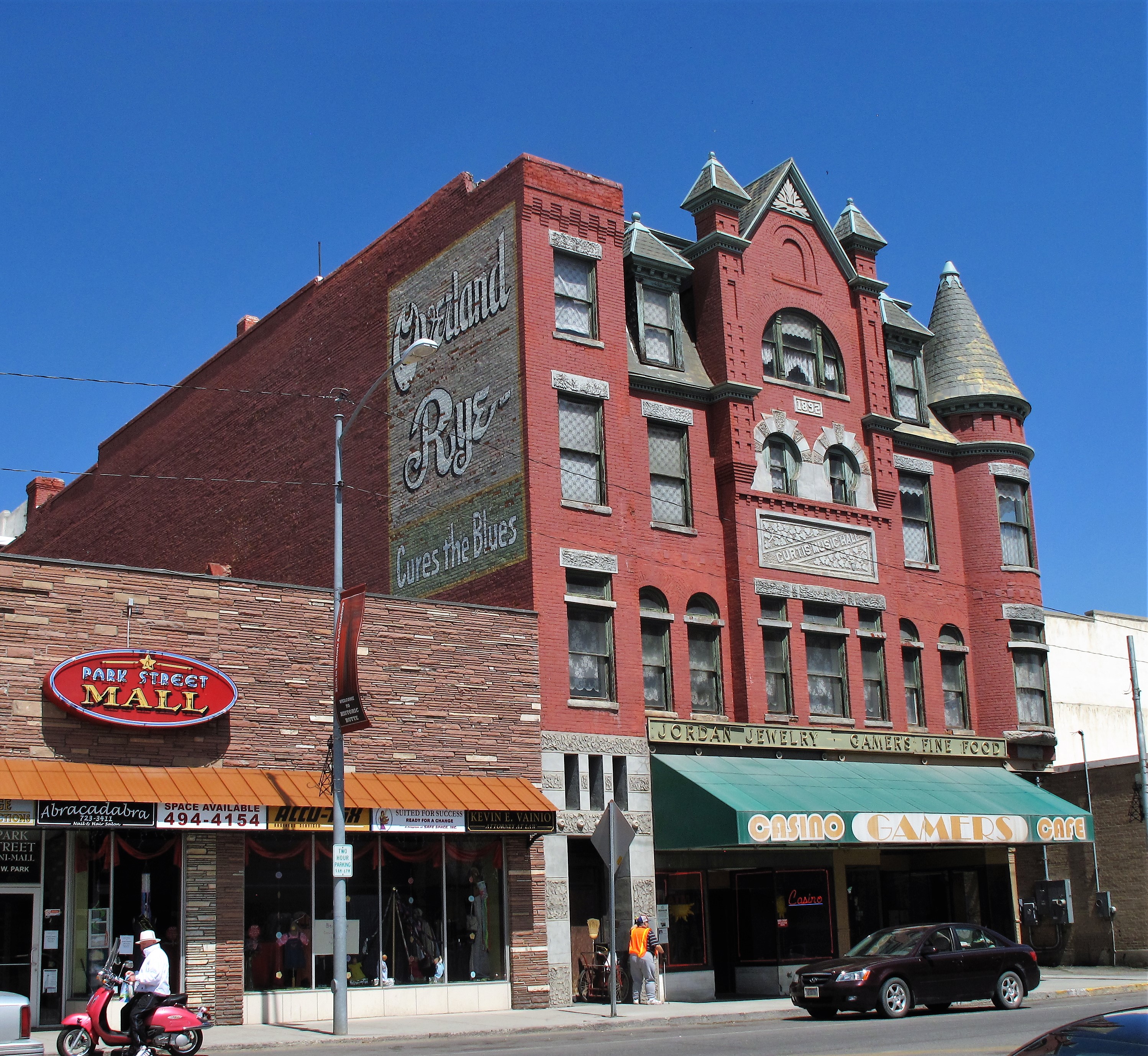
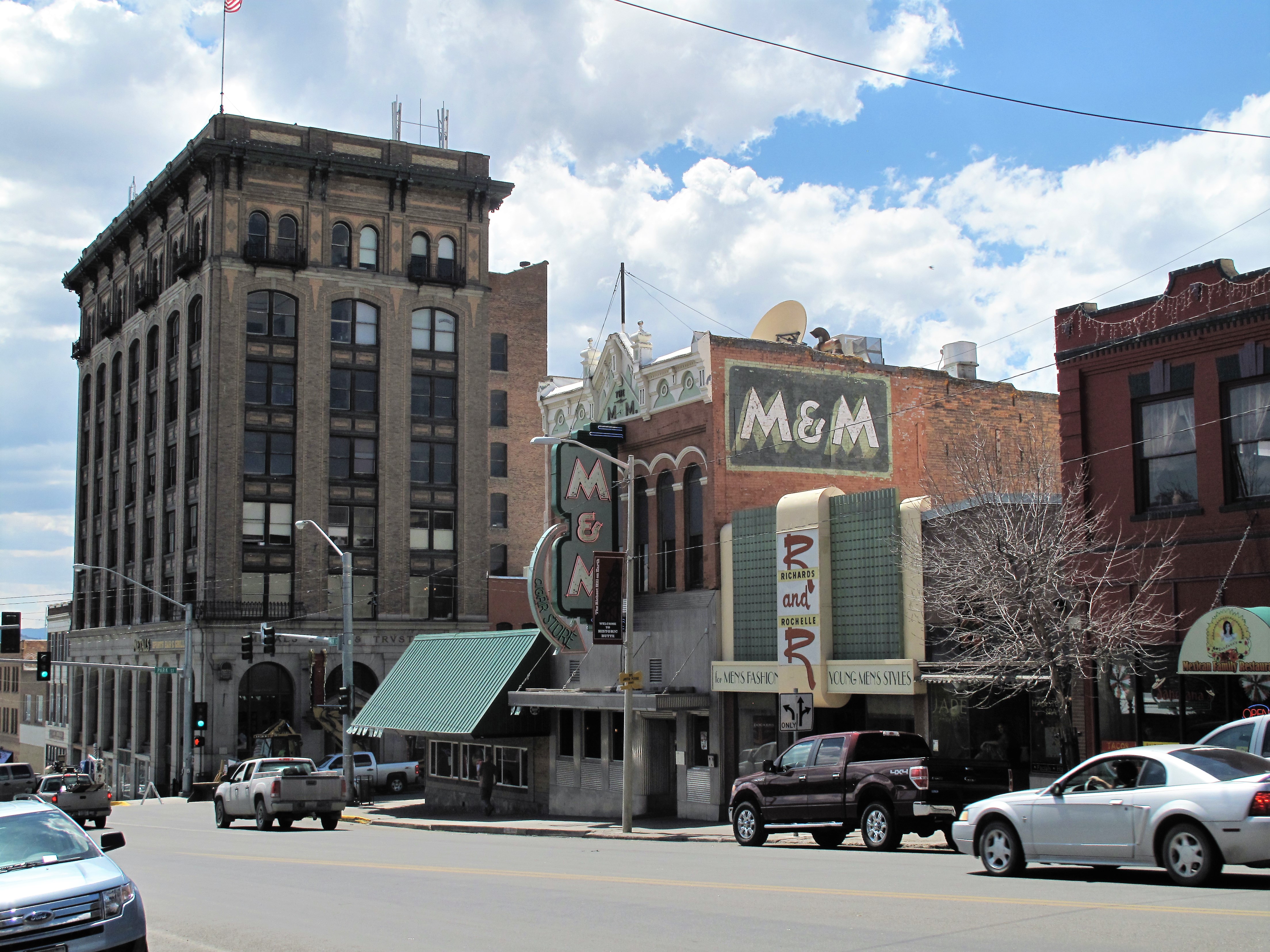
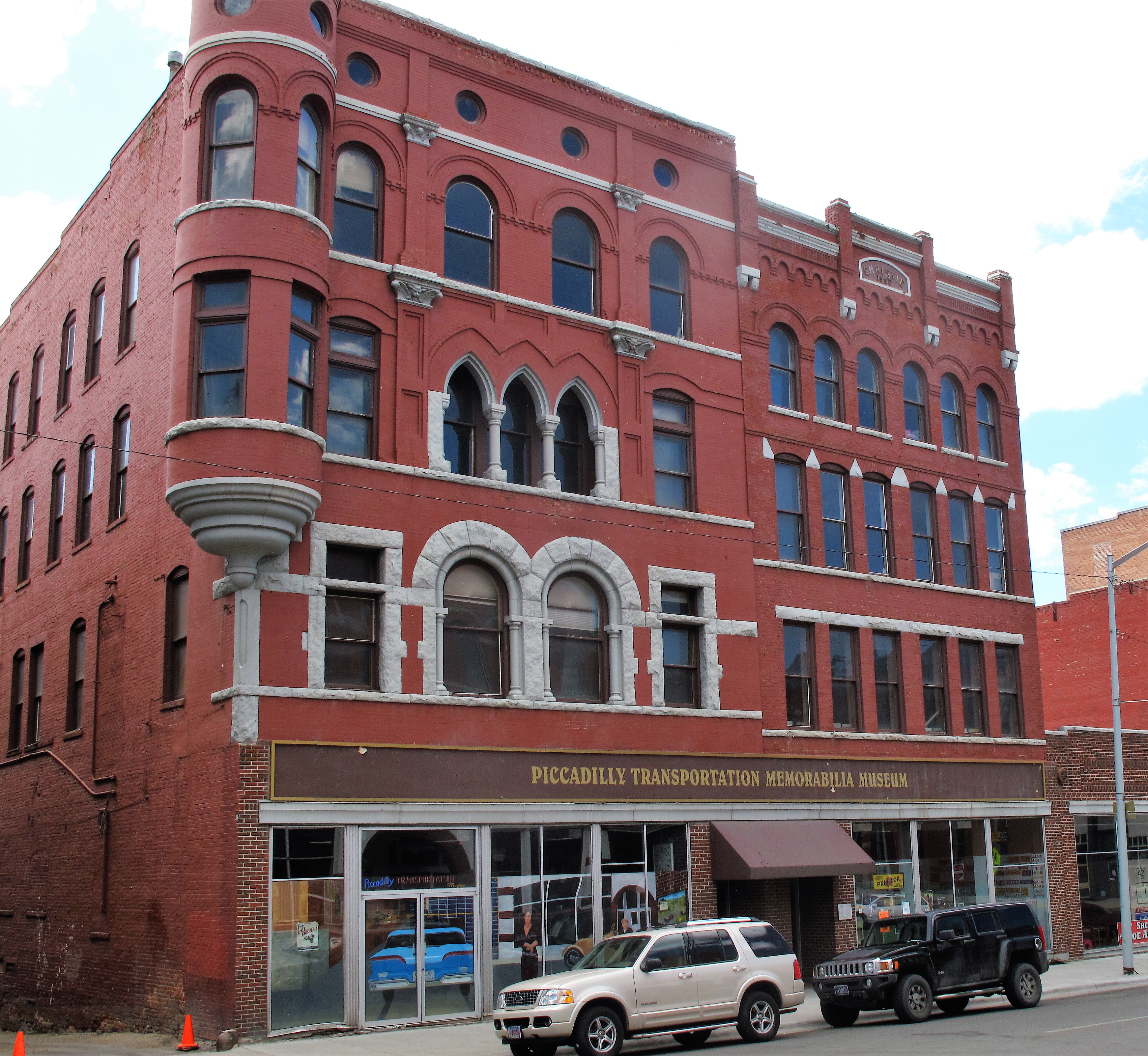
Typical streetscape in Uptown Butte, MontanaFormer Curtis Music Hall (theatre). Butte, MontanaThe old M&M Cigar Store and adjacent structures. Uptown Butte, MontanaPiccadilly Transportation Memorabilia Museum. Butte, Montana
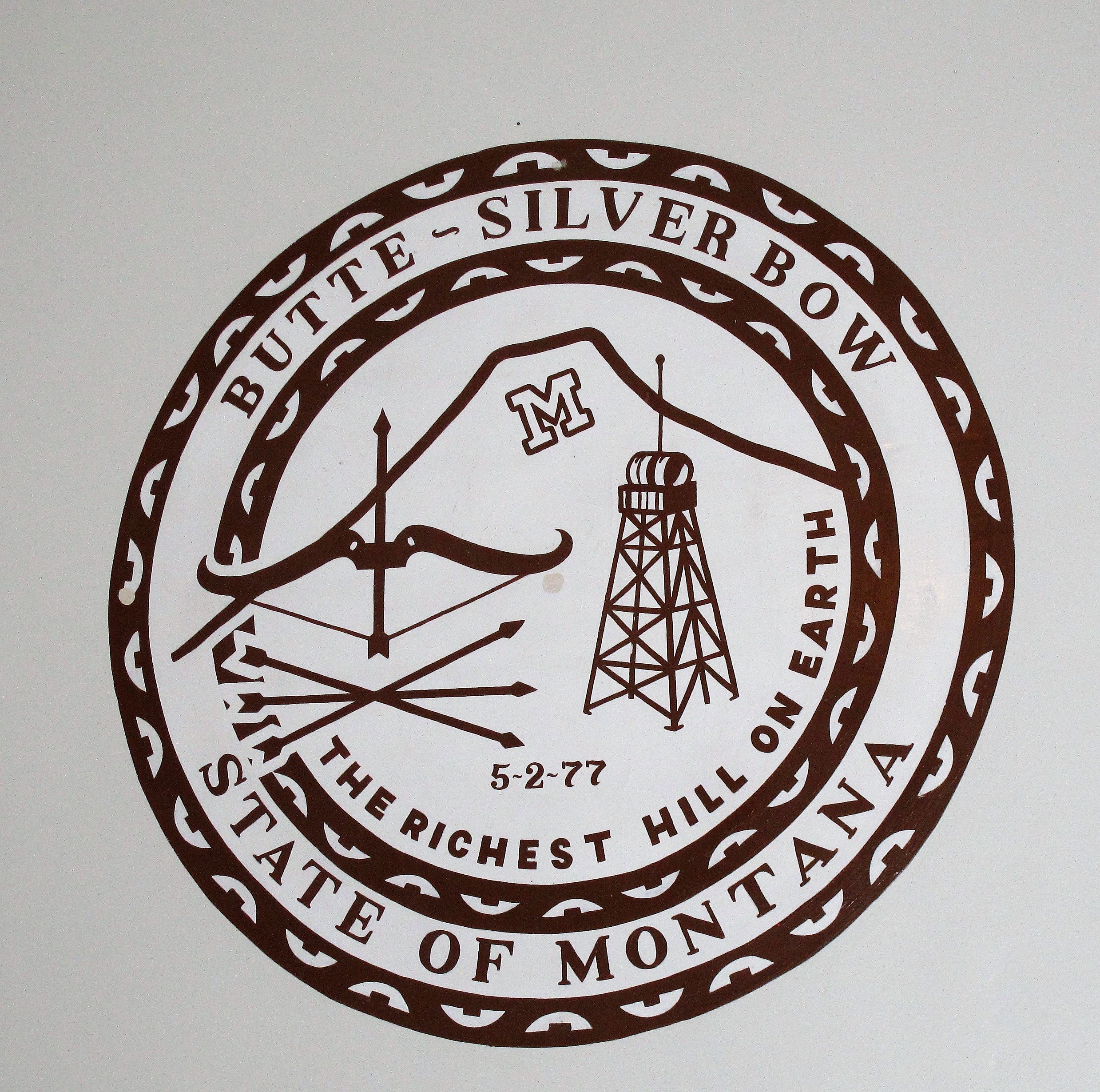
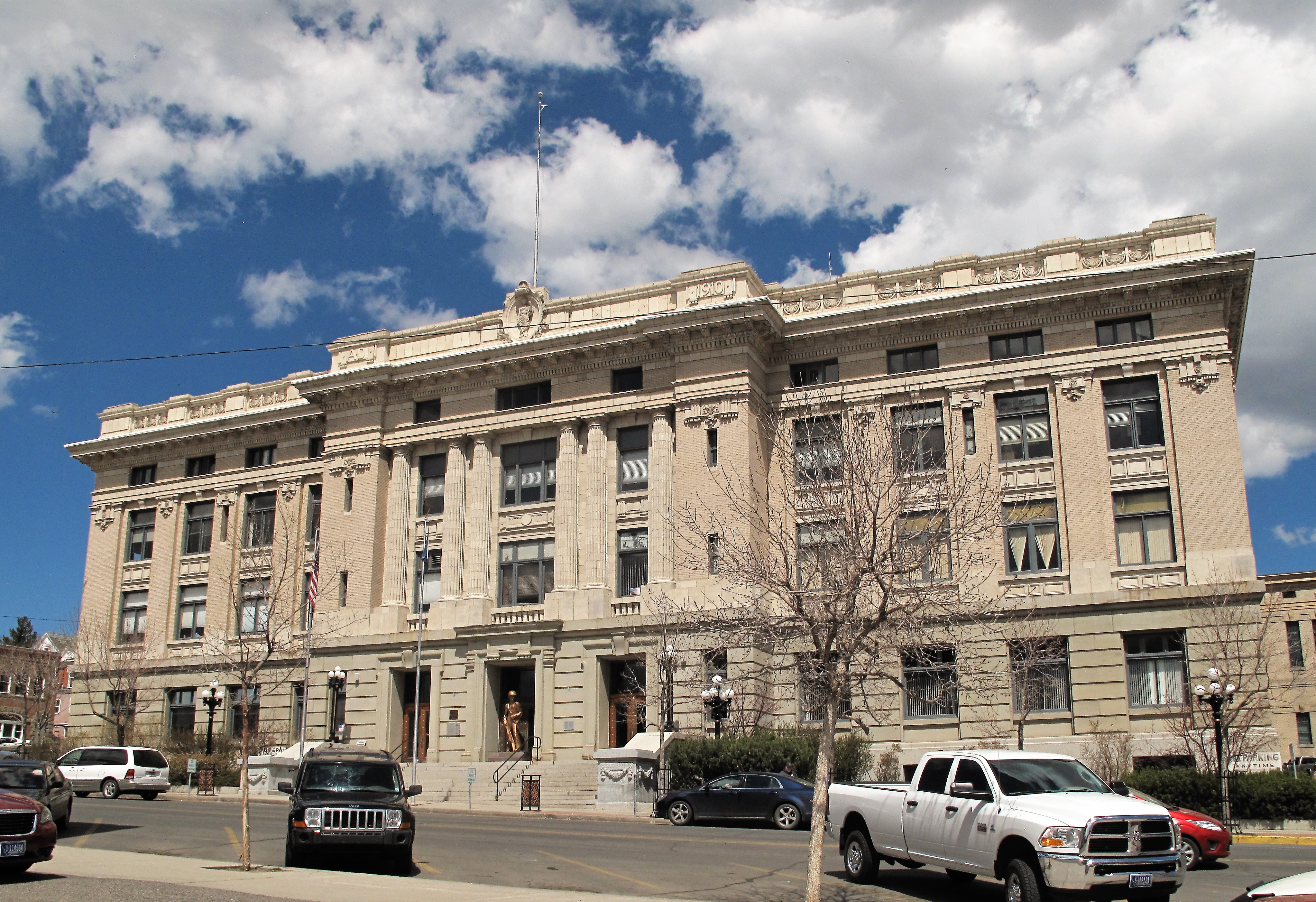
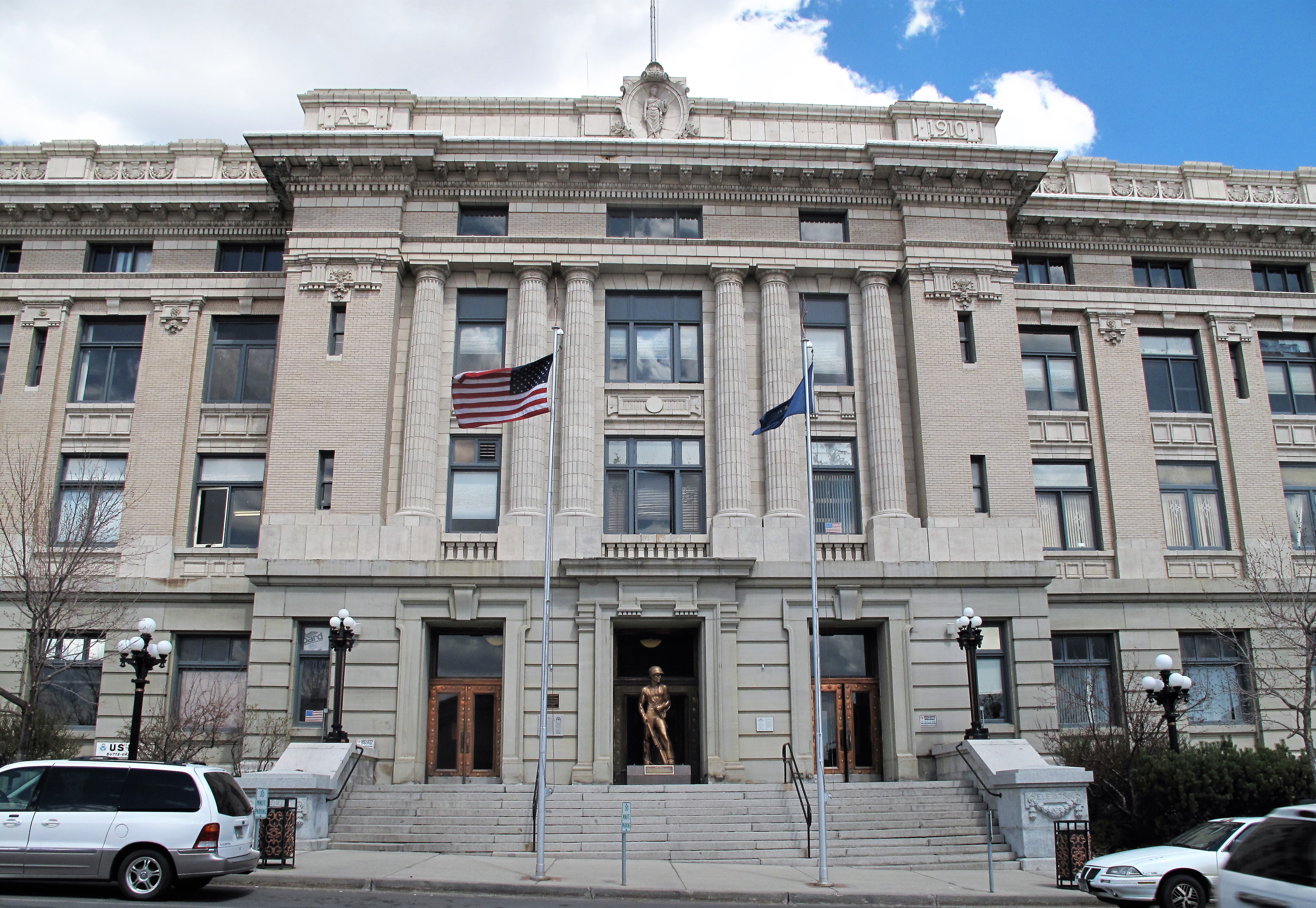
Butte is the county seat of Silver Bow County, Montana. The county courthouse here was erected between 1910 and 1912 at the height of Butte’s mining boom.
Silver Bow County Courthouse. Butte, Montana
The courthouse currently features a sculpture of a World War II “Jungle Fighter” at the front entrance.
Silver Bow County Courthouse with “Jungle Fighter” sculpture. Butte, Montana
Butte’s mines had amassed great wealth for the city by the time it came to build this courthouse. The city and county Fathers spent $750,000 here, an outrageously huge amount of money for 1910. (The ornate courthouse was used as National Guard barracks when mine labor violence provoked the imposition of martial law in 1917).
The interior of the courthouse is one of the most ornate in the United States featuring gold and copper inlays, marble floors, and mahogany doors.
Marble pillars and banisters, wall murals, and mahogany doors. Silver Bow County Courthouse. Butte, Montana
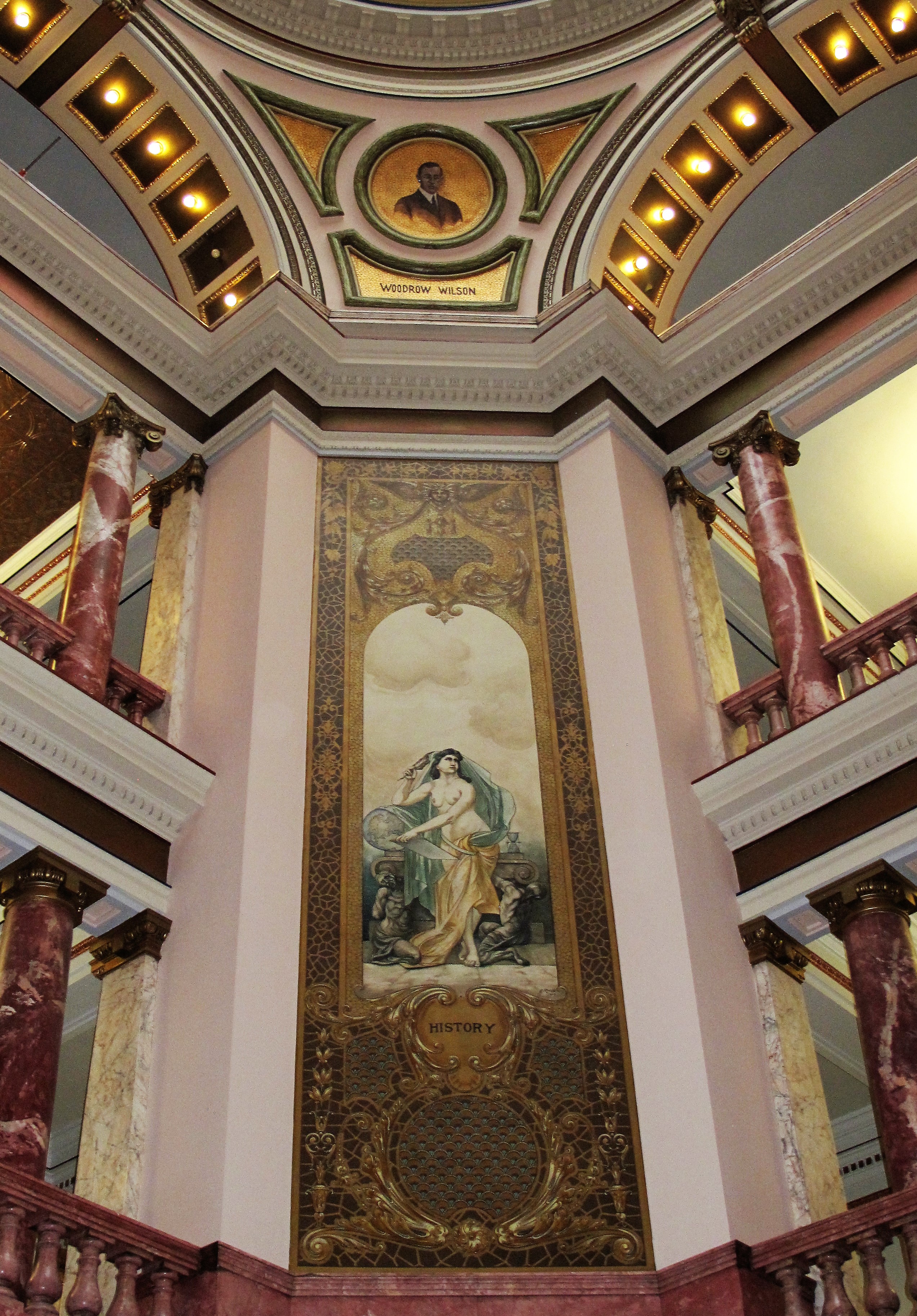
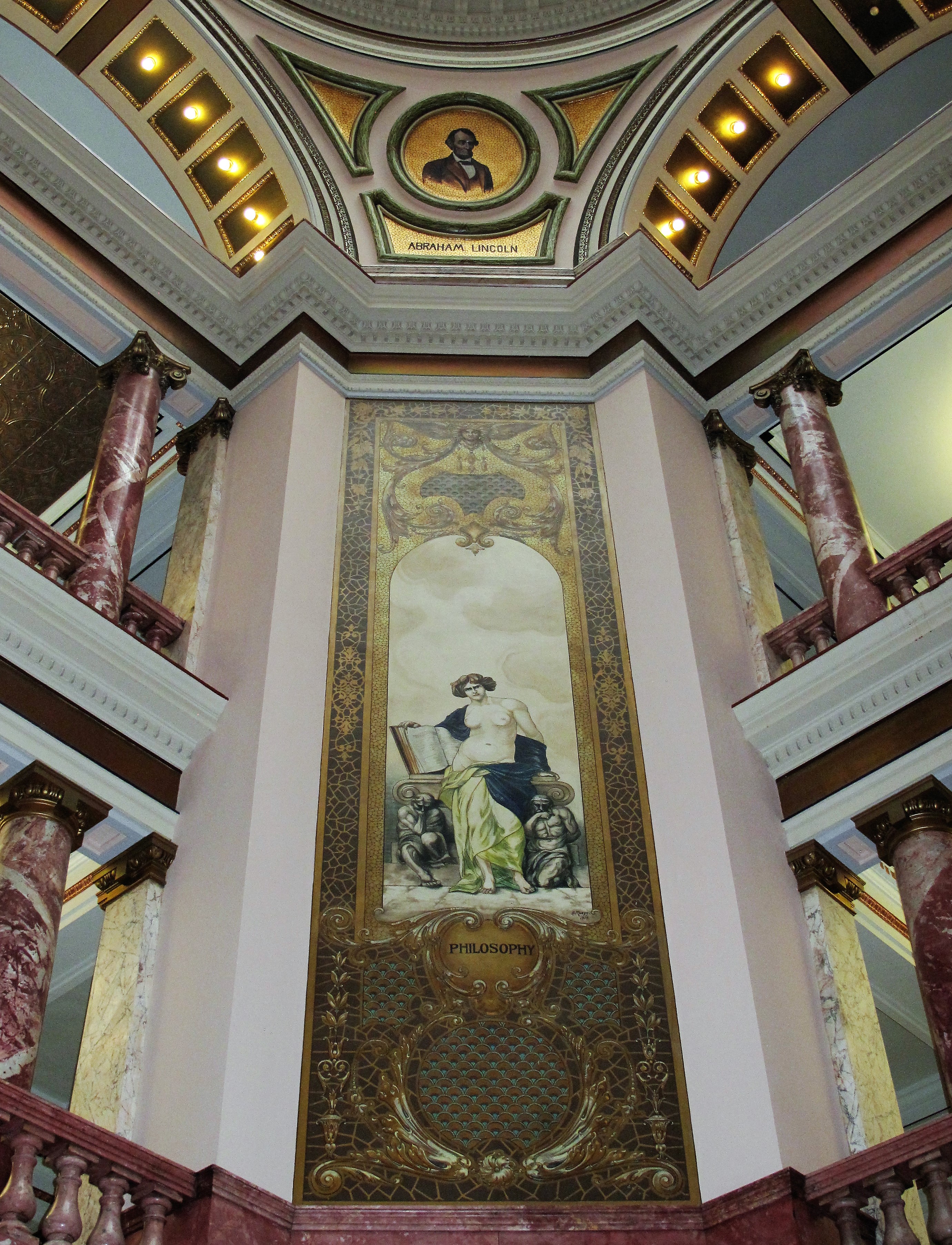
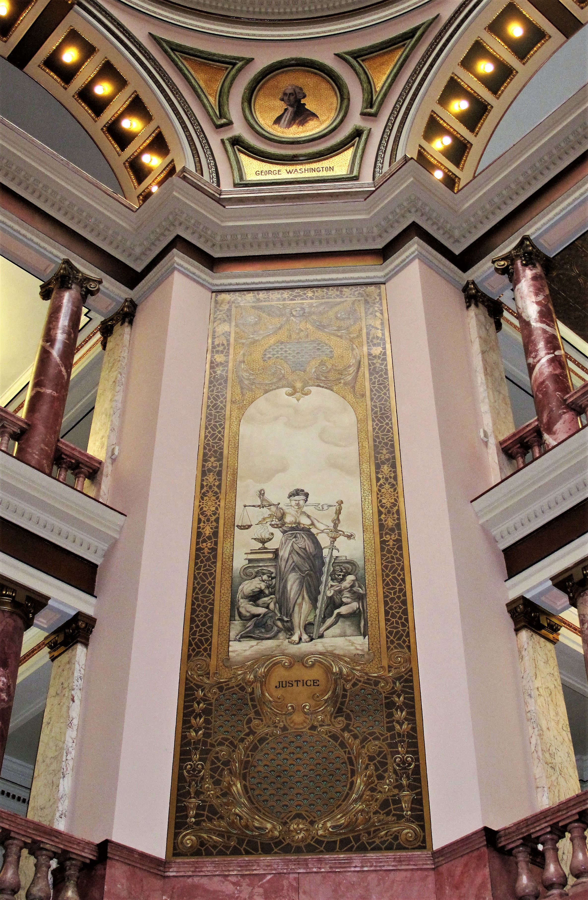
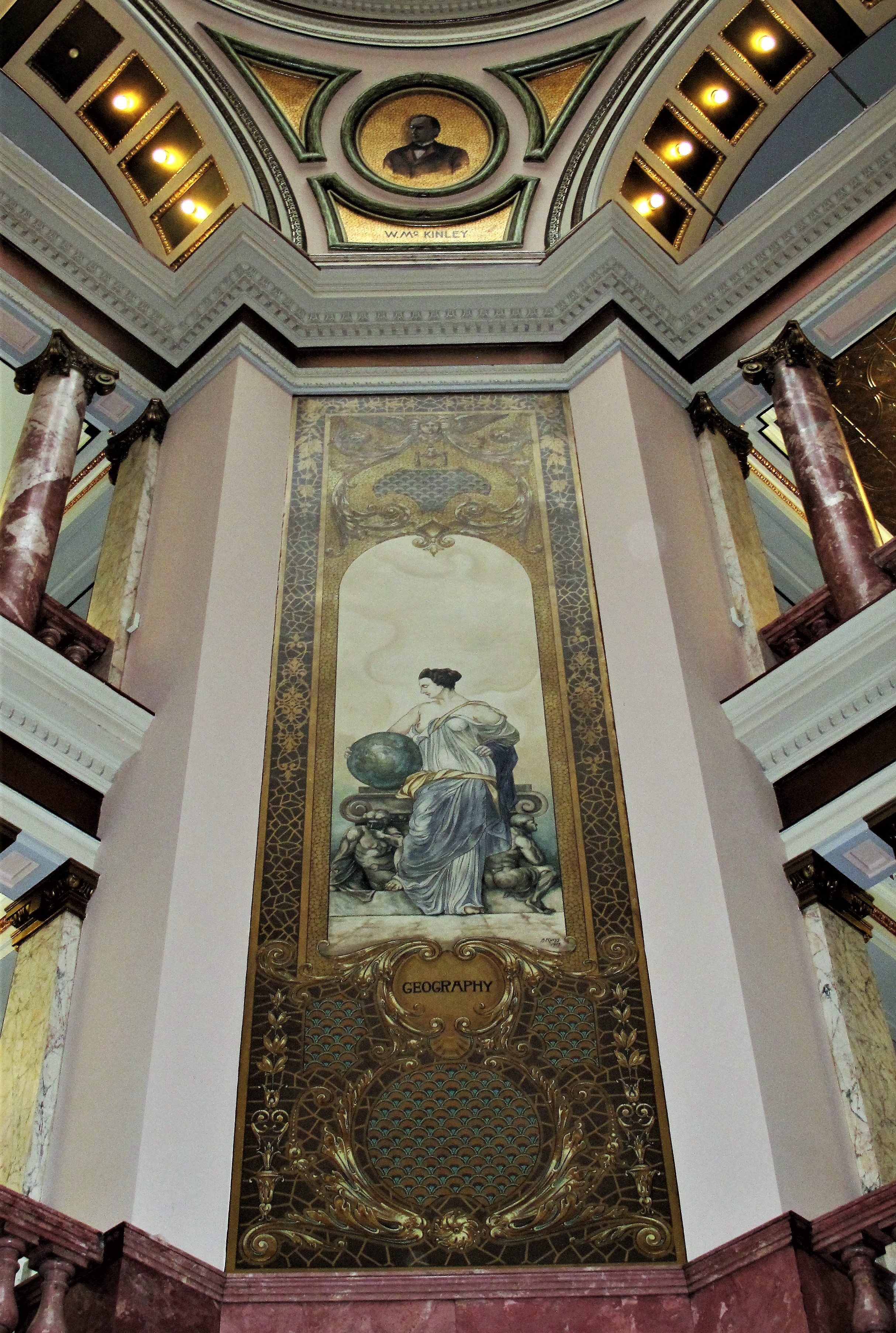
The second-floor walls facing the central atrium feature murals of four pillars of civilization: History, Philosophy, Justice, and Geography. Above these murals are paintings of four presidents (respectively): Woodrow Wilson, Abraham Lincoln, George Washington, and William McKinley. Below are photos of the murals and paintings:
Mural of History with Woodrow Wilson above it. Silver Bow County CourthouseMural of Philosophy with Abraham Lincoln above it. Silver Bow County CourthouseMural of Justice with George Washington above it. Silver Bow County CourthouseMural of Geography with William McKinley above it. Silver Bow County Courthouse.
Oddly, Wilson was included on these walls when the building was completed in 1912, the same year of his election. Also, I find it odd that Jefferson was left out considering that much of the state of Montana was included as part of the Louisiana Purchase.
Silver Bow County in the state of Montana
Here’s a view of Butte from a nearby highway overlook, and then a historical sign explaining the town’s development.
Butte, Montana from a highway overlook with mountains in the distanceButte, Montana historical sign
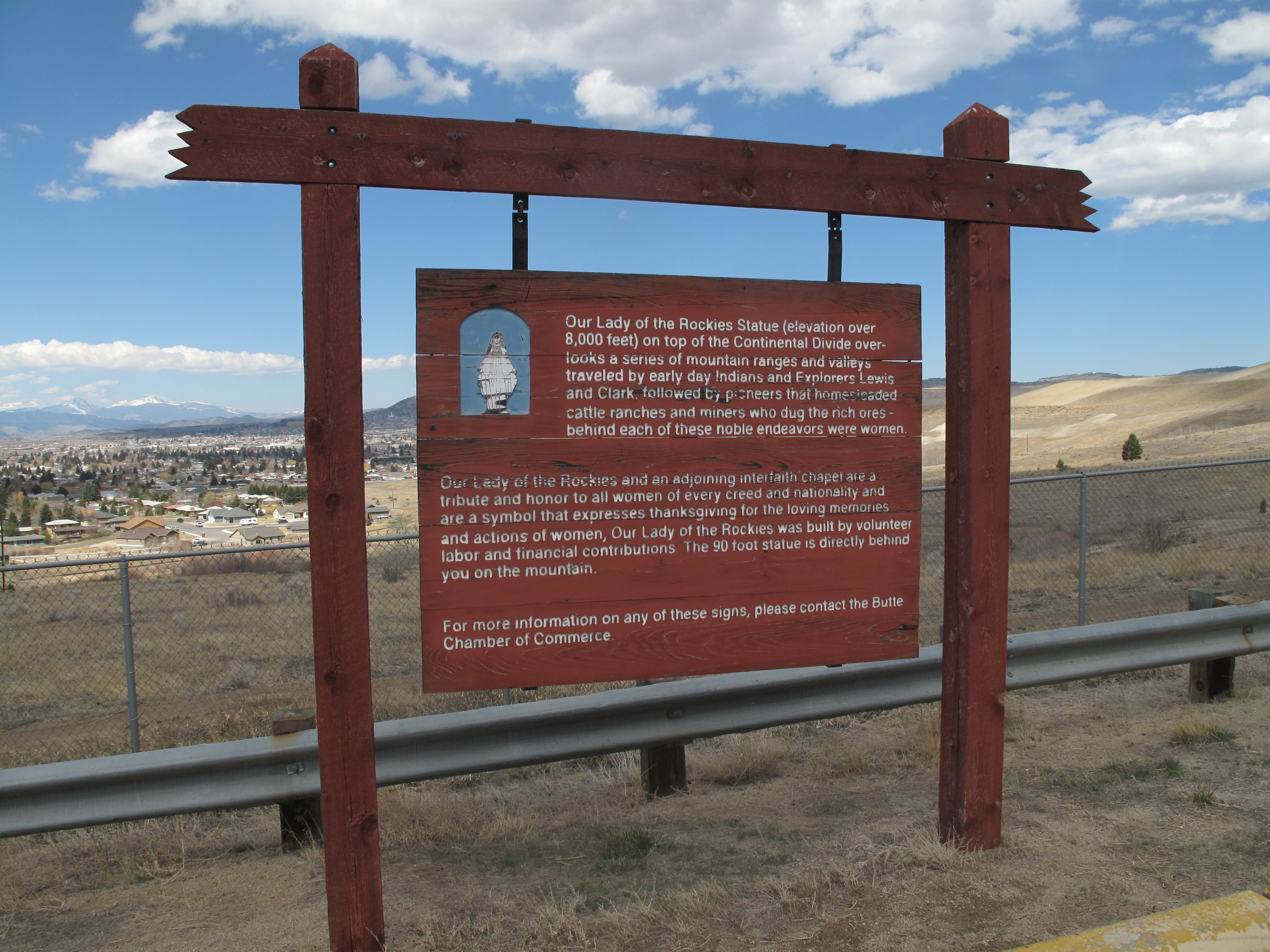
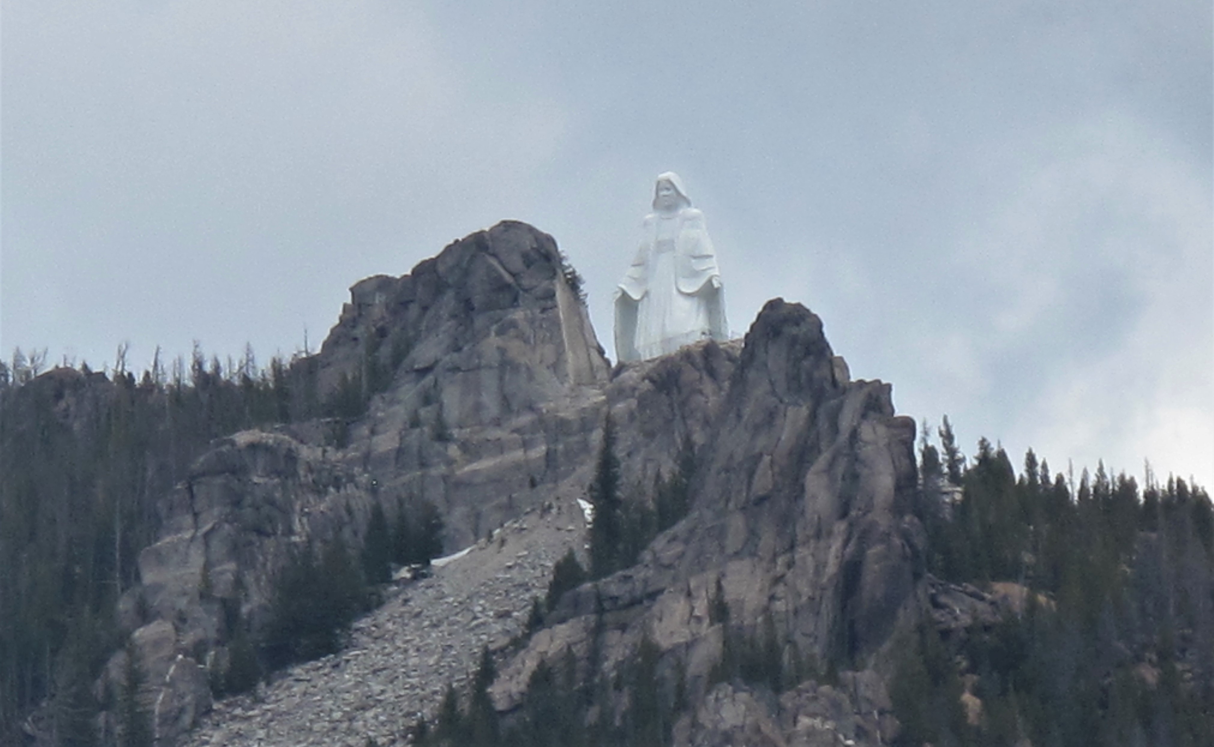
Finally, one last historical sign and one last statue:
I travel as a hobby and not for a living (yet) — but donations are happily accepted if you’d like to help defer my costs. Thanks, The TimMan
Donations to TimManBlog
Use this form to make donations to support this site. Paypal, Visa, Mastercard, Amex, and Discover cards are accepted. Donations can be made in increments of $5.00; increase the number of units to increase the donation amount.