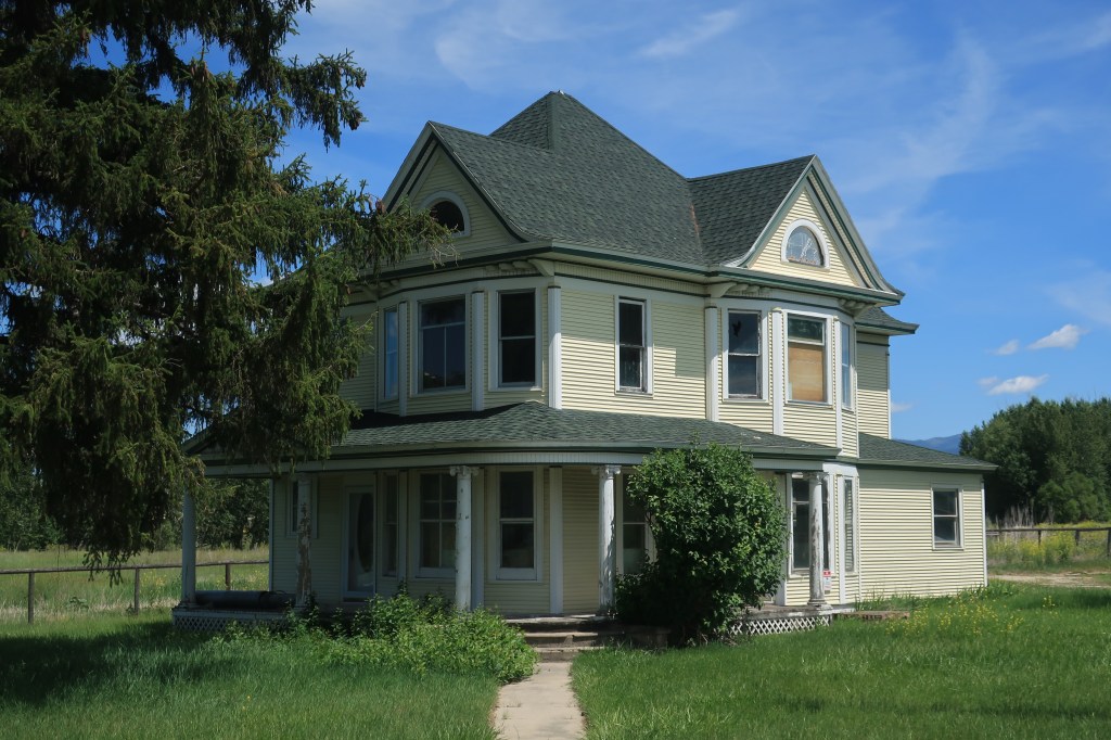
Nestled in a shallow mountain valley along the upper Allegheny River, Warren looks like many other central Pennsylvania small towns. Its population stands at 10,000 or so, and the streets here are lined with tall deciduous trees. Often shaded behind those trees are old Victorian homes dating back to Warren’s oil and timber boomtime in the late 1800s. But prosperity has come back to town, as you’ll see below.
In the fall it’s absolutely beautiful here. A stroll down 5th Avenue in Warren isn’t at all like a stroll down 5th Avenue in Manhattan or even in Pittsburgh, but it’s striking in its own way. I used this photo as my PC desktop background for a while.
5th Avenue in Warren, Pennsylvania
Imagine sitting on the front porch of this fine home, enjoying a coffee or a whiskey depending on the time of year.
Classic brick home with an American flag in Warren, Pennsylvania
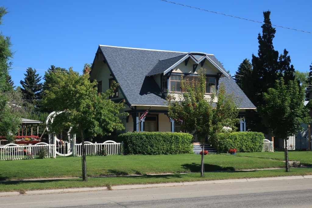
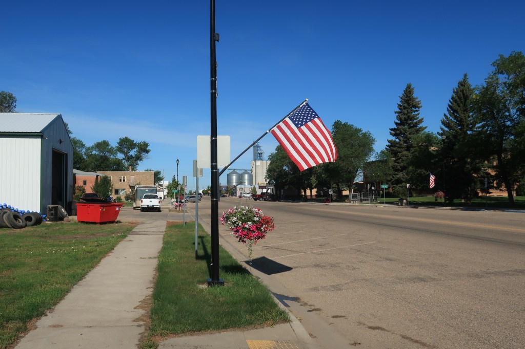
Just one more home please. 5th Avenue in Warren runs along the base of a mountain, as seen off to the right in this photo.
Victorian home with classic front porch and the American flag. Warren, Pennsylvania
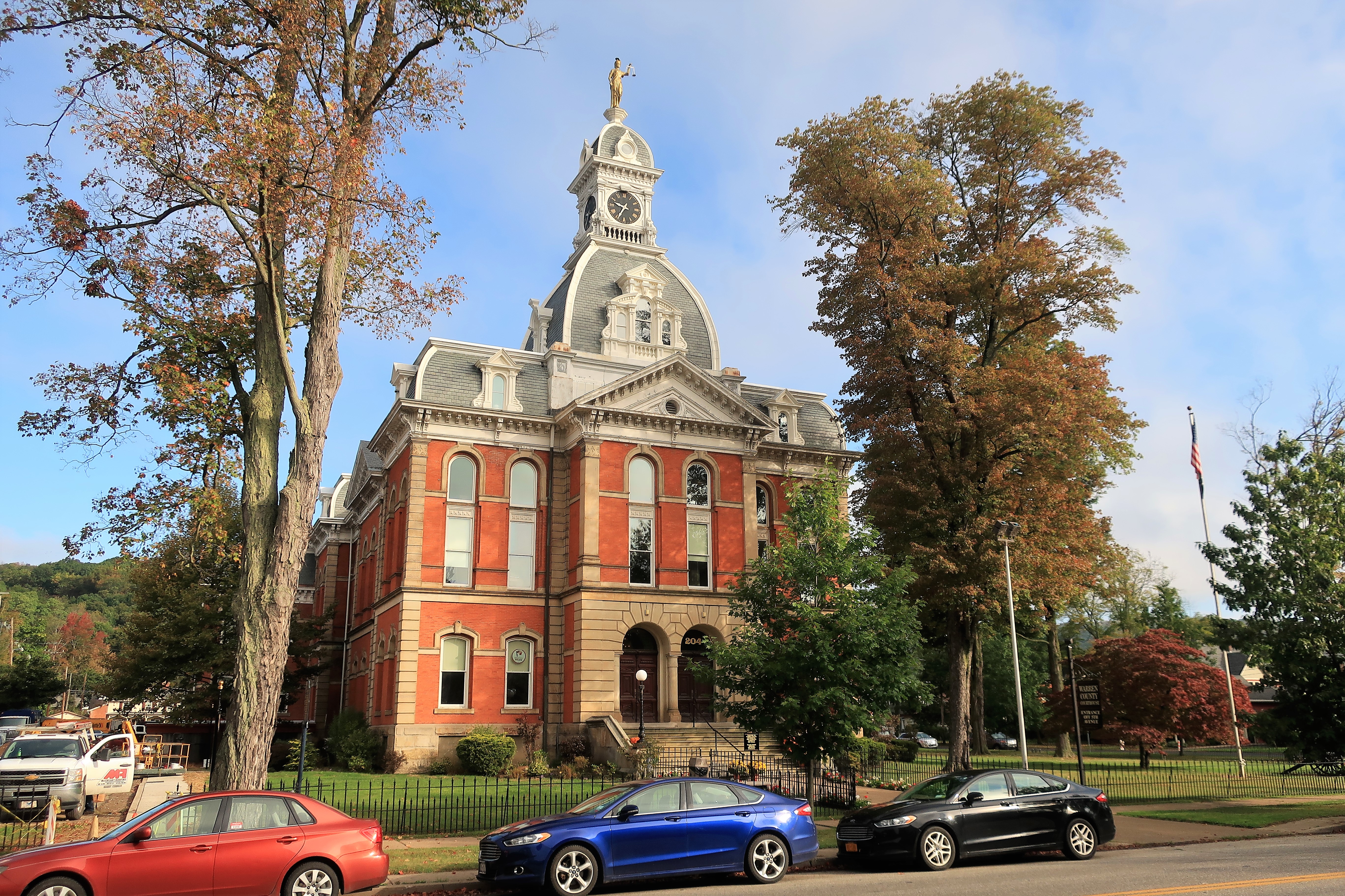
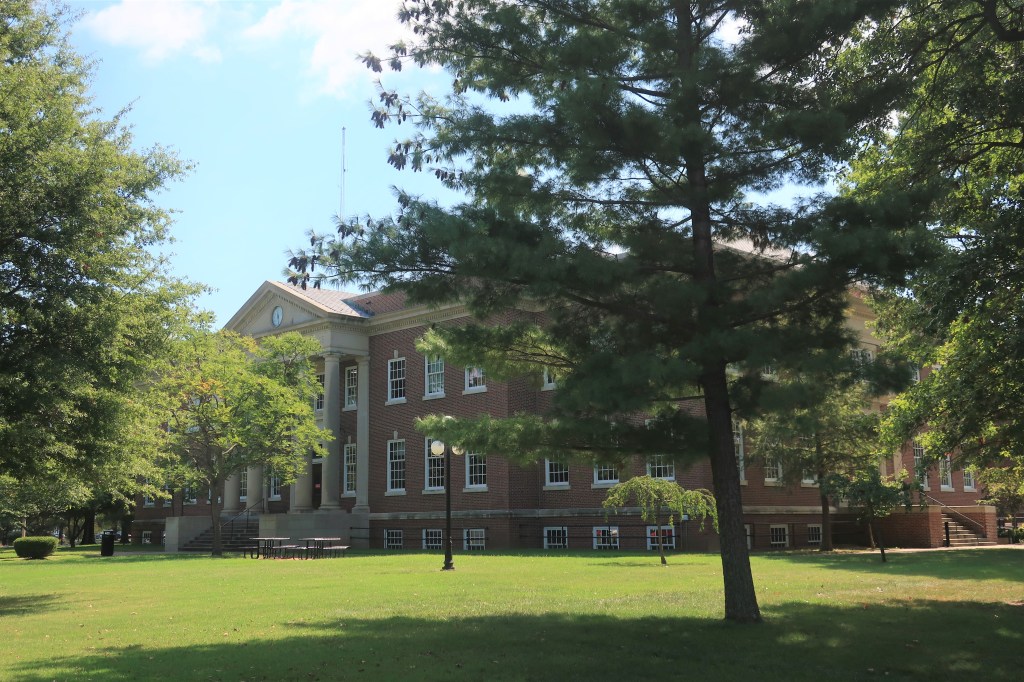
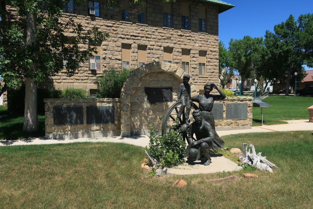
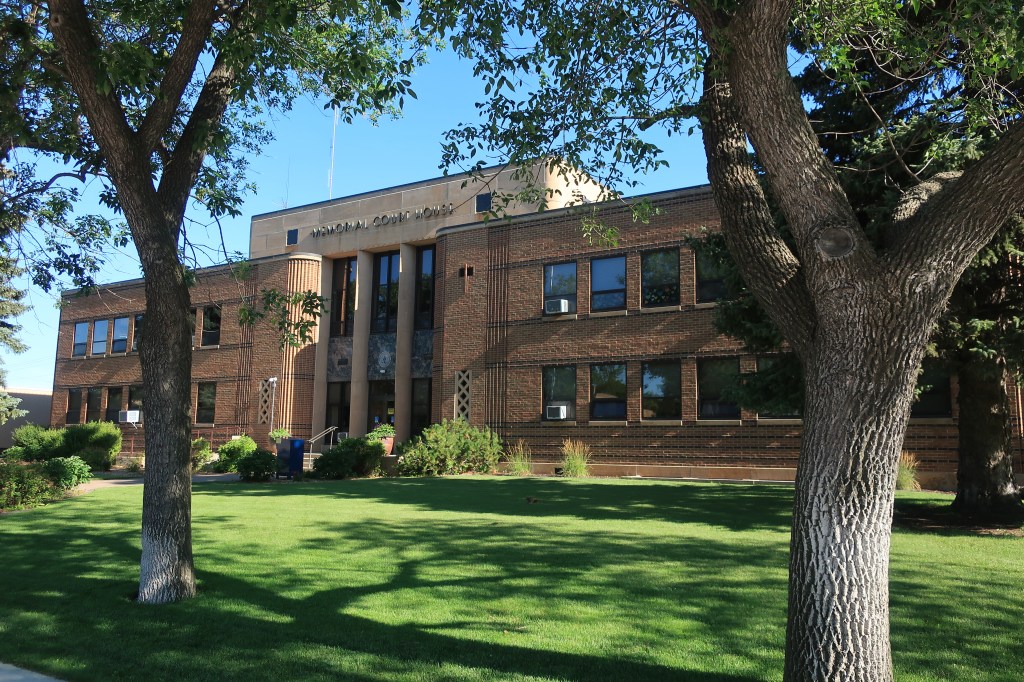
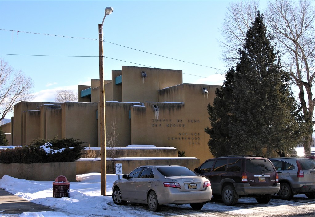
The Warren County Courthouse is just down the street.
Warren County Courthouse. Warren, Pennsylvania
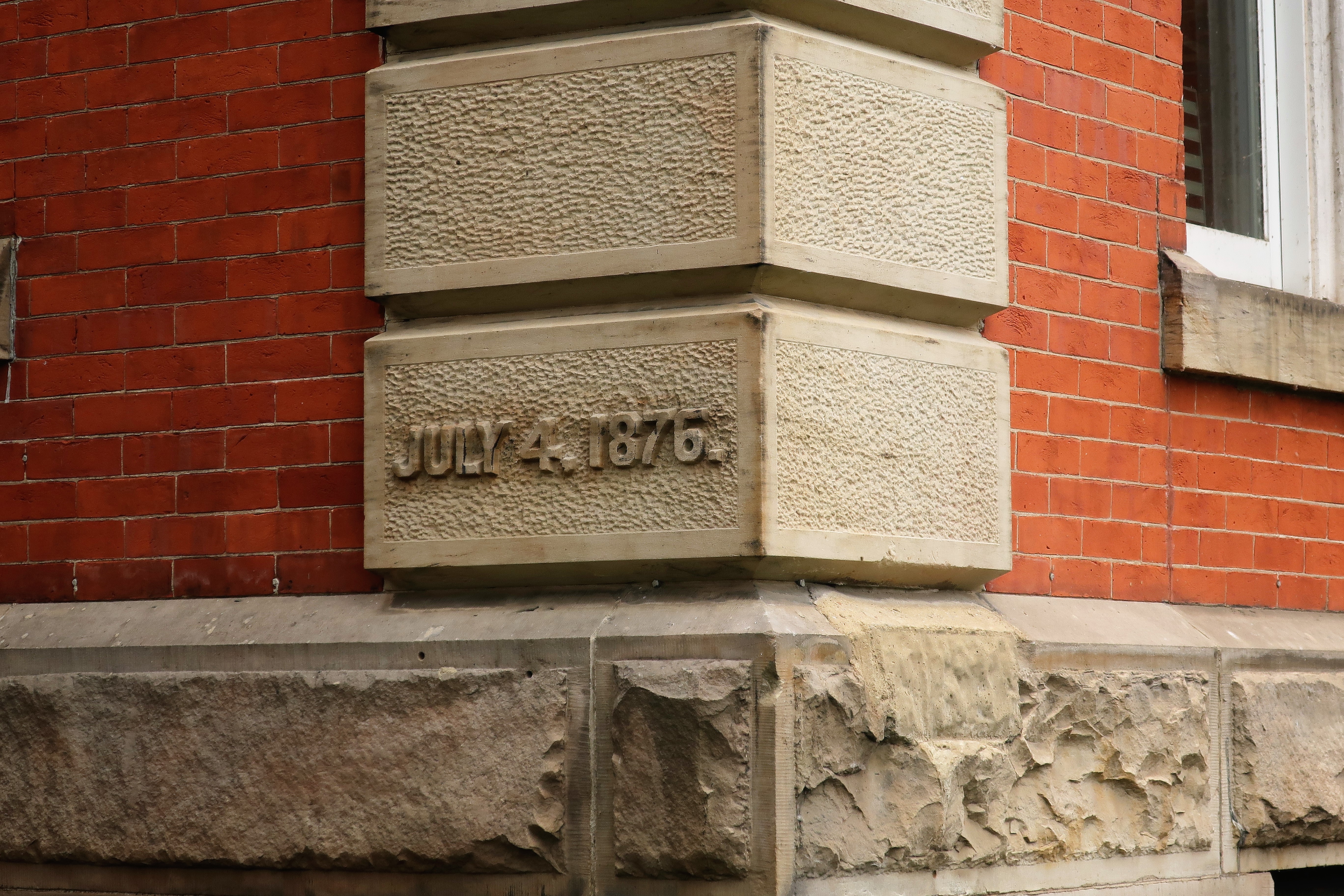
Built in 1876, the cornerstone says July 4, 1876, or the day of America’s first Centennial celebration.
The Warren County Courthouse cornerstone
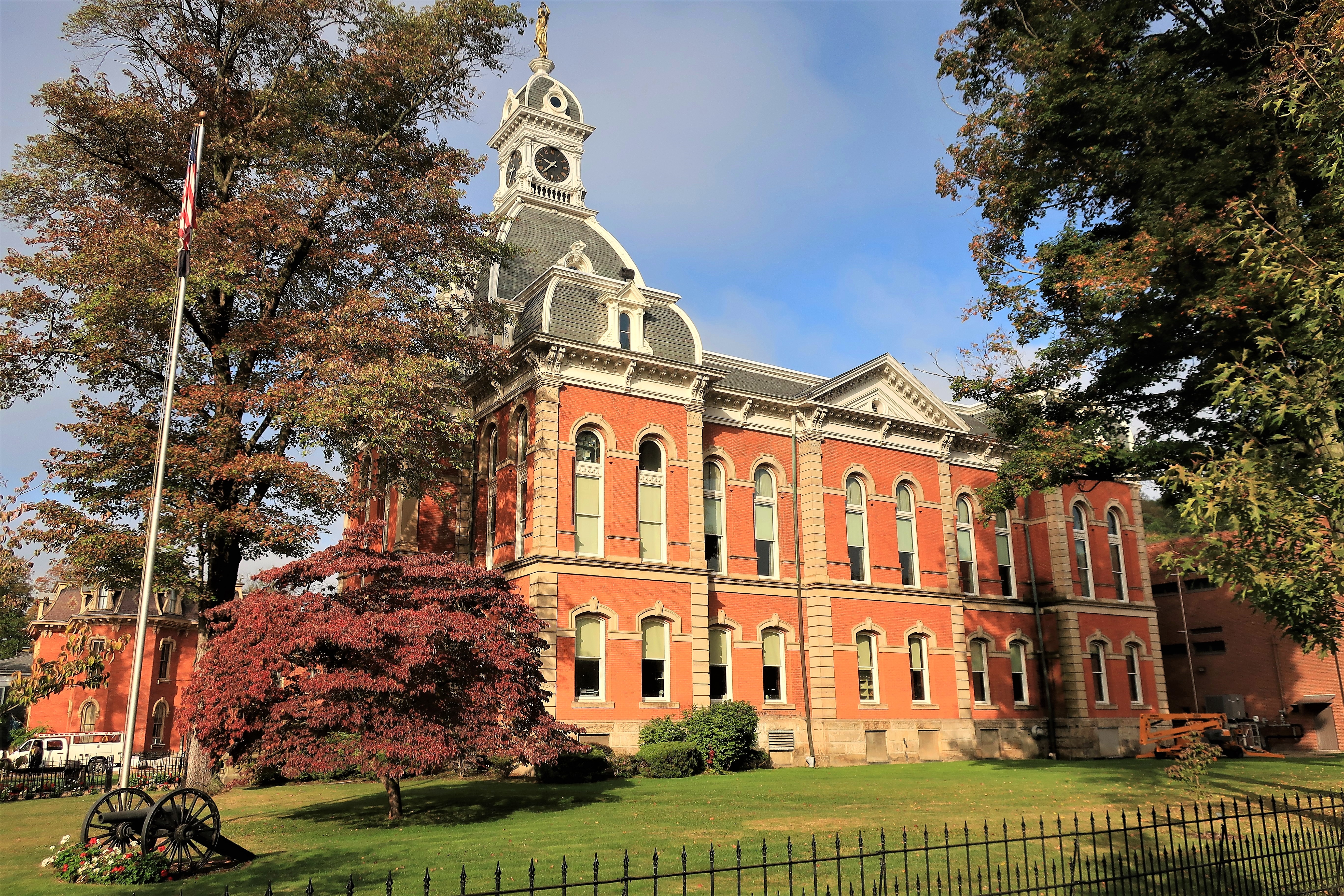
Renovated in 1999, the courthouse was originally topped by a steel statue of Lady Justice, which has since been replaced with a fiberglass version. The original statue currently sits in a first-floor display case. According to the historical notes, the replacement to a fiberglass version was undertaken since fiberglass is better able to withstand lightning strikes, other weather, and gunshots. Gunshots? Yes, the notes mentioned that when taken down in 1999 the old Lady was found bearing bullet marks. What happened? Were bored residents using her as target practice from their front porches on quiet evenings? It doesn’t say.
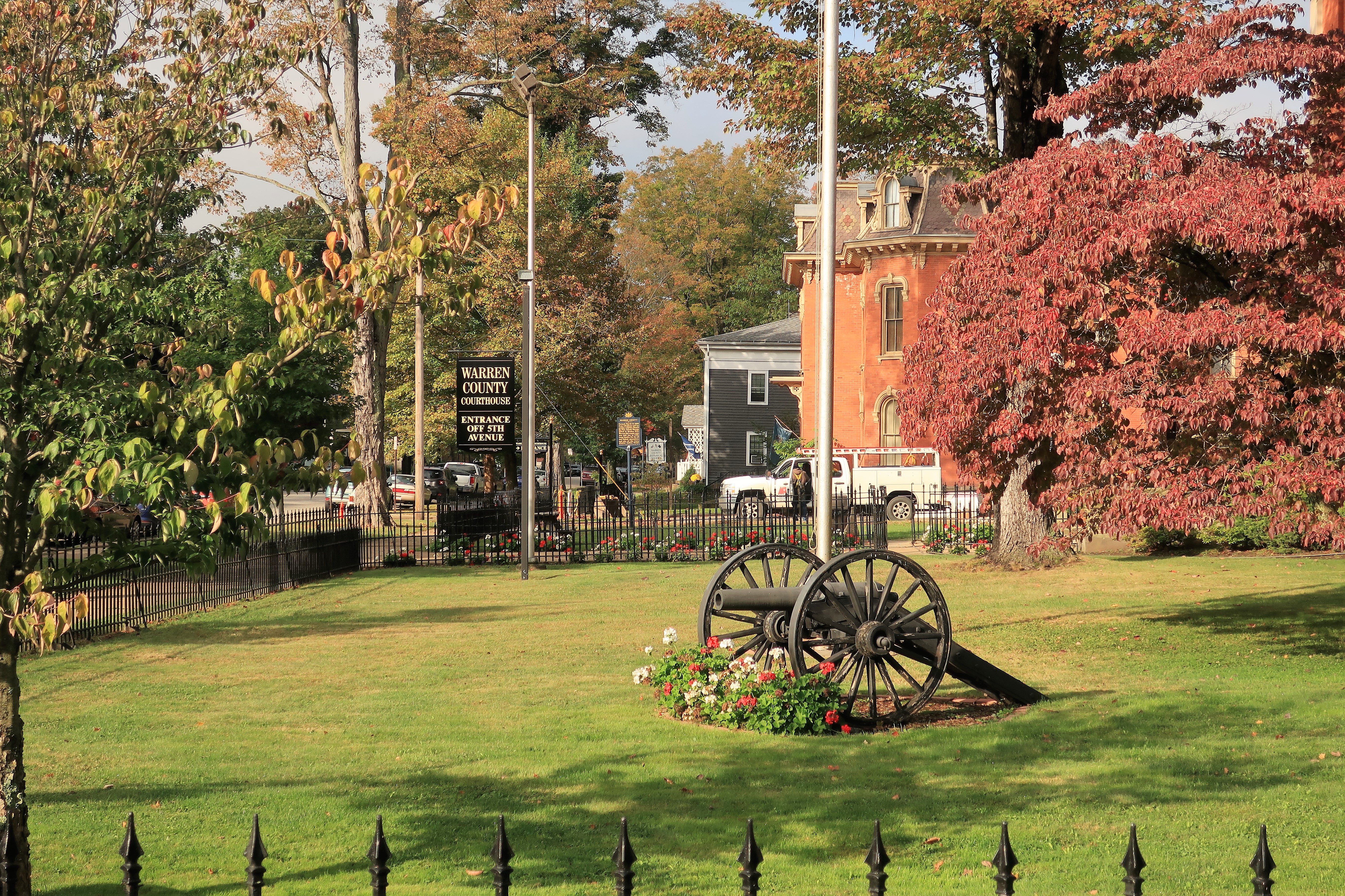
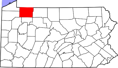
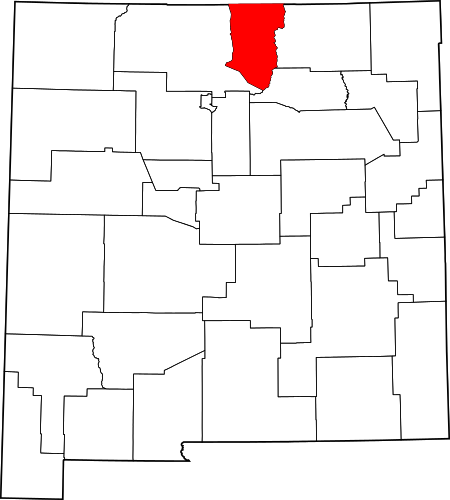
Warren County CourthouseWarren County Courthouse front lawn and Civil War cannonWarren County in the state of Pennsylvania
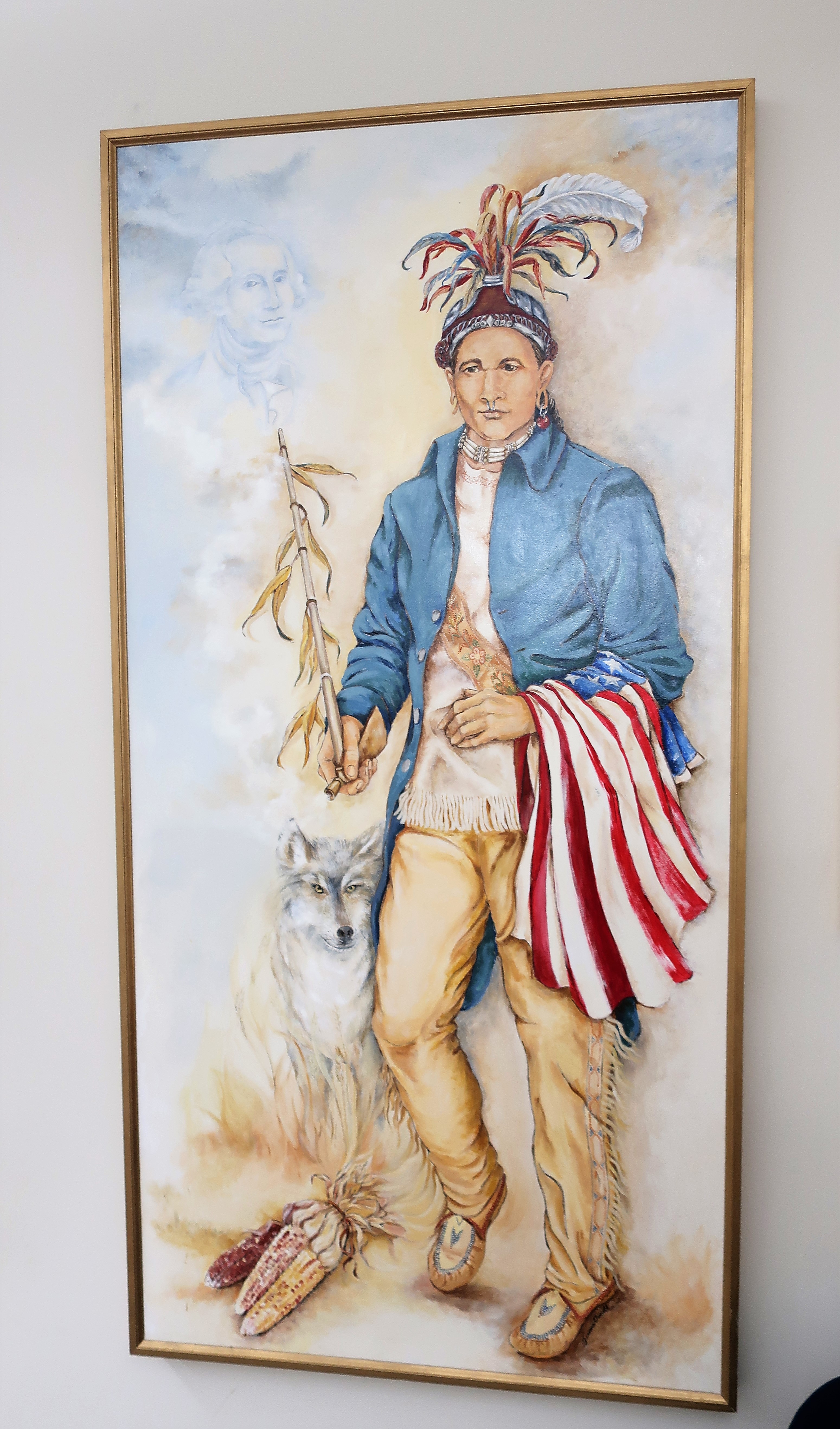
The history of this part of north-central Pennsylvania includes conflicts with Seneca and other Iroquois tribes. One war chief named Cornplanter, son of a Dutch trader and a Seneca woman, led negotiations with the new United States after the end of the Revolutionary War. Wikipedia has an entry on Cornplanter here. On his painting, found displayed prominently inside the courthouse, Cornplanter is shown with an American flag draped over his left arm with the shadow of George Washington over his right shoulder,
Dutch-Seneca Chief Cornplanter
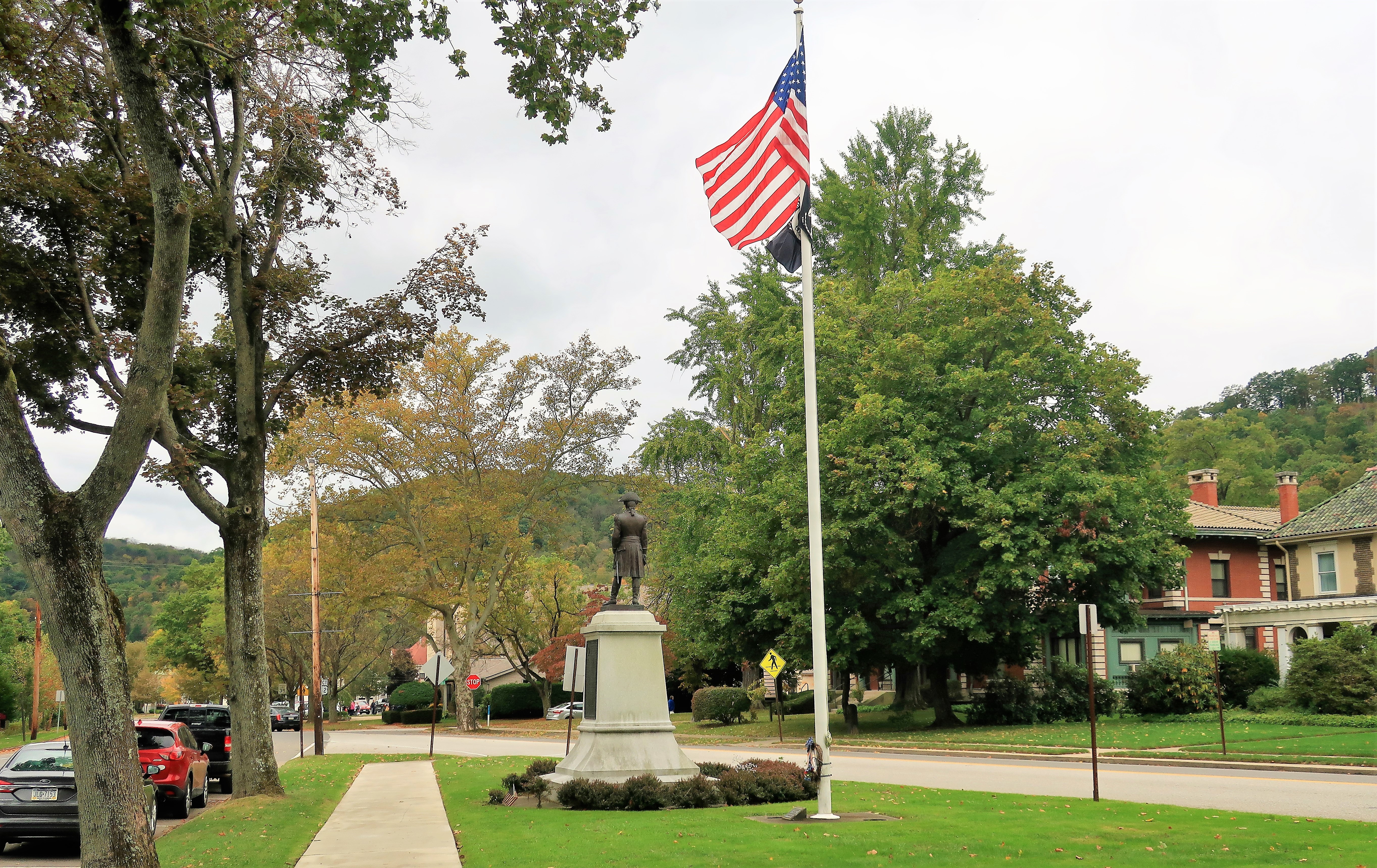
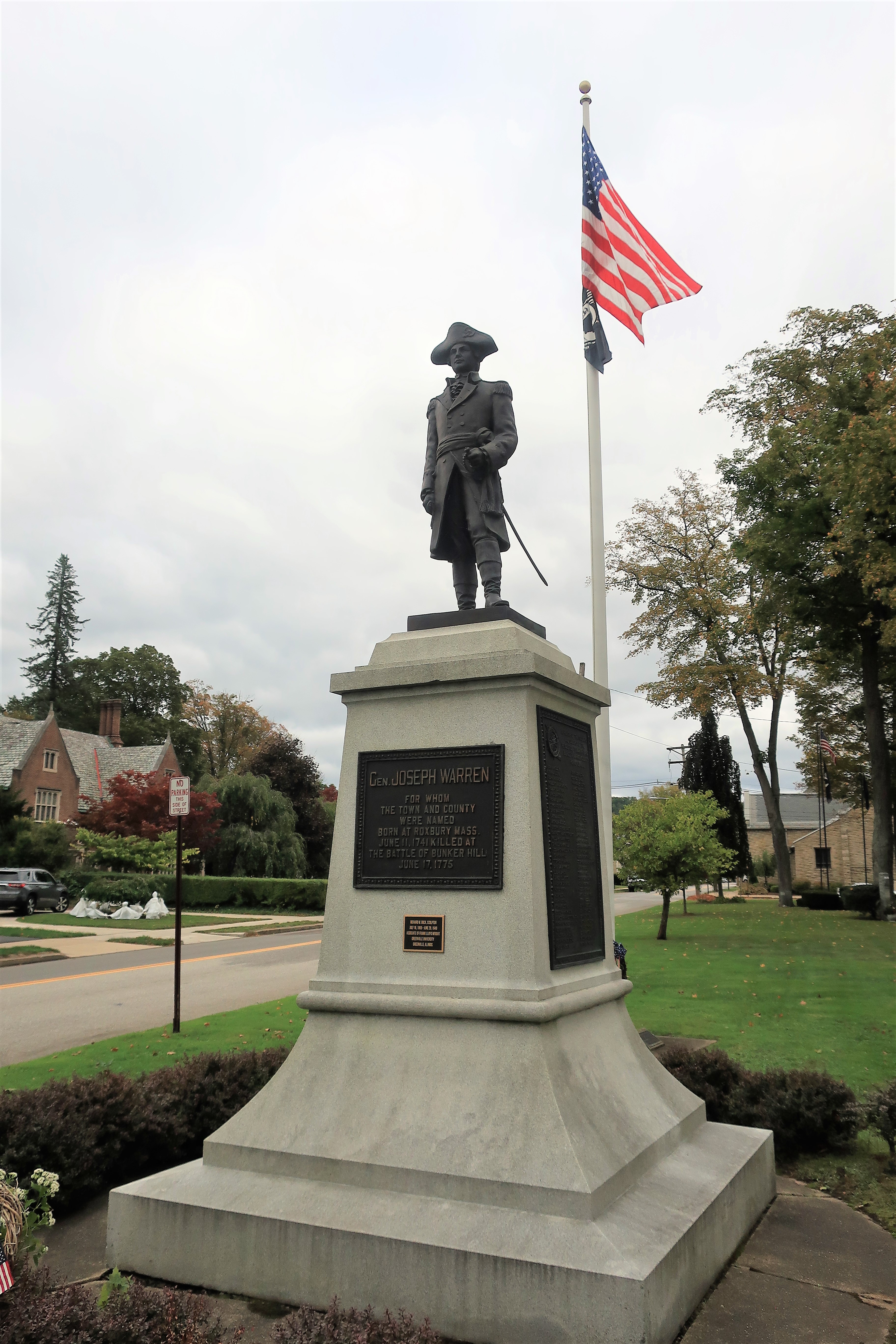
Warren was named for Revolutionary War hero General Joseph Warren, who died at the Battle of Bunker Hill. The town honors him with a statue in the park, below the tree-lined ridge at the north end of town.
Statue of Joseph Warren in Warren, PA
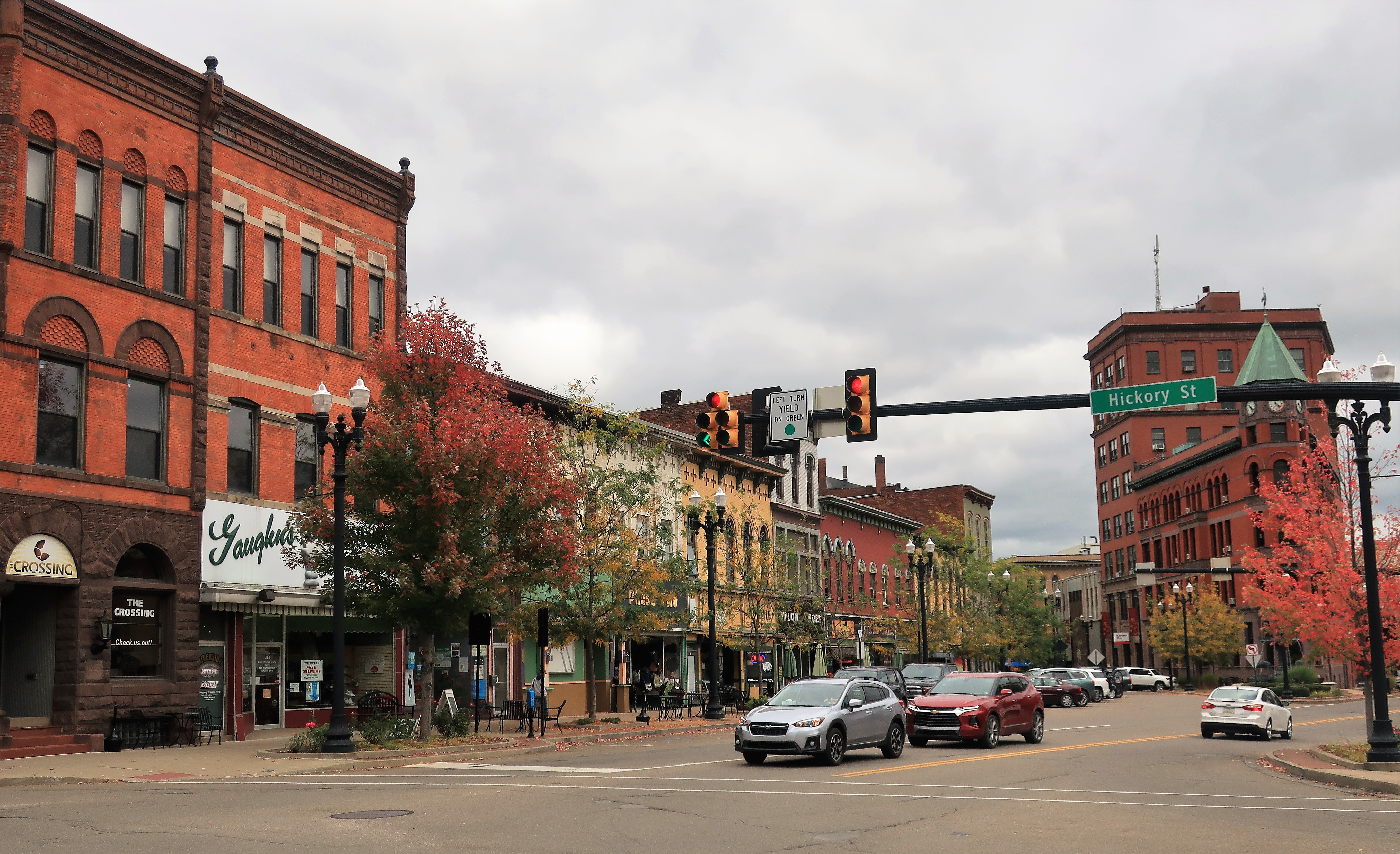
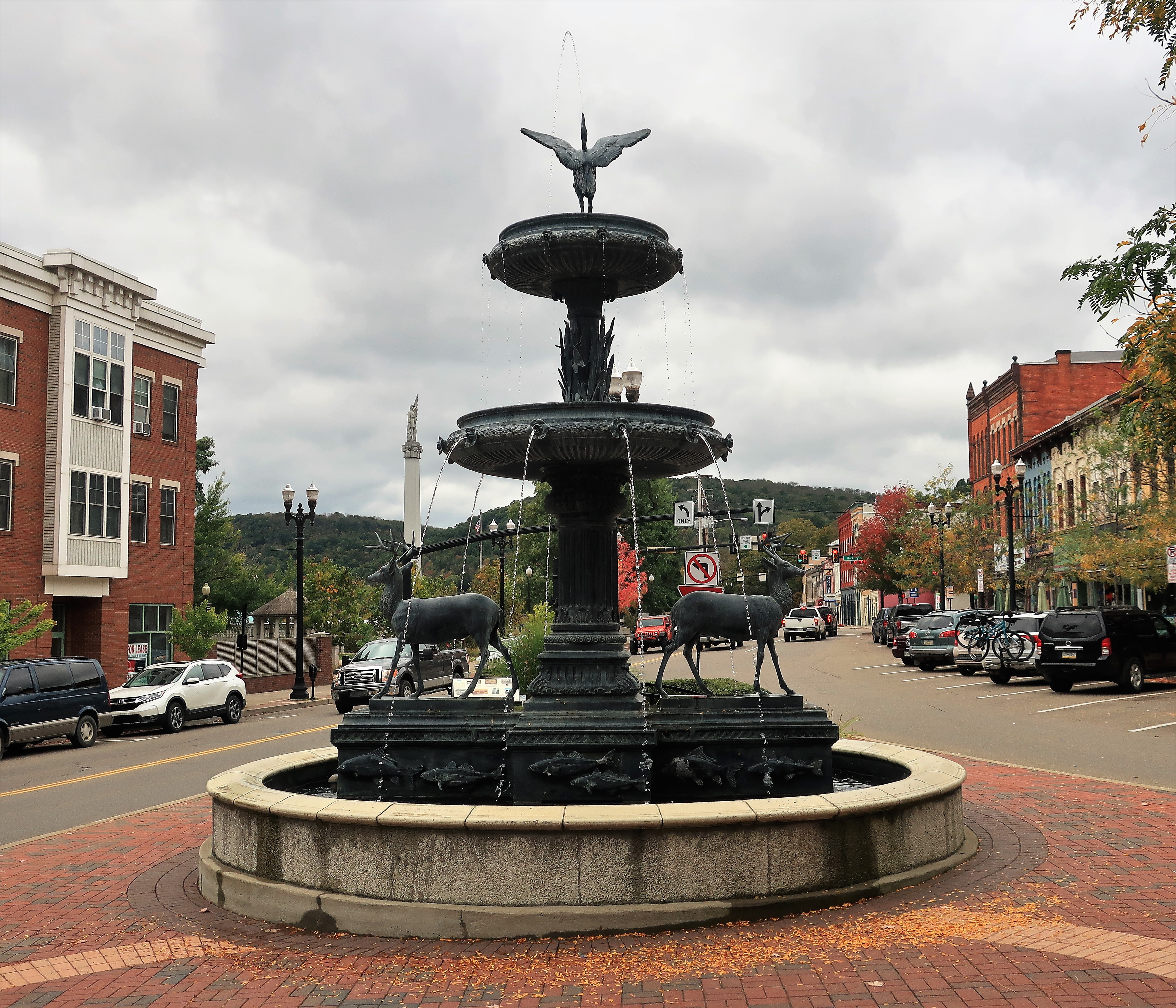
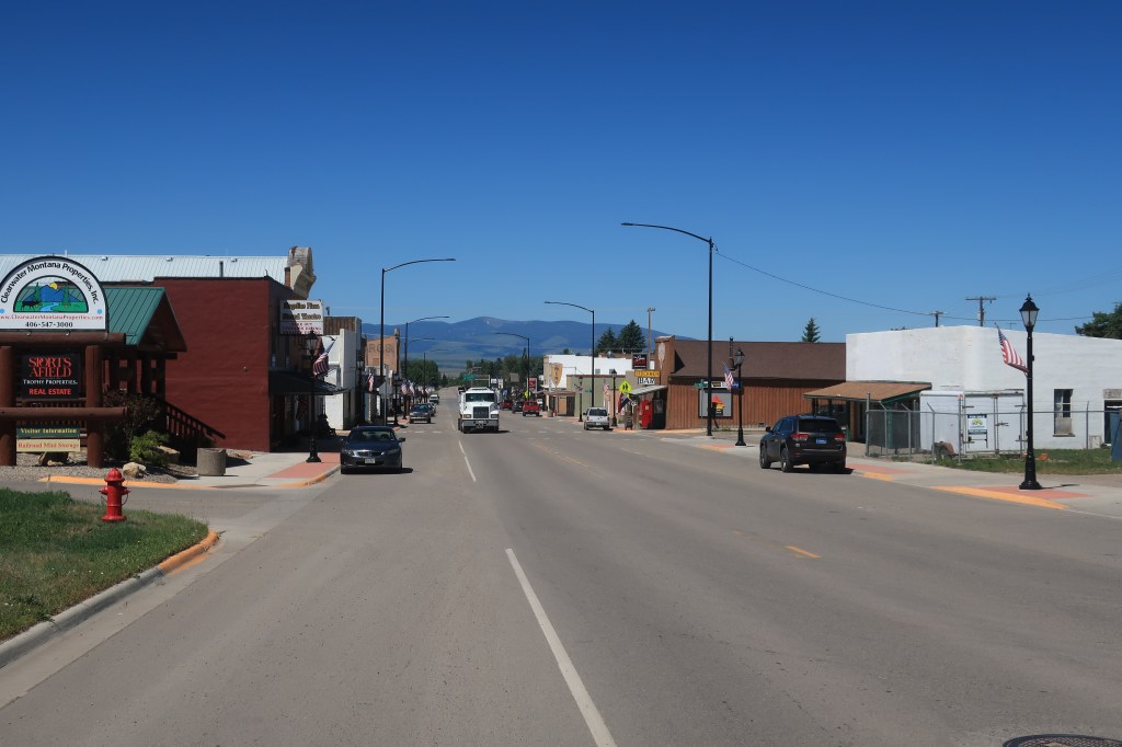
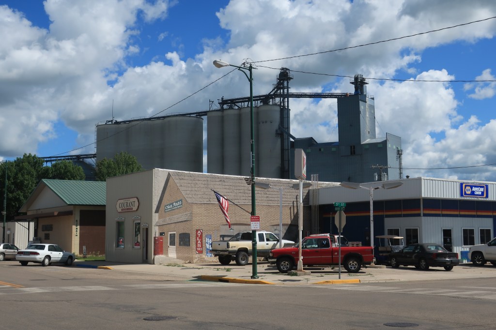
Warren has always been an oil town, and its proximity to the Marcellus Shale and its fracking activity helps with its prosperity today. Storefronts downtown along Pennsylvania Avenue (main street) are mostly occupied. I hope the prosperity lasts — beautiful, stately small towns like this deserve a break.
Downtown Warren, PennsylvaniaDowntown Warren, PennsylvaniaElk fountain in downtown Warren, looking west
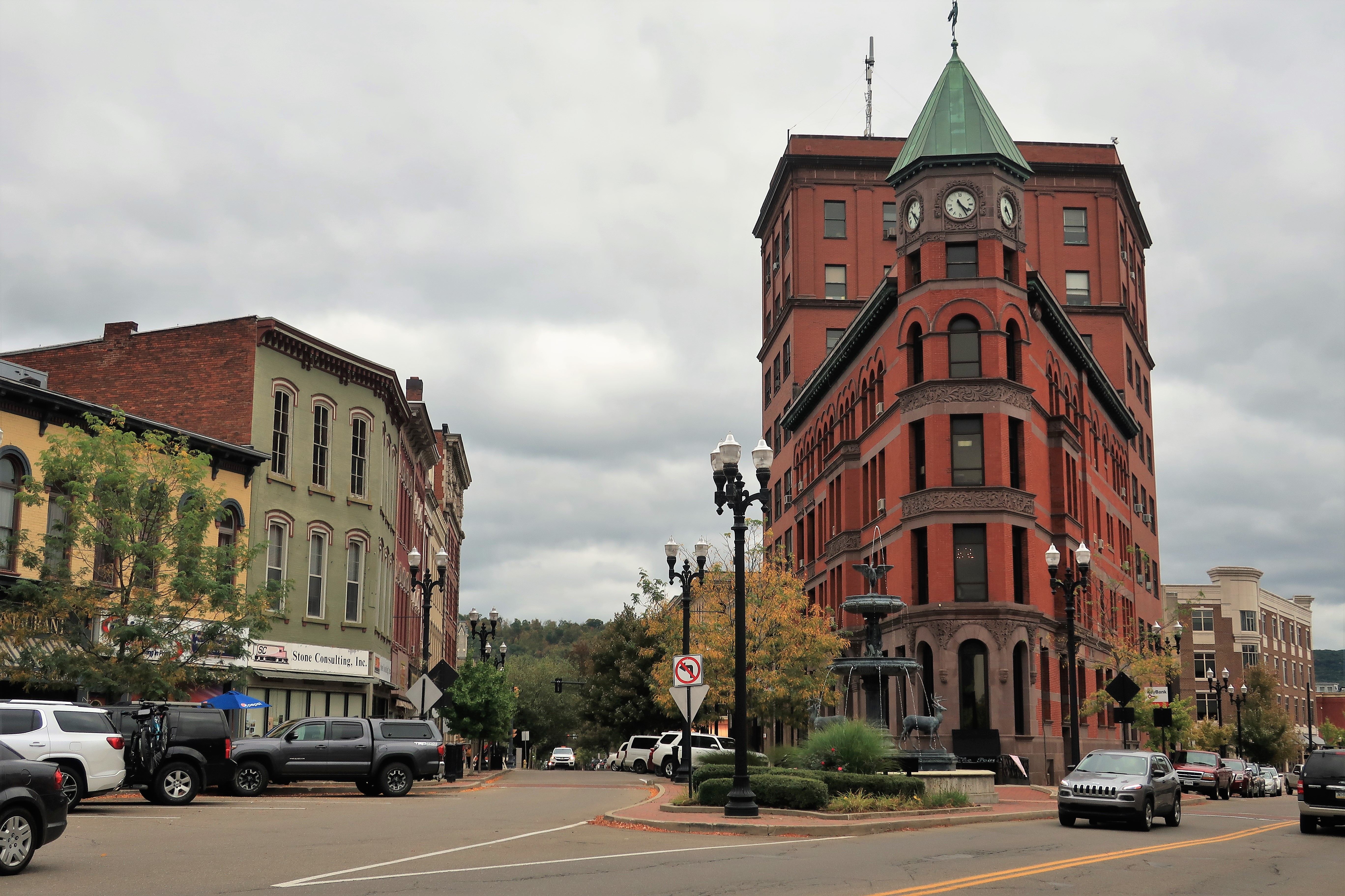
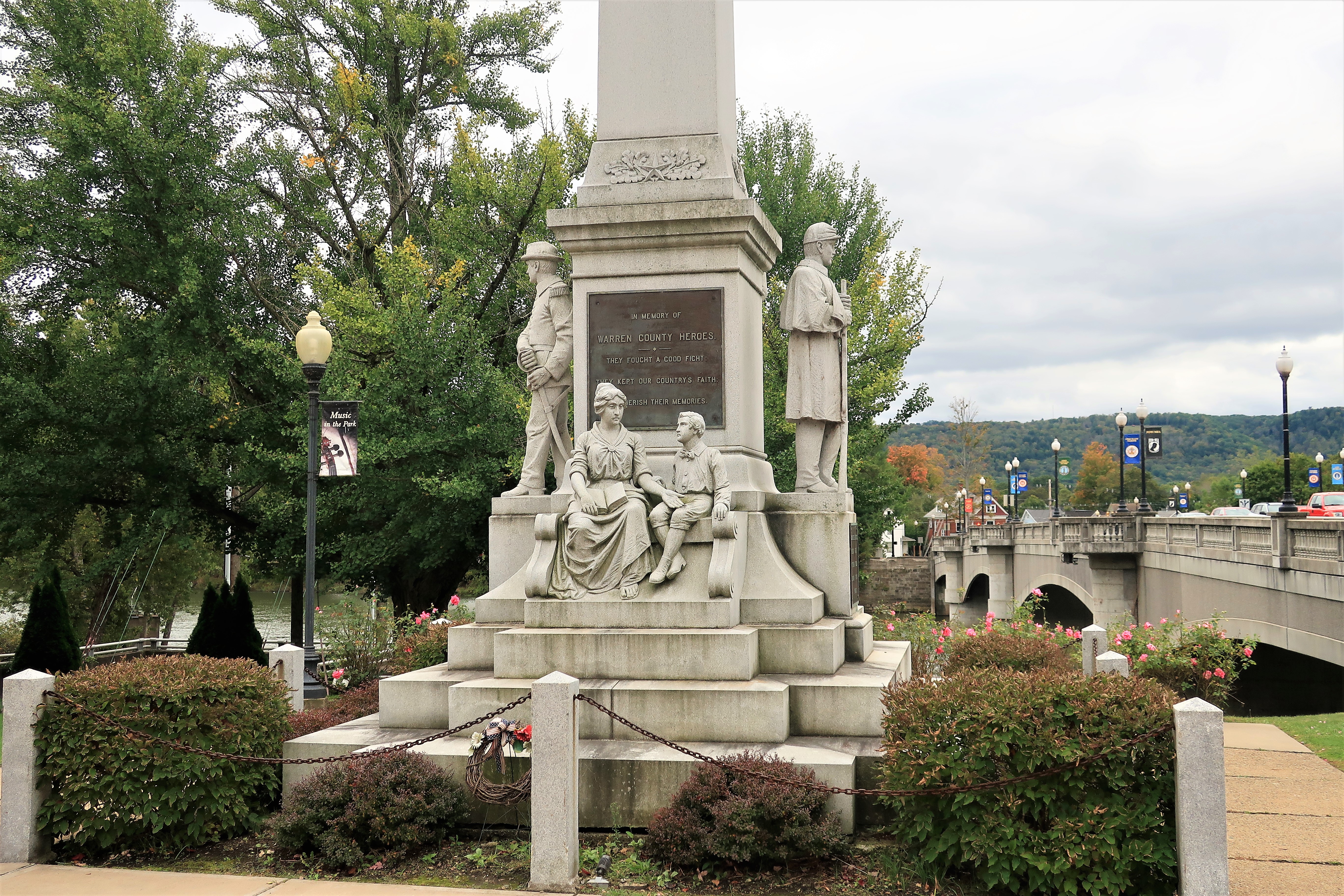
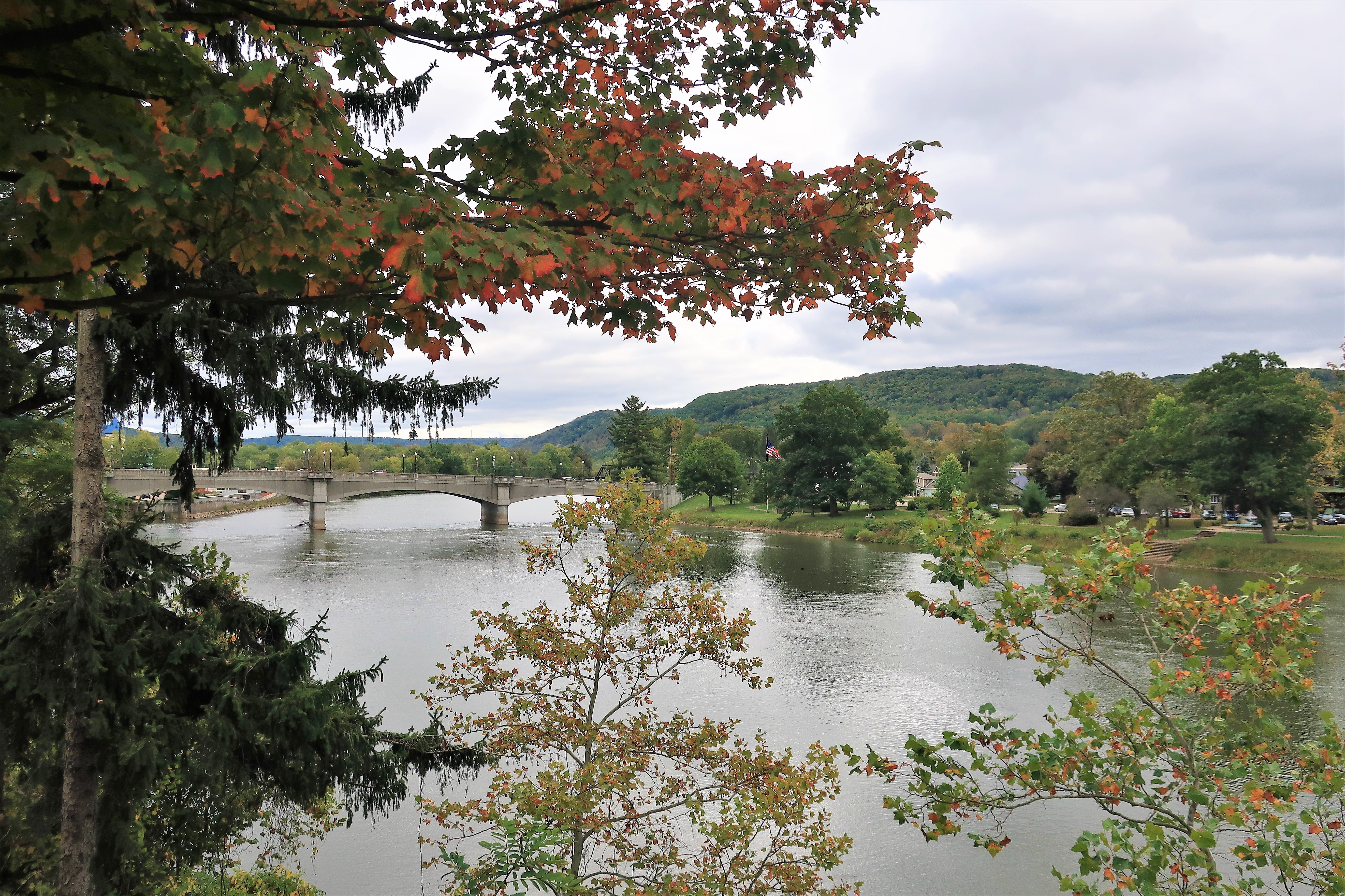
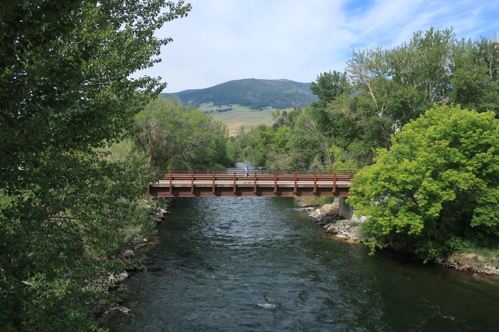
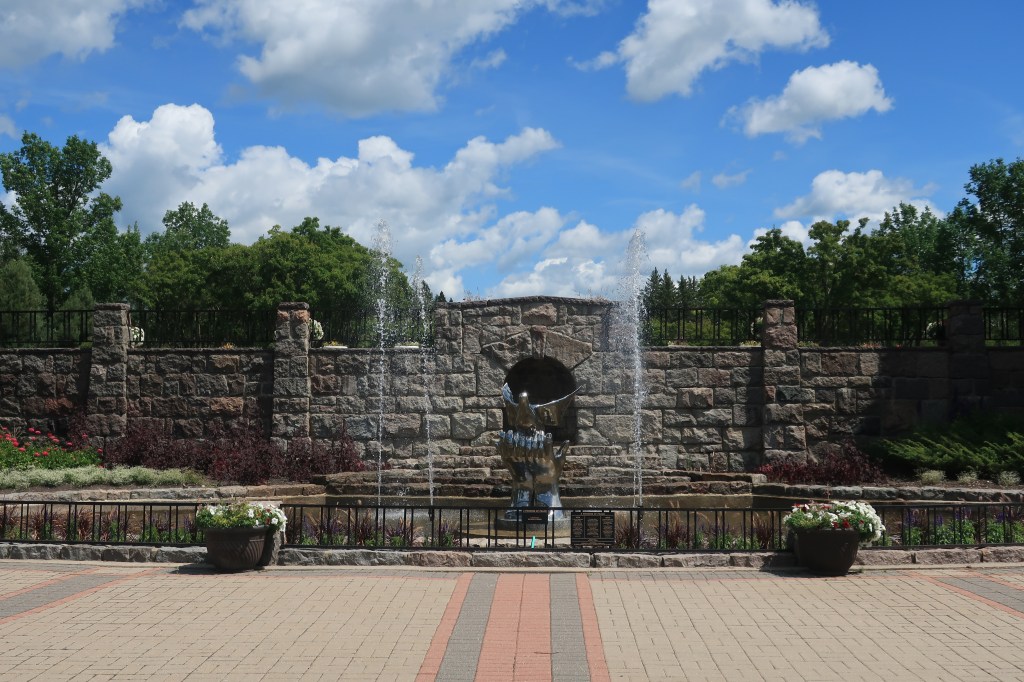
Every old Pennsylvania town has a statue honoring its Union veterans from the Civil War. Warren’s statue is at the base of the Hickory Bridge over the Allegheny River, at one corner of the main intersection in town.
Civil War memorial in Warren, PA. Hickory Bridge over the Allegheny is at the right.
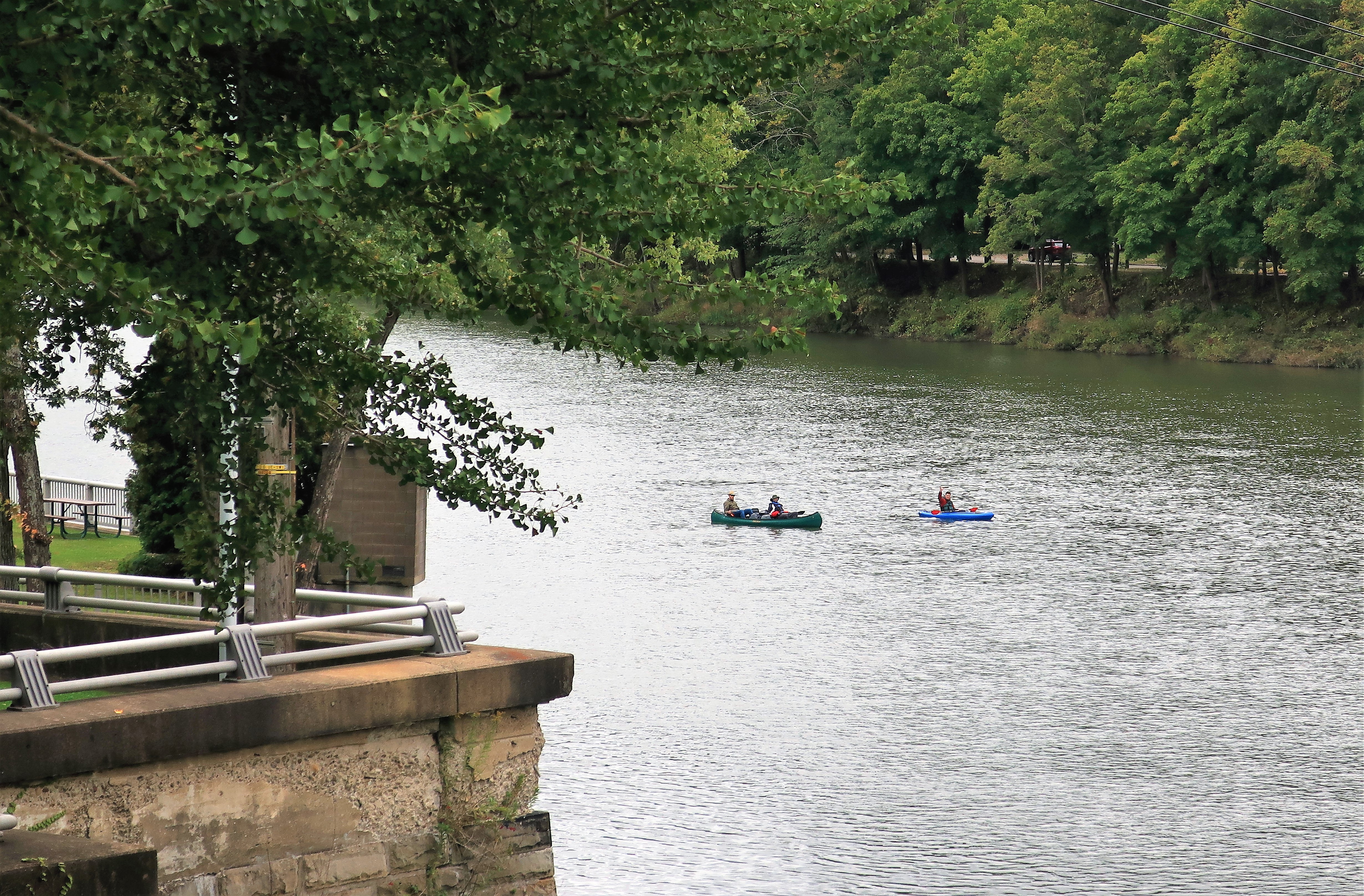
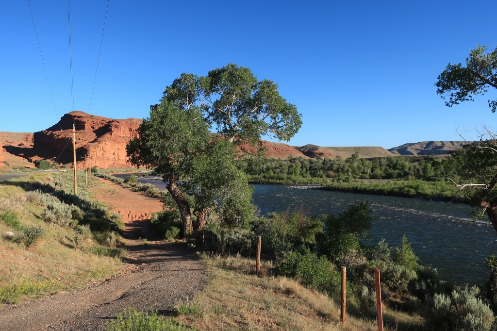
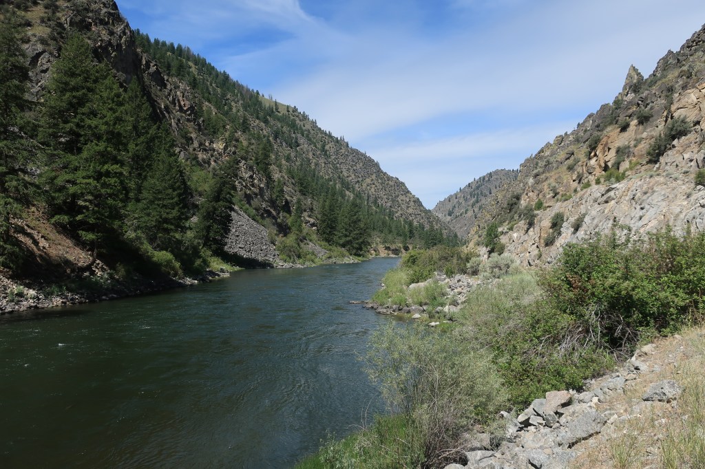
Downtown Warren lies along the banks of the upper Allegheny River — far, far upstream from the river’s confluence with the Monongahela at Pittsburgh. Here, the Allegheny is just a big mountain stream.
Hickory Bridge over the Allegheny at Warren, PAAllegheny River near WarrenCanoeists and a kayaker on the Allegheny, waving at me
Although Warren has only 10,000 residents, it does have some culture. The Struthers Library Theatre uses the old town library building for events. A list of events can be found on their website here. It’s impressive. A photo of the classic venue is below.
Struthers Library Theatre. Warren, Pennsylvania
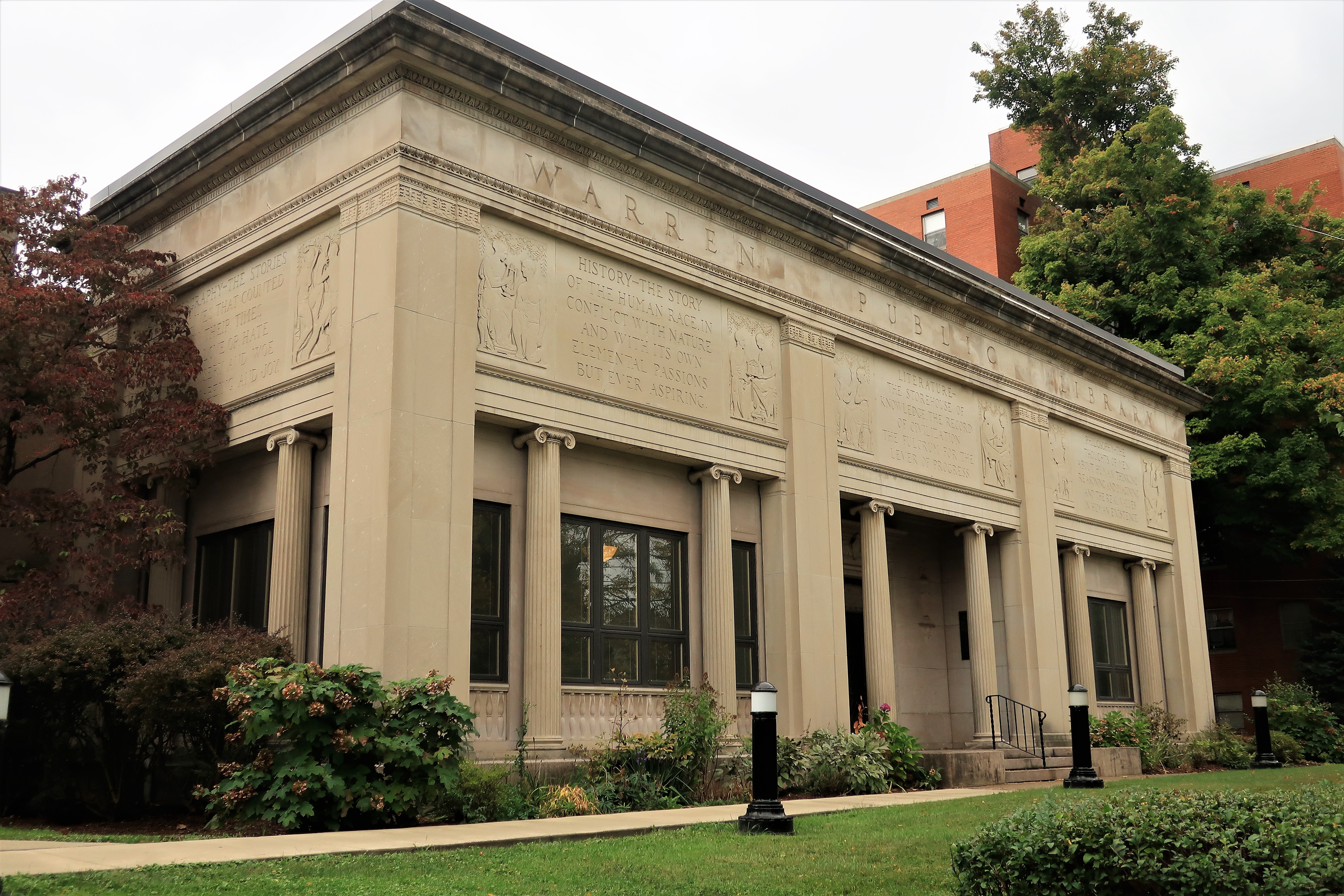
Of course, the new library building is pretty nice too. I like the classical references along the exterior walls.
Warren Public Library
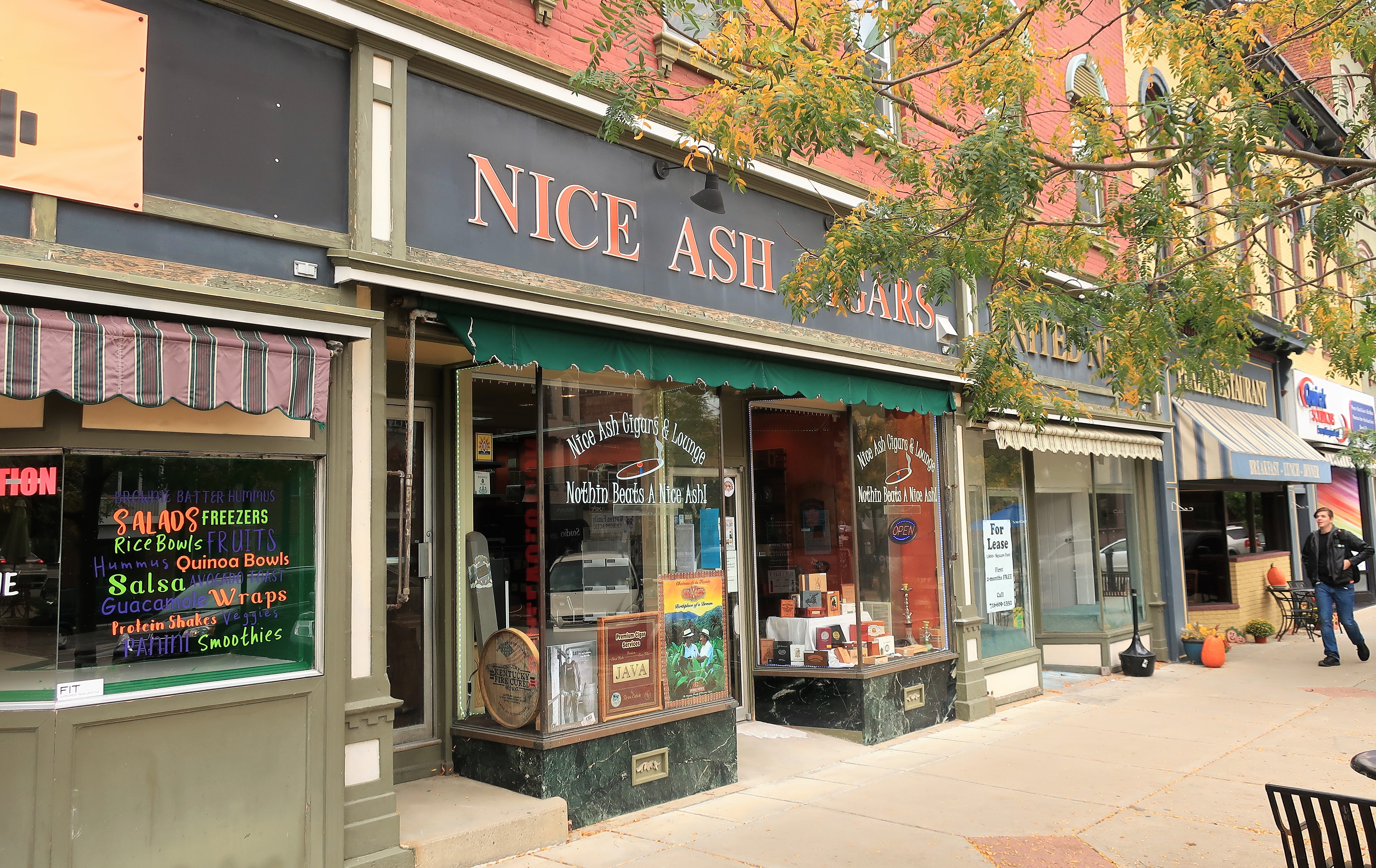
Finally, and not at all least importantly, every cool town needs a cool cigar lounge. Allow me to present Nice Ash Cigars and Lounge (link here), a classy part of the Warren nightlife. Nice Ash has two additional locations in Depew and Fairport, New York — but why cross the border into New York (no-fracking country) when you can enjoy a cigar in Pennsylvania?
Nice Ash Cigars and Lounge. Warren, PA
As the sign on the window says, Nothing Beats a Nice Ash!
All photos were taken by the author either on October 4th or October 8th, 2019.
A list of all photo posts from the American County Seats series in TimManBlog can be found here.
I travel as a hobby and not for a living (yet) — but donations are happily accepted if you’d like to help defer my costs. Thanks, The TimMan
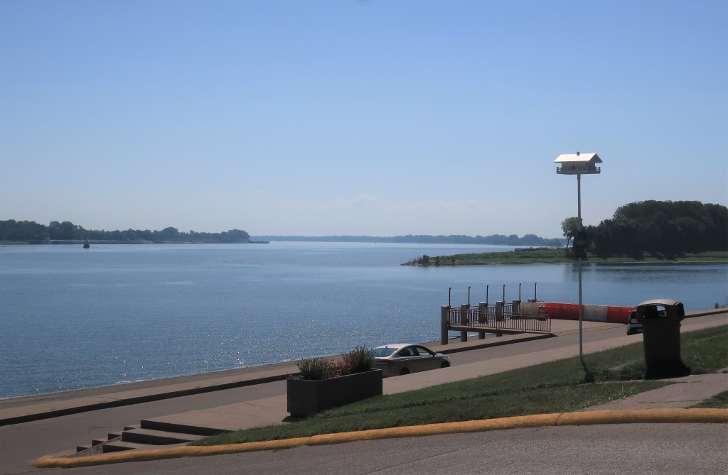
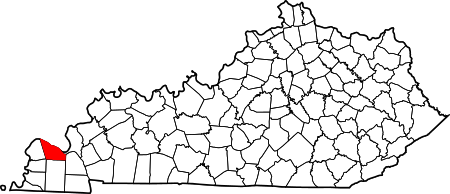
Paducah, Kentucky is a small city situated on the south bank of the Ohio River at its junction with the Tennessee River, which comes up from the south.
The Paducah waterfront looking northeastward up the Ohio River with the Tennessee River joining it
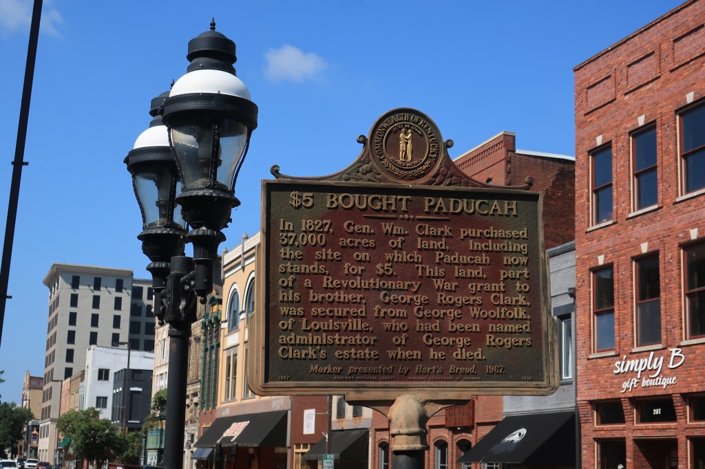
Paducah is an old city in terms of the American west, founded in 1827 by William Clark of Lewis & Clark fame with a purchase of 37,000 acres of land for the sum of $5. A historical sign downtown explains the circumstances.
Colonel George Rogers Clark had claimed the land as a warrant for his army service during the Revolutionary War, in which he effectively gained the entire Northwest Territory for the new United States of America.
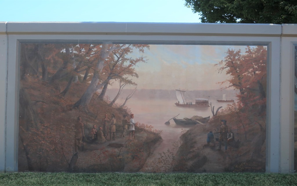
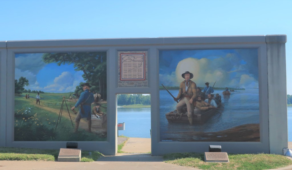
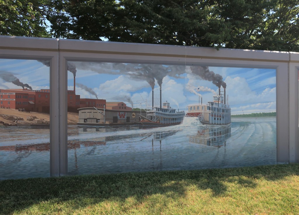
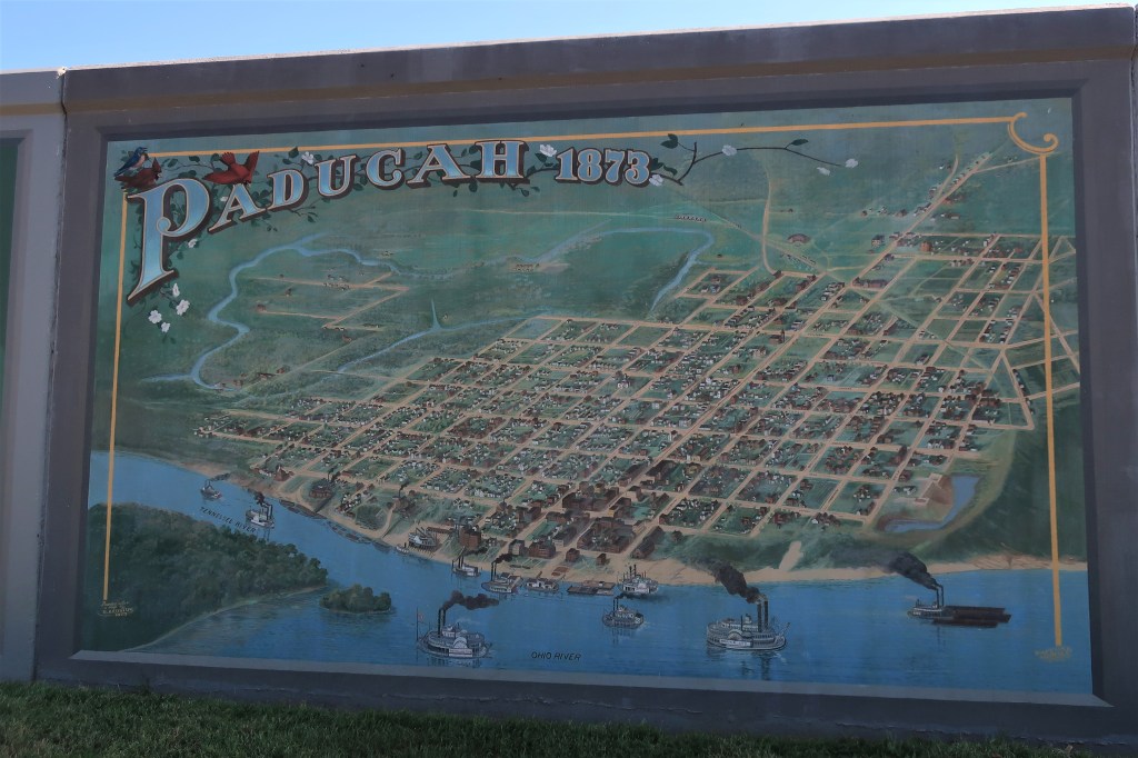
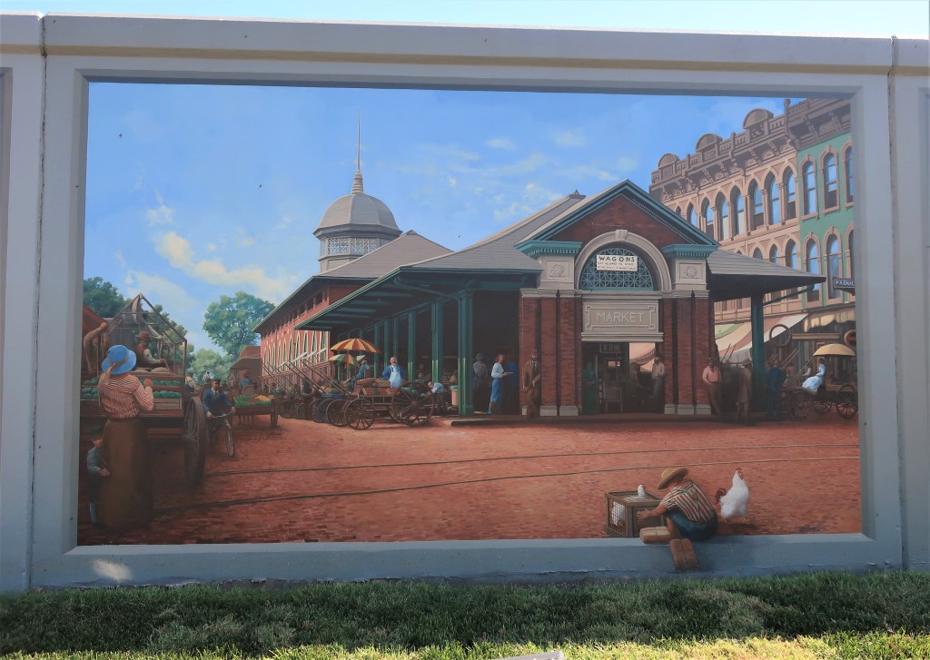
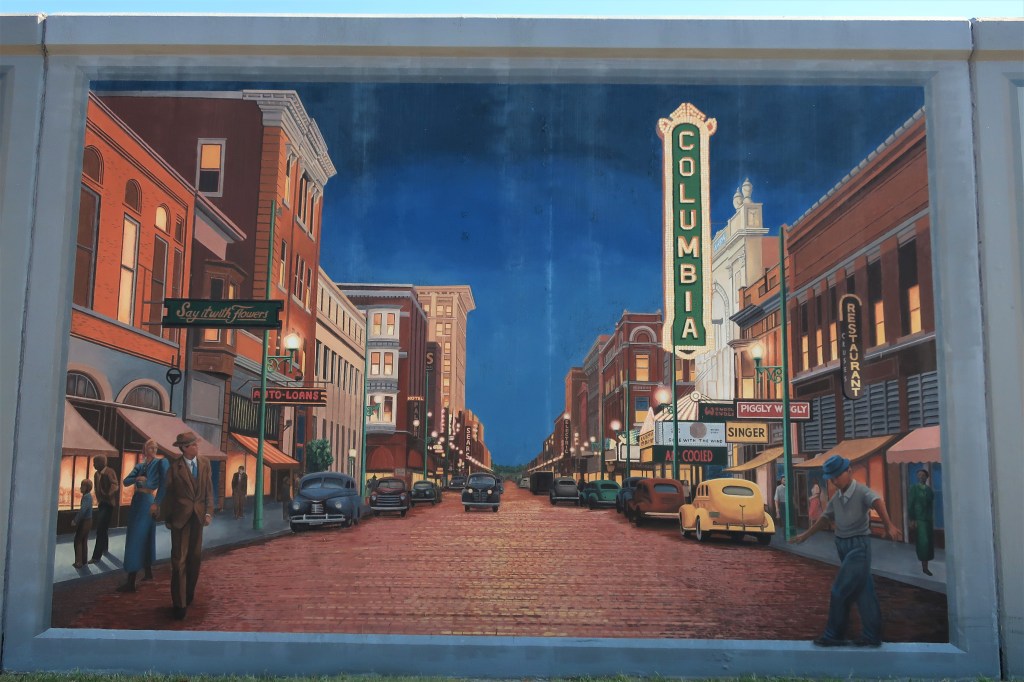
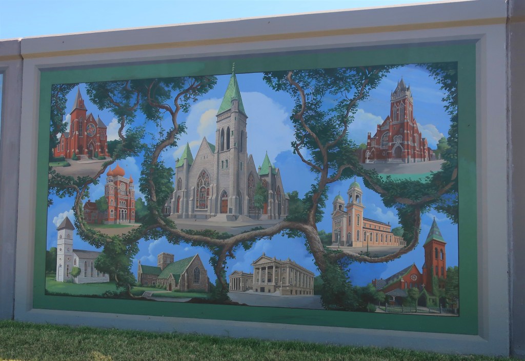
Much of Paducah’s history is recounted by murals painted on the town’s Ohio River floodwall. A walk along the wall is a walk through history.
Kincaid Mounds near Paducah, around 1300 A.D.Chickasaw tribesmen along the Ohio River in the early 19th Century. The Lewis & Clark flotilla is shown passing by on their way downstream to the Mississippi.
The name “Paducah” was given by William Clark. Some say Clark named the town for the “Padoucas”, a Great Plains tribe he encountered in his travels to the Pacific with the Corps of Discovery. Others say Clark named the town for Chief Paducah, leader of a nearby Chickasaw band.
Scenes of early white settlement in PaducahSteamboats docked at Paducah
The town was a major prize in the early days of the Civil War. In 1861 while Kentucky was trying to remain neutral in the impending conflict, General Ulysses Grant took Paducah on September 6 before his Confederate counterpart could do so. Later in the war, Confederate General Nathan Bedford Forrest conducted a successful raid on the city.
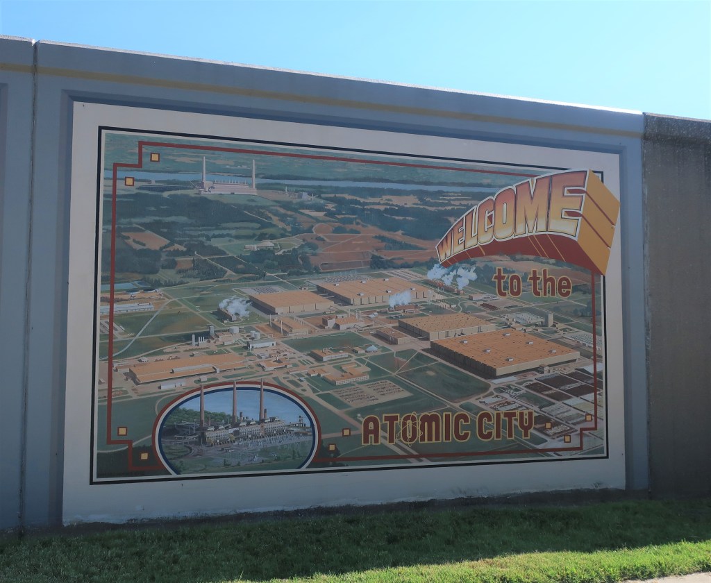
The Battle of Paducah, 1864Paducah, Kentucky in 1873Paducah in the early 1900sPaducah Townscape in the 1930sPaducah as the “Atomic City”. Home to the nation’s only uranium enrichment facility.
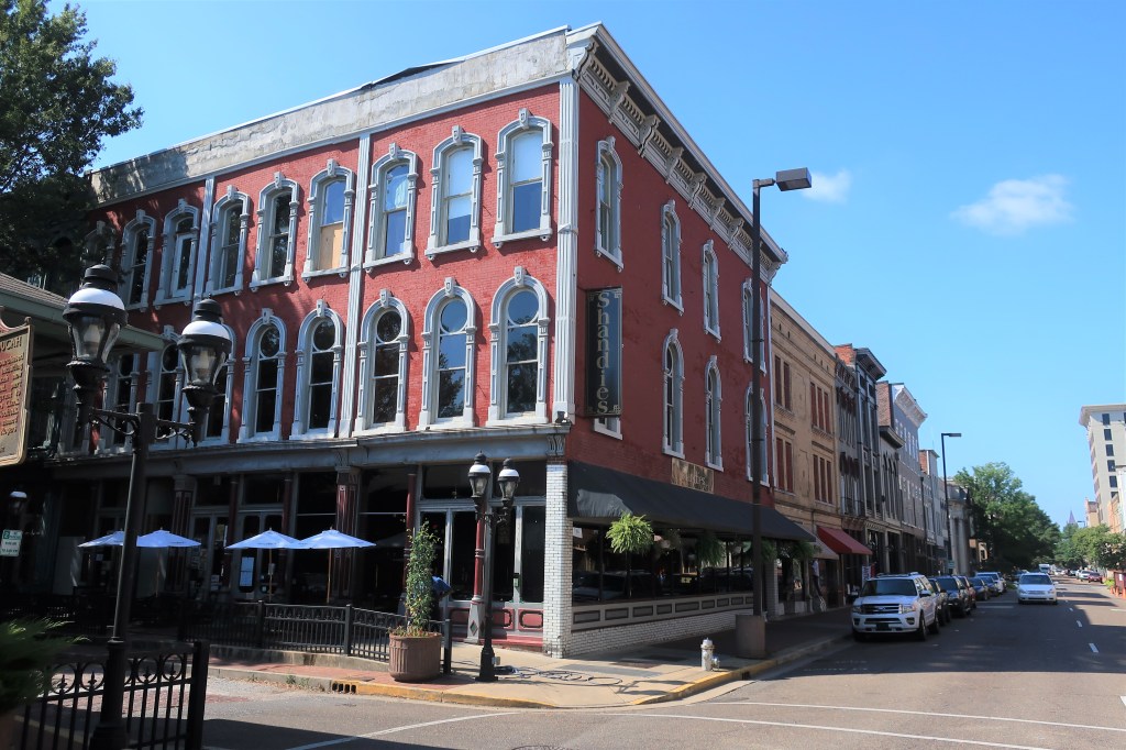
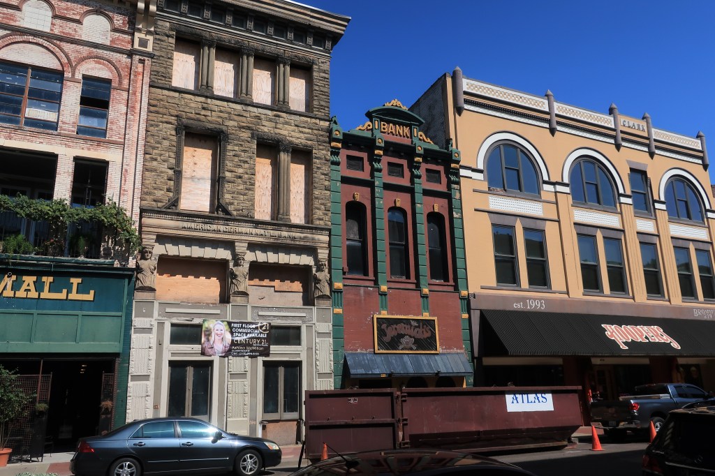
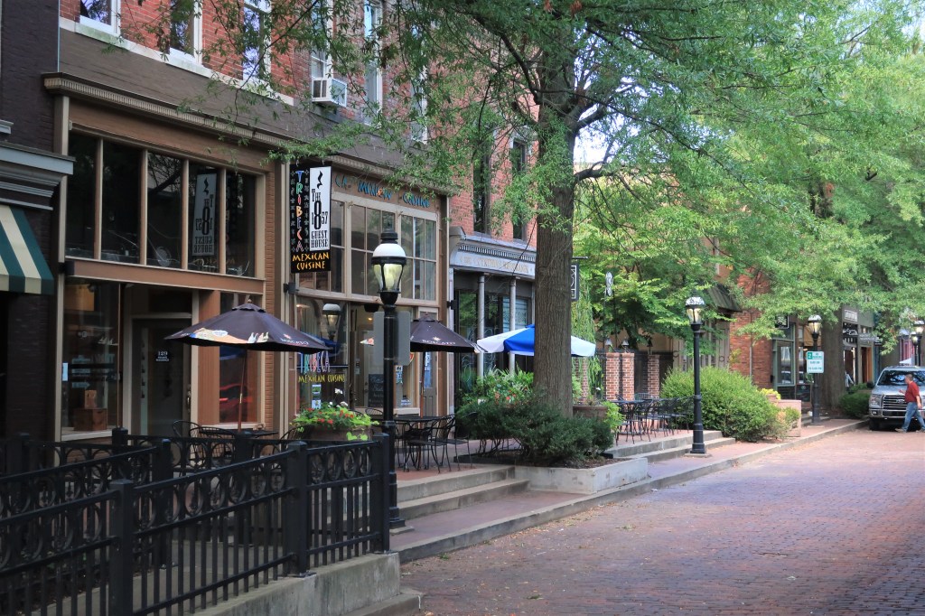
The Ohio landing areas near the riverfront provide an insight into late 19th Century Paducah. The area abounds in old brick merchant buildings now used as restaurants, bars, and antique shops.
Downtown Paducah19th Century brick buildings in Paducah, KentuckyTree-lined merchant shops converted to restaurantsPaducah, Kentucky. Red brick streets downtown
The McCracken County Courthouse occupies an entire city block seven blocks away from the river. This two-story red brick structure was built between 1940 and 1943 under the auspices of the WPA.
McCracken County CourthouseMcCracken County Courthouse. Paducah, KentuckyMcCracken County in the state of Kentucky
Here’s a final floodwall mural of some of the most prominent old buildings in Paducah. Most of them are churches.
The churches of Paducah, Kentucky
All photos were taken by the author on September 3, 2019.
A list of all photo posts from the American County Seats series in TimManBlog can be found here.
I travel as a hobby and not for a living (yet) — but donations are happily accepted if you’d like to help defer my costs. Thanks, The TimMan
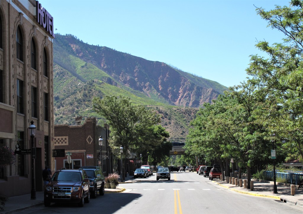
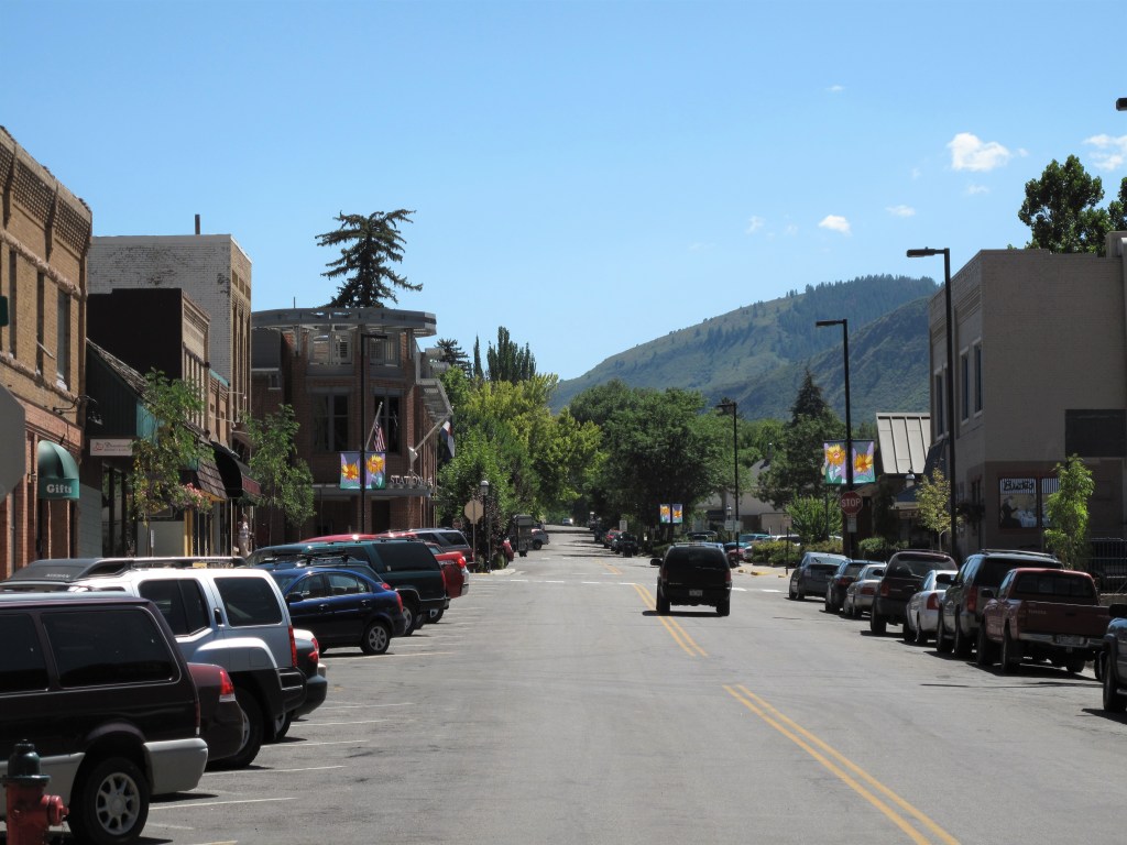
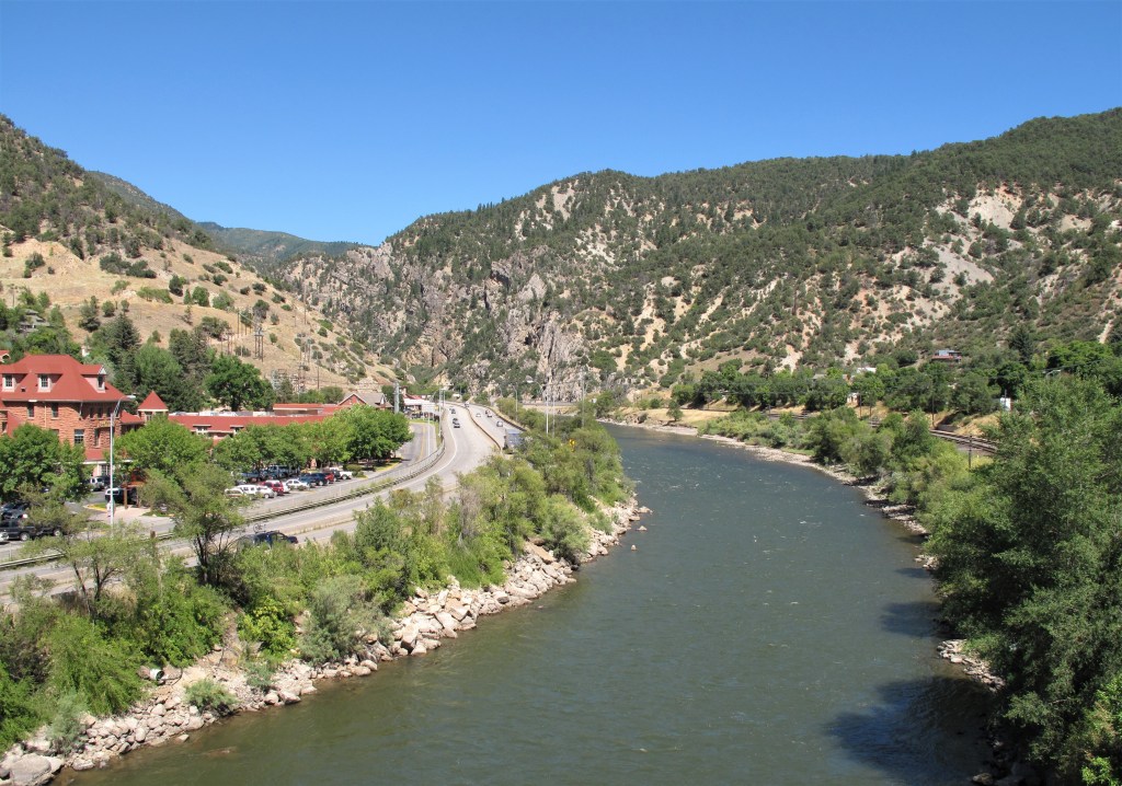
An August day is a good day to come to Glenwood Springs, Colorado. This is a tourist town and a Rocky Mountain mecca. Downtown has antiques shops, outdoor gear merchants, old bars, and new coffee places. Glenwood Springs straddles the Colorado River at the bottom end of Glenwood Canyon.
Doc Holliday Tavern, Glenwood Springs, Colorado
I remember the very first time I came through Glenwood Springs in September 1991. I was driving an old Mazda GLC on my first cross-country trip.
Downtown Glenwood Springs with the red cliffs of the Rockies as a backdrop
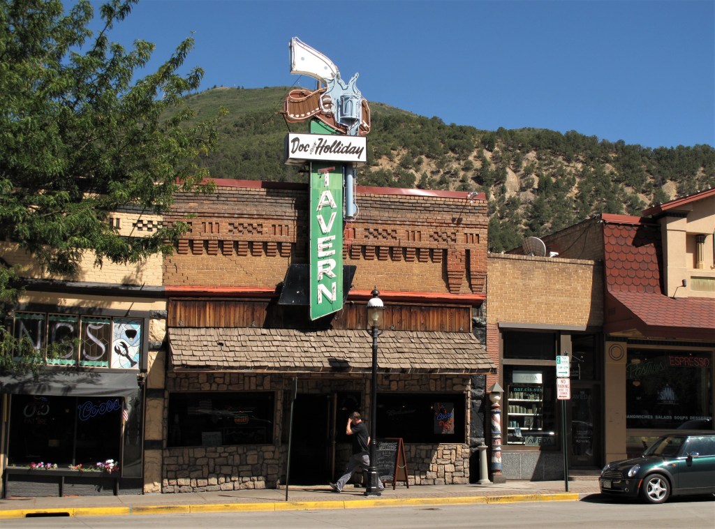
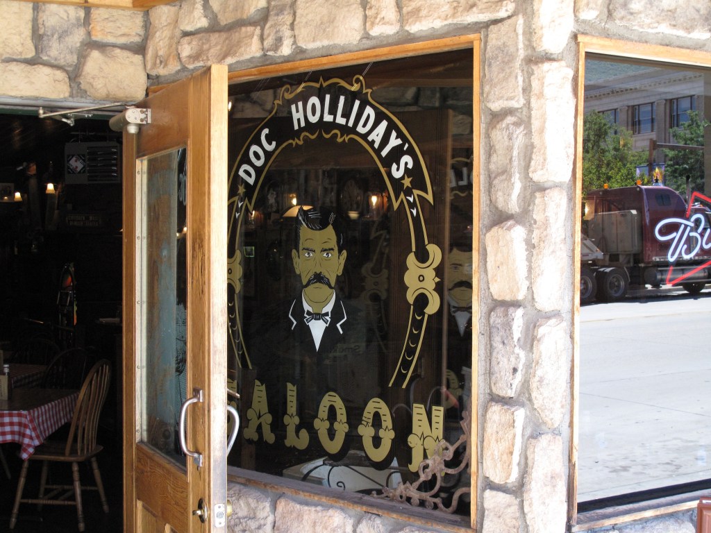
I was charmed by the old buildings and wild west flavor. Main Street includes the Doc Holliday Tavern & Saloon — a little box of a building with a neon sign fashioned as a revolver above the front door.
The entrance to Doc Holliday’s Saloon, Glenwood Springs
Doc Holliday’s life story can be found here. He was a dentist-turned-gunslinger driven west as a remedy for tuberculosis. Ultimately the disease took his life (not a gunshot wound), and he died and was buried in Glenwood Springs.
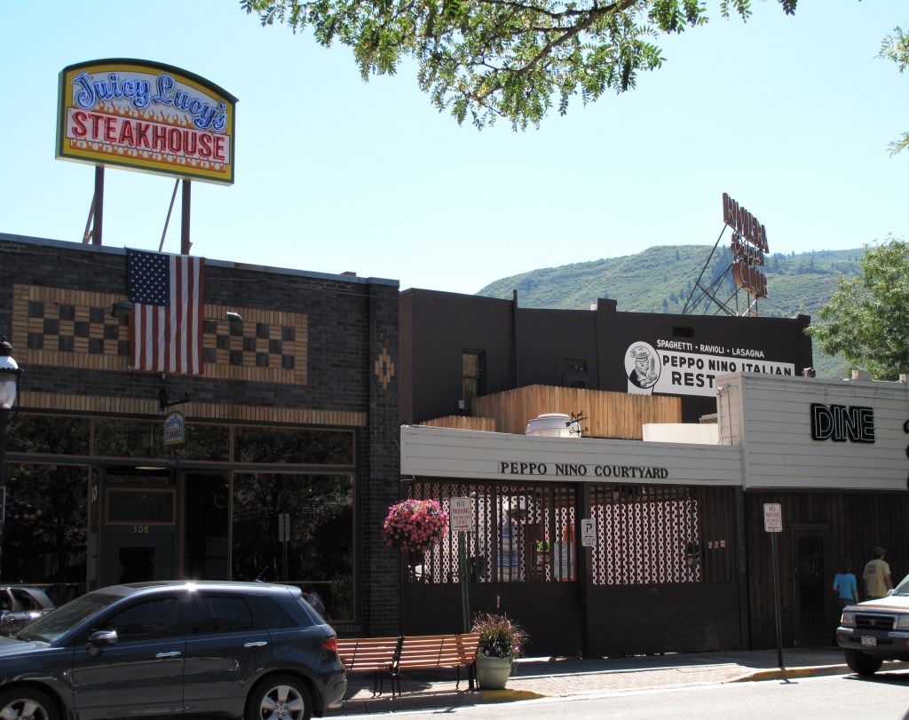
Other buildings downtown are old stone and brick structures and provide a solid western feel, like this one:
Downtown Glenwood Springs
Because Glenwood Springs is situated deep in a canyon, nearly every view provides a mountain vista behind it:
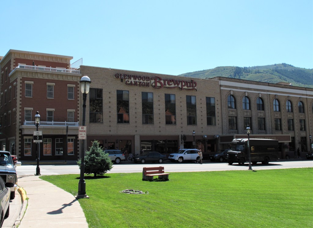
Glenwood Springs is not without its brewpubs.
Glenwood Canyon Brewpub
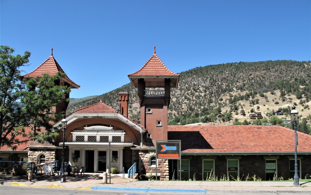
Amtrak runs through Glenwood Springs and then up into Glenwood Canyon. Here’s the old train station.
Amtrak train station, Glenwood Springs
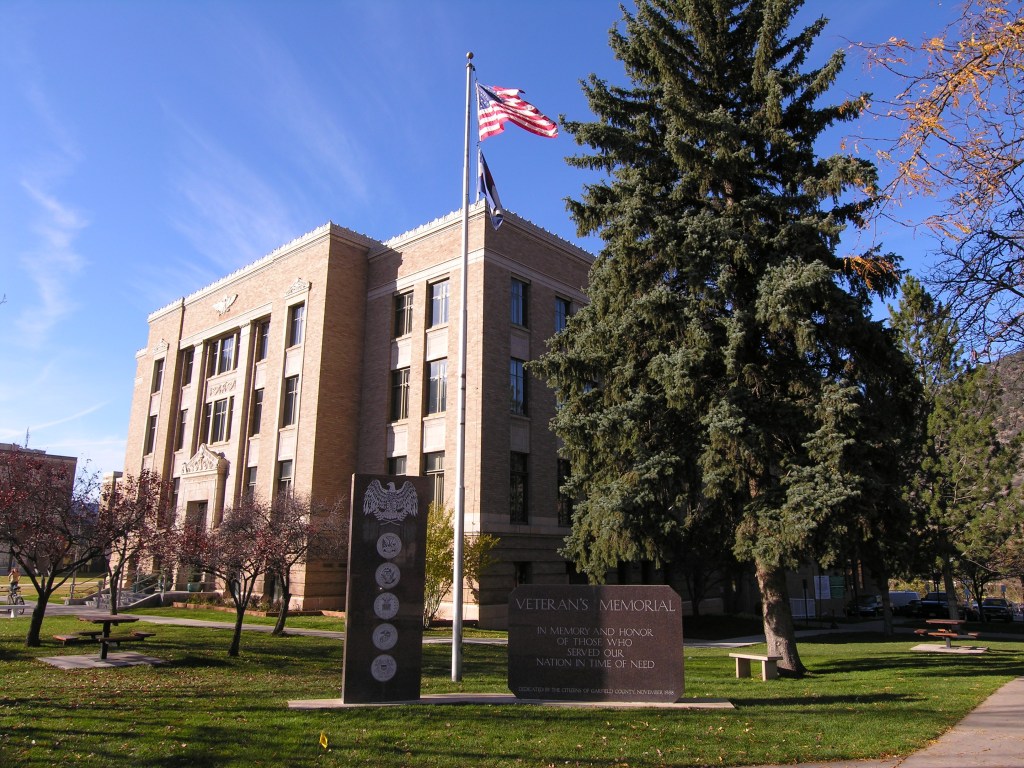
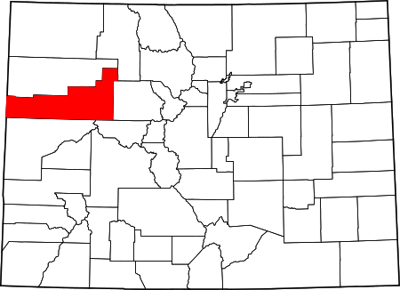
Glenwood Springs is the largest town in this area and the county seat of Garfield County, Colorado.
Garfield County Courthouse, Glenwood SpringsGarfield County in the state of Colorado
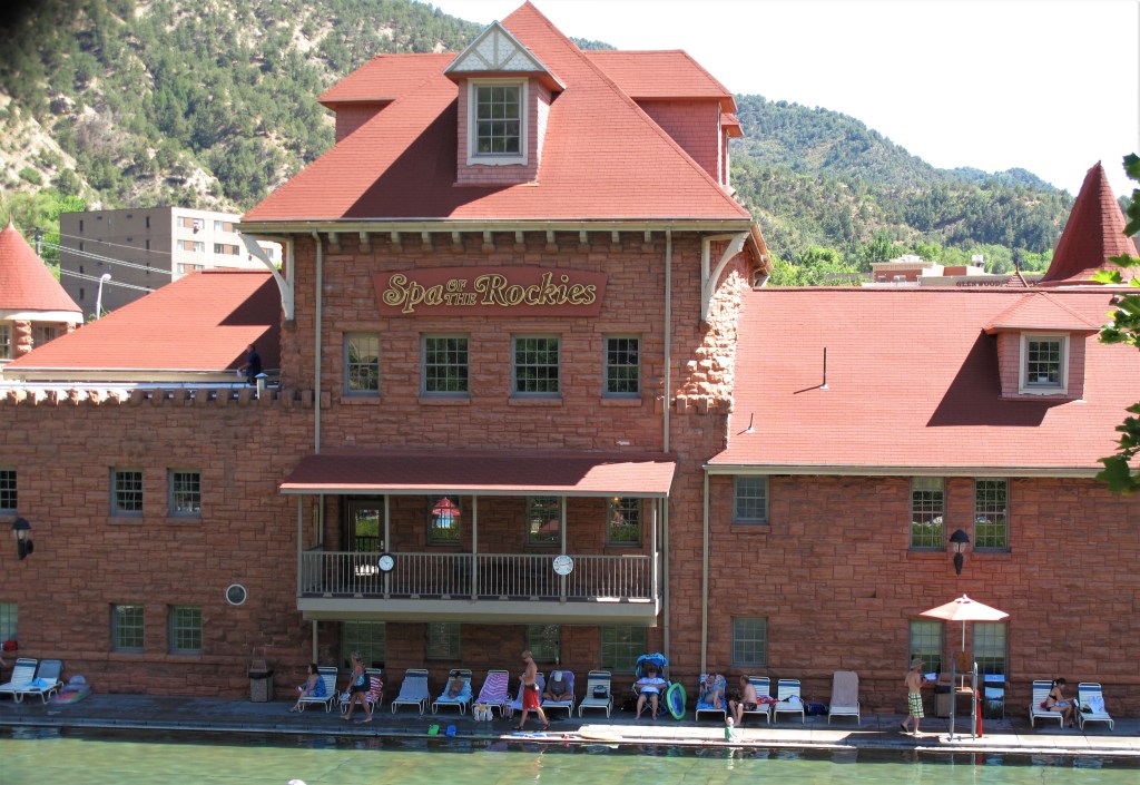
The downtown area is along the south side of the Colorado River. If you go across a metal bridge spanning the river (and Interstate 70) you’ll find the Spa of the Rockies.
Spa of the Rockies, Glenwood Springs, Colorado
Nice place to enjoy some hot springs — or just take a dip in their pool on a hot day. Or just a place to lie around the pool thinking about it.
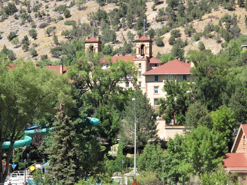
Here’s another view of the Spa of the Rockies, their old hotel towers, and their waterslide.
Spa of the Rockies
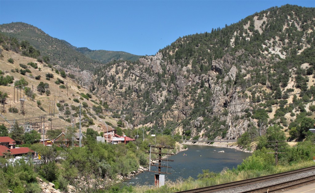
There’s nothing like rafting down the Colorado River on a hot August day. These rafters have just exited the rapids of Glenwood Canyon, which is just upstream of Glenwood Springs.
Rafting on the Colorado River
I’ll finish with some photos looking eastward, upstream along the river into Glenwood Canyon. Both Amtrak and Interstate 70 snake their way through the canyon along the banks of the Colorado River, providing breathtaking views unmatched anywhere outside of the Grand Canyon of Arizona. I drove through this canyon for the first time back in that first cross-country trip in 1991 — I’ve come back many times since. Of course!
Looking eastward from Glenwood SpringsColorado River at Glenwood Springs
All photos were taken by the author either on August 2, 2006, or August 21, 2009.
A list of all photo posts from the American County Seats series in TimManBlog can be found here.
I travel as a hobby and not for a living (yet) — but donations are happily accepted if you’d like to help defer my costs. Thanks, The TimMan
Radio personality Todd Herman described the upcoming 2020 elections as a choice: “Chaos and Communism or Calm and Community.”
With a hat tip to Mr. Herman, I’ll borrow his phrase to describe what I saw on a little vacation road trip through Wyoming, Idaho, Montana, North Dakota, and South Dakota. Nothing but Calm and Community up there. Here’s my road trip chronicle — including breakfast photos! To drum up business for the deserving, I’ll throw in some links to some local businesses I patronized.
Nine Days Total. Enjoy!
Friday, July 10, 2020, Day 1 6-hour drive from Colorado up to Lander in central Wyoming, just northwest of historic South Pass. Lander is a smallish town (population 7,487) oriented towards tourists seeking outdoor recreation. Main Street boasts a brewery with live music on summer weekends and two ice cream stands.
Veterans Memorial outside Fremont County Courthouse. Lander, WyomingElk statue in front of the Pronghorn Lodge in Lander, Wyoming
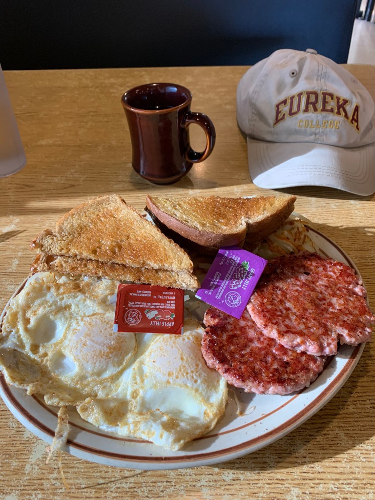
Saturday, July 11, 2020, Day 2 Up with the dawn (5 am) and out the door by 5:30 in time to catch McDonald’s opening hours for an Egg McMuffin breakfast to go.
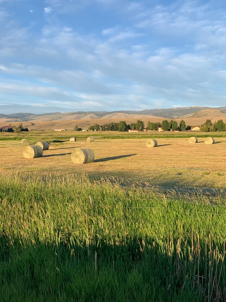
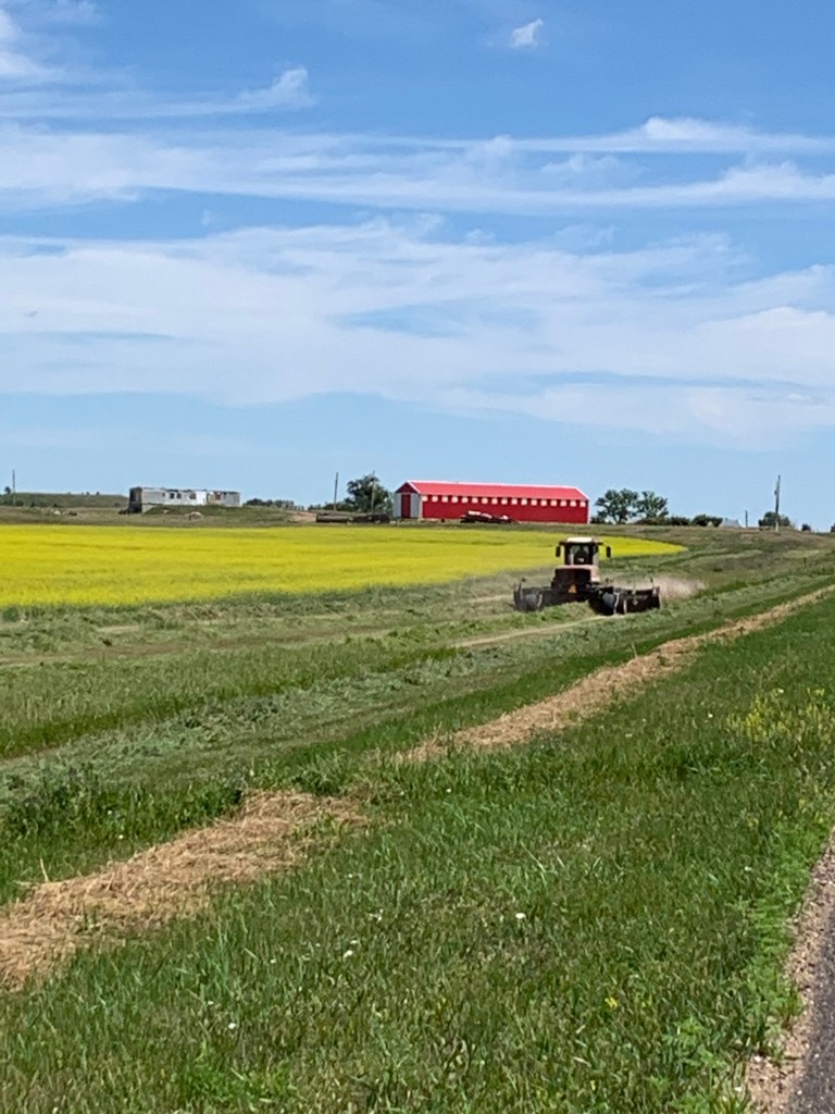
Just outside Lander along US 287, I caught some mid-summer hay fields in the early morning light. Those are the Wind River Mountains in the background.
Like something out of Van Gogh, hayfields in Wyoming’s Wind River Valley
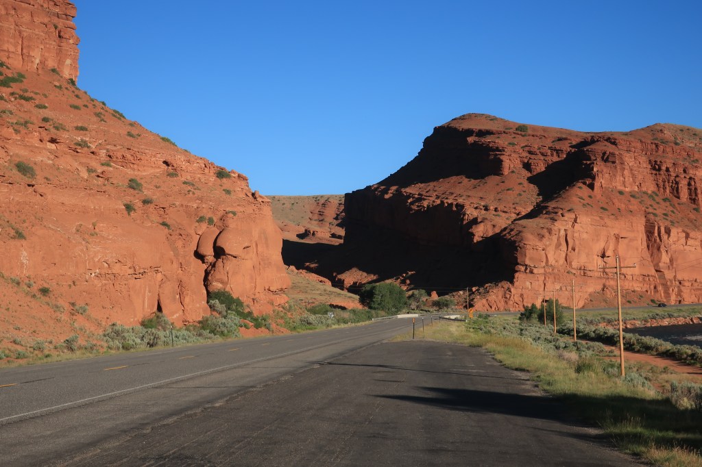
As the combined routes US 287 and US 26 head northwest towards the continental divide at Togwatee Pass, the human stories of this land become as dramatic and colorful as the scenery surrounding it. I pass Crowheart Butte — named for the grisly outcome of a long-ago battle over hunting grounds between the Shoshone and Crow tribes.
At a turnout a few miles up the road, the scenery gets even more colorful where Wind River breaks through a red rock canyon.
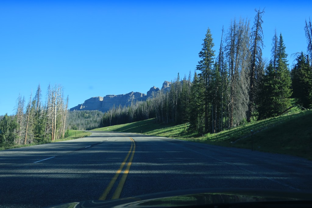
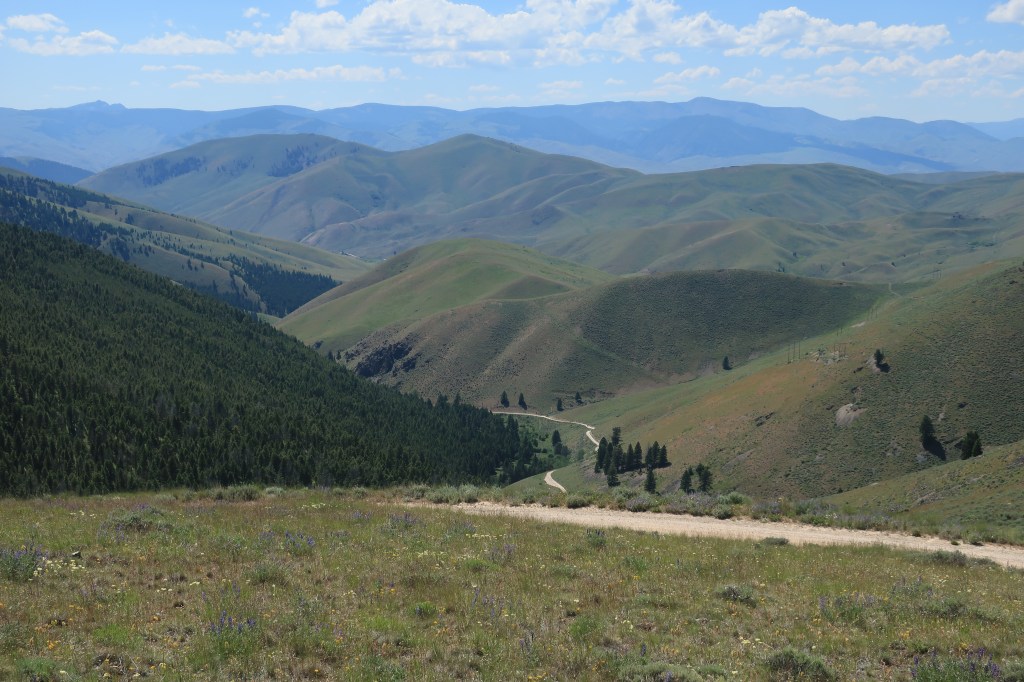
Highways 26/287 continue past the mountain town of Dubois, Wyoming, and on toward the Continental Divide. The road reaches the divide at Togwatee Pass.
On the western side of the pass, the peaks of the Grand Tetons come into view, getting larger in the windshield as the miles went by.
For the next 4 hours I drive west through Idaho farming country, stopping only for a Jack-in-the-Box burger in the industrious town of Rexburg, Idaho and at a gas station in Dell, Montana along Interstate 15.
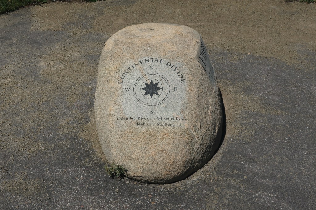
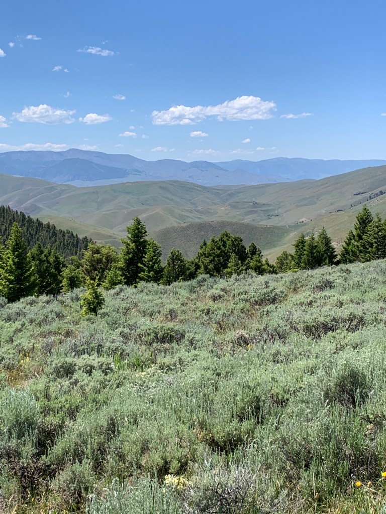
Lemhi Pass, where Lewis & Clark crossed the Continental Divide on their way across the continent to the Pacific.
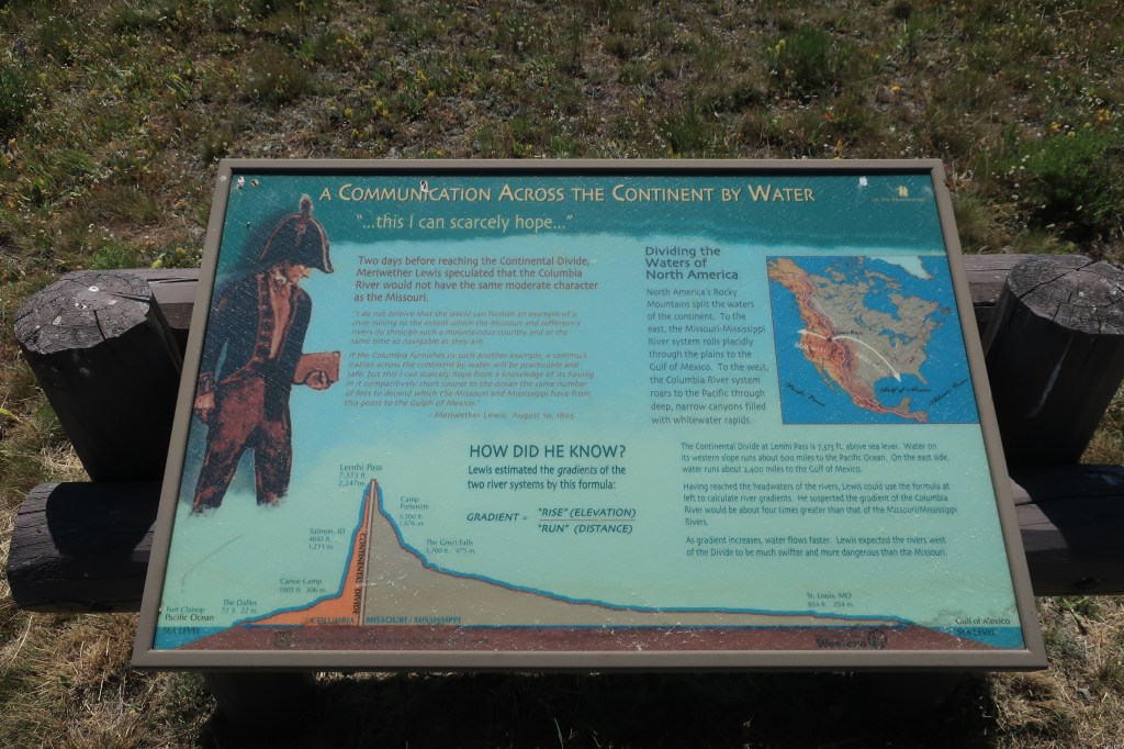
Lemhi Pass, looking westward into IdahoLemhi Pass looking eastward back into MontanaHistorical sign explaining the crossing of the Continental Divide by Lewis & Clark at Lemhi PassContinental DivideLemhi Pass looking west. I posted this on Facebook along with the caption below:
Looking west from the summit of Lemhi Pass. On August 12, 1805, Captain Meriwether Lewis finally reached the Continental Divide at this place. Lewis viewed the same aspect as in the attached photo — mountain ranges as far as the eye can see — and realized that there was no Northwest water passage along this route. Today, July 11, 2020, from the very spot where Meriwether Lewis stood in 1805, I dictate my words into an i-phone, take a photo with that same phone, and post both the words and the picture for the entire world to see — instantly.
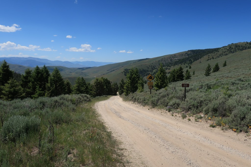
The ‘High point’ of the journeyThe steep road down the western side of Lemhi Pass
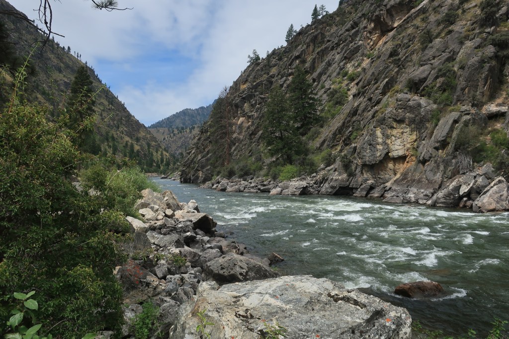
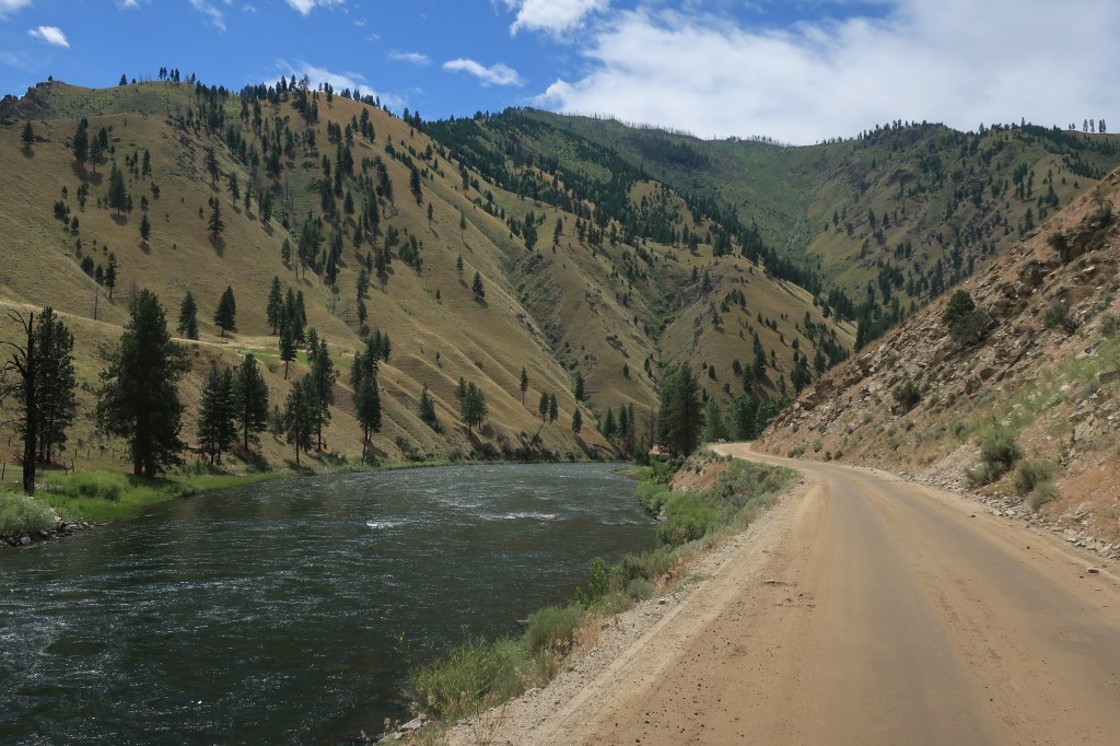
Sunday, July 12, 2020, Day 3 Sunday was a day of rest, mostly, except for a drive along the rapids of the Salmon River.
Salmon River, downstream of North Fork, Idaho
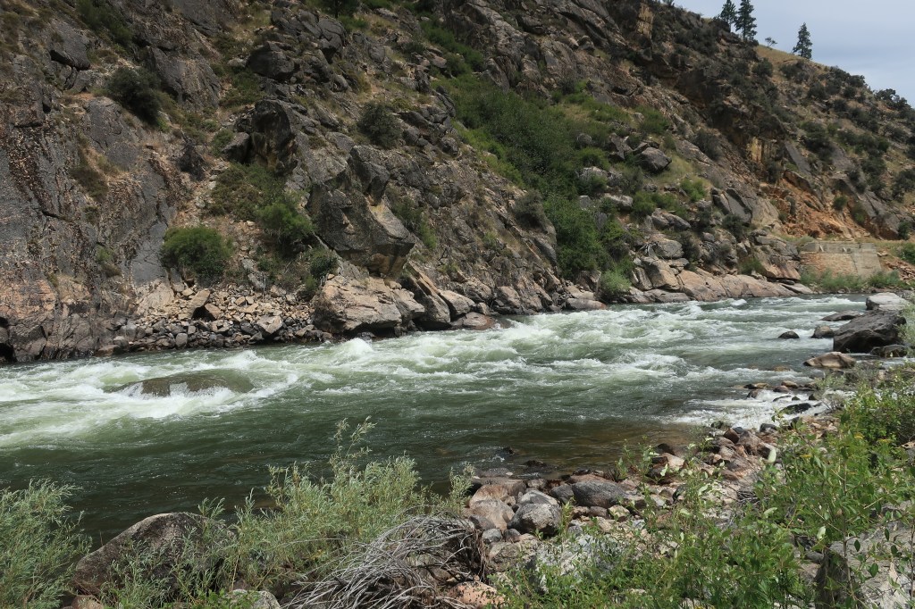
After crossing the Continental Divide at Lemhi Pass, Lewis and Clark figured they would make dugout canoes from the local timber and just float their way downstream until they reached the Columbia River and the Pacific Ocean. Captain William Clark, a master boatsman, reconnoitered the Salmon River on horseback for some 20 miles below current day North Fork, Idaho. Seeing the river’s extreme rapids and rocky banks, it was near this exact point that Lewis and Clark gave up on the water route down the Salmon.
Salmon River near where Captain Clark turned back.
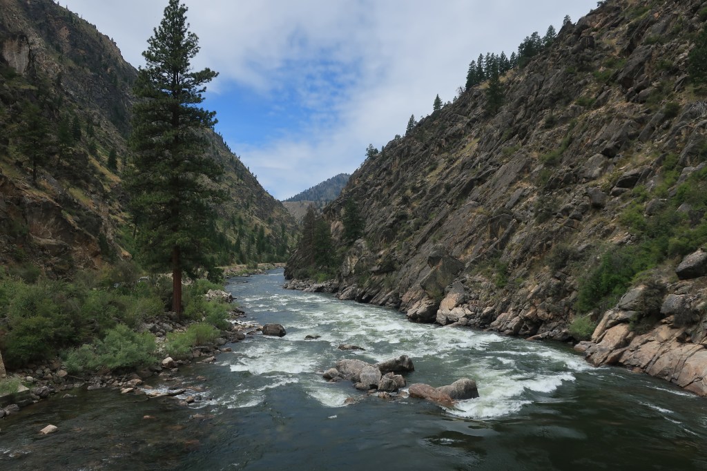
The Salmon River rollicks through these mountains for hundreds of miles and is, in fact, far too dangerous for travel by dugout canoes. These days, however, scientifically designed inflatable rafts take whitewater rafters downriver all the time — young and old, human and sometimes canine, with oars and usually beers in hand.
The dirt road along the banks of the Salmon ends just below the point where the Middle Fork of the Salmon joins the main branch. Beyond this lies the River of No Return Wilderness, perhaps the most remote area in the continental United States.
The carving on the log reads: Middle Fork of the Salmon — Yonder lies the Idaho Wilderness
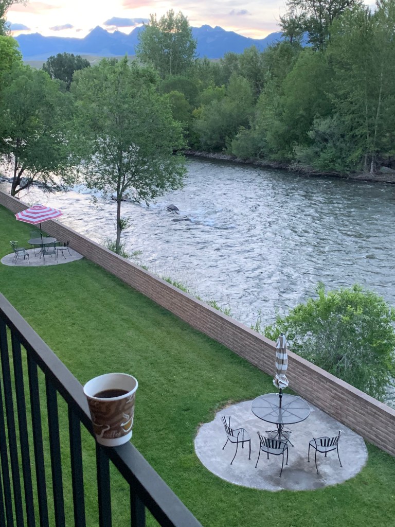
Monday, July 13, 2020, Day 4 Salmon, Idaho has beautiful mornings:
From the hotel room balcony. Salmon River foreground, Beaverhead Mountains background.
Breakfast at the Red Dog Diner on Main Street, which is actually part of a gas station. Aren’t all the best bbq places located in gas stations, like Joe’s in Kansas City? In this gas station, you get breakfast and can listen to the local old men talk politics.
Red Dog Diner. Salmon, Idaho
Here’s a look around the calm community of Salmon, Idaho, population 3,112 and county seat of Lemhi County:
Main Street. Salmon IdahoLemhi County CourthouseSalmon River
Back in the car by mid-morning. I’m heading north to Missoula, Montana the east to Helena.
Stickering the Montana sign has become a popular pastime for bicyclists and hikers.
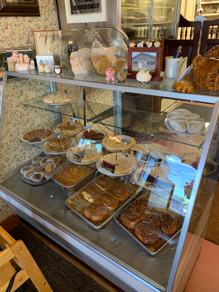
Following Lewis & Clark’s route (for a while) north into Montana’s secret Bitterroot Valley. Huckleberries grow here and I had to include them in my lunch in Hamilton, Montana (population 4,348 and growing fast).
Lunch at the Coffee Cup Cafe in Hamilton, Montana. Huckleberry pie included.Pie and Pastry displayCalm and Community at the Coffee shop
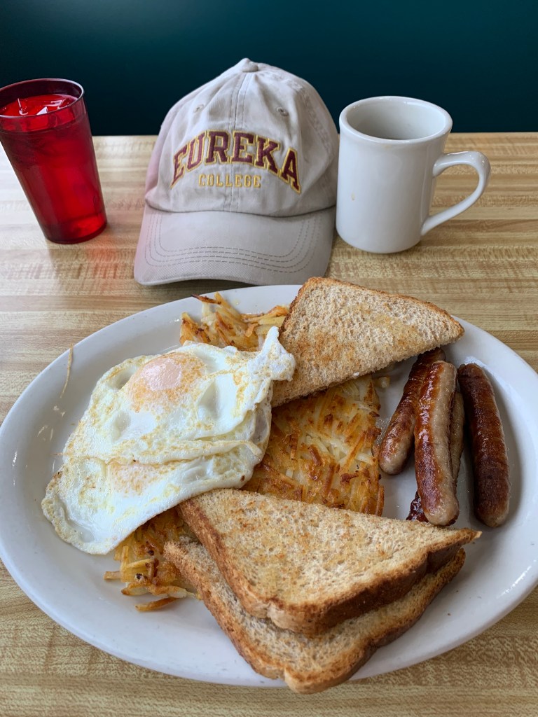
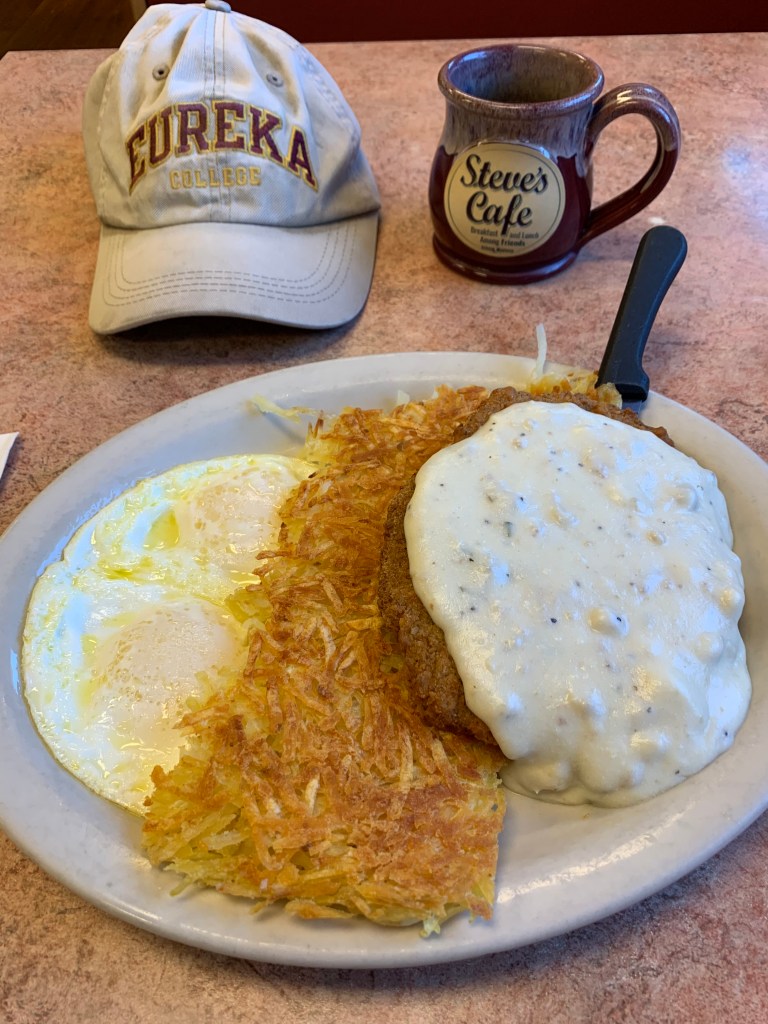
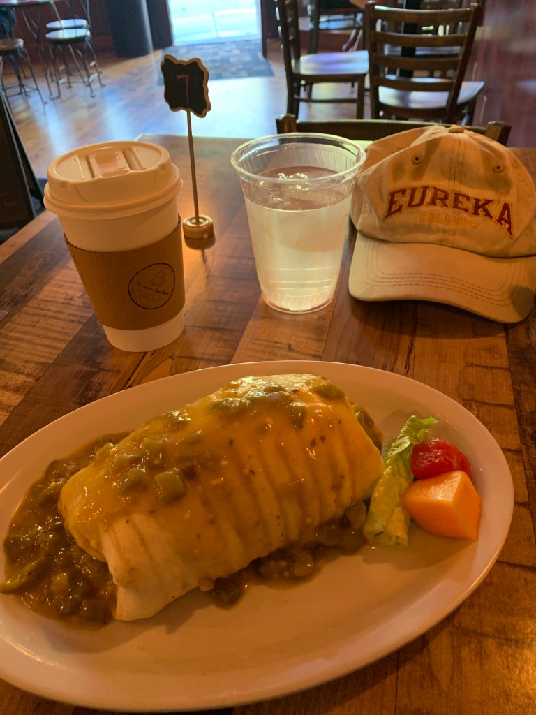
Tuesday, July 14, 2020, Day 5 Breakfast at Steve’s Cafe in Helena!
Chicken Fried Steak with hashbrowns. Eggs over easy.
Link: Steve’s Cafe, open for breakfast and lunch among friends. Click the link — just looking at the photo will make you hungry.
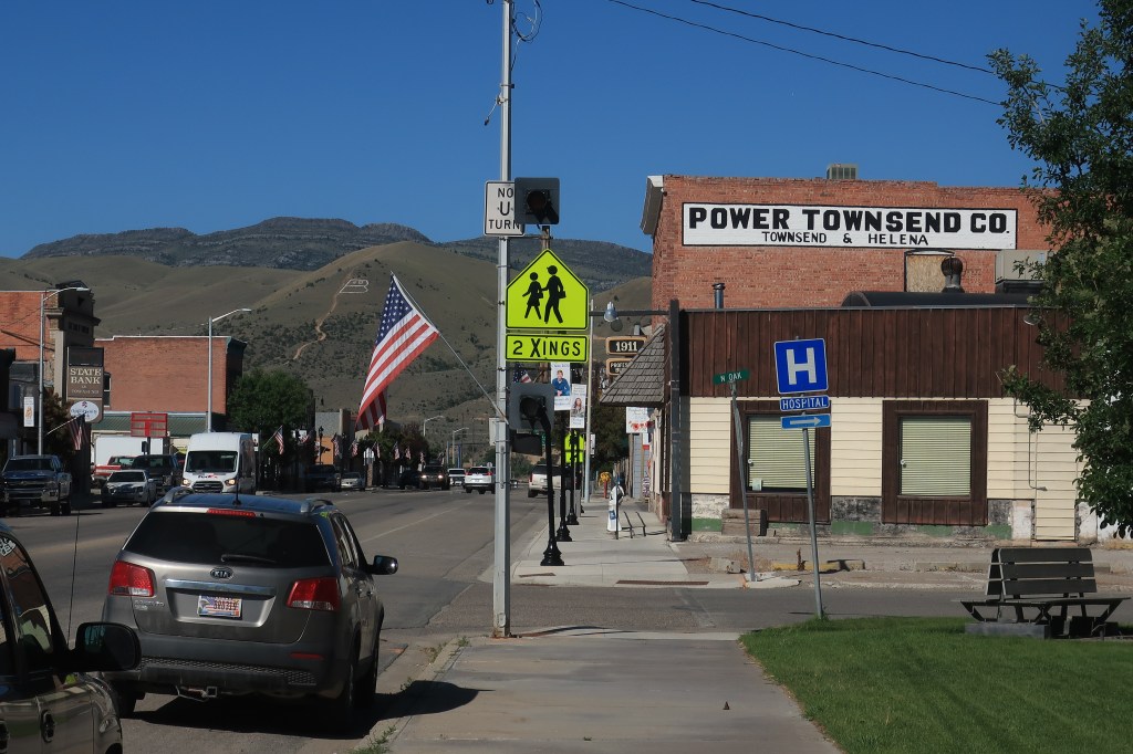
Today I’m off across the Montana plains to see some small towns and courthouses. First stop, Townsend (population 1,878).
Broadway Street Townsend, MontanaPhotos of seniors from the Class of 2020 have been placed up and down Main Street.
The practice of putting photos of graduating seniors on town light poles will become a theme among Montana towns I visit today.
Missouri River Trading Post, Antique store.A bungalow on Broadway, Townsend, converted to professional offices.
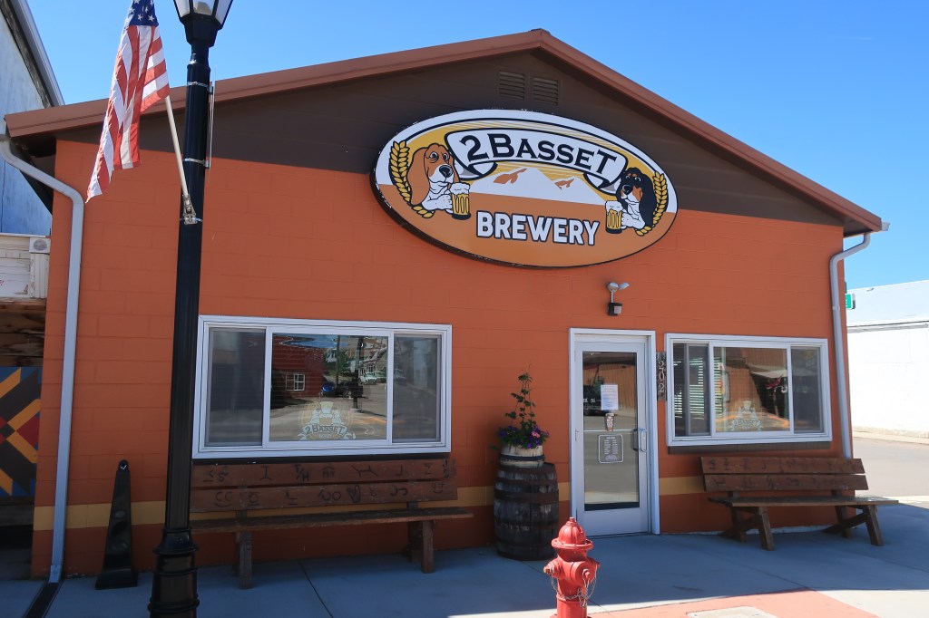
On down the road, through some hills and ranches to White Sulphur Springs, Montana (population 939).
2 Basset Brewery White Sulphur SpringsMain Street White Sulphur SpringsInside the Meagher County Courthouse
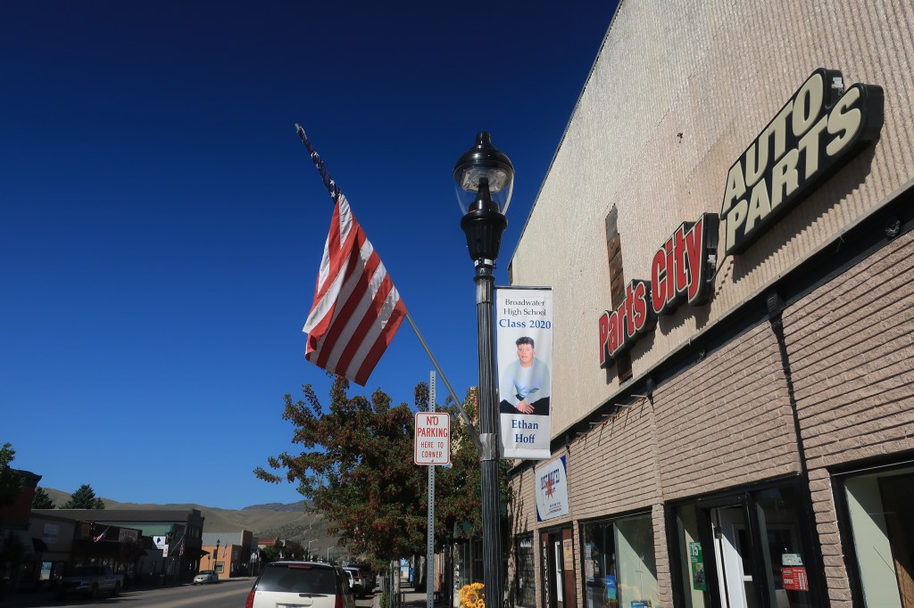
Next stop: Harlowton, Montana (population 997)
Statue at the Wheatland County Courthouse, Harlowton, MontanaOld bank building, Harlowton St. Joseph Church, HarlowtonThe old Graves Hotel, Harlowton, Montana
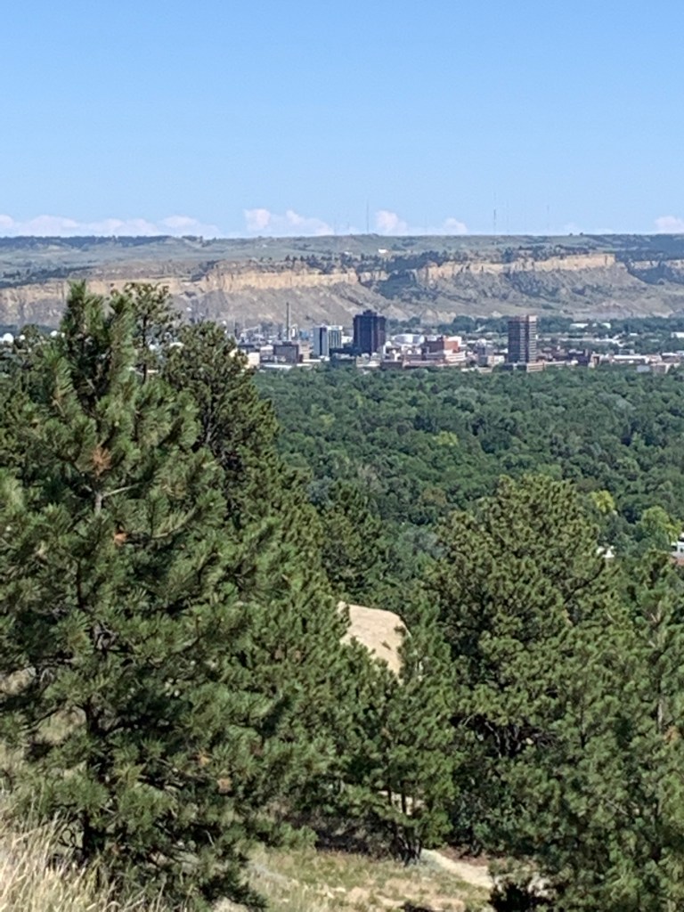
Late in the afternoon, I arrived in Billings, Montana (population 109,577). I took some photos from the ridge above the city.
Billings, Montana from the airport area
I’ve enjoyed each of my many visits to Billings. Billings has a surprisingly vibrant downtown with a good choice of hotels, restaurants, steakhouses, brewpubs, and Montana casinos. A few short blocks away, old-town Billings has its own group of bars and restaurants clustered around the old train station.
Links: most convenient yet affordable lodging in downtown Billings: The Clocktower Fanciest restaurant in Billings ($30-50 per person): Walkers Grill. See and be seen at the bar, if you’re into that.
Breakfast is free with a night’s stay at the Clocktower. Opens early at 5:30. Dare yourself to walk out of this place without one of their giant cinnamon rolls.
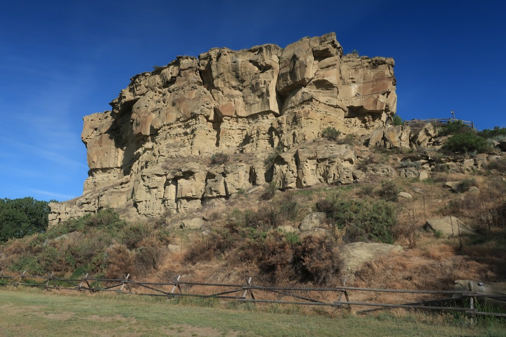
Pompey’s Pillar:
Pompey’s Pillar
Pompey’s Pillar National Historic site lies about an hour east of Billings along I-94. The rock formation along the Yellowstone River has been used as a landmark and register for travelers for centuries. Its most famous signatory carved his name into the rock in 1806:
W. Clark. July 25, 1806
William Clark and half of the Lewis and Clark expedition came this way on their return trip from the Pacific in the summer of 1806. Clark inscribed his name and named the edifice “Pompey’s Pillar” after Sacajawea’s infant son, who was nicknamed “Pomp” by the crew. Captain Lewis and the other half of the company were exploring the Marias River in northern Montana at the time. The two groups would rendezvous at the junction of the Yellowstone and Missouri rivers shortly thereafter.
Visitors can climb up to see the preserved markings:
Pompey’s Pillar
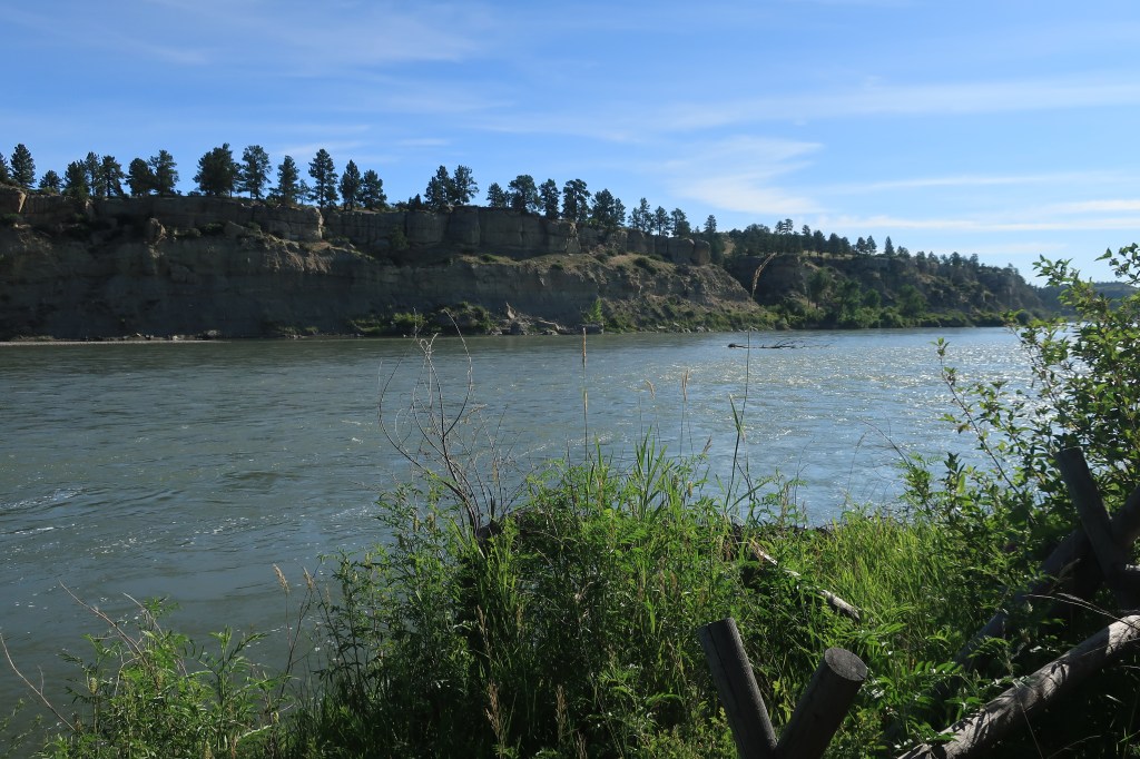
The area has a calm, park-like setting.
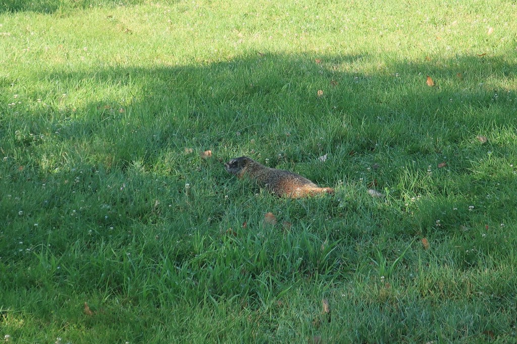
Yellowstone River at Pompey’s PillarYellowstone RiverA beaver or groundhog, or some other critter or varmint-like mammal enjoys an early feed before more people arrive.
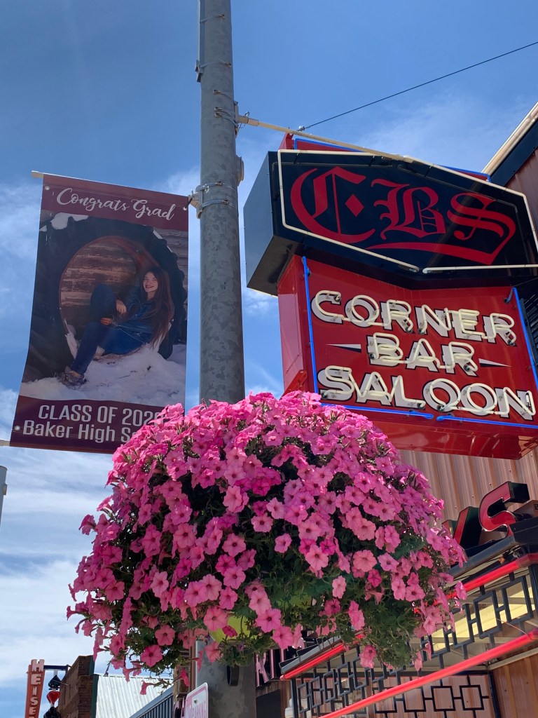
I stopped in Baker, Montana (population 1,741), near the North Dakota line, to find another town honoring its graduating seniors with lamppost fame. Perhaps the town does this every year, but it’s a very nice gesture for the class of 2020 who didn’t have a formal graduation ceremony. I’ll do my part to make them famous.
Link: Corner Bar Saloon, Baker. Sandwiches for lunch for me. Sat at the bar without drinking. Stuck a $20 in one of the Montana video poker games and quit with $22.50. Pool tables were not being used during the lunch hour.
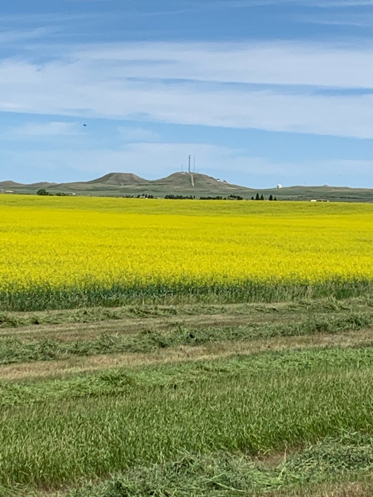
Into North Dakota. Wide fields of canola near the town of Bowman (population 1,650) in the extreme southwestern part of the state.
Farmers at work (aren’t they always?)
Amidon (population 20), Slope County, North Dakota once billed itself as America’s smallest county seat, but no longer. Wikipedia has the skinny (link):
Amidon was the smallest incorporated county seat in the 2000 census. When the 2010 census reported its population as 20, it became the second-smallest incorporated county seat after Brewster, Nebraska, with a population of 17. In 2000, Amidon had 26 people to Brewster’s 29.
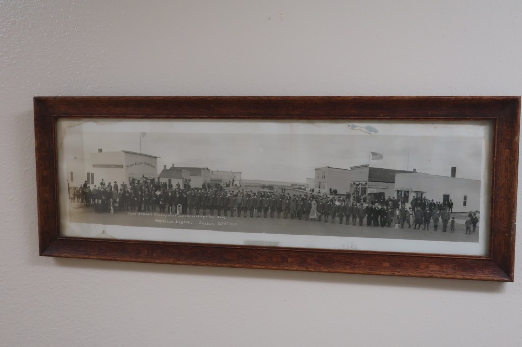
Slope County Courthouse. Amidon, North DakotaGone but not forgotten1919: American Legion First Annual Encampment after the end of the Great War. Amidon, North Dakota
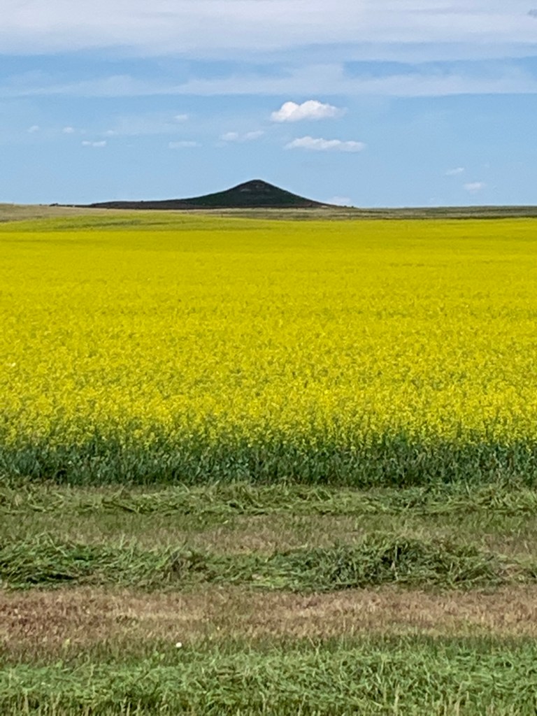
I end the day with a long drive to Minot (population 40,888), North Dakota, past oil wells, fracking towers, and wide bright canola fields sprinkled with glacial ponds called ‘sloughs’ (more on those later).
Thursday, July 16, 2020, Day 7 Hotel breakfast. Mistake. Should have eaten at Denny’s down the road.
I was rewarded with an early morning view of the Upper Souris National Wildlife Refuge, northeast of Minot.
A lone black bird photobombs my landscapeSouris RiverCanola Fields
The town of Mohall (population 783), Renville County North Dakota. This is one of my favorite photos of the whole trip — a city worker using a heavy forklift to carry a crate of water and a sprinkler attachment to water all the town’s flower pots.
Using heavy machinery to water the town’s flower pots on Main StreetMemorial Courthouse, Renville County, Mohall, North DakotaSt. Jerome’s Church, Mohall, North DakotaMain Street, Mohall North Dakota
Finally, this. Found in a basement meeting room of the county courthouse.
Read this. It was probably written during one of the World Wars
The town of Bottineau, North Dakota, with a population of 2,211.
The town’s namesake, Pierre Bottineau. Trapper and guide.Grain elevators. A common sight on the Plains
In the background of the next photo, Main Street can be seen ascending into the heights north of town. These heights are a plateau known as Turtle Mountain. More on Turtle Mountain later.
Main Street, Bottineau, North DakotaA bank becomes a bar
Somehow I missed the highlight of Bottineau, the Pride Dairy. They are the last small town creamery in North Dakota, yet they supply their ice cream, cheeses, and syrups to locations as far away as Mount Rushmore. Hint: try their ice cream bars, called ‘Cow Pies.’ Larger and more delicious than the average ice cream bar.
Entrance to the International Peace Garden, on the boundary line between the United States and Canada
Link: The International Peace Garden. Situated literally on the boundary line between North Dakota and the Canadian province of Manitoba, this park was dedicated on July 14, 1932, to peace between the two large North American neighboring countries. This site in particular was chosen with a nod to its location near the geographical center of North America.
It was here in the Peace Garden gift shop that I first tried ice cream from the Pride Dairy in Bottineau — and was so sorry I hadn’t stopped at their ice cream parlor when I was in town. Their ice cream is fantastic!
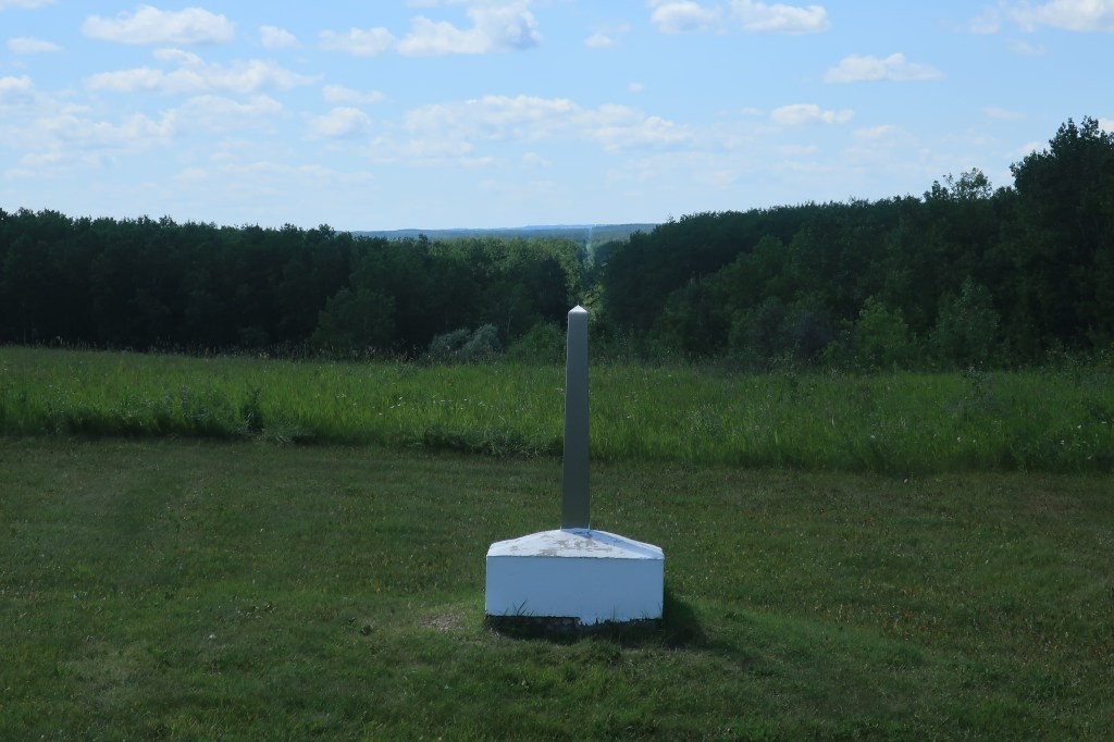
One last photo of the Peace Garden shows an international boundary marker and the clearing marking the boundary extending in the far distance.
The International boundary between the United States (left) and Canada (right)
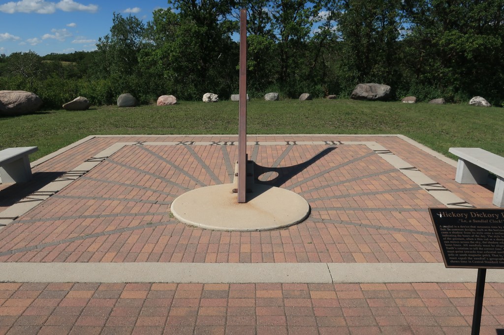
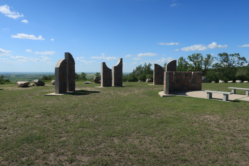
I took some back roads I had found on the map on my way back to Minot for the night. These little roads led along the crest of Turtle Mountain within five miles of the Canadian border. At one point I saw a highway road sign that simply said “Point of Interest” with an arrow pointing to a driveway off to right. No other explanation. Ok, I like mysteries, so I pulled up the driveway, around a bend, and found this:
Mystical Horizons
It’s a small park called Mystical Horizons (link) and it’s not shown or advertised on any map — I don’t know why.
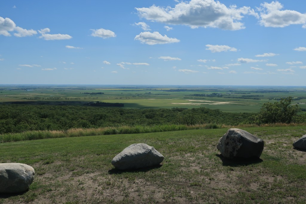
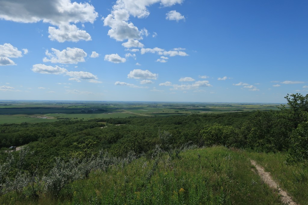
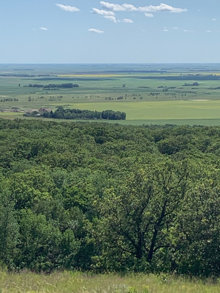
This one or two-acre park, unmanned, has a replica of Stonehenge-like astronomical clocks, a sundial, and a Polaris sighting tube (to be used in finding the North Star). The park sits atop Turtle Mountain with spectacular views of the North Dakota countryside below.
Sundial at Mystical Horizons showing 3:00 pm (4:00 pm Daylight Time)Astronomical observatory. Sunlight shines between the slots on the equinoxes and the solstices.Looking west from Mystical HorizonsYellow canola fields and blue ponds can be made out in the distance
Back to Minot for dinner.
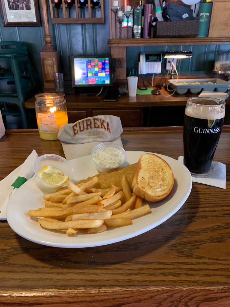
Fish and Chips at Ebeneezer’s Eatery & Irish Pub, with a well-earned Guinness
Friday, July 17, 2020, Day 8 Time to return to Colorado. It will be a 2-day drive. I left very early, before breakfast, heading south on US Highway 83.
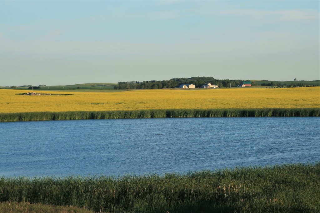
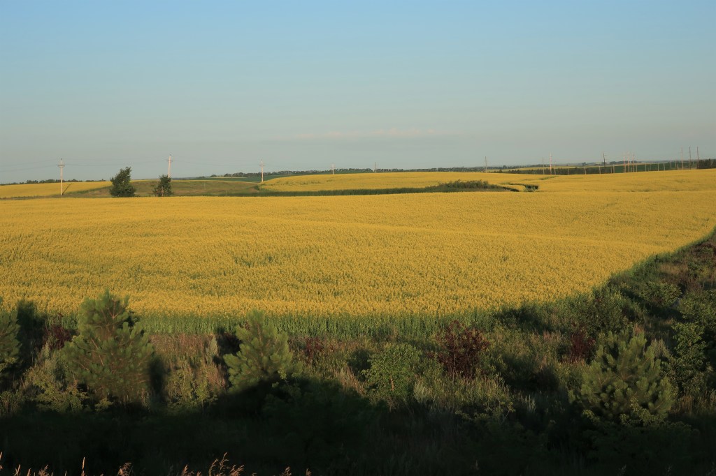
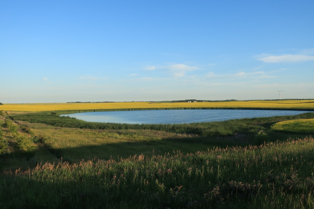
Canola fields and sloughs south of Minot, North Dakota
For miles and miles, the landscape was simply covered with canola fields interspersed with bright blue glacial ponds. I stopped on the side of the highway to take photos. After a bit state highway patrol car pulled up behind me to see if I was taking pictures or “just having a bad day.” This was near 7:00 in the morning. The trooper and I talked a bit, saw a deer running through one of the canola fields. I asked her if people around here referred to the water as ‘lakes’ or ‘ponds’ and she said they called them “sloughs” instead.
After another hour of driving, breakfast!
Hashbrowns are under the toast, and the patties are sausage patties, not corned beef
Link: Rolling Hills Restaurant at the Flying J Travel Center in Mandan, North Dakota. Mandan (population 22,752) is across the Missouri River from Bismarck. There’s nothing like a cooked breakfast at an Interstate truck stop!
It was a long, 100-degree hot drive down to Hot Springs (population 3,711), South Dakota. I was detoured around the Cheyenne River Sioux Reservation due to Covid-19 concerns. They’re having a hard time of it there and are restricting travel to locals and those with special permits.
That was a bit of a curveball after all the eggs and hashbrowns I’d been having this trip. Thank you to the Mornin’ Sunshine Coffee House (linked) for the excellent breakfast.
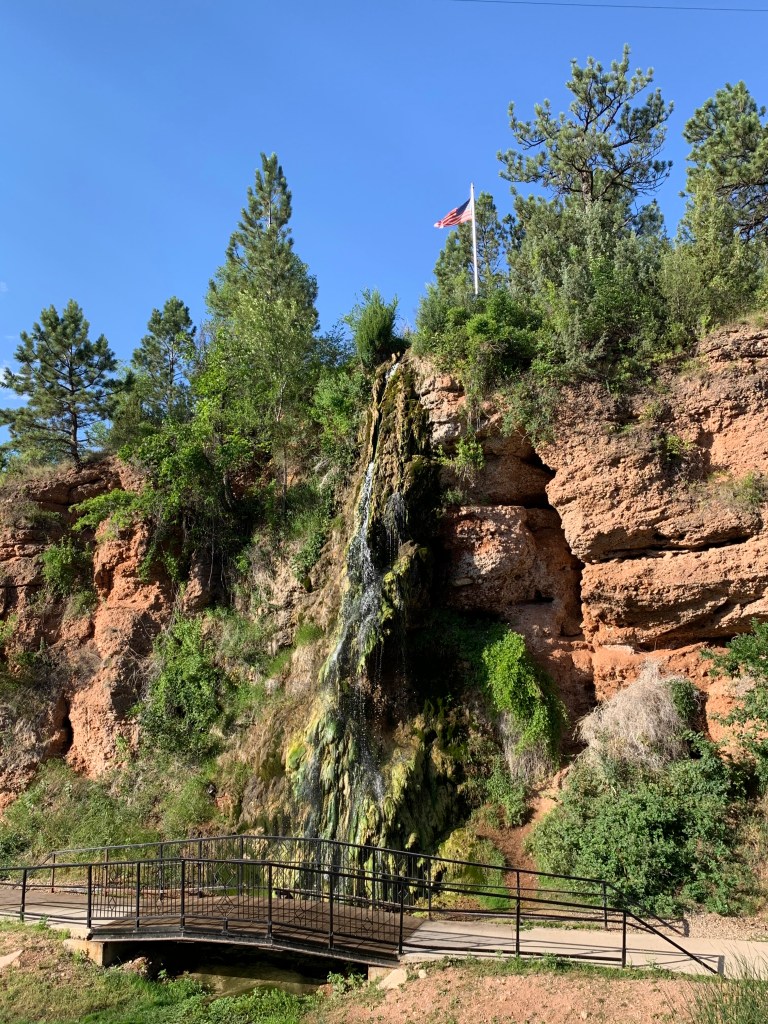
Hot Springs, South Dakota was once a very popular resort town back in the days when doctors prescribed “taking the waters” as a cure. Because it was built up at that early time the town’s buildings are mostly constructed of limestone blocks, giving the town an air of antiquity. It’s a great place and lies in a hilly country about 50 miles south of the Black Hills. I even saw a pair of newlyweds on their honeymoon.
The town’s claim to fame, of course, is its hot springs, shown here cascading down into the Fall River below.
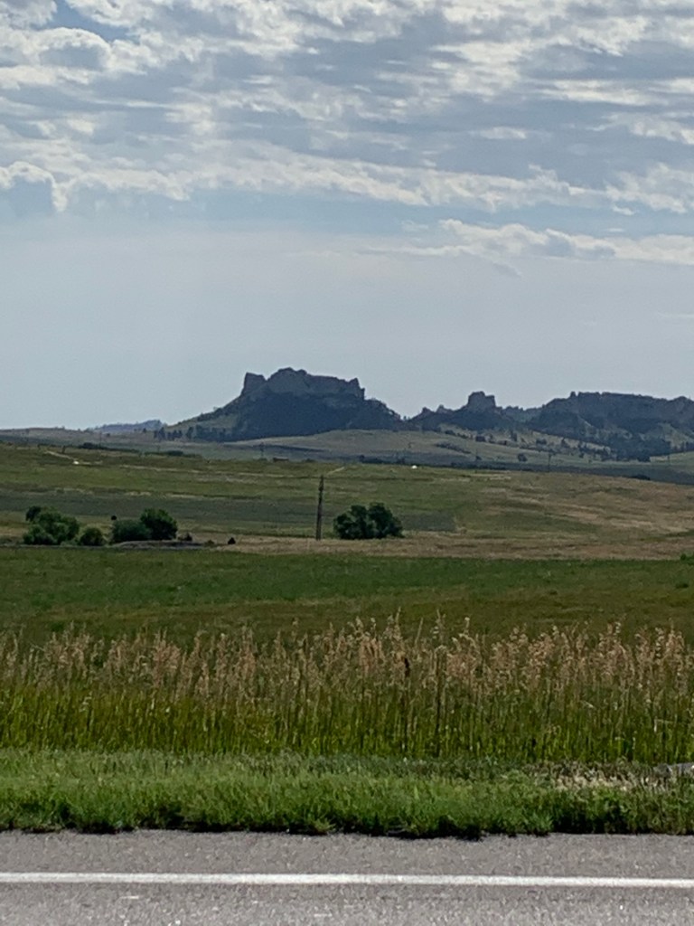
One last photo on the way home. I passed by Pine Ridge near Crawford, Nebraska (population 997). I’ve stopped in this town before, usually for gas, and always for some Dairy Sweet as well.
The Pine Ridge of Nebraska
Home to Colorado Springs by late afternoon.
A most epic trip! Hope you enjoyed it with me.
All photos were taken by the author in July 2020
A list of all Freedom Voyage posts in TimManBlog can be found here.
I travel as a hobby and not for a living (yet) — but donations are happily accepted if you’d like to help defer my costs. Thanks, The TimMan
Note: I wrote the draft of this post after visiting Waseca, Minnesota in June 2016 — but didn’t publish it. I’ve had a very busy schedule this month so I’m dusting off the draft and putting it out there today. Hope you enjoy it.)
June 28, 2020
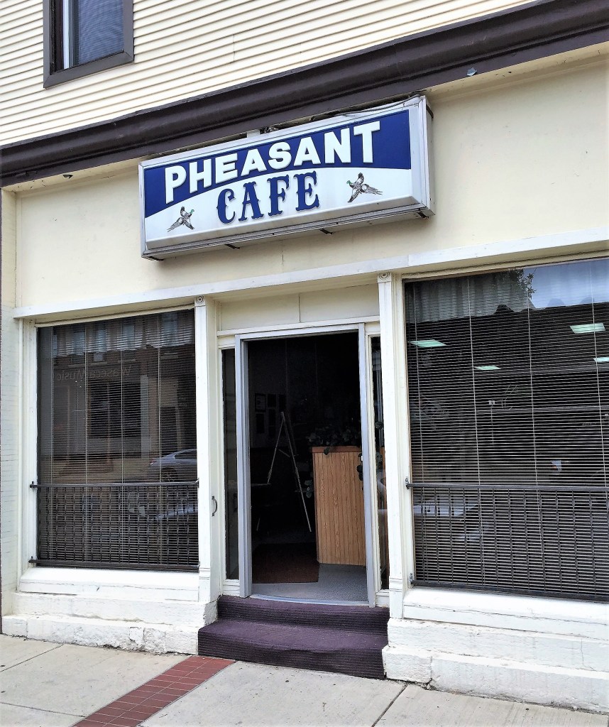
While sitting at the counter one bright summer morning at the Pheasant Cafe…
That cry echoed across the diner with the urgency of a Chicago commodities trader hawking pork bellies at the Merc.
I looked up from my ham and cheese omelet with hash browns to find the source of the sudden commotion. There, off to my far right sat four old men around a corner table. A fifth man, probably a septuagenarian, stood leaning forward, left hand on the table, right hand clutching five big red dice, ready to toss them onto a white tablecloth. Dishes and silverware from finished breakfasts had been pushed to the edges of the table, making room for a small pile of silver coins in the center. Old friends playing for nickels and dimes — early Thursday mornings here in rural Minnesota somehow resemble late Friday nights at Caesar’s in Las Vegas.
Meanwhile, not minding the rambunctious old men, a lone old woman sat at a separate table across from them, calmly sipping her coffee, waiting for her husband who should arrive in a few moments. At yet another table two old women sat together, similarly sipping their black coffee and waiting. Perhaps they are wives to one or two of the dice-playing men. Or perhaps they have no one to wait for. I wondered.
Waseca, Minnesota lies about an hour south of Minneapolis but a world away. It’s corn and soybean country; no casinos, those are an hour south in Iowa. Here’s a free plug for the Pheasant Cafe. Drop by someday — I doubt you’ll get any action, but the good food will be reward enough.
Outside the cafe, State Street has been prepared for the Fourth of July.
State Street. Waseca, Minnesota. (verified by the town water tower in the background)
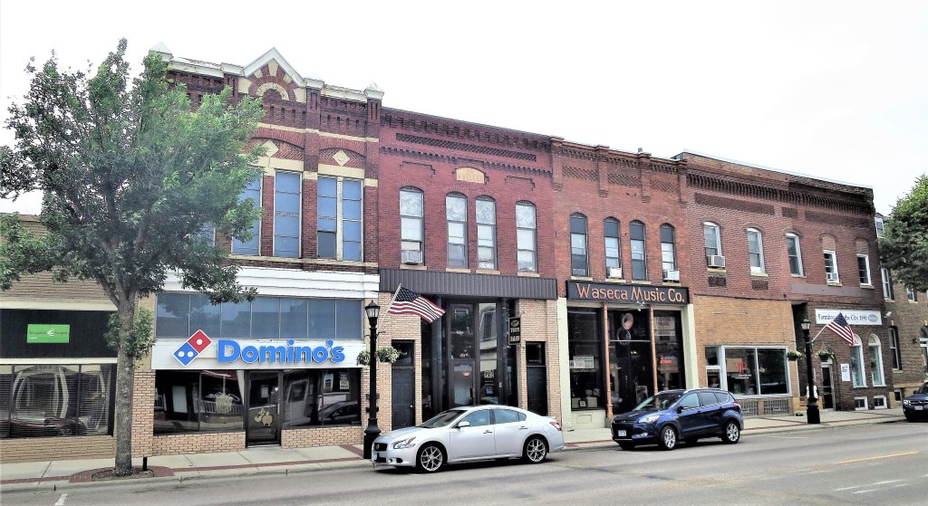
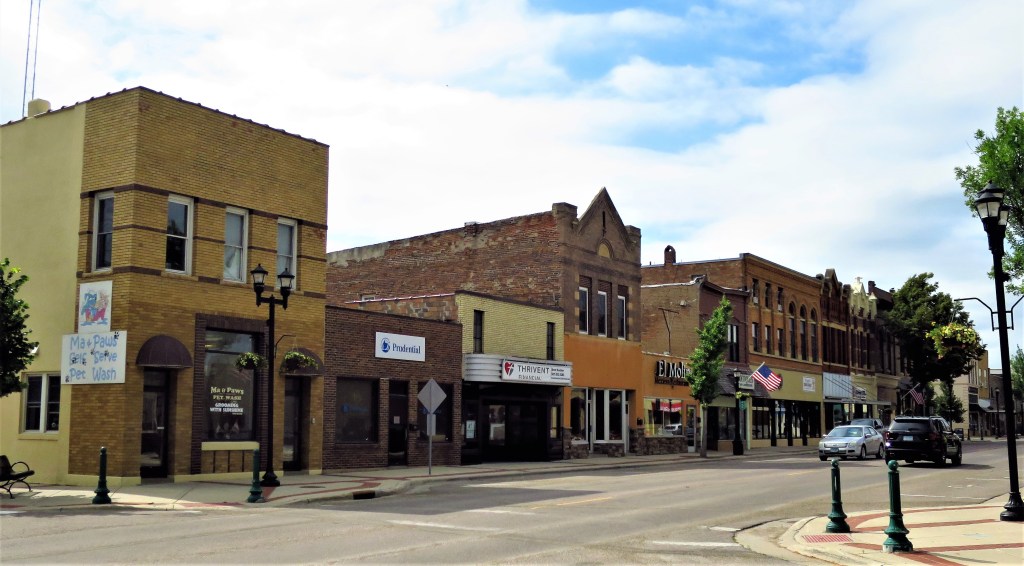
In addition to the classic breakfast café, Waseca successfully meets and exceeds all one’s small-town expectations. The two blocks of downtown businesses are all open. (This includes two other coffee shops, several bars, and at least two casual dining restaurants.) Side street houses are shaded by tall leafy trees. Lawns are being mowed, wood siding is being re-painted.
The Waseca Music Company, and other classic brick businesses. Waseca, Minnesota
The Waseca Music Company is still around, still on State Street. In fact, they’ve been around since 1952, which means they were around when the Beach Boys’ “I Get Around” charted to number one in the United States in 1964. The Waseca Music Company probably sold that record as a 45.
Thrivent Financial, El Molino Restaurant. State Street. Waseca, Minnesota
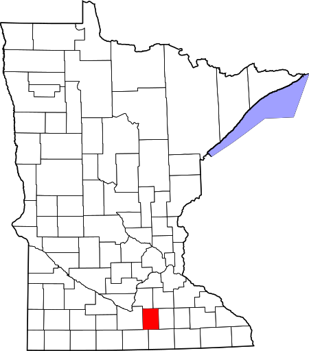
Waseca boasts a population of 9,000. That’s small but growing — 9,000 is its largest size since settlement in 1867. Waseca is the largest town in Waseca County and the county seat.
People think Minnesota is full of Swedes, but the census says that there are twice as many people of German descent here as there are Scandinavians, and in turn twice as many Scandinavians here as Irish, who are twice as many as the combined totals of all other Waseca residents.
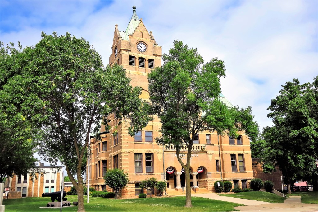
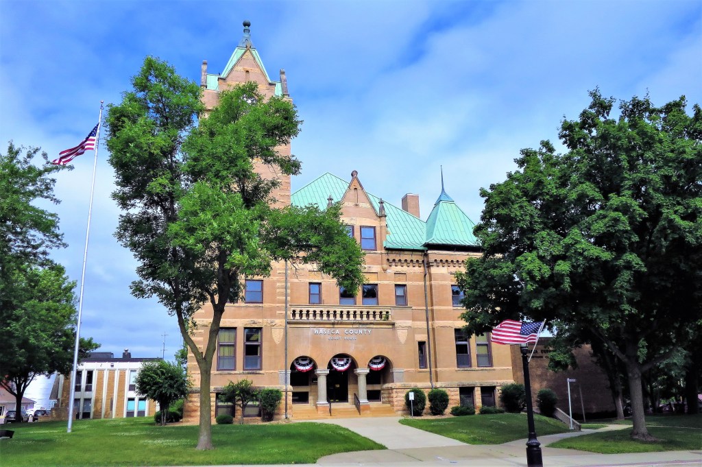
Waseca County Courthouse, preparing for Fourth of July festivities
Built in 1897, this Richardson Romanesque structure has three granite pillars across the front entrance. The entrance is clothed in American flag banners in anticipation of the Fourth of July just two weeks away at the time of the photo. Above it all, a corner, four-faced clock tower rises 100 feet above the ground and keeps accurate time.
Waseca County Courthouse
This courthouse can be found on the National Register of Historic Places. Here’s some additional information on Wikipedia. That entry, however, doesn’t mention the cannon found on the courthouse lawn. It seems too large to be from the Civil War — perhaps it’s a World War I artifact.
Cannon at Waseca County CourthouseWaseca County in the state of Minnesota
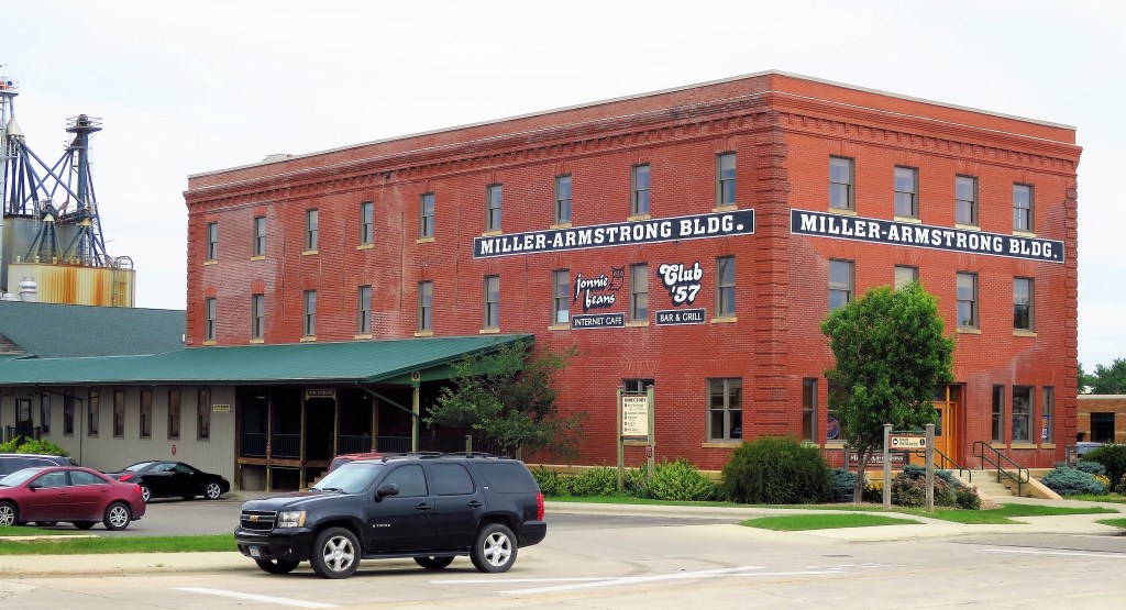
Nearby grain elevators give away the county’s main line of business.
The old Miller-Armstrong Building. Waseca, Minnesota
Later on, as I walked along a residential street, three 10-year-old girls ran swiftly past me on the sidewalk. I heard: “Hi”, “Hi” (the third one a bit behind the other two) and “Hi”. Wearing summer pastel shorts and t-shirts, each one said good morning to the stranger (me) as they rushed along to accomplish 10-year-old girl things.
They were probably going to the lake. Every Minnesota town has its own lake — didn’t you know that? Until James Lileks features Waseca in The Bleat, you can find out more here (the website has a rotating series of photos and the 2nd one is a good aerial view of the town and lakes).
All photos were taken by the author on June 23, 2016.
A list of all photo posts from the American County Seats series in TimManBlog can be found here.
I travel as a hobby and not for a living (yet) — but donations are happily accepted if you’d like to help defer my costs. Thanks, The TimMan
(Note: I wrote the draft of this post after visiting Heber City, Utah in May 2012 — but didn’t publish it. I’ve had a very busy schedule this month so I’m dusting off the draft and putting it out there today. Hope y’all enjoy it.)
An old wit once compared the nineteenth-century Mormon pioneers of Utah to the Jewish refugees who settled in Israel after the Holocaust — fleeing oppression, both groups settled in barren deserts only to turn them into beautiful gardens.
As I drove into Heber City, Utah, I could tell this was an old Mormon town just by reading the street signs. The Mormons are peculiar yet conformist — each Mormon town has the same street layout, a rigid system of grid numbers. There are never streets named for trees, ex-Presidents, nor even esteemed Mormon leaders. Instead, a street 9 blocks north of the town center is called simply “900 North” while a street 3 blocks east of the town center is “300 East,” and so forth everywhere. The only exceptions are for the central north-south street, called “Main”, and the central east-west street which is called “Center”.
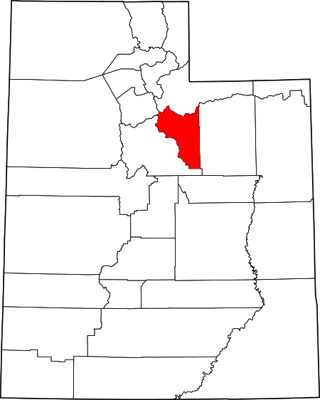
Wasatch County in the state of Utah
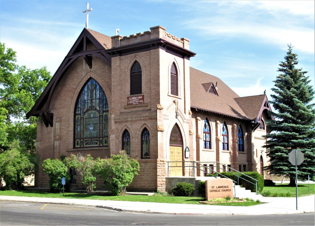
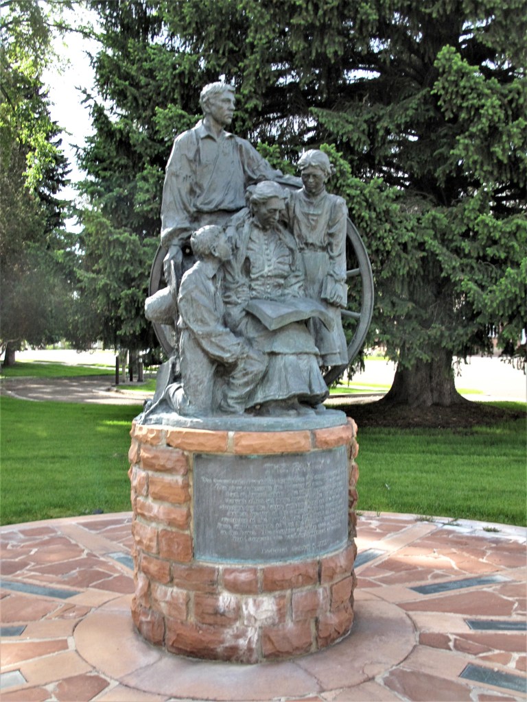
Each Mormon town has a tabernacle, and it usually rises at the intersection of Center and Main, the center of town and so symbolically the center of town life.
Pictured below is the old Wasatch Stake Tabernacle in Heber City, built in 1889. Today this is just a historical artifact — having outgrown the old building the local congregation has since built a larger facility nearby.
Wasatch Stake Tabernacle with the statue of “The Family,” Heber City, Utah
I glanced quickly at the bronze statue of “The Family” on the temple lawn. At first, it seems like a typical statue honoring a simple pioneer family, yet I thought it a peculiar subject for the formerly polygamous Mormons. Nevertheless, it is true that the LDS church outlawed polygamy in 1890 and that only a minority of Mormons practiced it even when it was sanctioned.
Wasatch Stake Tabernacle
Heber City was founded in the late 1850s by English immigrants of the Mormon faith (early Mormons heavily evangelized in England) and named for Mormon leader Heber C. Kimball. Like many other Utah towns, Heber City is often referred to as just “Heber” — as Salt Lake City is often referred to as just “Salt Lake” or Brigham City as “Brigham.”
Heber is down-slope from its famous ski neighbor Park City (or is it just “Park”?) on the eastern slopes of the Wahsatch Mountains. The area is a combination of old-time Mormon community and newer, ski-related growth. The two appear to intermingle well. The established folks provide services to the newer ski group who in turn spend their money on land and retail sales.
Business block at the Corner of Main and Center. Heber City, Utah
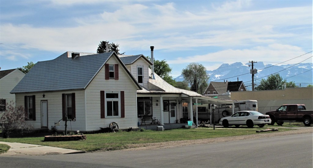
Heading away from the intersection of Main and Center, I photographed a typical home — smallish but well-kept and with a fantastic view behind it:
In the Shadow of the Wahsatch. Heber City, Utah
Snow-capped peaks in the background. It’s late May.
Heber City is prosperous. New, upscale restaurants compete with fast food places and national-brand big-box stores up and down Main Street. Competing with McDonald’s, Heber offers you Dairy Keen (“Home of the Train”) — a family-oriented hamburger and ice cream shop featuring a miniature train running in a loop along the edge of the dining room ceiling. Everybody loves trains!
Dairy Keen was nearly full when I went inside; half were eating while the other half were watching the trains chugging along over their heads. Here’s a link so that you can support them the next time you’re in Heber: www.dairykeen.com.
Dairy Keen, Main Street. Heber City, Utah
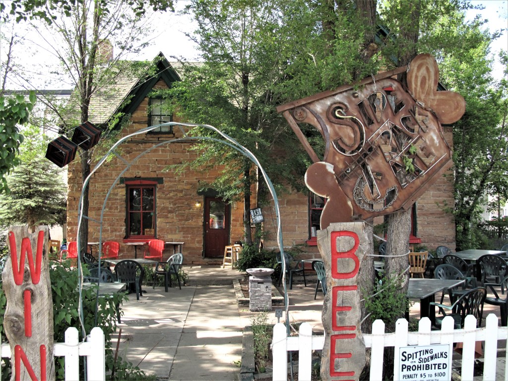
Another promising place is the Side Track Café and espresso bar. (Note: the photo was taken in 2012; the Side Track has since closed).
Side Track Cafe
Built into an old Mormon stone house the Side Track offered all the products Mormons notoriously eschew — beer, wine, espresso and live music. In fact, the Side Track seems to be flaunting them. Perhaps the owners are rebellious old hippies but I’ll never know since the Side Track Café was closed when I dropped by — even though their flashing neon sign said they were O-P-E-N, O-P-E-N, O-P-E-N.
When saying that Heber City is a “Mormon” town that doesn’t mean that the town is only Mormon. Other faiths are well-represented:
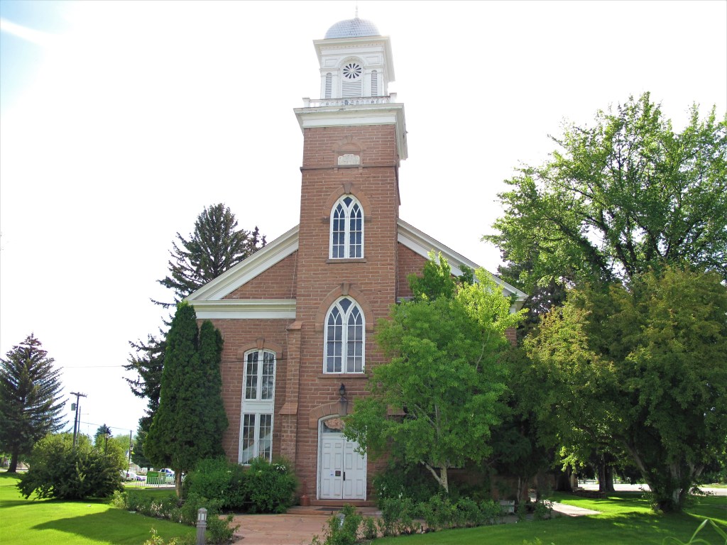
St. Lawrence Catholic Church, corner of Center Street and 100 West. Heber City, Utah.
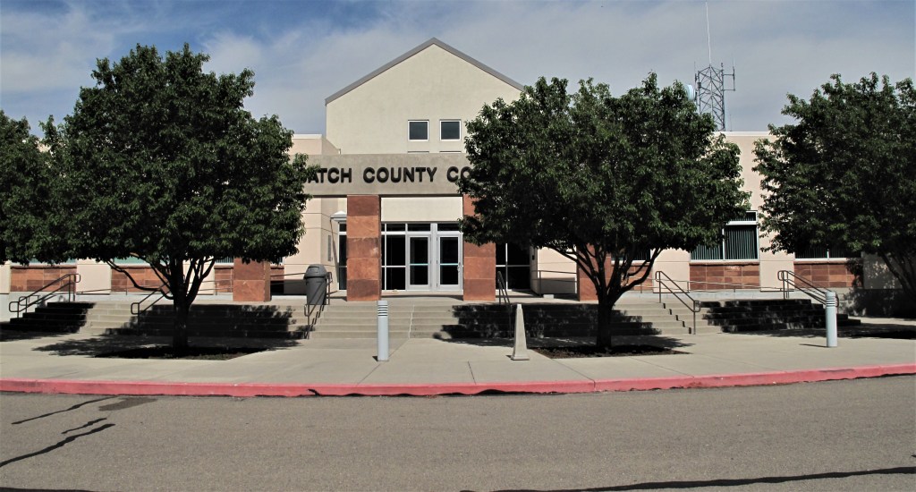
Because Utah is booming, nearly every county seat I visited in the state has a new courthouse and a new justice center. Wasatch County’s new justice building is just south of town. The structure is a semi-circular ranch-style building covered by a red stone veneer with yellow stone trim.
Wasatch County Courthouse. Heber City, Utah
Let’s finish back at the beginning with the old Tabernacle. In front of the old tabernacle is a bronze statue of a pioneer family called “The Family.”
Statue of “The Family.” Heber City, Utah
Here’s the inscription:
The monument’s foundation symbolizes the eternal nature of the family. The plow represents the industry of man. The wheat is the fruit of honest labor. The wheel represents progress; through effort we move forward. The father provides direction for the future with his hand on the wheel. The mother, located at the center, provides teaching and nurturing of the family. The son kneels at his mother’s knee which reminds us that the greatest lessons are taught in the home. The daughter standing with a book in her hand suggests the need for continued education.
First, there is “industry” then “labor” and then “progress” through “effort”. “The Family” travels in a setting of Liberty: This is a statue of the American experience — a Statue of Liberty if you will. This monument could represent any of the many American pioneer emigrations and could be appropriate in any number of states: in Kentucky showing how Daniel Boone led settlers through Cumberland Gap, or in Oregon at the end of the Oregon Trail, or even in Massachusetts describing the Pilgrims landing at Plymouth Rock.
All long journeys are both physical and spiritual endeavors. Anyone who says otherwise hasn’t read “Huckleberry Finn.”
Although today’s modern journeys are less physically taxing than those of our ancestors, they can be just as spiritually transformative. Try it. You’ll see.
Finally:
Plaque honoring Heber C. Kendall. Heber City, Utah
The People of Heber City cherish the heritage bequeathed by our pioneer forebears and the challenge set forth by the city’s namesake, Heber C. Kendall: Now you people have named your little town after me. I want you to see to it that you are honest, upright citizens….that I may not have cause to be ashamed.
All photos were taken by the author on May 30, 2012.
A list of all photo posts from the American County Seats series in TimManBlog can be found here.
I travel as a hobby — donations are happily accepted if you’d like to help defer my costs. Thanks, Tim
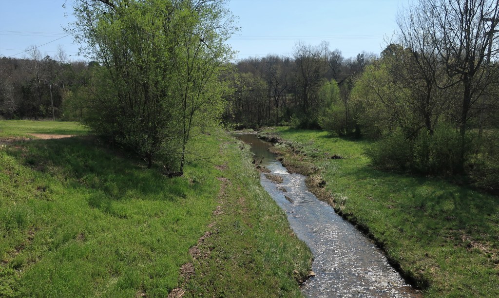
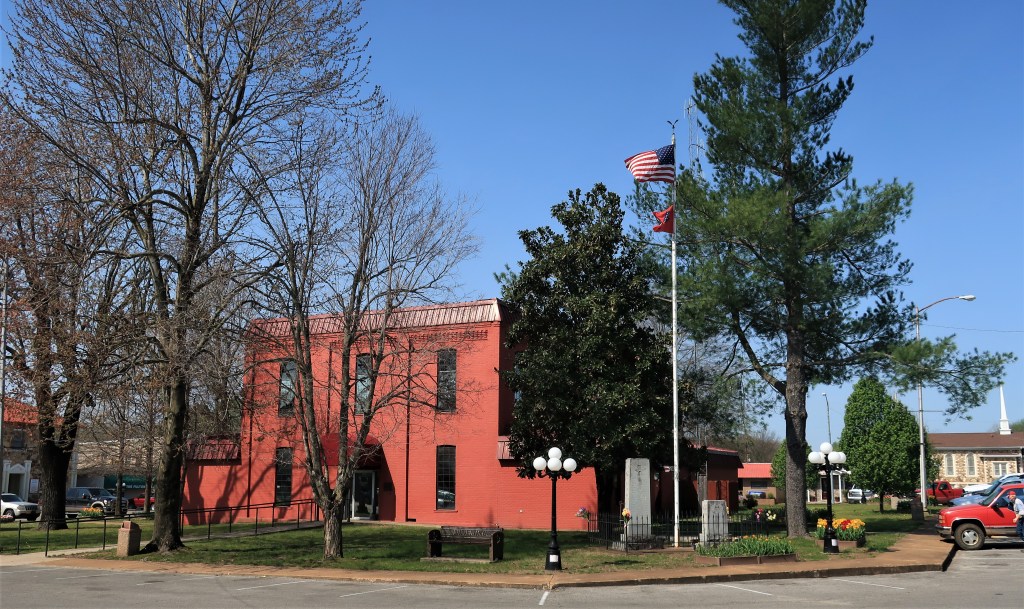
Salem, with a population of less than 2,000, is the largest town in northern Arkansas’ Fulton County. The landscape here consists of rolling farmland, yet mostly used for cattle raising from what I can see. It’s hard to say if the county is considered part of the Ozarks or not – there are some tall hills around but I wouldn’t call them mountains.
Town Creek. Salem, ArkansasFulton County in the state of Arkansas
The Salem has the standard town layout – the courthouse is at the center of the town square with roads and businesses on all four sides.
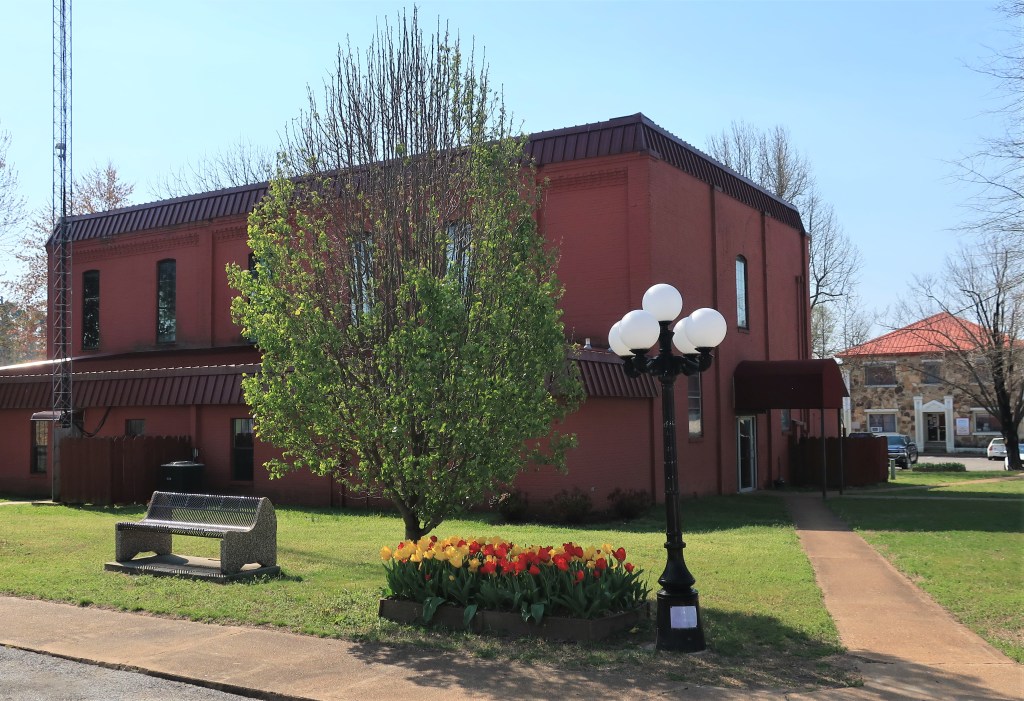
Fulton County Courthouse. Salem, Arkansas
A sign on the courthouse lawn explains that the land for the Fulton County Courthouse was donated in 1842. The current building was constructed in 1891 and renovated in 1974. It’s a two-story brick structure with the bricks painted red. The architecture I would characterize as sturdy – there are no adornments whatsoever. It’s purely functional.
Inside the courthouse, some professional photographs of rustic county scenes line the single first-floor hallway. These are professionally done and very striking photographs. I’m surprised that they aren’t for sale, I imagine each one could sell for hundreds of dollars.
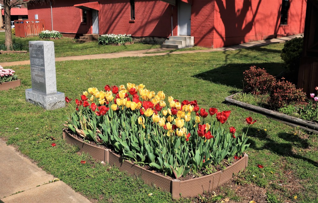
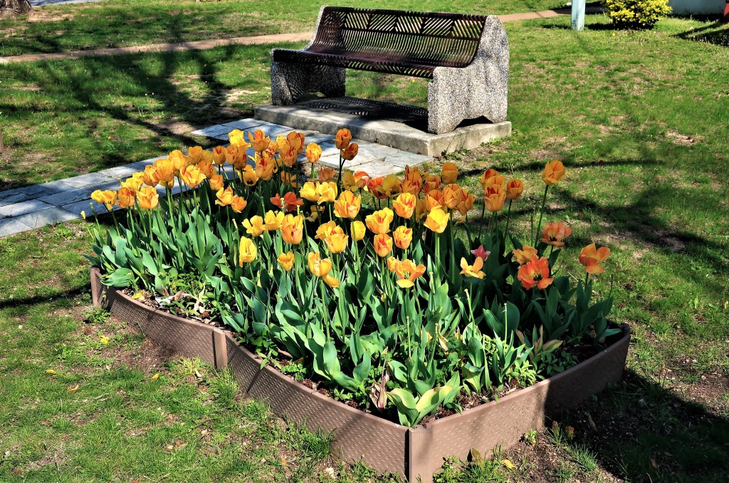
A local group called the “Fulton County Master Gardeners” provides landscaping for the courthouse lawn and they did an excellent job. The group maintains over a dozen flowerpots on the lawn currently filled with blooming tulips. Here are some examples of their fine work:
Tulips at Fulton County Courthouse. The stone marker on the left describes the Civil War battle of Salem, March 11, 1862.Tulips at Fulton County Courthouse. The small sign above the planter identifies the work of the Fulton County Master Gardeners.
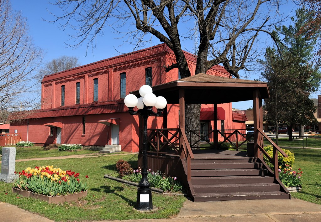
I took some photos around town. Salem is a small place.
Looking east down Church Street. Salem, Arkansas
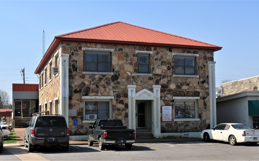
On one corner, Swingles Family Diner looks inviting although I’ve had breakfast already. Nearby, an old two-story stone building is marked “Federal Building“. It’s nice to see the Federal Government occupying such humble offices for once. The sign on the door lists 3 offices: Election Office, Revenue Office, and the Veterans Office.
The Federal Building in Salem, Arkansas
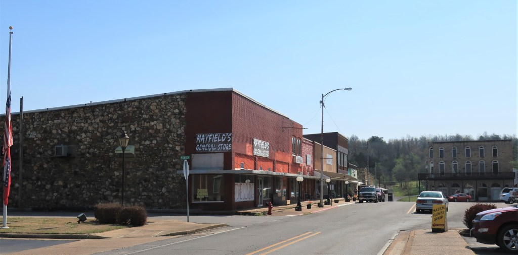
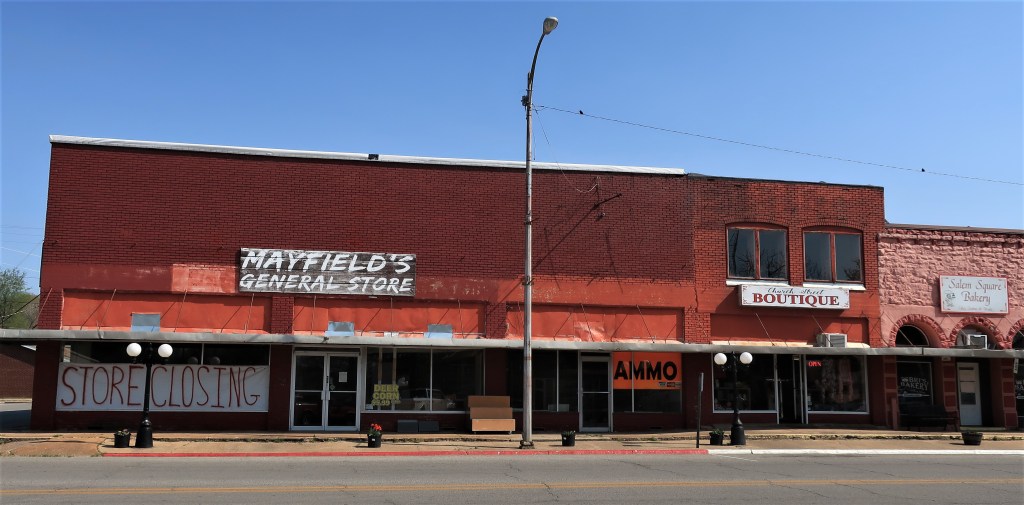
The newest building around the town square is the Bank of Salem, a catercorner to the courthouse. Across the street from the bank, Mayfield’s General Store is sadly going out of business, leaving others to services the town’s feed corn and ammo needs.
Businesses along the town square in Salem, Arkansas.
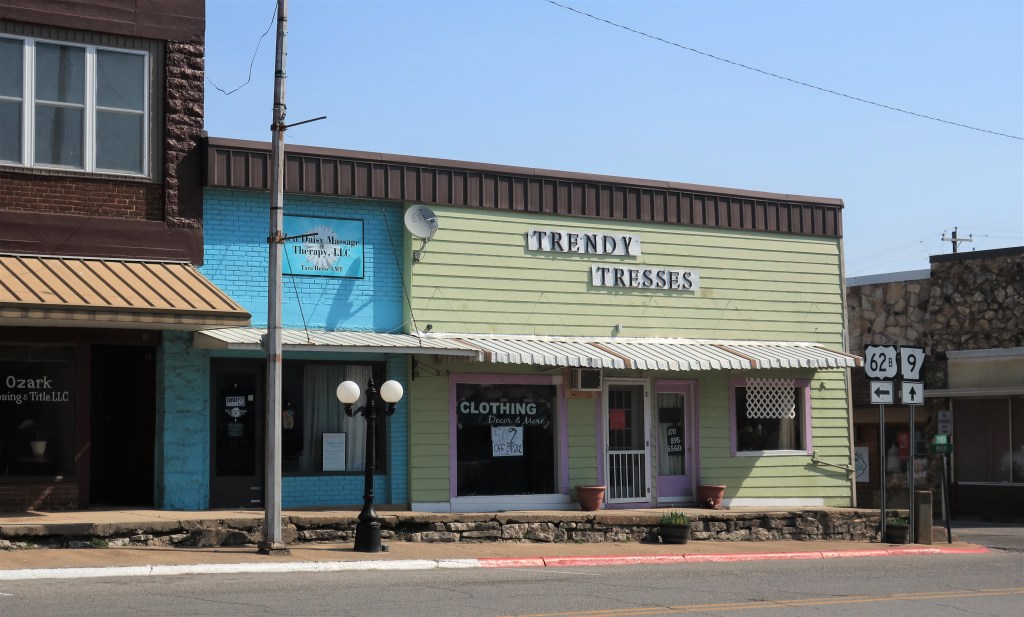
However, the true center of town is the hair salon down the street, “Trendy Tresses.” They’re doing a booming business.
Trendy Tresses. Salem, Arkansas
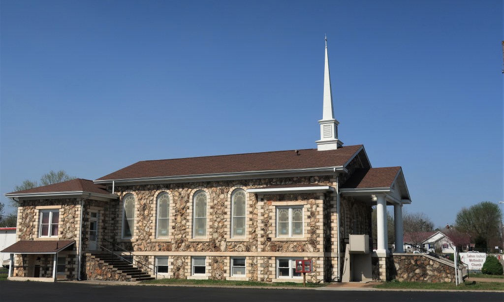
Across town square stands the picturesque Salem United Methodist Church. I love old stone buildings.
Salem United Methodist Church. Salem, Arkansas
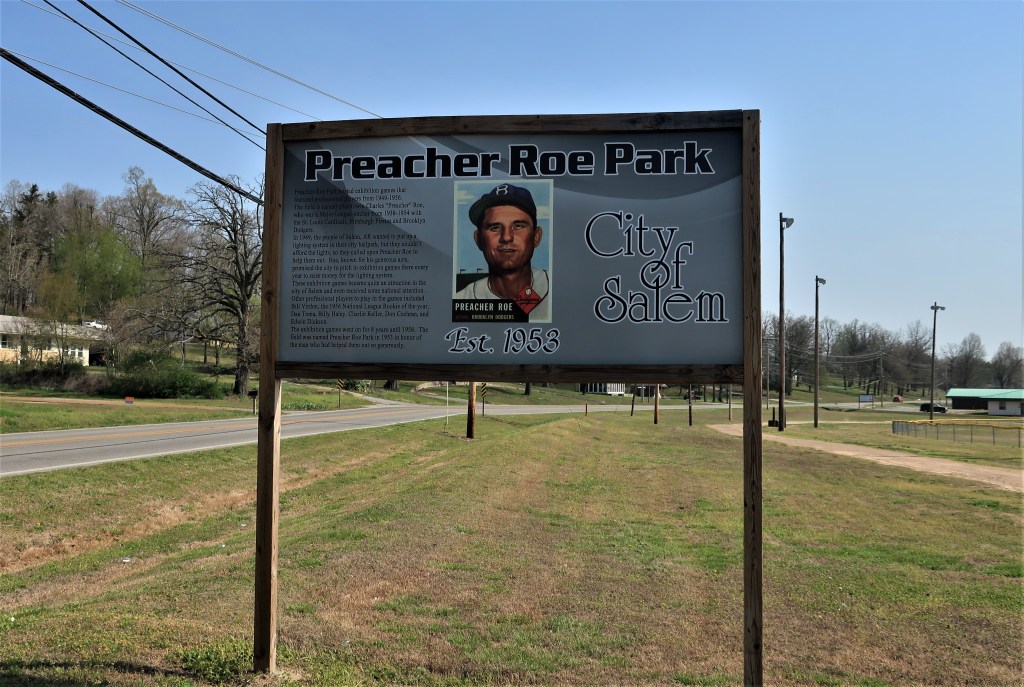
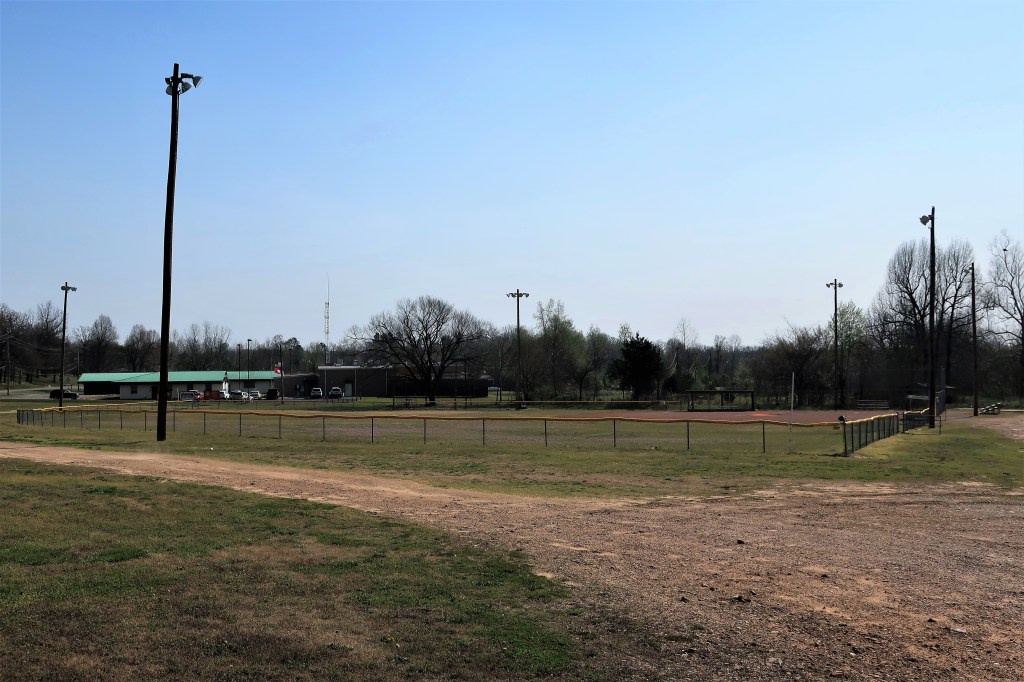
A half-mile from the Salem town square, Preacher Roe Park is the town baseball field, probably used for Little League and pony league games only these days.
Historical sign at Preacher Roe Park. Salem, Arkansas
There is a historical sign by the park explaining how Preacher Roe, a famous major-league pitcher for the Brooklyn Dodgers in the 1950s, offered his time to help raise funds for lighting the park. He brought himself and some major league friends, including Pittsburgh Pirate Bill Virdon, to play exhibition games here in Salem. The funds were raised in a few years of games.
Preacher Roe Park — with lights — about a half-mile walk north of town square along Route 9. Salem, Arkansas.
Here’s a little bit more about the old ballplayer, from Wikipedia:
“Roe was still pitching in the majors at age 39, unusual at the time, and was the third-oldest player in the National League in the 1954 season, his last in the majors. When asked to explain his longevity, he replied “Clean livin’ and the spitball.” He described his methodology in a 1955 article in Sports Illustrated, “The Outlawed Spitball Was My Money Pitch”, published a year after he retired.”
Clean living and the spitball. Life is a knot of paradoxes.
Hope you enjoyed this walk around Salem. Here’s a link to Salem’s Chamber of Commerce site. Quite a bit different than Salem, Massachusetts, don’t you think?
All photos were taken by the author on April 18, 2018.
A list of all photo posts from the American County Seats series in TimManBlog can be found here.
I travel as a hobby — donations are happily accepted if you’d like to help defer my costs. Thanks, Tim
I learned in grade school that Baton Rouge is the capital of Louisiana and that New Orleans is its largest city. But that’s not the whole story. West of New Orleans lies Acadiana. Visit the Cajun homeland, and you’ll see that it’s sort of a separate country.
Bayou Teche in St. Martinville Parish, LouisianaSaint Martin Parish in the state of Louisiana
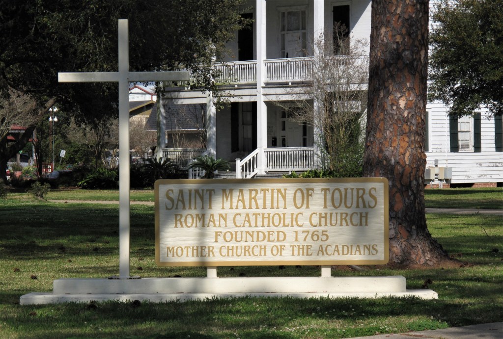
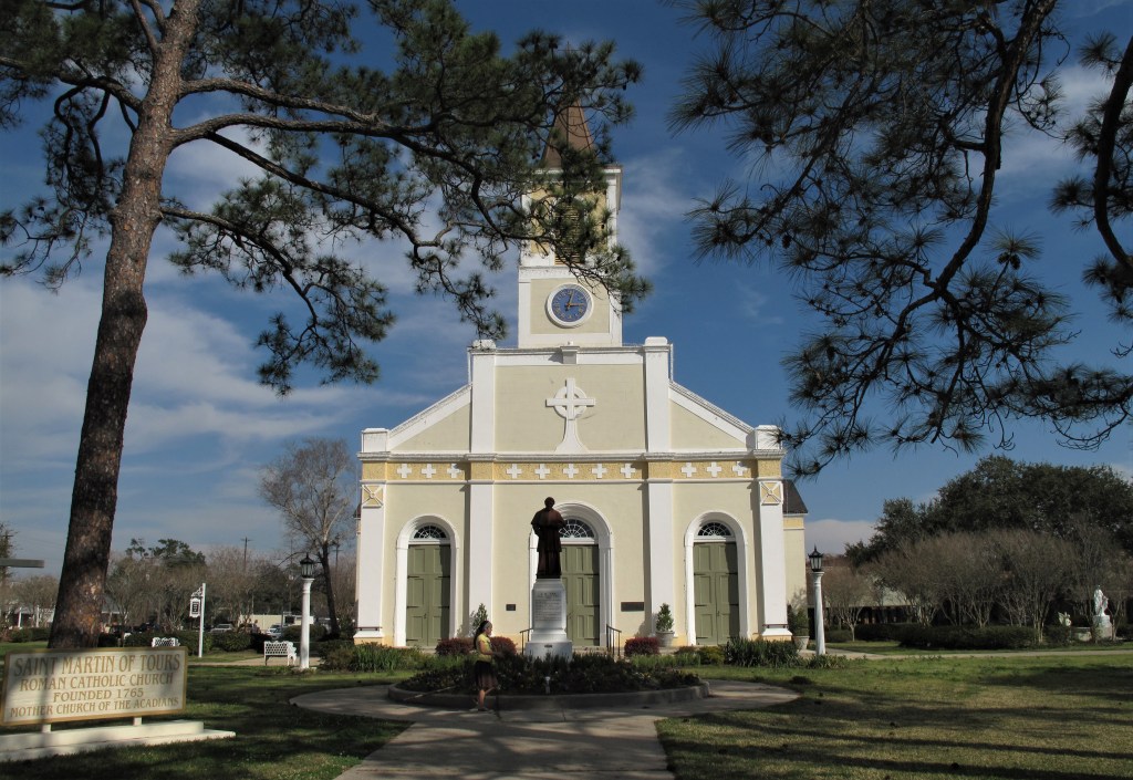
I had thought that Lafayette was the capital of Acadiana; it’s not, it’s just “the city.” St. Martinville is the Acadian capital and spiritual home. At the center of St. Martinville is St. Martin of Tours Catholic Church, a grand yet simple church.
St. Martinville, LouisianaSt. Martin of Tours, St. Martinville, Louisiana
I caught a work crew cleaning the church grounds, and a little girl was raking the shrubs around the statues. She was maybe 10 or 11 and had the French Acadian features — brown hair, blue eyes, and fair skin.
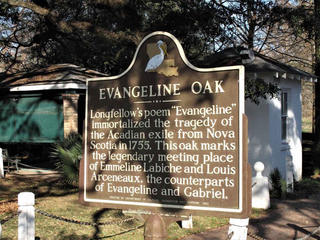
More background on the Acadians, or “Cajuns,” is available from Wikipedia here. The Expulsion is the Acadian’s national origin narrative, and “Evangeline” is their epic poem. St. Martinville is the home of this remembrance.
Evangeline, outside St. Martin of Tours churchThe Evangeline Oak, St. Martinville, Louisiana
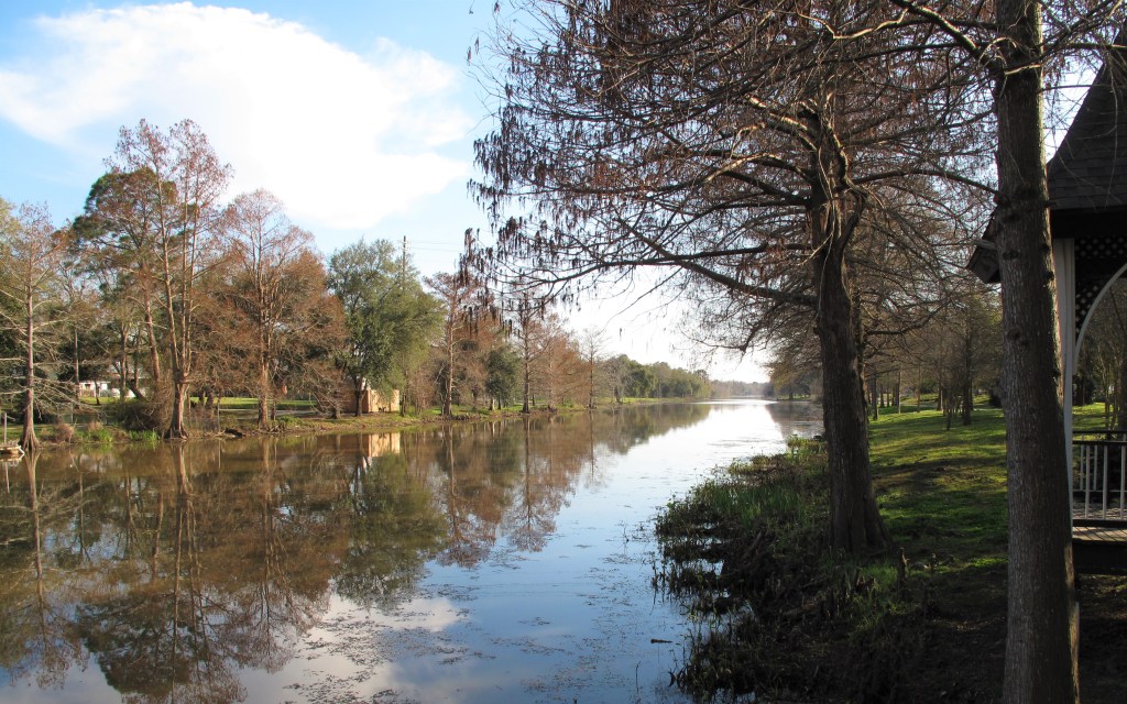
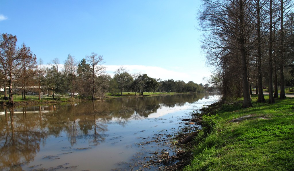
The Evangeline Oak (and the church) lie along the banks of Bayou Teche which runs through town. It was a warm, calm spring day and I took some photos along the bayou, where cypress trees stand along the banks with half their roots out of the water. It was so peaceful and quiet, and not a single mosquito.
Bayou Teche
I’ve been told that Louisiana bayous are actually slow-moving rivers and not standing water or swamps. Someday I’ll test that. I’ll set up a bayou-side lawn chair on some warm, mosquito-less winter day. Then I’ll toss a leaf in the water and spend the day with a book, some tunes, some snacks, and see how the leaf travels downstream in an afternoon. It will be an “experiment.”
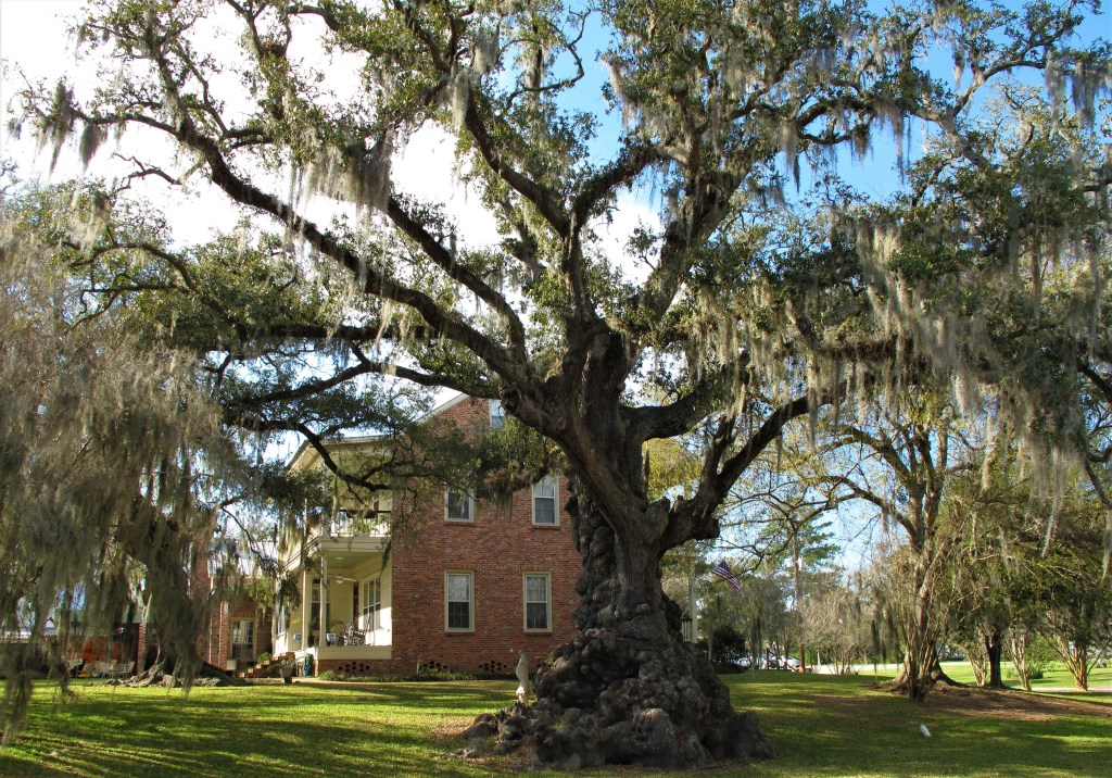
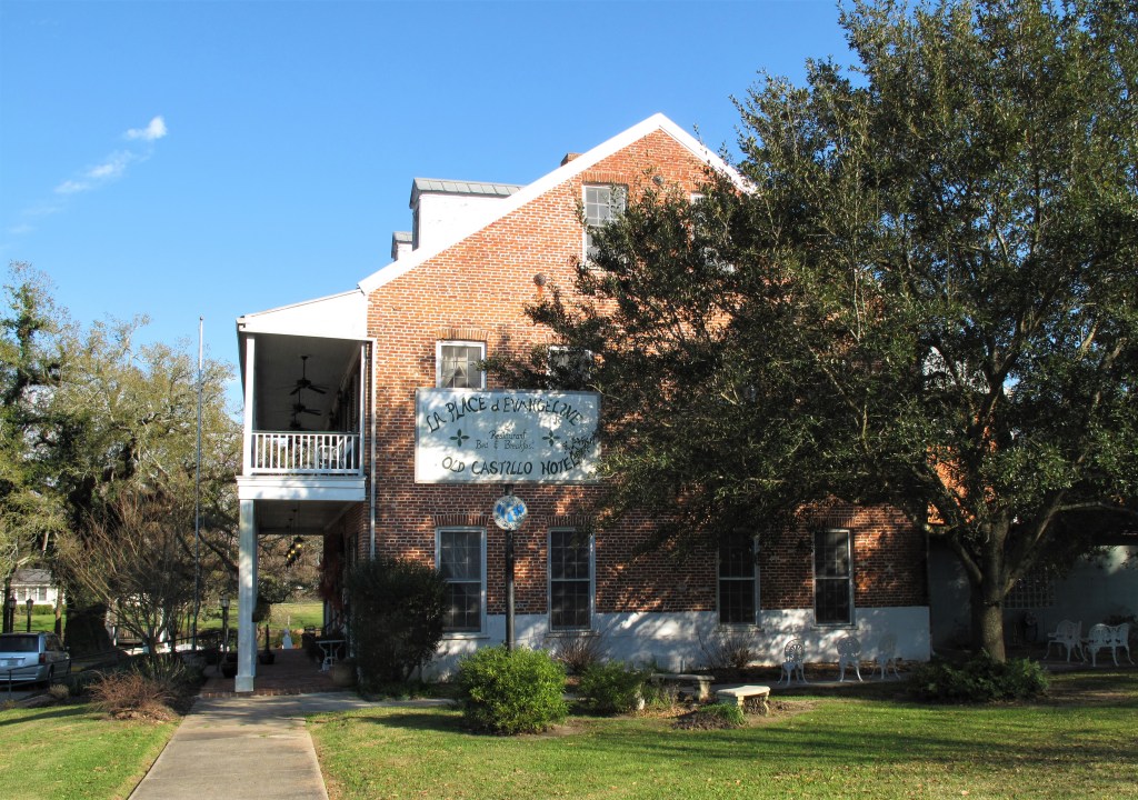
There are some nice little places along the bayou complete with tall, wide oaks covered with Spanish moss, and this hotel.
Spanish Moss. St. Martinville, LouisianaOld Castillo Bed & Breakfast. St. Martinville, Louisiana
The old hotel lies along the bayou, near the Evangeline site and St. Martin’s Church. Their website is here.
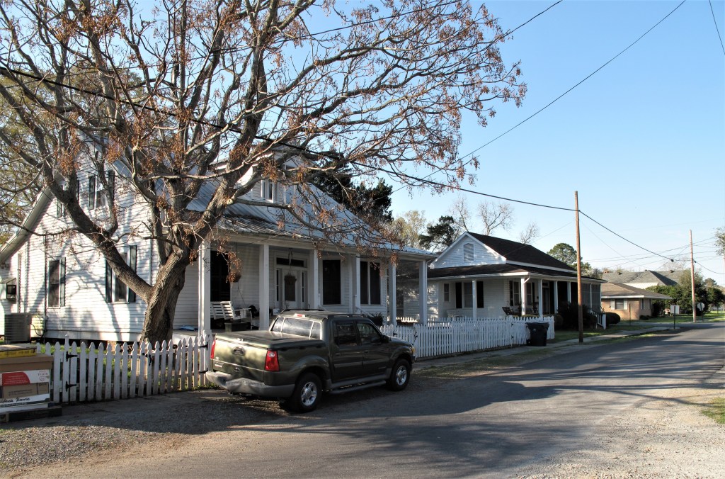
I walked around town. Things are quaint, well-run, well-kept, and busy. These aren’t rich folk, but they prosper.
Typical street scene. St. Martinville, Louisiana
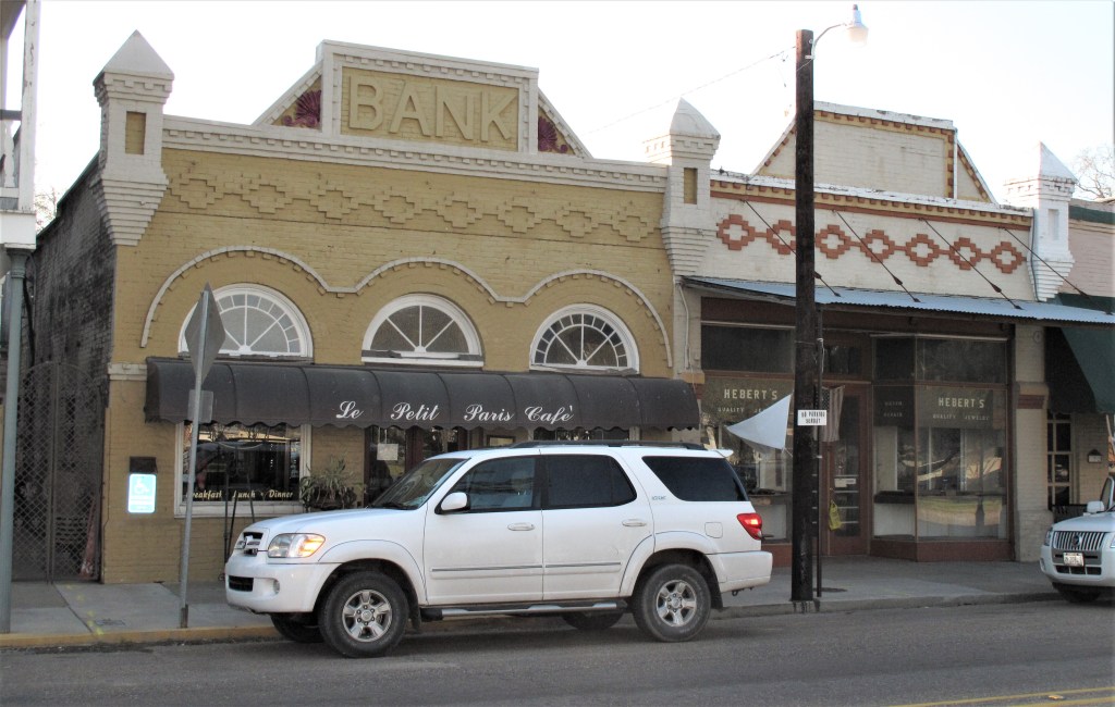
The local shops carry an obvious French influence.
Le Petit Paris Cafe
Street signs in the center of town are written in both English and French.
St. Martinville is the seat of St. Martin Parish, Louisiana (counties are called “parishes” here). I found the courthouse a few blocks south of the church along Rue Principal Sud (Main Street South). It’s a two-story wooden building that looks like a southern plantation house. Unfortunately, the place was being renovated at the time and I couldn’t go inside.
St. Martin Parish courthouse. St. Martinville, Louisiana
I hope you have a chance to visit St. Martinville. The town is a real treat. And by the way, Acadian gumbo is a national treasure! Despite the humid climate, I could see myself living here for a while.
All photos were taken by the author in March, 2011.
A list of all photo posts from the American County Seats series in TimManBlog can be found here.
Donations are happily accepted if you’d like to help defer my costs. Thanks, Tim
Today is Leap Day, February 29th, a day which comes only once every four years. I remember a former colleague of mine insisting that Leap Day should be a company holiday — if not a national holiday. “It’s an extra day, people! Why do you want to work?” Hard to argue with that logic.
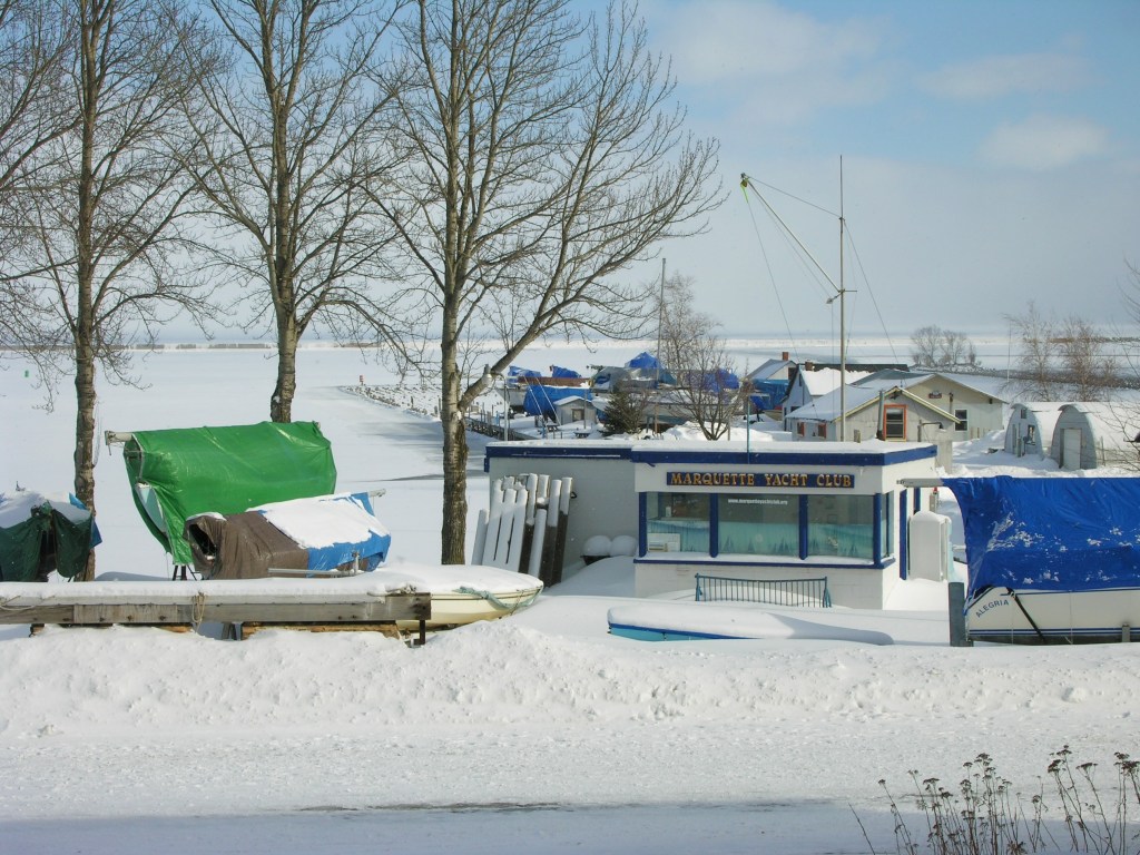
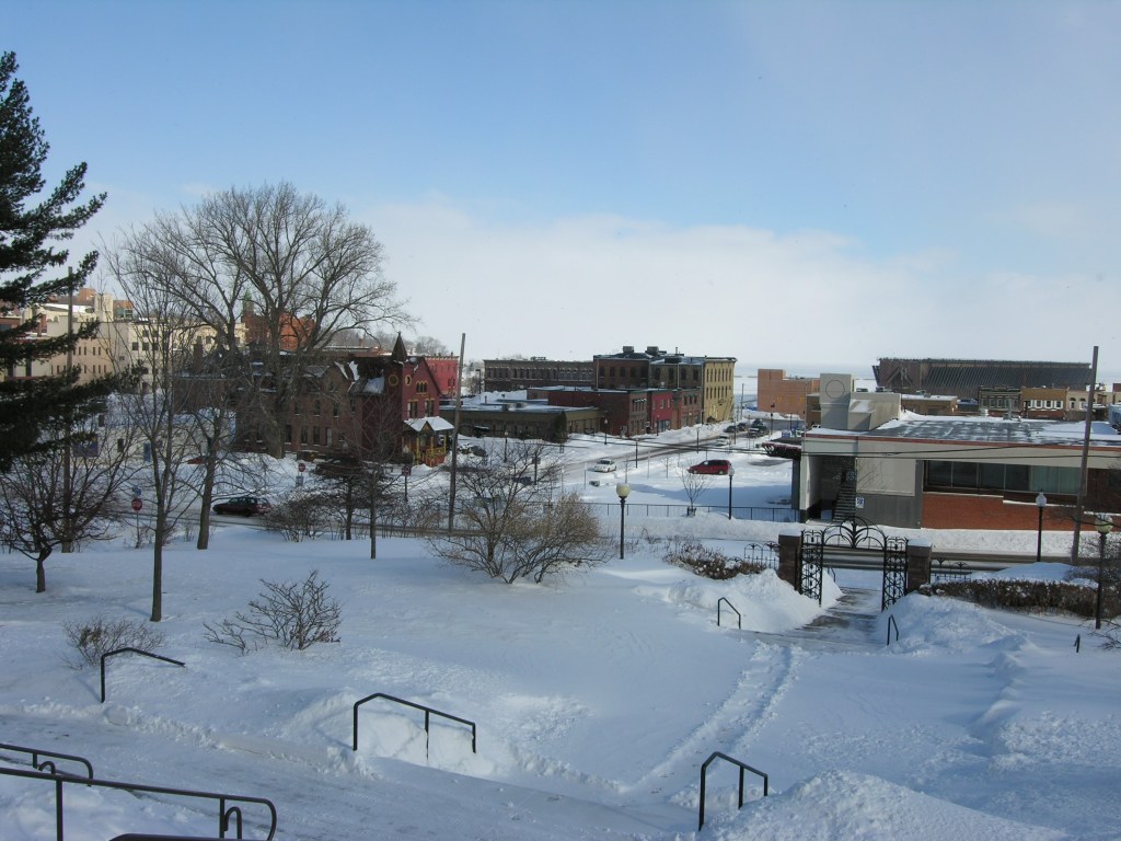
So, for such a rare day I offer a glimpse of the fine city of Marquette, Michigan, where the street signs invite you to Experience the Warmth beneath 10 inches of accumulated snow! (Ten inches is the statistical average of constant snow depth in Marquette during February.) It’s a nice town, despite the irony. Enjoy!
Marquette Yacht Club with frozen Lake Superior in the background
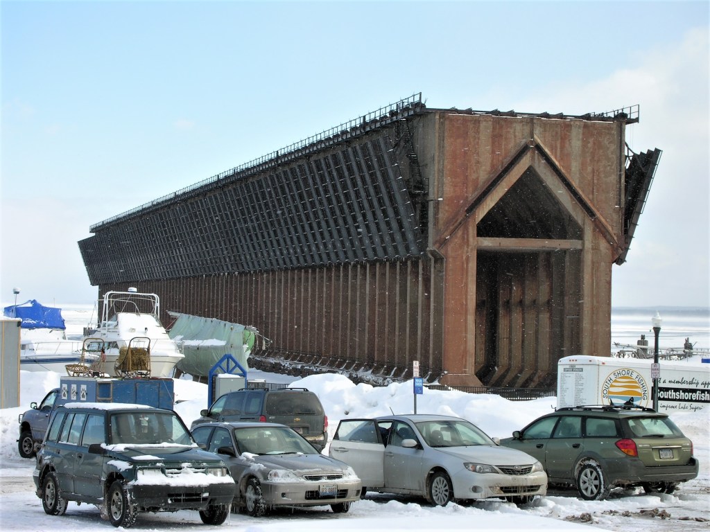
Marquette, Michigan (population 22,000 or so) is a small city on the shores of Lake Superior. Established around iron ore mining in the mid-1800s, Marquette was the largest iron boomtown in Michigan’s Upper Peninsula (the “U.P”) and it’s still the largest town in the U.P. today. 7.9 million gross tons of ore passed through Marquette’s Presque Isle Harbor in 2005.
Lower Harbor Ore Dock, Marquette, Michigan
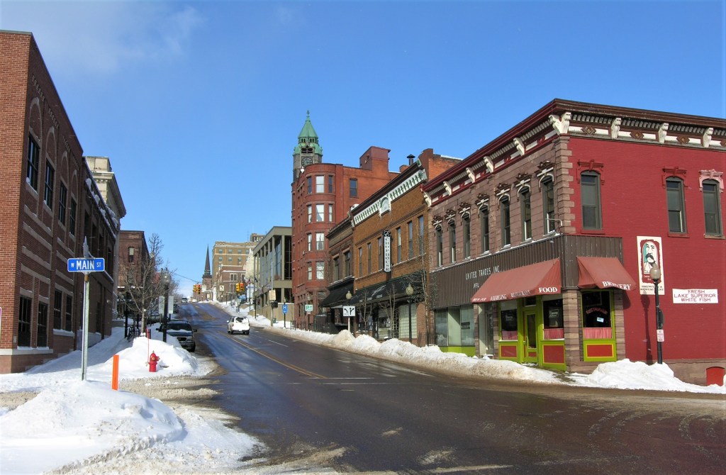
Despite the gritty image of iron ore mining, Marquette’s commercial district boasts some grand old buildings along its main street (Washington Street) with an equally grand view over a bluff down to the shores of the lake.
Marquette City Hall
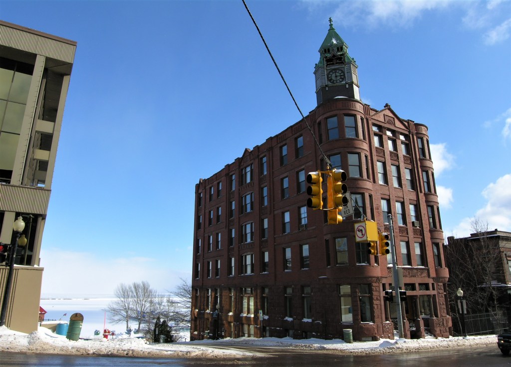
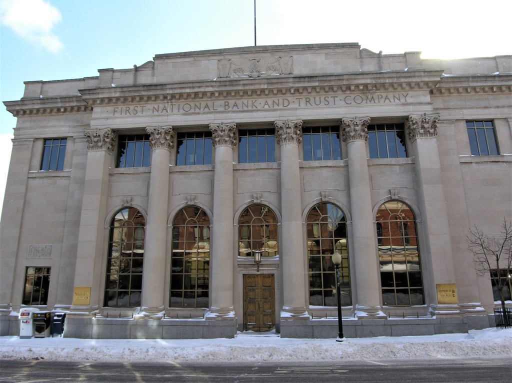
The old Savings Bank building (photo below) was built in 1891 and is still used for commercial office space. Because the building rises above a cliff leading down to the lakeshore, the front side has five floors while the rear has seven. I can only imagine the views from a corner office space. Wikipedia has an entry and more photos here.
Marquette’s Savings Bank building. Listed on the National Register of Historic Places
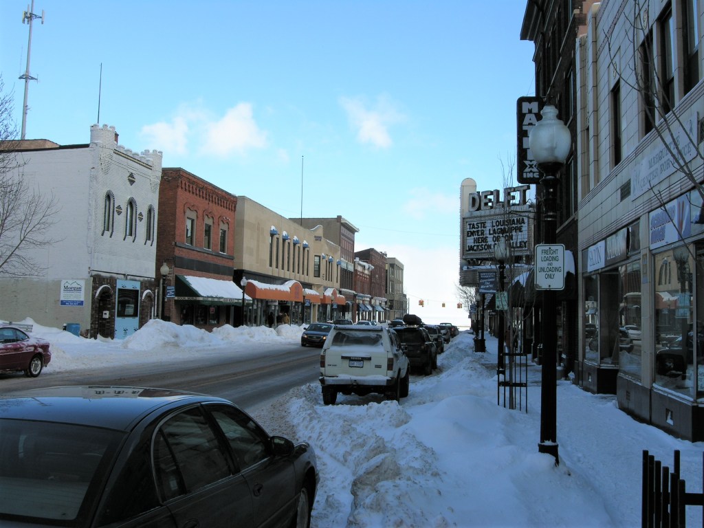
Even in winter, downtown Marquette remains a vibrant place full of cozy restaurants, bars, and hotels.
Marquette, Michigan: view looking north along Front Street from Main toward Washington
What could warm your stomach better than the Lagniappe Cajun Creole Eatery? It’s there on the right in the photo below, occupying an old movie theatre.
Marquette, Michigan along Washington StreetCurrently a Wells Fargo branch. Notice the front floor-to-ceiling windows.
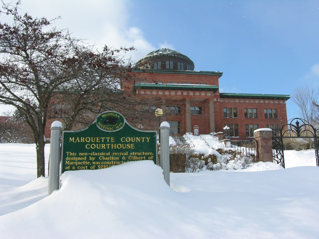
Many of the buildings in old Marquette were constructed using attractive Jacobsville red sandstone and often have iron cupola domes. This includes the Marquette County Courthouse. This attractive building sits atop a little rise overlooking both the harbor and a few blocks of the downtown district. They’ve added an annex and a jail behind the original structure. More here.
Marquette County CourthouseMarquette County Courthouse including annex and jailMarquette County CourthouseView of downtown Marquette from the courthouse. The lower harbor ore dock and Lake Superior are in the background.Marquette County in the state of Michigan
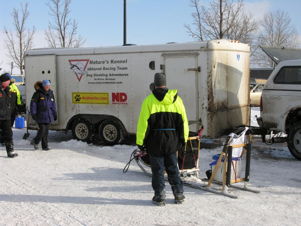
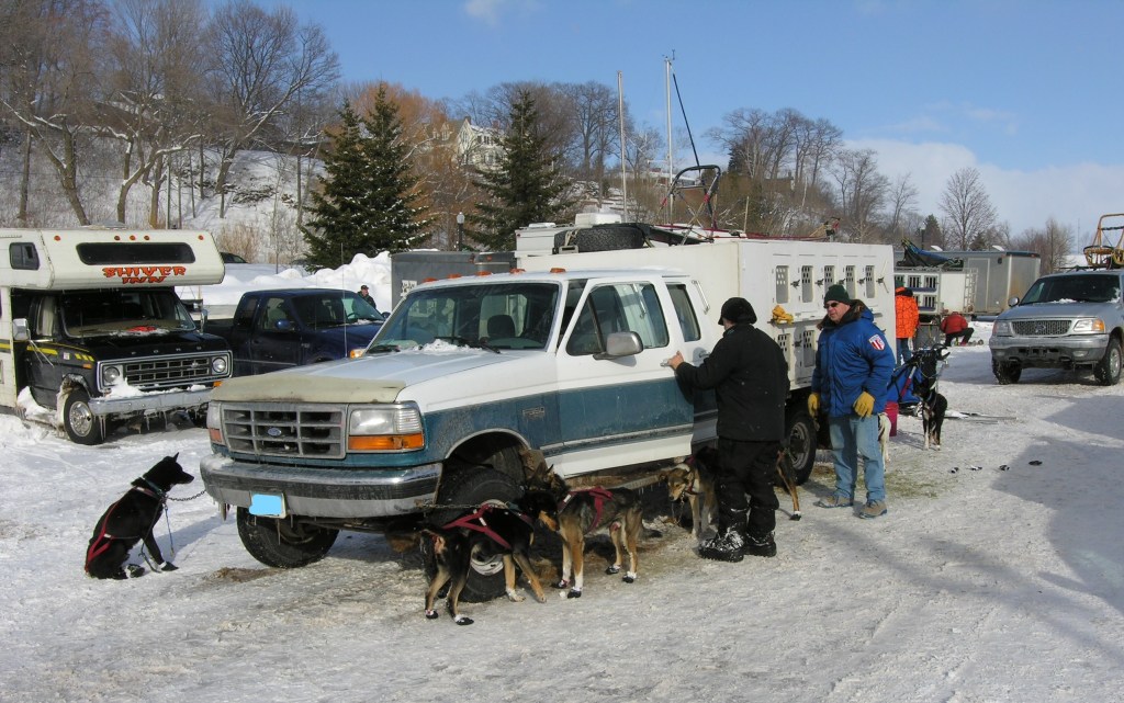
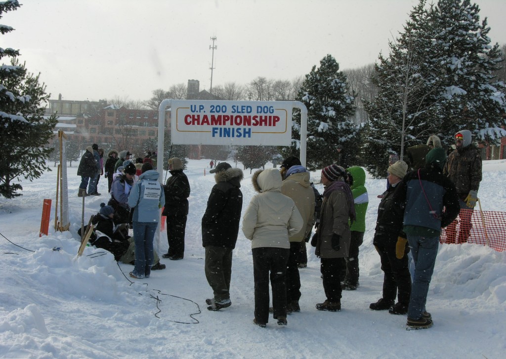
People have come to Marquette on this day to watch the sled dog races. I didn’t catch all the details but it seems to be a big and well-organized event since they have officials and official volunteers. I walked down to the finish line where Starbucks was giving away free cups of coffee to the humans. Both dogs and people seemed to be having a good time.
Sled dog sled (with musher?)Sled dogs after the raceThe Finish Line
The backdrop to the festivities:
Frozen Lake Superior at Marquette, Michigan, in February 2009
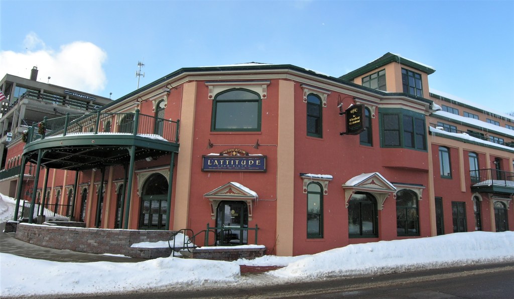
Need a warm-up after the race? Go for a beer at L’Attitude Bistro (now the Iron Bay Tap Room).
This little place on Marquette’s frozen waterfront occupies the basement of a refurbished old downtown building. The inside walls are old brick and the hallways back to the kitchen and restrooms are like a labyrinth of caverns. The urban tourist crowd loves this place and many of the tables are filled with skiers and old hippies with hoop earrings and long, gray ponytail manes.
Seriously, Marquette is a great town. In 2012 it was named among the 10 best places to retire in the United States. (Wikipedia entry here)
Enjoy the Warmth!
All photos by the author and were taken in February 2009.
A list of all photo posts from the American County Seats series in TimManBlog can be found here.
Donations are happily accepted if you’d like to help defer my costs. Thanks, Tim
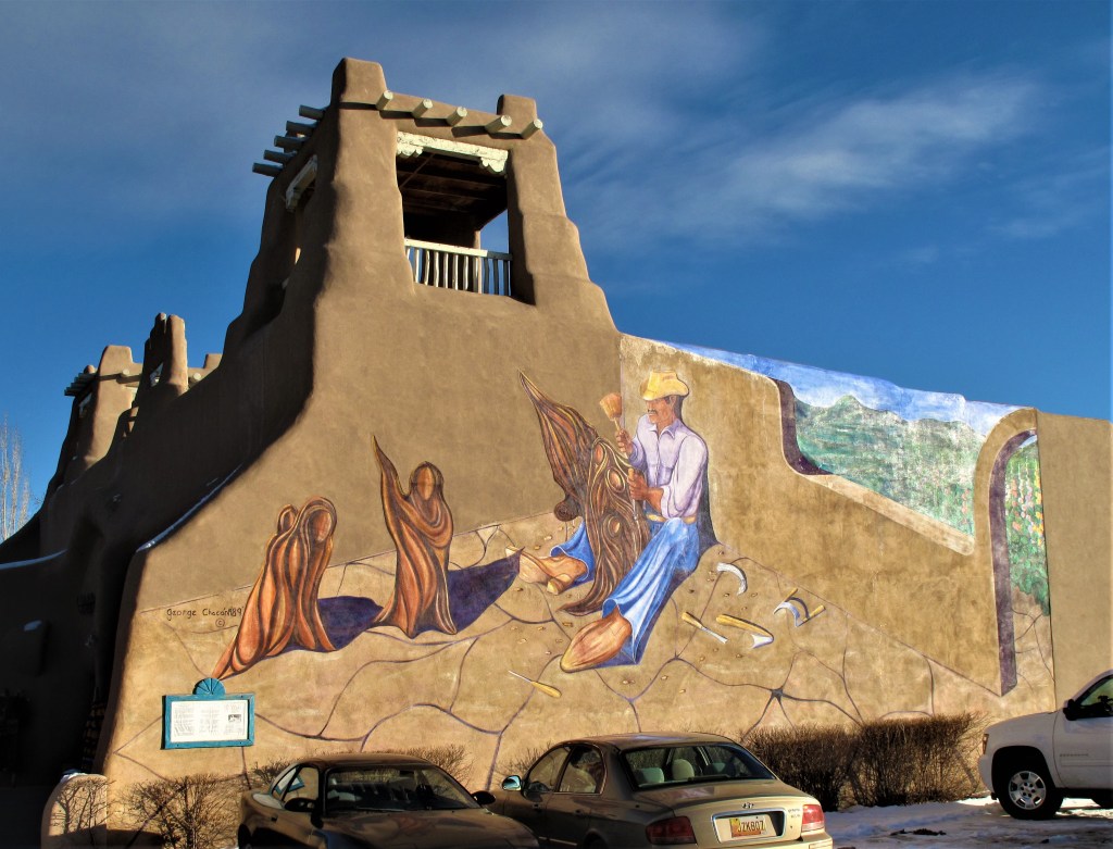
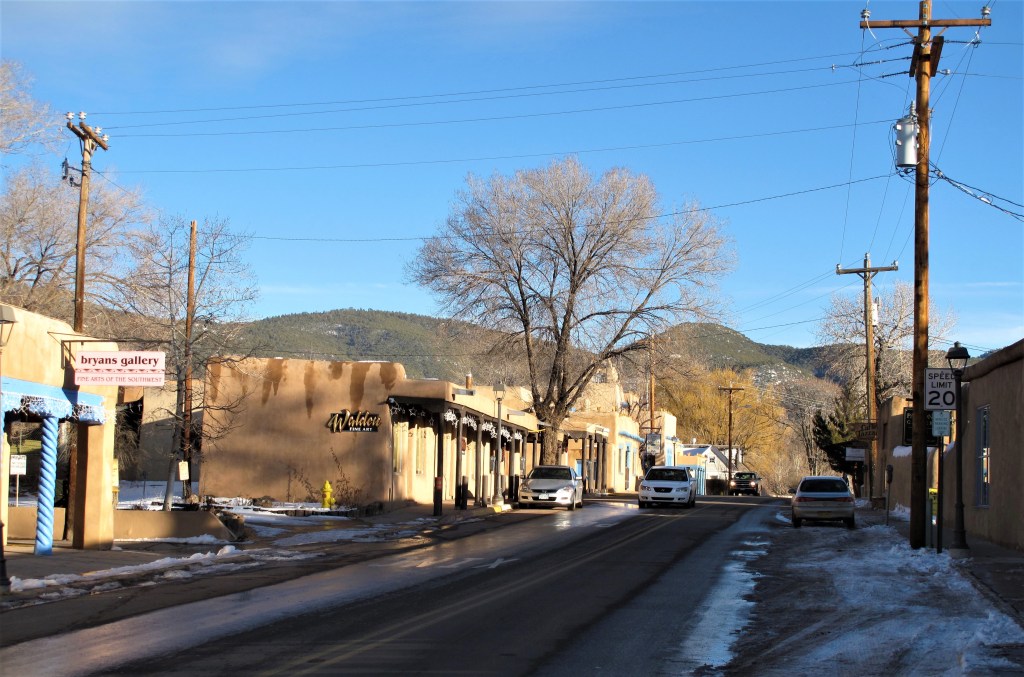
Taos — such a unique name that no further qualifiers are needed. Just remember to put the “a” before the “o” and everyone knows the place.
Street mural. Taos, New Mexico
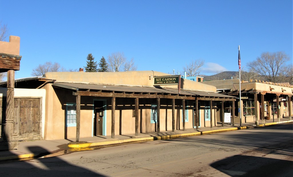
Let’s start the Taos tour at the home of its most famous resident — noted Western pathfinder Kit Carson.
Kit Carson home and museum. Taos, New MexicoLooking east from the center of Taos along US 64, towards the mountain divide
Born in Kentucky in 1809, Kit Carson grew up in Missouri on land once owned by the sons of Daniel Boone. As a teenager, he left the farm and shop life and set off westward on the Santa Fe Trail. Using Taos as his base, Carson built his reputation as a scout and a mountain man over the next decade. Later, in the 1840s, Carson served as the chief scout on John C. Fremont’s western expeditions and served with General Stephen Watts Kearny during the Mexican War. Carson died in 1868 as a brevet brigadier general at nearby Fort Garland, Colorado. (more on Kit Carson’s life here.)
Kit Carson Historic District. Taos, New Mexico
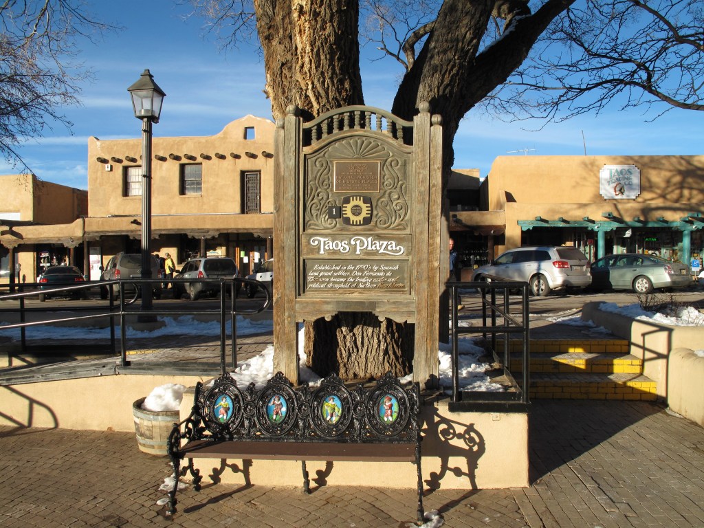
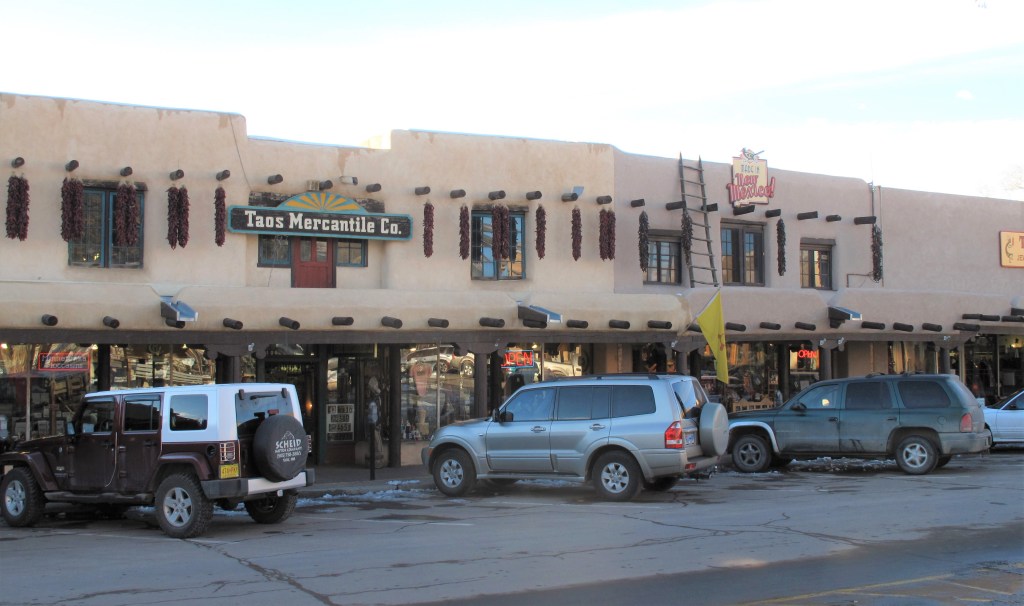
Nearly catercorner from the Kit Carson house, Taos Plaza is the marketplace of old Taos.
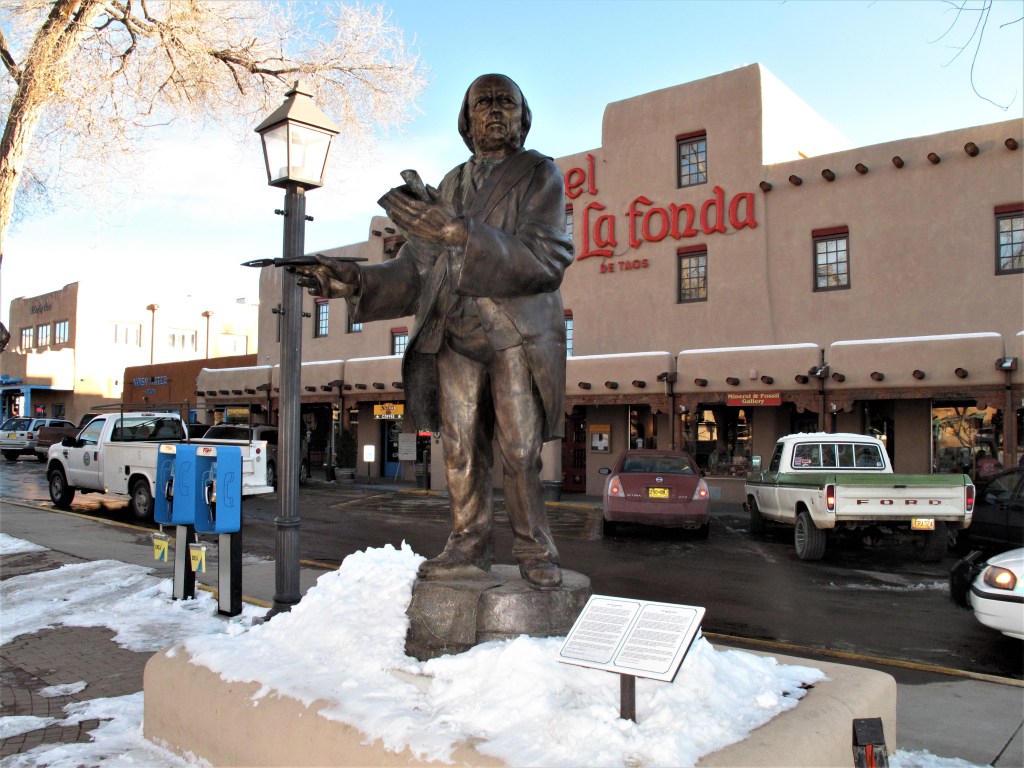
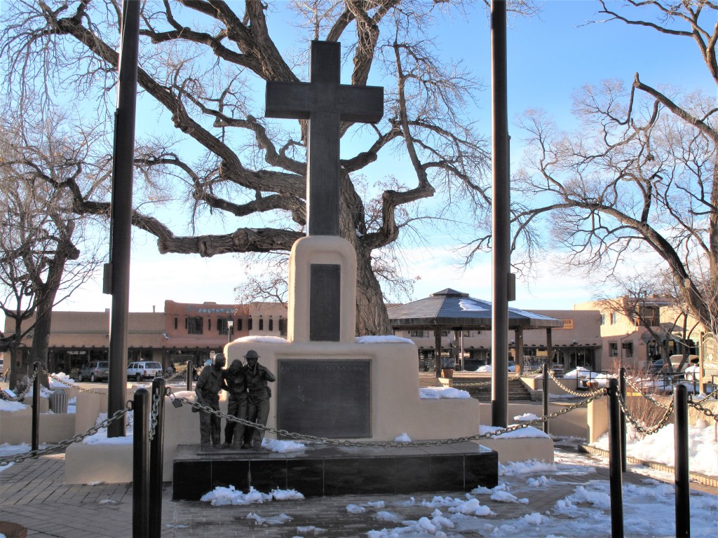
Taos PlazaPadre Antonio Jose Martinez, and the Hotel La Fonda de Taos. Taos PlazaWar memorial in Taos PlazaShops in Taos Plaza. Notice the wooden ladder giving access to the roof.
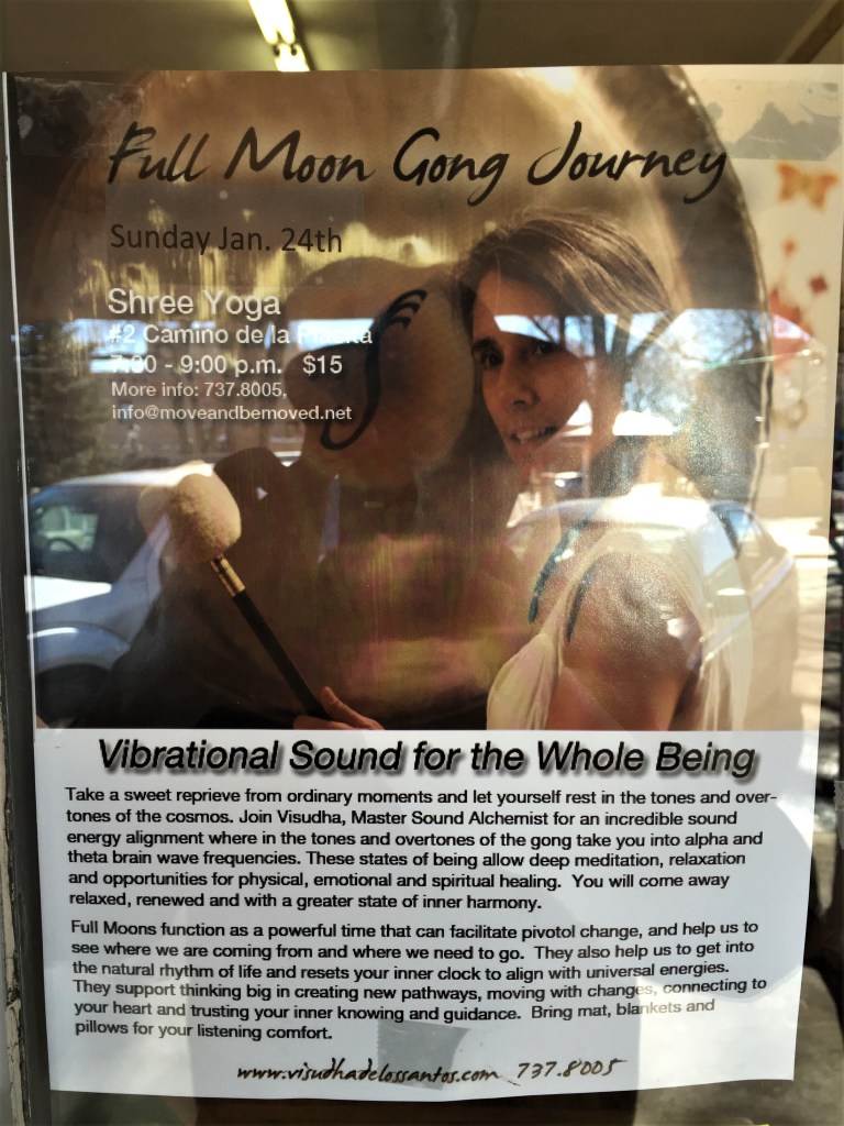
Taos Plaza is like most town squares around America, except with a Hispano flair. Here one can find shops, cafes, park benches, statues and memorials, and even a hotel. You can also find posters and advertisements for local events. One such event was advertised by the photo below: “Full Moon Gong Journey” as presented by Shree Yoga. Vibrational Sound for the Whole Being. Only $15. Yes, Taos was “New Age” long before there was anything like “wokeness.” (Sorry about the quality of the photograph. My I-phone did the best it could to remove my reflection.)
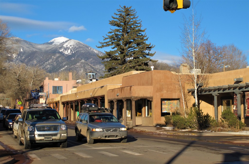
While in town, I had drinks and dinner at the Taos Inn (photo below). A flamenco guitarist entertained and sang to the bar crowd in Spanish. I didn’t understand a word. His audience consisted of artists and tourists along with the odd skier.
Looking north from Taos Plaza. The famous Taos Inn is in the background.
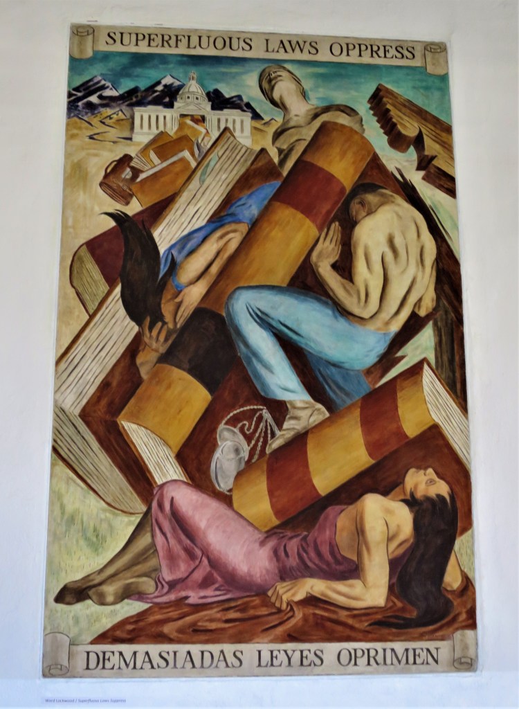
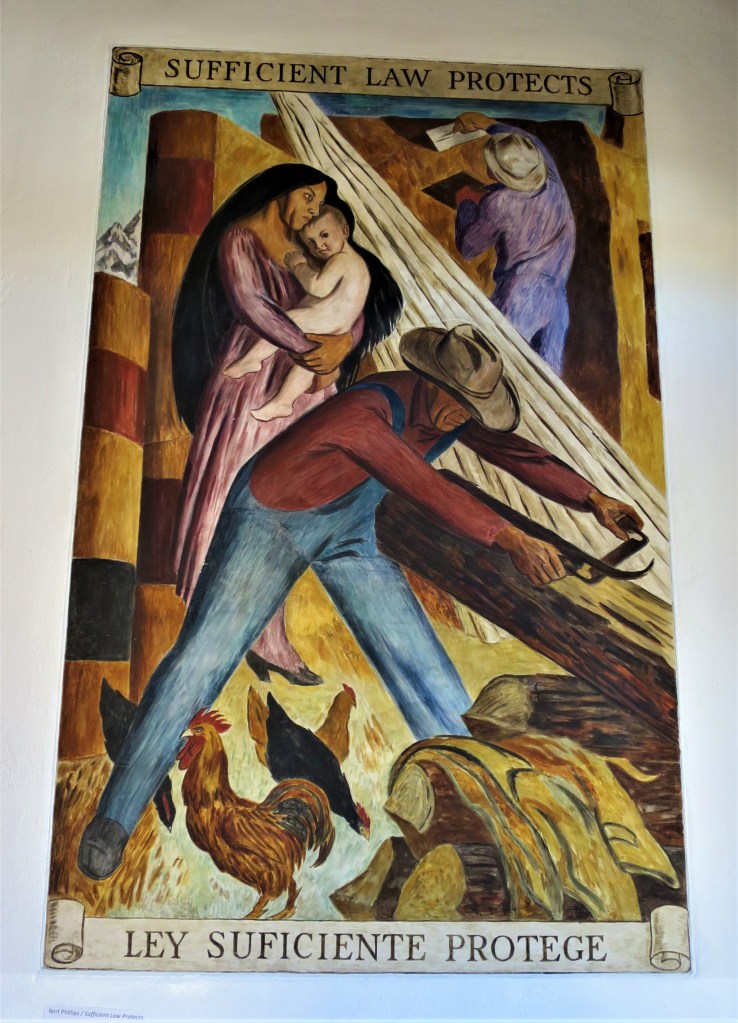
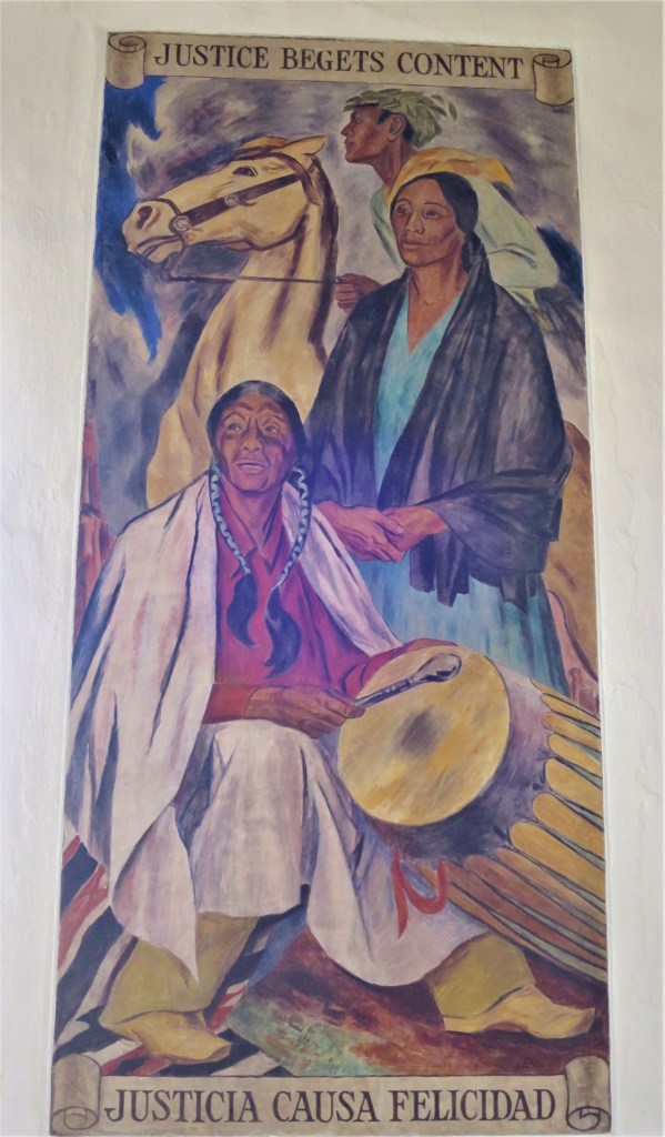
In bygone days the Taos County Courthouse was adjacent to the plaza, but a new facility was built a half-mile away in 1979. The old structure still stands and holds some fascinating wall murals. Murals include both English and Spanish titles, reflecting the many centuries of Spanish influence in Taos:
Moses the Lawgiver. Old Taos courthouse.
Some of the murals are remarkably prescient. Note how it was understood that laws must be moderate to be effective and just:
Nearly all the buildings in Taos (if not ALL the buildings) are constructed in the adobe style — even the new courthouse.
Modern Taos County Courthouse. Taos, New MexicoTaos County in the state of New Mexico
Of course, Taos was occupied long before Spanish conquistador Capitan Hernan Alvarado arrived here in 1540. It’s estimated that the Tiwa Indians settled here sometime around 1350 A.D. The name “Taos” is believed to be an adaptation of the Indian word Towih, meaning “red willows.”
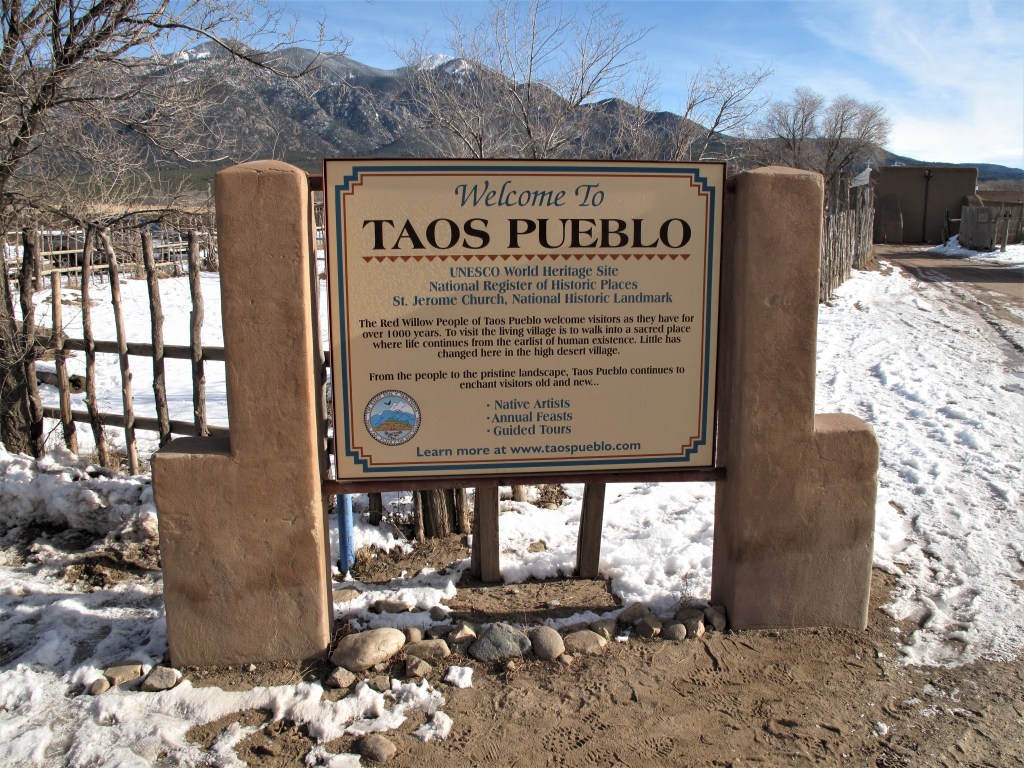
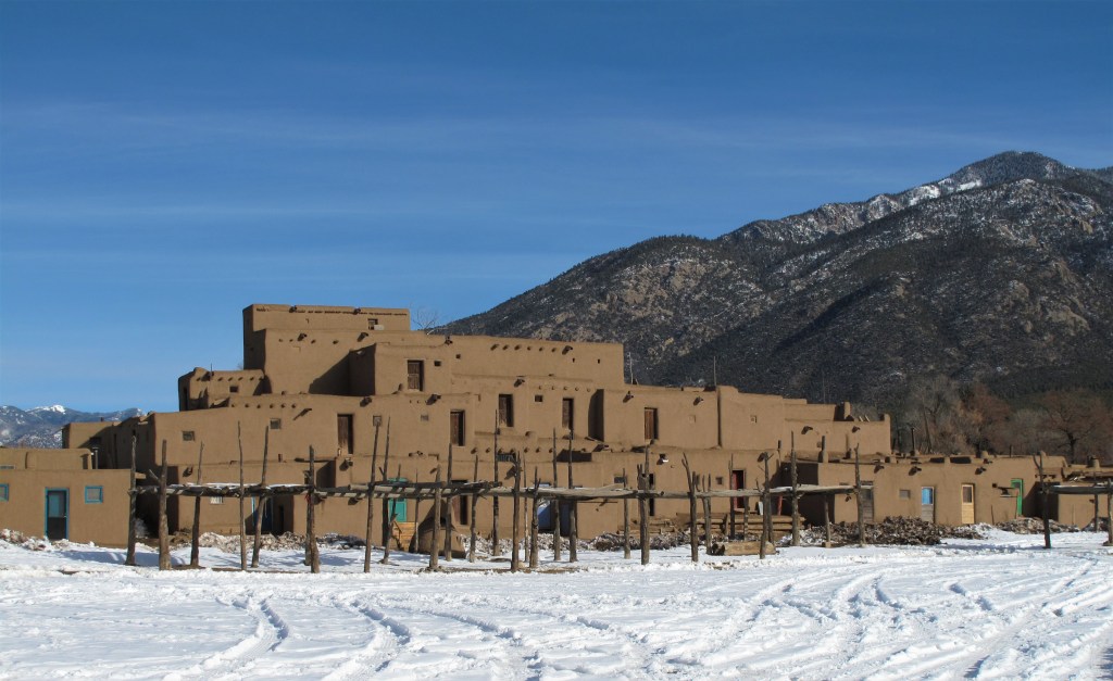
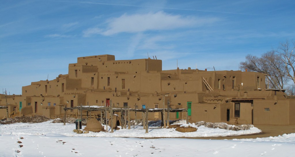
Just north of Taos at Taos Pueblo, descendants of the ancient ones live much as they used to.
The most prominent structure is this multi-story, multi-family adobe complex, said to have been built between 1000 and 1450 A.D.
Taos Pueblo
Notice the external wooden ladders used to navigate between floors. Exterior doors are painted bright red, green, or blue for contrast against the adobe brown.
Taos Pueblo
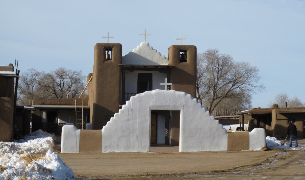
Spanish missionaries left their mark among the native peoples, and their influence has become permanent.
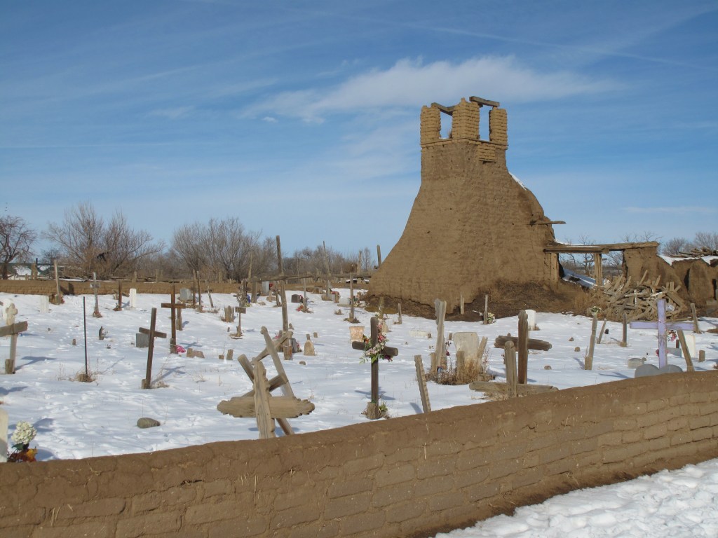
St. Jerome Church. Taos PuebloOld graveyard. Taos Pueblo
All photos were taken by the author in January 2007 or January 2010.
A list of all photo posts from the American County Seats series in TimManBlog can be found here.
Donations are happily accepted if you’d like to help defer my costs. Thanks, Tim