North-central North Dakota: the People behind the Places
Freedom Voyages — Life in the United States
November 14, 2021
Welcome to another Freedom Voyage! These trips give me the chance to see the width and breadth of the USA — its landscapes, its small towns, its cities, and its courthouses. Along the way I take and share photos of what I see and what I eat — and whatever I’m thinking.
I choose my road trip destinations with two primary considerations in mind: a) have I never been to this place before; and b) what’s the weather going to be like when I get there? For this trip, I saw an opportunity to see 15 North Dakota counties I’d never traveled to before, and under sunny skies and pleasant temperatures.
Want to live out a Freedom Voyage vicariously? Experience a bit of joie de vivre? My purpose here is to try to convey the experience, the joy I feel as I travel the country. I hope in this way that you can also enjoy these sights, whether you are unable to travel or simply do not have the time or resources to do so.
With that, here’s a photo log of the eight days of clear skies and verdant fields I found in north-central North Dakota. Nothing better than sunshine and a road trip! Enjoy!
Freedom Voyage Day 1, Saturday, June 26, 2021: Colorado Springs to Gillette, Wyoming
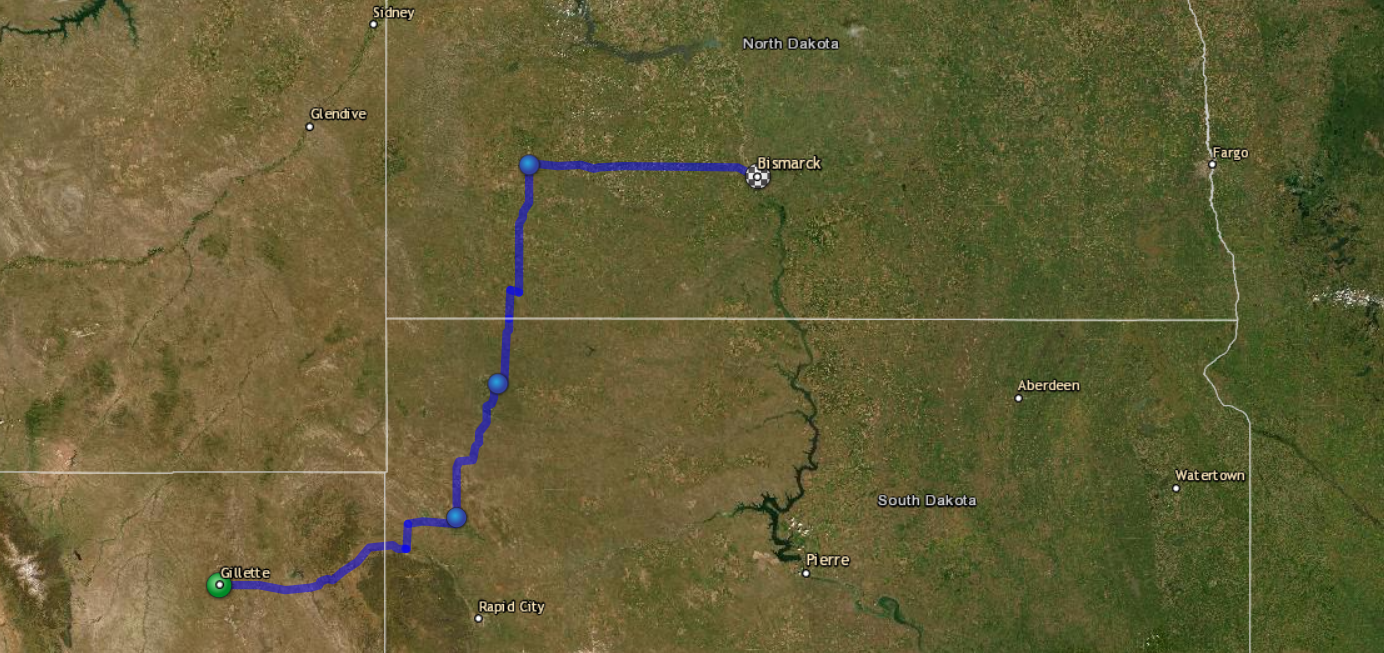
My overall plan was to reach Bismarck, North Dakota by Sunday night. That’s a 12-hour drive from Colorado Springs so I decided to split the travel into 2 legs — up to Gillette, Wyoming on Saturday and then on to Bismarck Sunday.
For the drive to Gillette, I stayed on Interstate 25 up to Douglas, Wyoming. There I switched to Wyoming 59, a two-lane highway that takes you through the massive coal fields of Converse and Campbell counties. There aren’t many towns along this road but the coal trains keep you company until you reach Gillette, 115 miles north of Douglas.
Gillette, Wyoming (population around 20,000) services the energy industry in northern Wyoming. The strong business climate for energy, especially during the Trump administration, has provided over a dozen business-class hotels to choose from, including at least one member of each of the larger US hotel chains. I chose Candlewood Suites for this stay.
Freedom Voyage Day 2, Sunday, June 27, 2021: Gillette to Bismarck, North Dakota
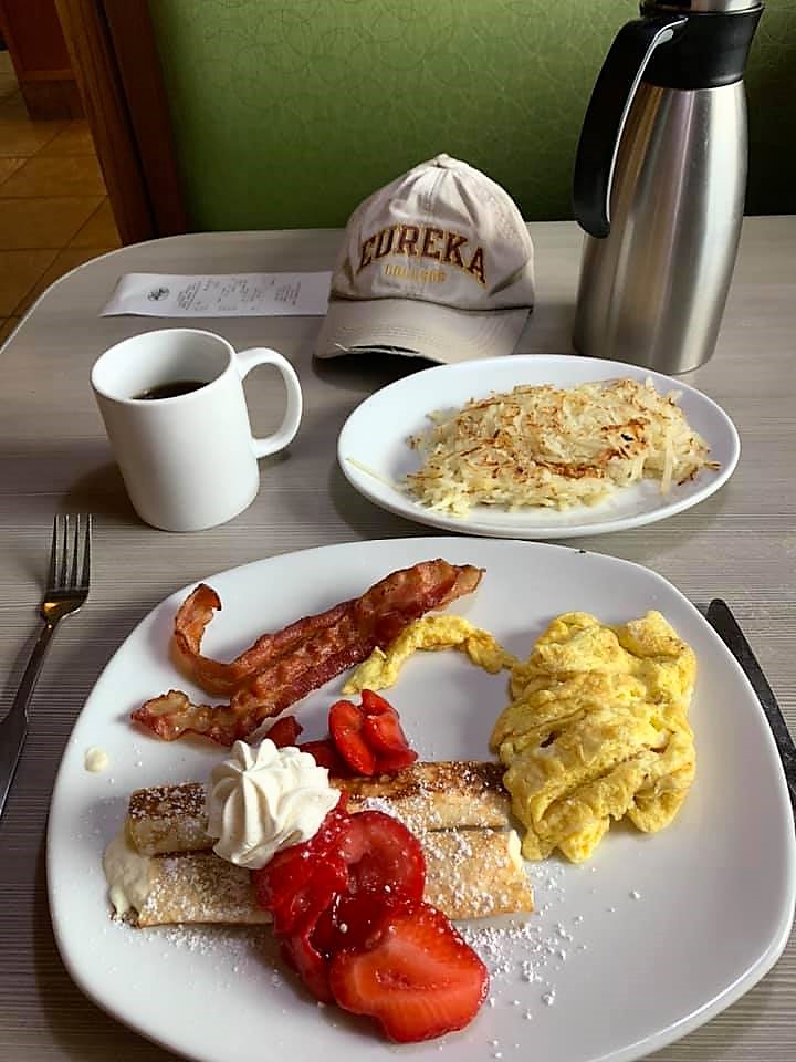
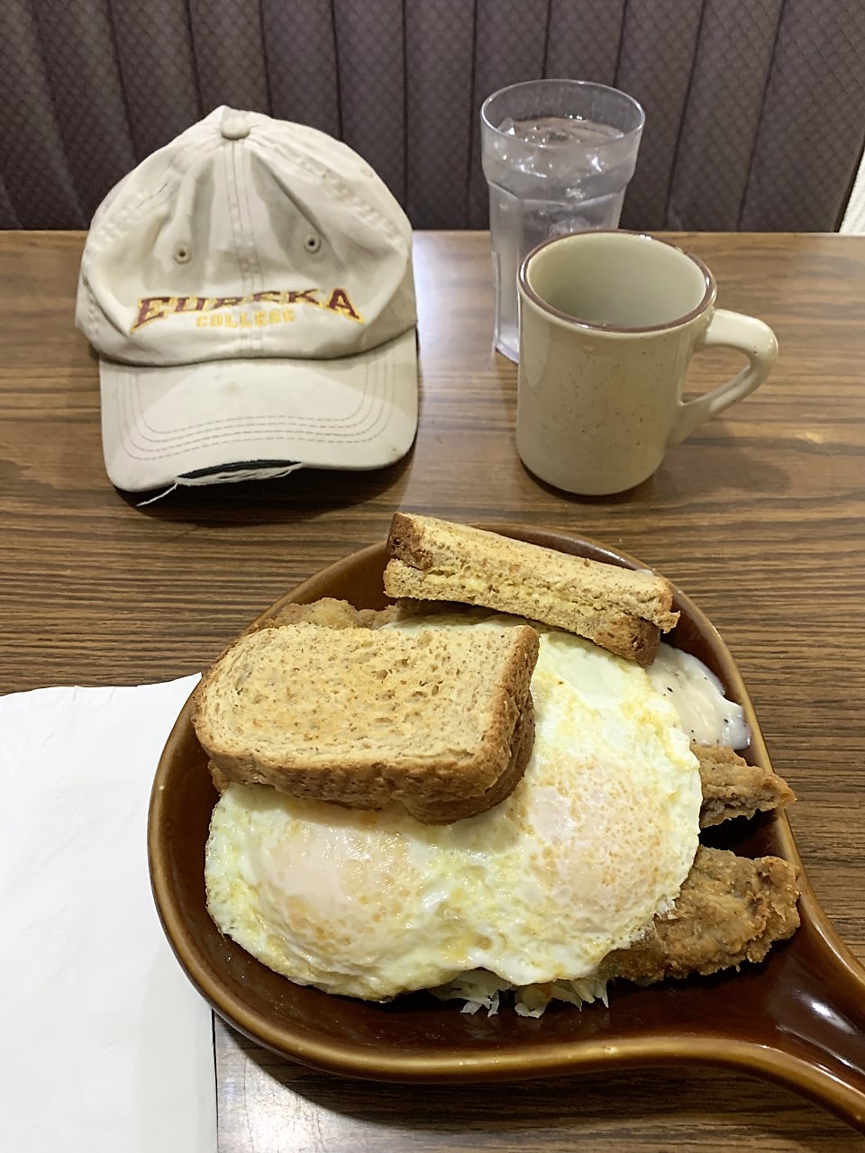
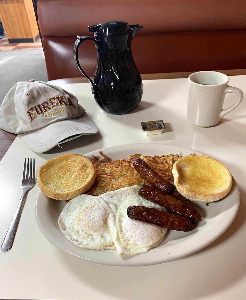
Good Sunday morning from Gillette! A short morning walk brought me to the local Perkins restaurant for breakfast:
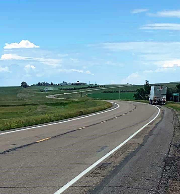
After church at St. Matthew’s, I got on the road at noon: east on Interstate 90 from Gillette, past Devil’s Tower (which can be seen off to the distance from the roadway), across the South Dakota state line, skirted the northern edge of the Black Hills, and then turned north. The roadways through western South Dakota are some of the most desolate stretches of highway in the state, punctuated by some dormant volcanic cliffs. After a few hours, I reached the border with North Dakota. The gallery of 3 photos below shows my sleek chariot, a herd of cattle grazing on the grasslands, and a cross-roads trucker enjoying a rest as the prairie highway winds out into the distance.


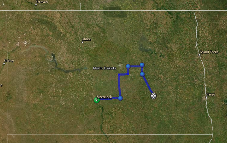
Nice country, North Dakota. Although the names of the two states are very similar, North Dakota has a more verdant landscape than its southern neighbor. I drove the 2-lane highways through some farmland until reaching Dickinson, then joined Interstate 94 heading east toward Bismarck.
Just west of Bismarck I pulled off the highway at the Scenic Vista point:
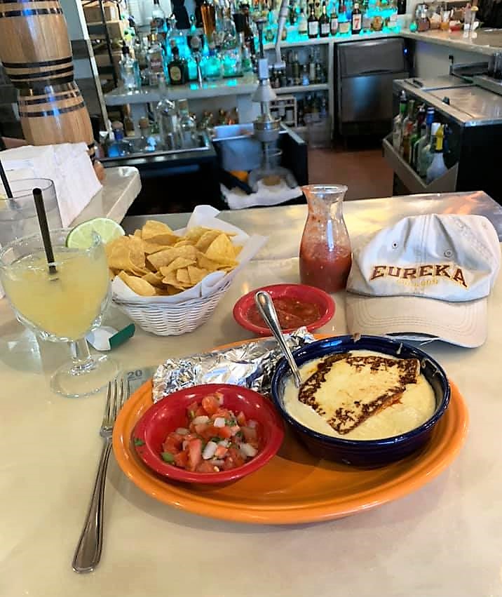
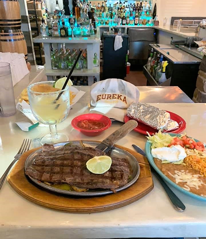
In Bismarck, I ate dinner at a great Mexican place called Charras and Tequila, which was next to the hotel where I would be spending the night. Due to today’s long drive, I had skipped lunch except for some convenience store snacks, and so I went full bore mode at dinnertime: chips & salsa, queso, pico, and carne asada with rice and beans. Plus a margarita, of course:
Bismarck is the state capital of North Dakota and has a population of 133,000. Plenty of lodging and dining choices are available in Bismarck. I checked some prices and chose a Wingate by Wyndham.
Freedom Voyage Day 3, Monday, June 28, 2021: Bismarck to Jamestown, North Dakota
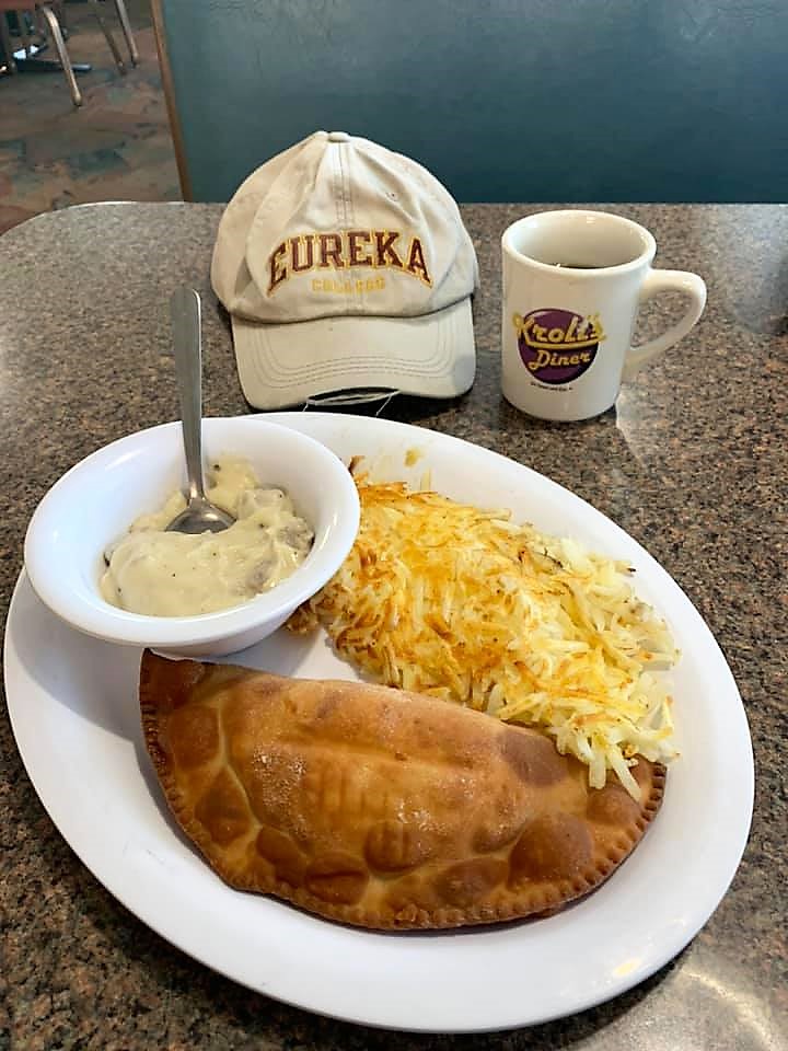
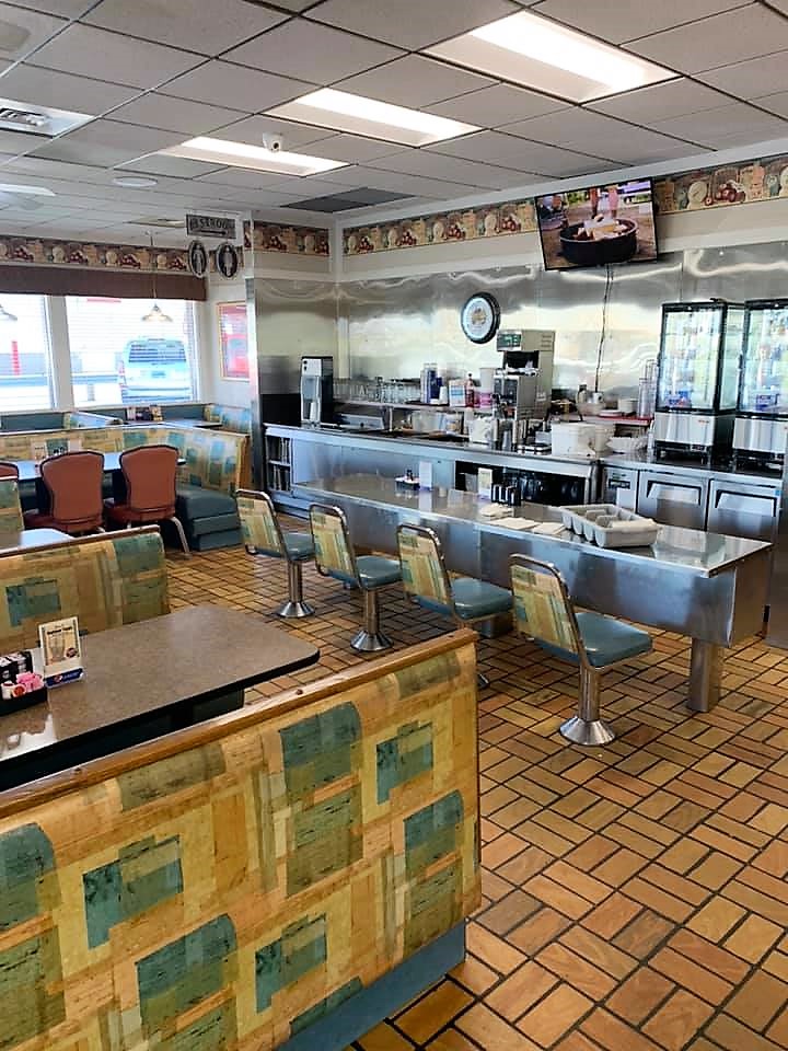
Good Monday morning from Bismarck, North Dakota. According to Wikipedia, North Dakota was a popular destination for 19th Century immigrant farmers and laborers from Scandinavia and Germany. I quickly found a Kroll’s Diner nearby, which is a chain of German restaurants with locations in Bismarck, Minot, and other cities in North Dakota. Their slogan is “Sit Down and Eat,” and that’s also their web address: www.sitdownandeat.com. Choosing from their list of German specialties, I settled on a Fleischkuechle: seasoned ground beef, wrapped inside a pastry and deep-fried.
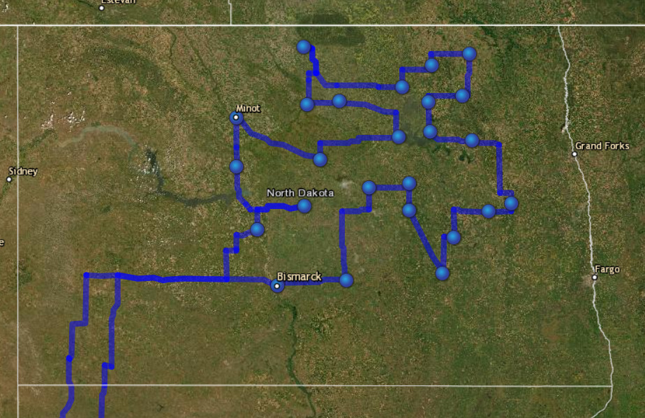
Over the next few days, I’ll be meandering through the north-central North Dakota countryside visiting small towns and county courthouses. Most of these towns will have populations less than 5,000 — they’re quiet but hard-working.
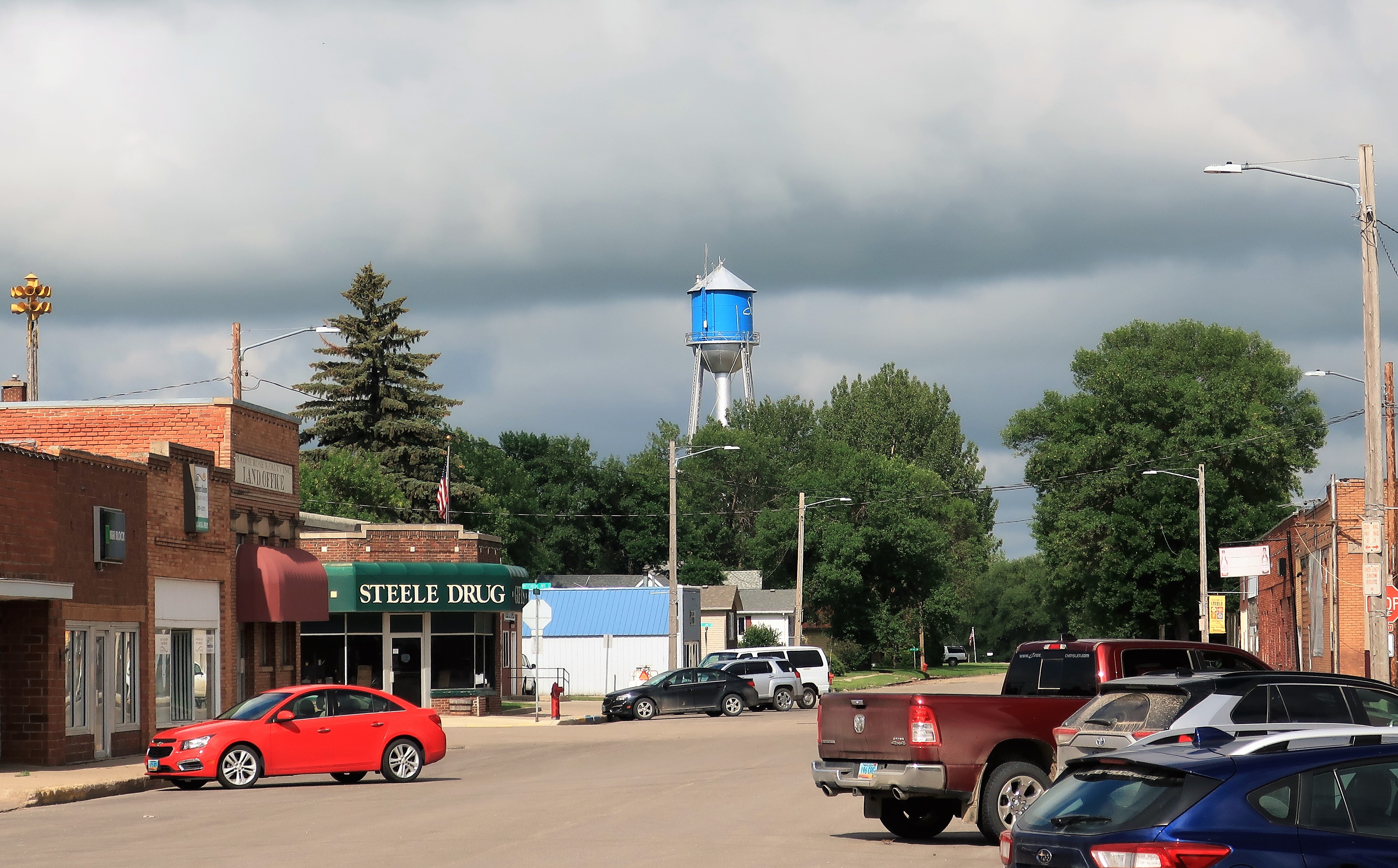
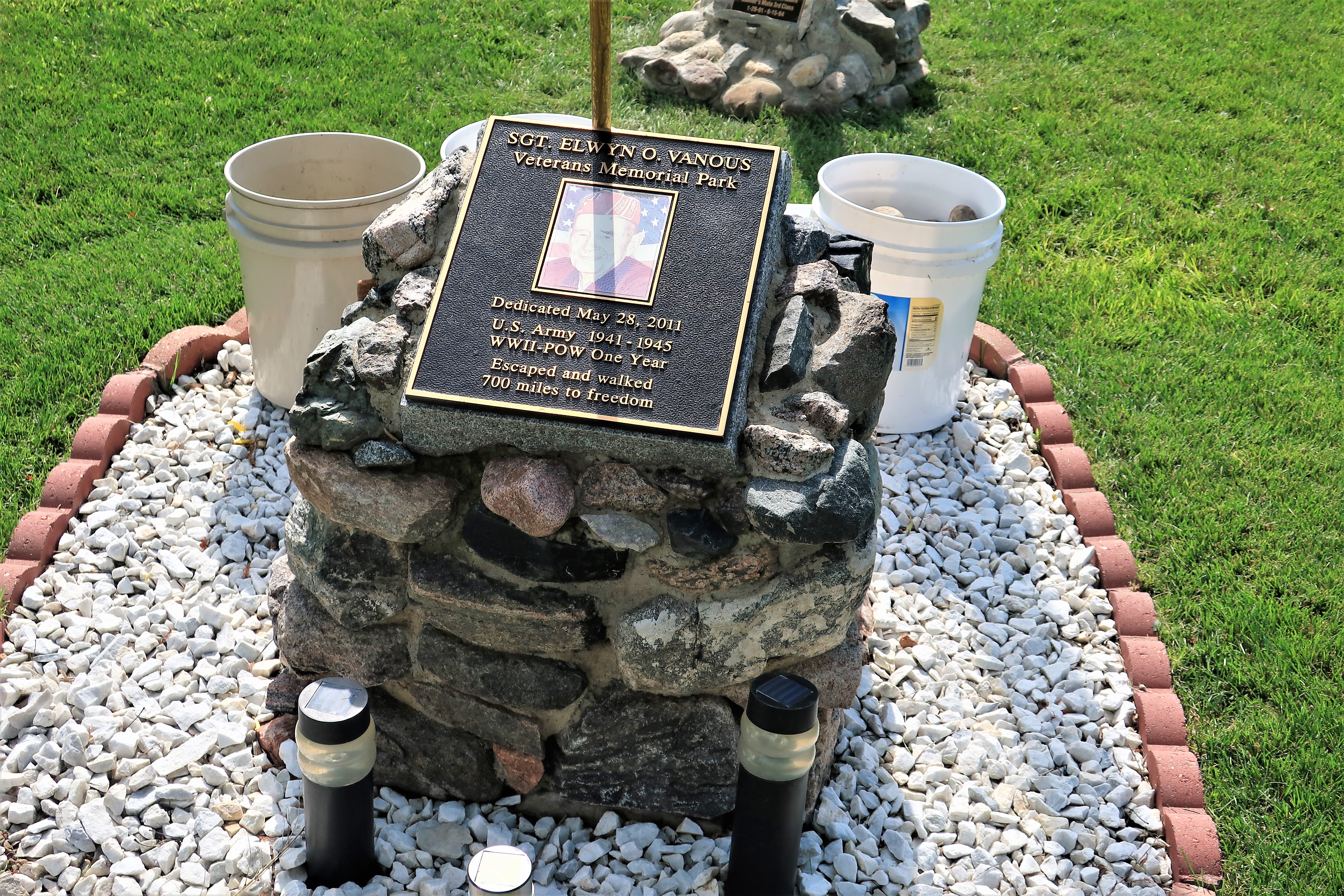
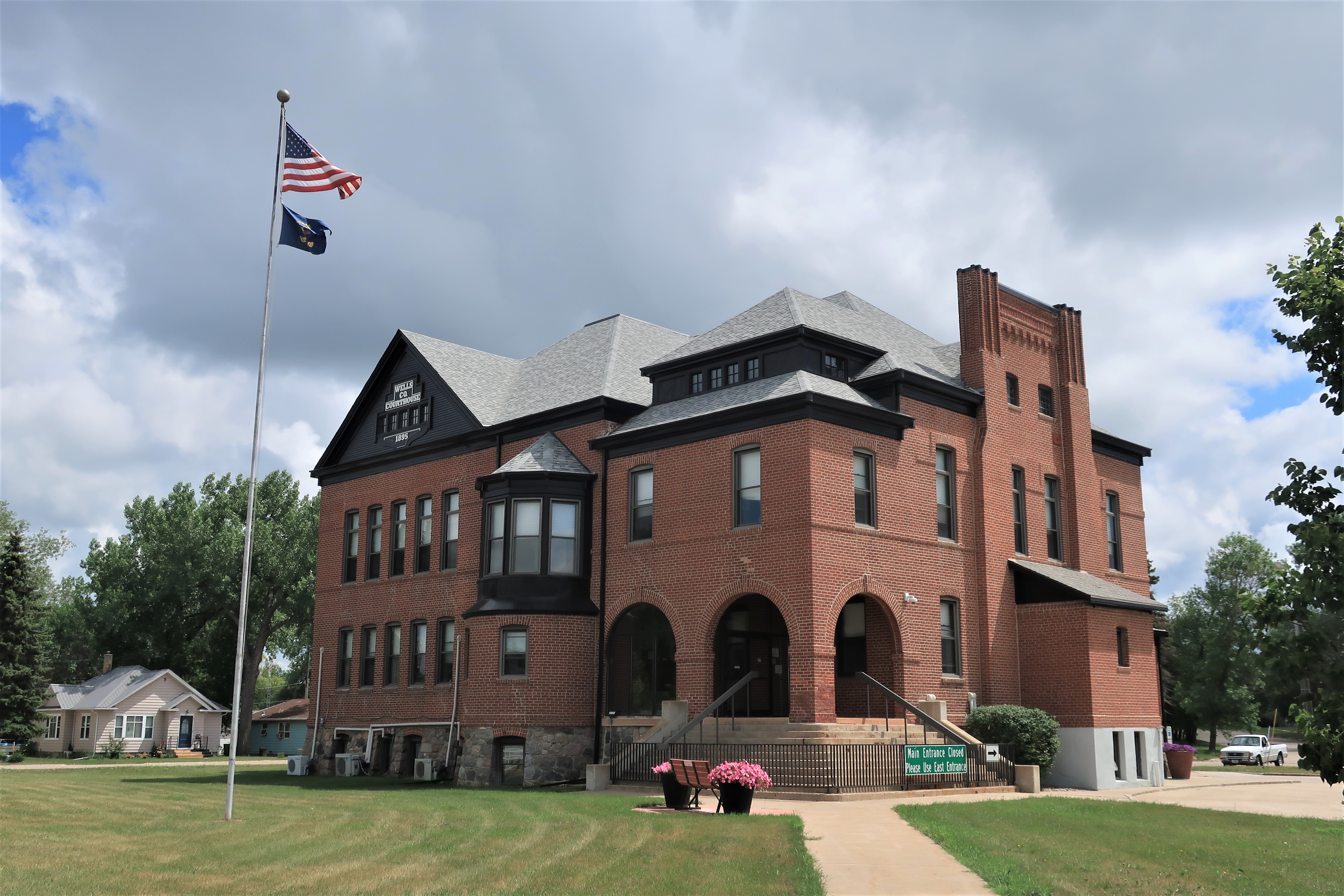
Heading east out of Bismarck my first stop this morning was Steele, North Dakota, with a population of 715 and county seat of Kidder County. The photos below show the STR United Methodist Church (top left), Kidder County Courthouse (top right), view down Broadway Avenue (center right), and Veterans Park behind the courthouse (bottom). Note that the church has a sign outside offering a chance to join services either on Facebook or YouTube. Steele’s storm warning sirens are stationed above the buildings at the far left of the photo looking down Broadway. No storm was coming this day, those clouds are just some morning humidity.
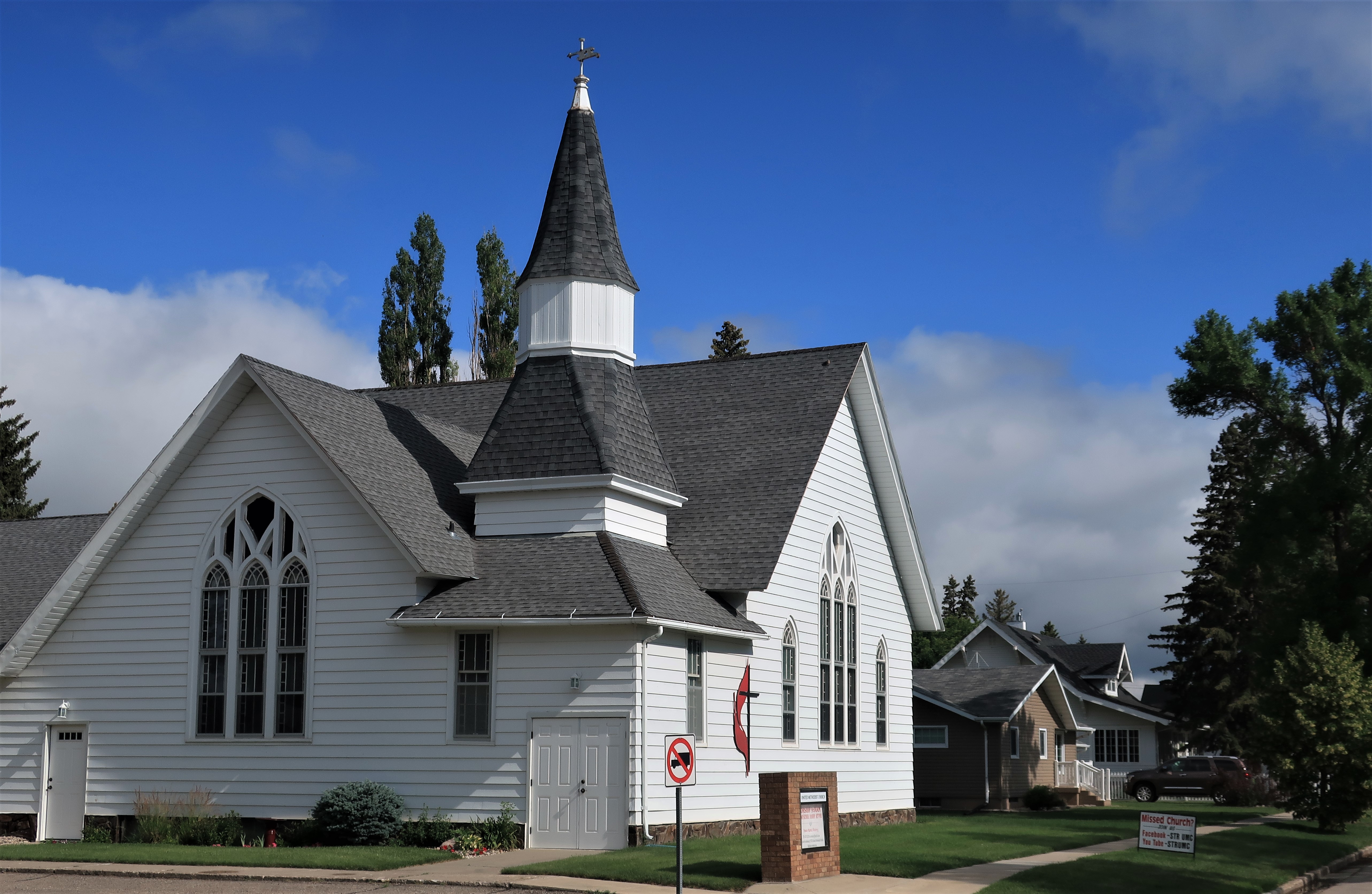
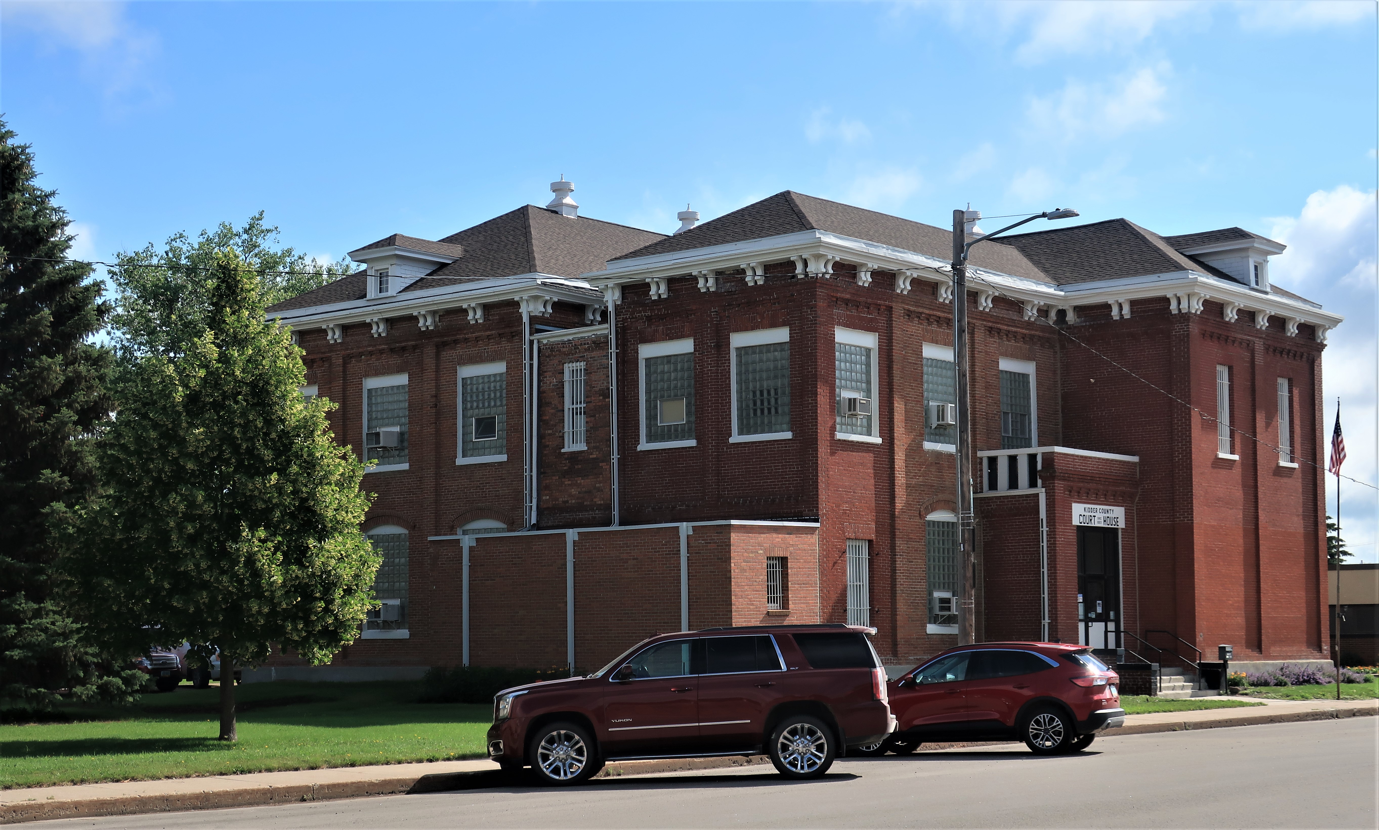
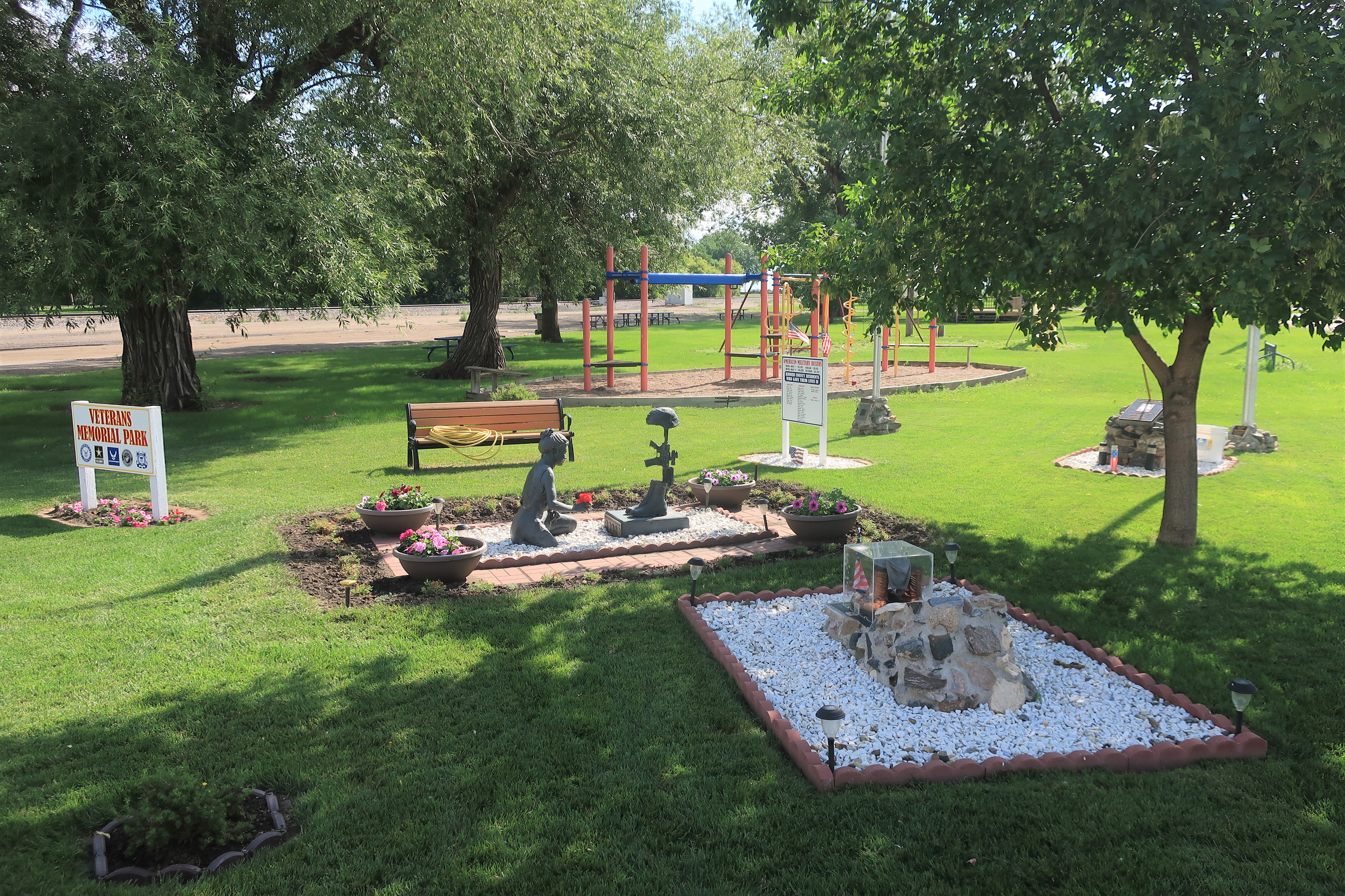
Most towns have a Veterans’ Memorial, but Steele’s is different because its Veterans Park highlights two specific soldiers and their stories. It’s a case of the town explaining the people behind the memorial.

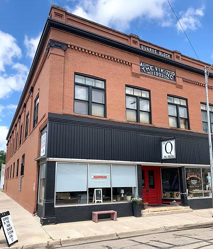
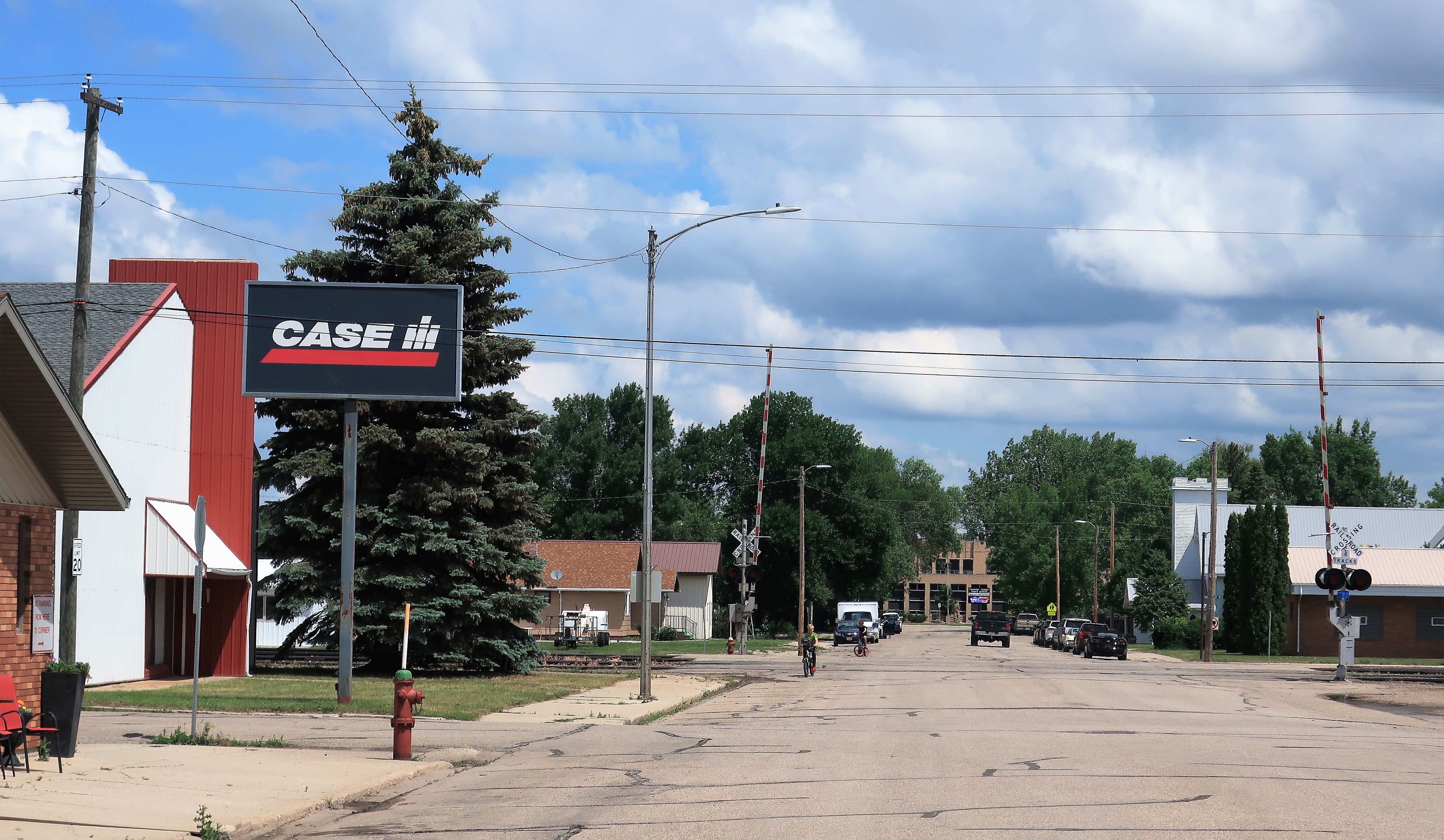
Heading north out of Steele, I stopped next at Fessenden, North Dakota, with a population of 479.
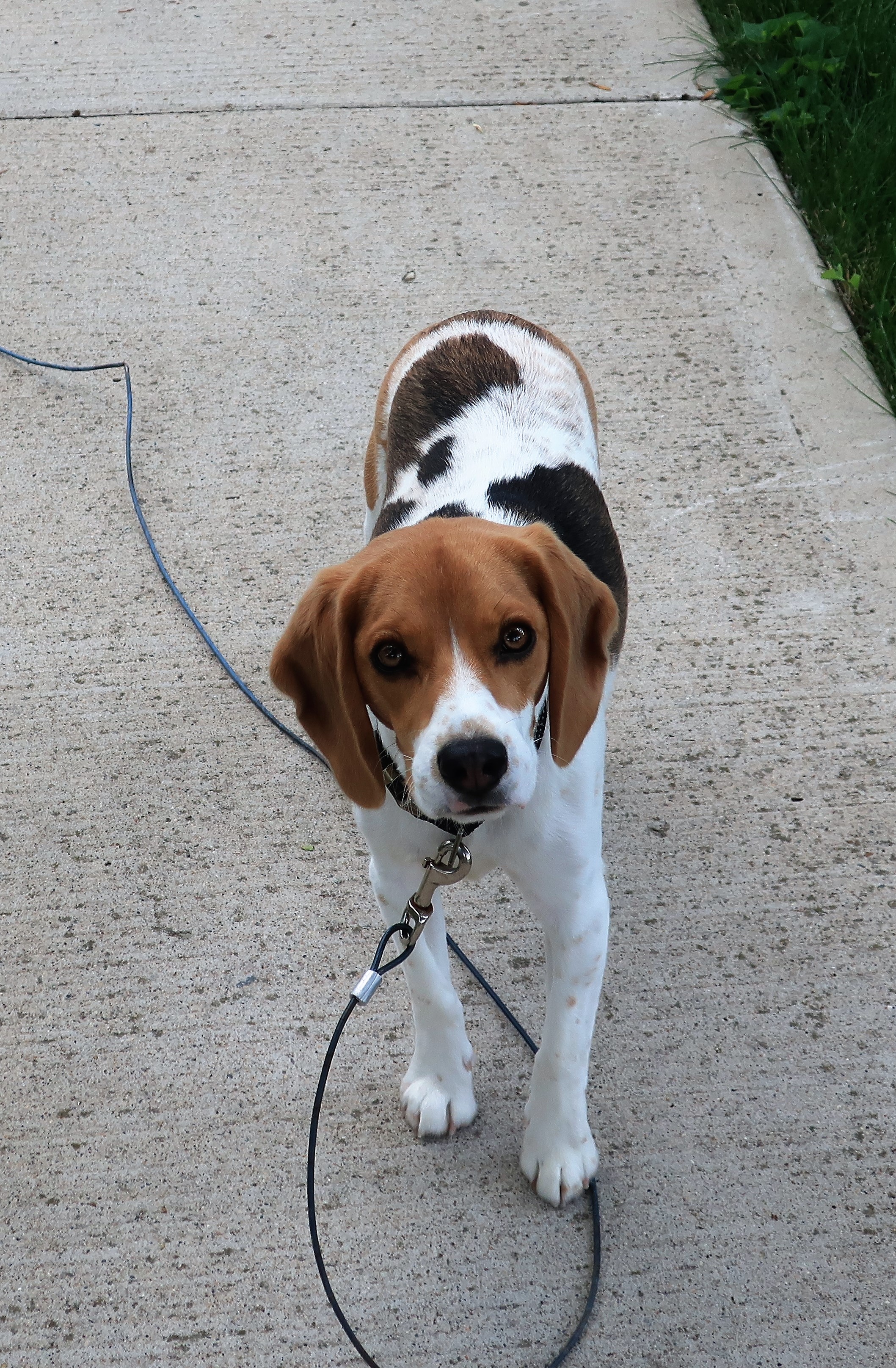
Fessenden: old Quarve Block, largest business building in town (left); Main Avenue (center); and a friendly beagle (right). Not pictured: I walked past about a dozen grade school kids heading down to the town pool for a noon swim — I didn’t think it was a good idea for a stranger to be taking photos of children in bathing suits!
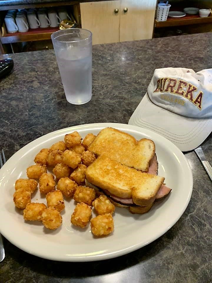
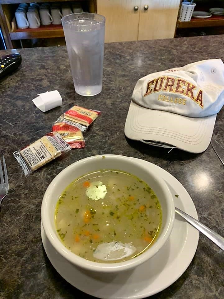
Lunch at the lunch counter at the Main Street Diner: Grilled ham & cheese, tater tots, and homemade chicken dumpling soup.
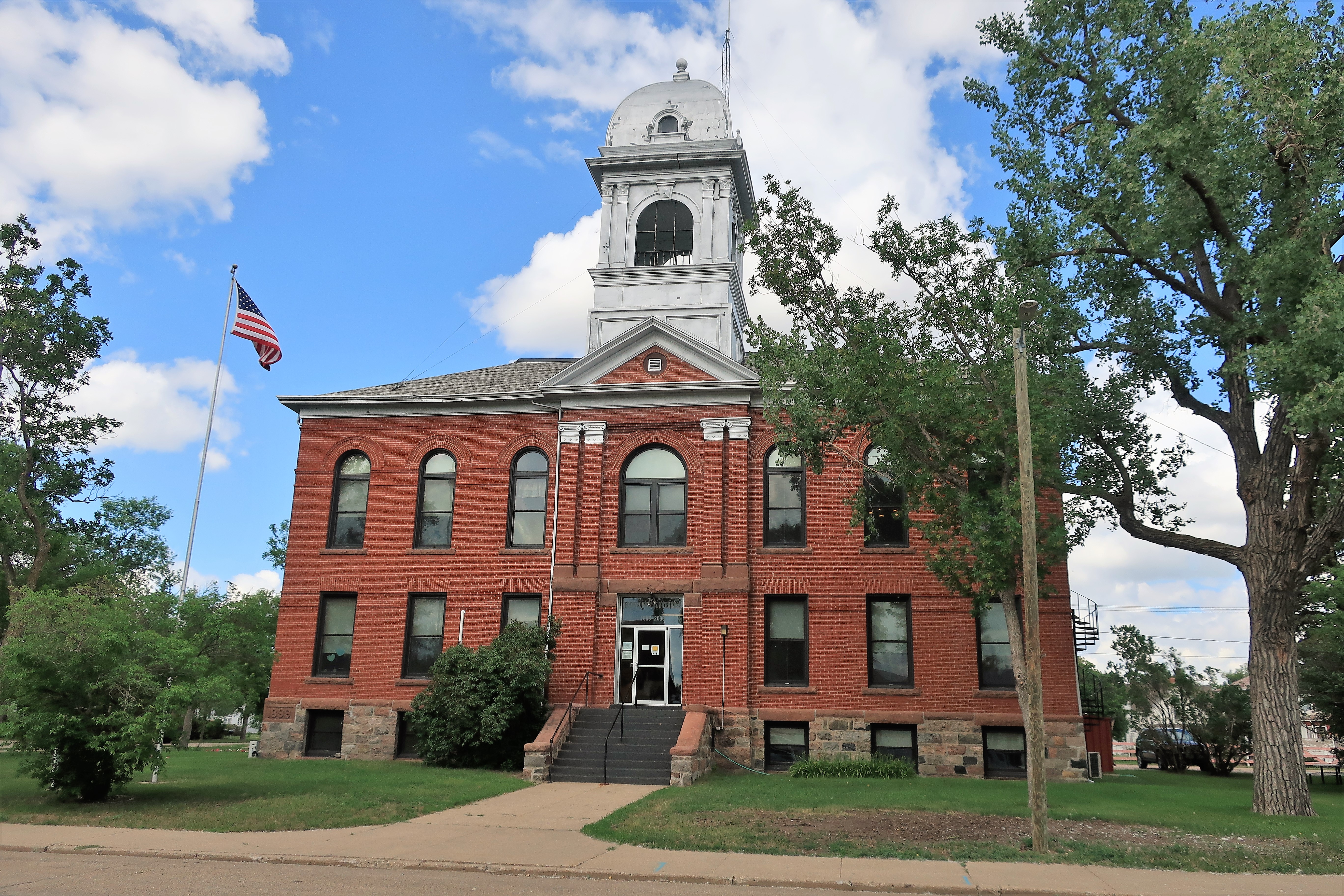
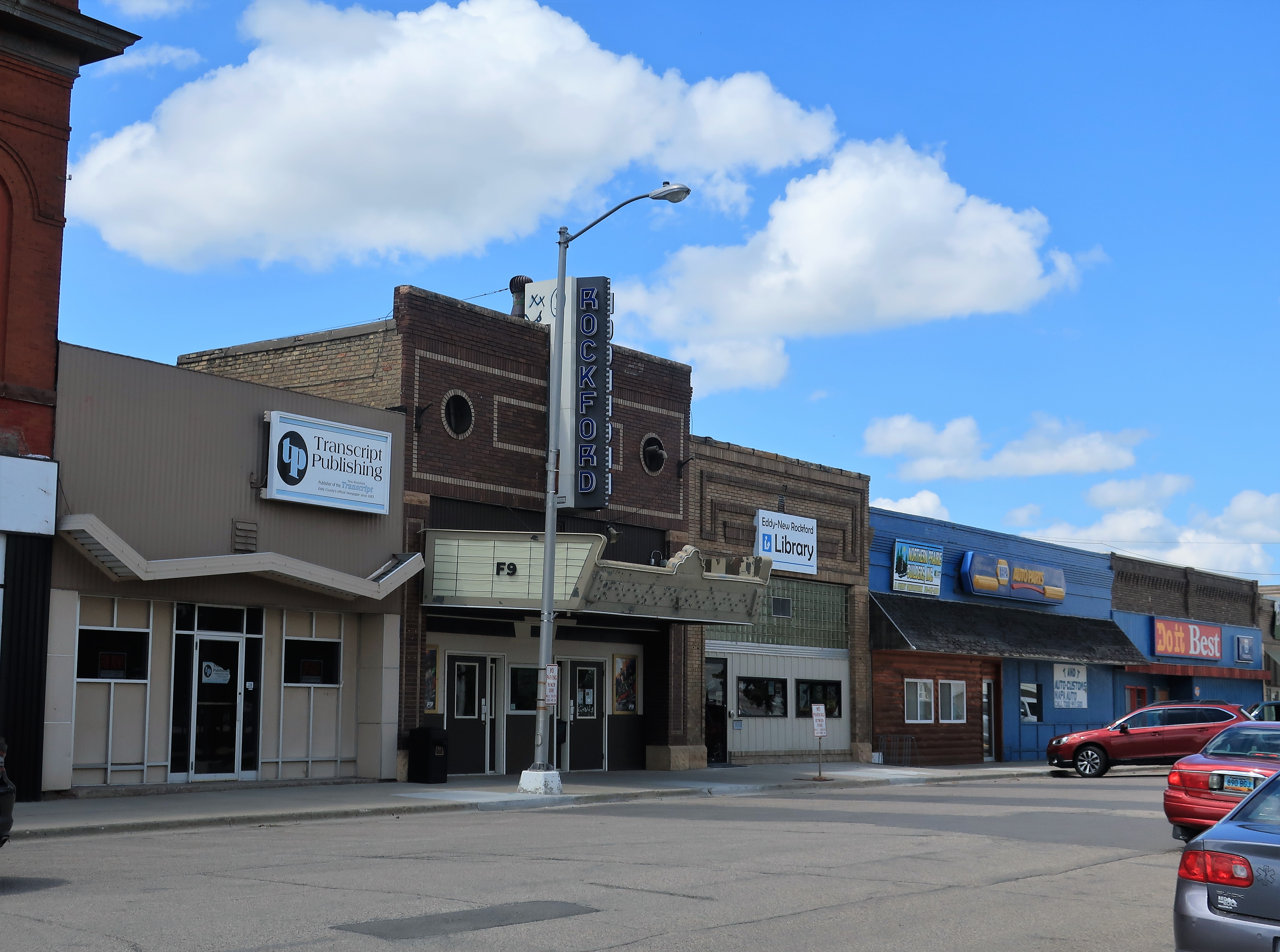
I next stopped at the larger town of New Rockford, having a population of 1,391. Photos below: the Eddy County Courthouse, erected in 1899 (left), courthouse main lobby and plaque (top right), New Rockford street scene (bottom right). The old courthouse here is still in use — in fact, a trial was taking place in the upstairs courtroom while I was there.

On my way to New Rockford, I drove by this herd of buffalo but didn’t stop to photograph them. After visiting the town I thought I might have missed an opportunity and came back to take a photograph of the herd. They were right up against the fence when I first drove by but by the time I got back they had moved away from the fence. He who hesitates is often lost!
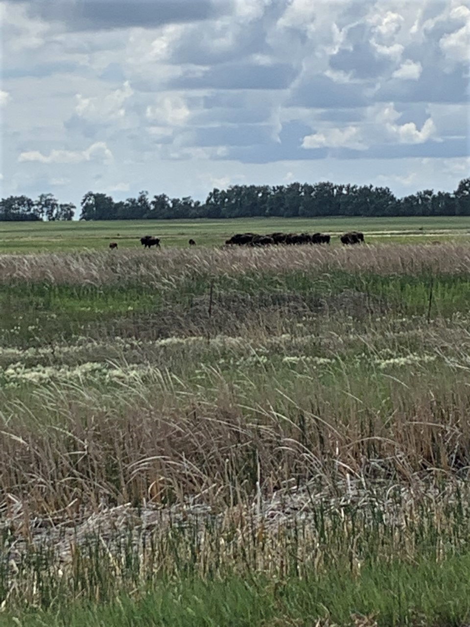
By the way, I prefer the term “buffalo” to “bison,” although I am told every so often that “bison” is the correct term. I don’t care. Buffalo is an iconic term of the old American West and it conjures up too many rich images to be replaced in common speech.
My last visit for today would be to the largest town of the day, Carrington, with a population of 2,065.

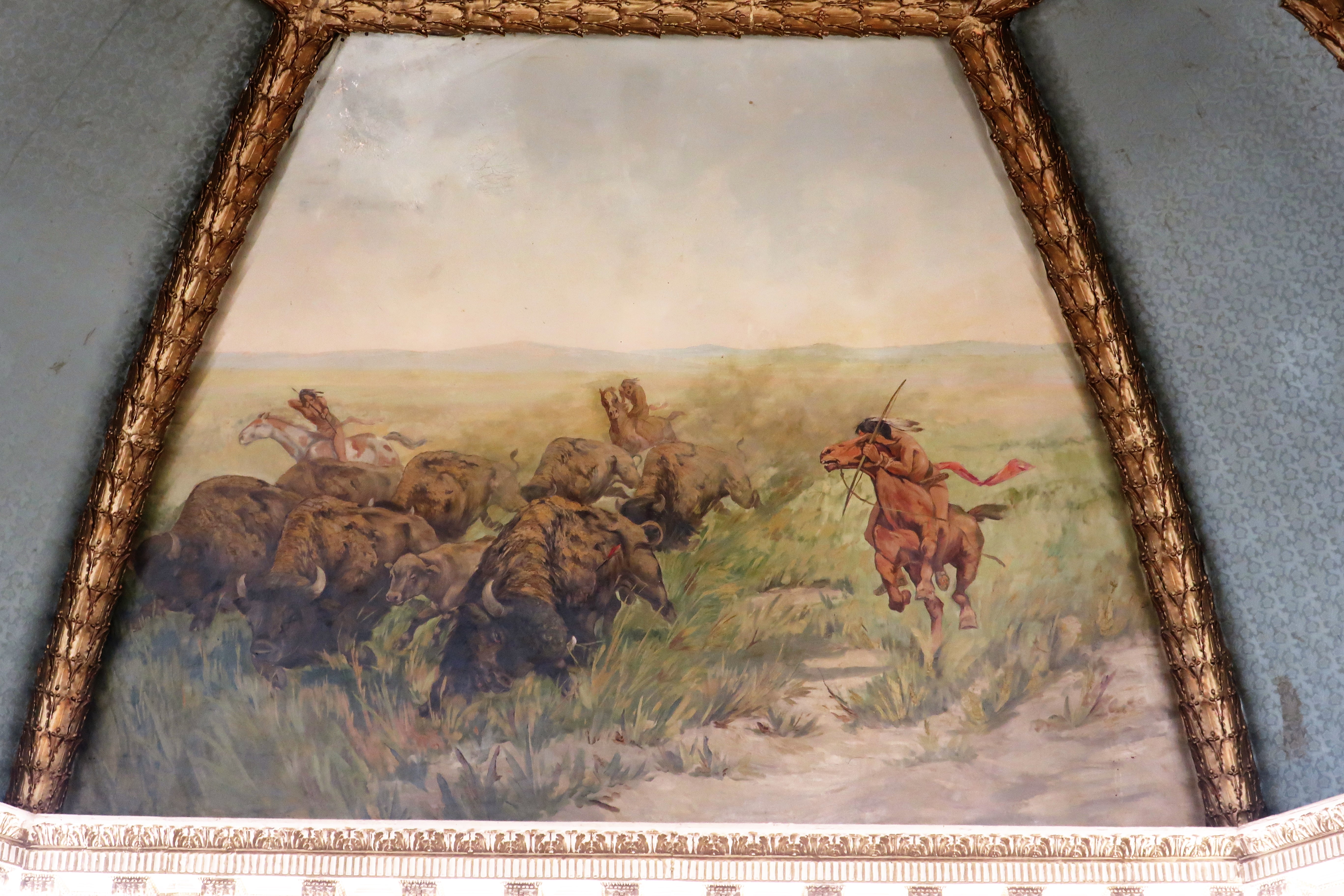
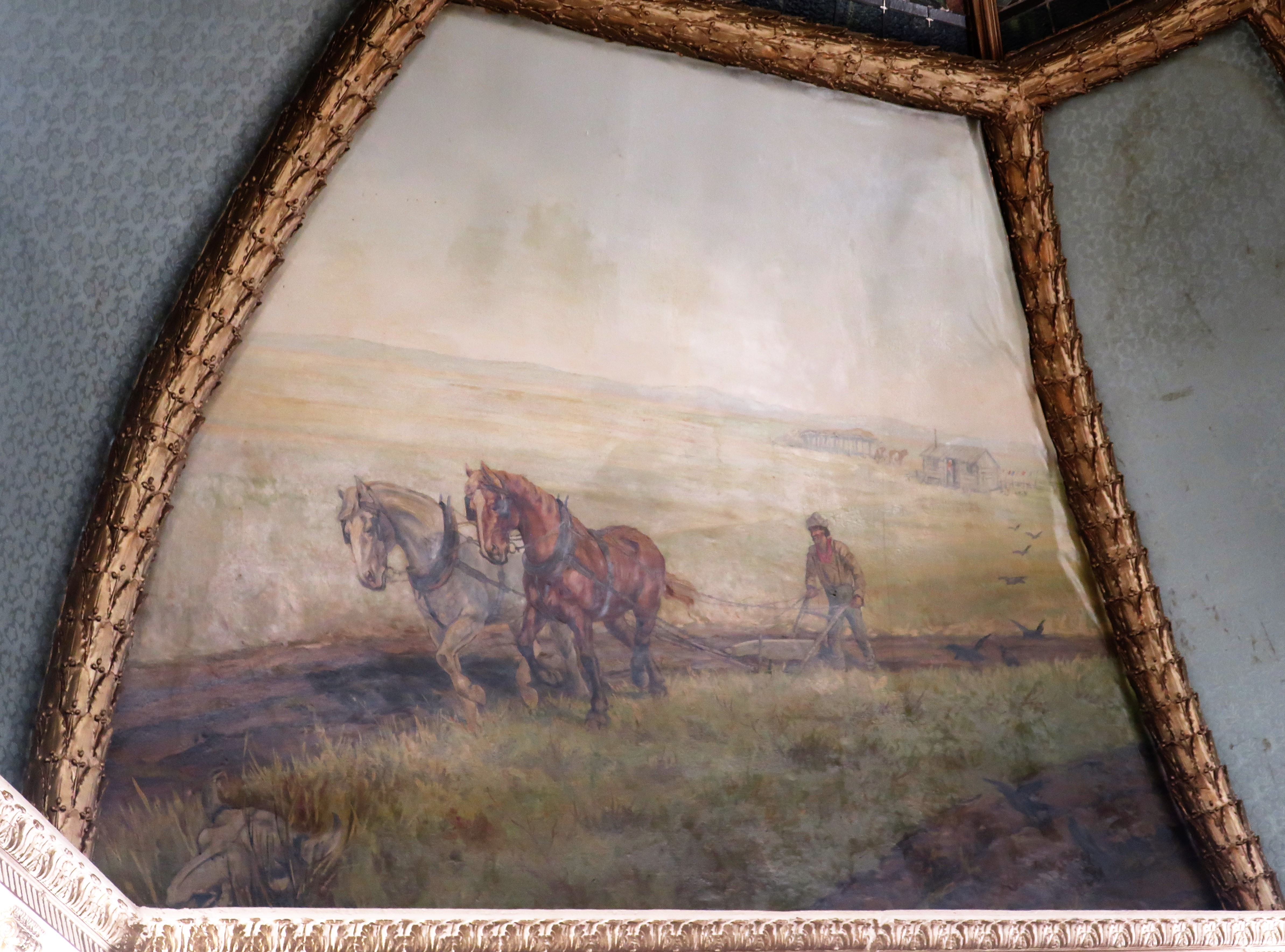
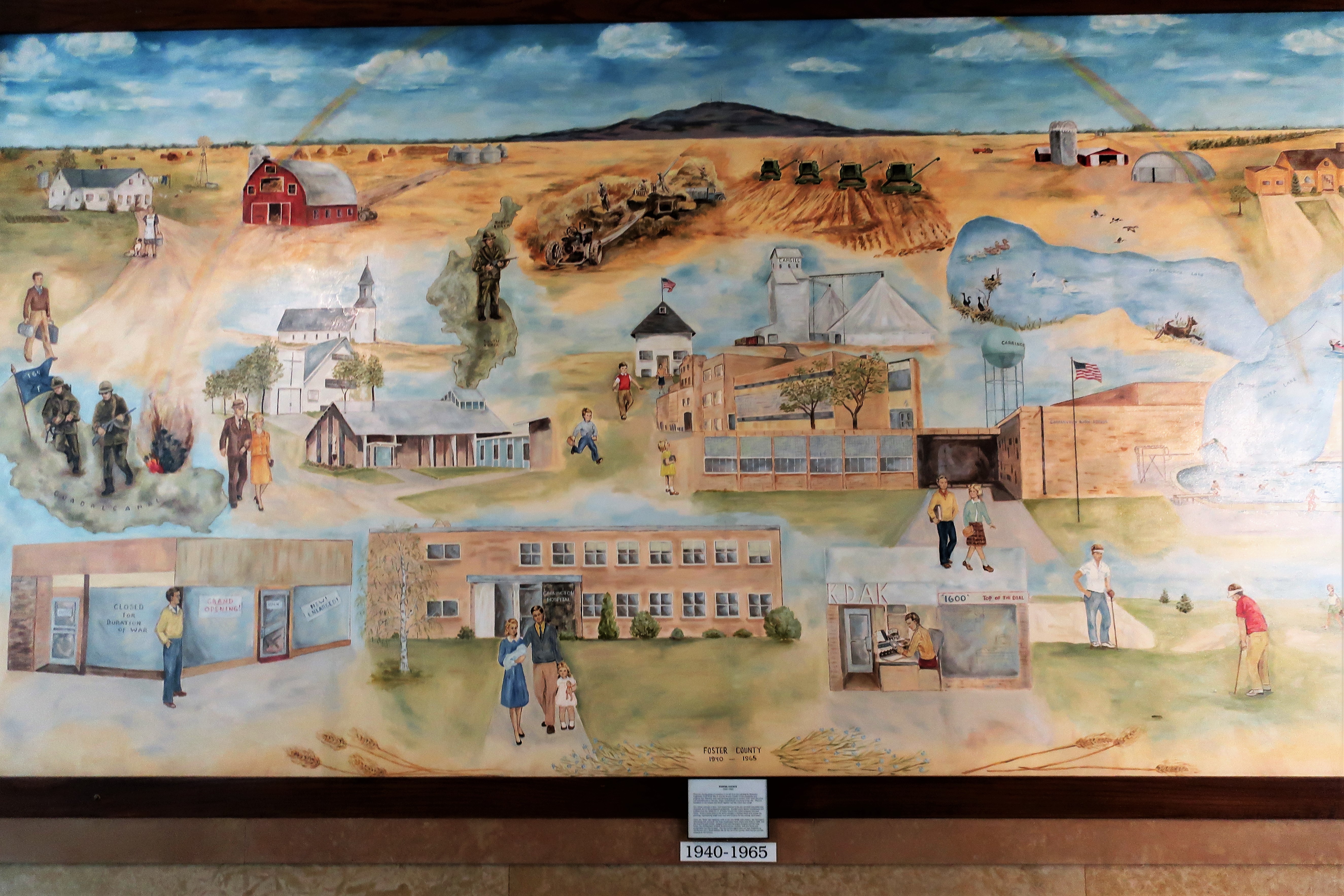
This courthouse, like most of the old courthouses in this region, was built in the late 19th to early 20th Centuries and was built with a great deal of pride — not only pride in the people but pride in their state and their nation as well. Like many other courthouses built throughout the United States during this era, this courthouse was designed with a sense of grandeur and uses granite exteriors and marble and brass interiors. Vibrant murals depicting county history are painted on the ceiling under the central dome and can be viewed from the building’s atrium two floors below.
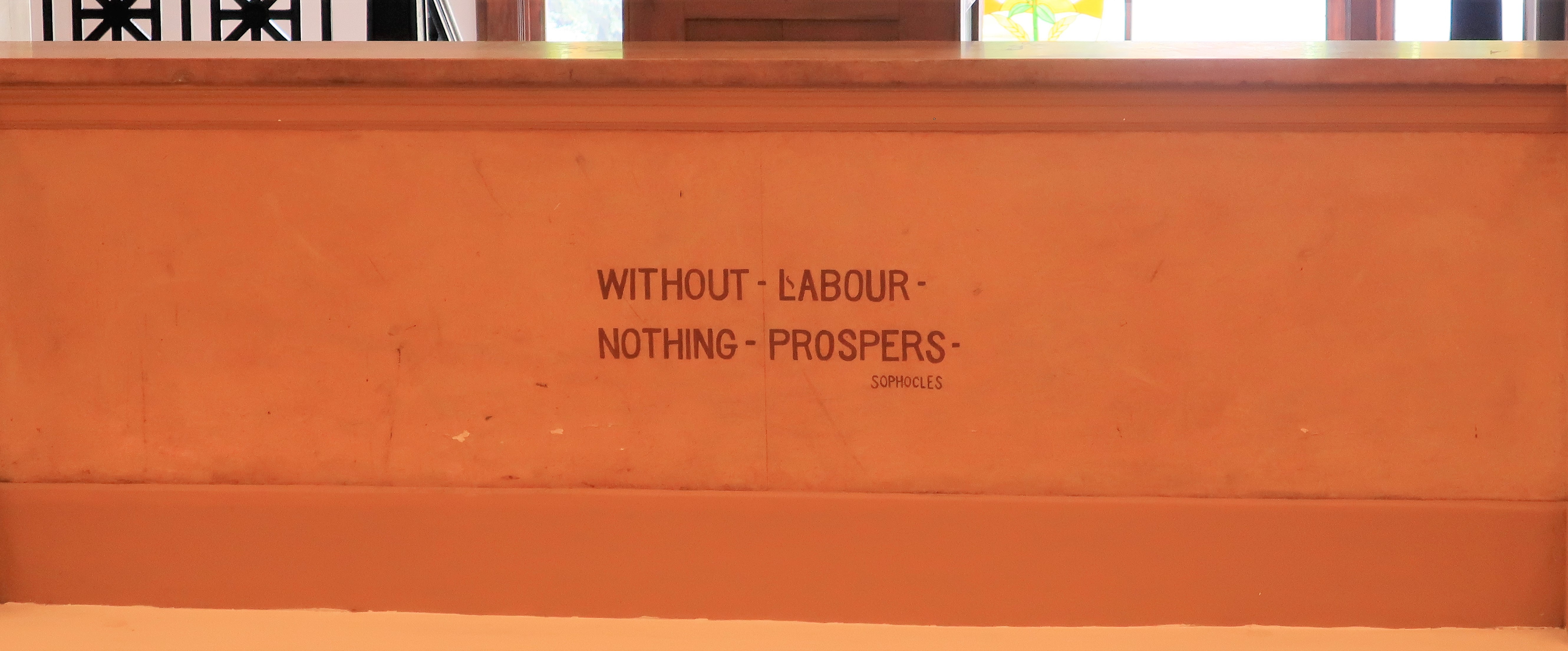
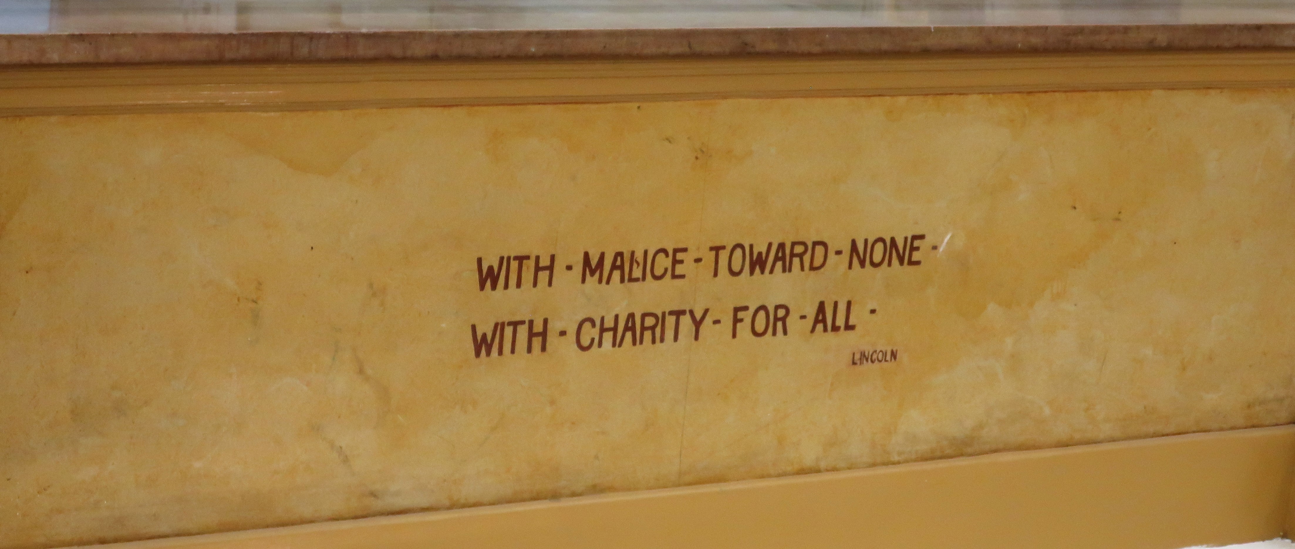
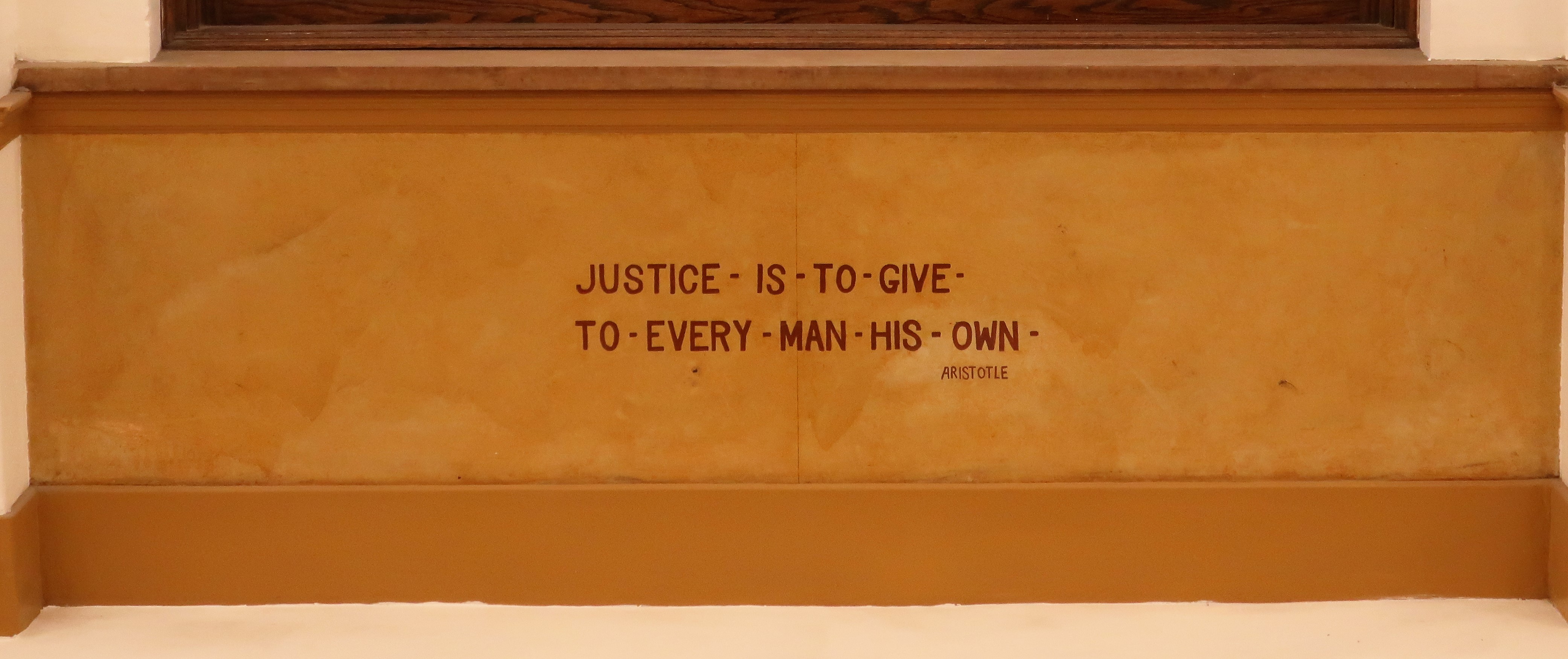
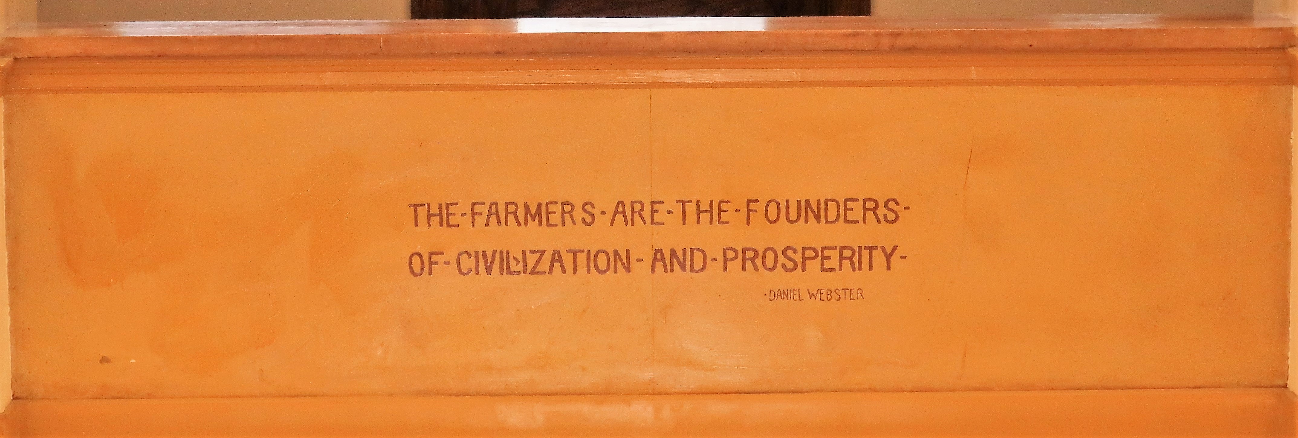
Words of wisdom are inscribed into marble walls along the second floor above the atrium, referencing wisdom from both the ancients (Aristotle, Sophocles) and from modern Americans (Webster, Lincoln):
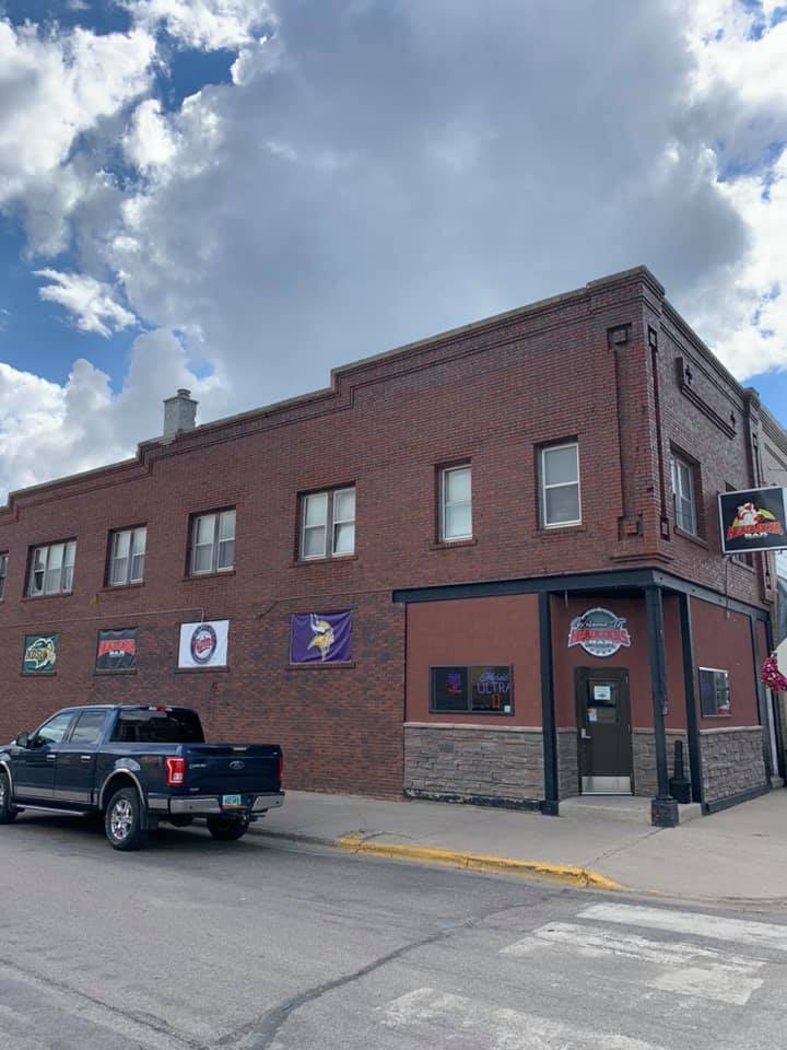
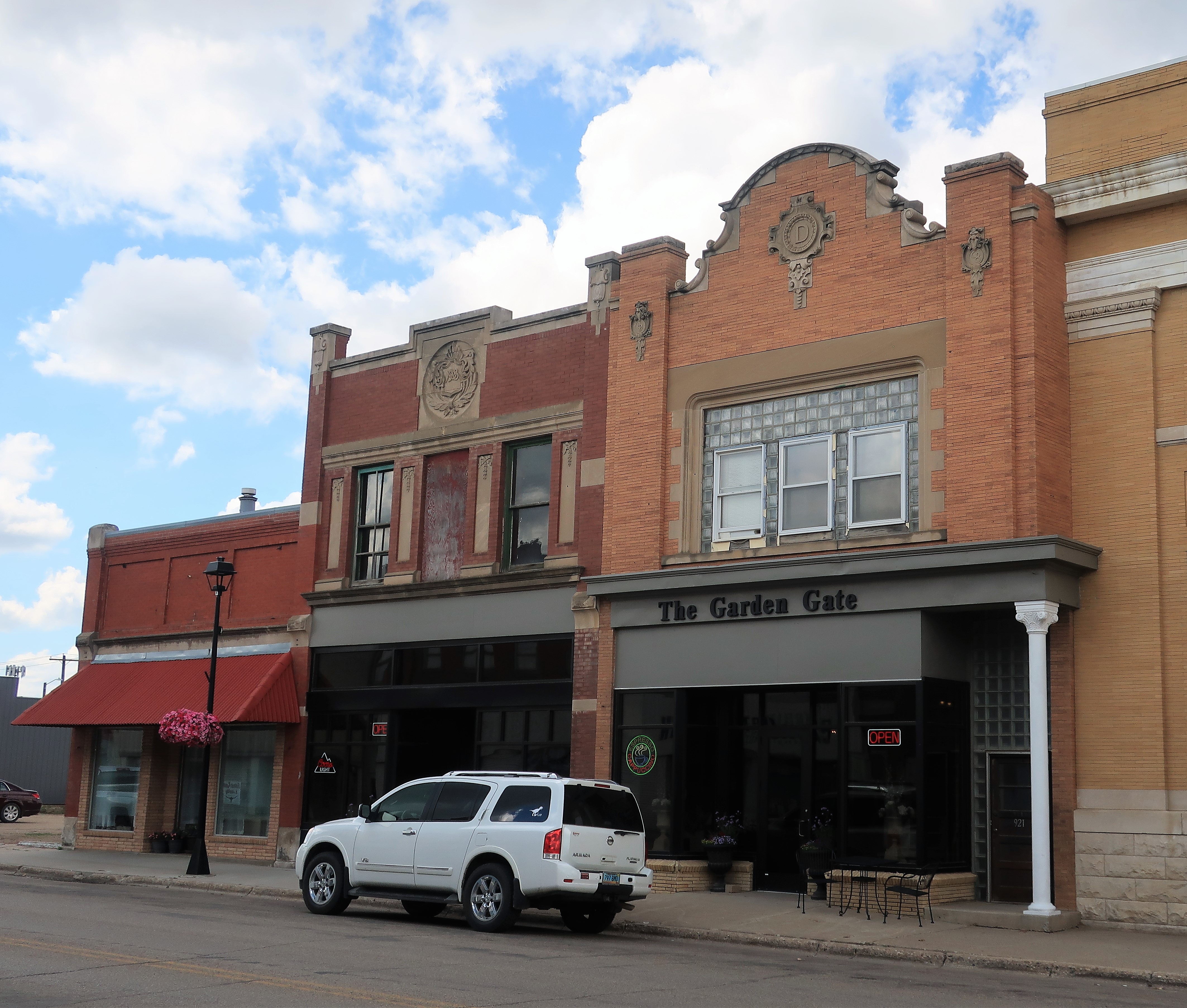
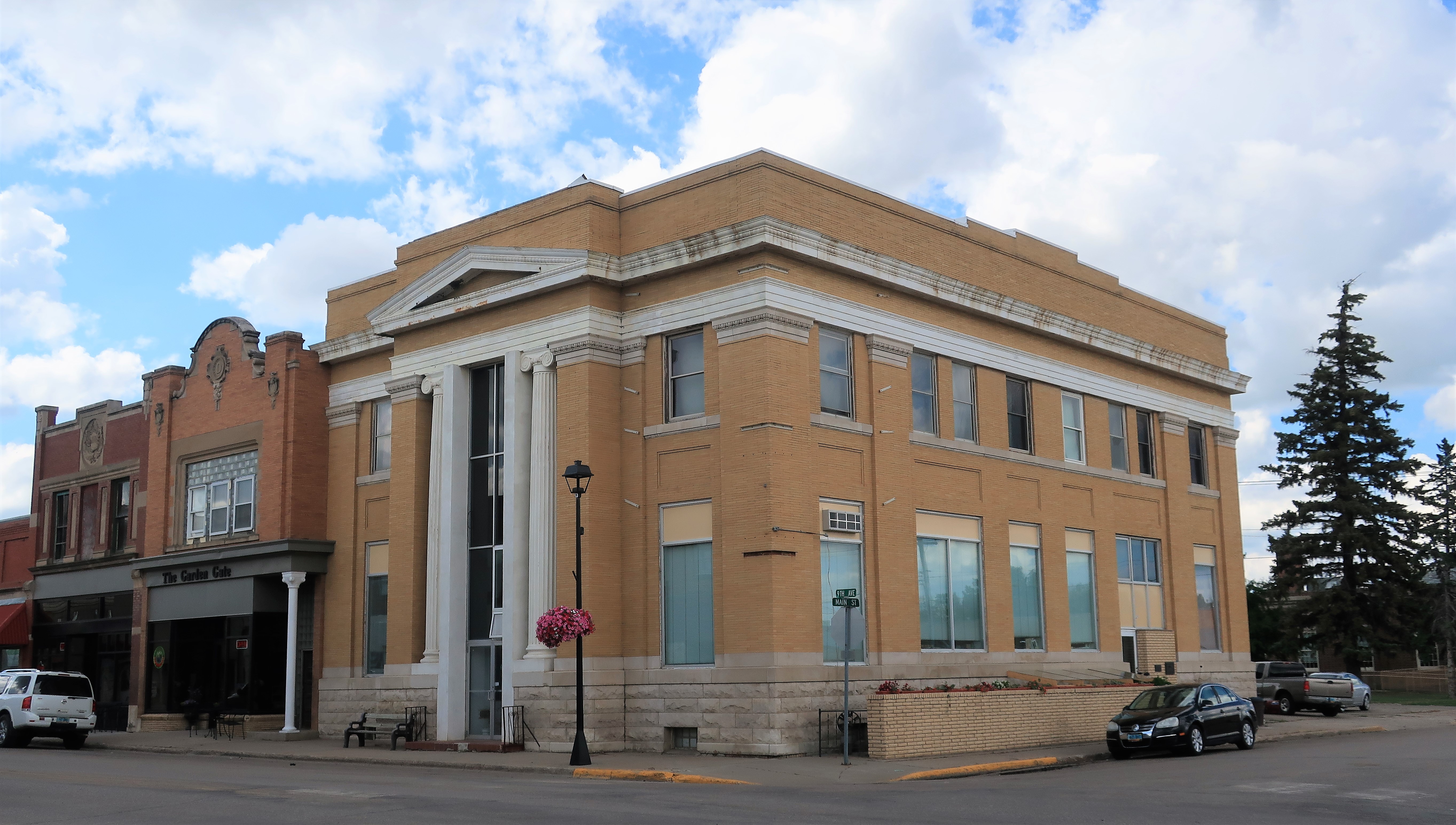
Feeling thankful for all the eye candy I saw in the courthouse, I strolled to downtown Carrington to get a beverage and write my notes: Headlocks — a sports bar (Minnesota Vikings bar), the Garden Gate — a combination wine bar, coffee shop, and gift shop, and the bank building.
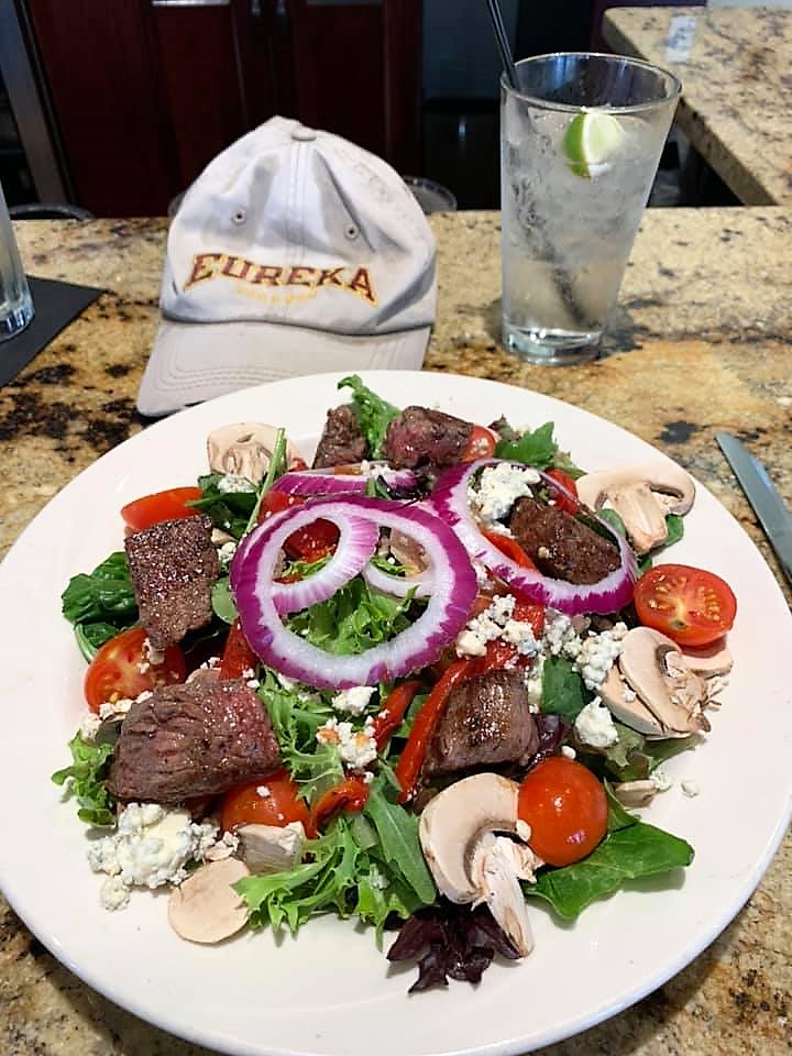
From Carrington, I drove down to the larger town of Jamestown to have dinner and spend the night. Keeping it light tonight I chose a steak salad with a gin & tonic at Sabir’s Buffalo Grill. Eat beef when in cattle country!
Jamestown is a small city adjacent to Interstate 94. There are plenty of lodging options available here. Checking prices, I chose the My Place hotel, part of a new and expanding hotel chain in the west and midwest.
Freedom Voyage Day 4, Tuesday, June 29, 2021: Jamestown to Devils Lake, North Dakota

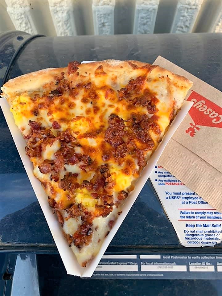
After spending the night in Jamestown (population 15,000 and change) it was time to have a look around. First stop, Casey’s General Store for some of their breakfast pizza. Based in Des Moines, Iowa, Casey’s is a convenience store chain with hundreds of locations throughout the Midwest, but only a few in North Dakota. Their breakfast pizza is my absolute favorite.
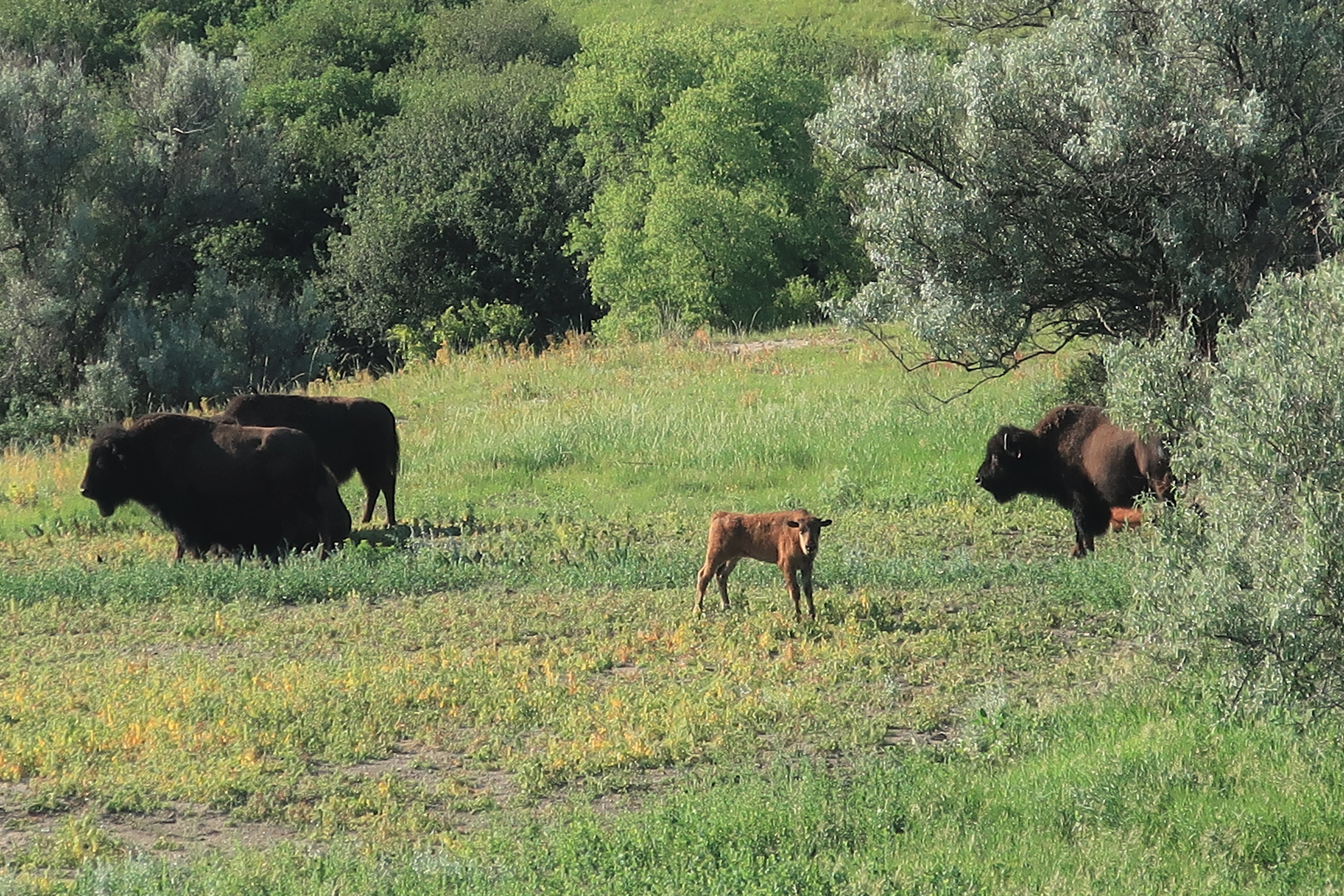
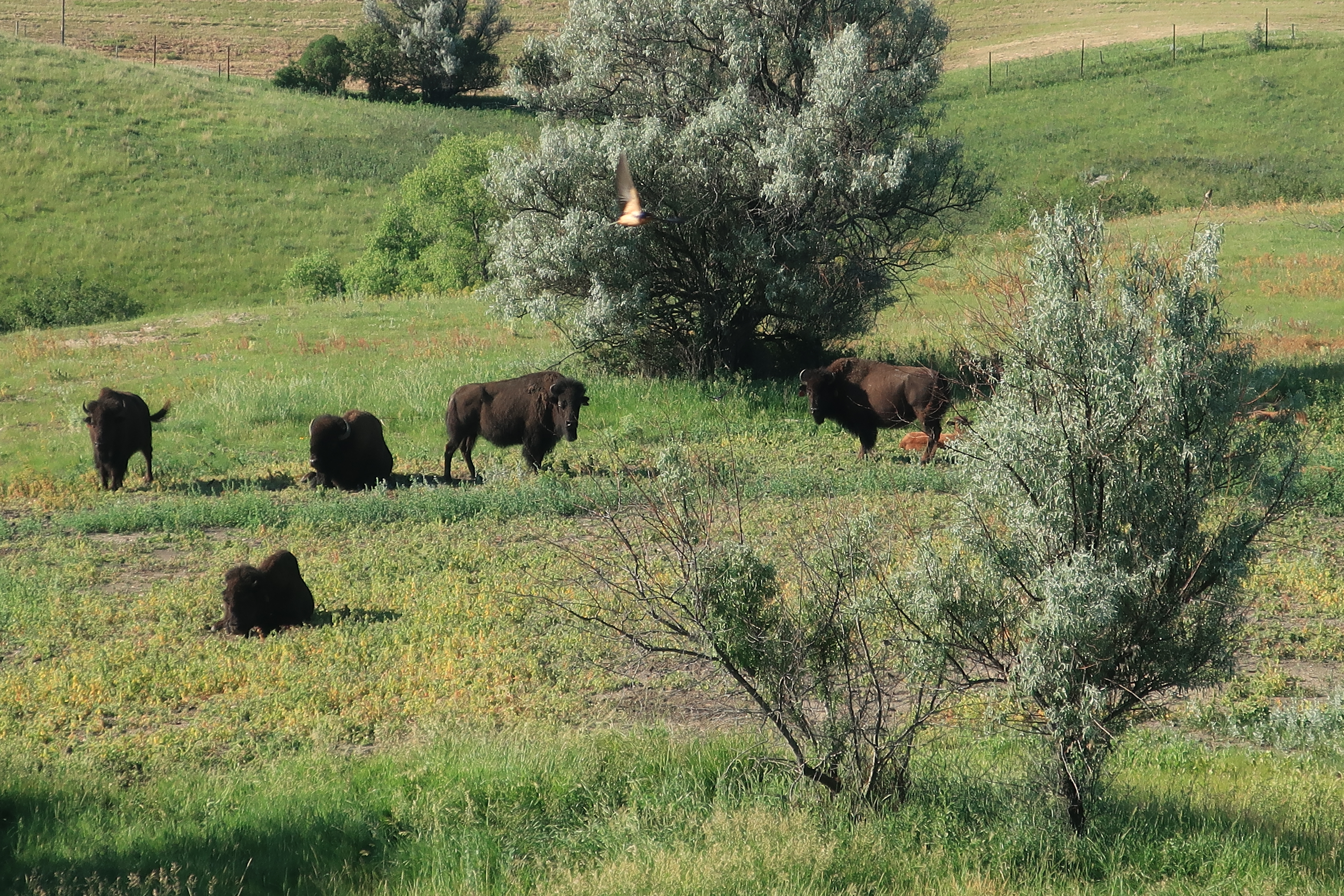
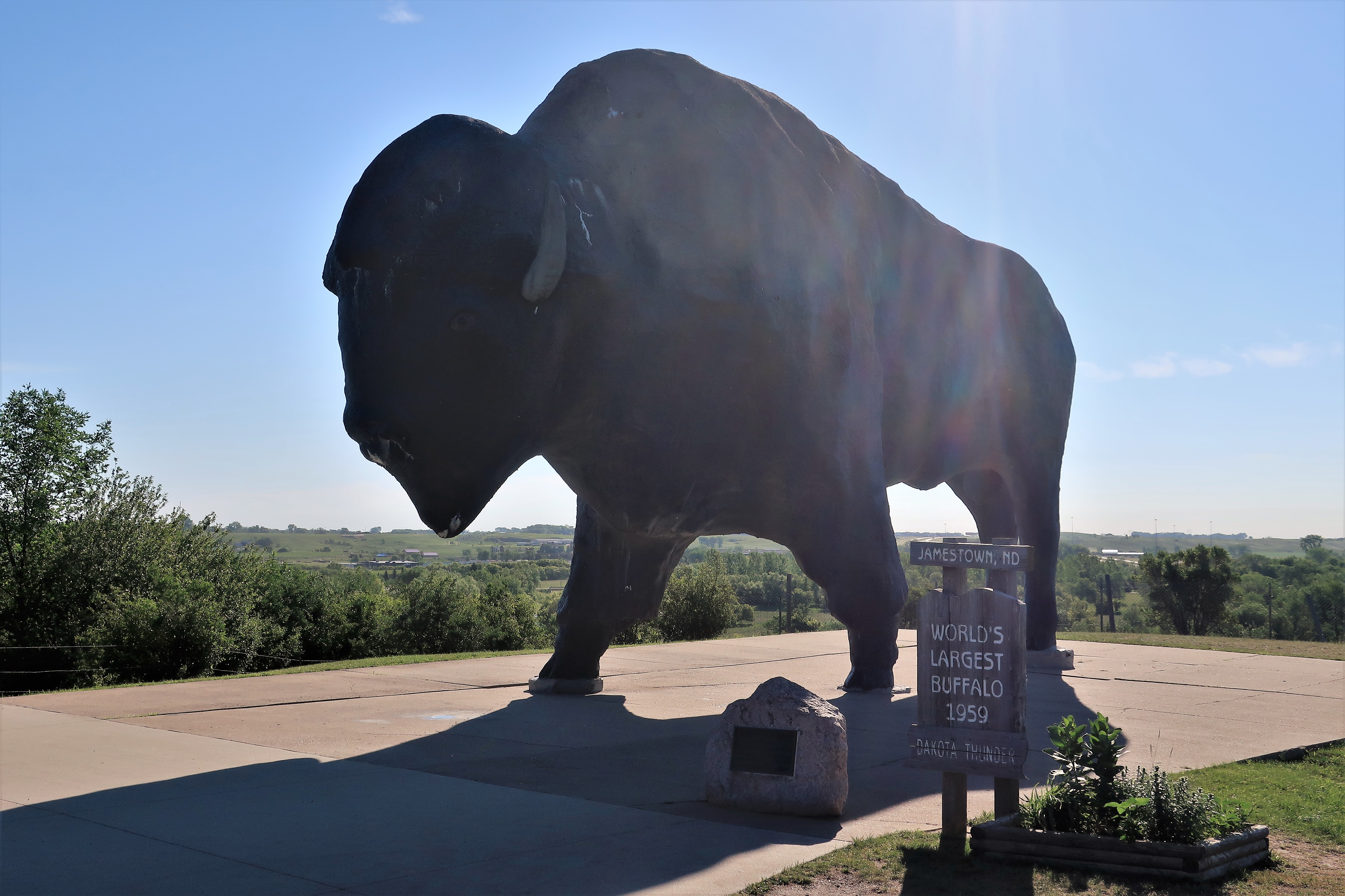
The locals here refer to Jamestown as “Buffalo City” so I drove by the National Buffalo Museum before it opened in the morning. They have a herd of about a dozen animals (that I could see), both adults and calves enjoying the early morning sunshine and prairie grasses near the World’s Largest Buffalo statue. The statue is visible from Interstate 94 nearby.
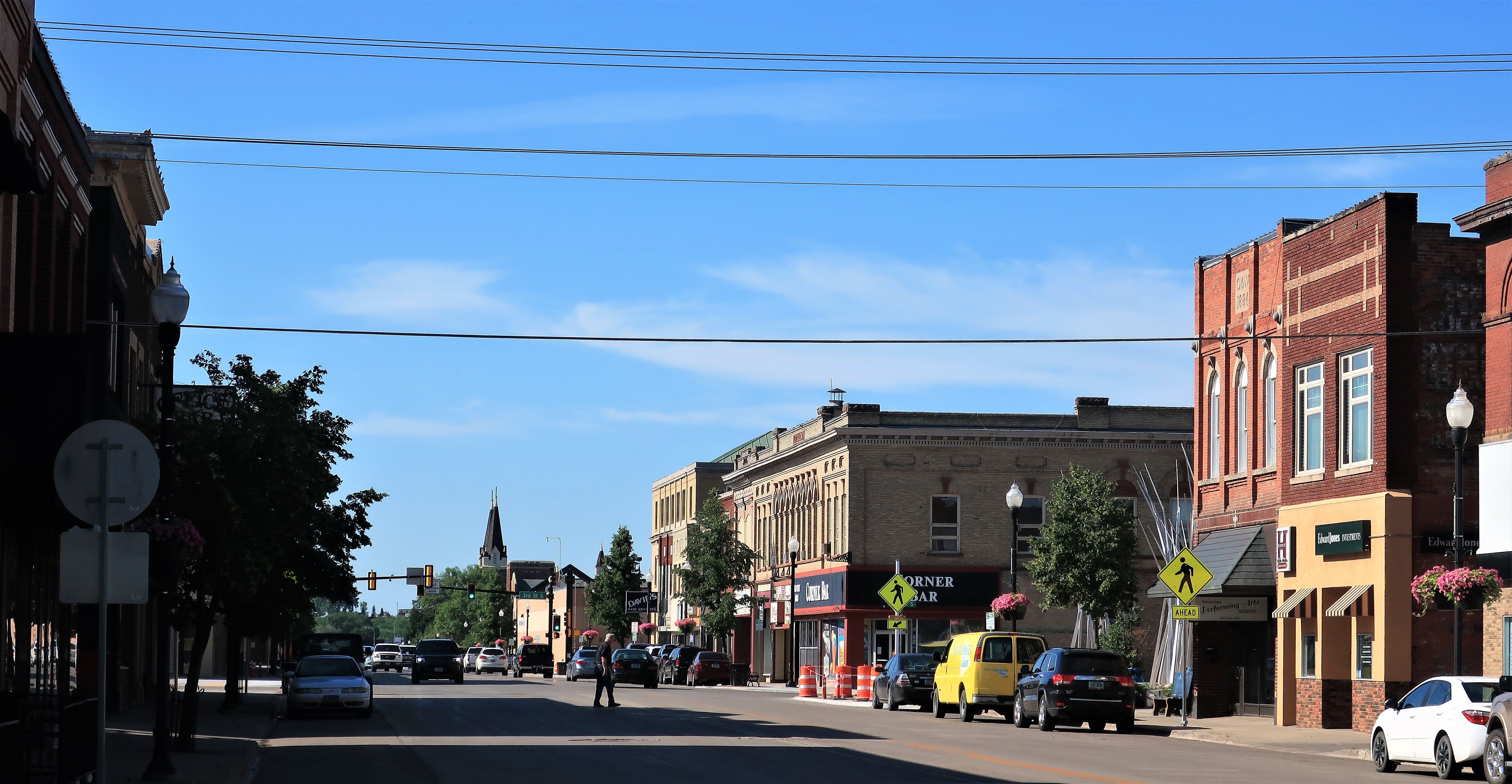
Jamestown has been a center of commerce since its founding in 1872 at the point where the Northern Pacific Railroad would bridge North Dakota’s James River. The town was named after Jamestown, Virginia, and today has a vibrant core of old buildings and plenty of restaurants.
People who live in North Dakota have to account for harsh winters, so their bars and taverns tend to be more spacious than those found in warmer climes. The Corner Bar is one such cozy watering hole providing comfort, community, and warmth.
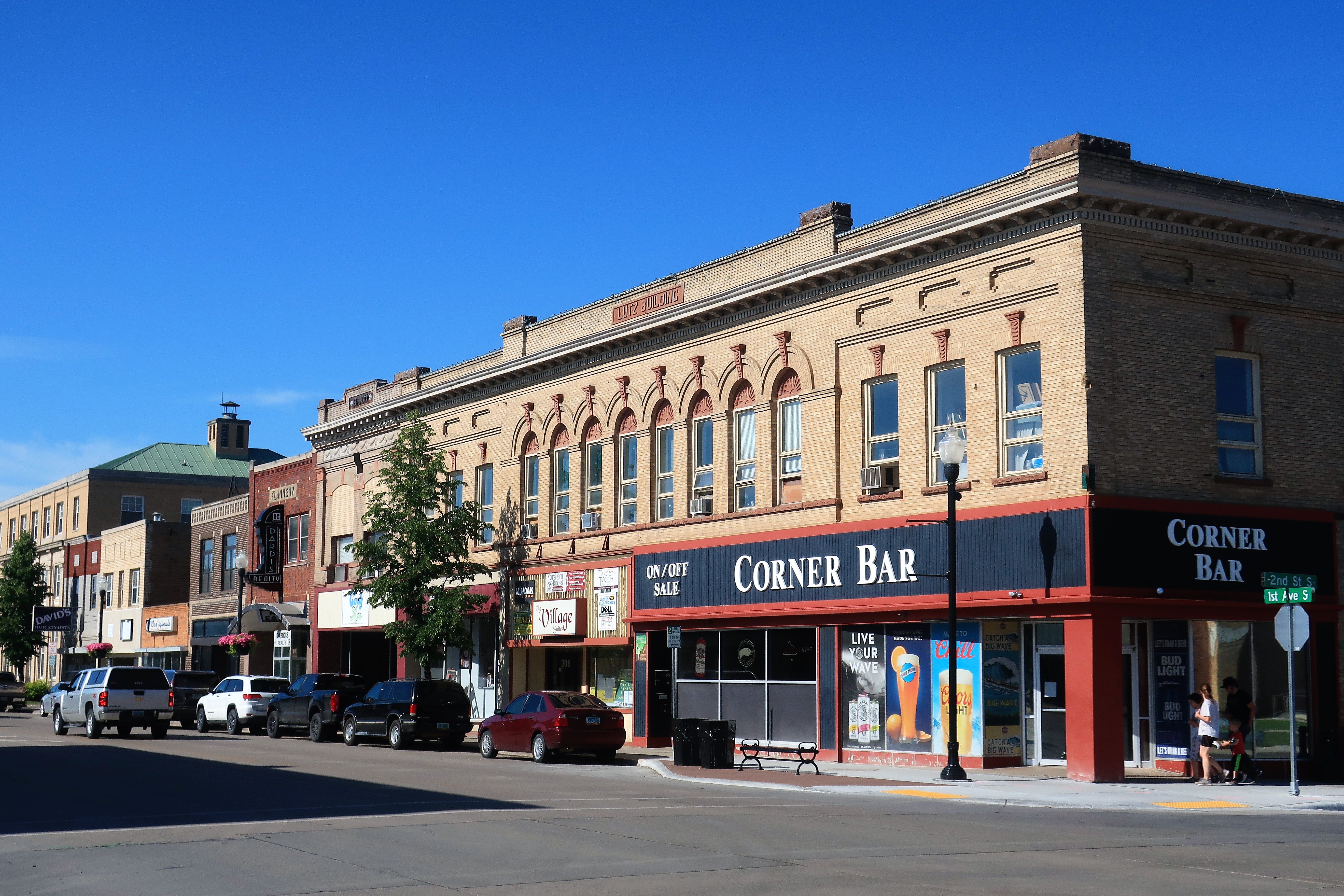
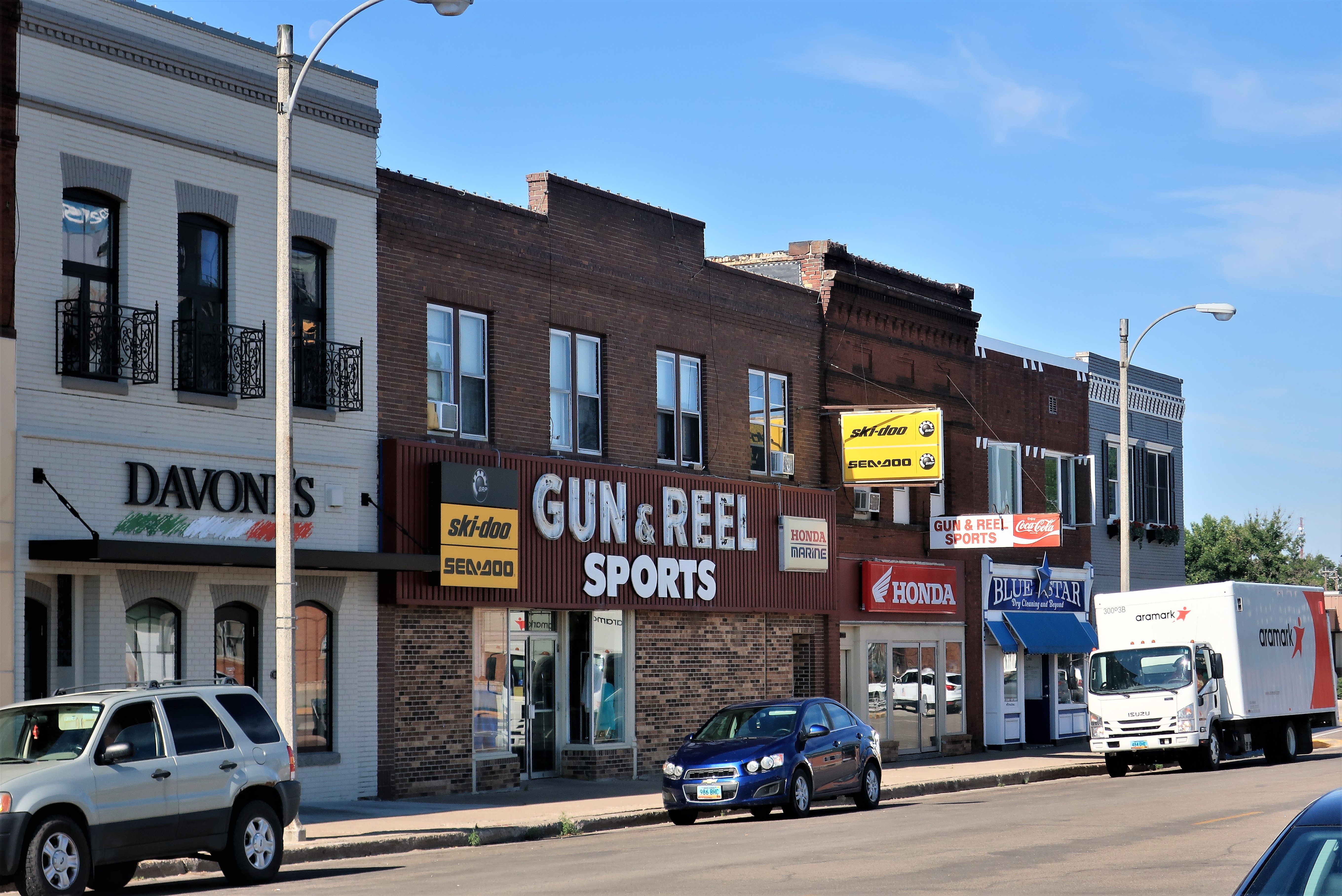
Just around the corner, you can find everything for the sportsman at Gun & Reel Sports.
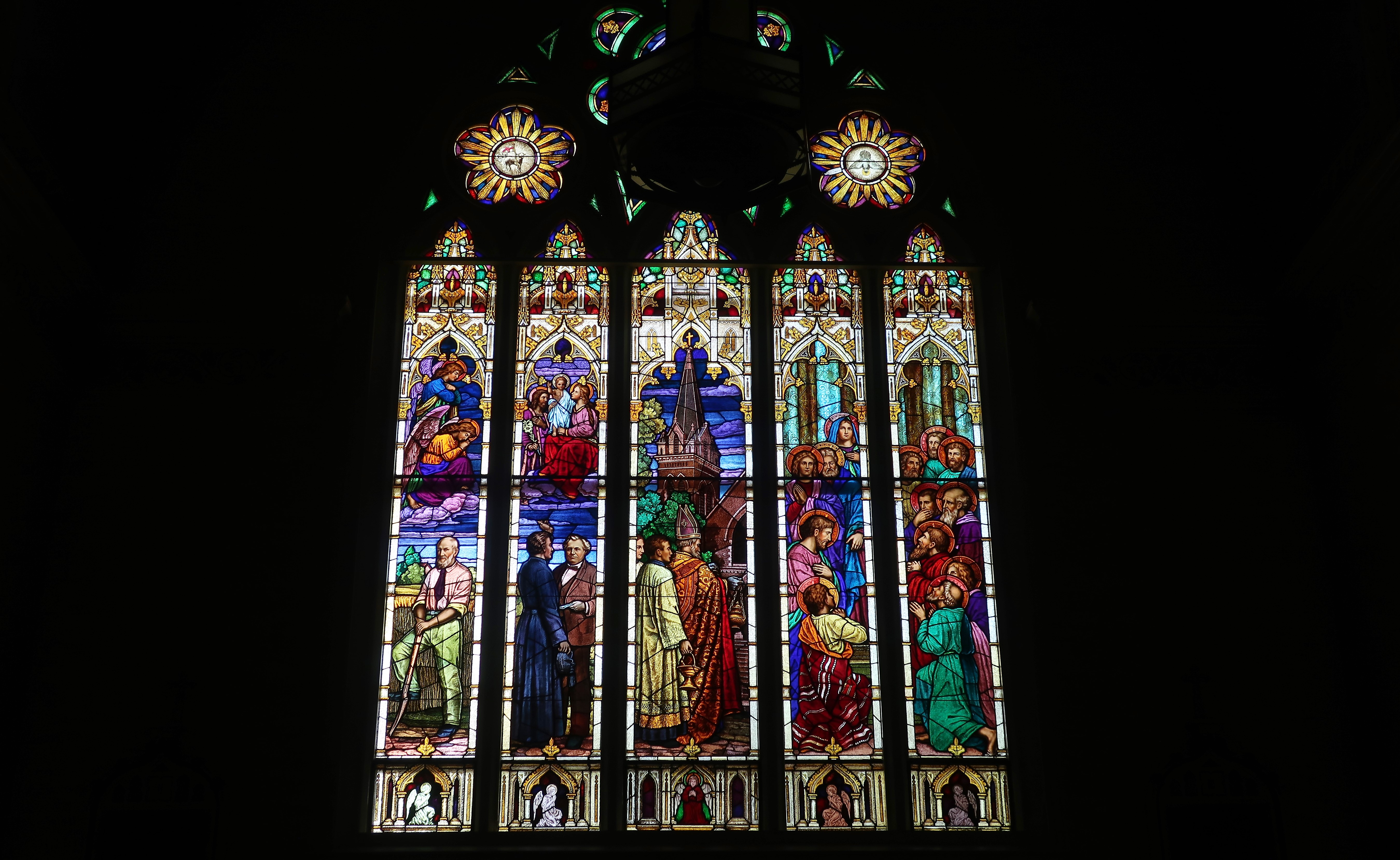
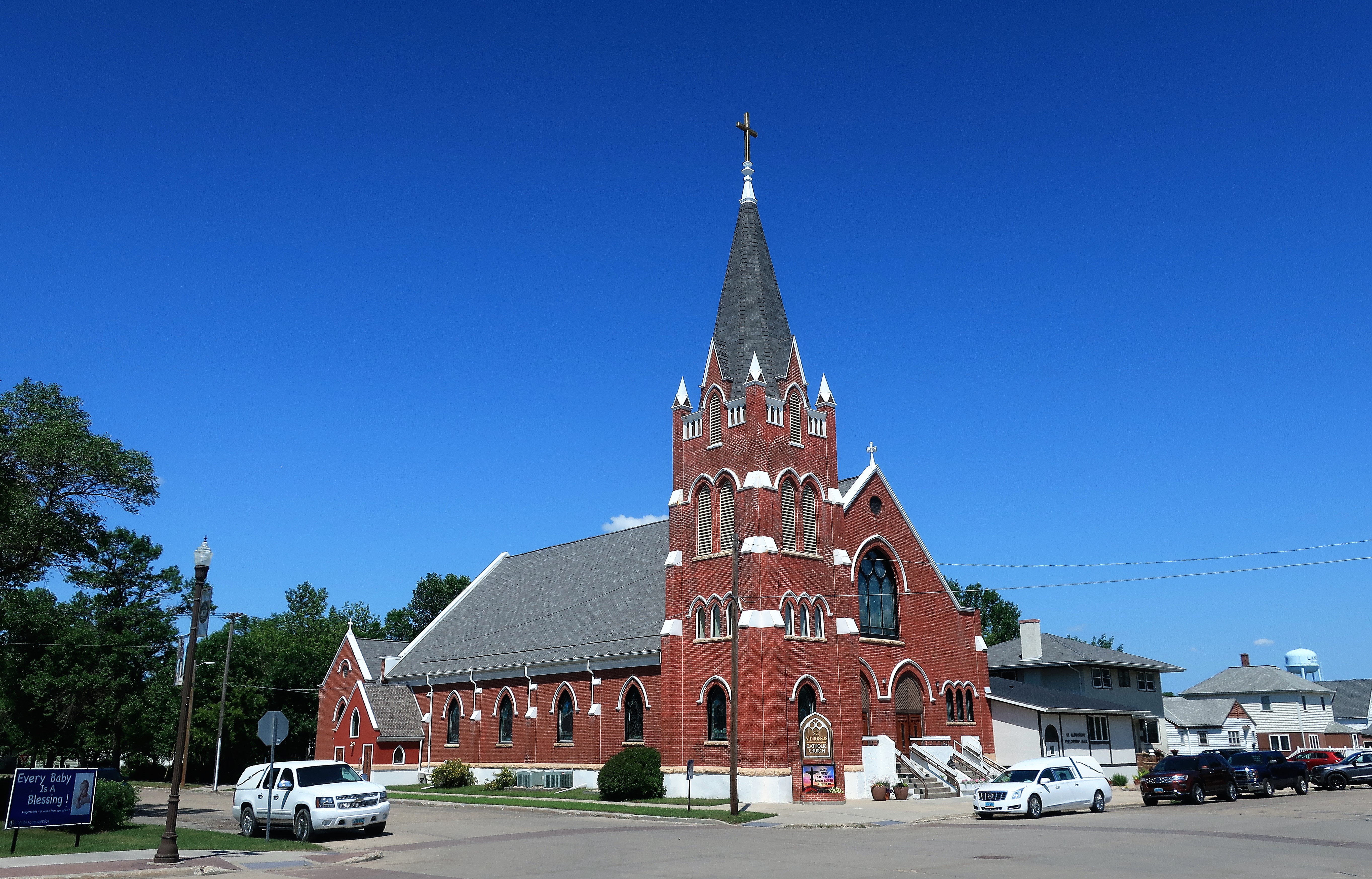
Completed in 1914, the Gothic-style Saint James Basilica is one of the oldest buildings in town, and in many ways, it’s the center of town. People in Jamestown are extremely proud of this church, seeing in it a great achievement erected upon the vast expanses of the North Dakota prairie. The driving force behind its construction was Father Edward Geraghty, an immigrant Irish priest.
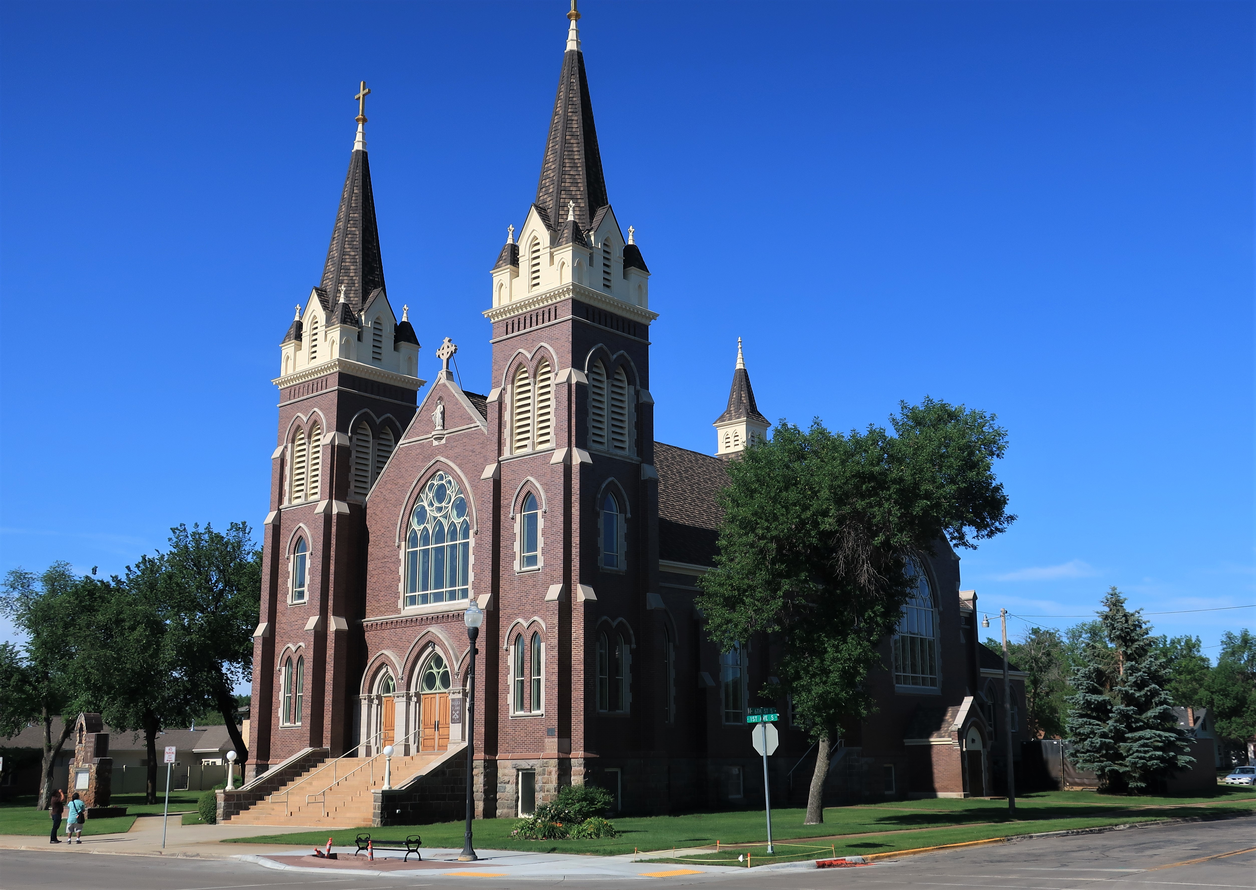
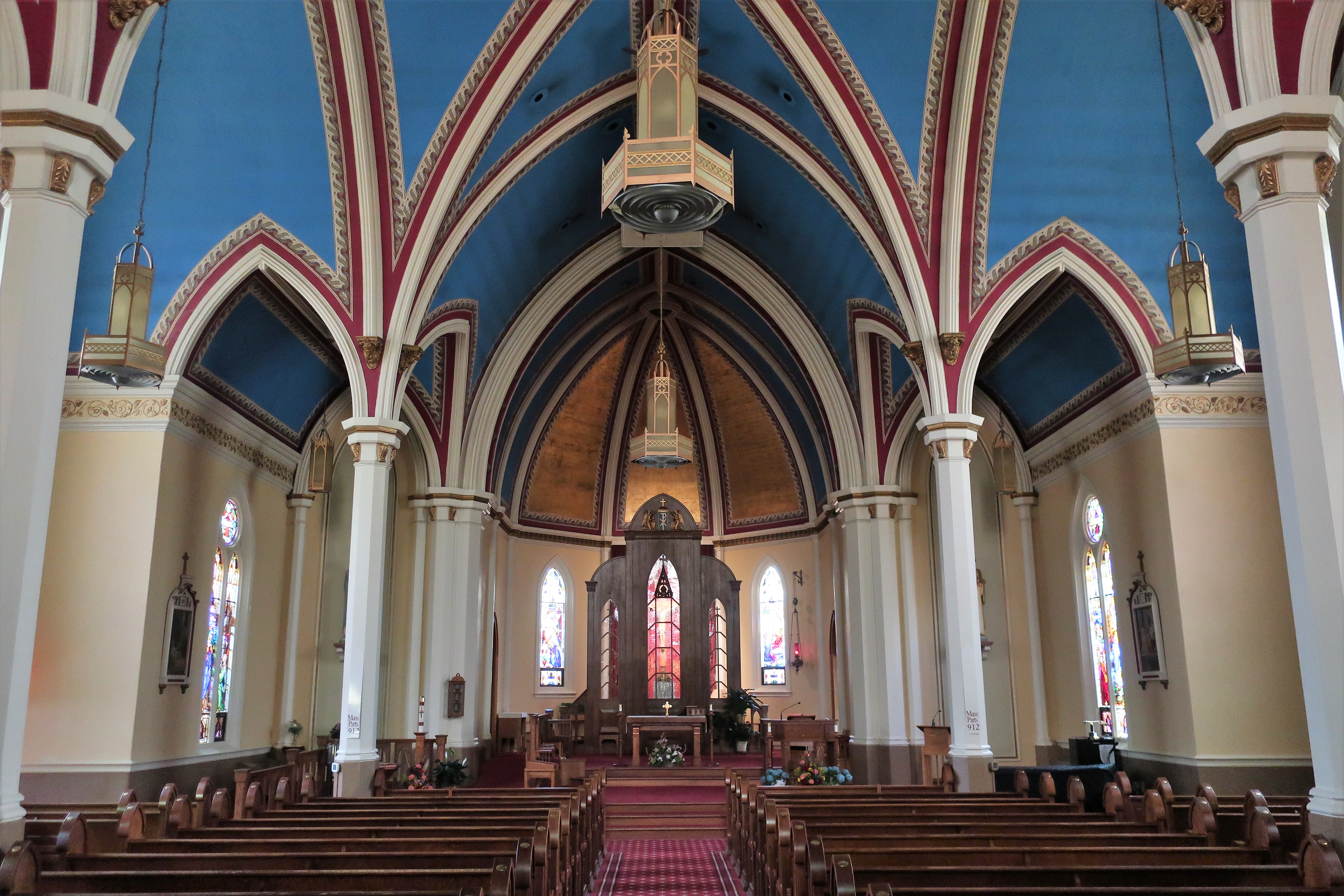
Here is a link to a fascinating 16-minute video that provides both the history of the church and of the early days of the town itself. Among the remembrances narrated is the time in 1883 when famous Lakota Chief Sitting Bull visited Jamestown, offering his autograph to residents for 25 cents each. History of St. James Basilica – YouTube.
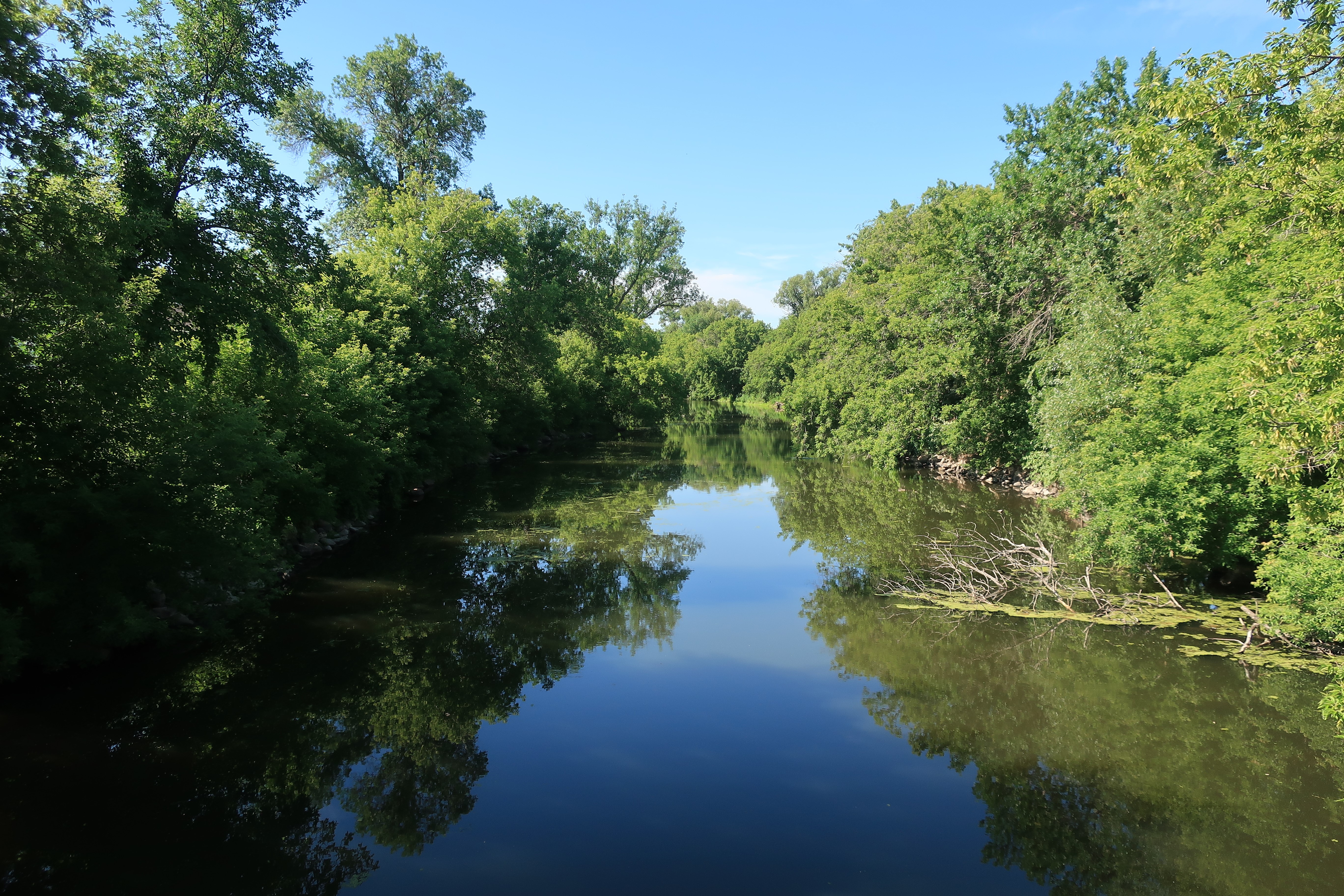
The 700-mile James River originates north of Jamestown and flows southward to join the Missouri River near Yankton, South Dakota. This river bisects Jamestown but, oddly, the town was named for Jamestown, Virginia, and not for the river. The Lakota called the river “E-ta-zi-po-ka-se Wakpa” (“unnavigable river”), while French trader Jean Trudeau named it the Riviere aux Jacques in 1794. Ultimately the waterway was anglicized into the “James River” by early American settlers. It’s a landmark in the wide prairie. Here is the river making its slow, lazy way through the center of town.
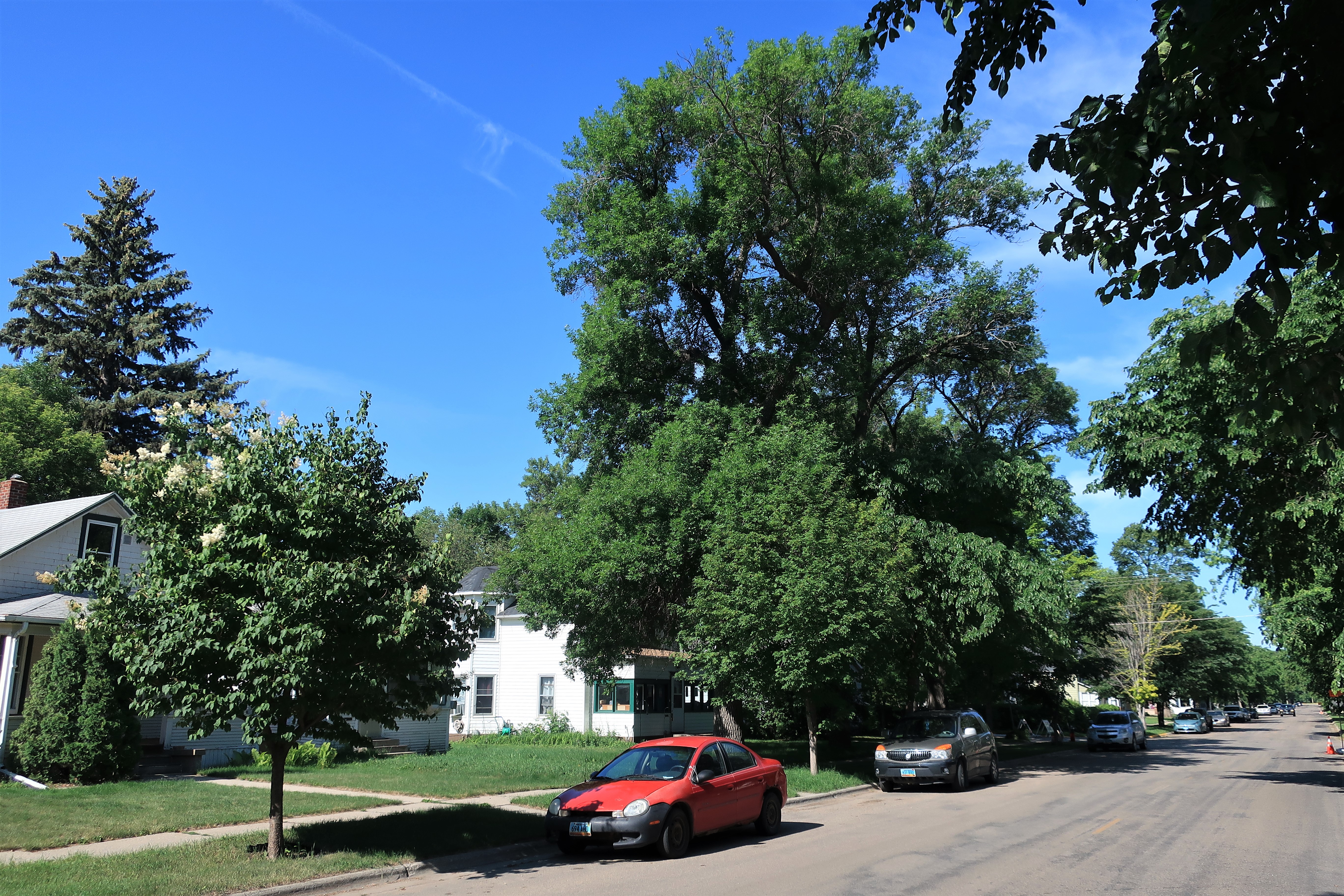
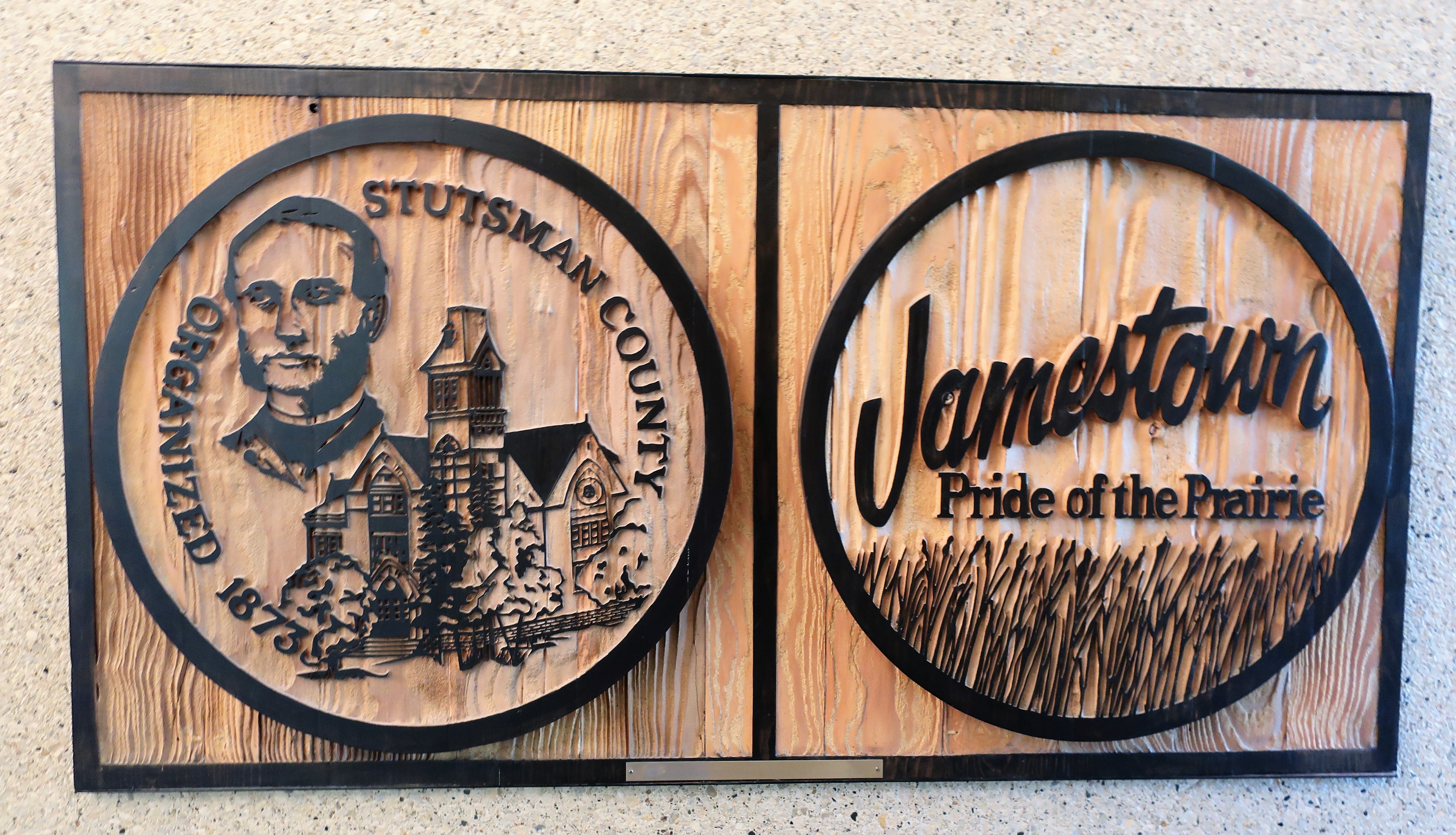
Here are some more photos around Jamestown (counterclockwise from top left): a sturdy home near the center of town, a typical residential street where the trees are twice the height of the homes, Stutsman County and Jamestown town logos, and the Stutsman County Courthouse, listed on the National Register of Historic Places.

Heading north out of Jamestown I traversed wide-open country dotted with small upland lakes. Finally, I arrived at a point dividing the Atlantic and Arctic Ocean drainages. Here’s your sign:

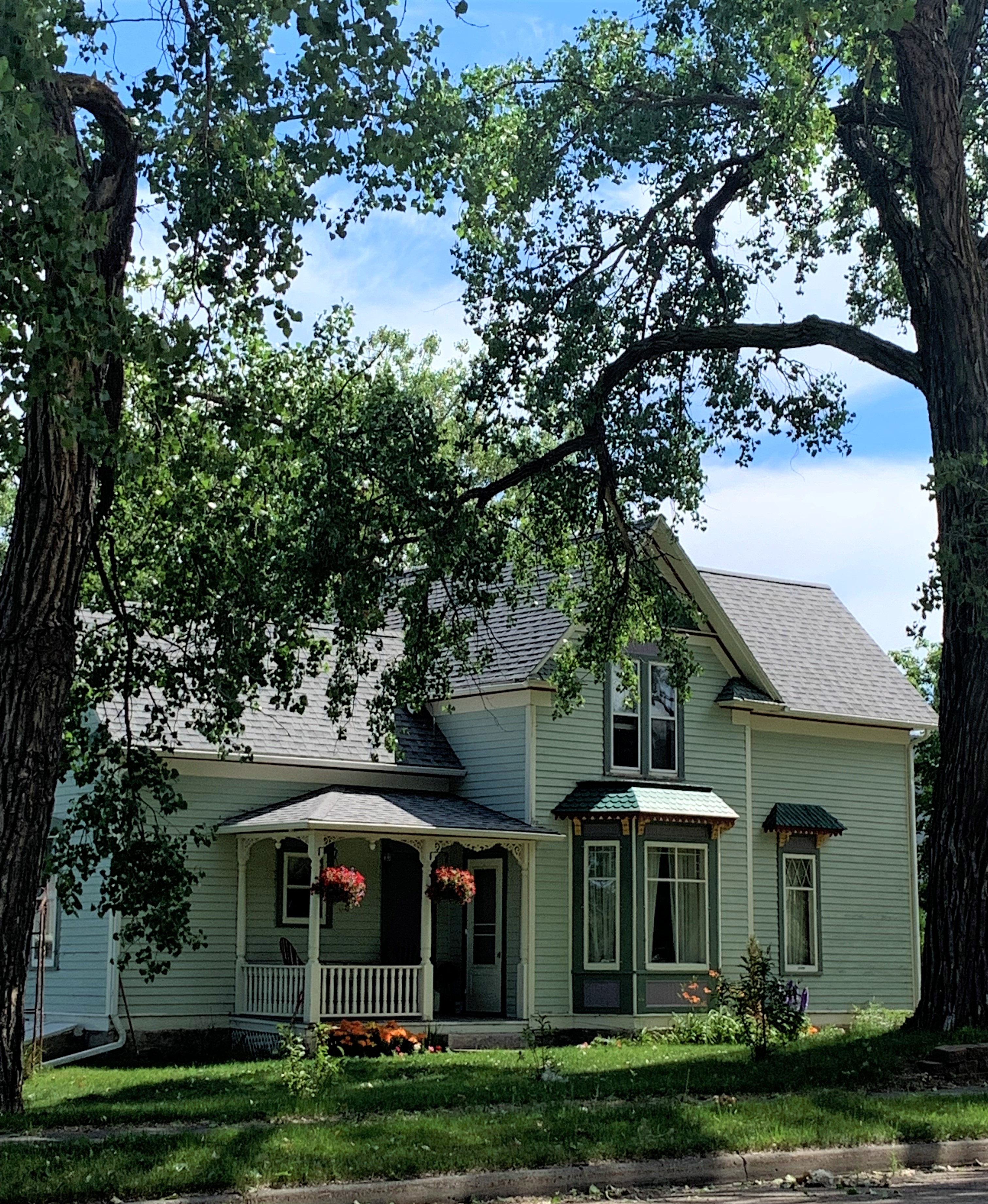
A few miles further east of this sign is Courtenay, North Dakota (population 45), a small farming town.
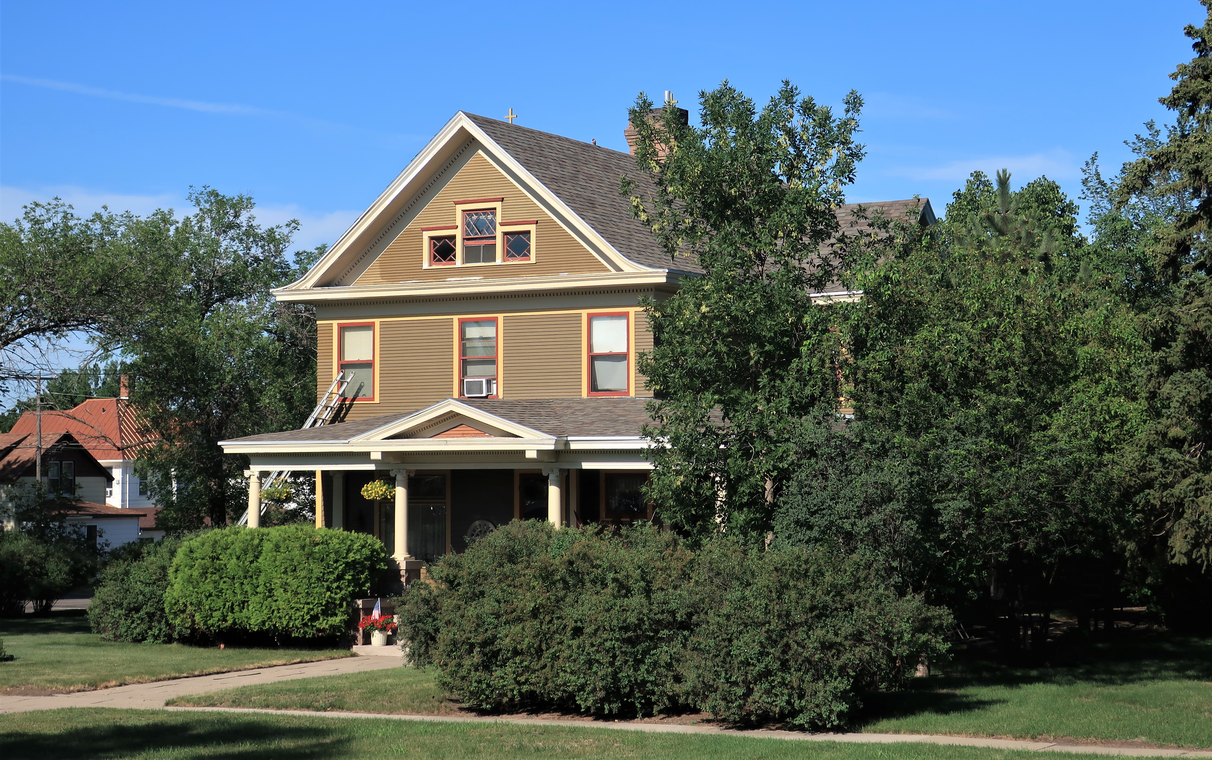
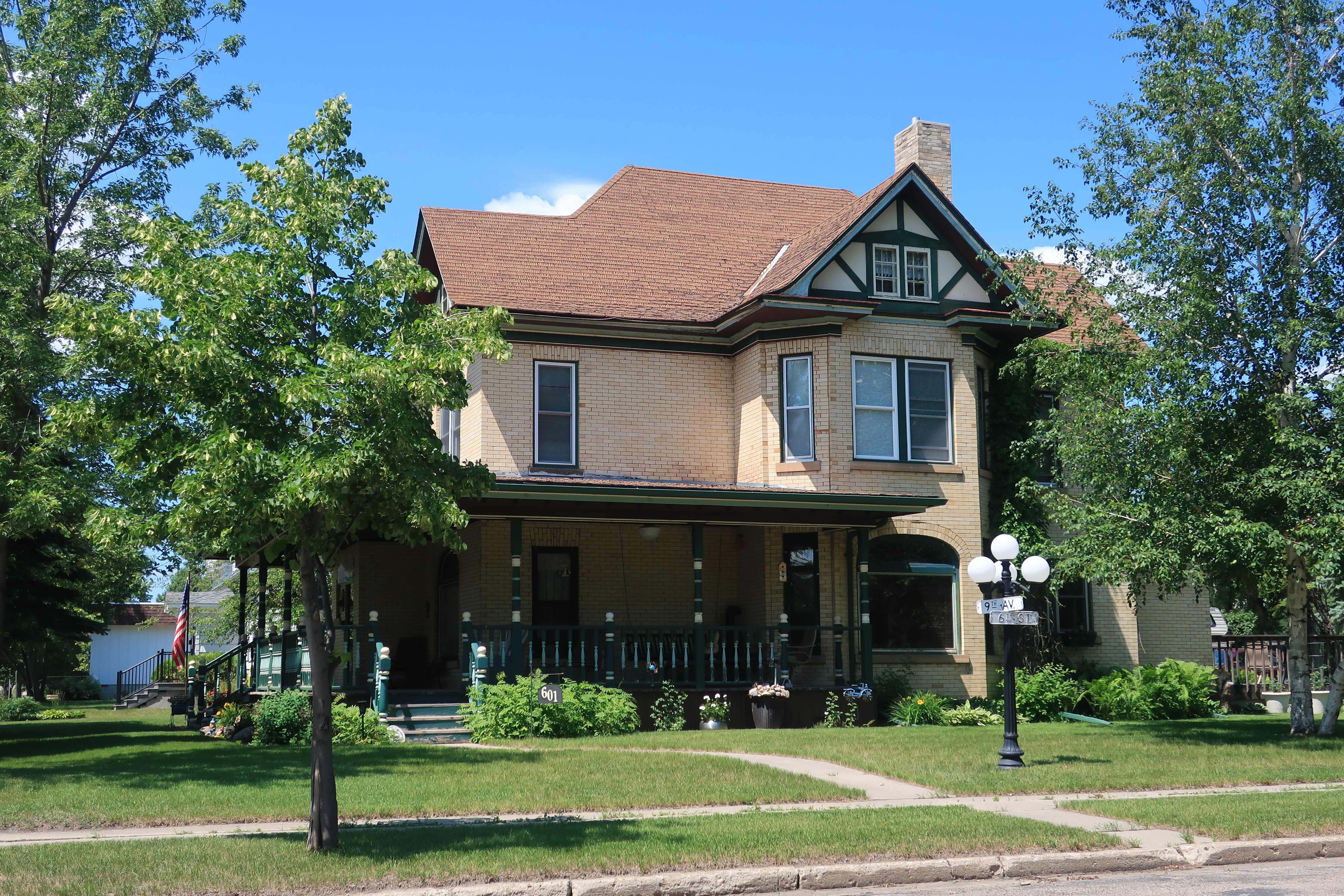
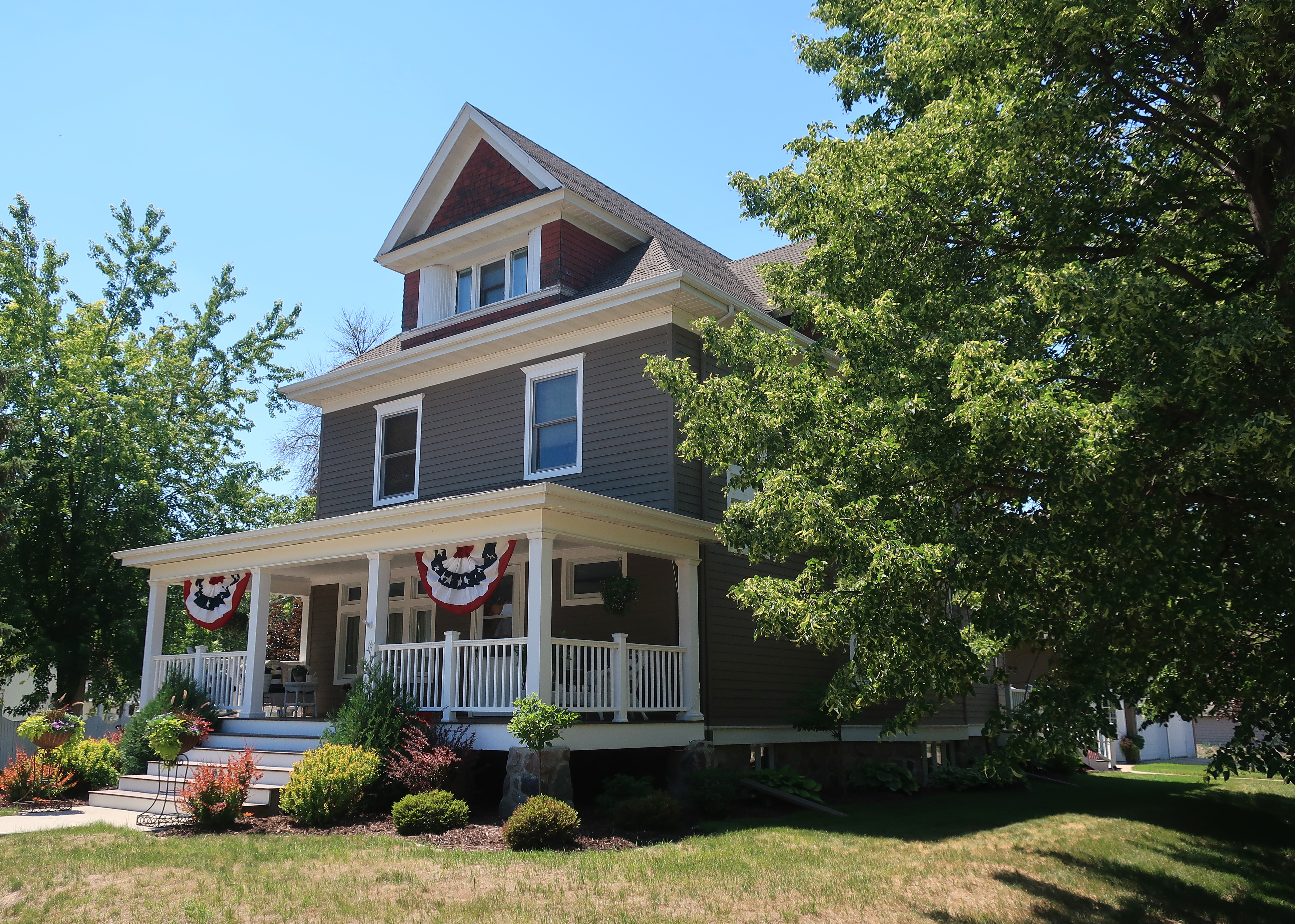
Here’s a beautiful home in Courtenay that I couldn’t help but stop the car and photograph. I so admire the perfect workmanship of the awnings above the front windows and the porch. The bright colors of the flower pots and flowerbeds perfectly complement the greens of the lawn, the trees, and the house.
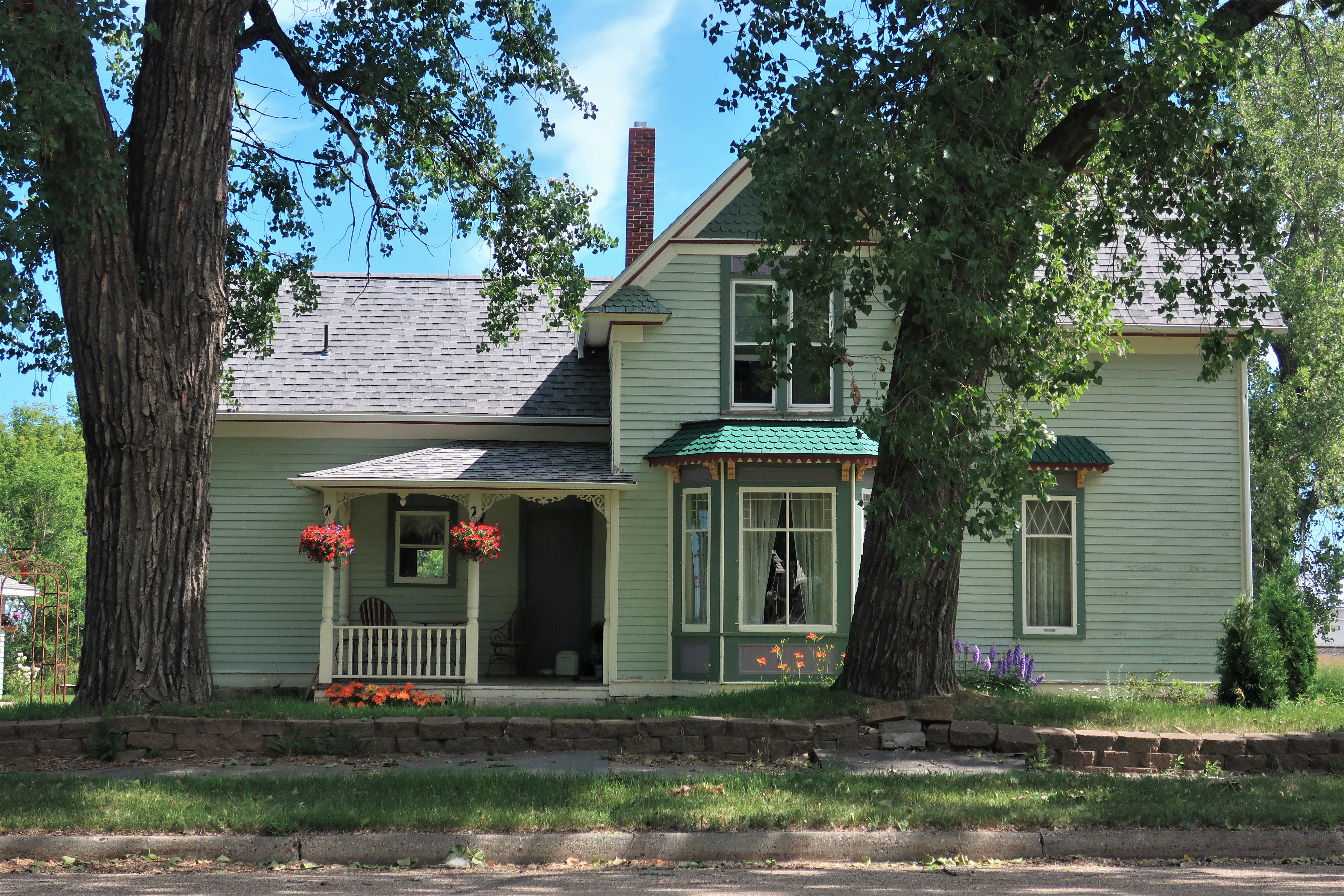
Here’s another view. This home is someone’s pride and joy, and I assume the exquisite trim was done by the owner himself or herself.
I was ready for lunch by the time I made it to Cooperstown.
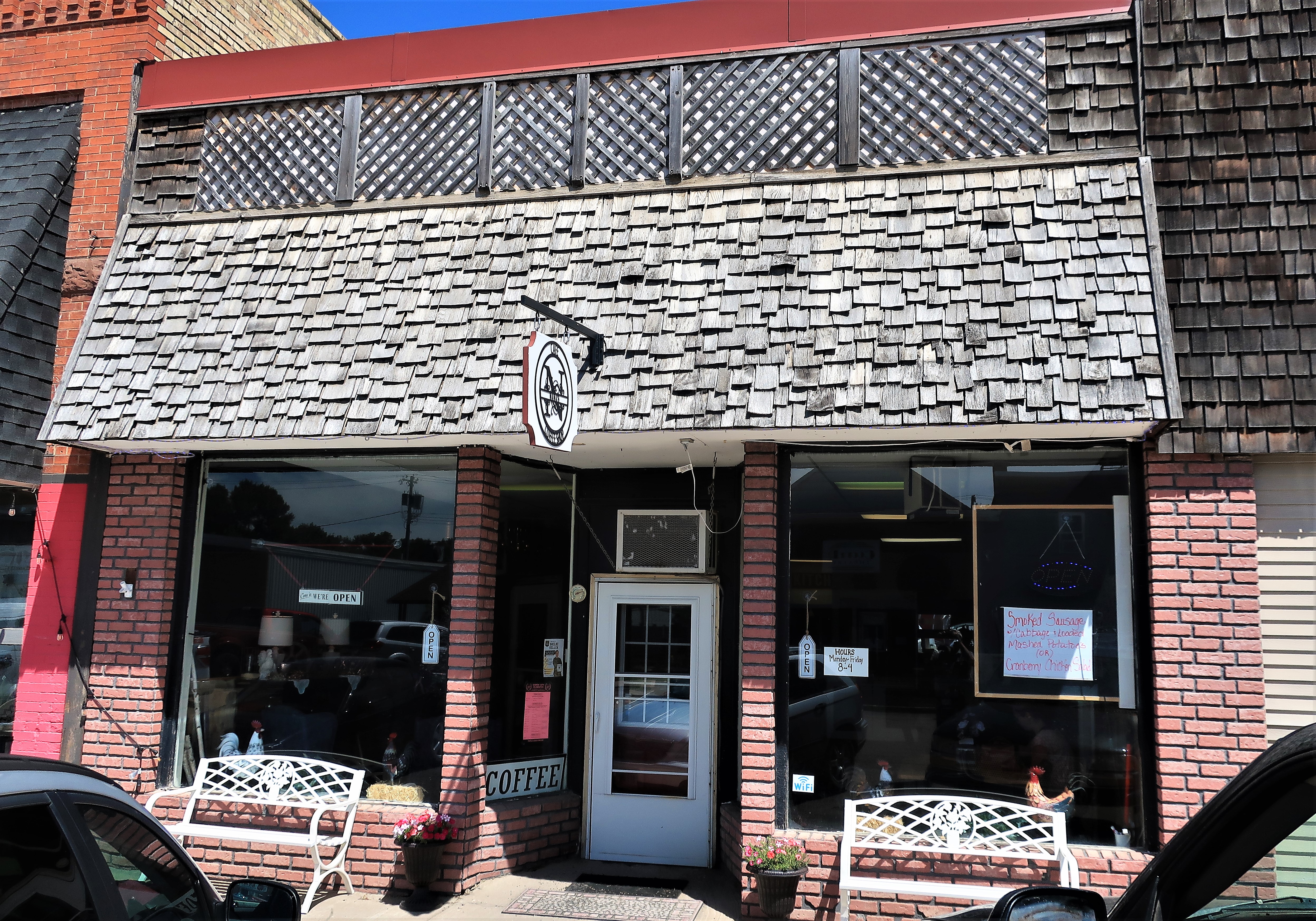
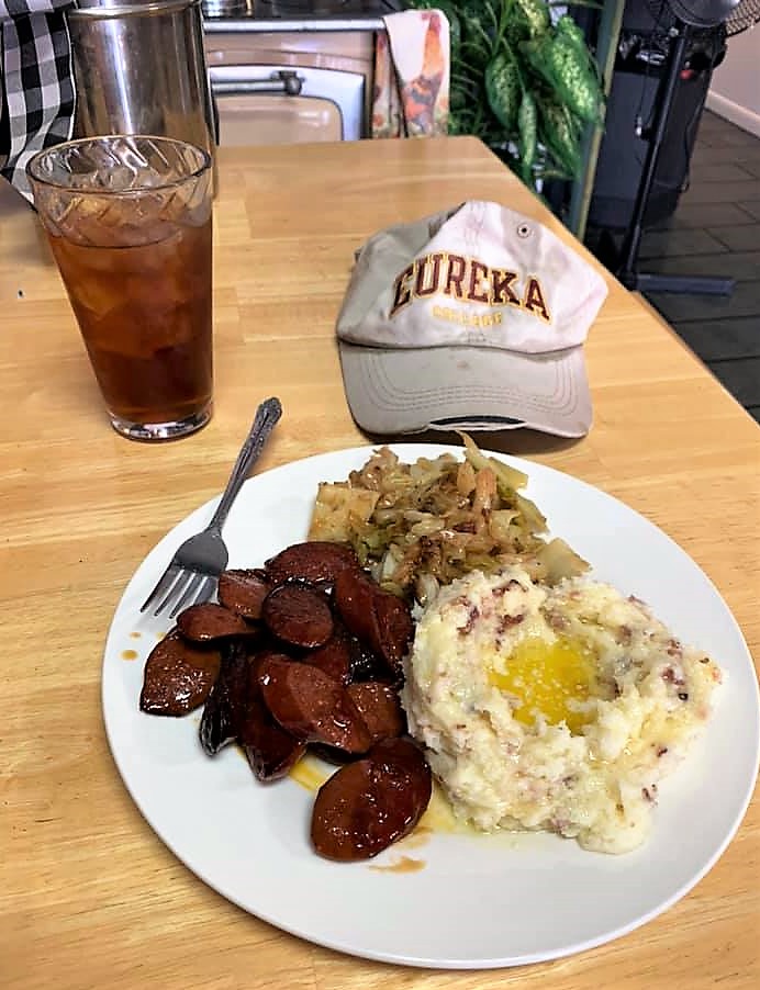
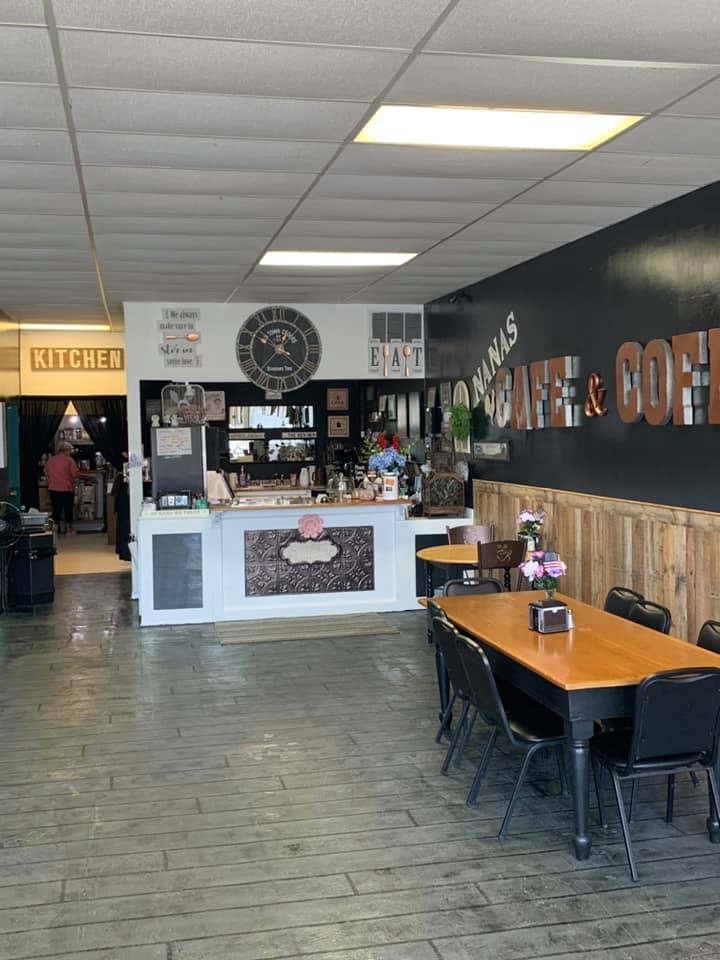
Ladies and Gentlemen, fair readers, inquiring minds — I had an exquisite lunch meal at Nana’s Cafe — the best meal of the whole trip. Those are glazed smoked sausage slices — probably locally made — next to loaded red-skinned mashed potatoes filled with a pool of melted butter, plus some delicious, buttery fried cabbage. As I sit at my desk today writing this description, I wish I had ordered two meals. I wish I could have that meal again. I’d like to go back to Nana’s Cafe for lunch right now. I recommend it highly.
Down the street from Nana’s, the local pharmacy was holding its annual Customer Appreciation Day. You’ll notice the barbeque grill parked in the street next to the vacant lot. Free bbq and sides for everyone today, come on in! The business and its customers are just one big family. I’ve heard of such things before, but I rarely see them anymore. But I guess they still happen in small, family-sized towns in North Dakota.

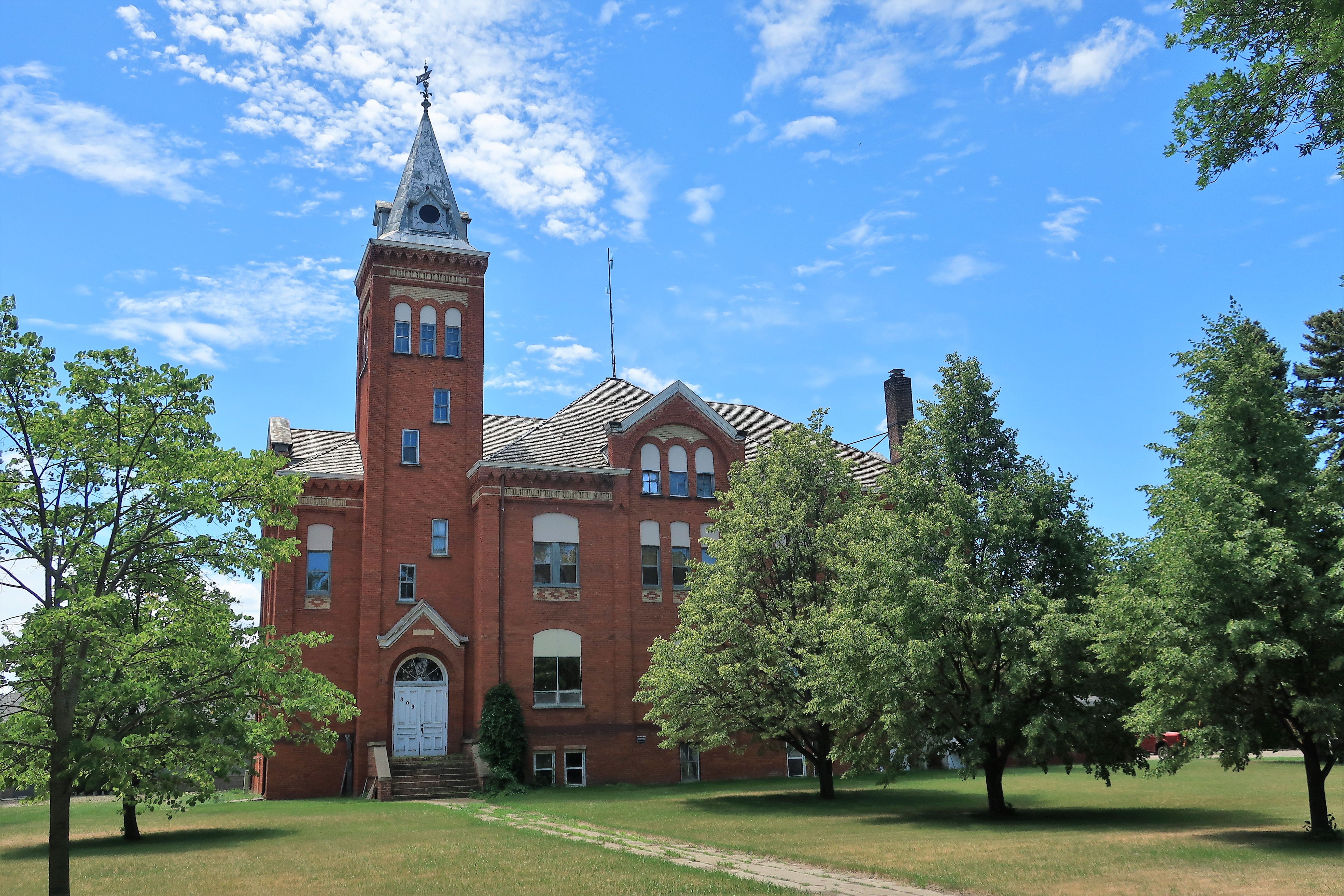
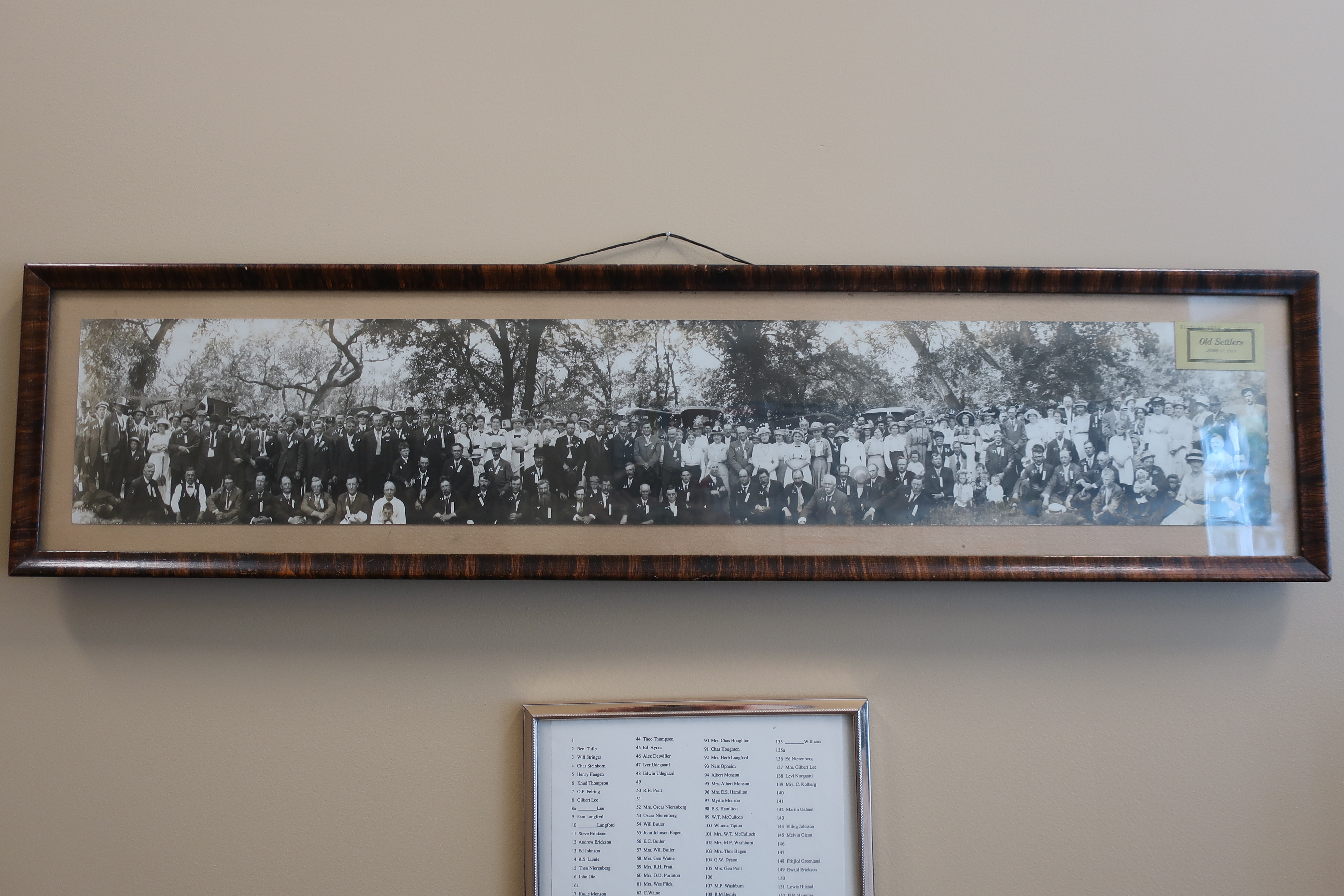
Artifacts from the old courthouse, truly from the town’s founding, are on display in the new courthouse. These include old machines, portraits of the founders, and a group photo of Cooperstown’s 50-year settler’s reunion.

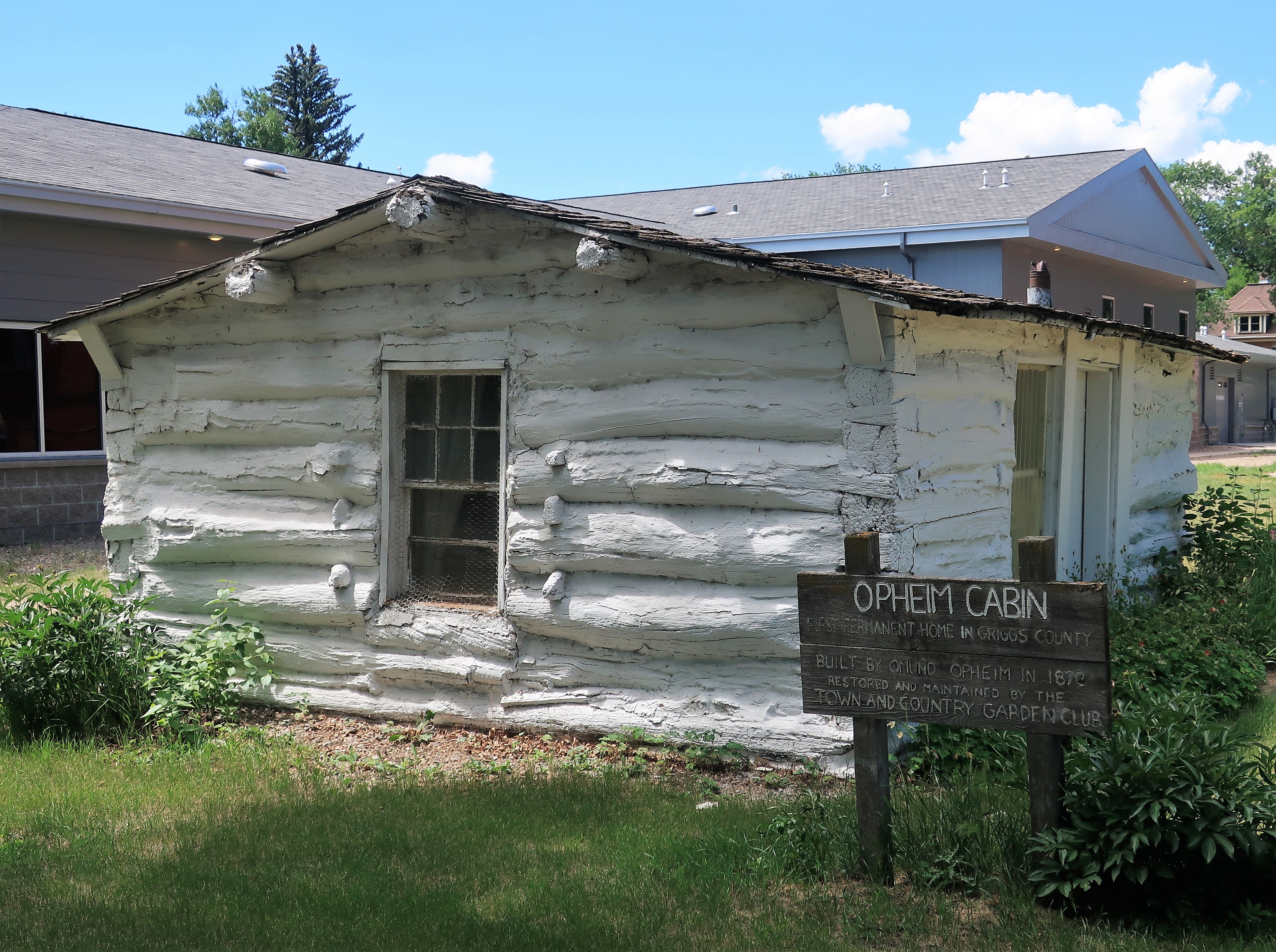
Just outside the courthouse, the county maintains the old Opheim cabin, which was built in 1878 and is marked as the first permanent settlement in Griggs County, North Dakota. Some of those pictured in the settler’s reunion might even have memories of the old Opheim place.
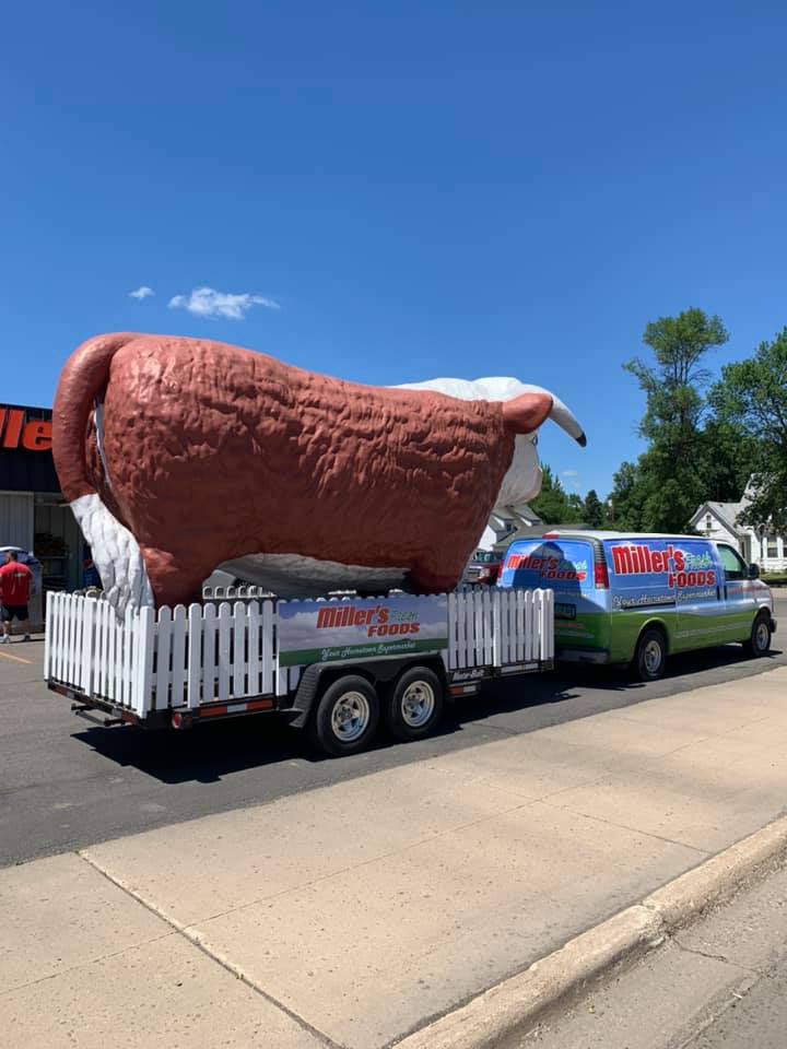
It’s five days until the Fourth of July and preparations were well underway for Independence Day festivities. The portable fireworks cart displays its wares, including the “Manic Energy” of President Trump. Although this area supports the ex-President “bigly,” they aren’t afraid of having a little fun with his energetic personality. At the far right, the town grocery store, Miller’s Foods, provides a float for the annual parade.


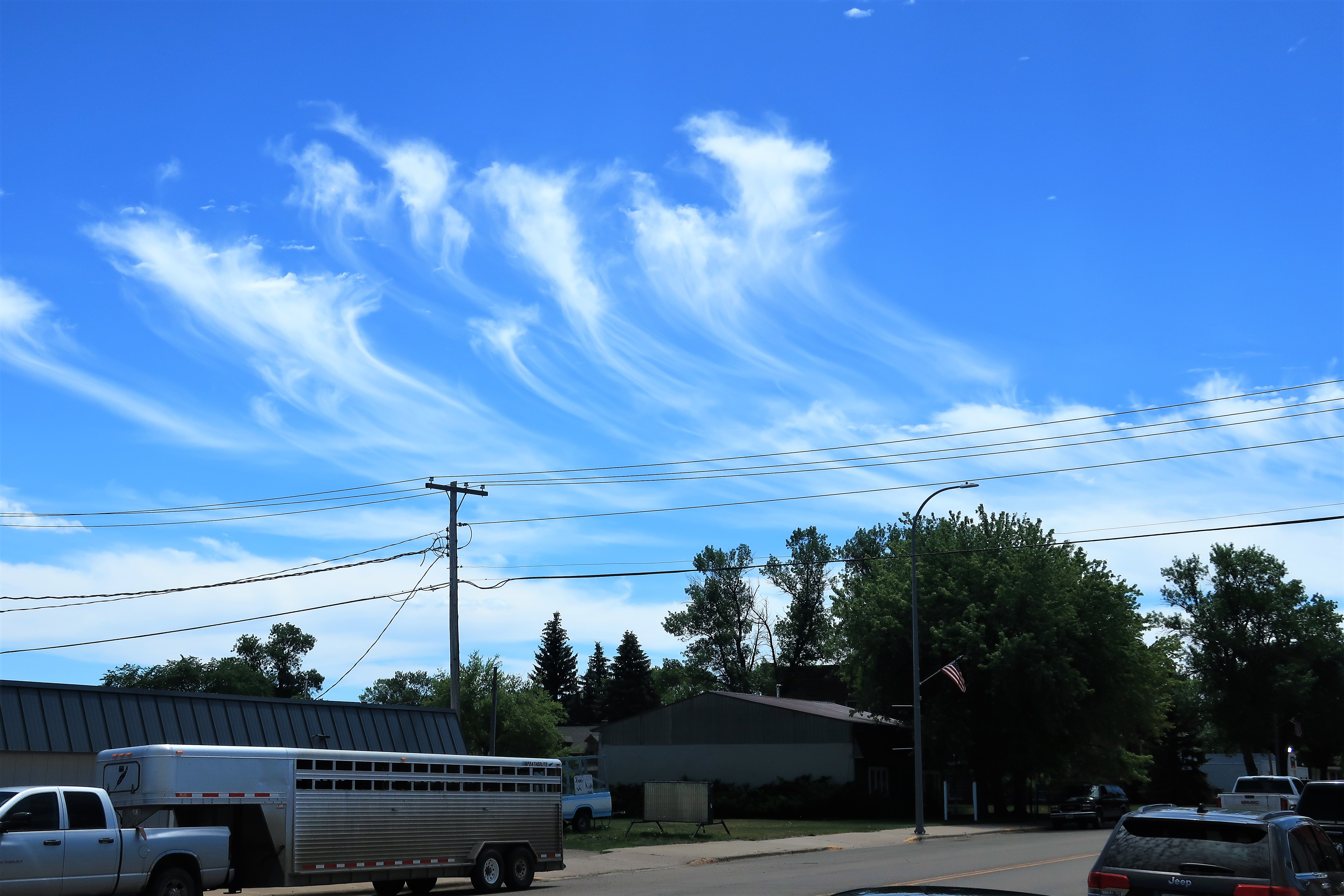
It was a great day in Cooperstown. Even the clouds above Cooperstown looked like they were throwing up a set of flares as if they were cheering for me.
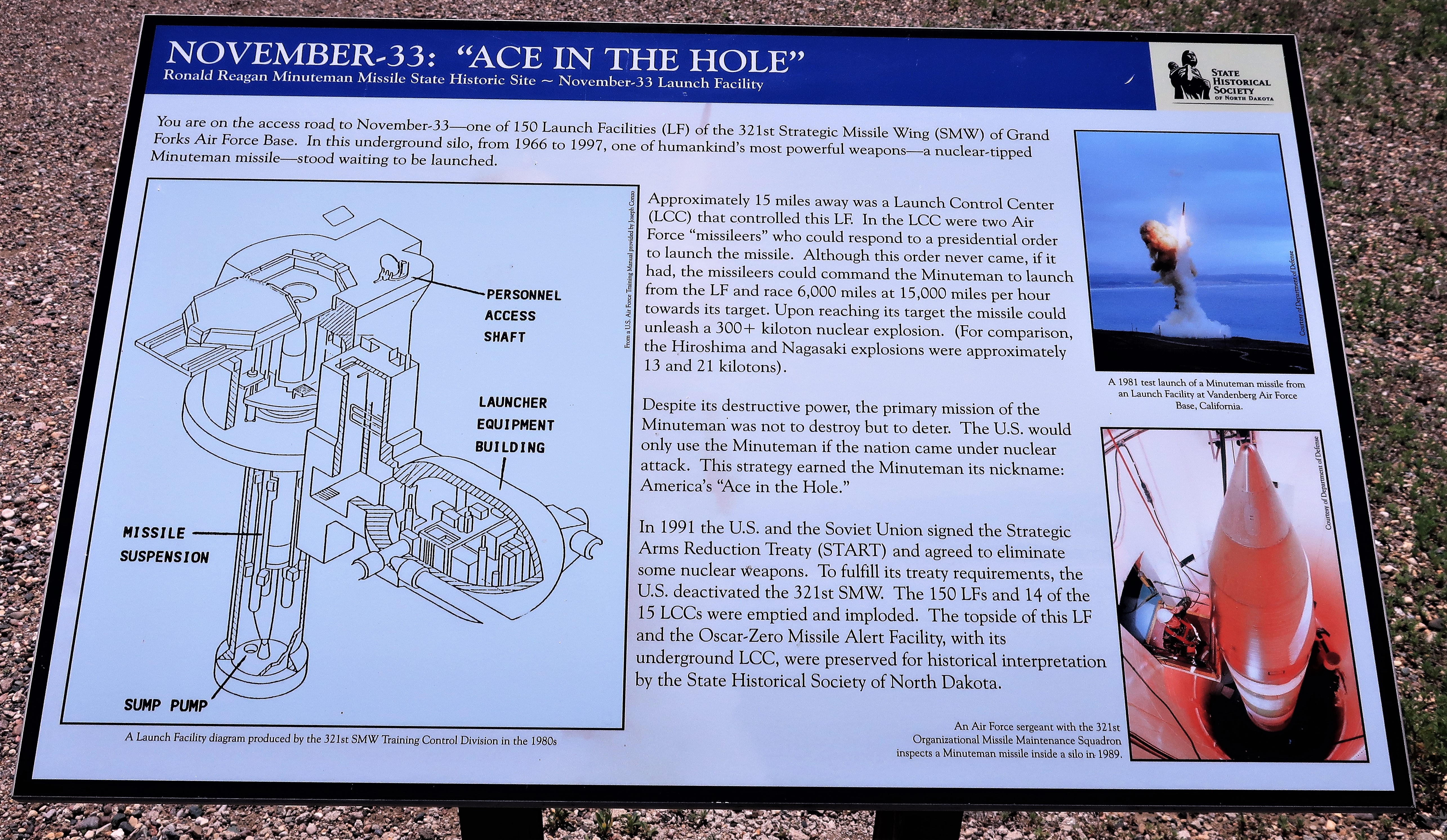
Just outside Cooperstown, I came upon this: the “November – 33” Minuteman missile launch facility (decommissioned 1997).
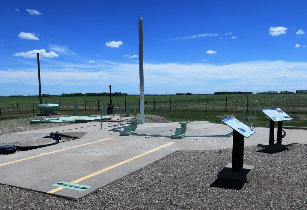
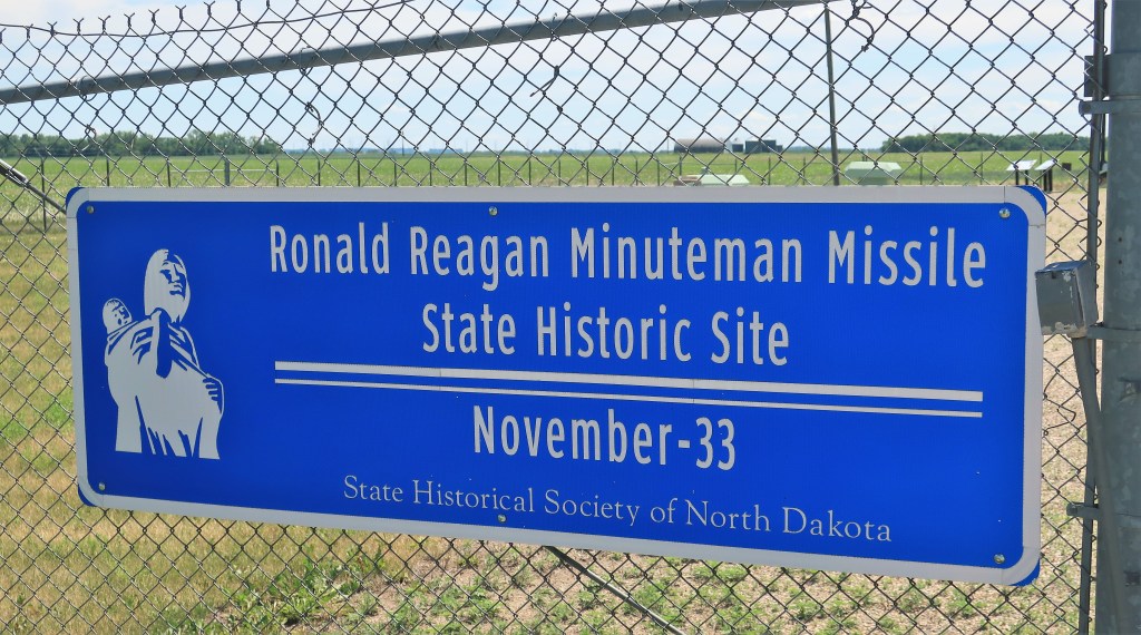
Several historical signs explain the purpose of the site, its operation, and its maintenance:
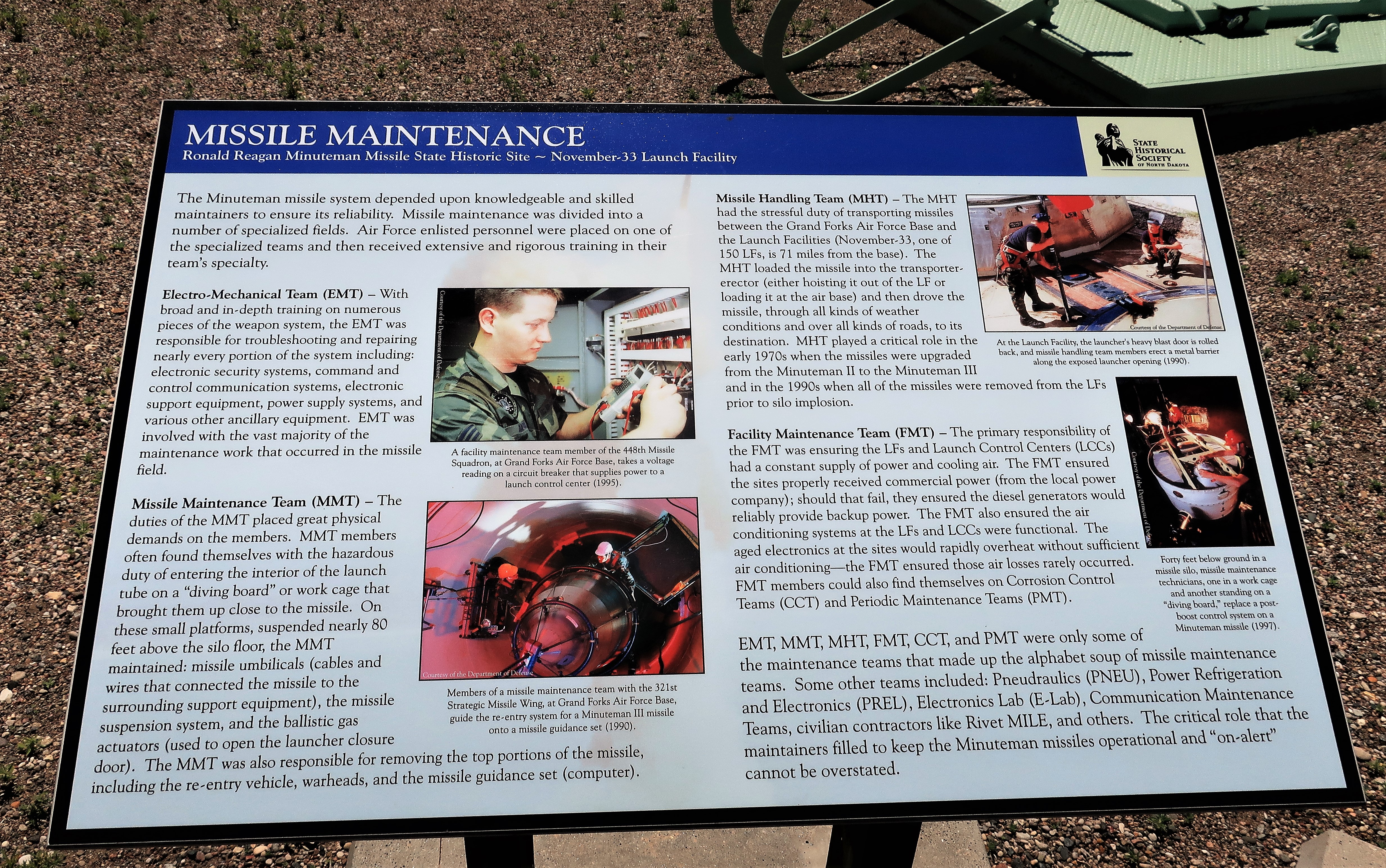
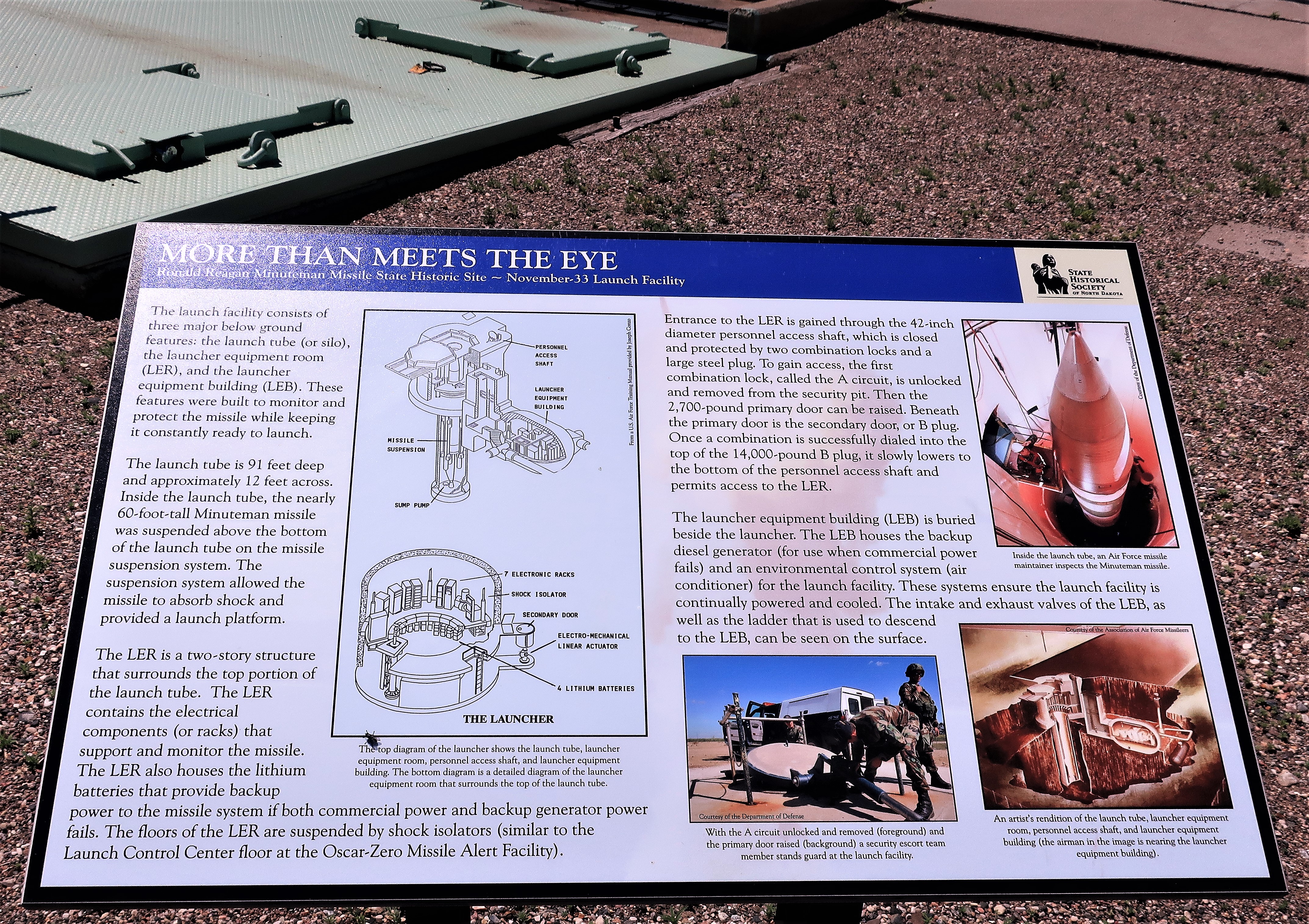
What surprising things you find when just out for a drive!
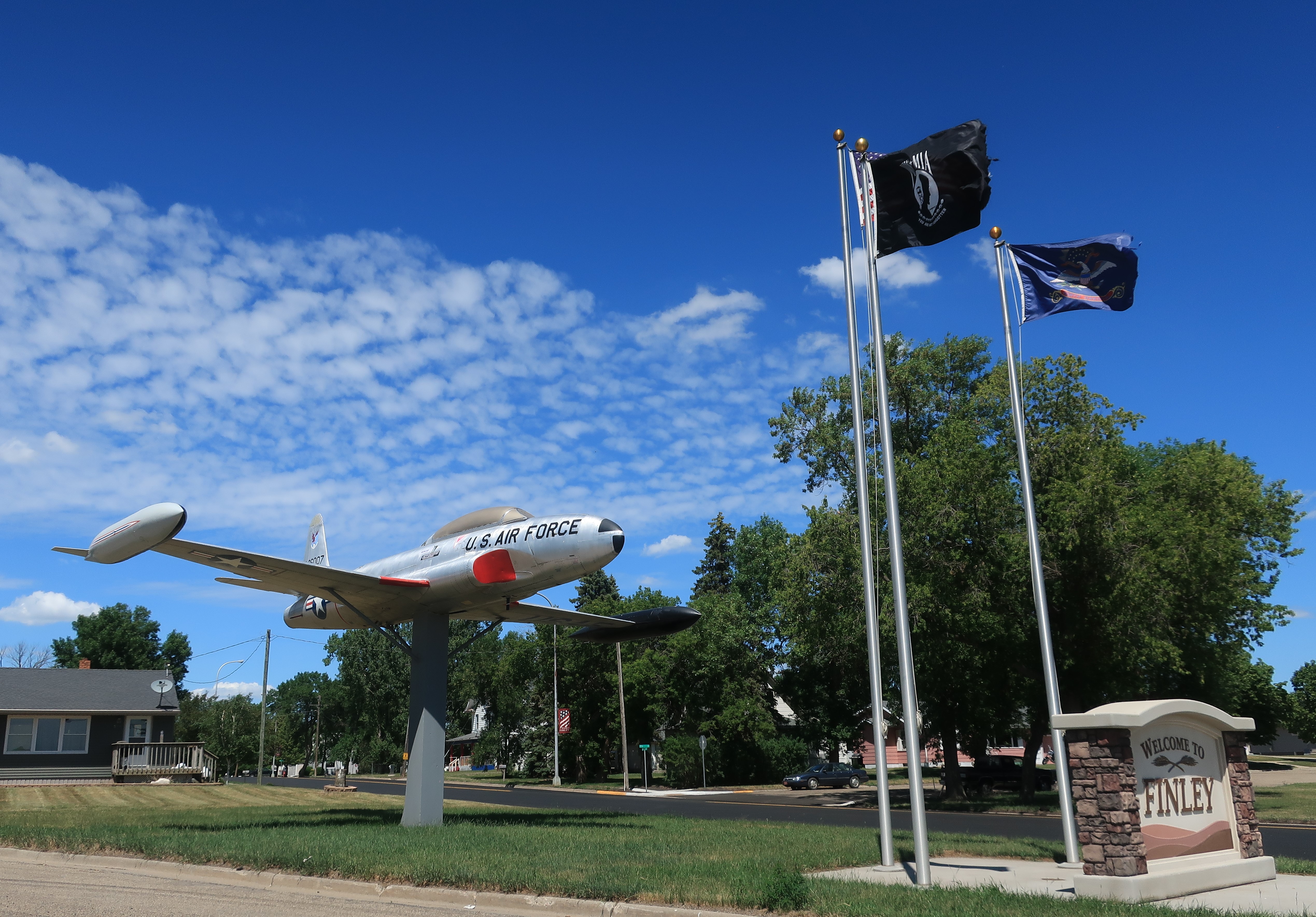
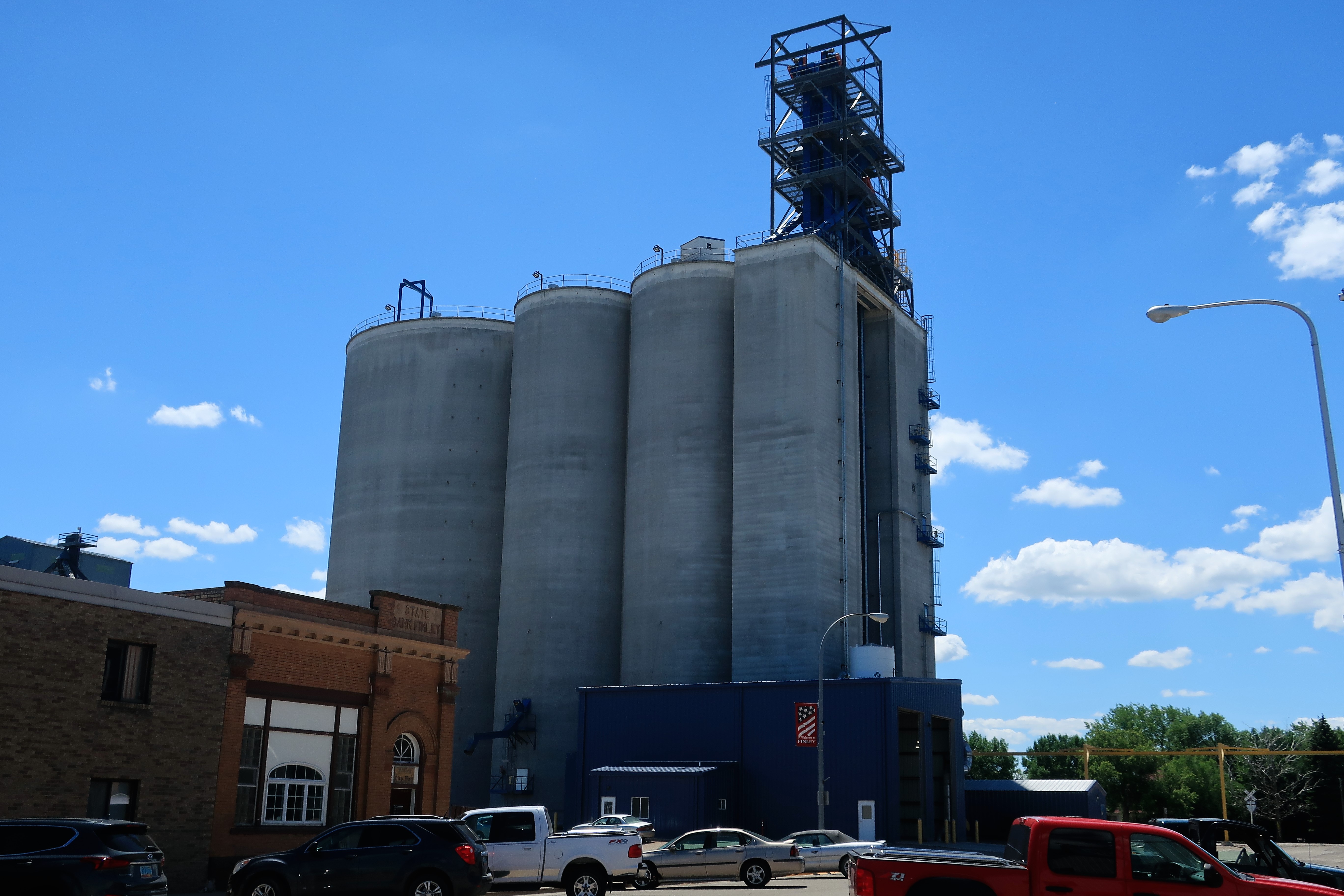
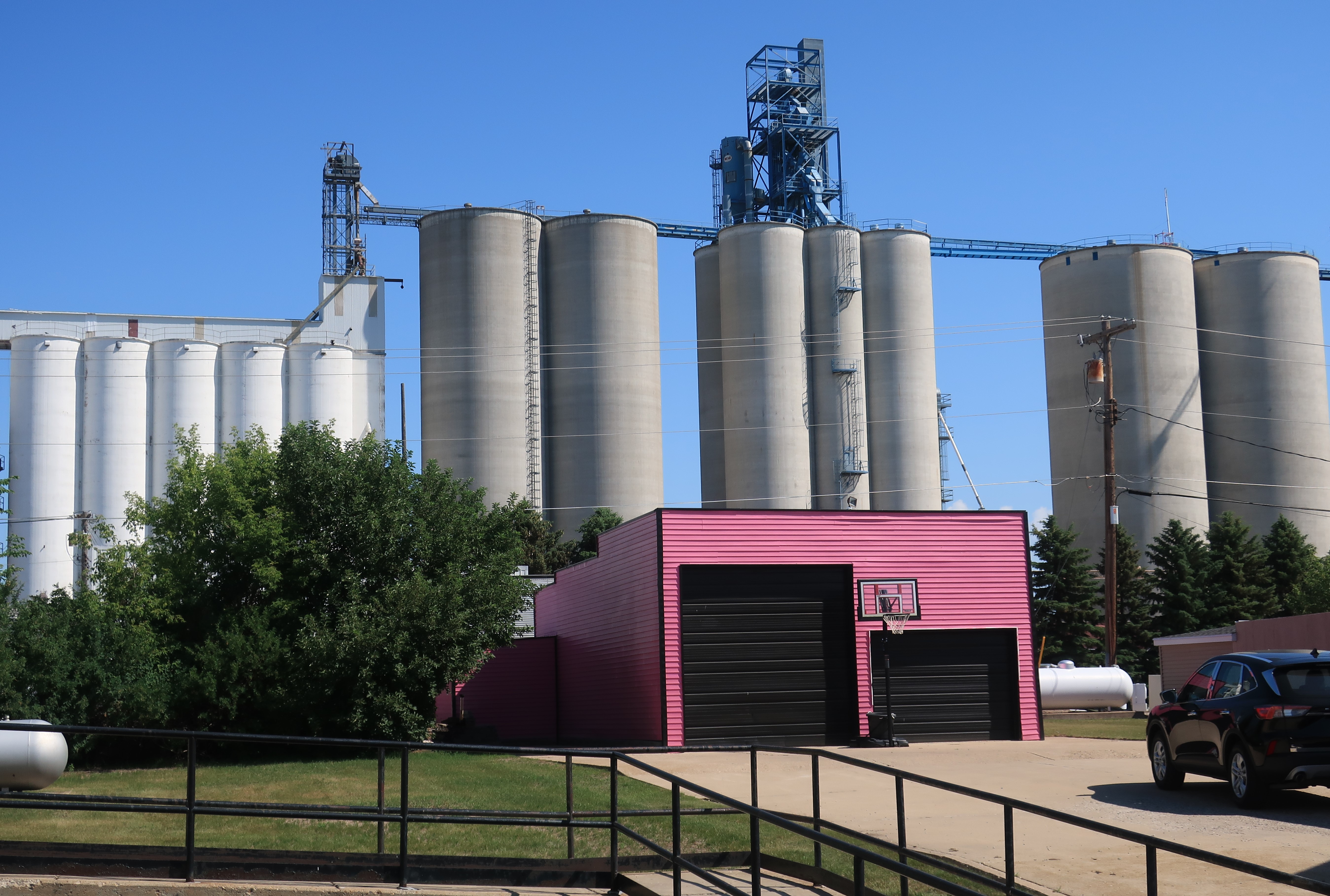
Next stop: the small town of Finley, North Dakota — tons and tons of grain and four-hundred people. An old Air Force plane next to a POW/MIA flag greet you at the edge of town.
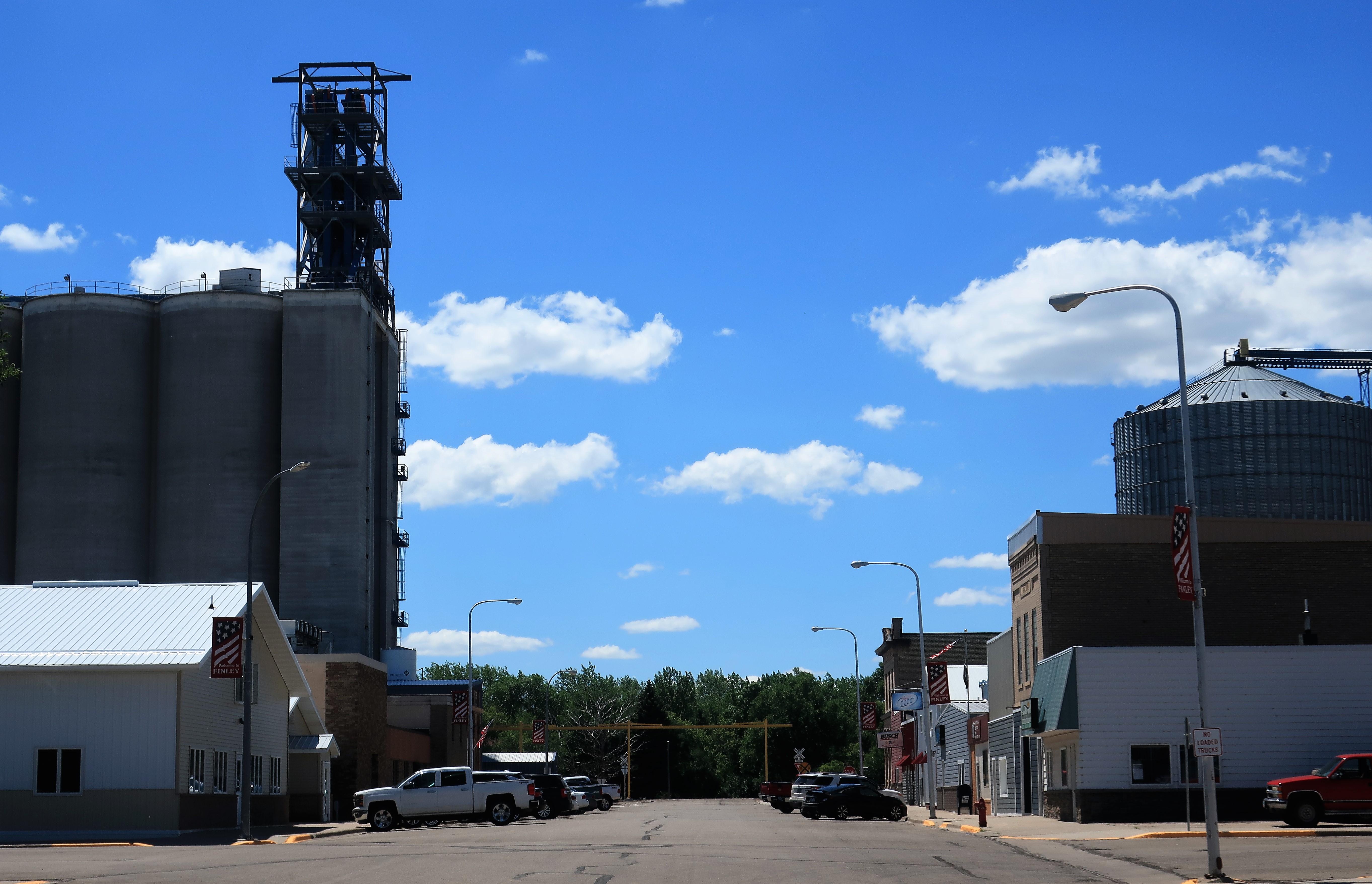
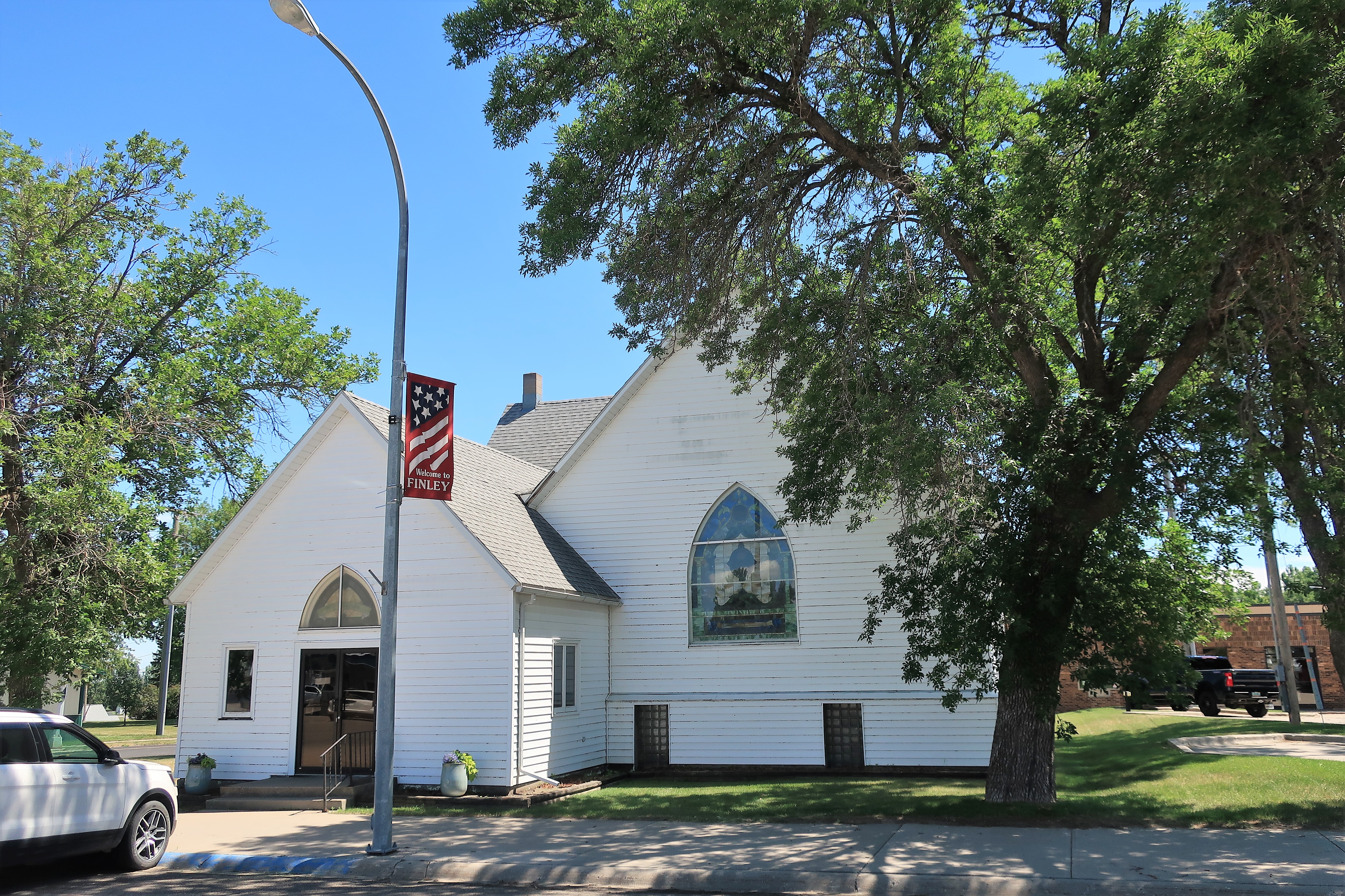
The grain elevators dwarf the town’s buildings which include the Rumors Tavern and an old Methodist church building just a block away.
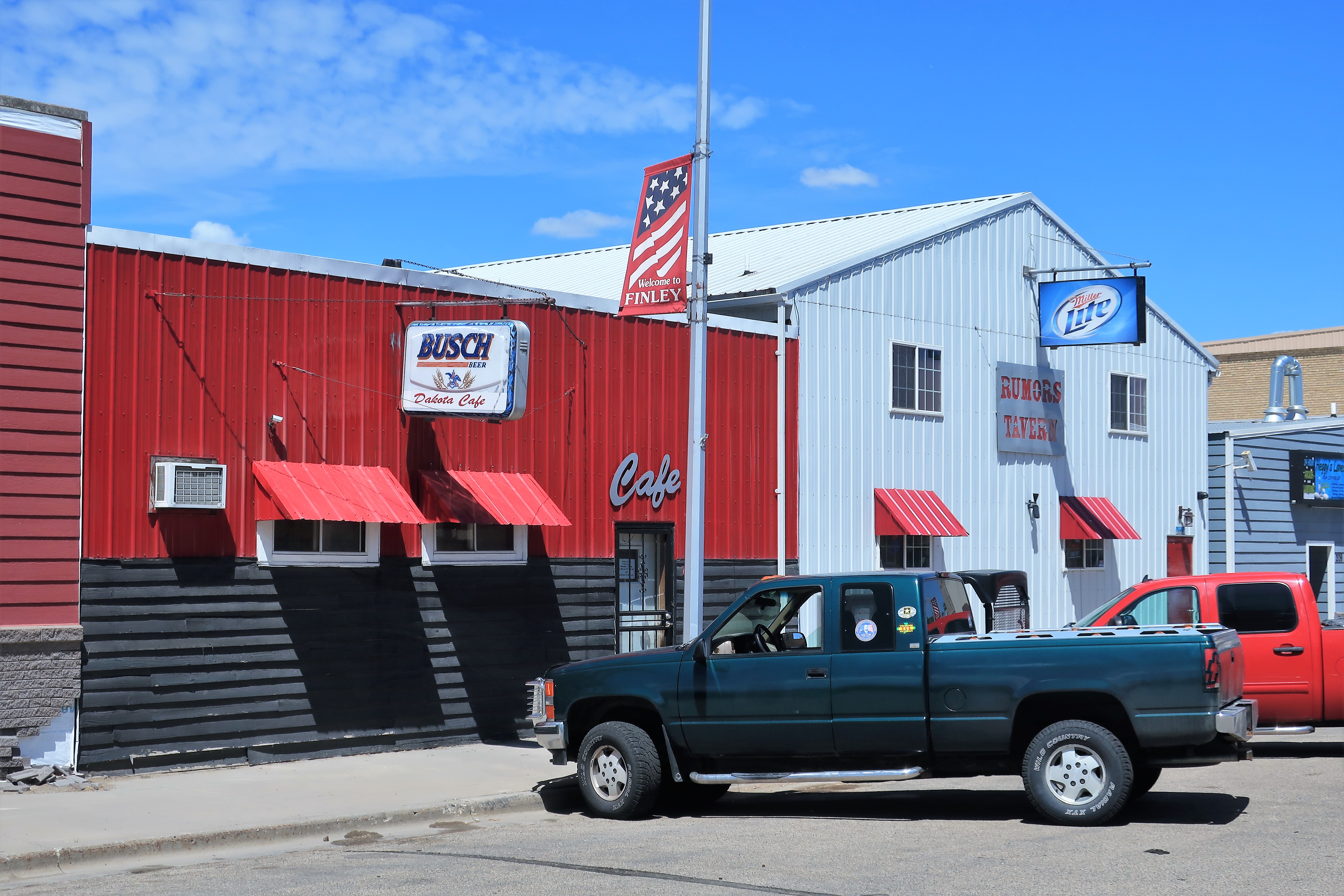
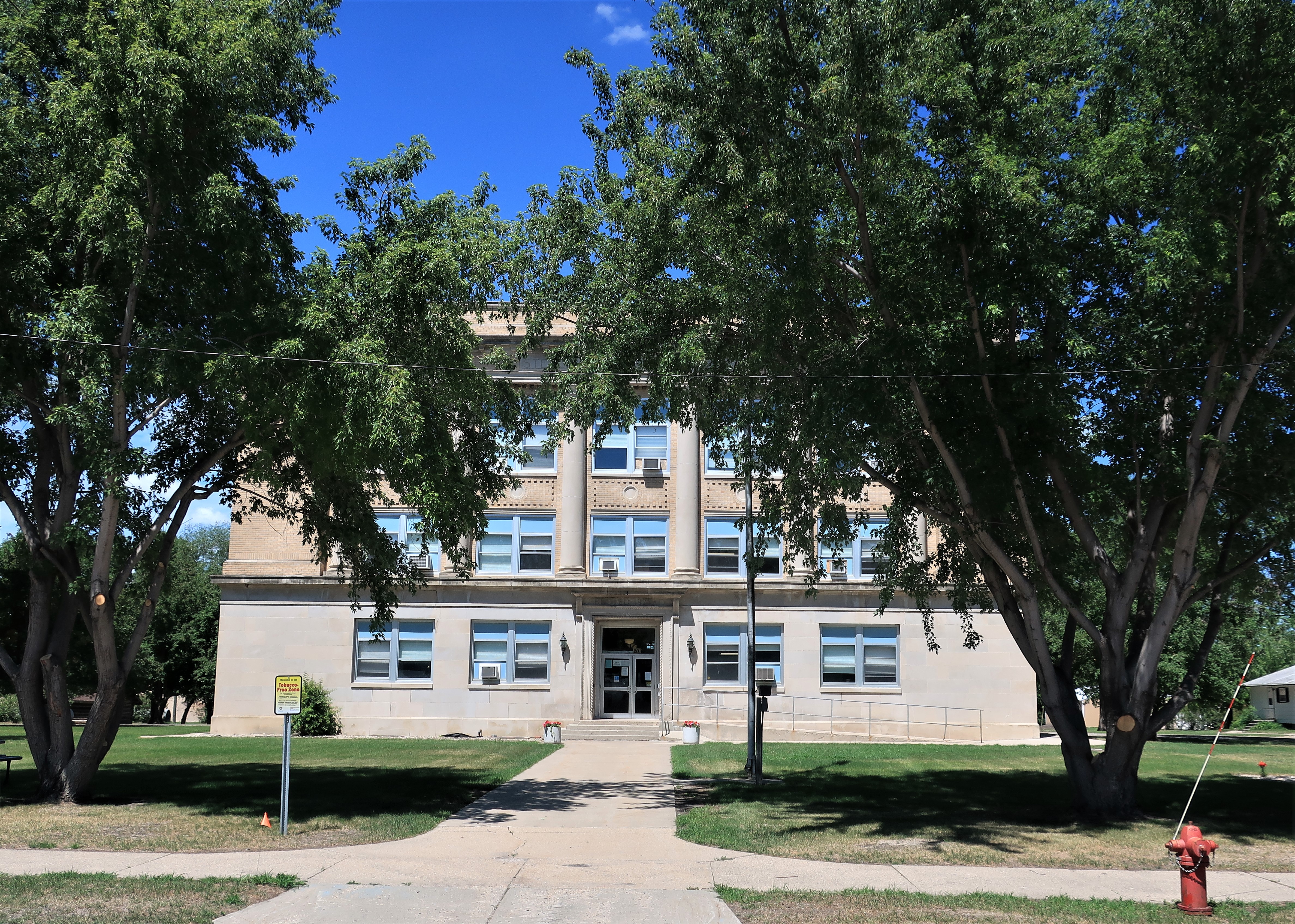
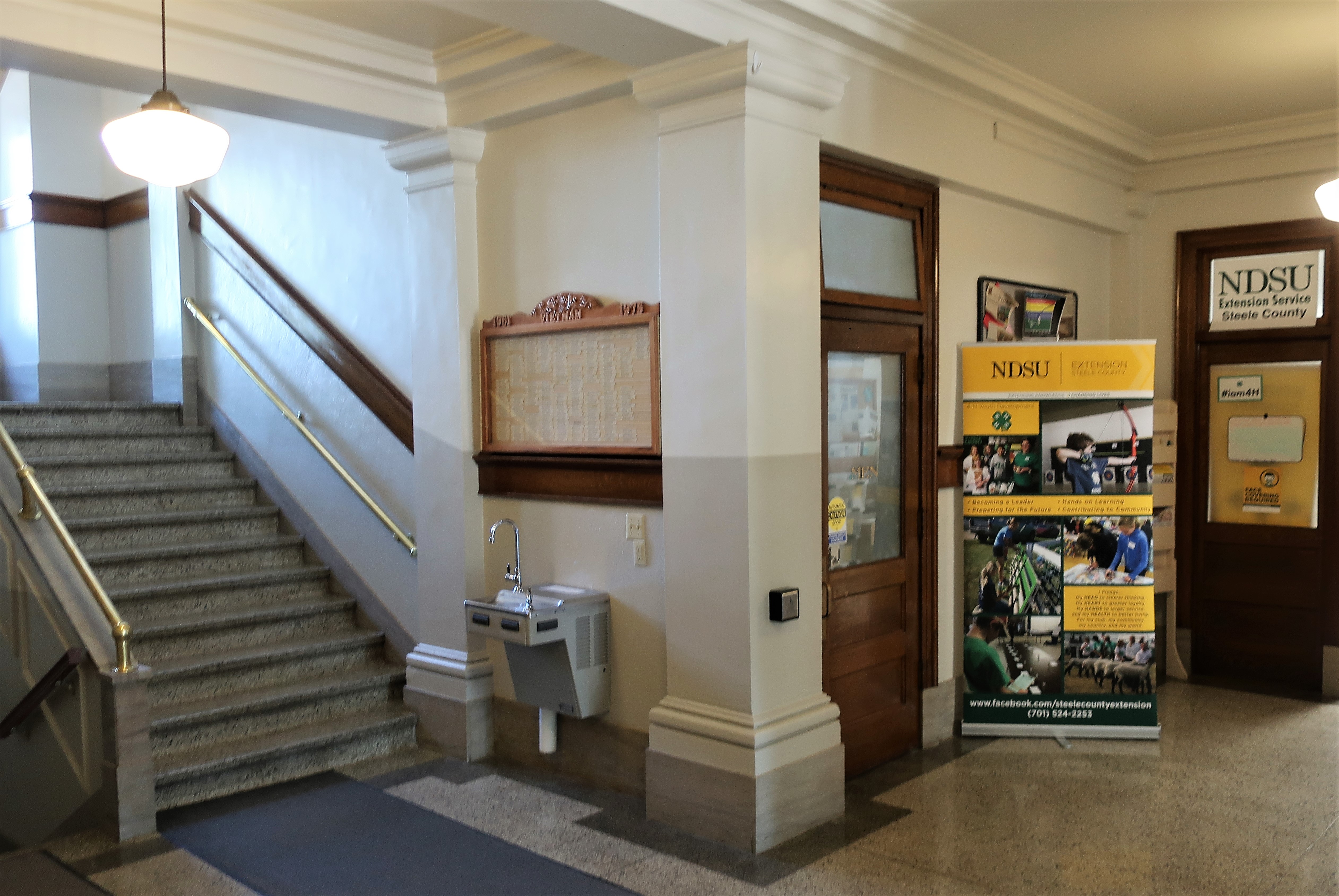
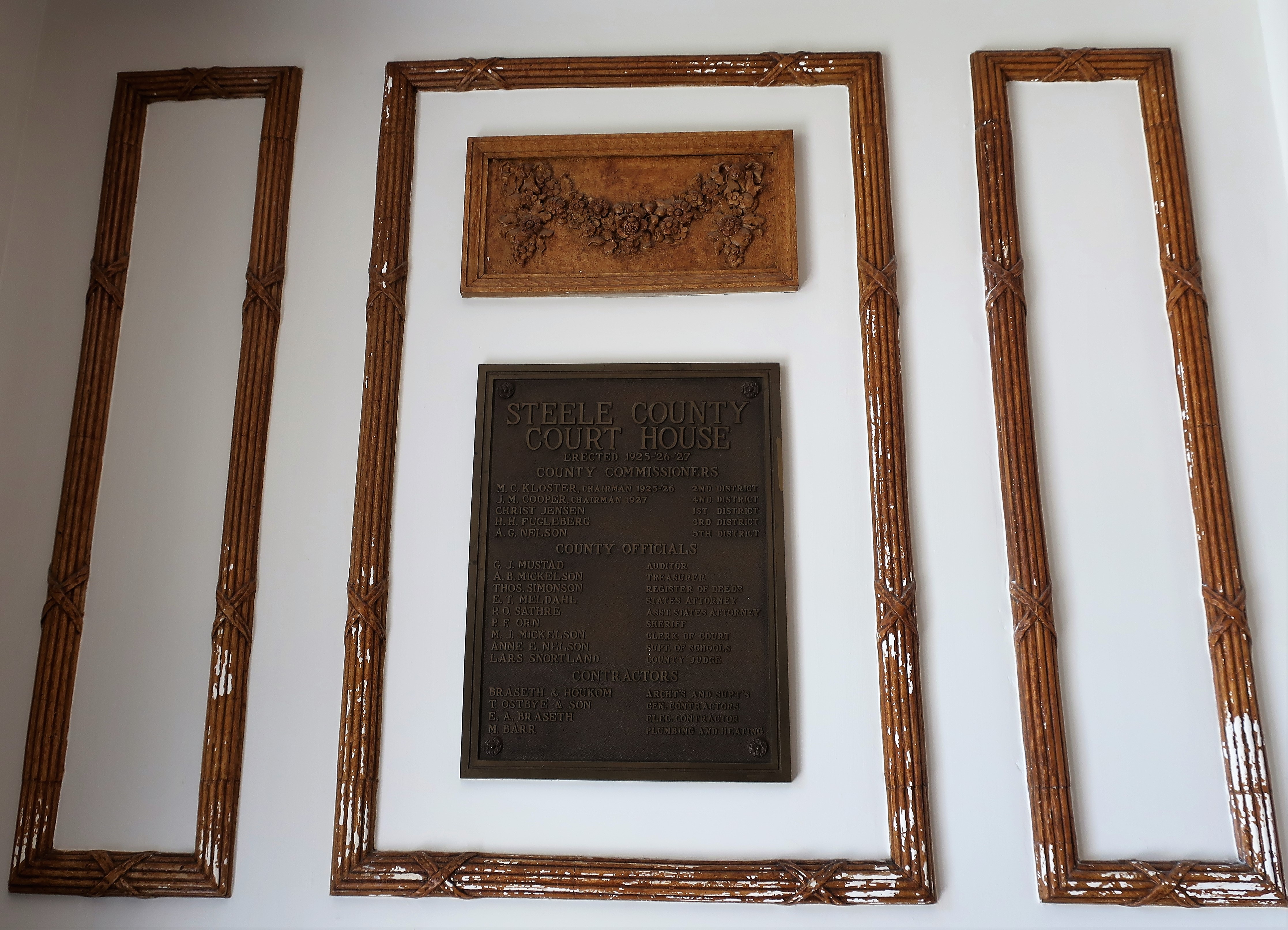
The Steele County Courthouse in Finley was built in 1925. From the outside, the courthouse could easily be mistaken for a 1930s WPA project, but the interior has marble trim and old-fashioned lettering that one would never see in the aluminum-based WPA structures. Notice the Vietnam War memorial plaque next to the staircase in the central photo. Recalling the POW/MIA flag I saw at the edge of town, I wonder if perhaps Finley suffered local sons lost during Vietnam? Such a loss would leave a mark in a town of 445.
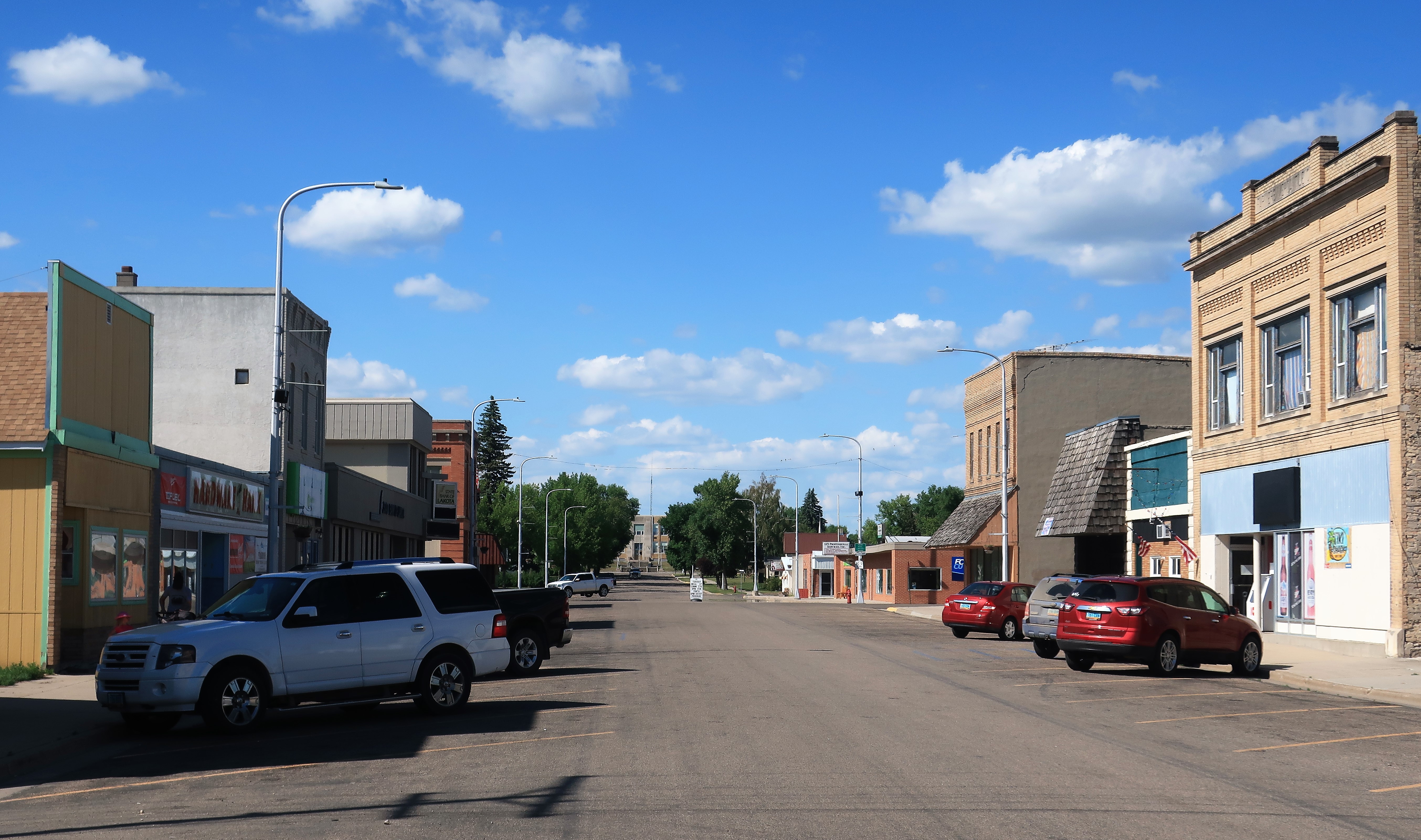
After a northward drive of an hour and a half, I reached Lakota, North Dakota, with a population of almost 700.

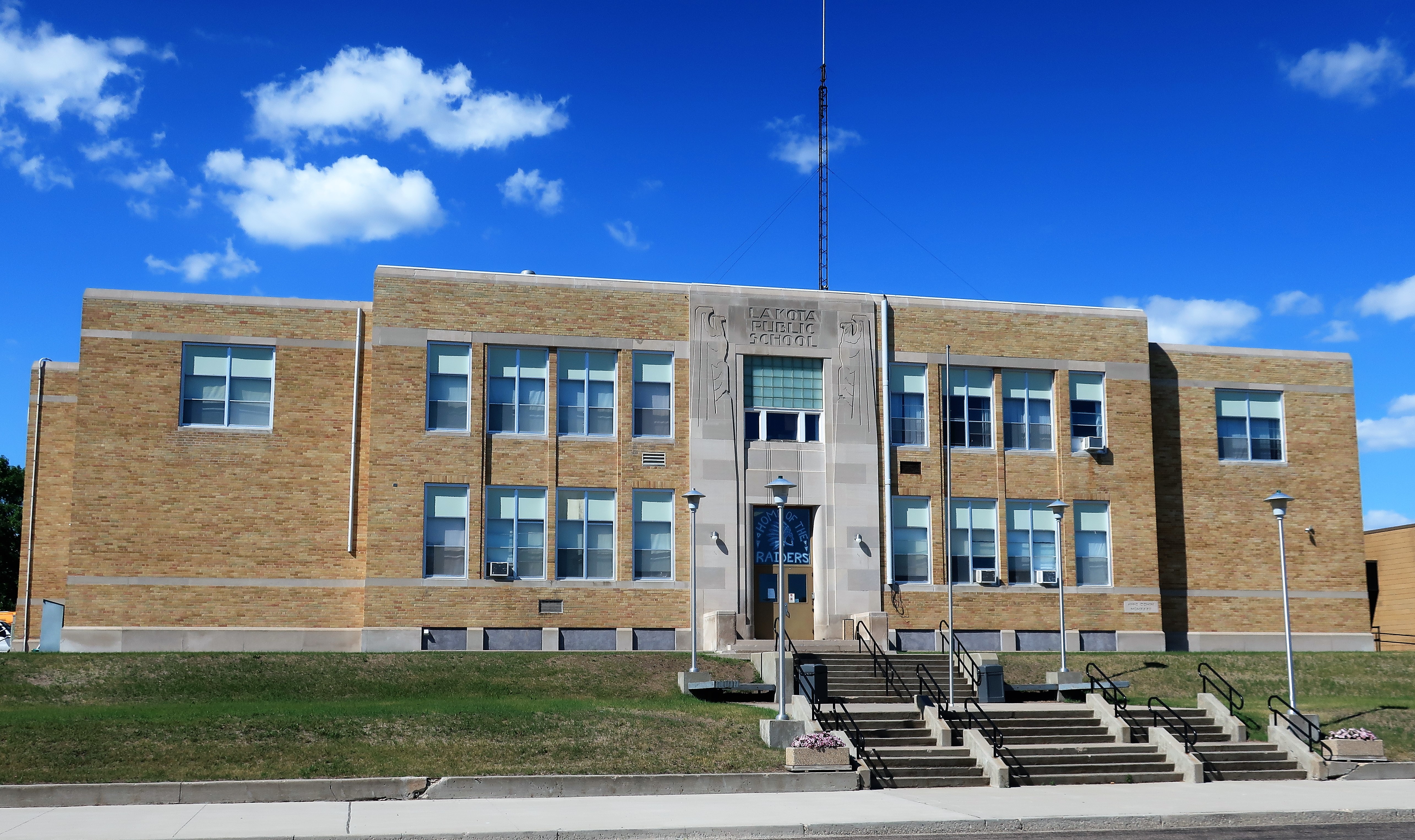
Main Street Lakota runs northward until it ends at the Art Deco style of the Lakota Public School building.
Although Main Street was pretty quiet today, its signage had some personality:
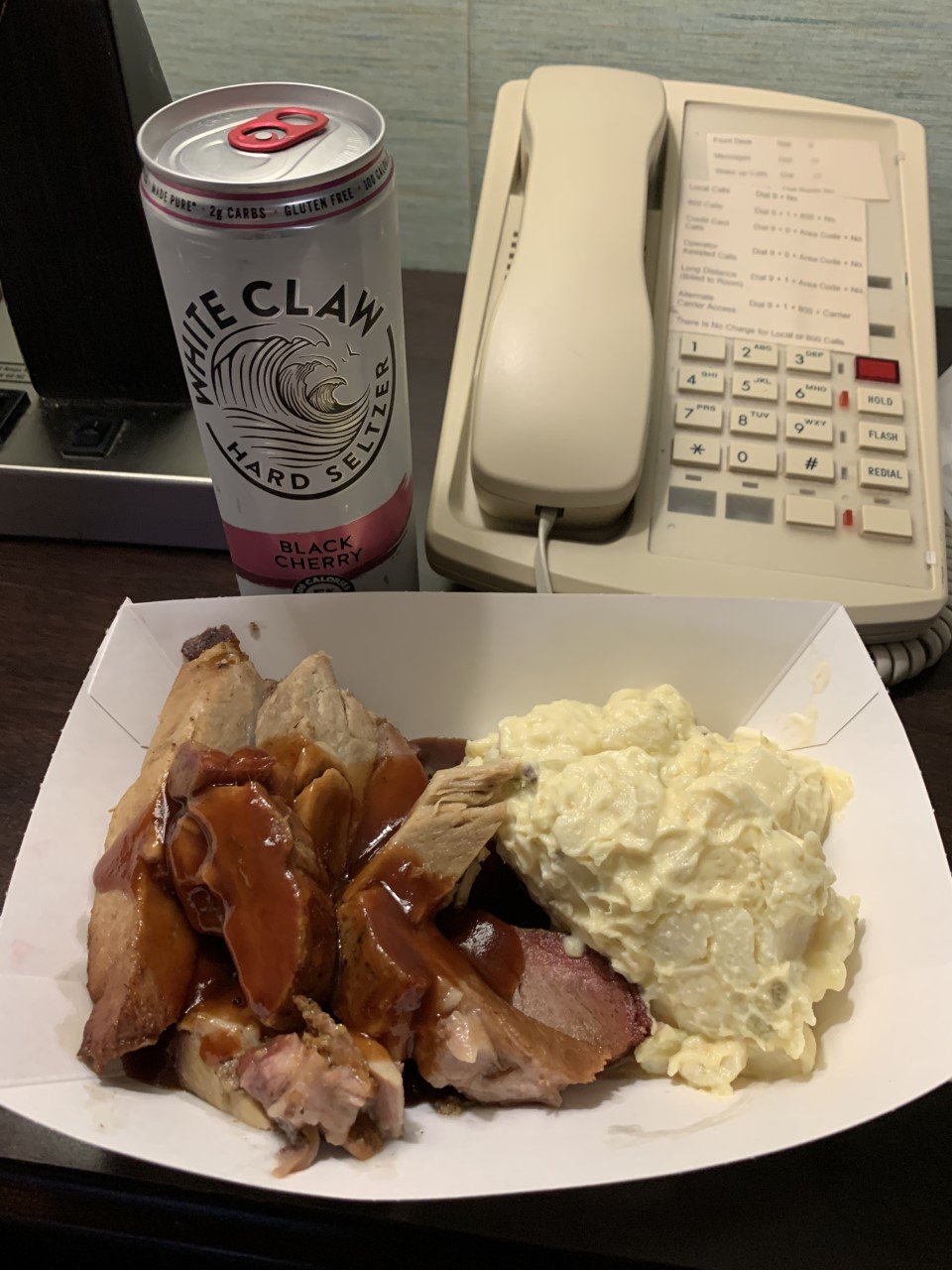
From Lakota, I drove 30 miles west and stopped for the day at the Fireside Inn and Suites in Devils Lake, North Dakota. This is a privately owned motel catering mainly to summer and winter sports fishermen on Devils Lake. The inn has a small lounge where fishermen can enjoy a brew while swapping fish stories! On this night the Fireside Inn offered their guests free ribs and potato salad with a free drink. I couldn’t pass up a free meal!
Freedom Voyage Day 5, Wednesday, June 30, 2021: Devils Lake to Bottineau, North Dakota

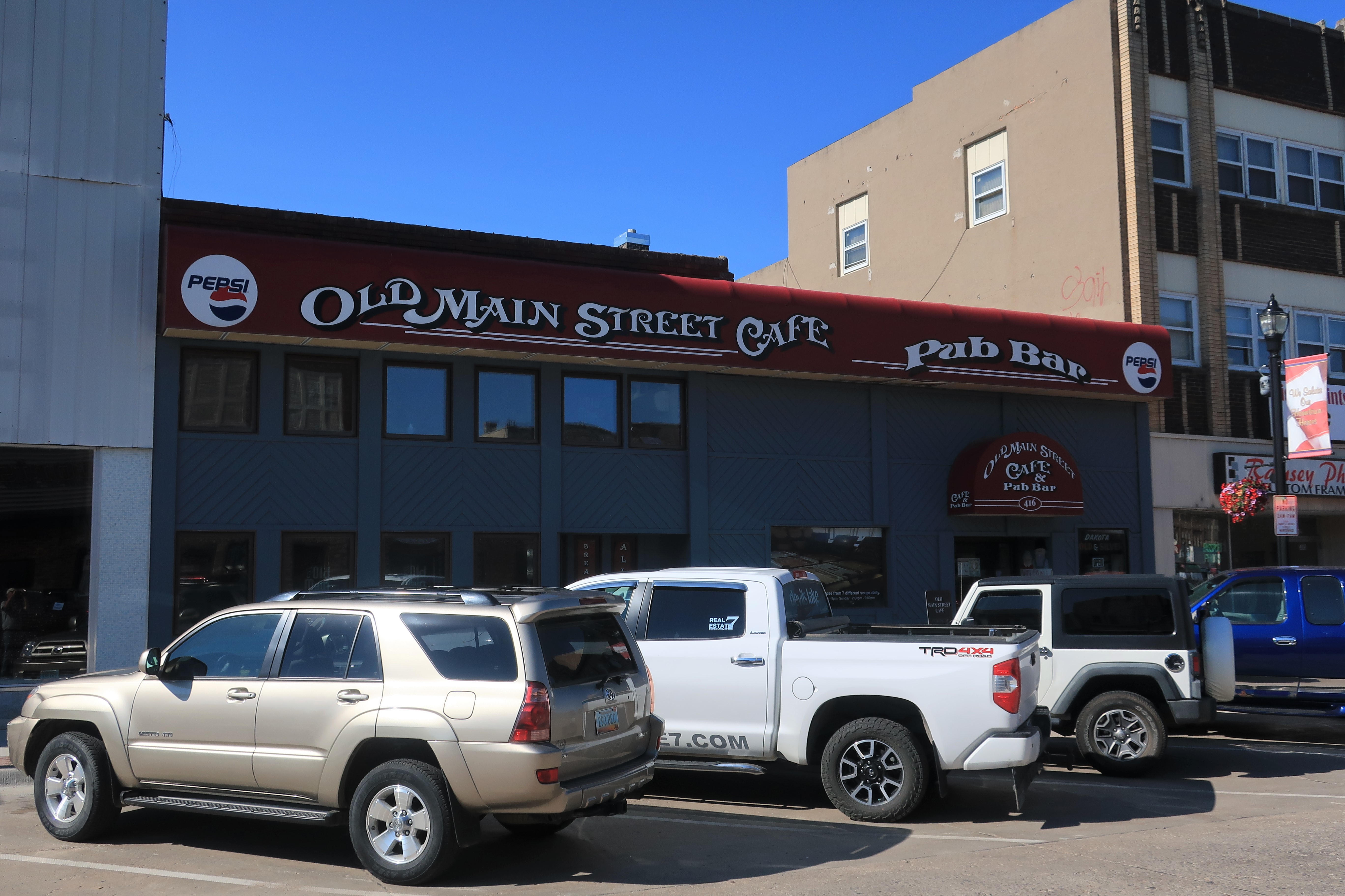
I had breakfast at the Old Main Street Cafe in Devils Lake. Actually located on 4th Street downtown, it’s a nice place — small, intimate, and includes a bar for late-night gatherings. Very efficient of them to have their space double as both an early morning and a late-night venue.
I found an interesting old photograph on the breakfast counter showing the local high school marching band parading down Main Street. Between the photo being black and white and the style of the parked cars, I’m guessing the shot was taken in the mid-1960s. Look how serious they are!

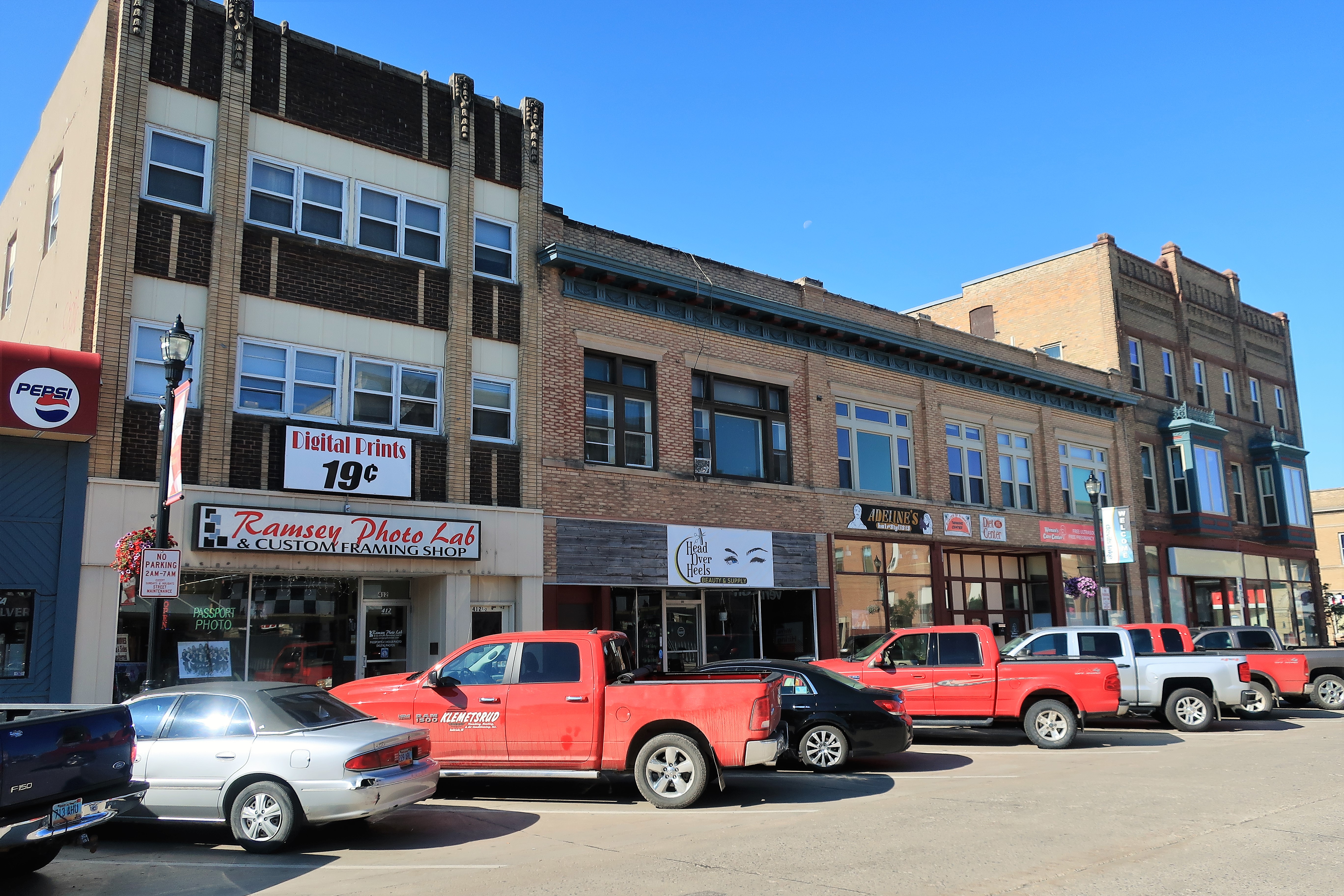
The Ramsey Photo Lab in Devils Lake offers 19-cent digital prints, plus custom framing. I imagine photoshops have a tough time in the digital age. Nevertheless, other downtown businesses are doing ok; few storefronts are vacant downtown.
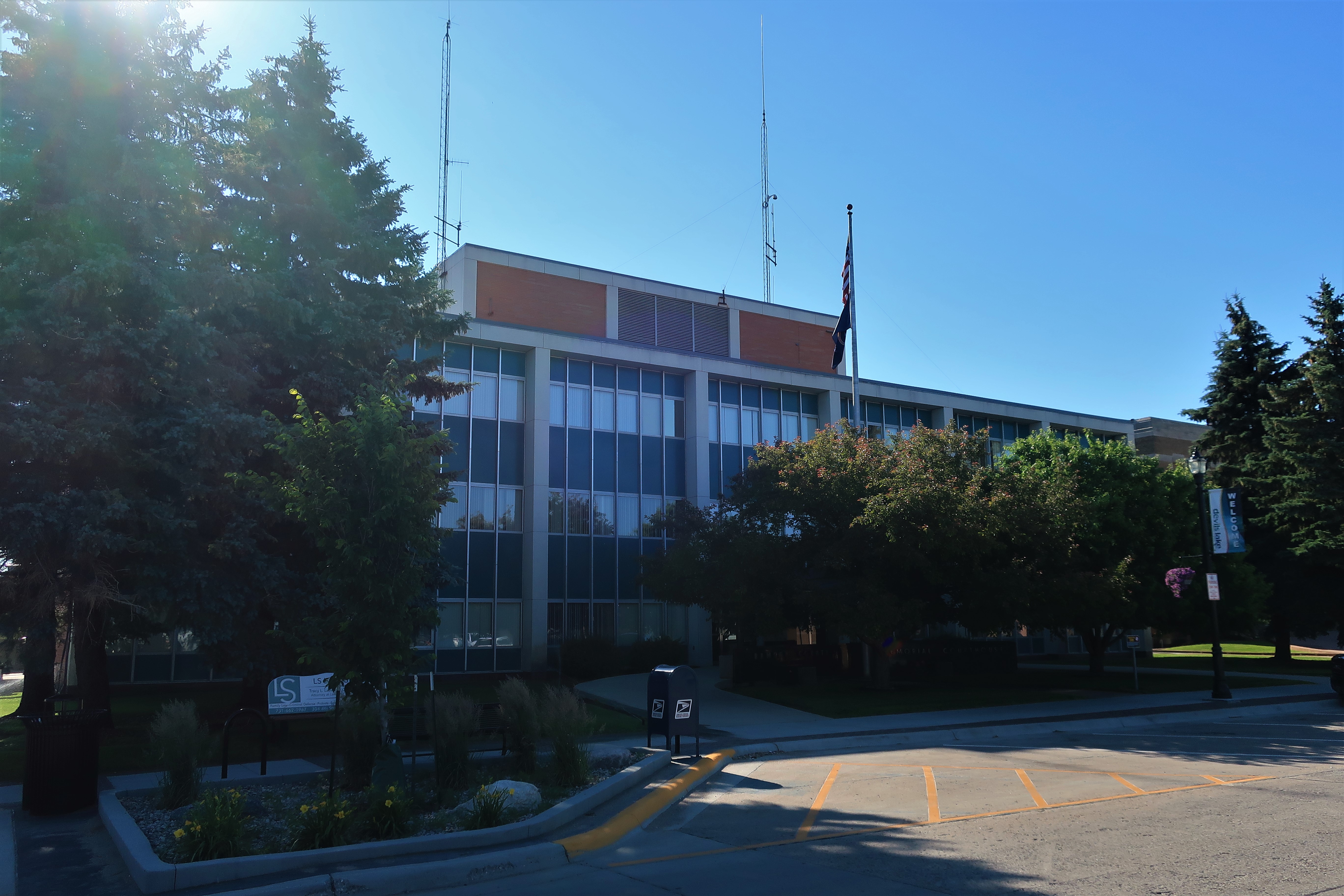
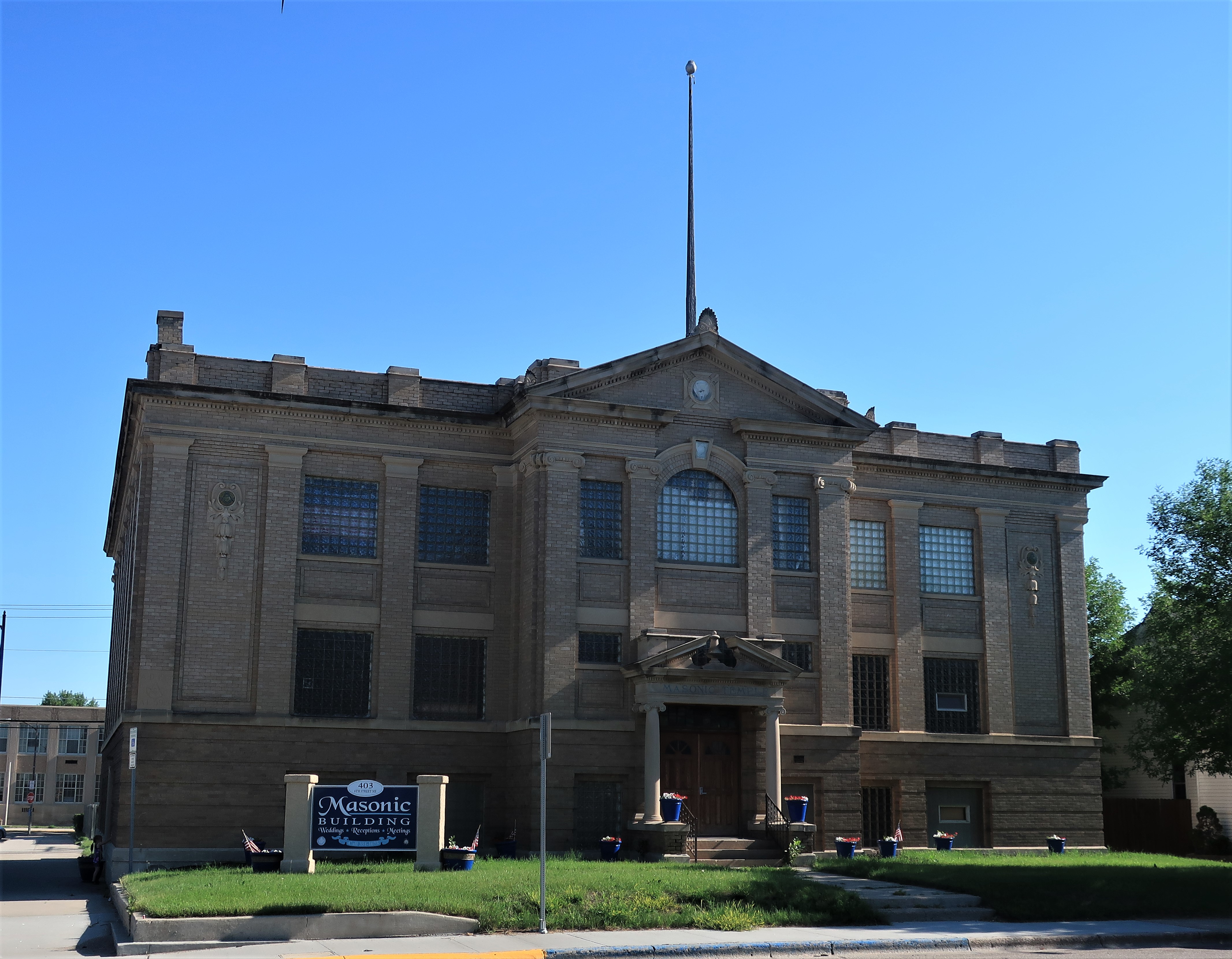
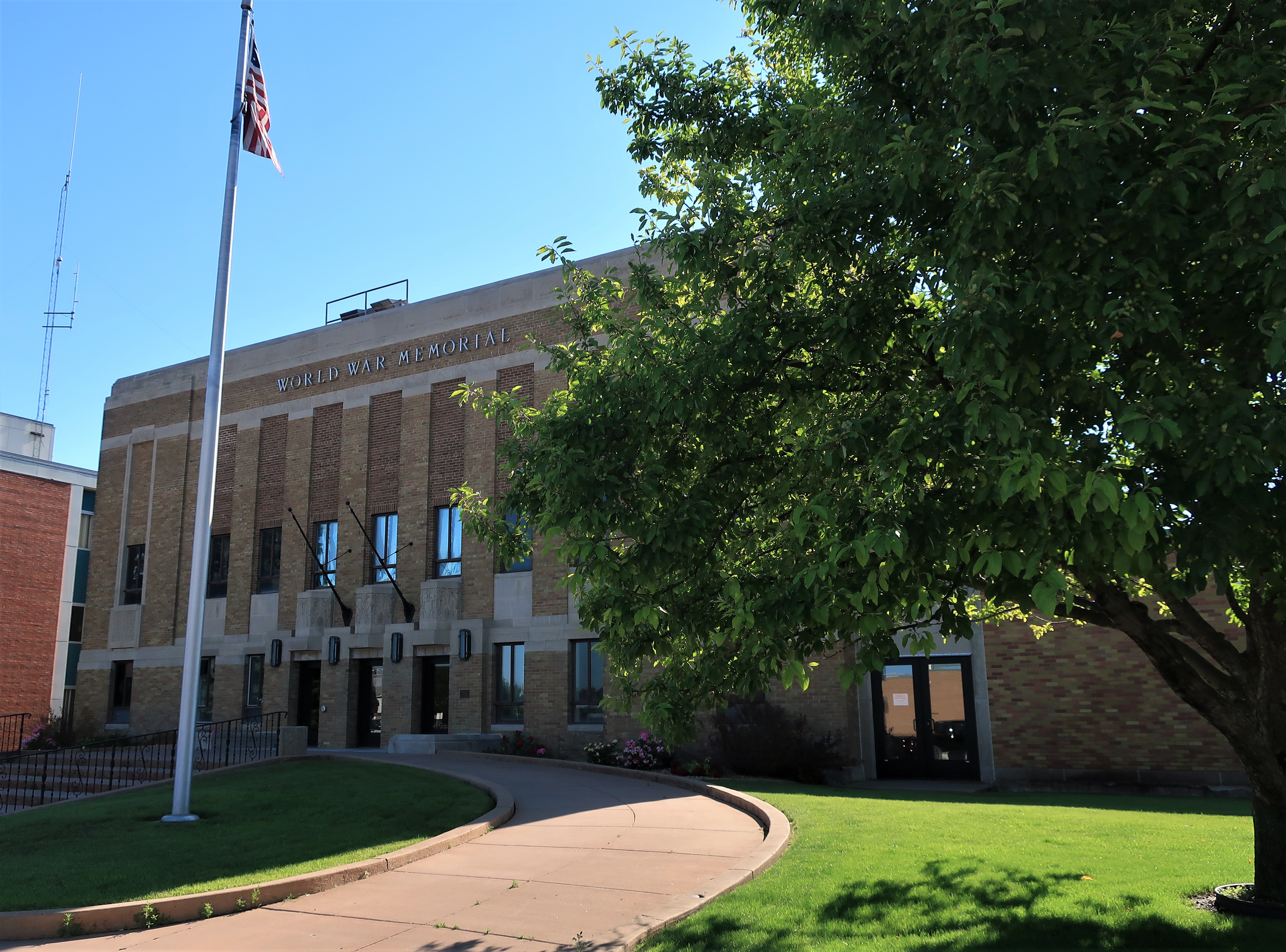
Here are a set of impressive public buildings in Devil’s Lake (clockwise from top left): Ramsey County Courthouse, the old Fire Station, the old Central High (now a middle school), Carnegie Library, World War Memorial auditorium, and the old Masonic building.


The town was named for the nearby body of water — “Devils Lake” or “Spirit Lake” as the Dakota tribe refers to it. This is the largest natural body of water in North Dakota. Devils Lake is a highly saline, closed system whose waters only flow outward to the Sheyenne River during times of extreme precipitation. More information on the formation and history of the lake can be seen in the historical sign below.


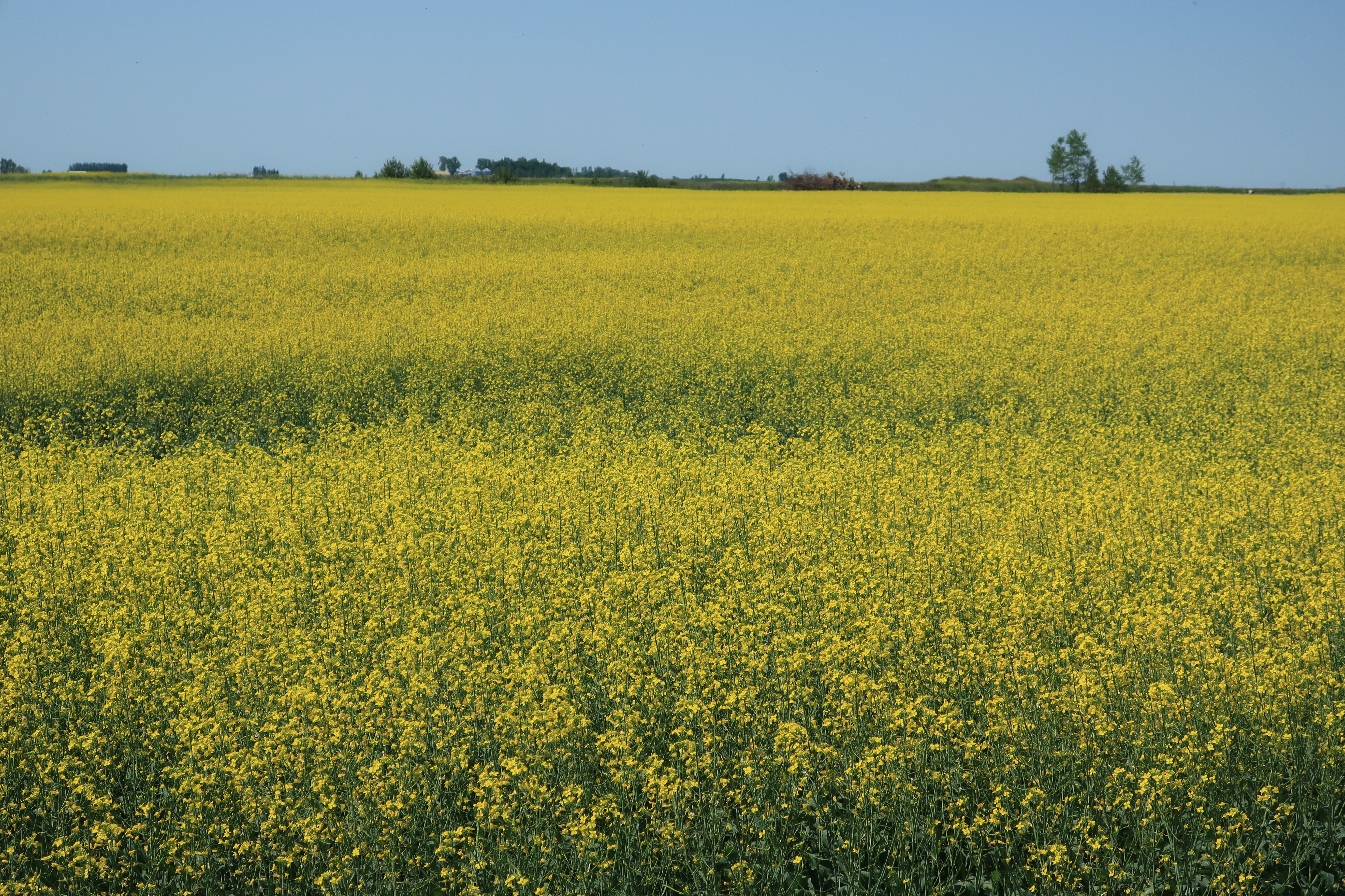
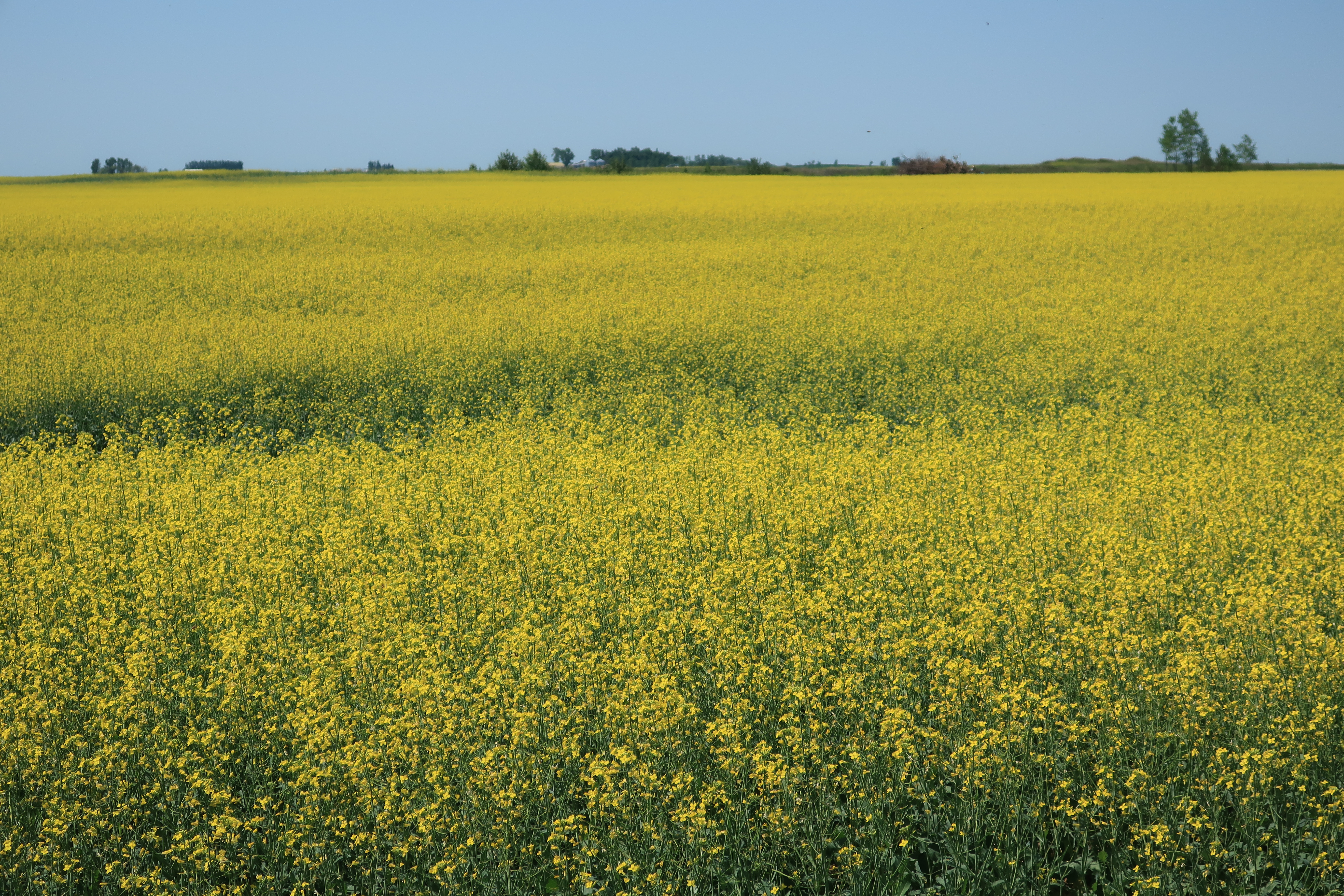
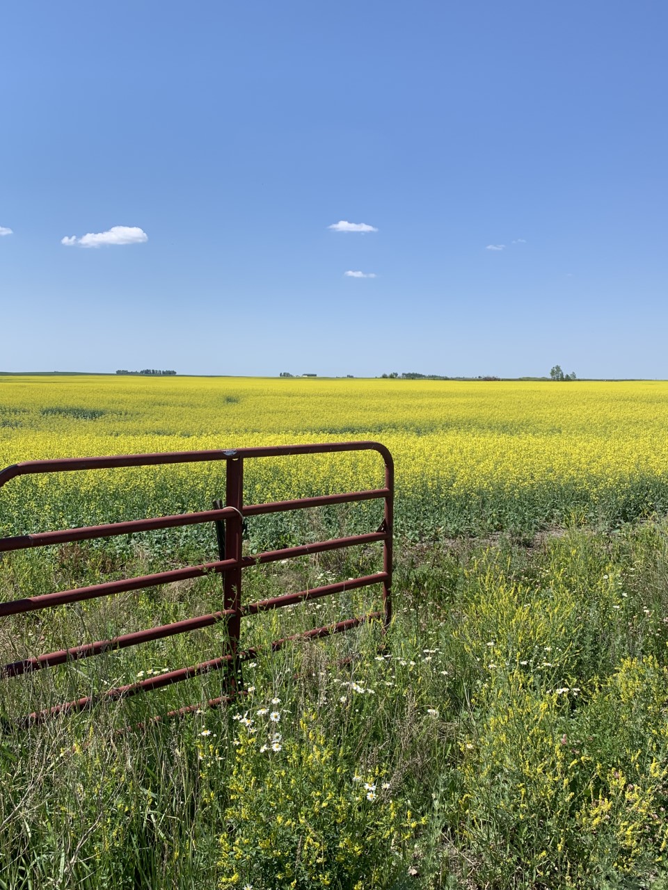
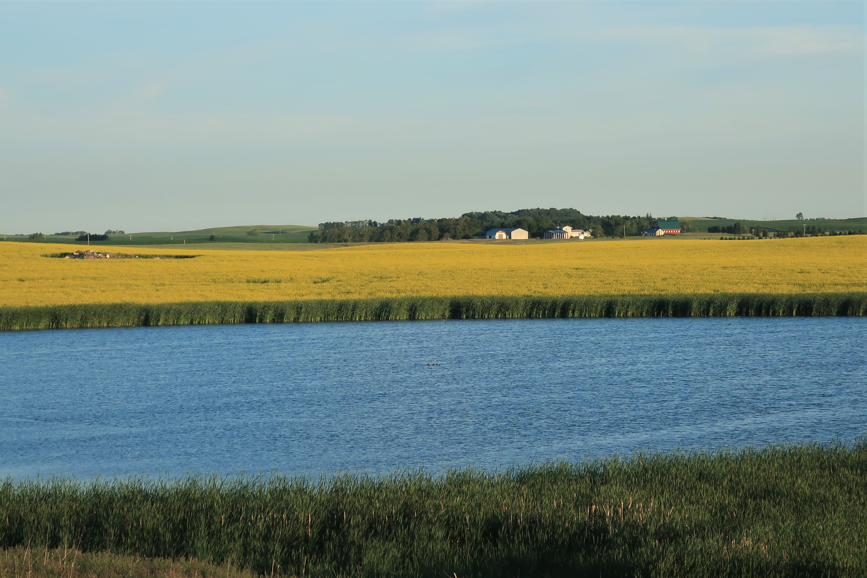
Heading northeast, I passed through miles and miles of flat farmland and small lakes. I soon came across wide fields of canola. These always make for great photos:


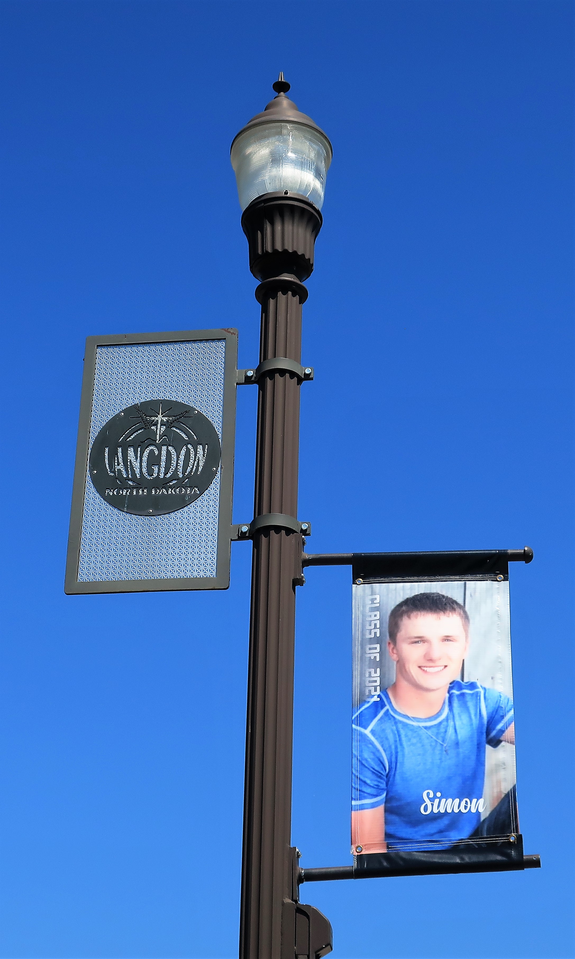
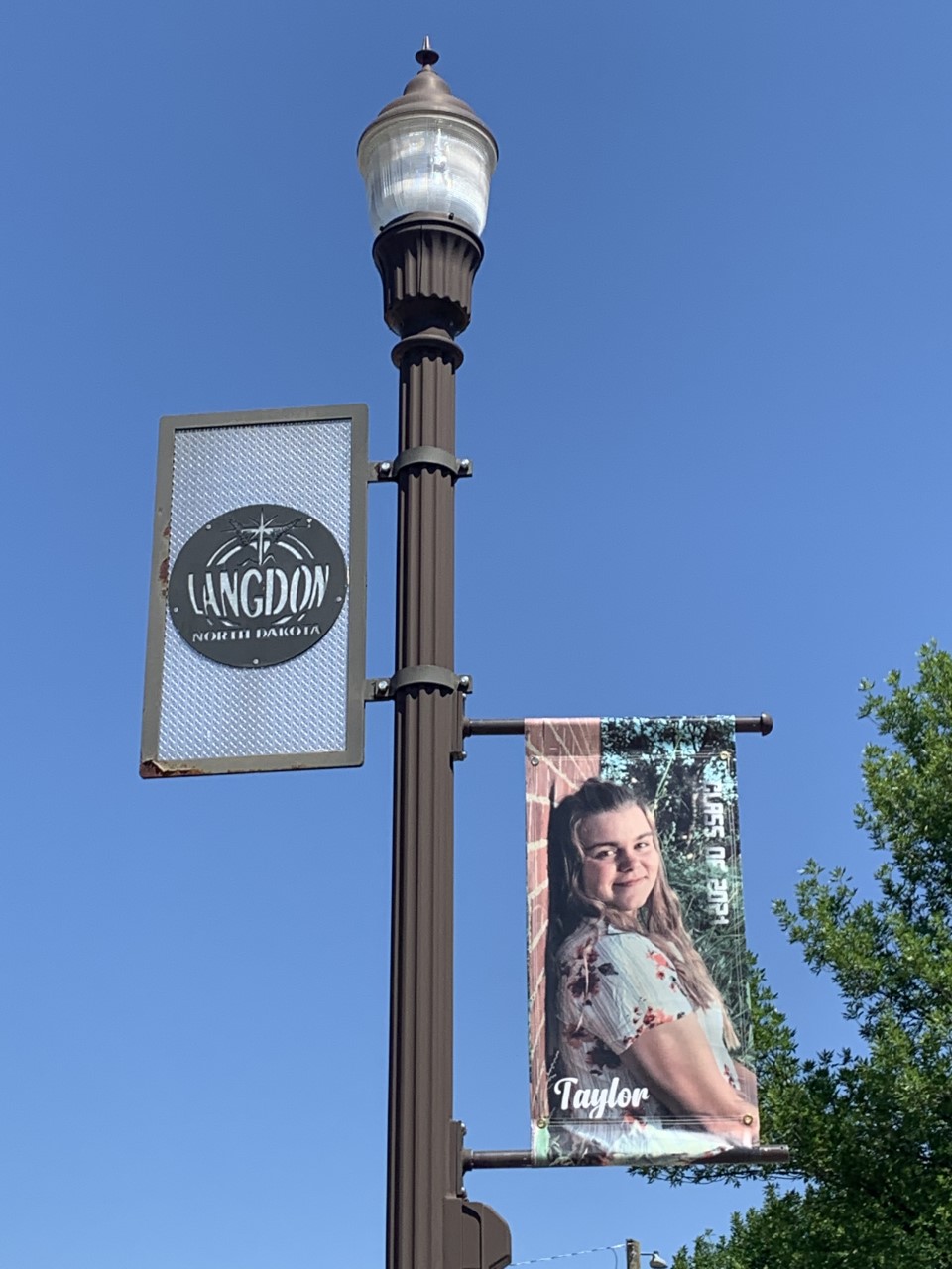
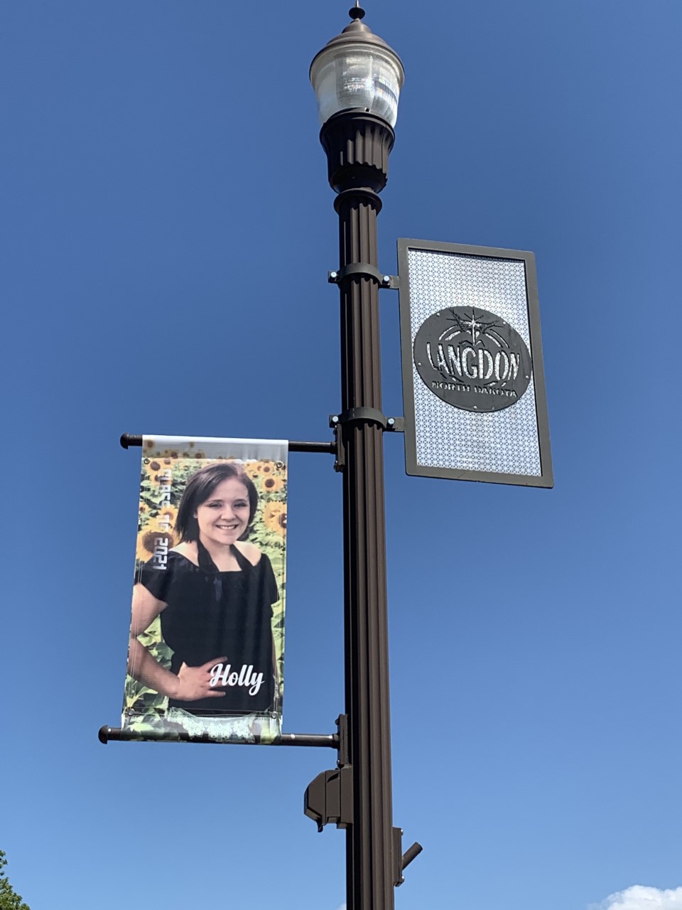
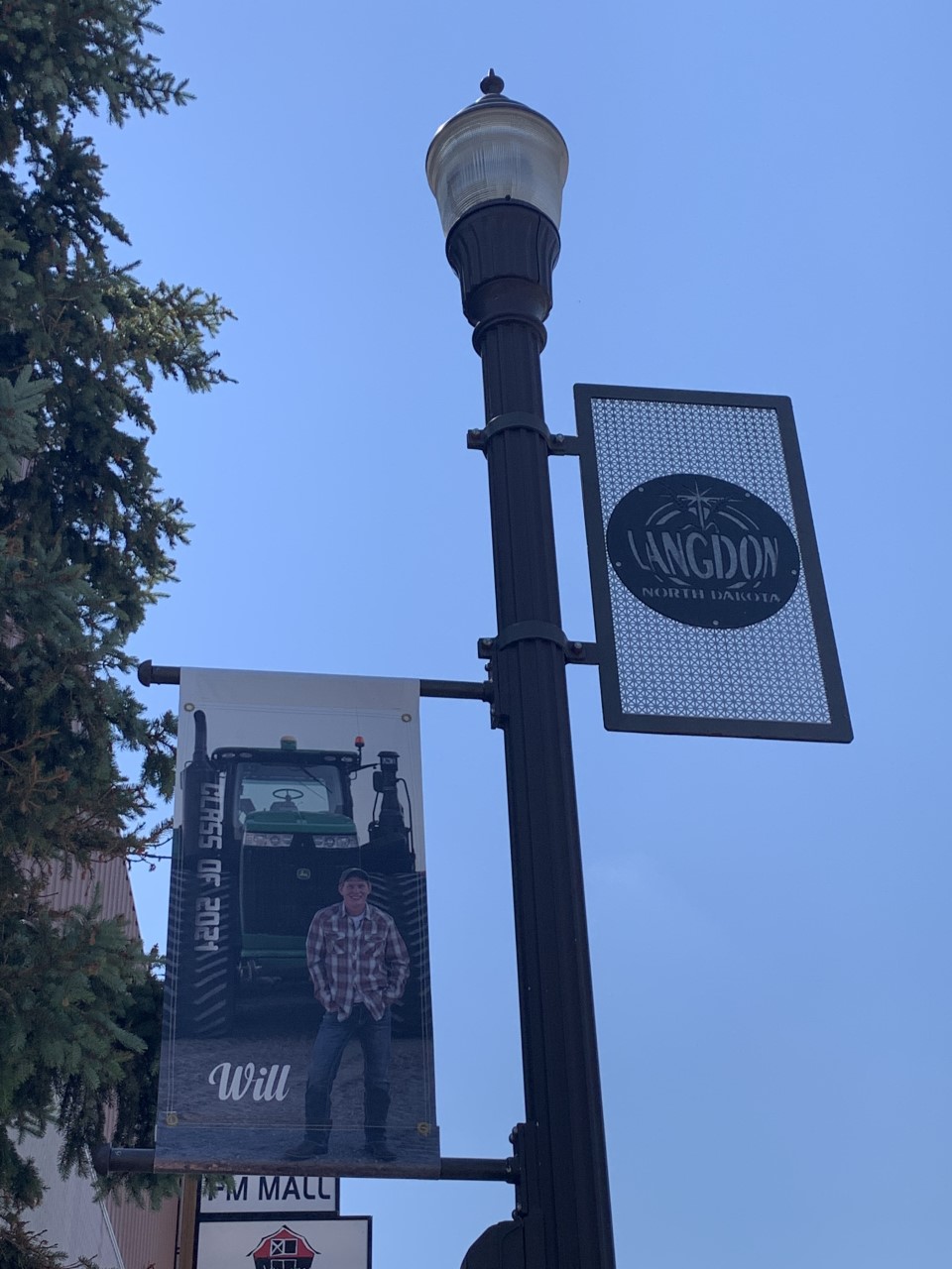
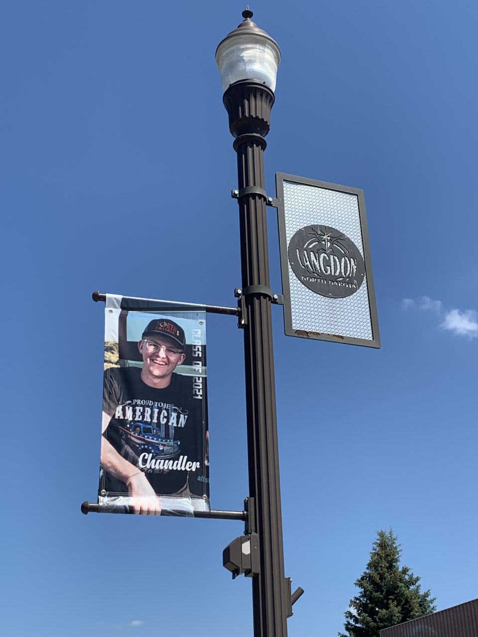
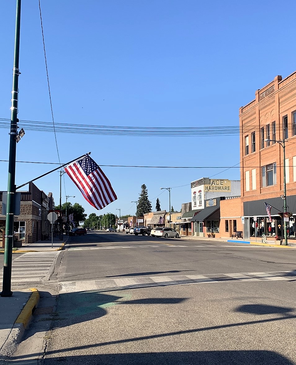
The town of Langdon, North Dakota, has a population of 1,800 and sits just 15 miles south of the Canadian border.


Some of the smaller towns in this part of the country have a wonderful tradition of posting photographs of their graduating seniors on Main Street lampposts. I’m a little jealous of these kids — both for the fanfare they’re receiving and for the quality of their photographs. My senior pictures didn’t look nearly as good as any of these kids’ photos do! Here are some of the graduating seniors of Langdon Area High School Cardinals, class of 2021:


It was a hot day today in North Dakota. 87°, clear skies with little or no breeze. Great weather for the crops, while the people were indoors and life was lazy.
My next stop, the town of Cando in Towner County, is about 50 miles southwest of Langdon. The county courthouse is a three-story yellow brick structure constructed in 1898. The old jail was included inside, even though it has not been used for incarceration since 1977.
Inside the old building, the second floor’s wooden floors creaked. The winding wooden staircases at each end of the hallway also creaked, but they look beautiful — demonstrating the great craftsmanship needed to withstand the pressures of 120 years of use.
Cando has a population of just over 1,100. I had a late lunch at the Cozy Café on Main Street, which was empty except for the wait staff and her friends. They made me an awesome grilled cheese and bacon sandwich with fries. After lunch I spent 10 or 20 minutes walking around town, sweating off the calories.
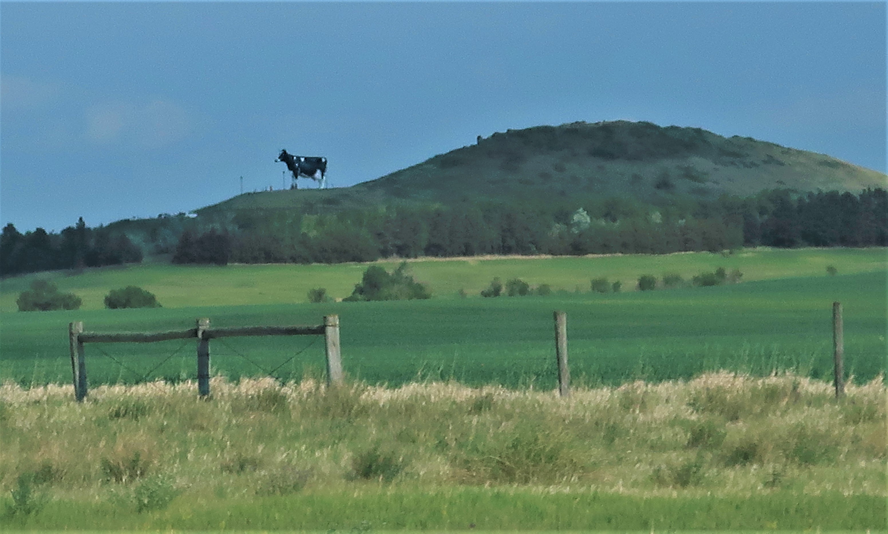
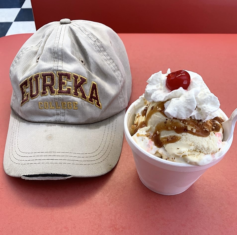
I left Cando around 3:00 in the afternoon so that I could get to the famous Pride Dairy in Bottineau, North Dakota, before its 5:00 closing time. I had been to Bottineau a few years ago but had missed the Dairy during that trip, so I had made sure to include a stop here while planning this trip.
The Pride Dairy is special not only for its excellent ice creams and cheeses but also for having the license to produce vanilla ice cream using Thomas Jefferson’s own vanilla ice cream recipe. (The recipe is recorded in the Library of Congress and it requires imported Madagascar vanilla beans.) So when you eventually make your pilgrimage to Bottineau make sure to ask for the “Thomas Jefferson vanilla.” You can also find this special flavor on sale at Mount Rushmore, South Dakota, and at the International Peace Garden, North Dakota, and Manitoba, Canada.
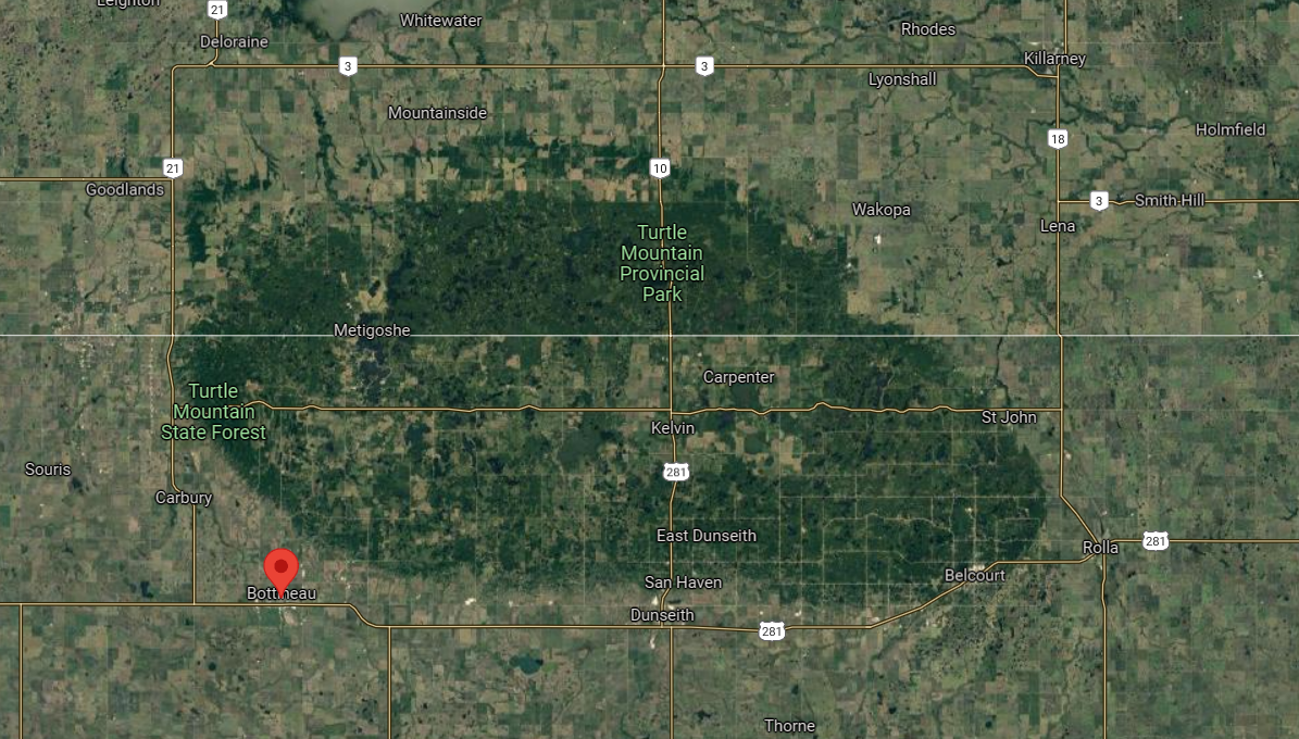
Just north of Bottineau, Turtle Mountain rises some 400 feet above the surrounding countryside. The plateau straddles the US-Canadian border and includes many parks and lakes for recreational activity.
I was also here last year. On Turtle Mountain both then and now, I’m reminded of an old Neil Young song called “Sugar Mountain.” The lyrics begin like this:
Oh to live on Sugar Mountain
With the barkers and the colored balloons
Of course, there are no barkers or colored balloons or circuses on Turtle Mountain. But there are a great many summer houses nestled among the woods and lakes here so it is a very festive place in its own way.
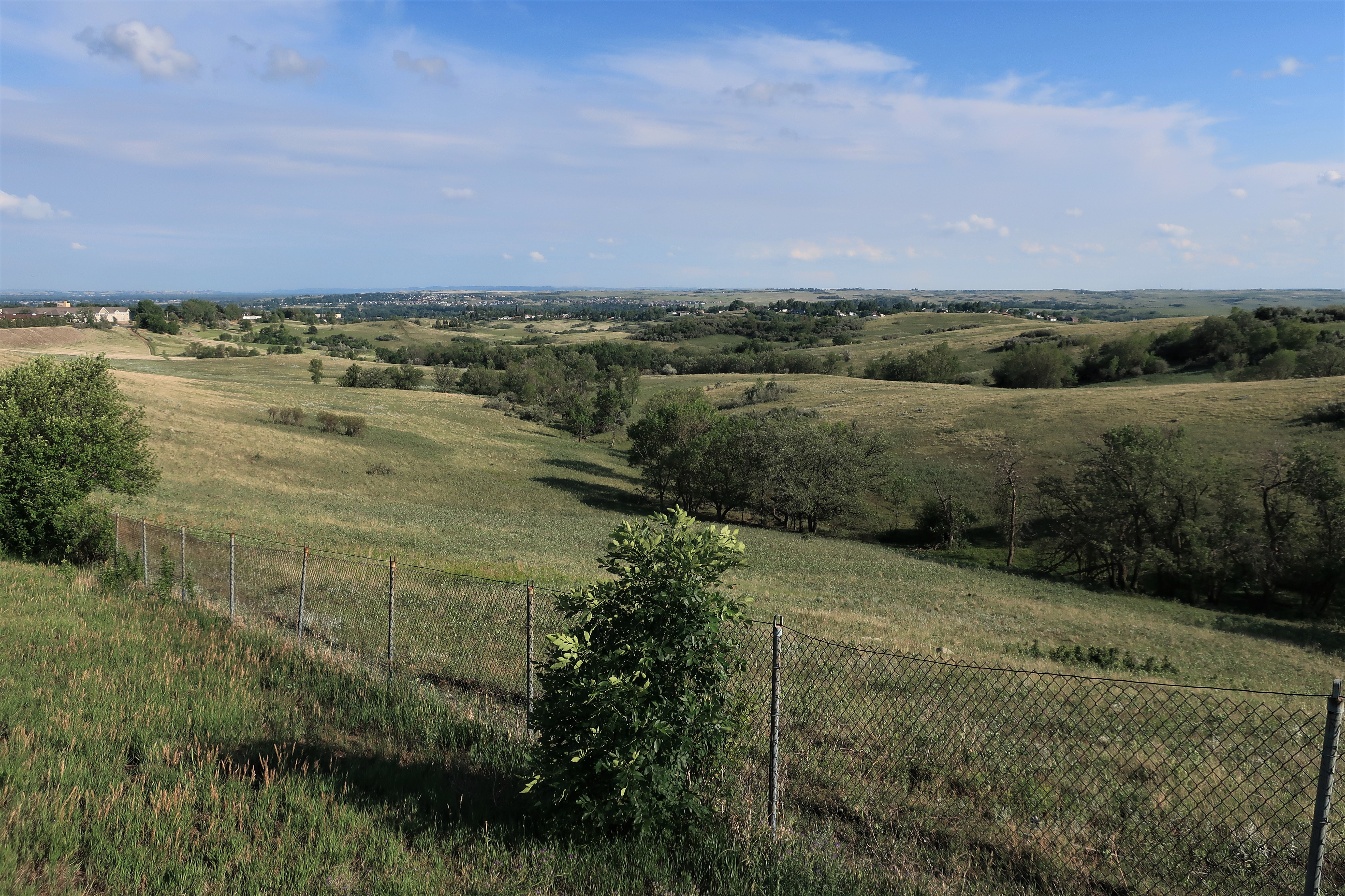
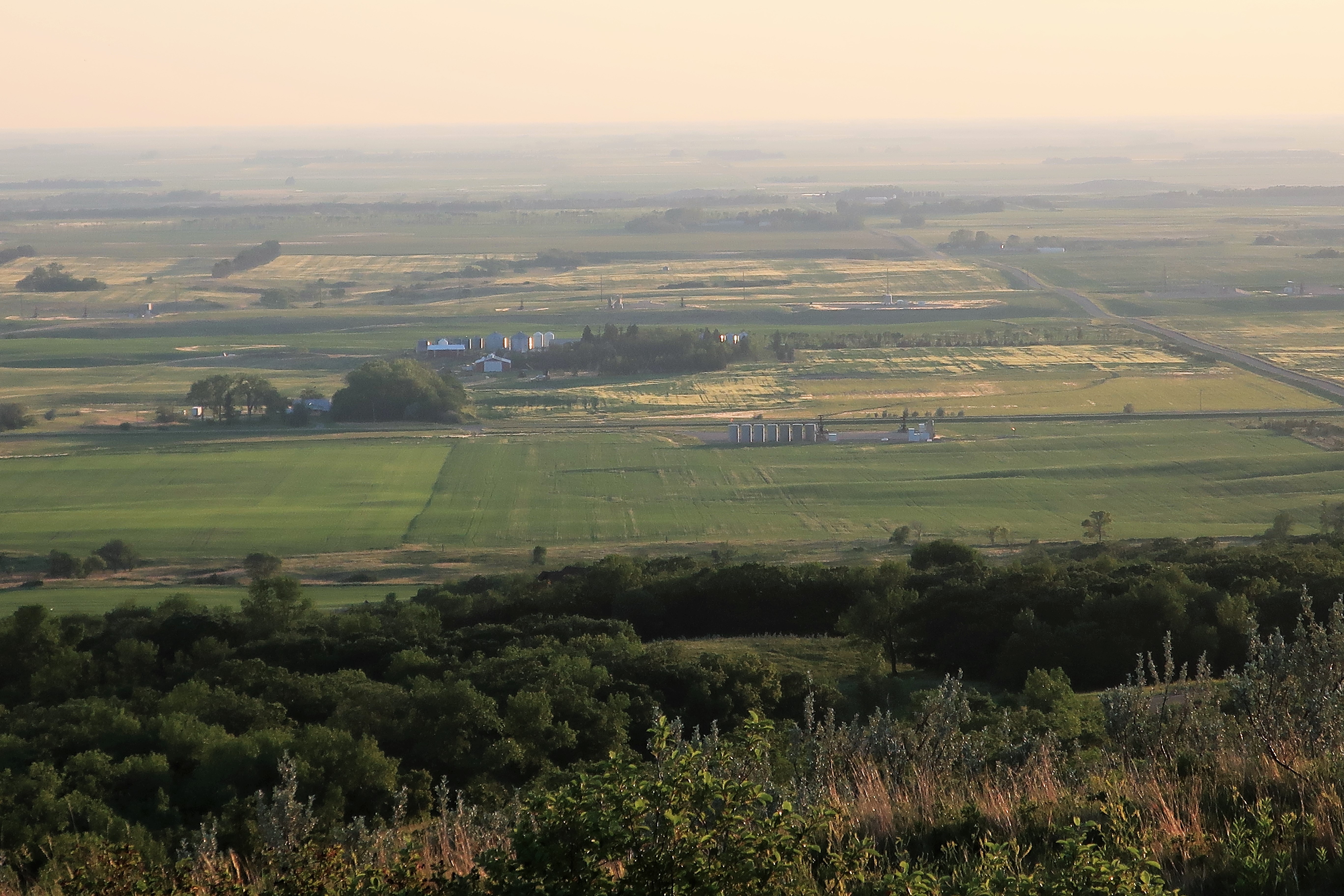
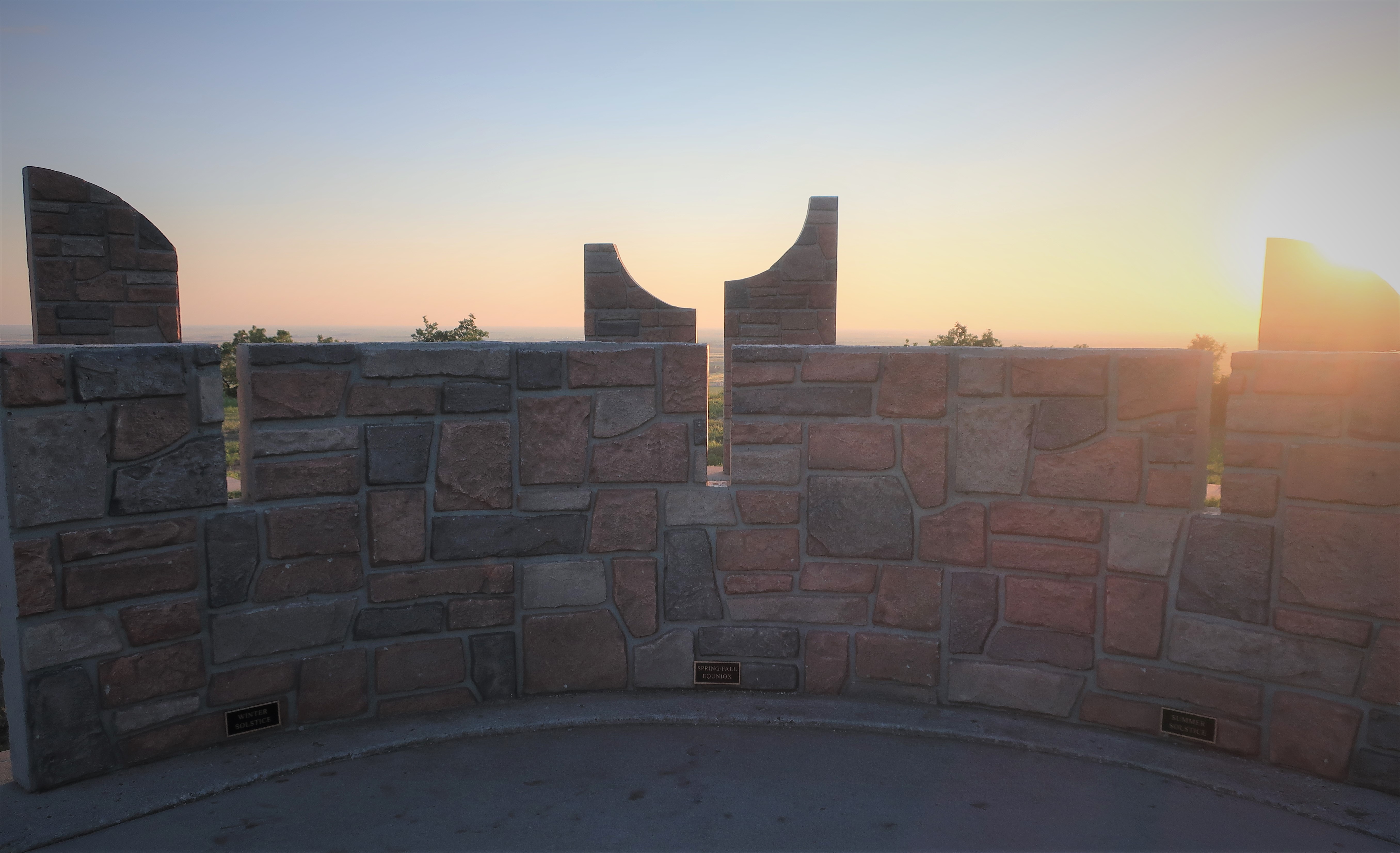
At the western edge of Turtle Mountain, the privately-built Mystical Horizons site offers sweeping views of the North Dakota prairie below. These photos were taken at 8:49 pm Central Daylight Time on June 30th, eight days after the summer solstice. At this latitude, at this time of year, sunset doesn’t occur until 9:49 pm.

The Mystical Horizons site includes stone and cement structures designed to view the summer and winter solstices and the equinox, mimicking celestial observation configurations at the Stonehenge site in England. A working sundial is also part of the Mystical Horizons site.
Bottineau is a small town so there are only a handful of places to stay the night. I chose the Cobblestone Inn, which is a nice place and part of a small chain of hotels found mainly in the Great Plains states.
Freedom Voyage Day 6, Thursday, July 1, 2021: Bottineau to Minot, North Dakota

Good morning from Bottineau, North Dakota! The summer sun’s up early in these high latitudes and so am I, and so is everyone else in this northern farming town. A great breakfast place is the Family Bakery & Restaurant on Main Street.
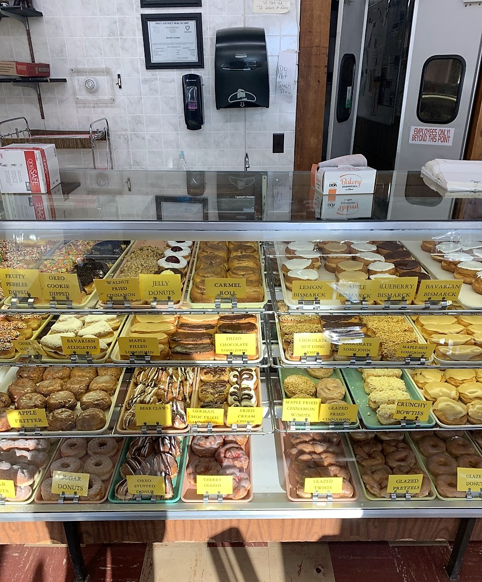
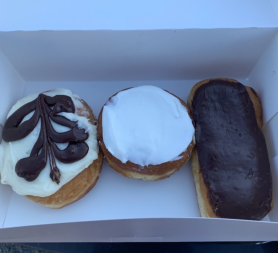
It’s 40 miles to my next destination, and luckily, the Family Bakery & Restaurant includes — believe it or not — a bakery where I can acquire some essential sustenance for the trip. I somehow limited myself to a mere three perfect pastries:
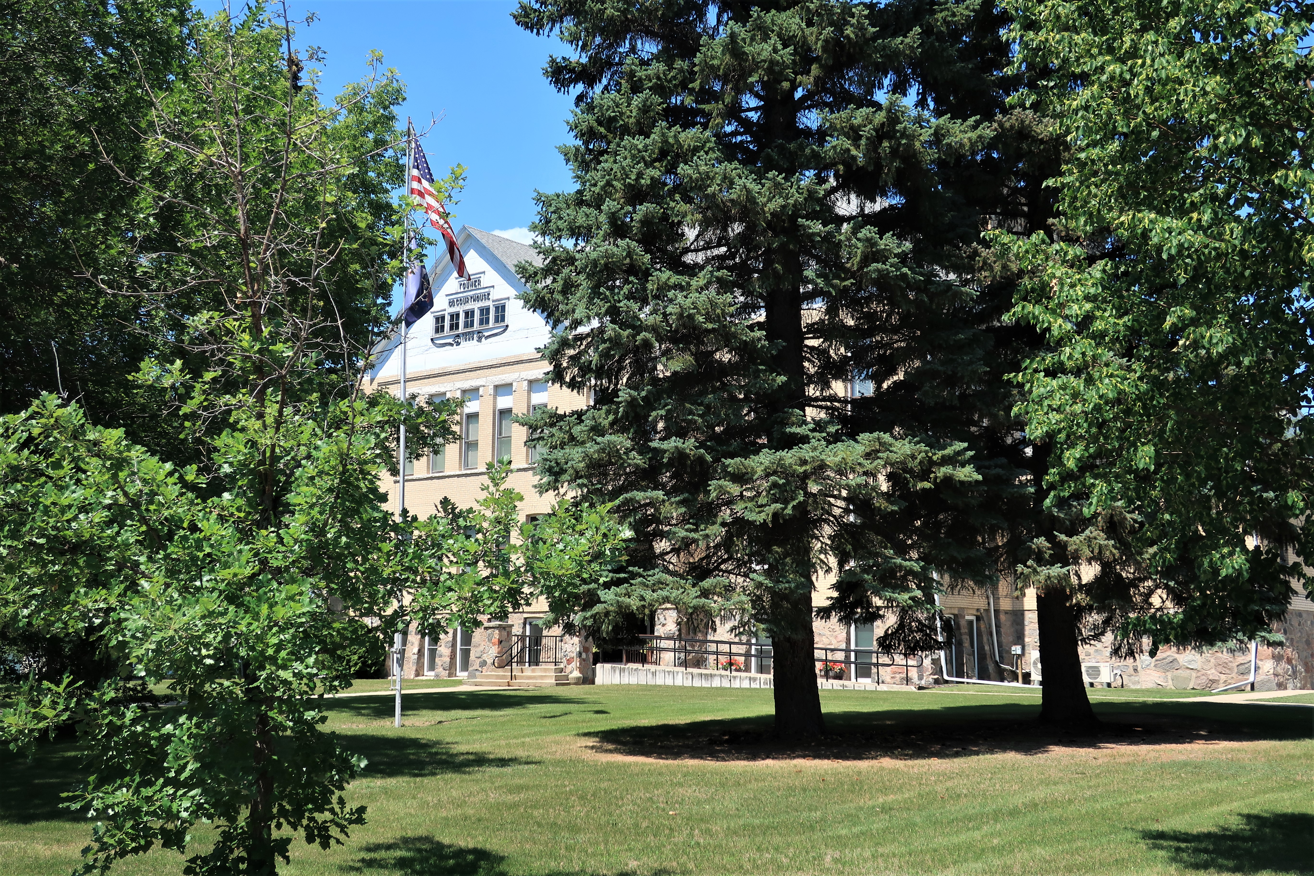
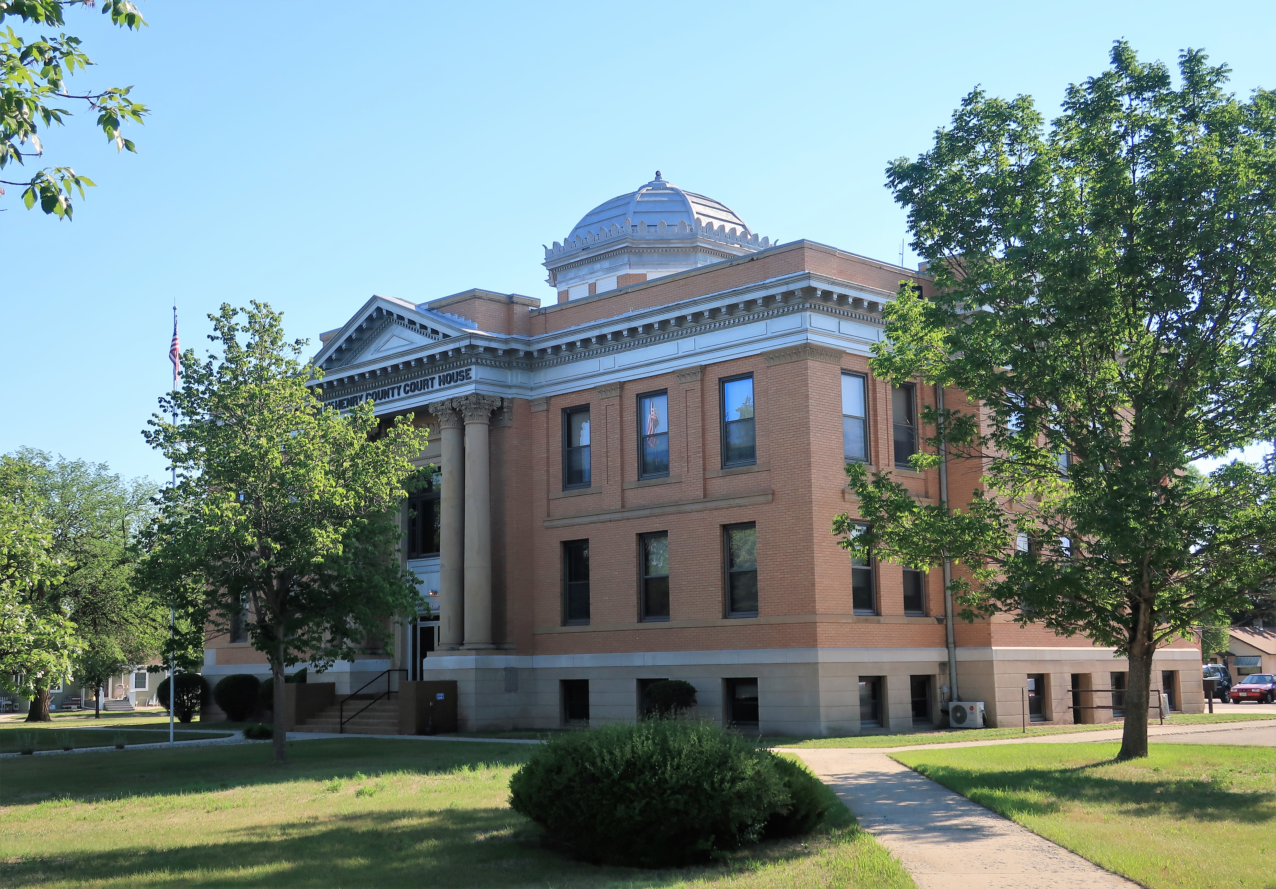
40 miles south of Bottineau lies the town of Towner, North Dakota, having a population of about 500. Yes, it’s “the town of Towner” and refers to itself as the “Cattle Capital of North Dakota.” Friendly place of course. The McHenry County courthouse, constructed in 1907, dominates the town with an architectural style typical of its time.
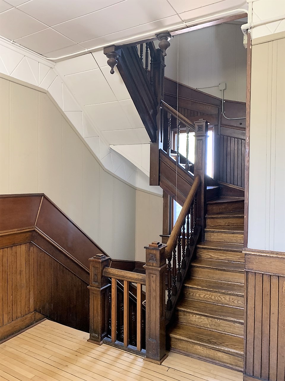
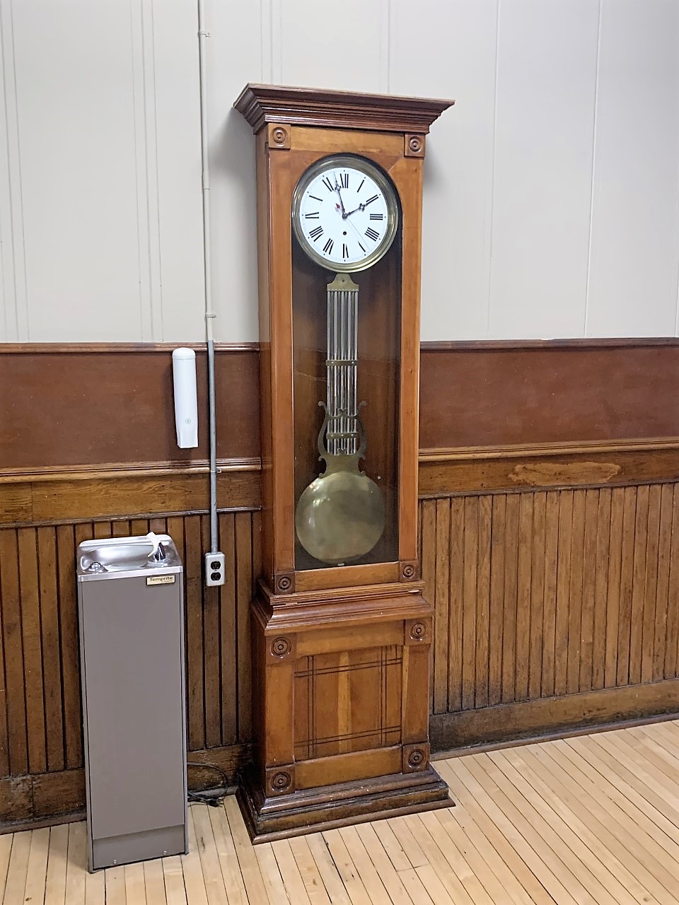
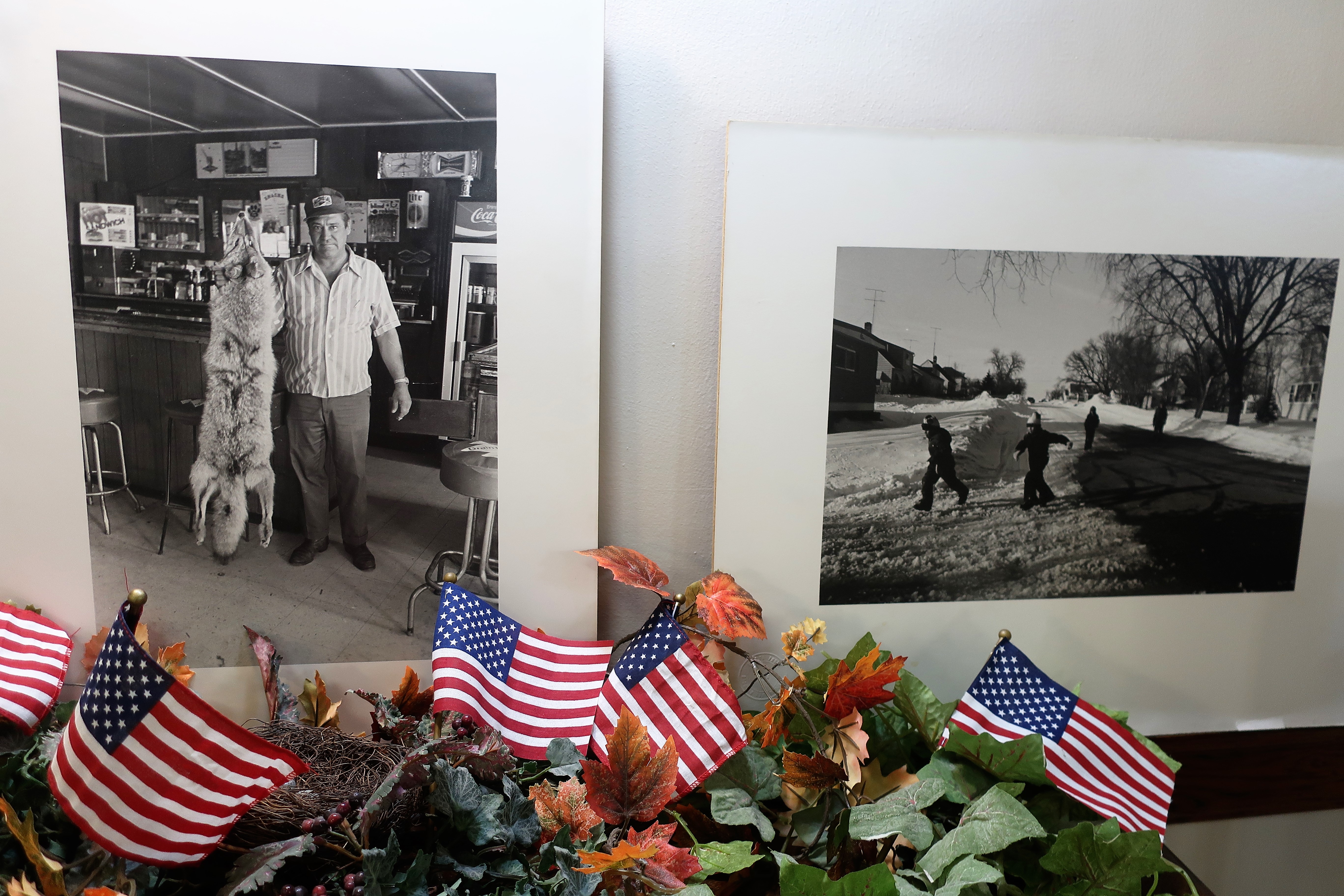
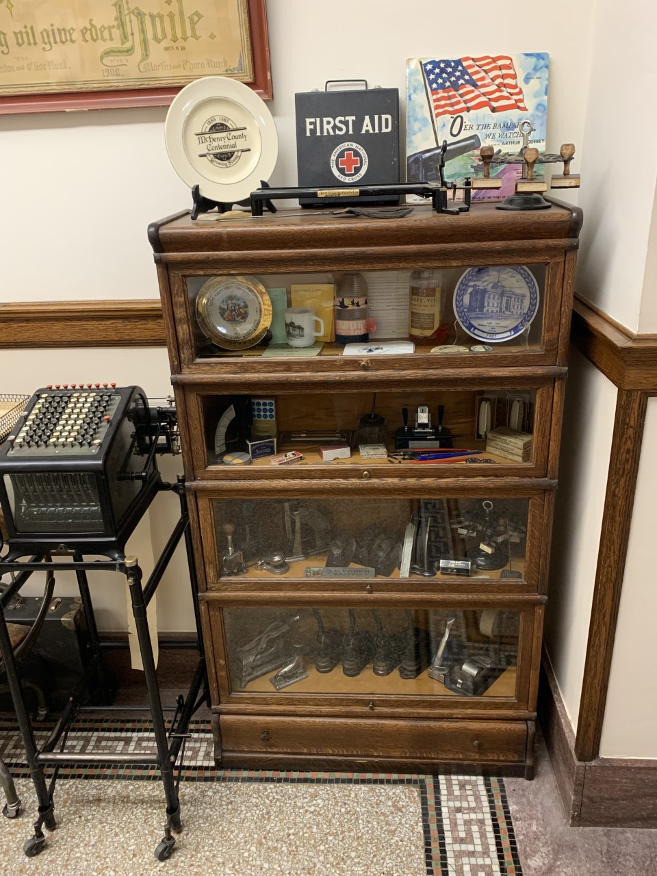
I was able to find and photograph some gems from inside the courthouse as well:

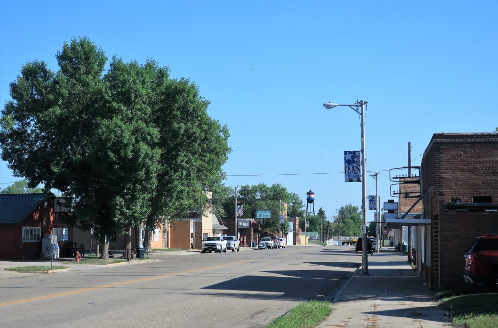
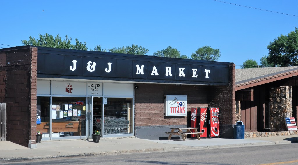
Here are some scenes around town: Main Street, the Towner Presbyterian Church, the J & J Market, and the old bank building.


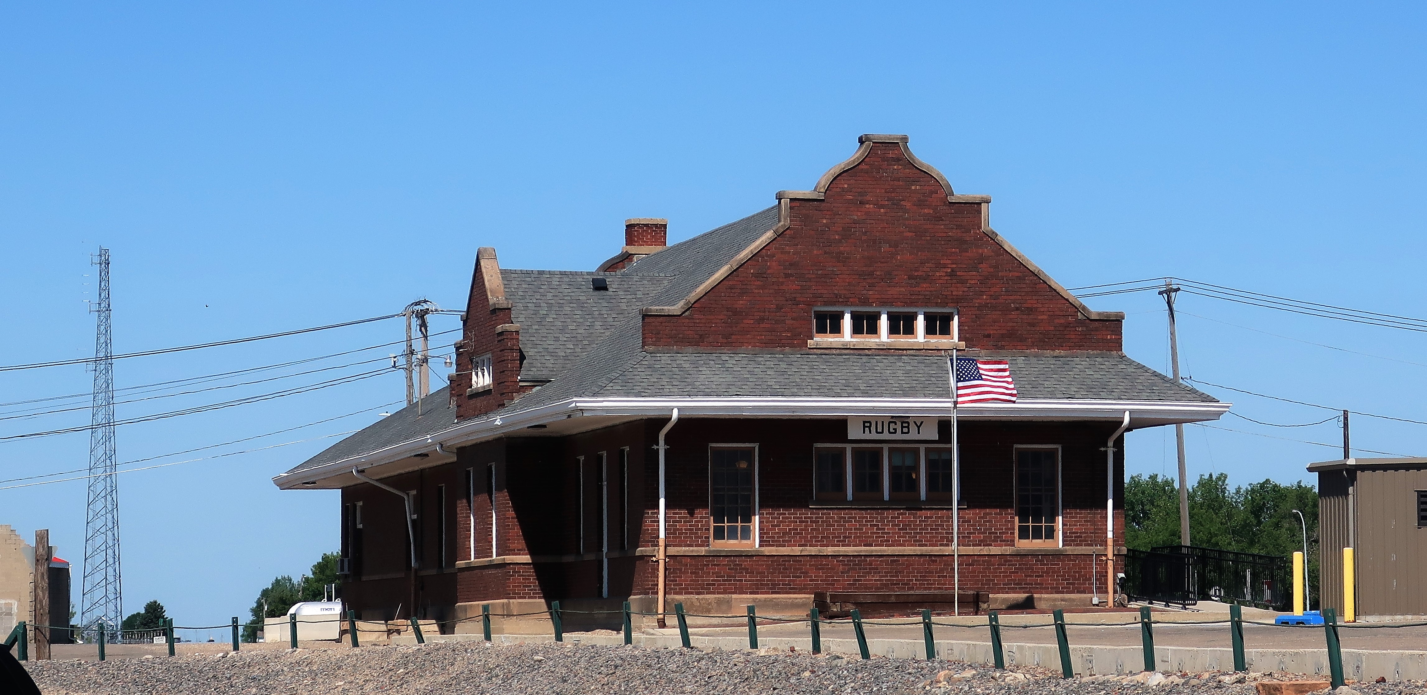
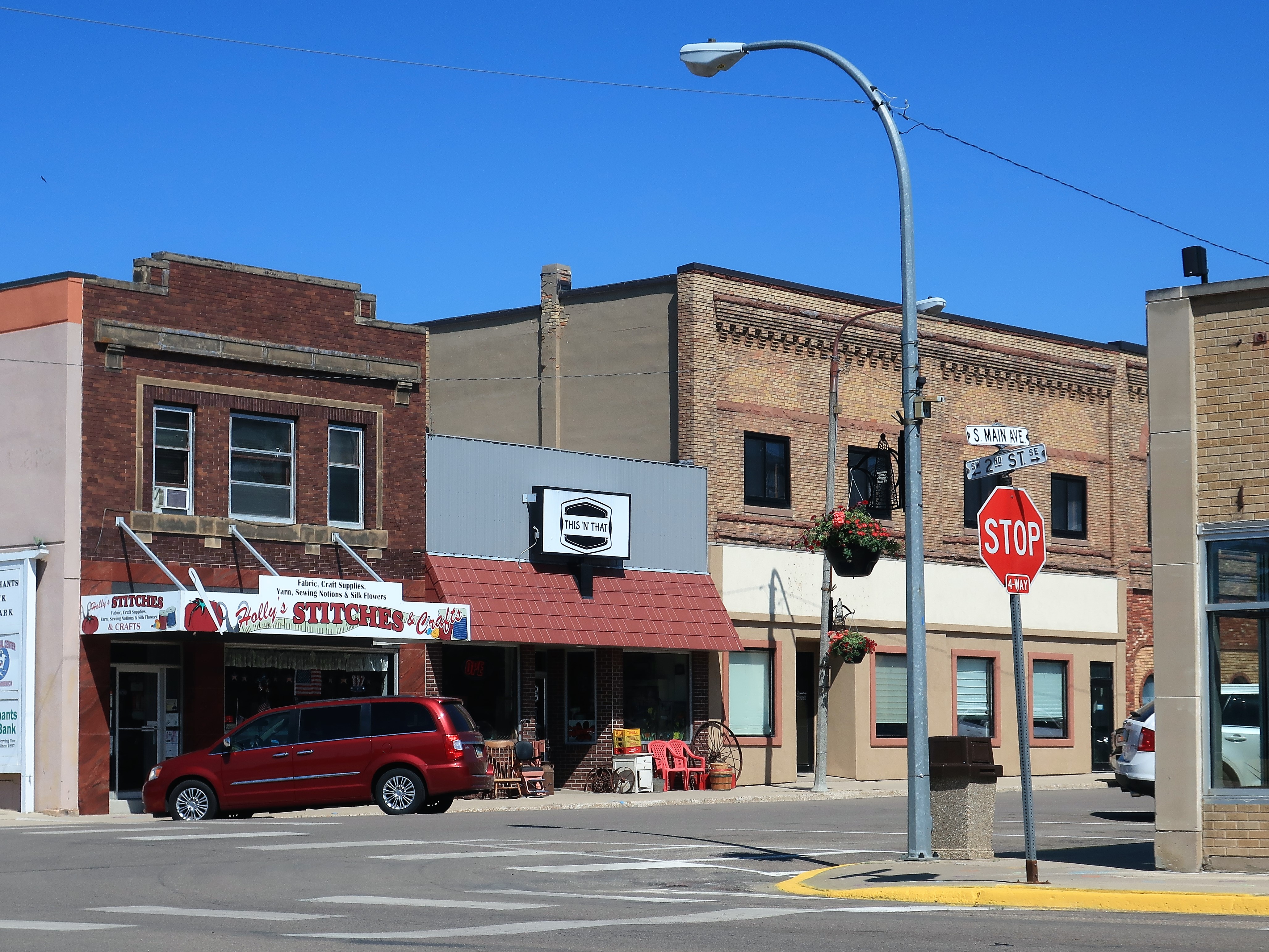
Just 20 miles east of Towner, the railroad town of Rugby, North Dakota was named for the town of Rugby, Warwickshire, England, by the original English financiers of the Great Northern Rail Line. Several other North Dakota towns along this rail line — such as York, Leeds, and Berwick — were similarly named for English country towns.
Below: Rugby train station (served by Amtrak), massive grain elevators storing tons of grain beside the railroad siding, Rugby’s downtown business blocks.

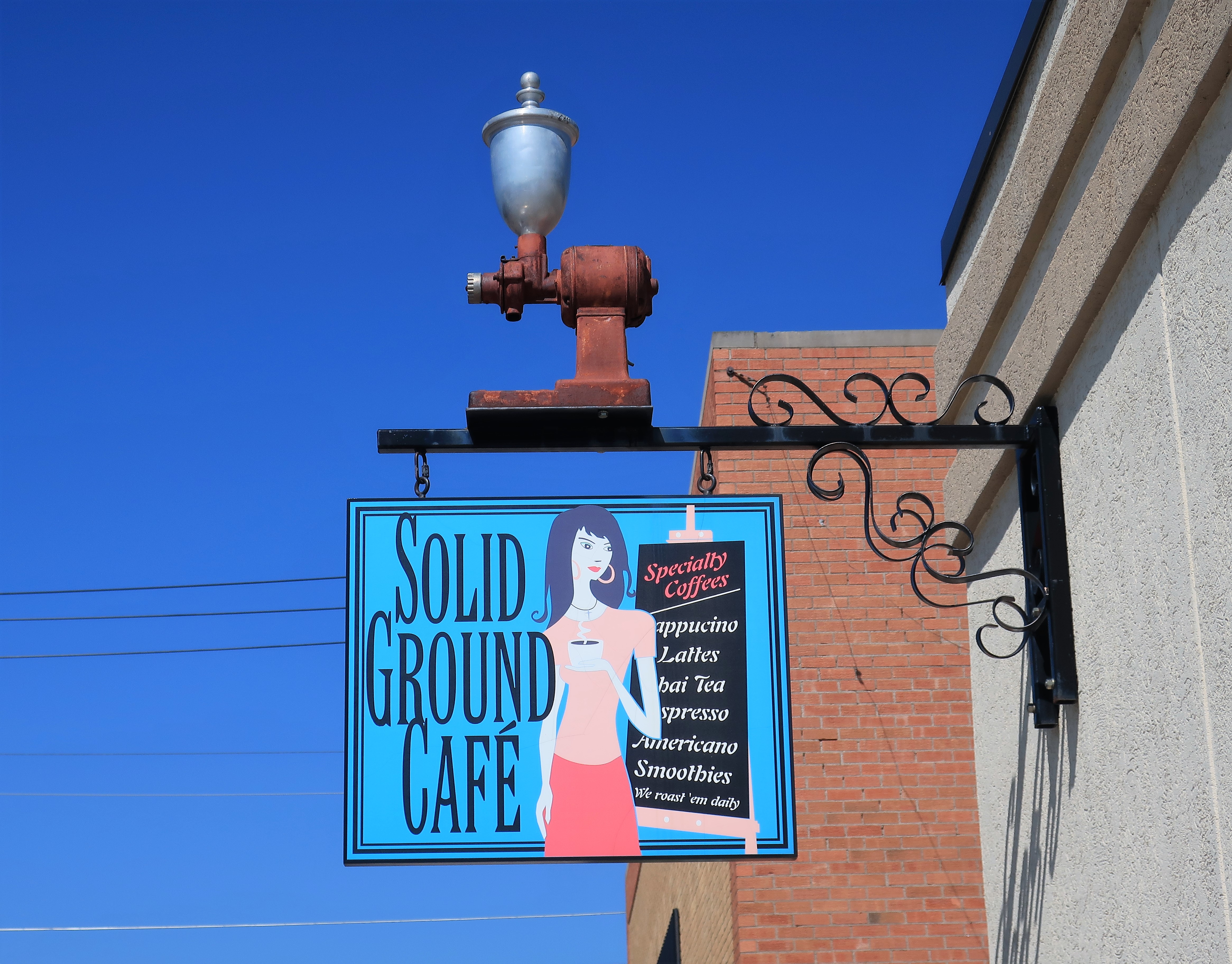
The town of Rugby sports a top-class combination coffee shop and styling salon. Their websites are here: The Solid Ground Cafe (and Stylin You salon and spa)
A few blocks down 2nd Street from the Solid Ground Cafe, the 1910 Pierce County courthouse is an excellent example of the proud and grand engineering typical of America in the late 19th and early 20th Centuries. This was President Teddy Roosevelt’s time — Bully! New settlers to the Dakota territories, many from northern and eastern Europe, left the “Old Country” for the new world, adopting their new country’s shining optimism.

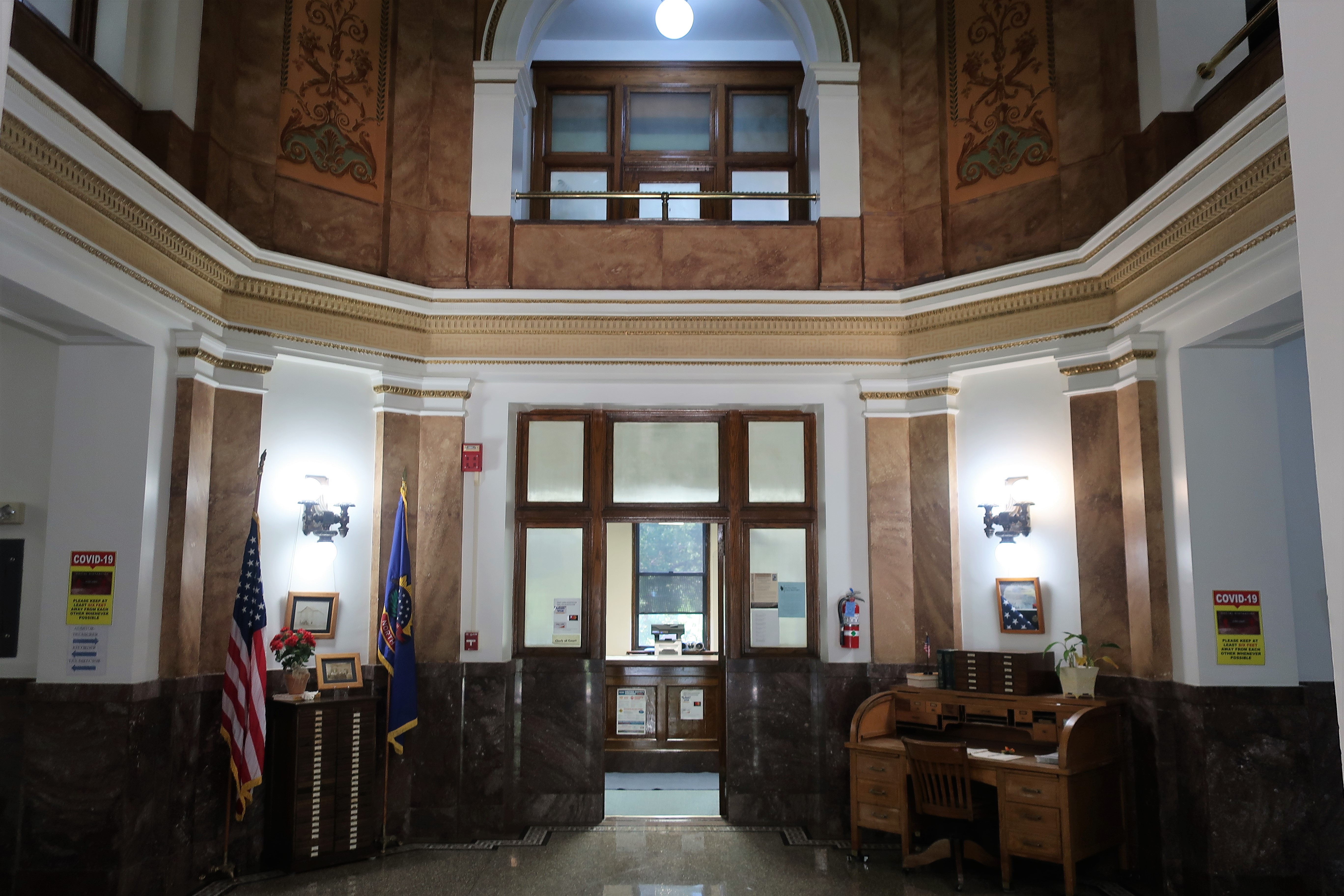
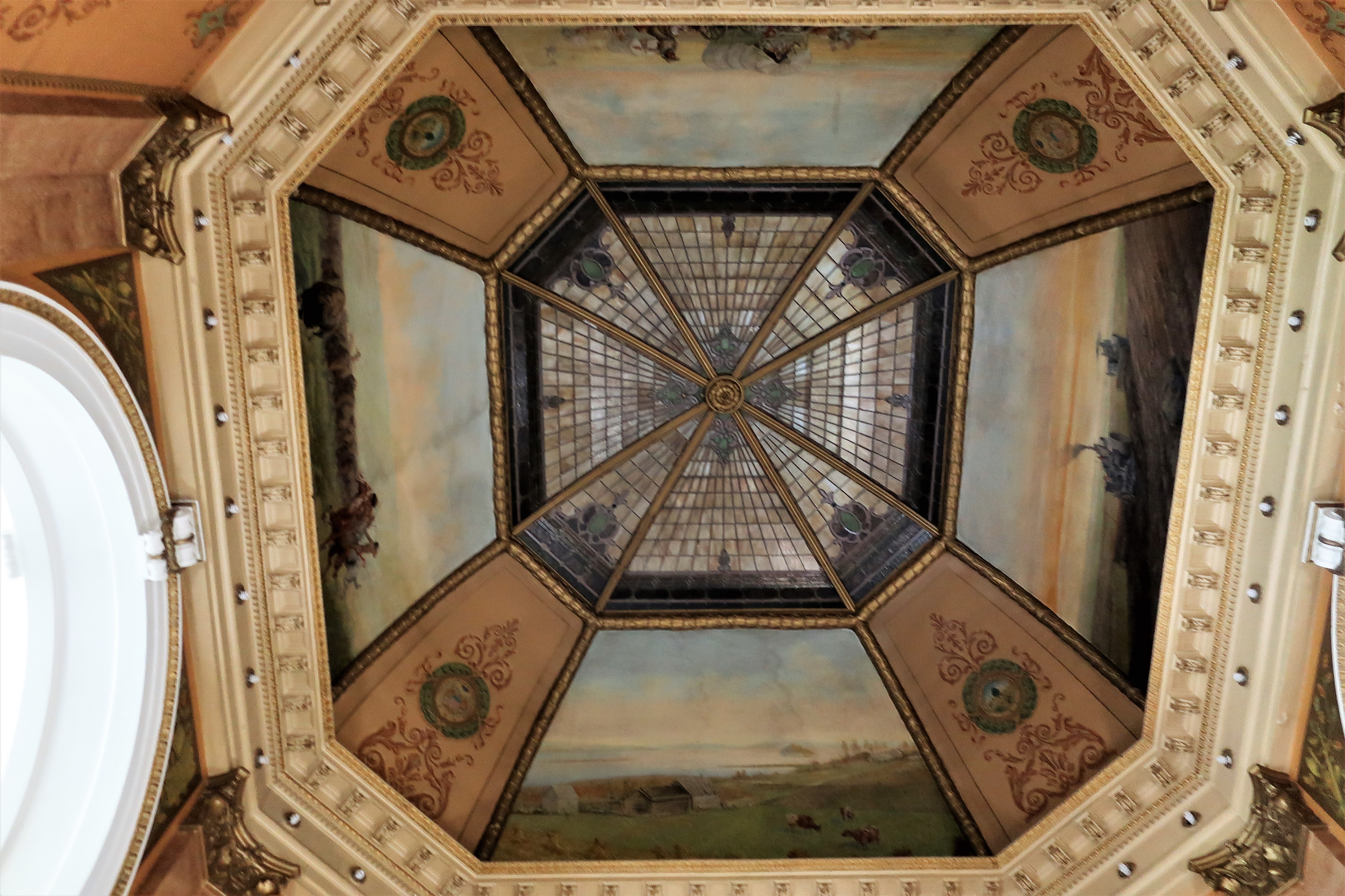
Courthouses built in the late 19th or early 20th centuries usually included a great deal of artistry and detail. They were a focal point of pride in one’s town, one’s state, and especially one’s country. Even though this is a small, rural county, the Pierce County courthouse construction included a grand central cupola and murals depicting county life and history.

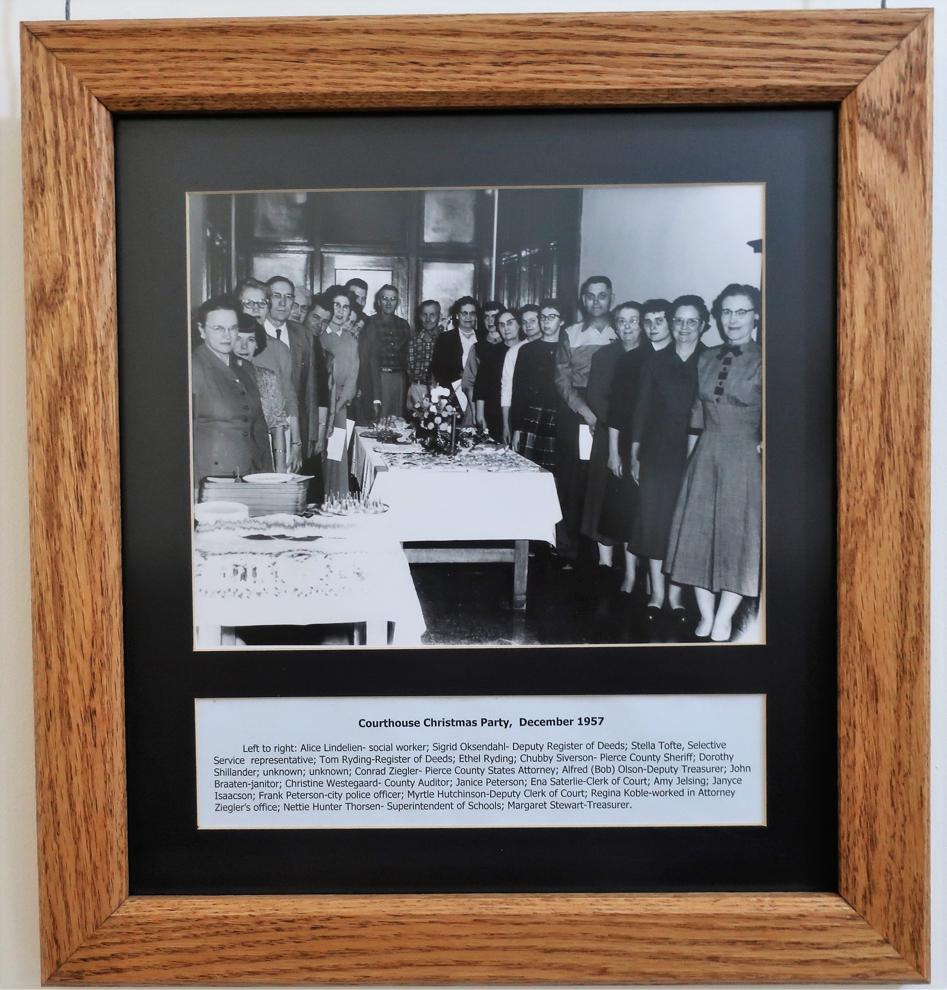
I especially enjoy old photographs hung on the hallway walls of these courthouses because they’re like viewing the contents of a time capsule. Here’s a photo of the 1957 courthouse staff Christmas party, where all classes and ranks gathered together to share some holiday cheer.
For a few more photos of the courthouse, see my earlier blog post on the town of Rugby: The Grand Courthouse in Rugby, North Dakota.
One particular house in Rugby truly stands out from the rest, and it’s intentional:
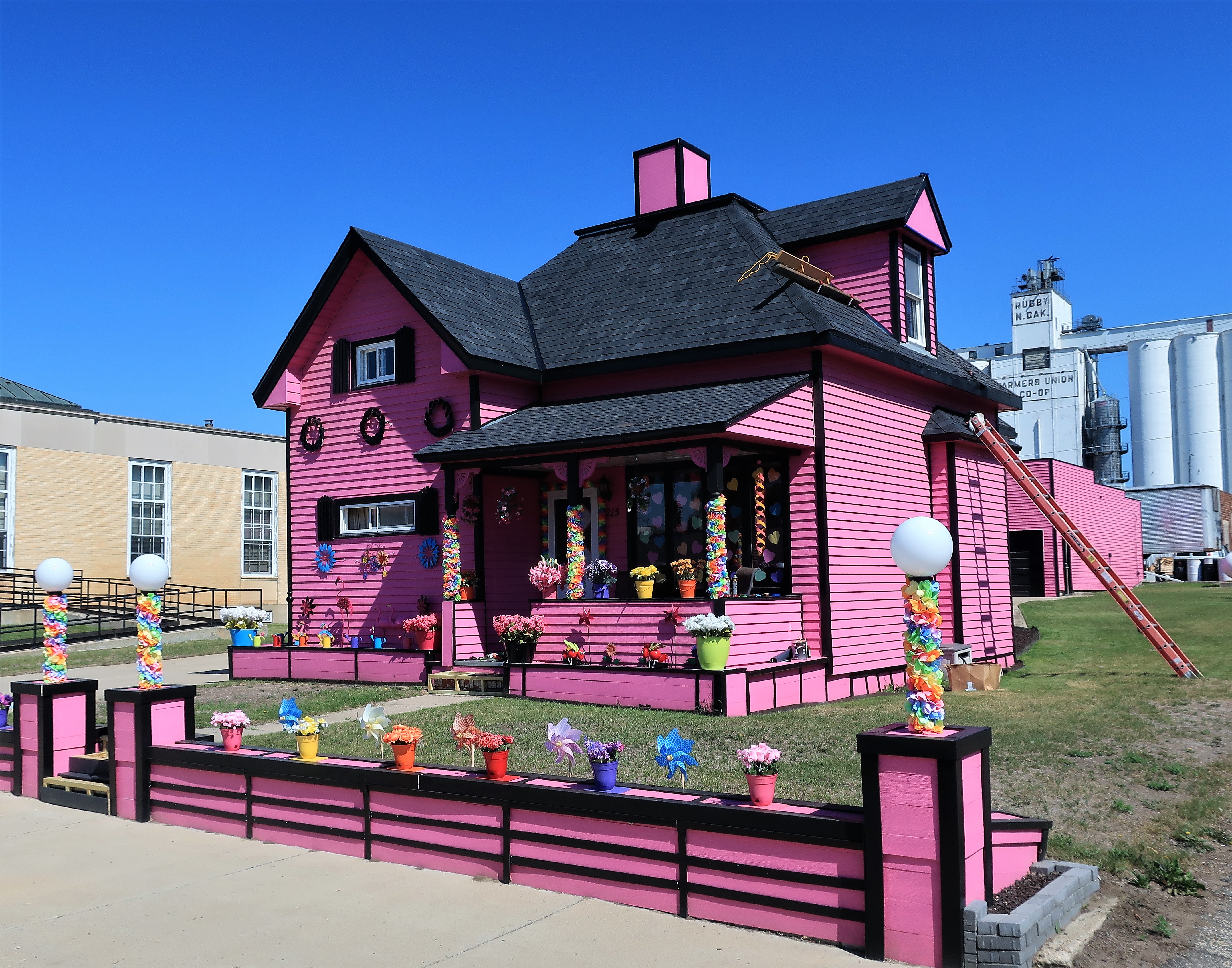
I don’t know the back story of this house, but I can see that the paint job is meticulous so I doubt it was done as a passing fancy.
There’s also a pink garage and basketball hoop behind the house, in the shadow of the town’s grain elevators next to the railroad tracks.
Just a mile or two south of downtown lies a point of interest almost always shown as that red dot on your Rand McNally road map:

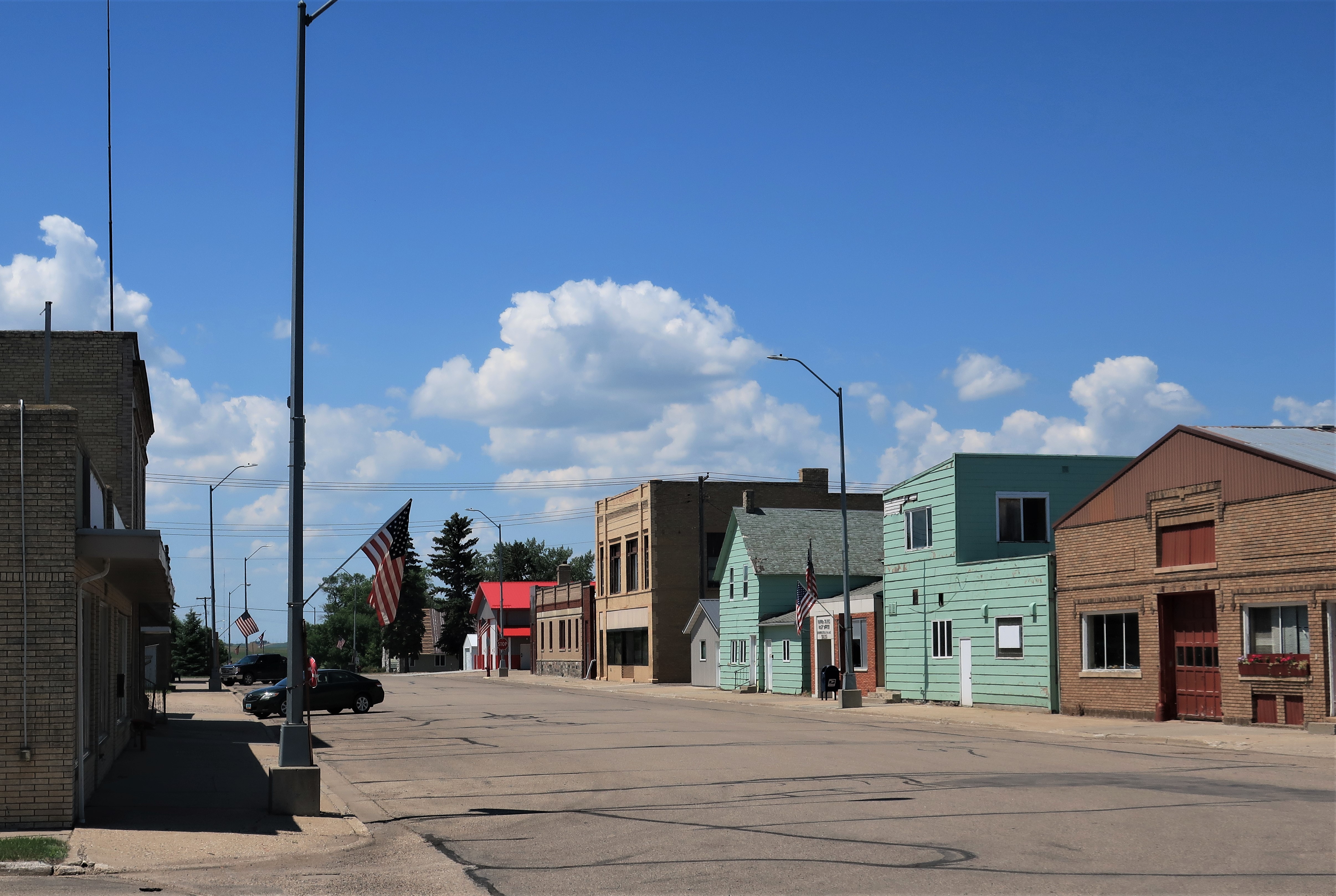
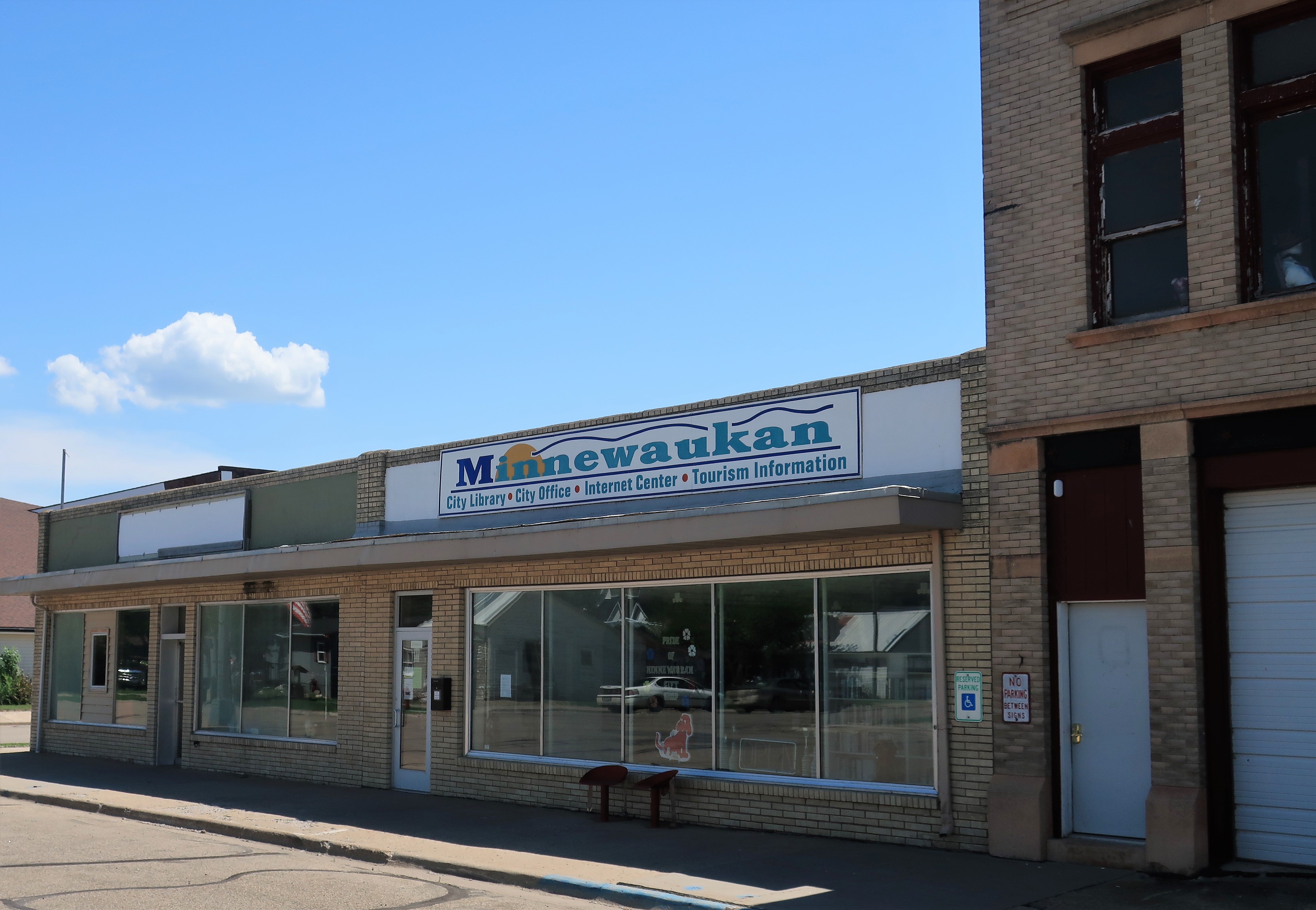
Back on the road again, I’m heading eastward to get to the south side of Devils Lake. The next stop is tiny Minnewaukan (population 224), the county seat of Benson County.

Minnewaukan, North Dakota: a quiet mid-day, mid-summer Main Street; the Minnewaukan City Library/Office and Internet center; the Dakota Spirits liquor and convenience store next to the offices of James Wang, ‘Attornly’.

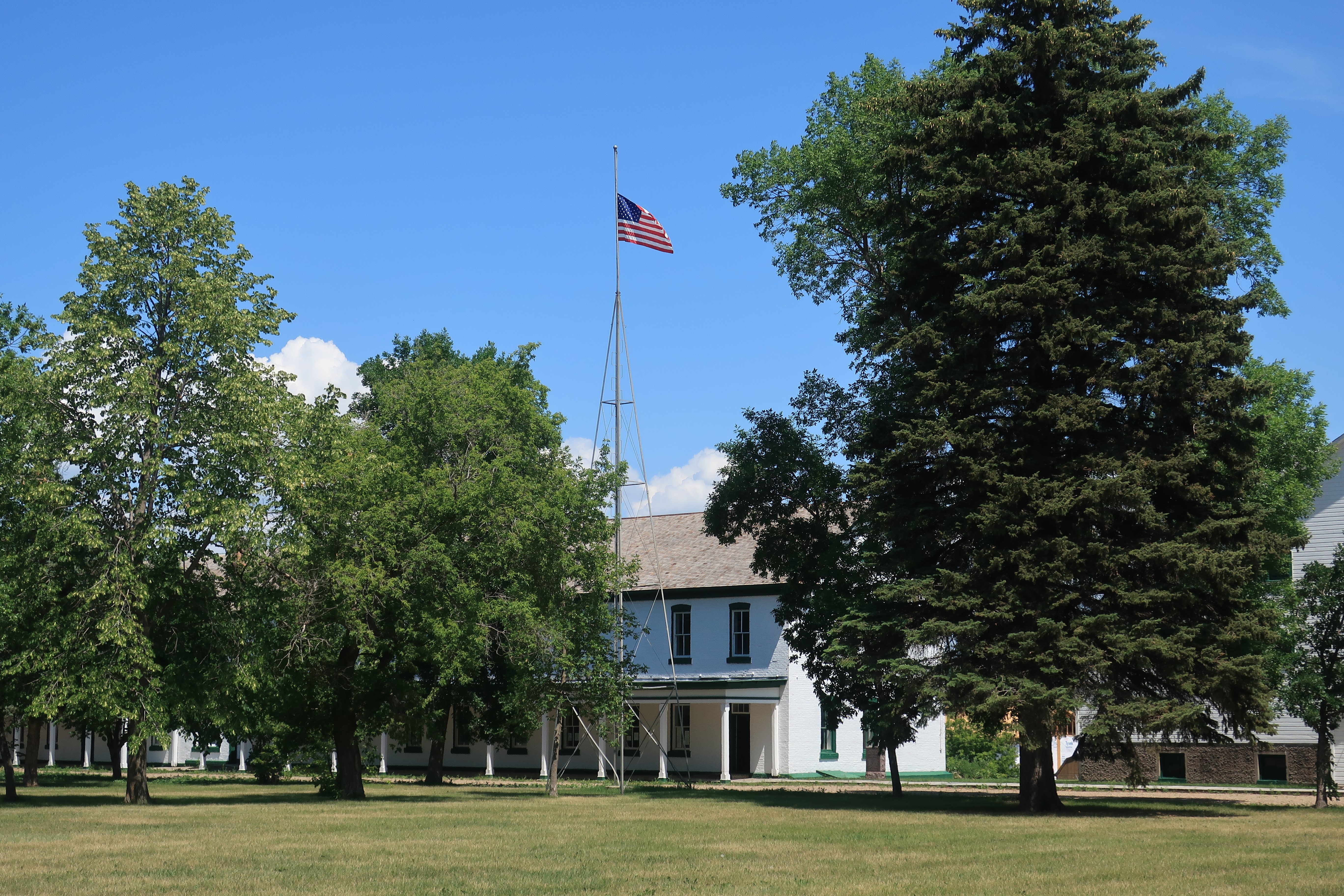
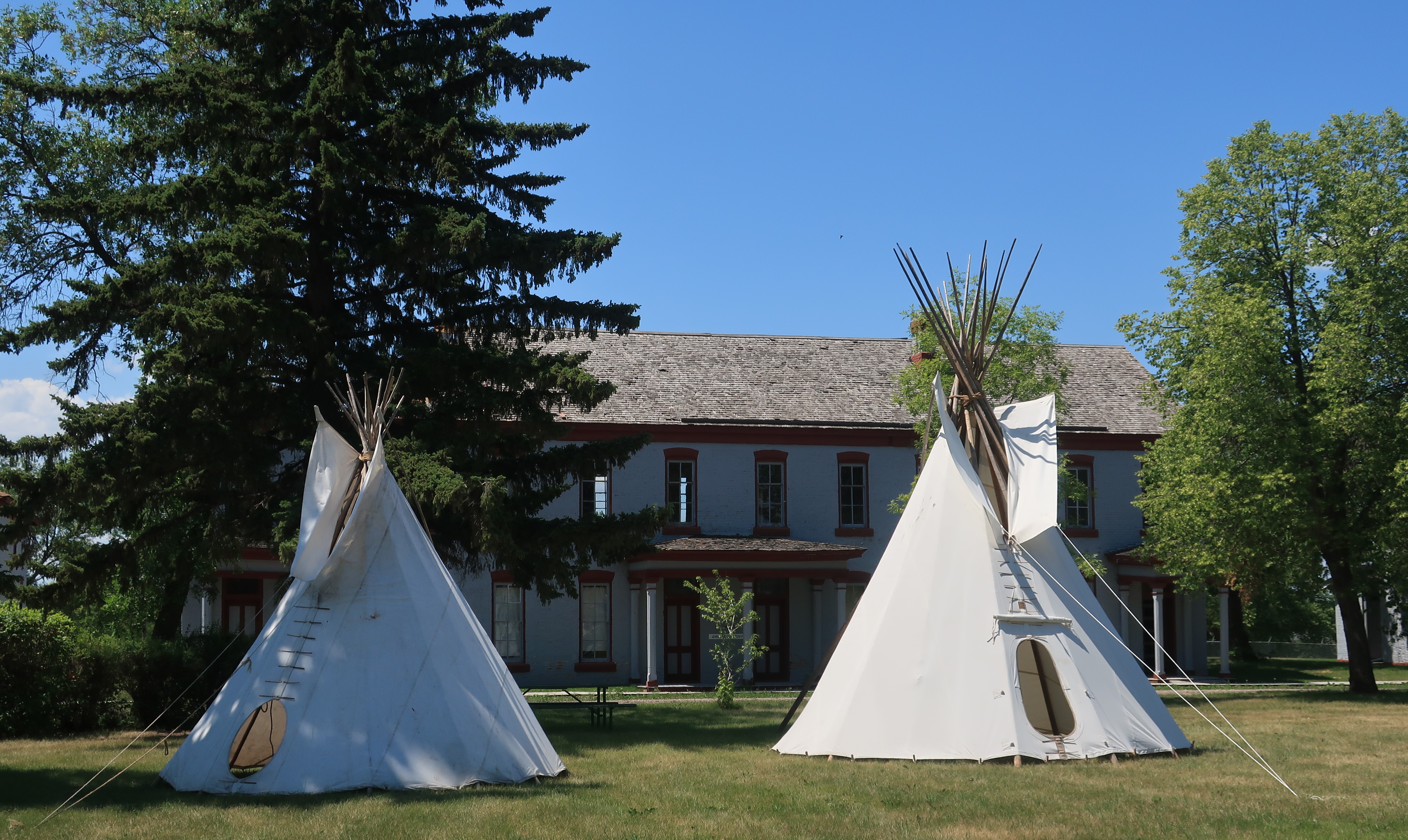
Benson County also includes most of the Spirit Lake Dakota Reservation, home to the Pabaksa, Sisseton, and Wahpeton bands of the Dakota Tribe. The tribe has over 7,000 enrolled members. The reservation grew out of an old army post called Fort Totten, which is a tourist attraction today.
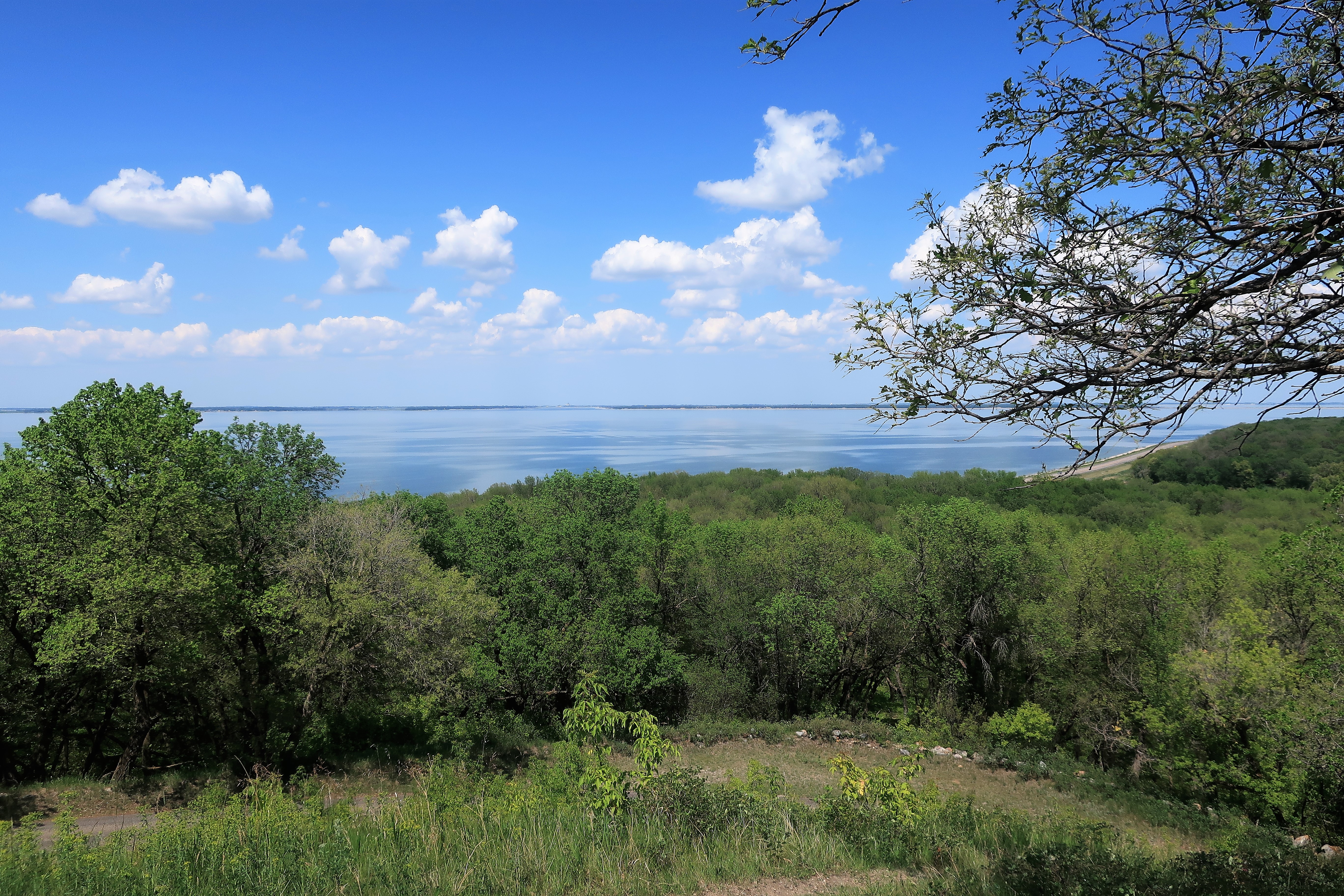
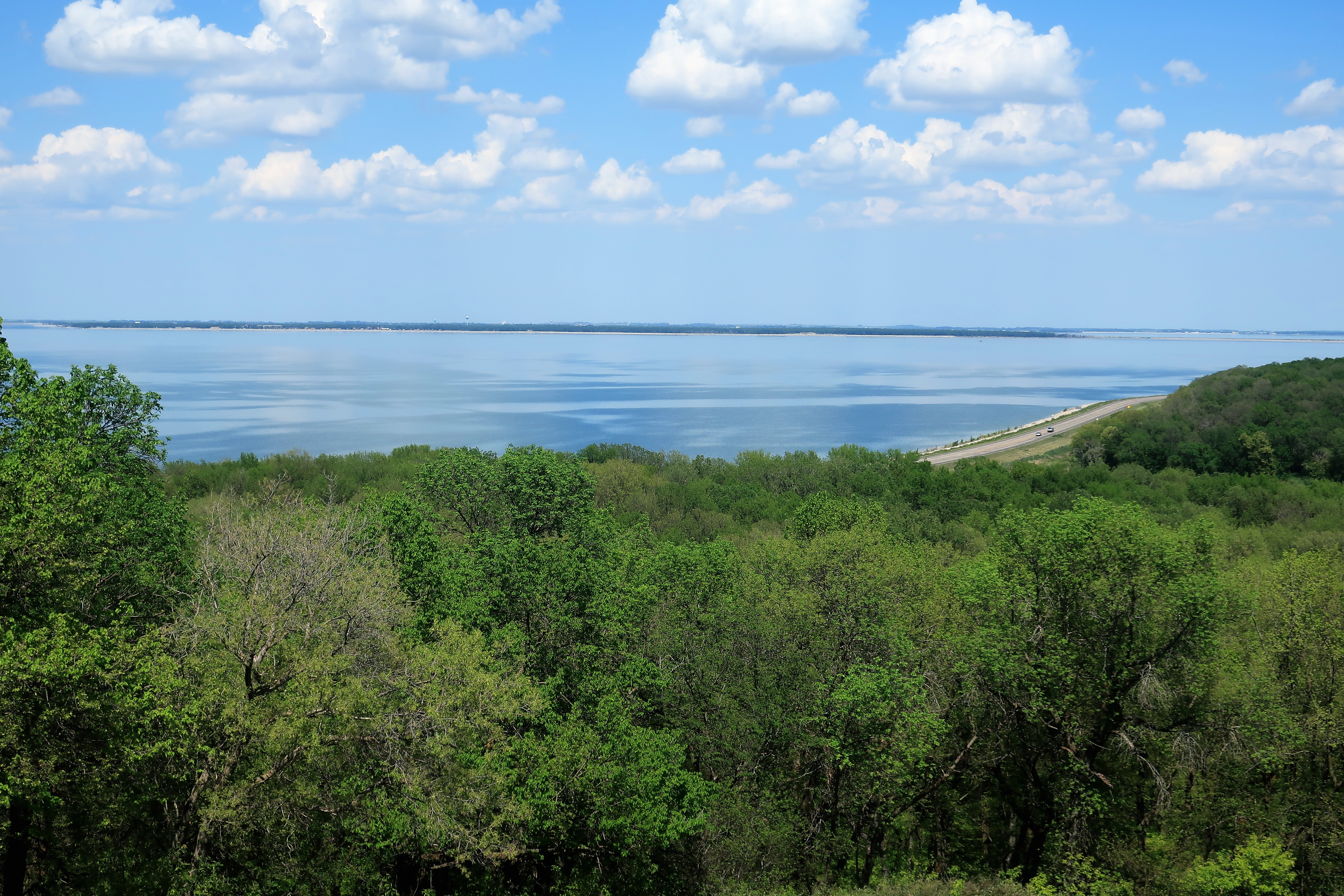
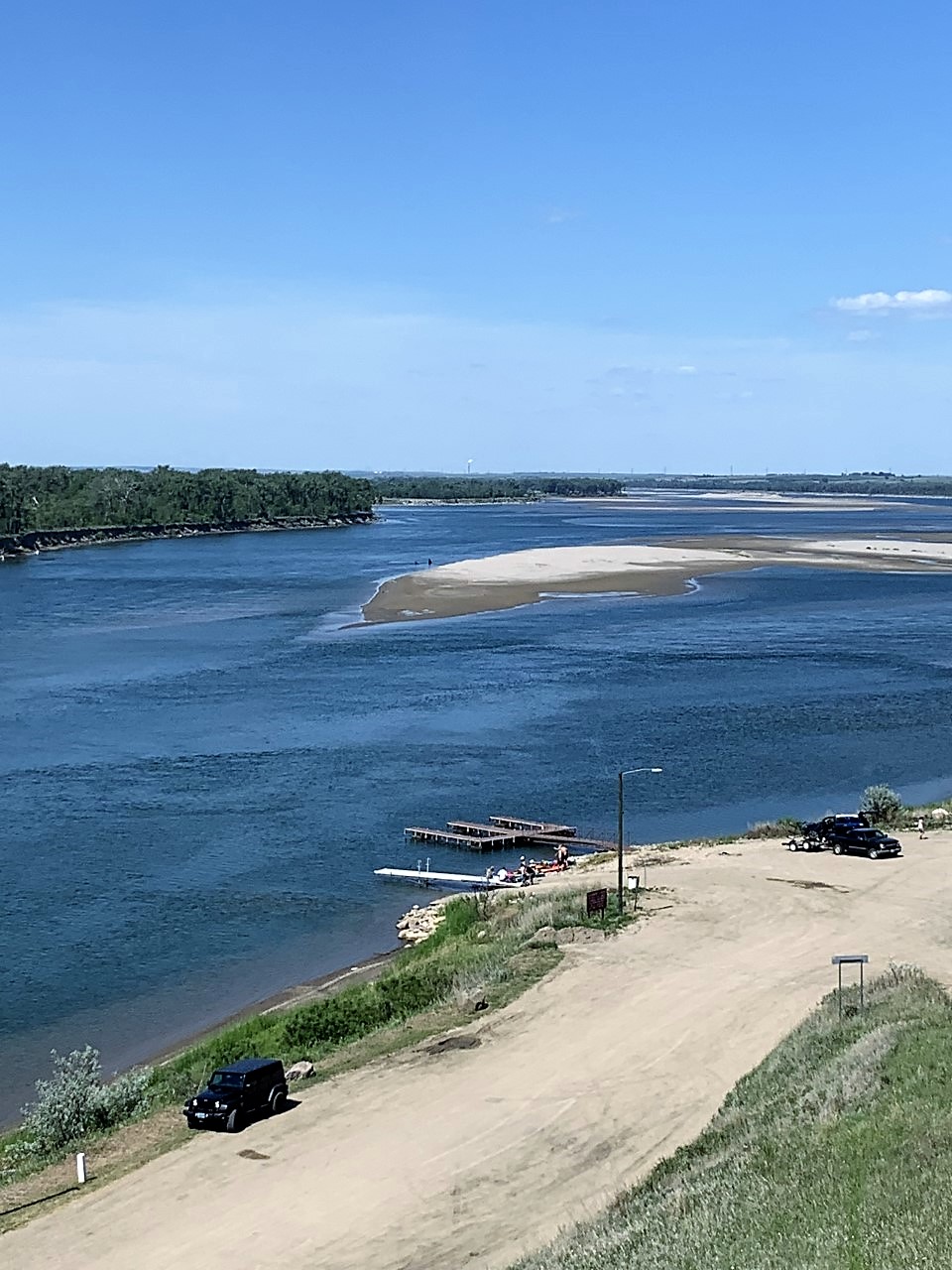
I came to the south side of Devils Lake to drive through White Horse Hill National Game Preserve (formerly Sully’s Hill National Game Preserve) for some photographs and a hilltop view of Devils Lake. I got what I came for.

The preserve includes some hiking trails, scenic drives, and a visitors’ center. I wanted to get to a hilltop overlooking Devils Lake.
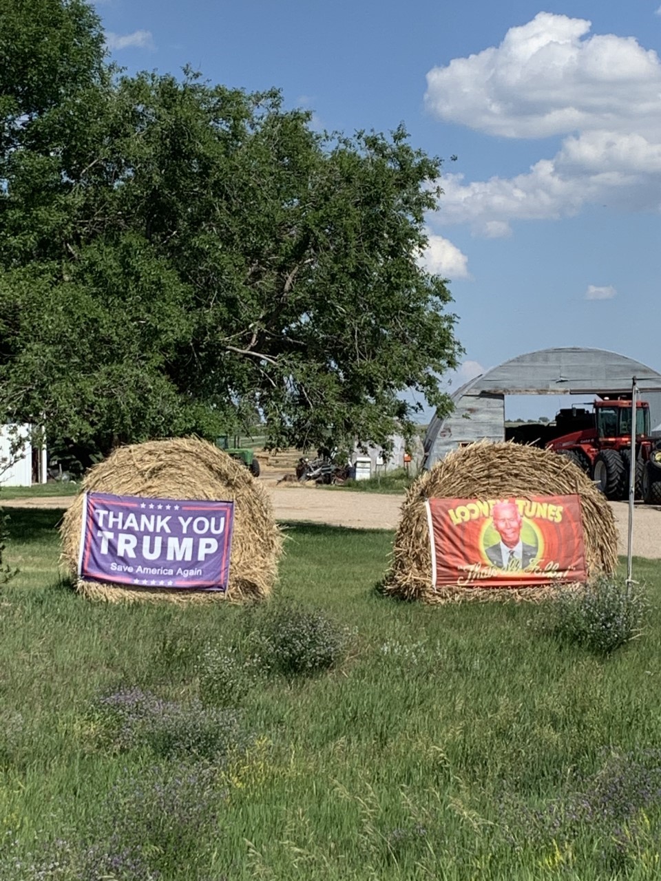
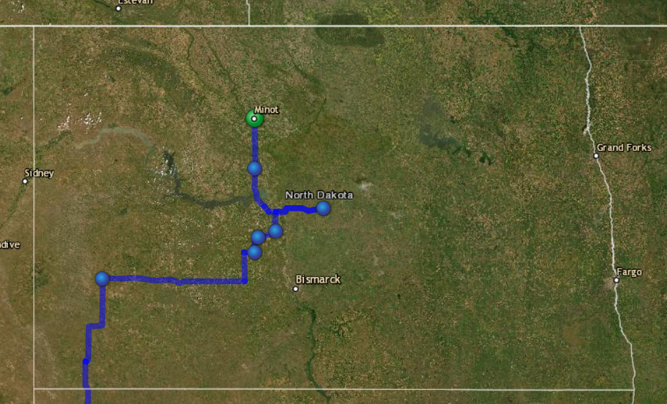
After getting in some spectacular views, it was time to head west again to get some dinner and a good night’s sleep in Minot, a decent town that I’ve stayed at before. The 2-hour drive to Minot took me through 100 miles of rural North Dakota farms and fields. The locals are vocal supporters of their country and its former president — displays such as this one are fairly common:
By the way, this particular drive passes through the town of Velva, population 1,000, and home to Dot’s Pretzels, a homegrown-turned-national snack food brand.
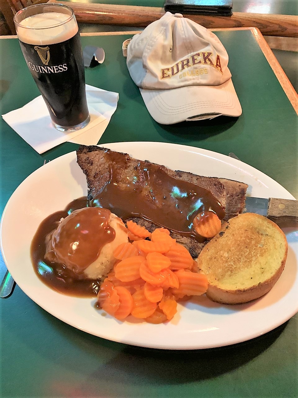
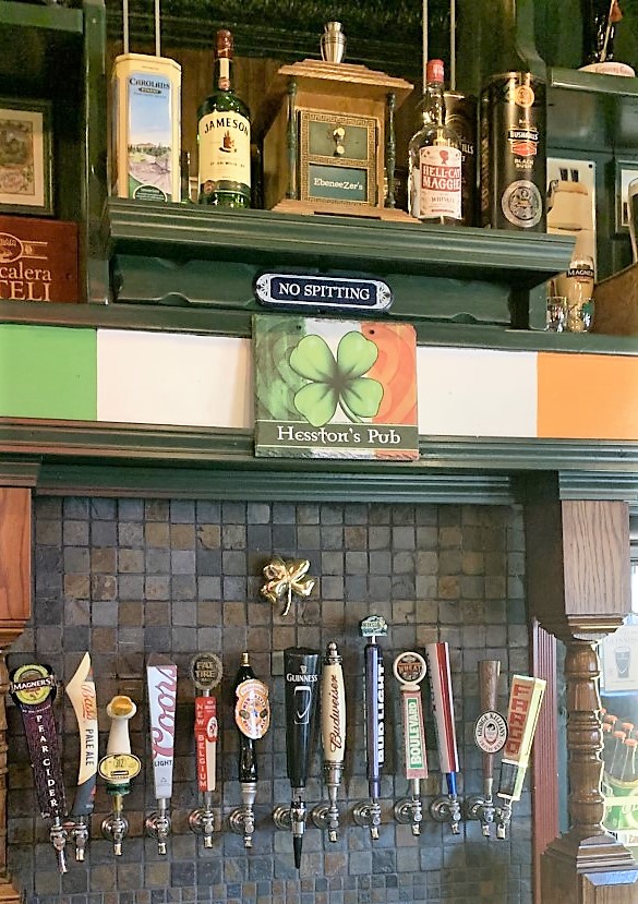
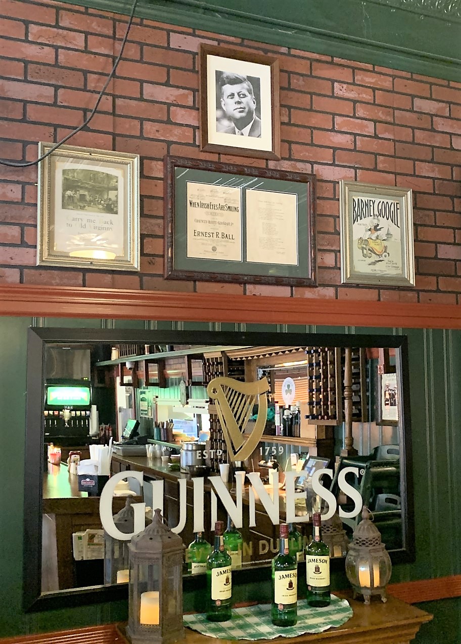
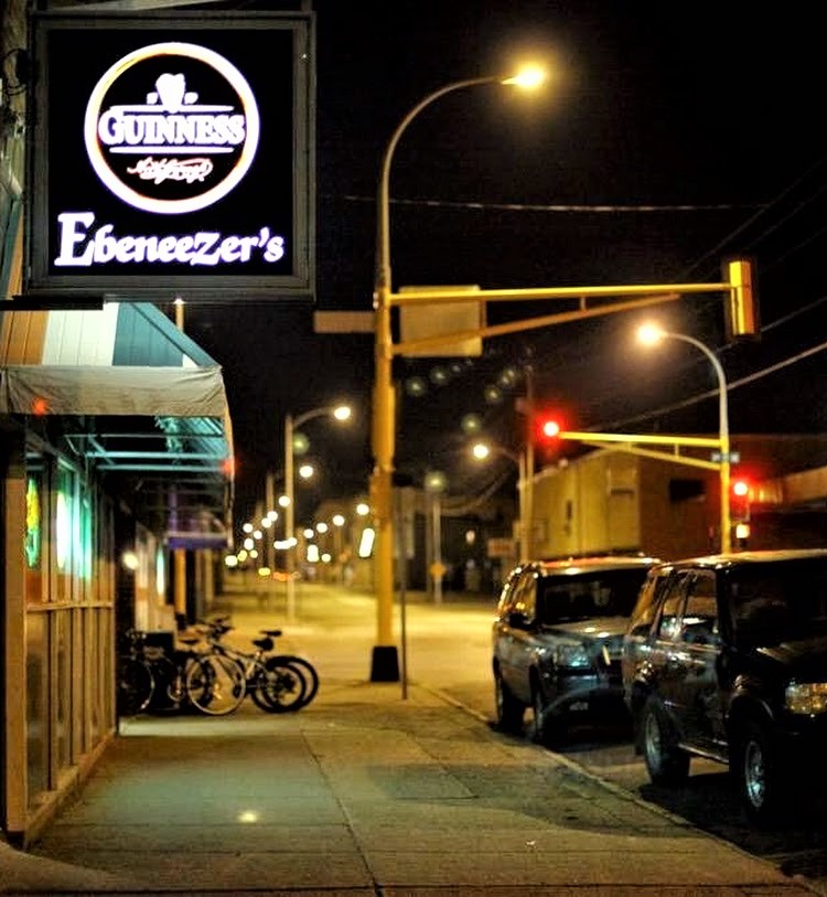
I arrived in Minot thirsty and in time for dinner. When in Minot I usually choose Ebeneezer’s Irish Pub. The roast beef plate was the Thursday special. For entertainment, I got to enjoy a few baseball games on the big screen. In a separate room, a local piano player sang “Desperado” and other popular songs for the crowd.
With a population of over 40,000 and the large Minot Air Force Base just north of town, Minot offers plenty of reasonably-priced lodging choices, many on the southern edge of town. Checking prices, I stayed at the Noble Inn in Minot.
Freedom Voyage Day 7, Friday, July 2, 2021: Minot, North Dakota to Gillette, Wyoming
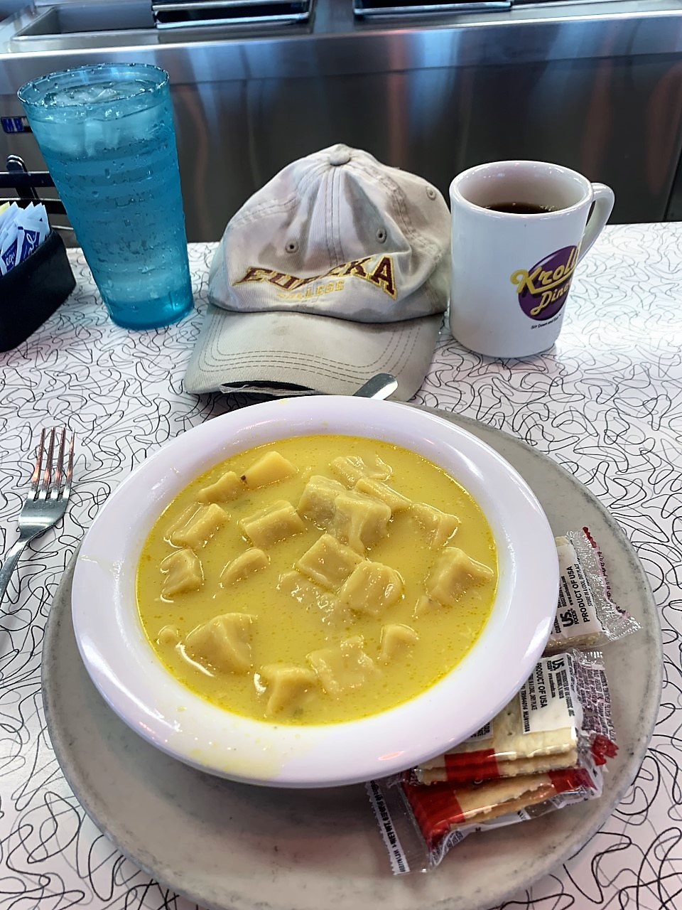
Good Friday morning from Minot! Although Minot is probably more Scandinavian than German, I couldn’t resist the call of Kroll’s German Diner (Güt for da Gut) on the south end of town. I particularly had to try their highly-touted knoephla soup this time — a mixture of knoephla dumplings and potato chunks in a buttery broth. Yes, it was delicious.

After breakfast, I drove south through the beautiful North Dakota prairie, passing over the Missouri Coteau and its plethora of sloughs — also known as kettle lakes or prairie potholes. These sloughs are the result of ancient glacier activity which left small, water-filled depressions in the surrounding plains. Since it was still early July and these canola fields hadn’t yet bloomed, here’s a photo I took during my travels to Minot in late July 2020:
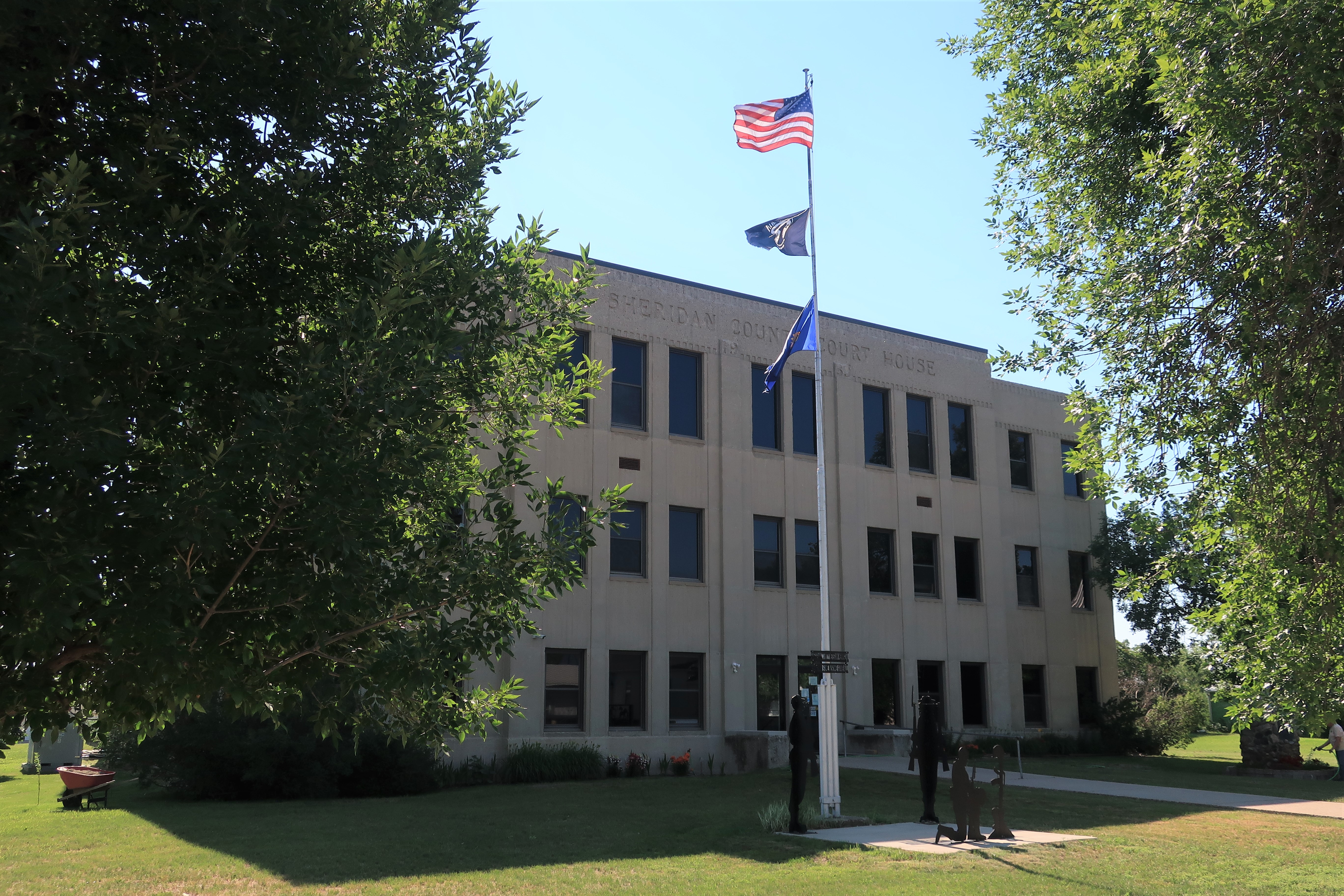
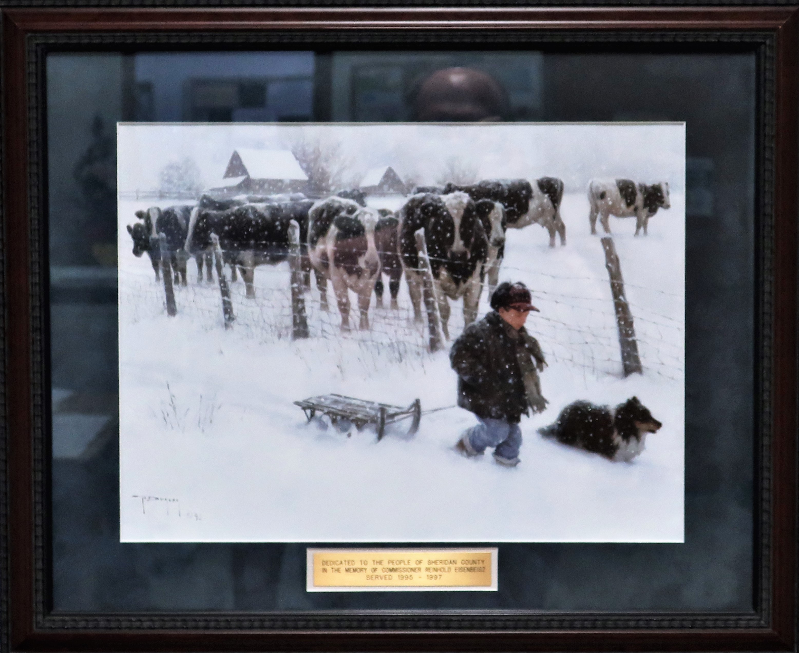
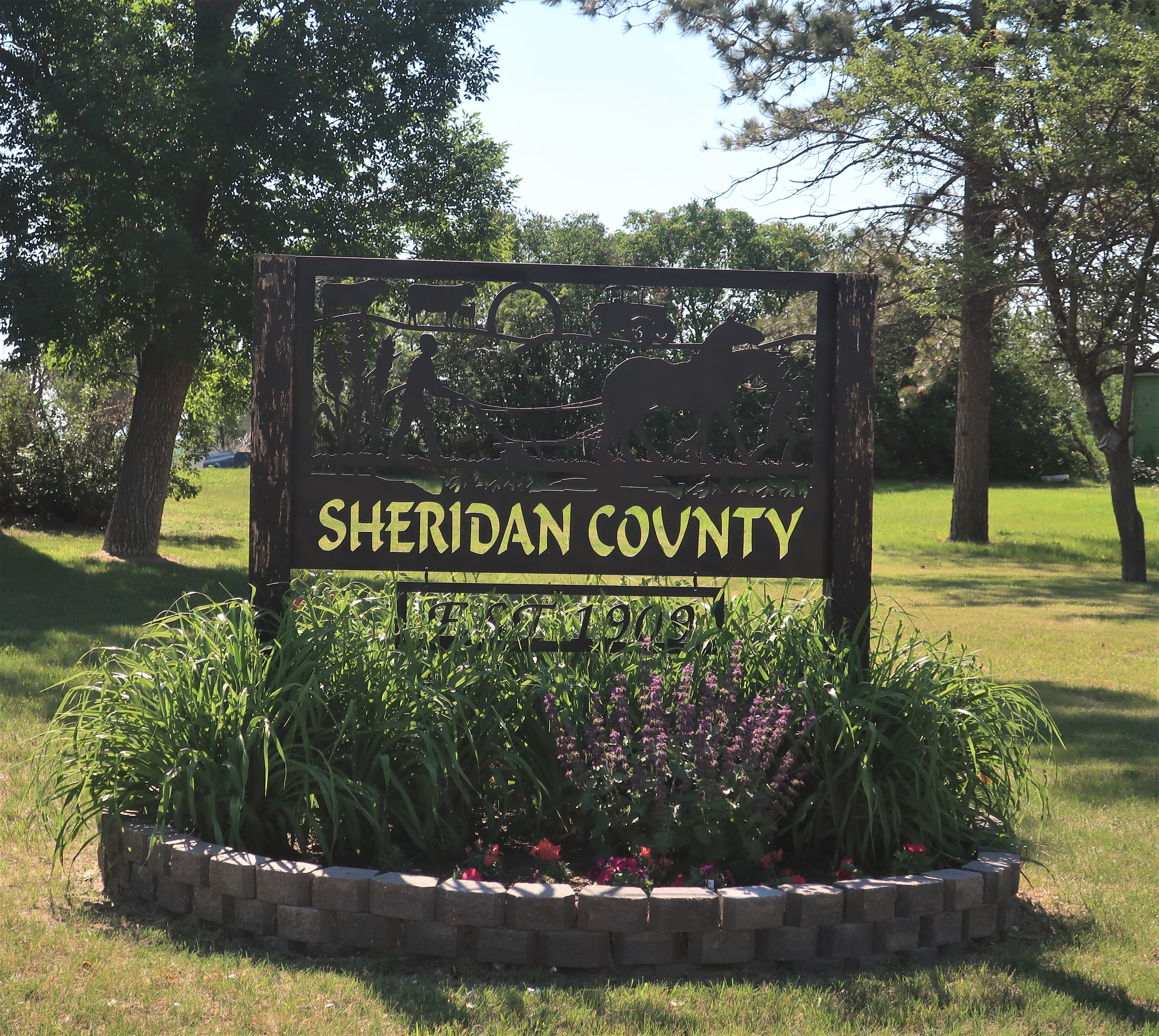
Further to the south and east, the town of McClusky, North Dakota, population 380, holds its place among these prairies. The Sheridan County courthouse is here in McClusky. I caught a morning photo of the 1940 structure, and a photo of snowy county life from a picture hanging on the hallway inside the courthouse.
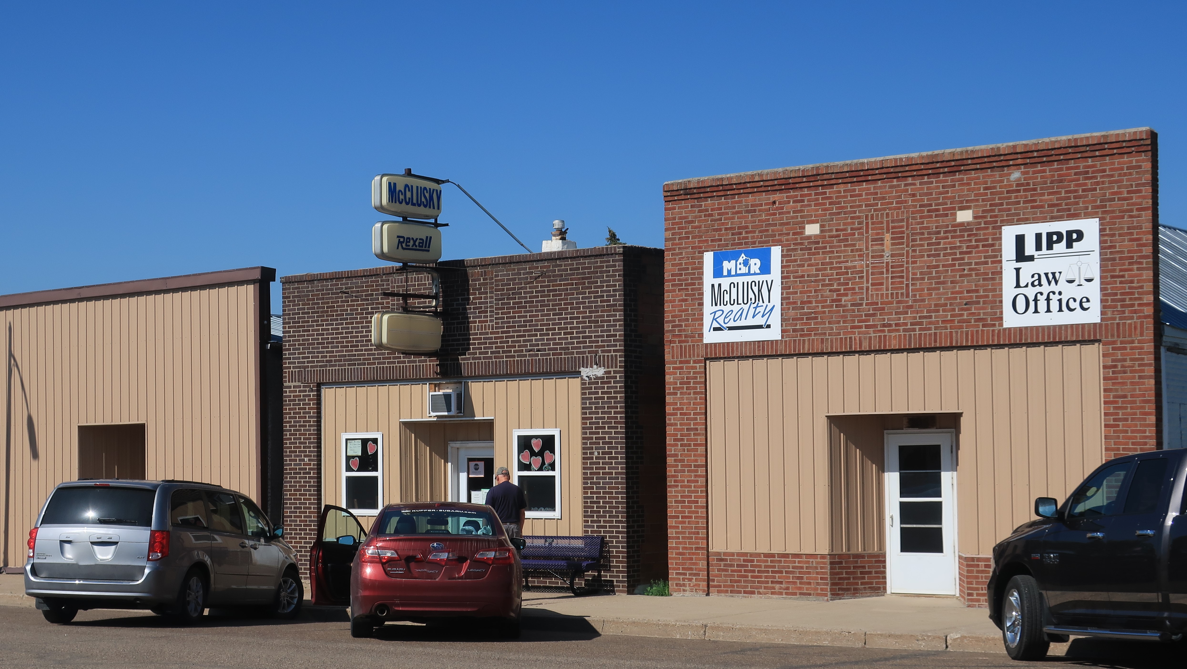
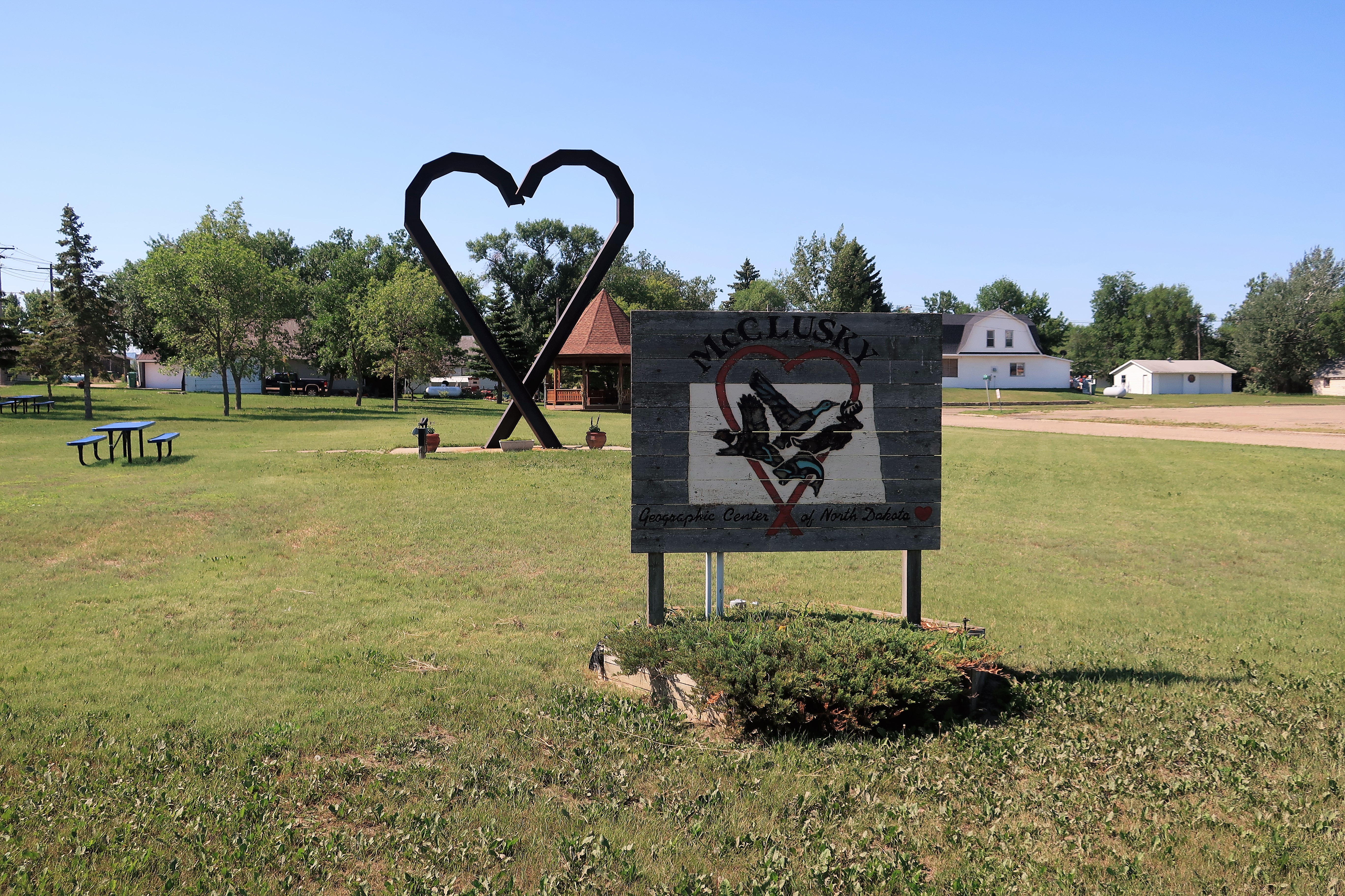
Here are a few photos of McClusky, “Heart of North Dakota”: (clockwise from top left) water tower; courthouse marker; Main Street pharmacy, realtor and law office; and town park.

It’s Friday. This has been a great week but it’s time to head home. My stop for the night will be in Gillette, Wyoming, 7 hours and 450 miles away, but there’s still enough time to stop for a photo or two should a good picture present itself.
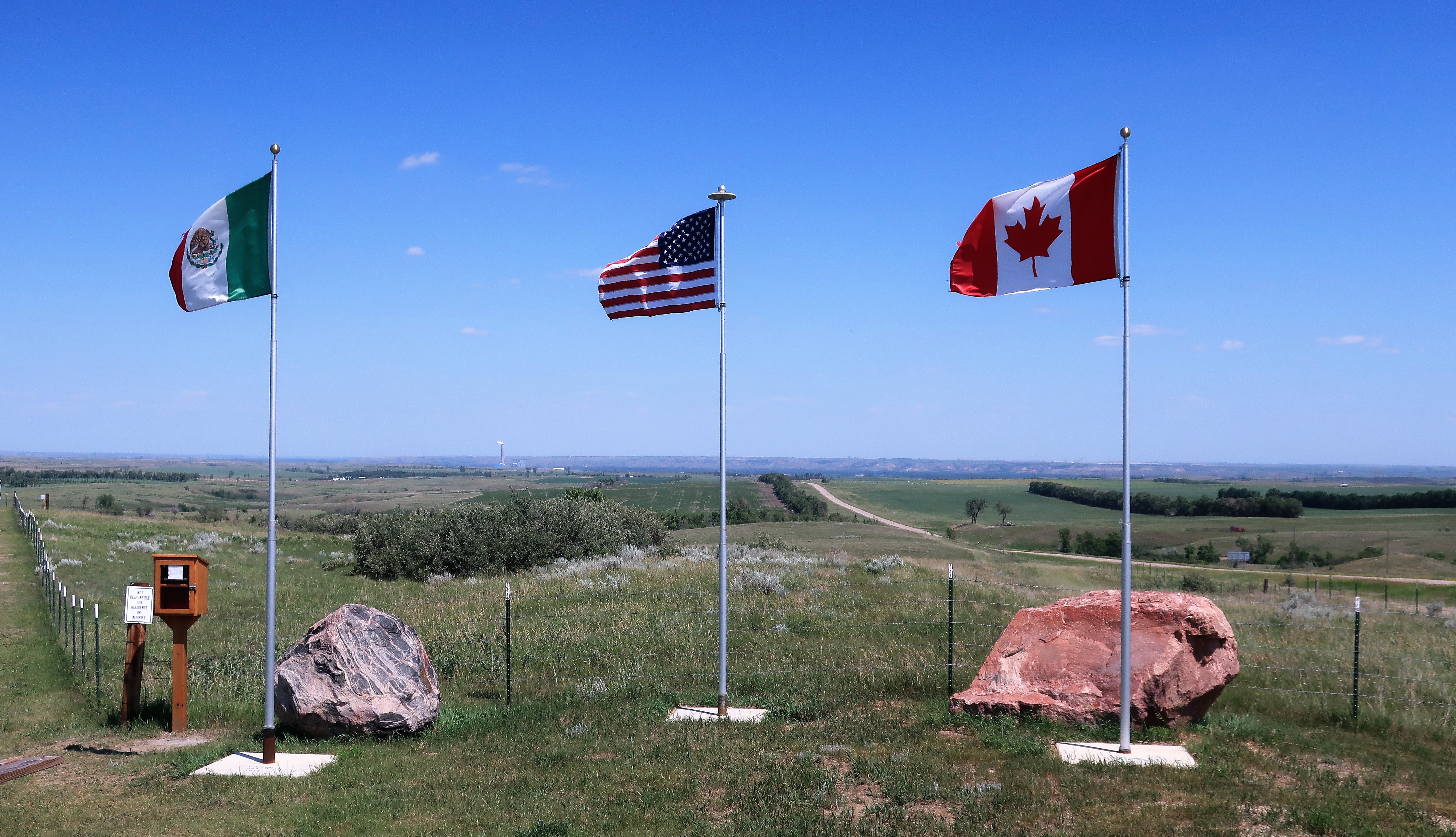
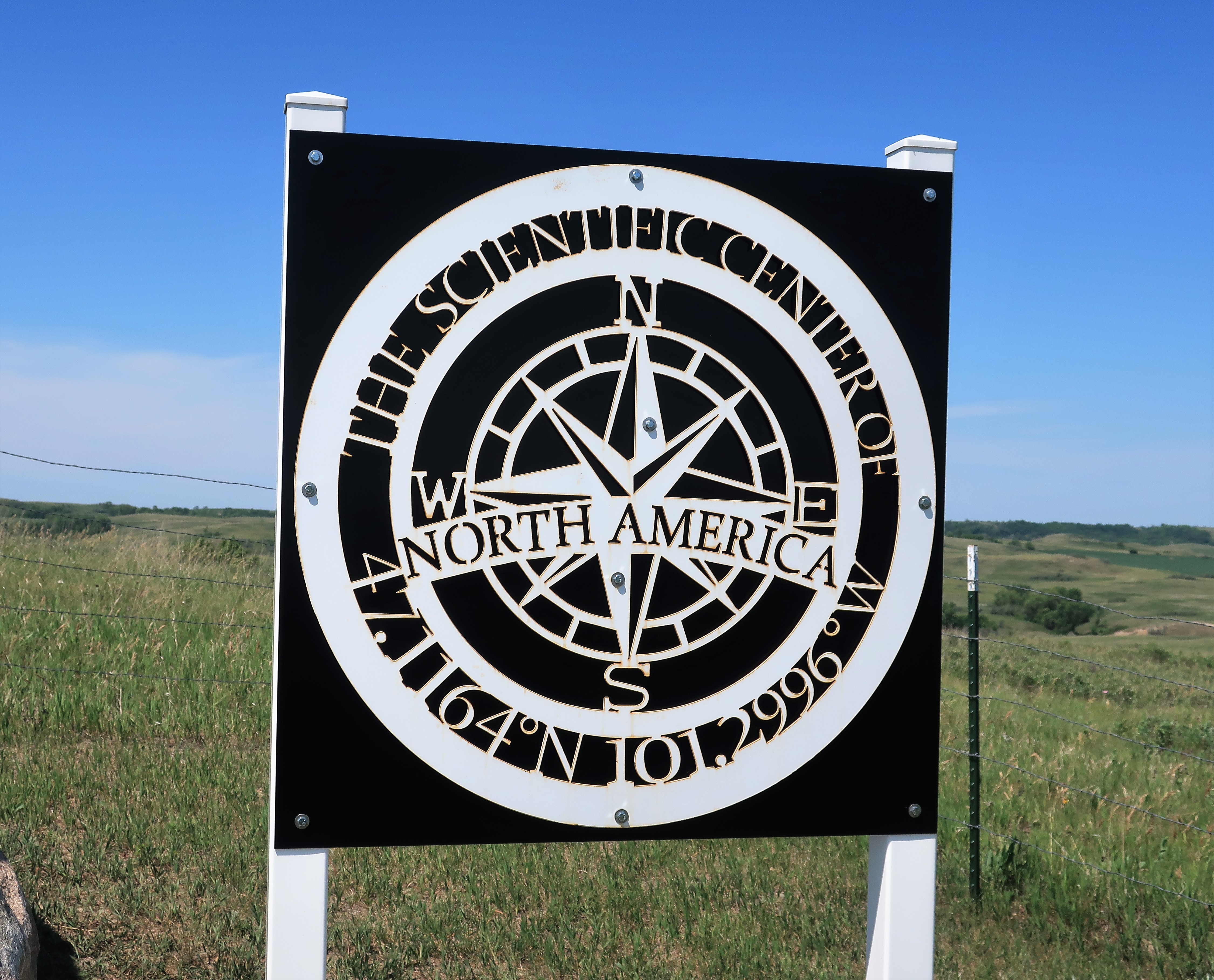
Traveling along in the afternoon, I came across signs for the “Scientific Geographical Center of North America” near (by extraordinary coincidence) the town of Center, North Dakota. This central point was found using more modern calculations than those used when Rugby, North Dakota, was determined to be the center of North America. Center, North Dakota, was established in 1902, decades before modern calculations were done.
After passing through Bowman, North Dakota, and western South Dakota down to Spearfish, I crossed into Wyoming and made it to Gillette by nightfall.
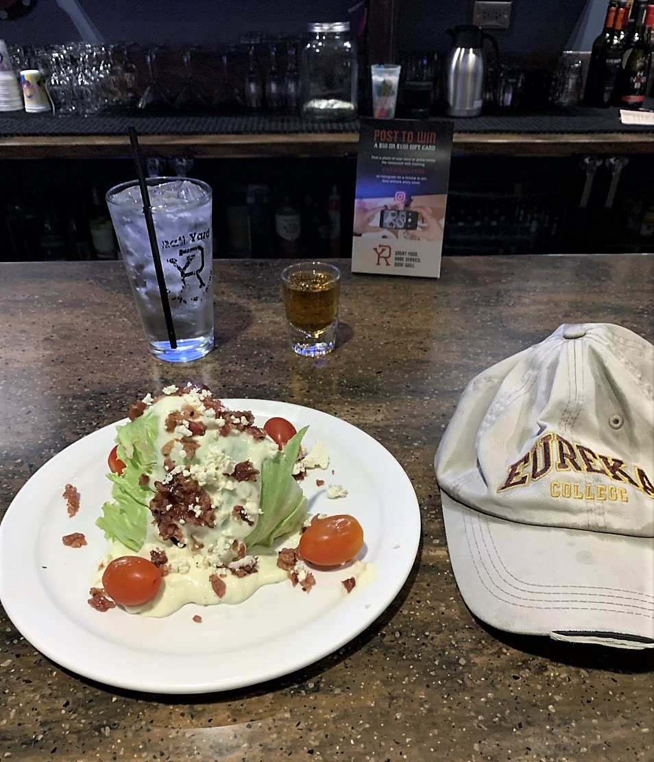
This is the Railyard Bar & Grille in Gillette, a fine steakhouse for my “last supper.” I return home to Colorado Springs tomorrow so I decided to punctuate this trip with a fine steak dinner and a wedge salad, plus a shot of Jack Daniels. The steaks out west always seem to be better and at lower prices.

Again, the town of Gillette, Wyoming offers many choices for decent lodging. This time I opted for the Arbuckle Lodge, a favorite for both hunters and rock bands playing the CAM-PLEX multi-event facilities across the street.
Freedom Voyage Day 8, Saturday, July 3, 2021: Gillette, Wyoming to Colorado Springs
Home now. I hope you enjoyed the trip!
All photos were taken by the author in June and July 2021, except for the photo of the exterior of Ebeneezer’s Pub in Minot.
A list of all Freedom Voyage posts in TimManBlog can be found here.
I do this as a hobby and not for a living (yet) — but donations are happily accepted if you’d like to help defer my costs.
Thanks,
Tim
Donations are NOT tax-deductible under U.S. law…but you knew that.
Make a one-time donation
Make a monthly donation
Make a yearly donation
Choose an amount
Or enter a custom amount
Your contribution is appreciated.
Your contribution is appreciated.
Your contribution is appreciated.
