On April 19, 1775, the battles of Lexington and Concord were fought in Middlesex County, Massachusetts, commencing the American Revolution. Each year on Patriot’s Day, the battles are re-enacted in remembrance of the day when the rights of men were asserted against despotic power.
I had long wished to be in Lexington, Massachusetts on April 19th and had my chance to go a few years ago. I stayed the night before in nearby Woburn, awoke at 3:00 am, and arrived in Lexington in the 4:00 am darkness. I wasn’t the first to arrive.
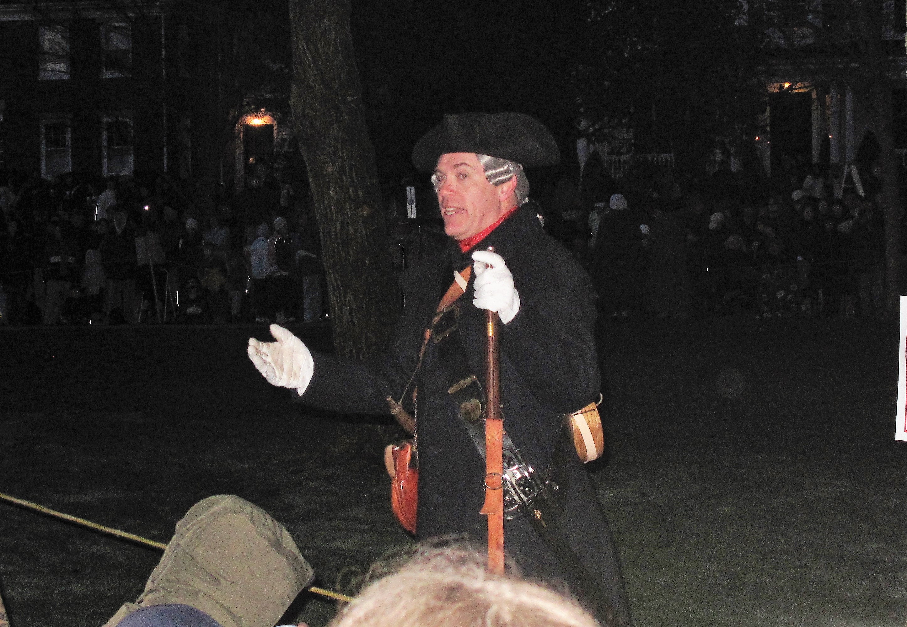
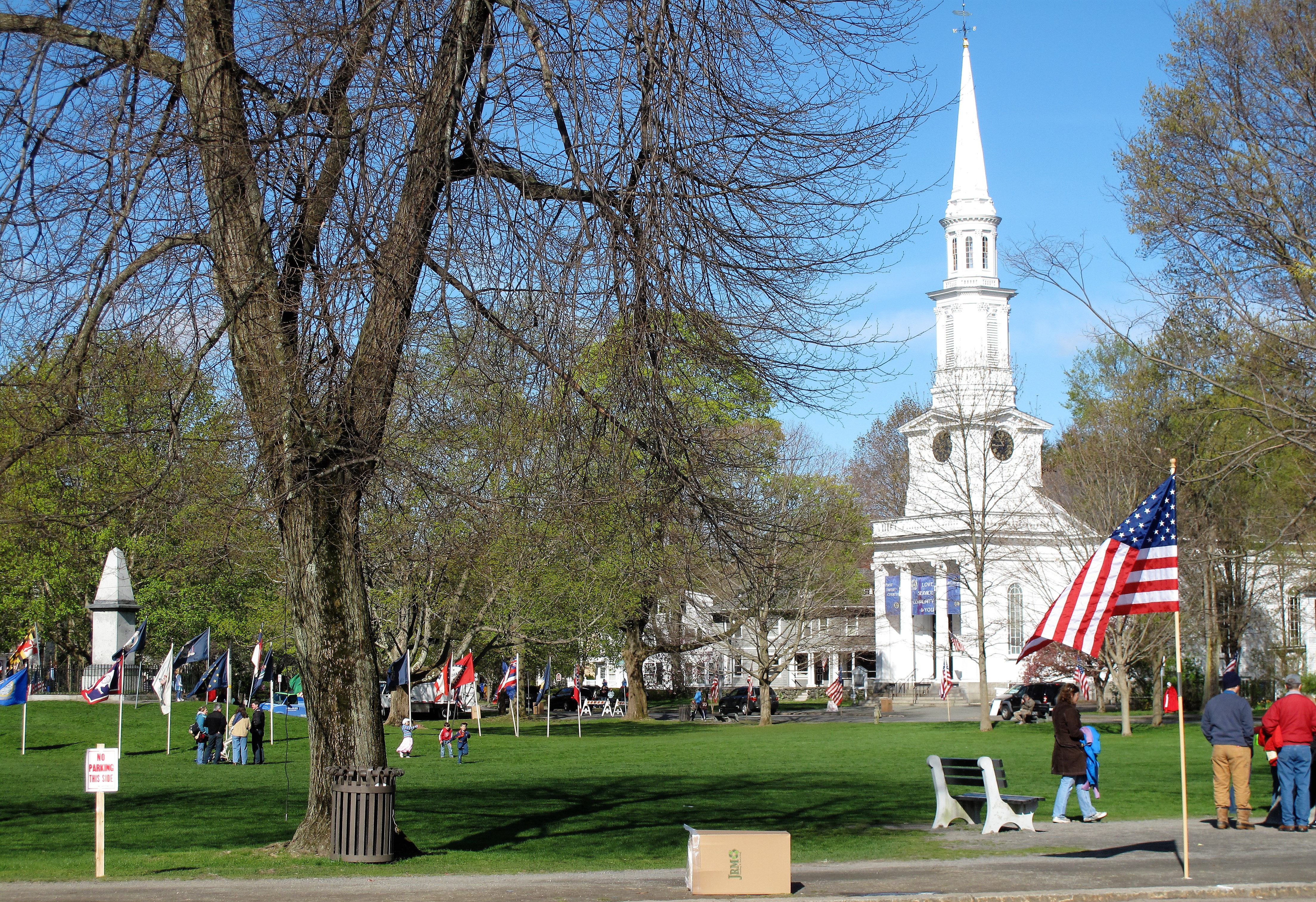
The crowds gathered before dawn on Lexington Green. About half were tourists while the other half were classes of schoolchildren, ready to watch history. Local guides dressed in period costumes explained to the crowds what is about to happen. I watched with keen interest.
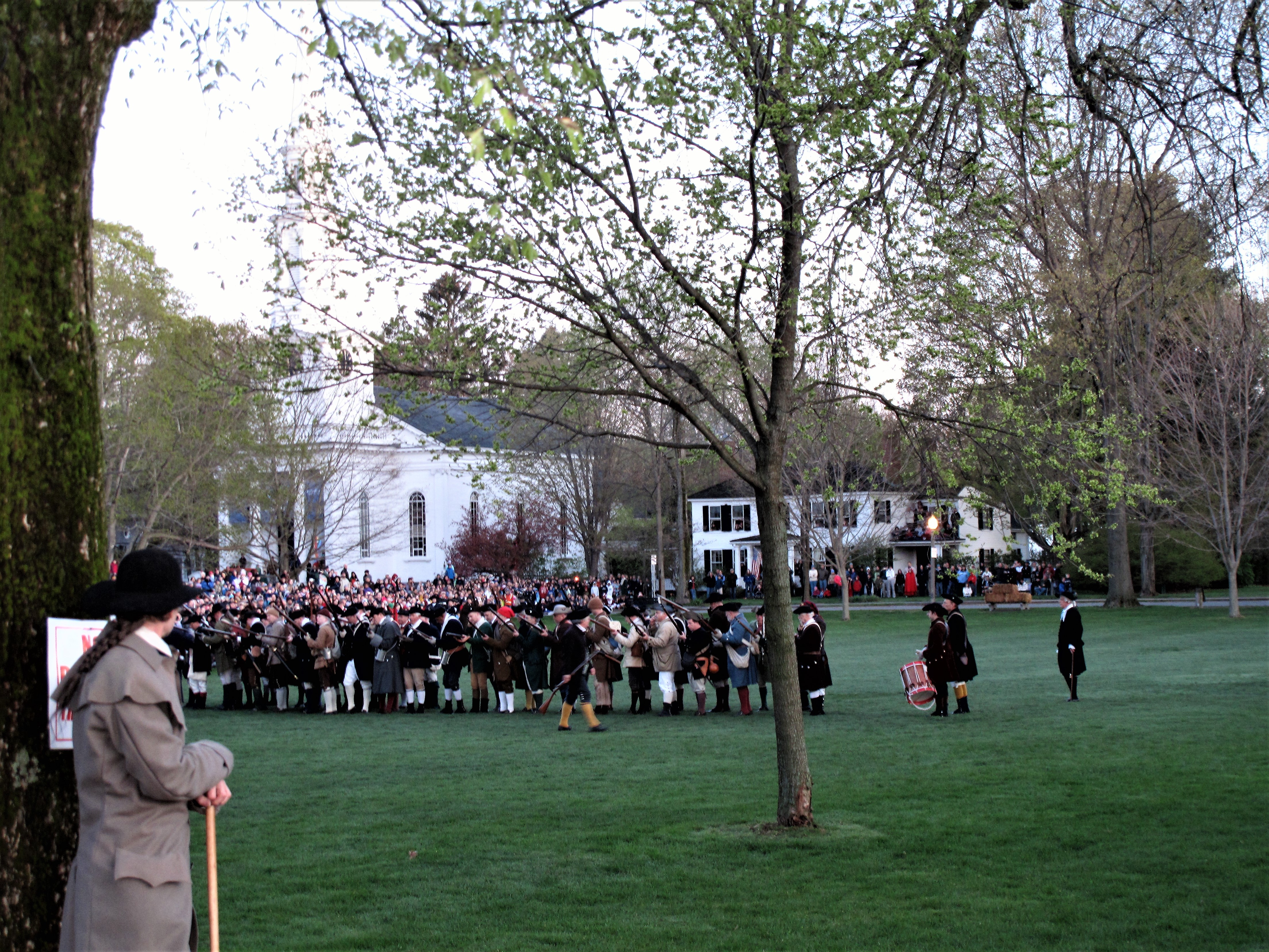
Learning of the impending British advance, Massachusetts Minutemen gather on Lexington Green at dawn. They know they will be outnumbered.
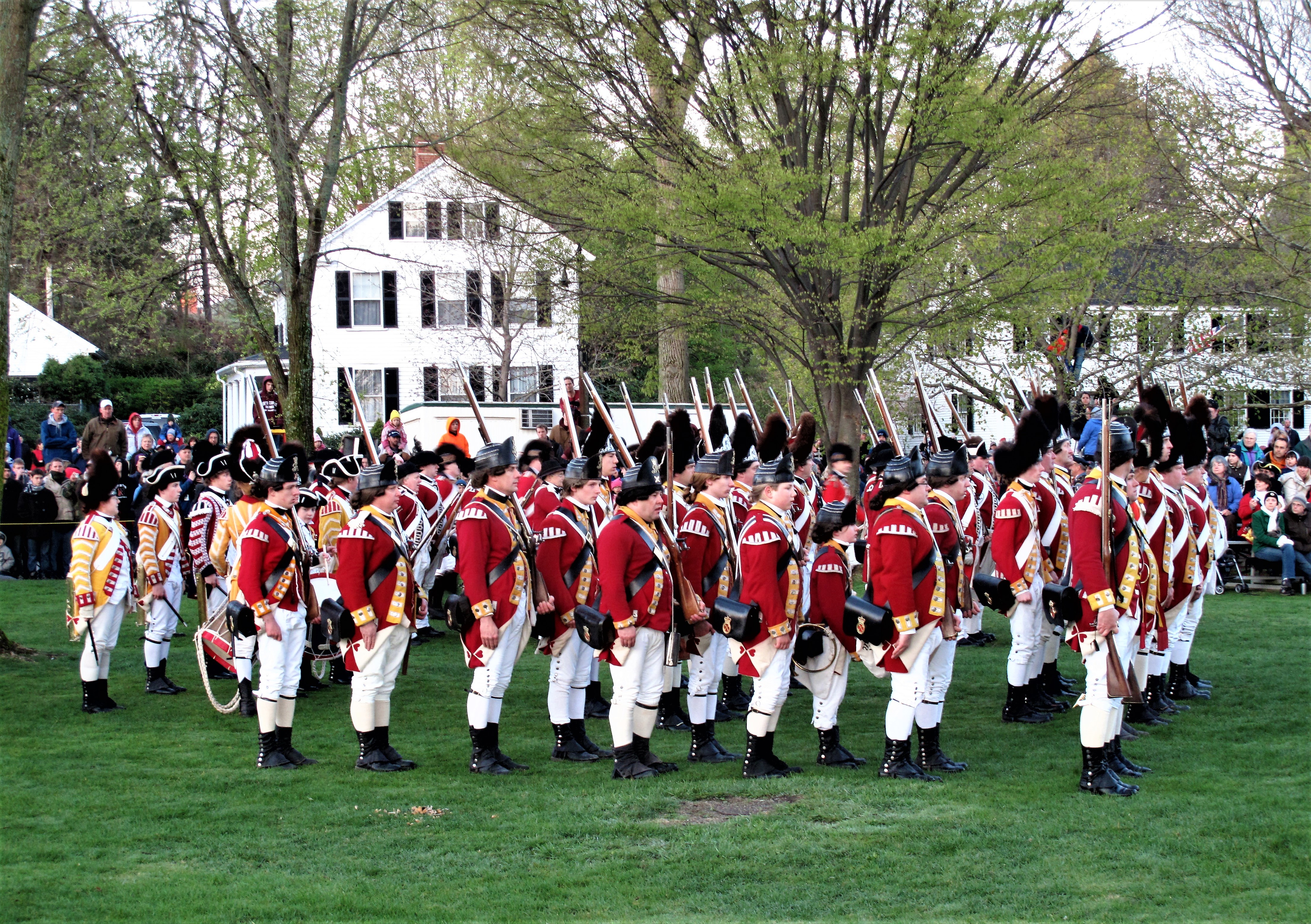
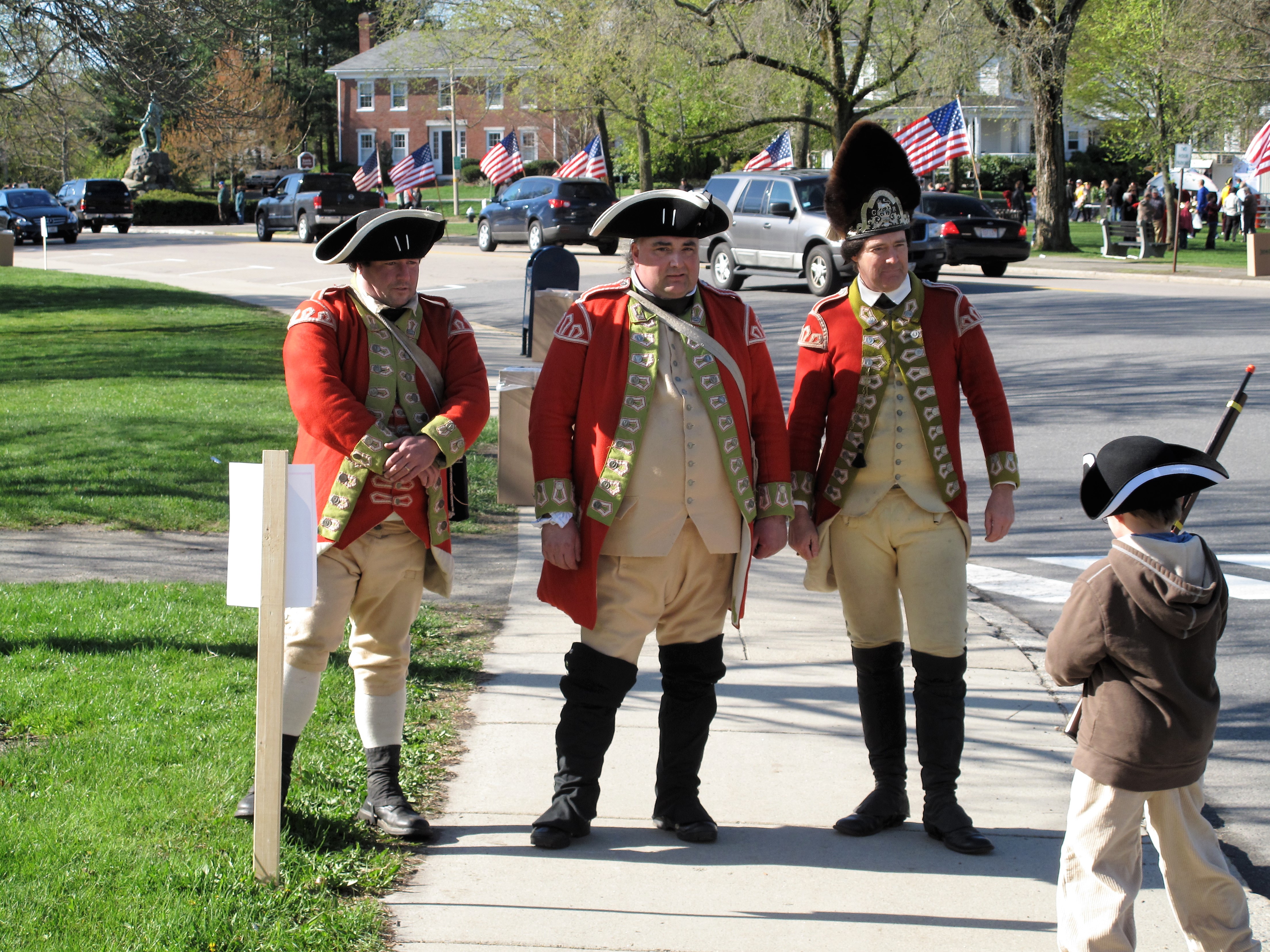
The Redcoats arrive in formation.
The two sides confront each other on Lexington Green. There’s a stand-off.
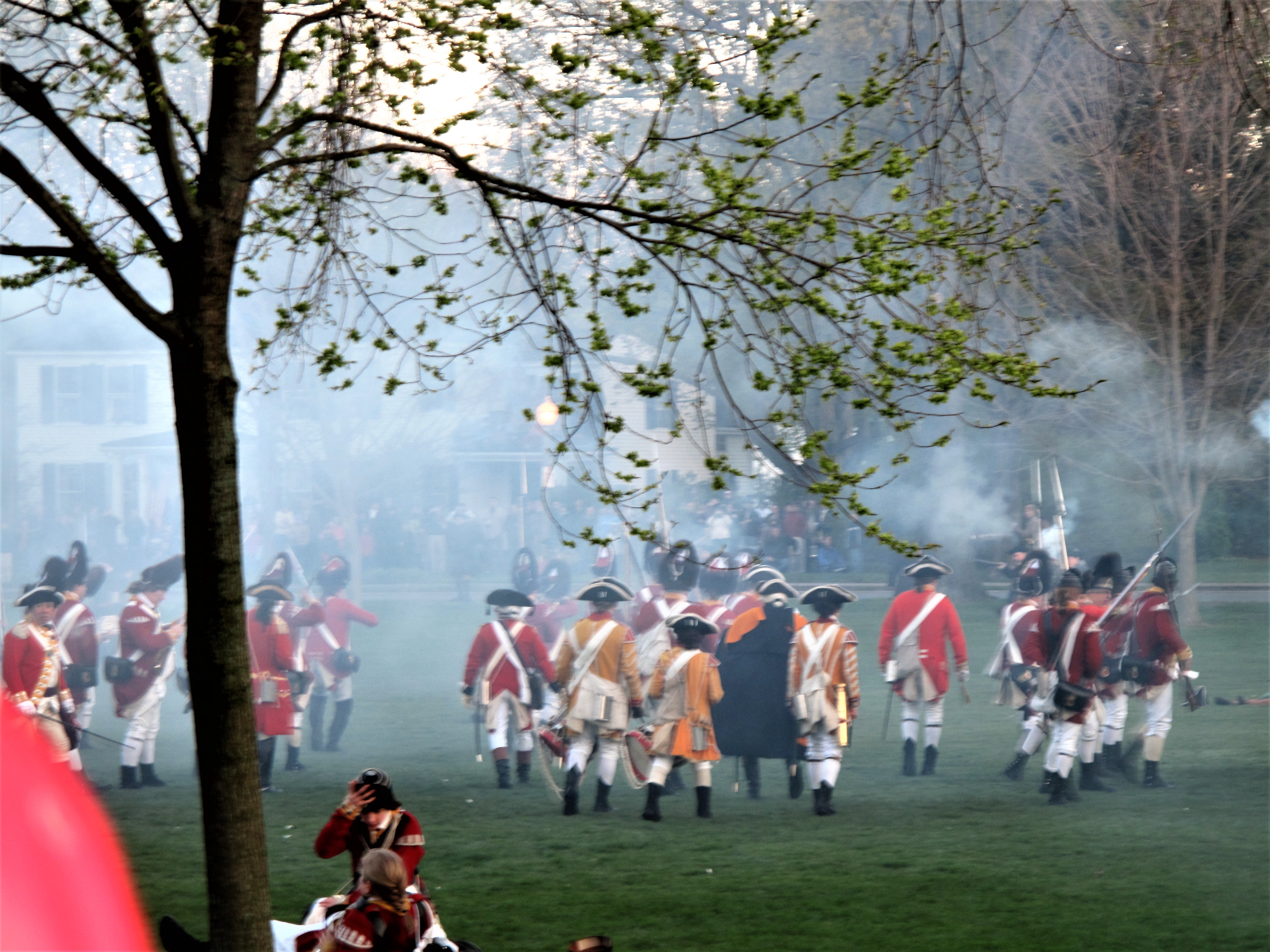
Then shots are fired. The noise and smoke are tremendous.
The result was eight militiamen killed, ten wounded. One British regular was wounded.
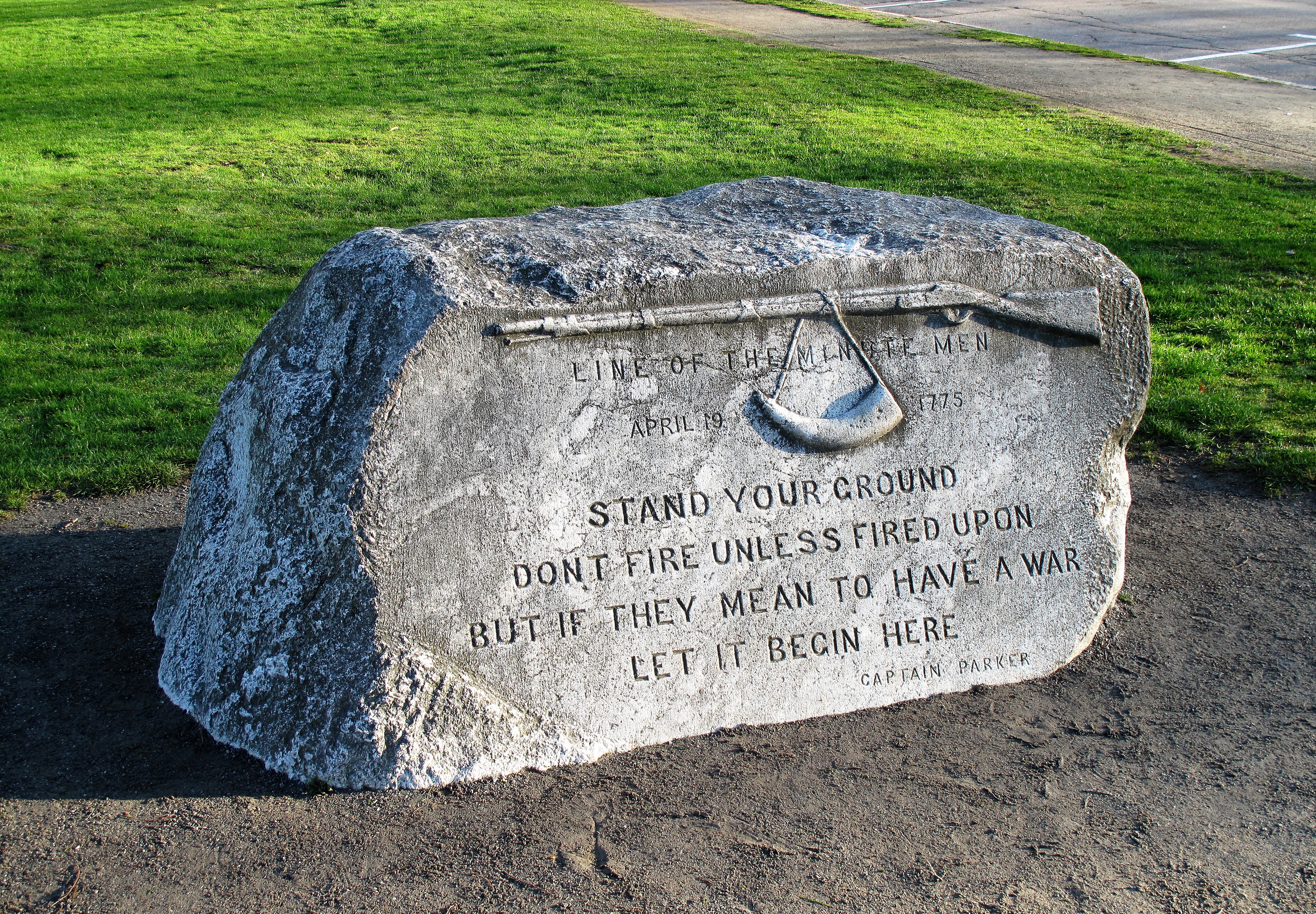
The words attributed to Captain John Parker of Lexington are memorialized in stone:
After the re-enactment was over, I had a chance to wander about taking photos. The April weather was cool, but the skies were sunny.
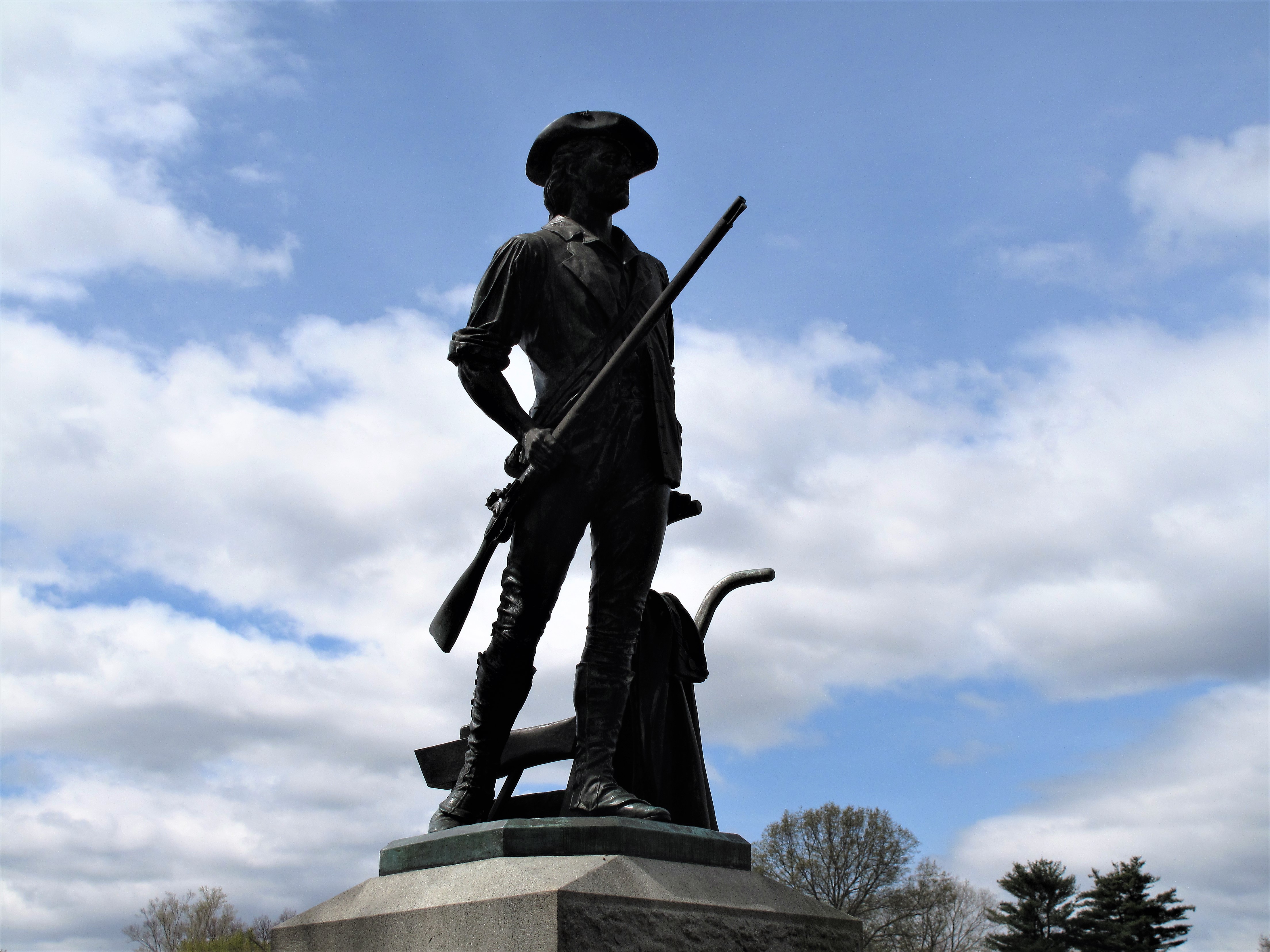
The famous Minuteman statue, Lexington Common. Lexington, MassachusettsAn armed Rebel youth confronts and captures three Redcoat soldiers! What pluck!Lexington Common
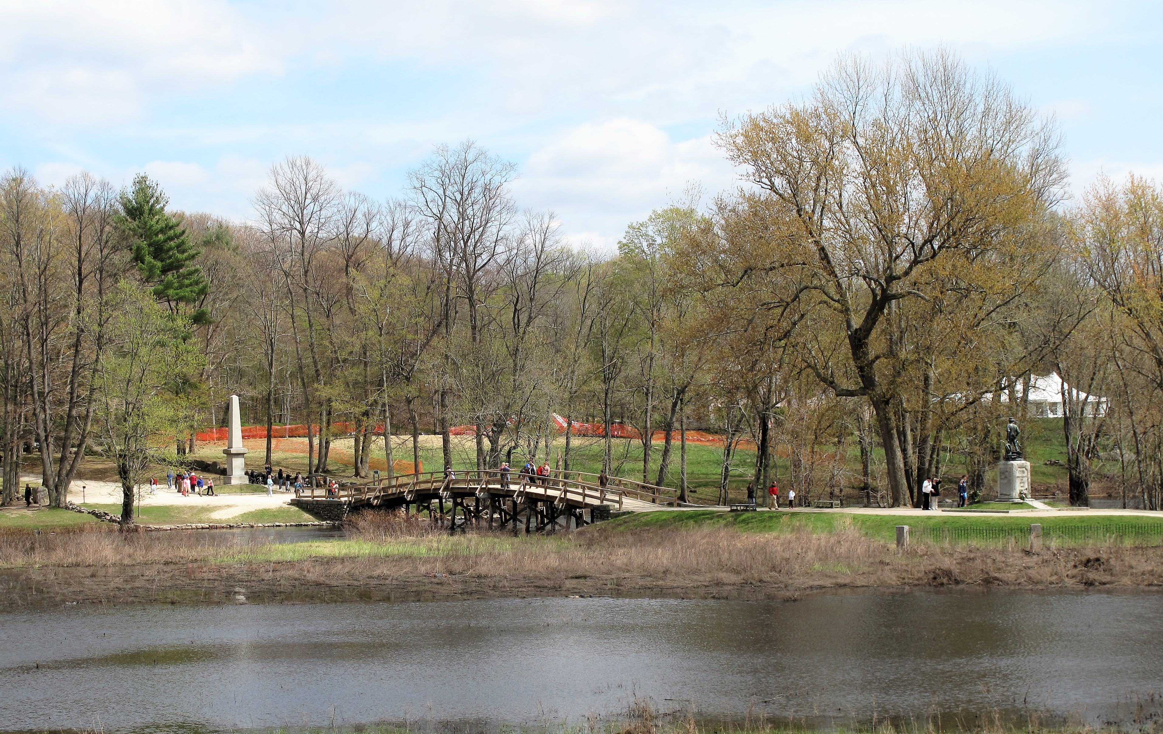
As you know from the history books, the fight then moved on to Concord bridge where 100 British regulars met 400 American militiamen.
Old North Bridge, site of the Battle of Concord. Memorial obelisk is on the left; Minuteman’s statue on the rightInscription on the obelisk at the Old North Bridge: “Here on the 19th of April 1775 was made the first forcible resistance to British aggression…”Minute Man statue at Concord, which was erected in 1875 on the centennial of “the shot heard round the world”A view down Walden Street. Concord, Massachusetts
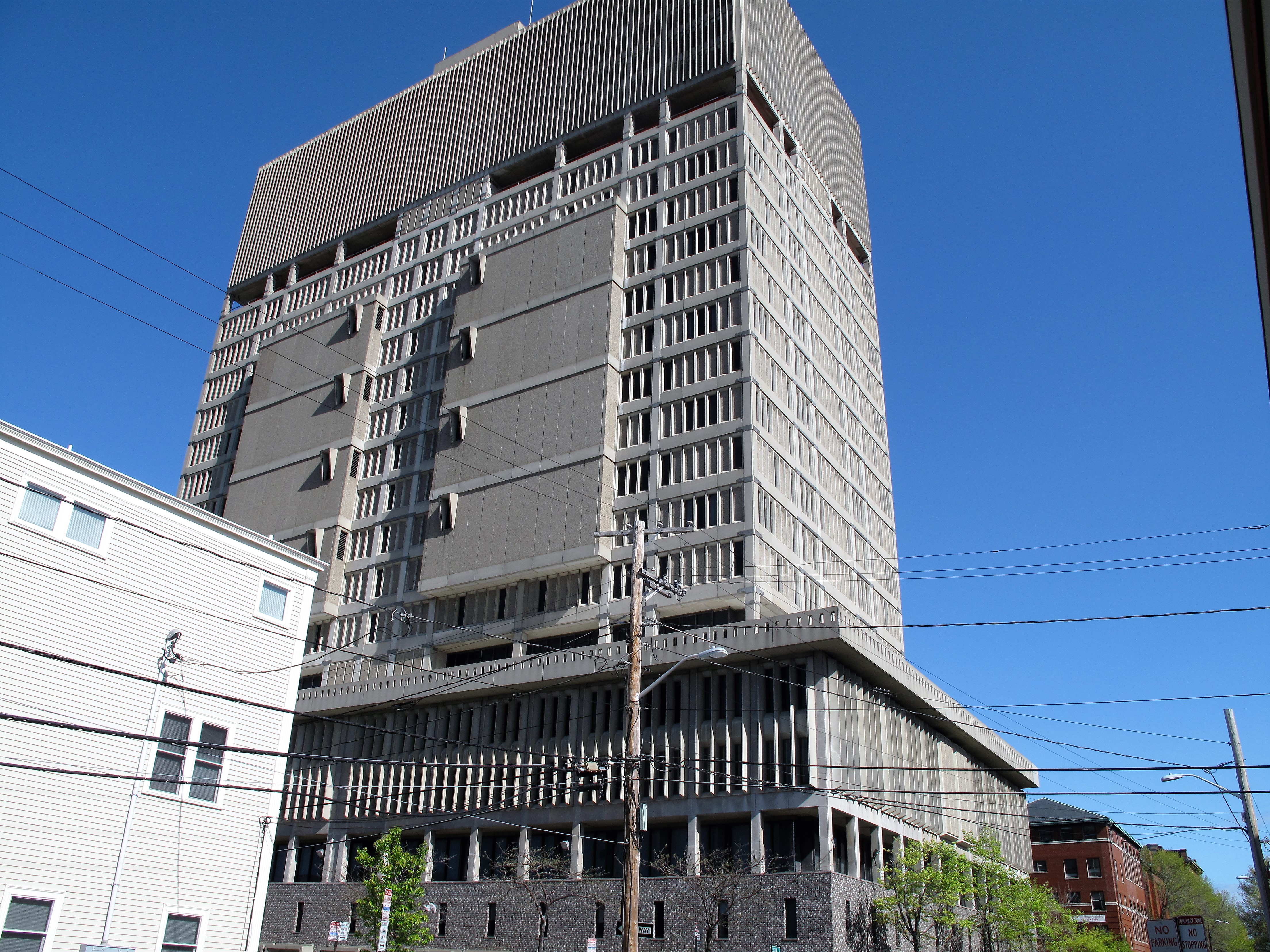
Later on, I drove down to Cambridge, the county seat. The Middlesex County Courthouse looks more like a military stronghold than a court of Justice, towering above residential East Cambridge like Saruman’s Tower from Lord of the Rings. I believe the jail occupies several of the floors.
The courthouse is in a part of town called East Cambridge, away from the Harvard Square area which was the original Cambridge settlement. The buildings here are townhouses of brick or wood. The brick ones are remnants of homes for the wealthy; the wood ones are cheaper, yet many have been painted bright colors and remind me of row houses on the Irish seashore.
Middlesex County Courthouse. Cambridge, Massachusetts
The old red brick courthouse is across the street.
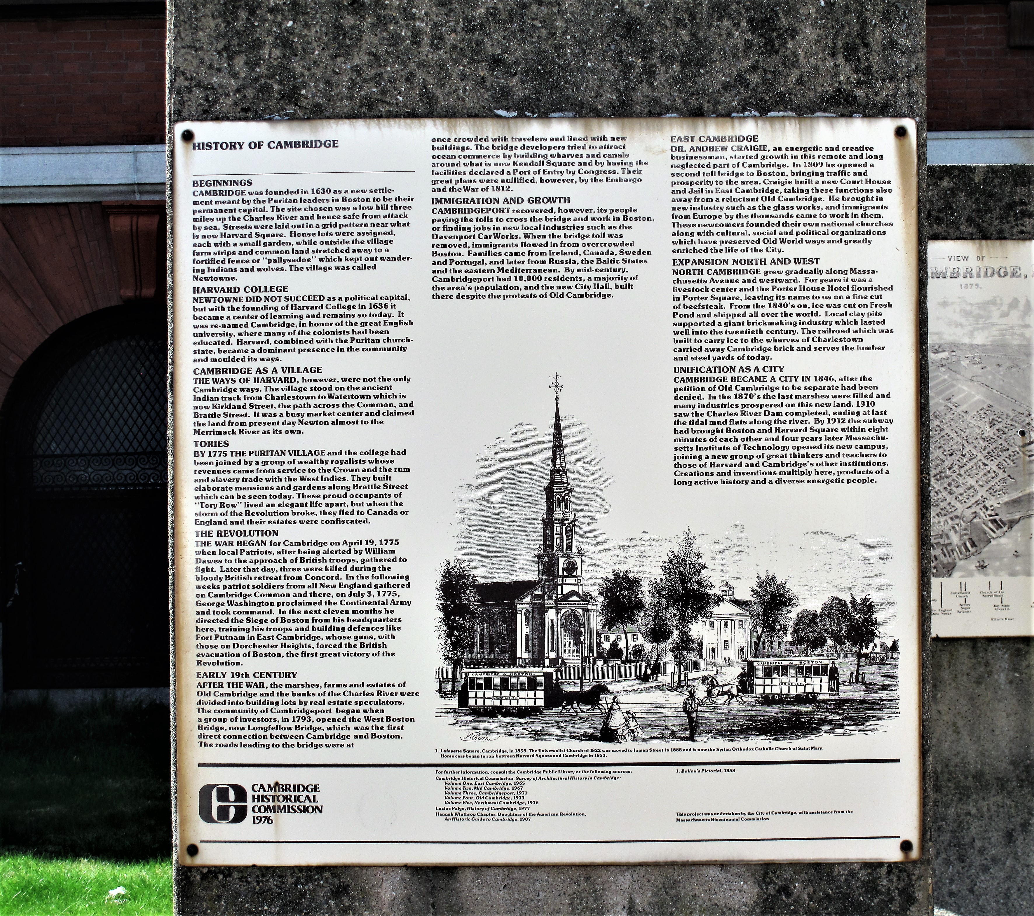
Registry of Deeds and Probate Court. Cambridge, MassachusettsHistorical sign: the History of CambridgeThe streets of Cambridge, Massachusetts
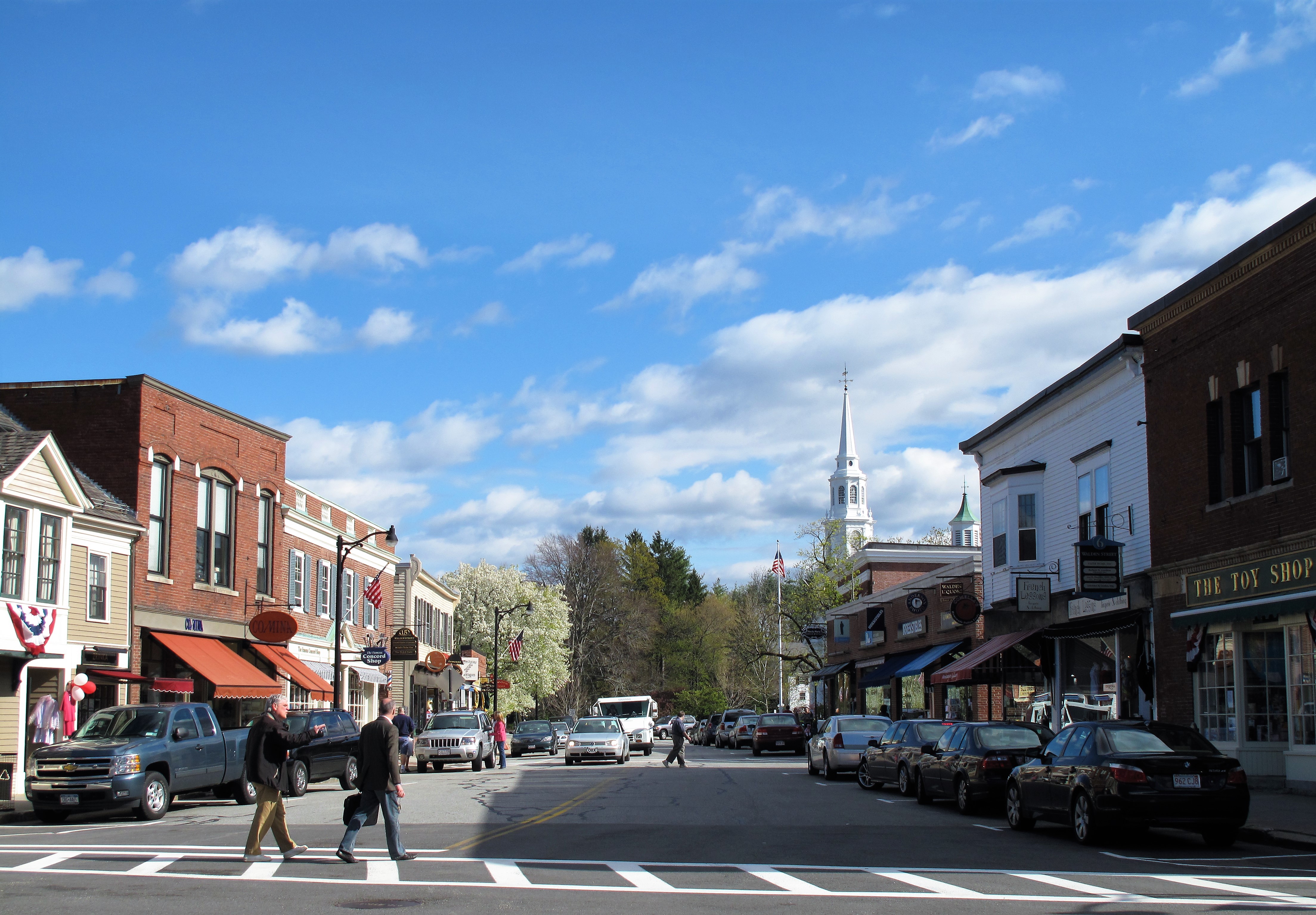
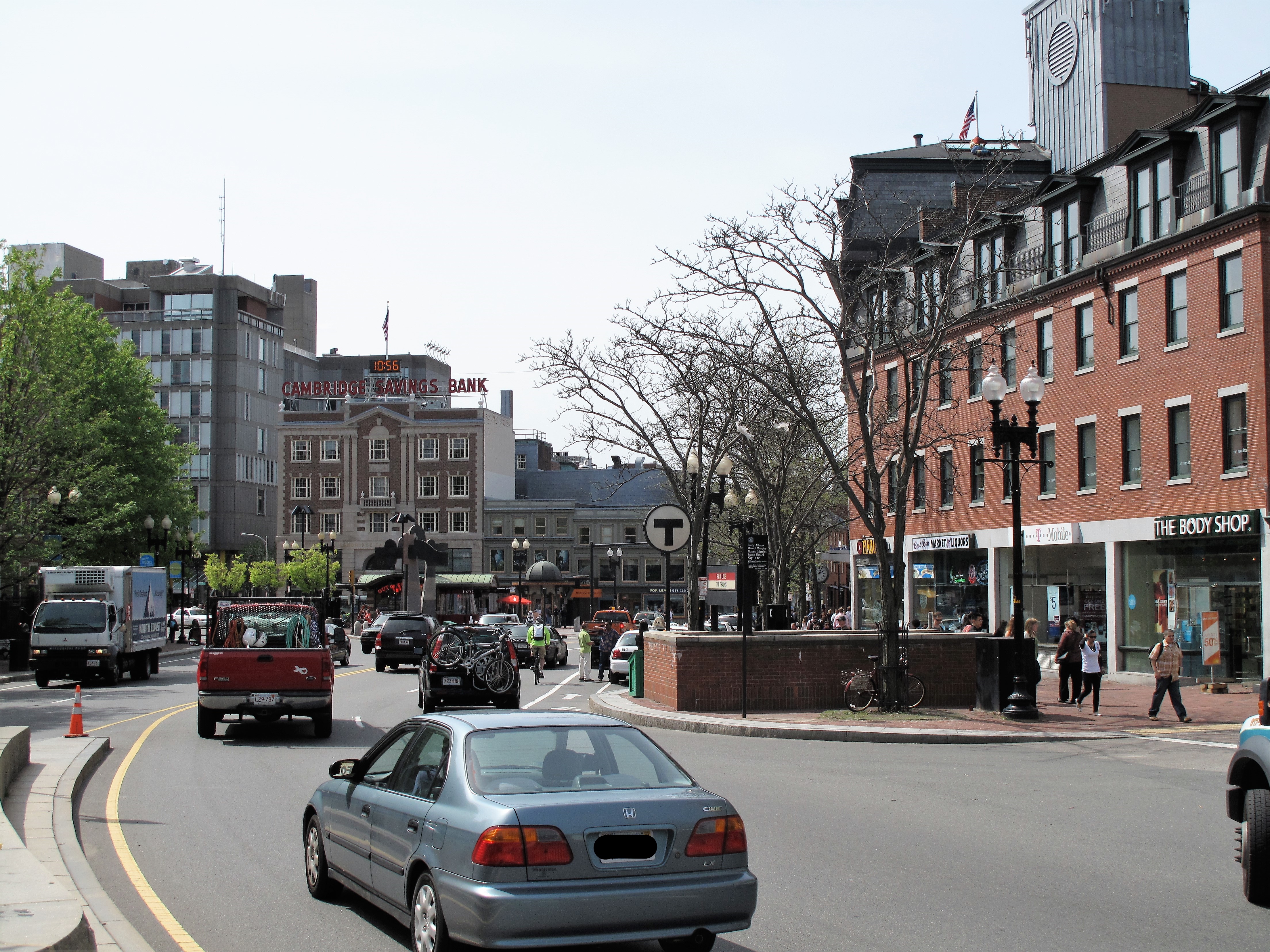
From East Cambridge, I drove down Main Street, up Massachusetts Avenue, around Harvard Square, and back down Broadway. Cambridge is a college town but usually isn’t thought of in the same way as Lawrence, Kansas, or Athens, Georgia. Yet I was amazed at how much Massachusetts Avenue looks like a college town’s main street. Shops are in single-story buildings with a few large brick two-story buildings nearby. Little restaurants and fast-food places predominate. I saw several Middle Eastern eateries. However, the pedestrians seemed to be not so much the college crowd as ethnic workers of all types. So downtown Cambridge seems more of an ethnic neighborhood than a college hang-out.
Residences along the side streets are mostly two-story
walkups surrounded by blooming trees.
It’s the middle of spring and all the trees are in bloom right now. That’s especially nice on a warm, shirt
sleeve day, perhaps the best day of spring so far.
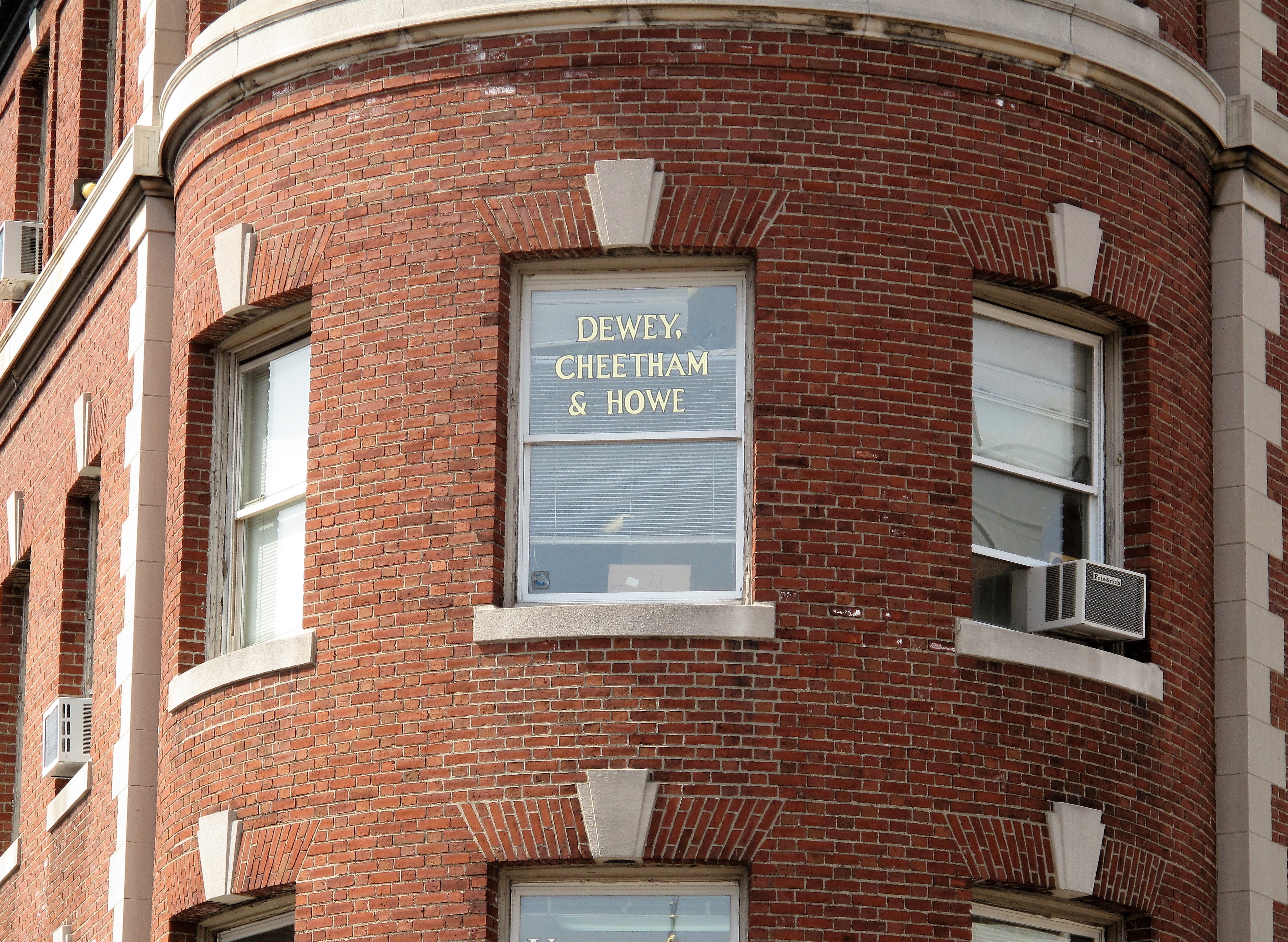
Harvard’s Most Prestigious Law Firm: Dewey, Cheetham & HoweHahvard Yahd
Meanwhile across the Charles River in Suffolk County (Boston) I found this and couldn’t resist adding it here.
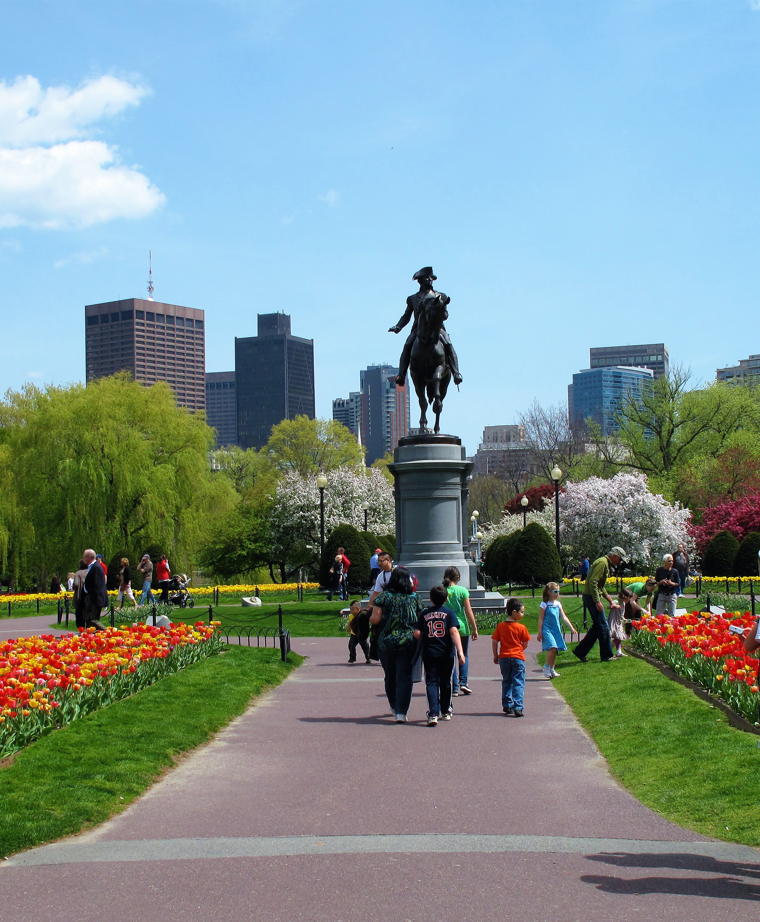
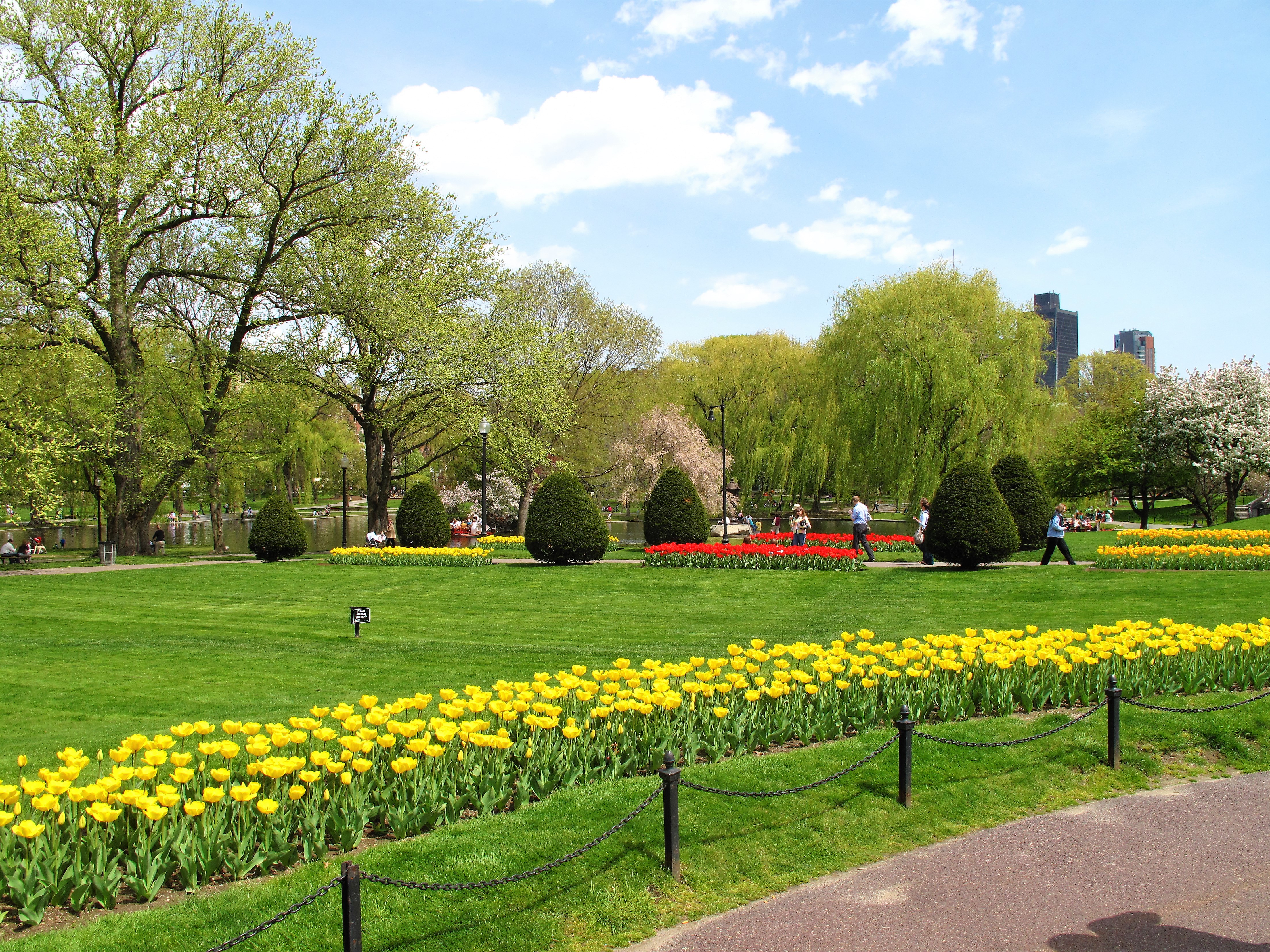
Statue of George Washington amid planters of tulips. Boston CommonFlower gardens blooming in April. Boston CommonMiddlesex County in the state of Massachusetts
All photos were taken by the author. Photos were taken between April 19-21, 2010.
A list of all photo posts from the American County Seats series in TimManBlog can be found here.
I’m trying to travel to all of America’s county courthouses, and each month a post about my visit to the most interesting county seats. It’s only a hobby — but donations are greatly appreciated to help defer my costs. Thanks, Tim
If someone were ever to write the Great California Epic, they might wisely choose Mariposa as the central setting, for Mariposa, near the entrance to the great Yosemite Valley, is the navel of the Golden State. All California life seems to flow from this place like water from a spring.
Mariposa is nestled in the foothills of California’s central Sierra Nevada Mountains, just outside the boundaries of Yosemite National Park.
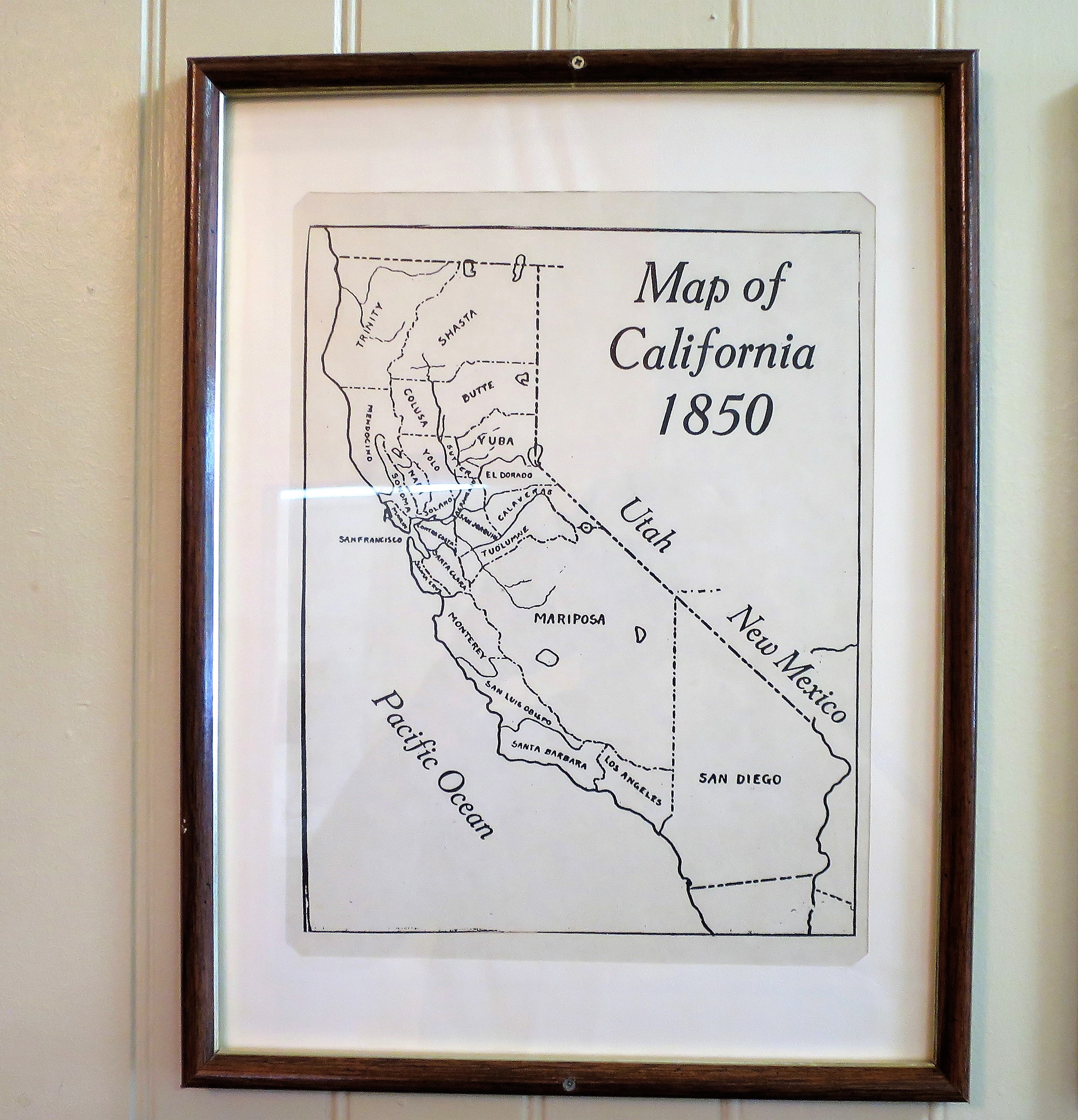
Mariposa County in the state of California
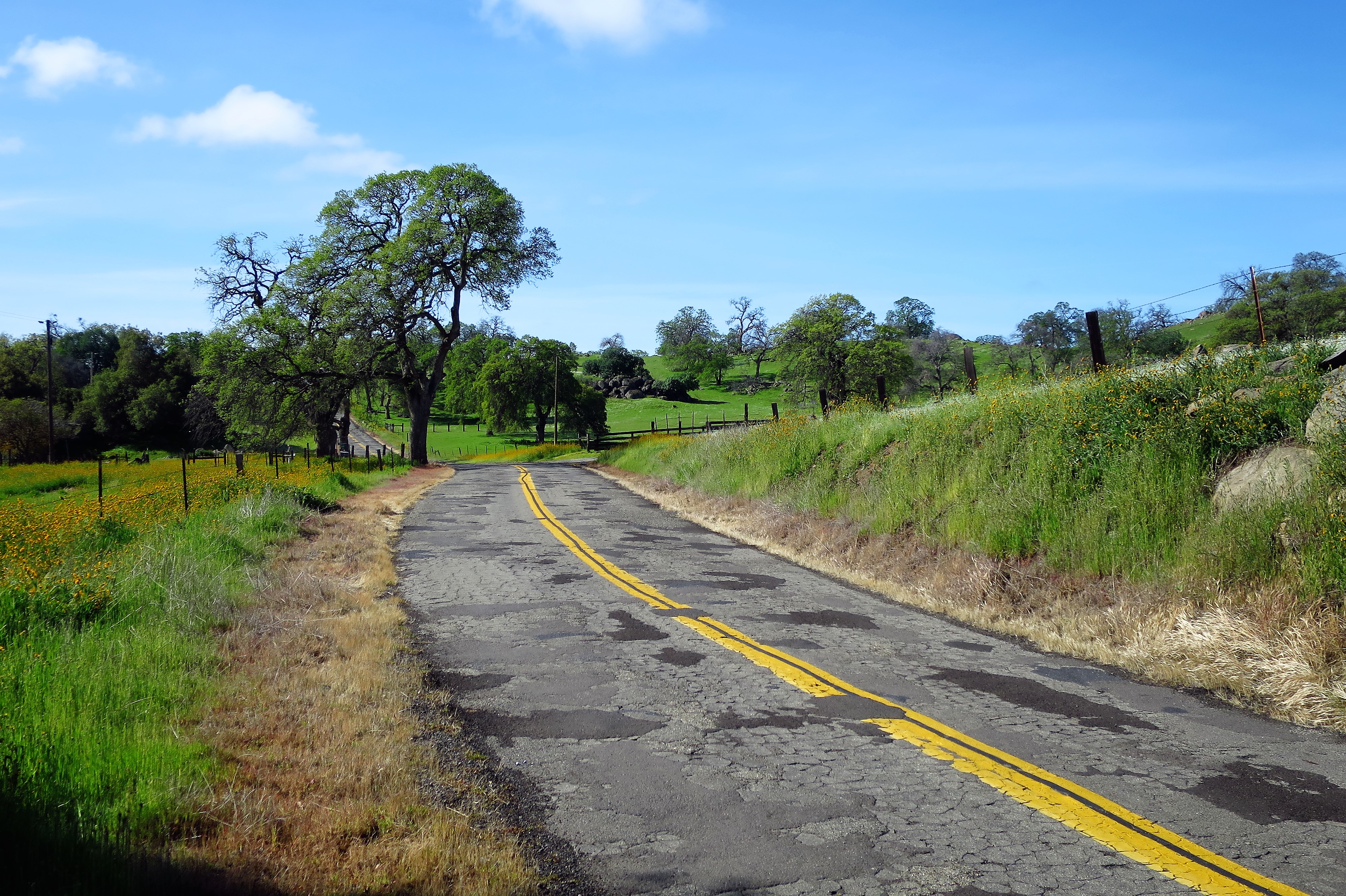
To get here, start from the San Joaquin Valley raisin towns of Fresno or Madera on a clear March morning (as I did, back in March 2016). Then, put away the road map and turn on Google Maps. Change the settings to “avoid highways” and follow the roads uphill. Here’s what your climb will look like:
Climbing above the San Joaquin Valley (Madera County, California)Country road, Madera CountyIsolated ranch hours, Madera County
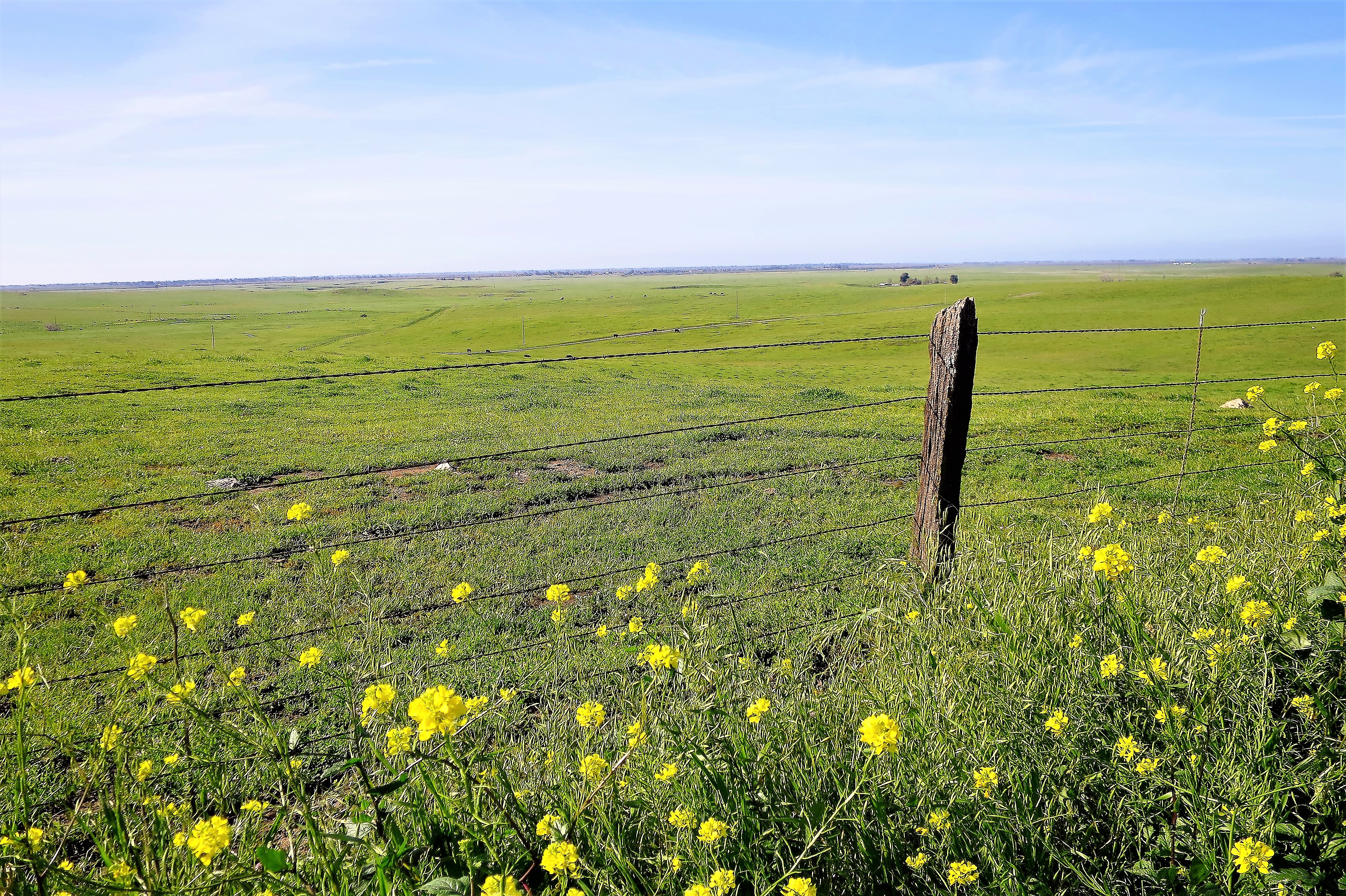
Entering Mariposa County:
Old Farm house, Mariposa CountyOak Trees, ranches, and Sierra spring run-off
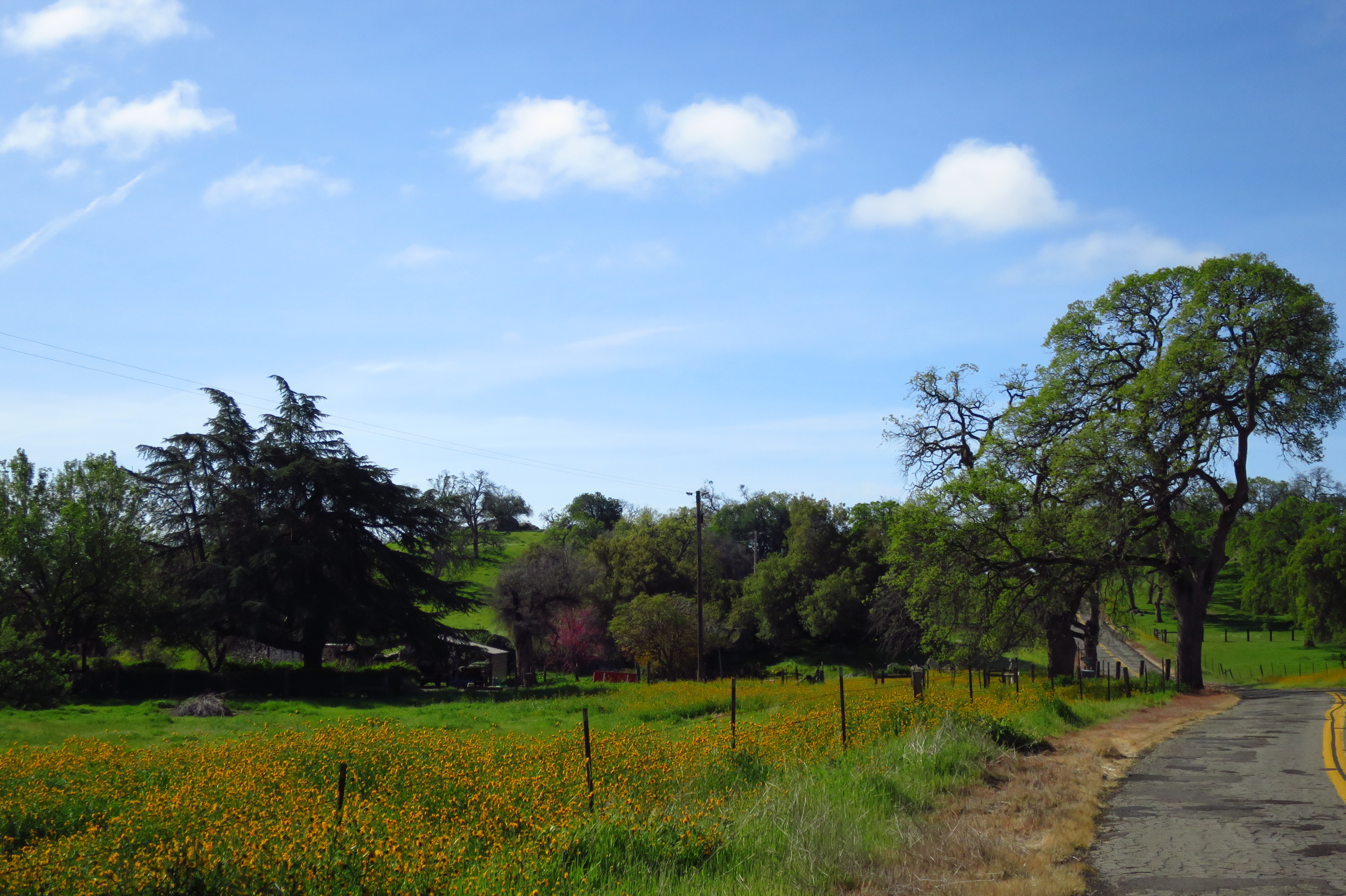
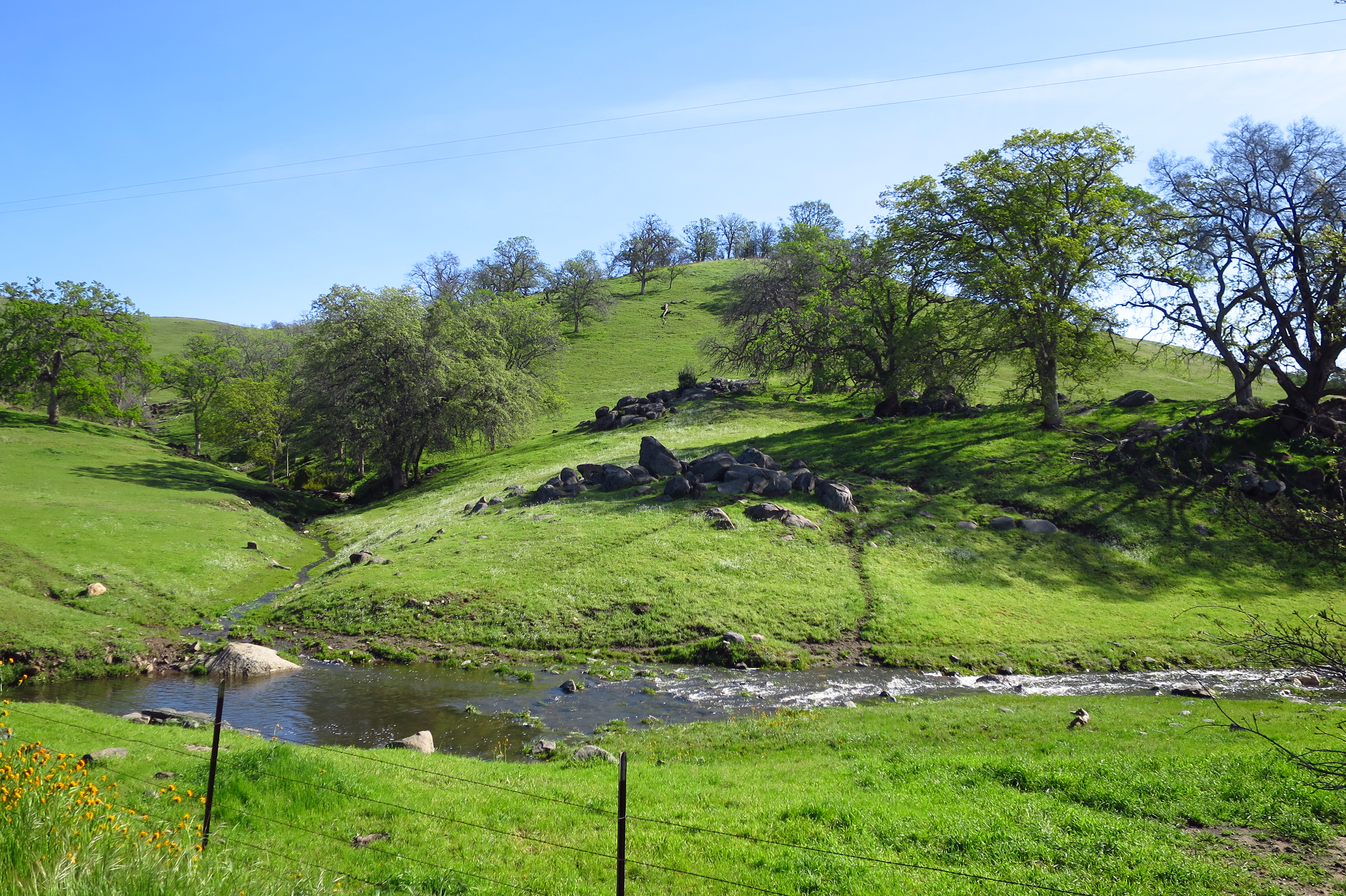
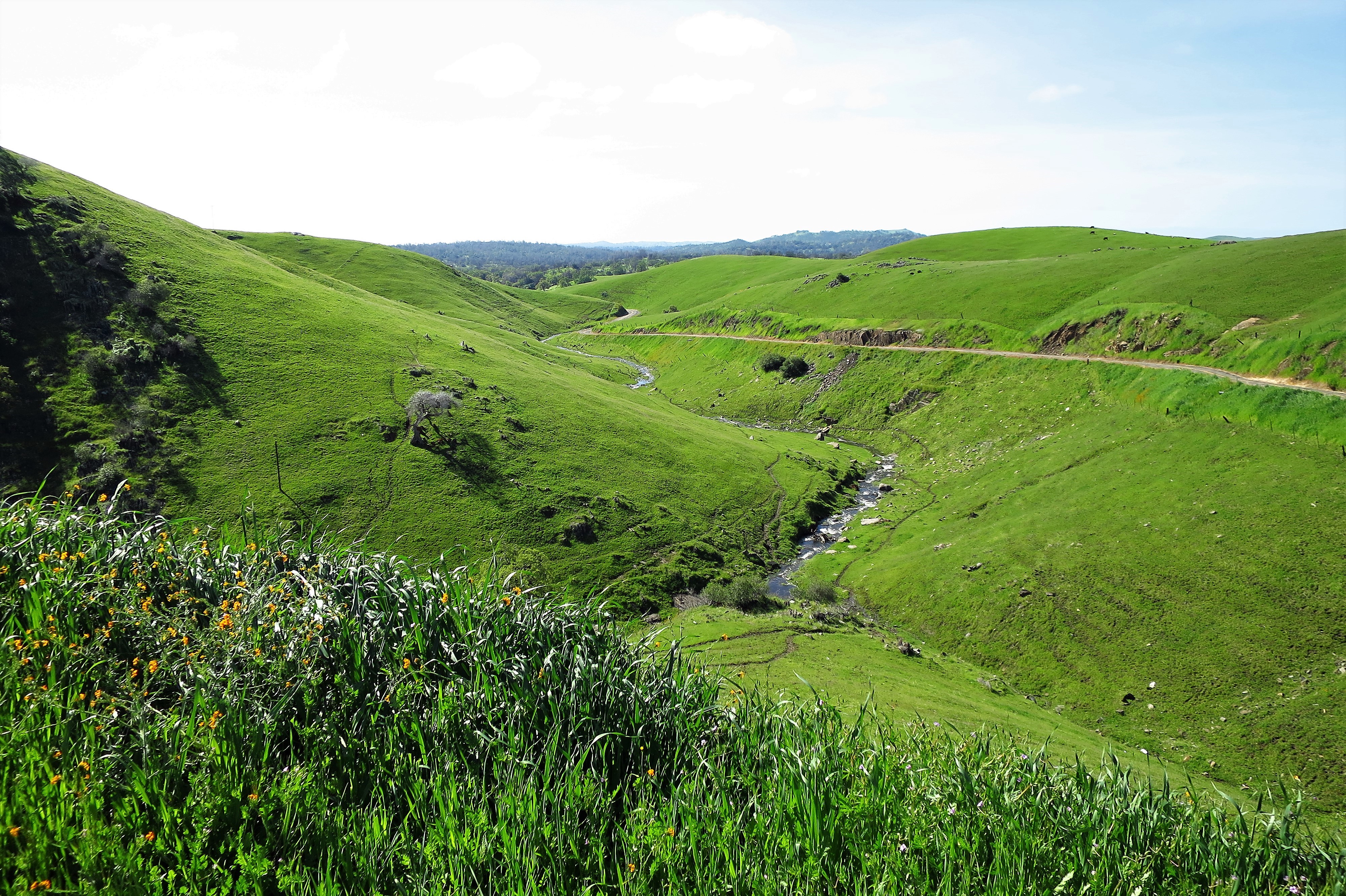
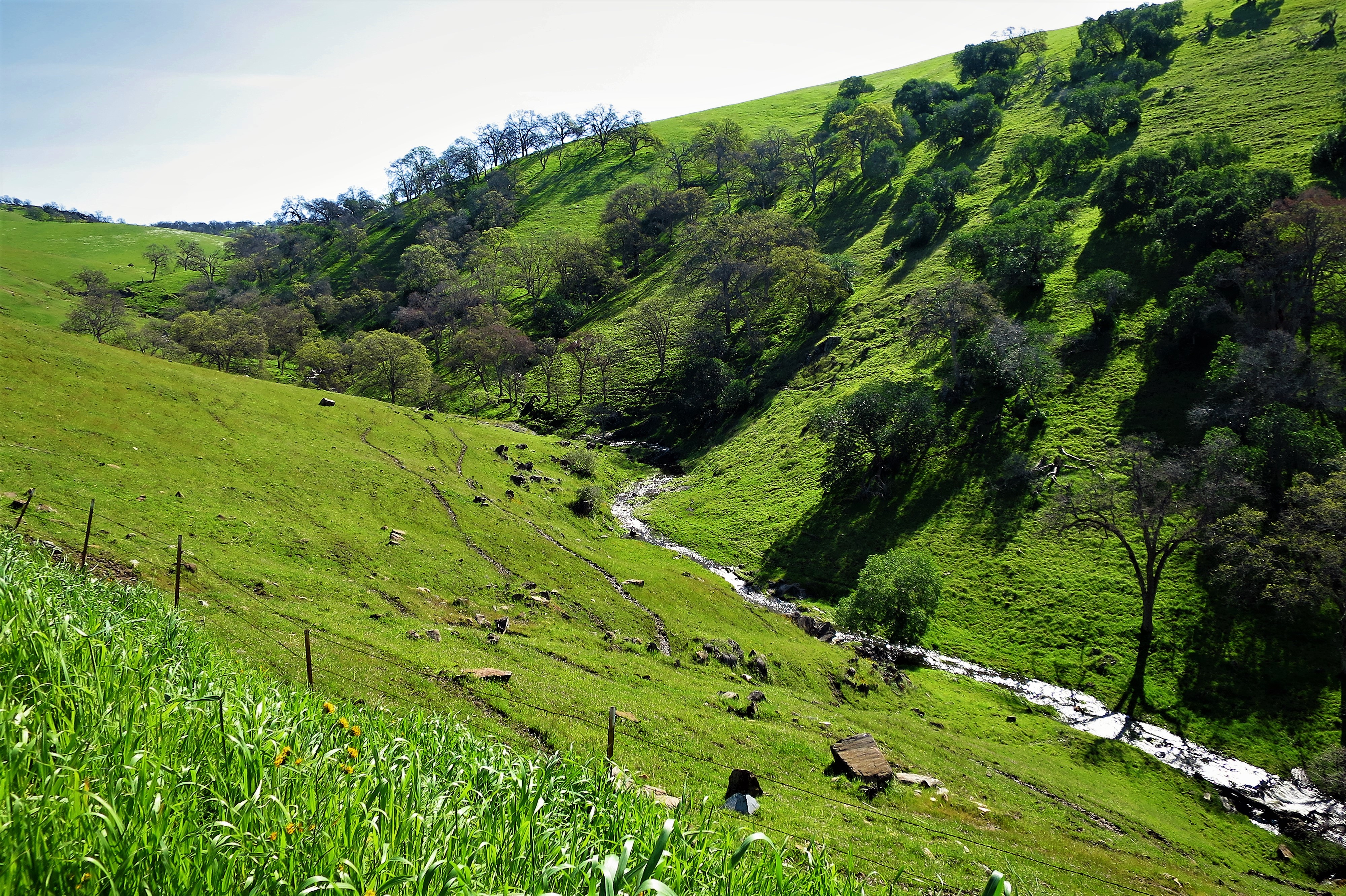
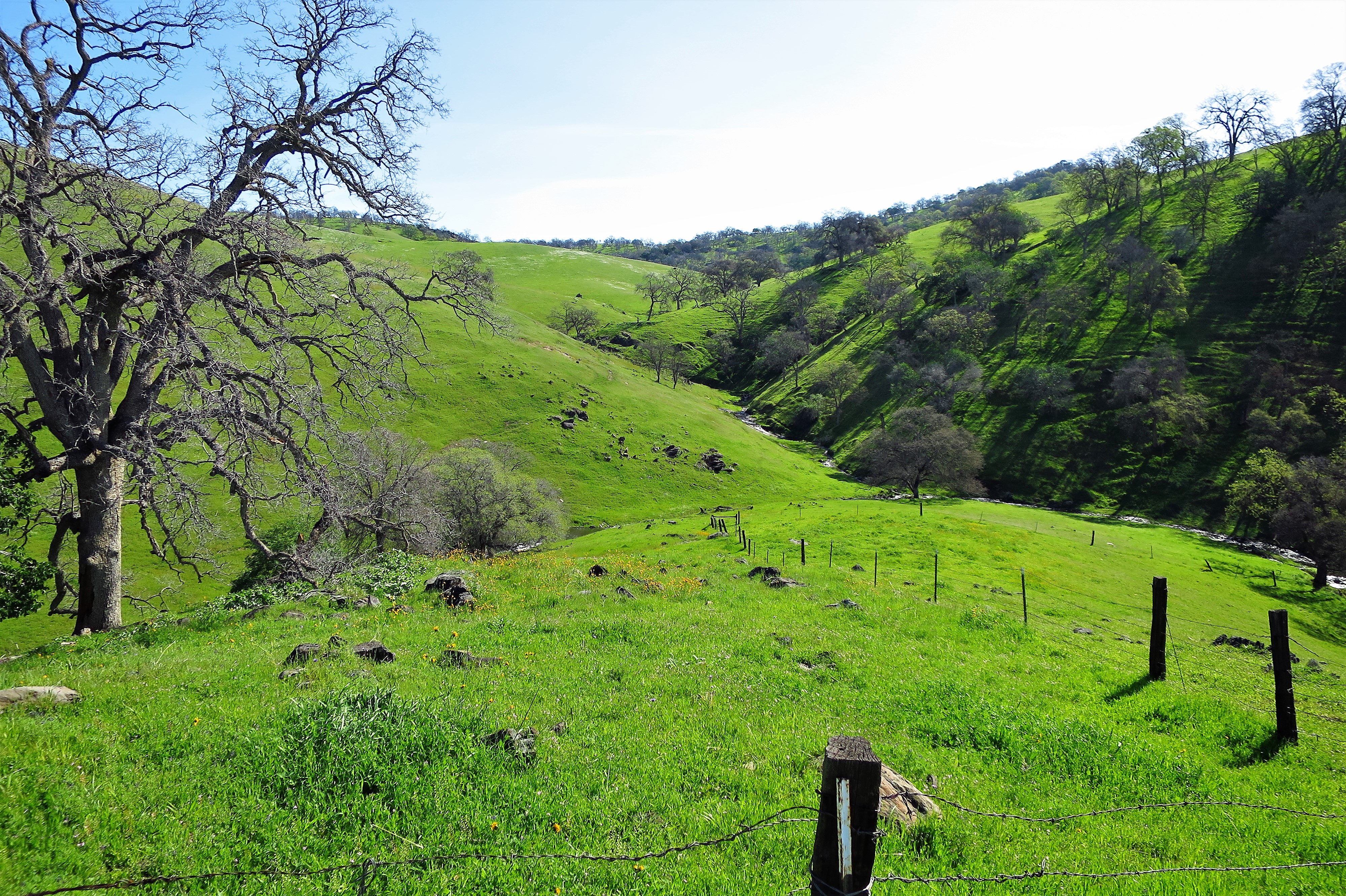
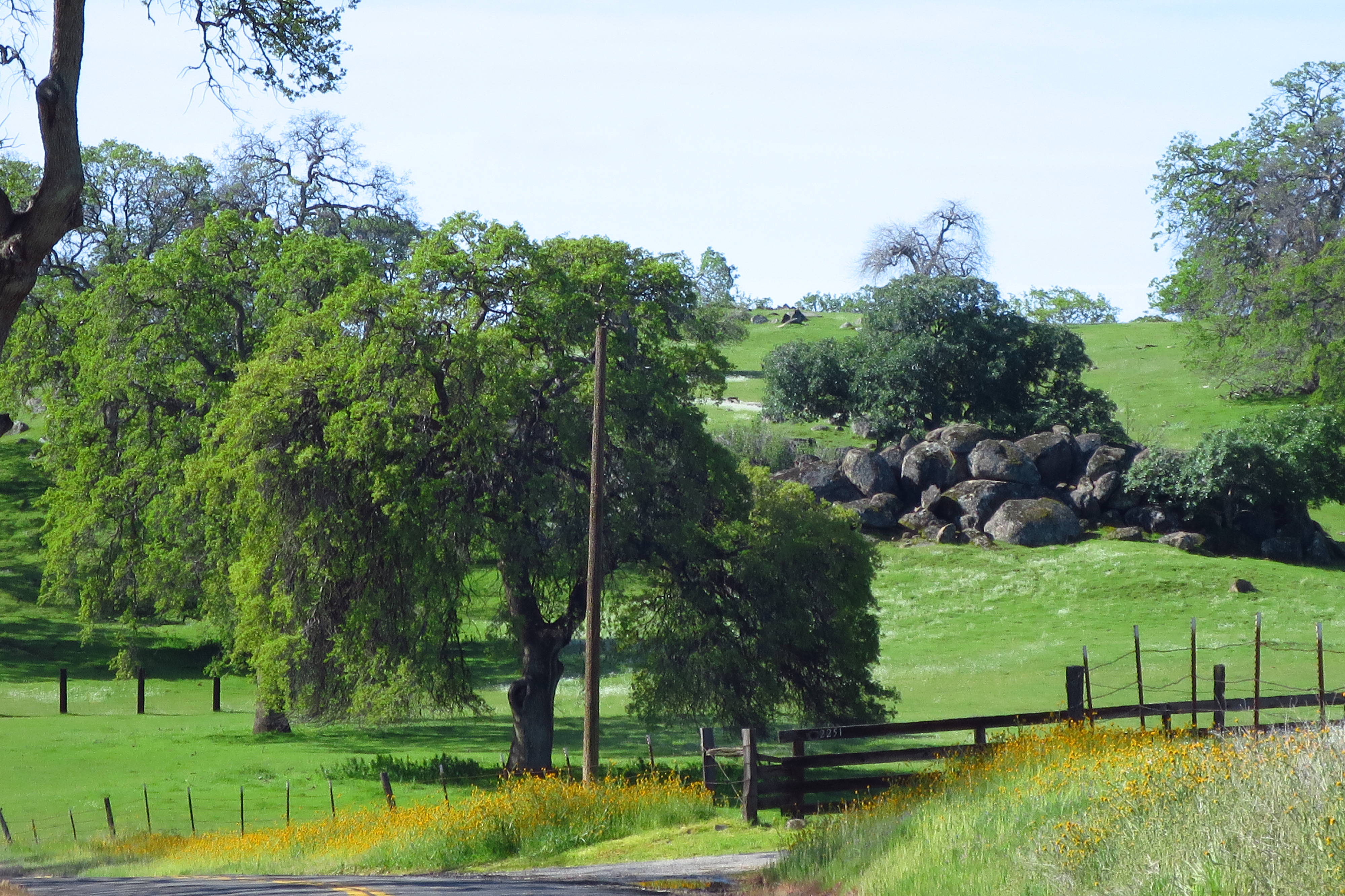
The climb gets steeper as you get higher into the Sierra, but the grass is still as green as if it were Ireland.
Sierra Nevada foothills, Mariposa County, CaliforniaSpring freshet, Mariposa County
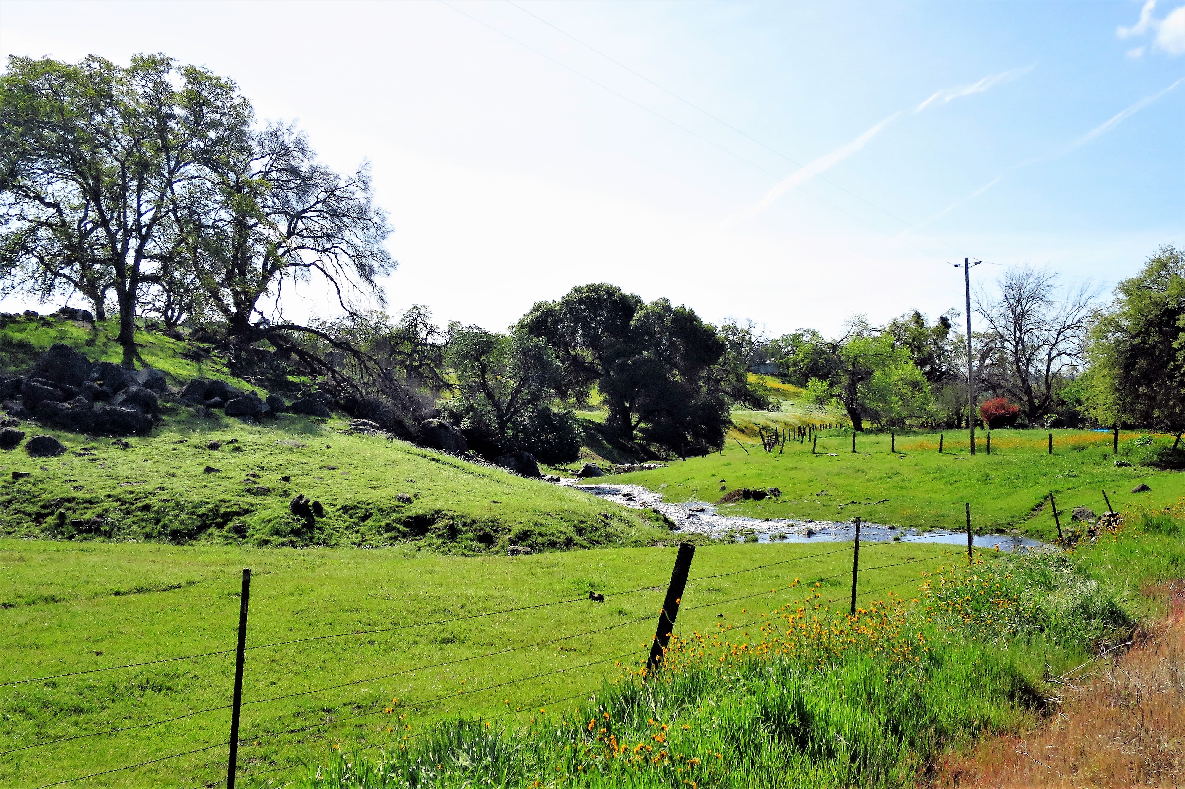
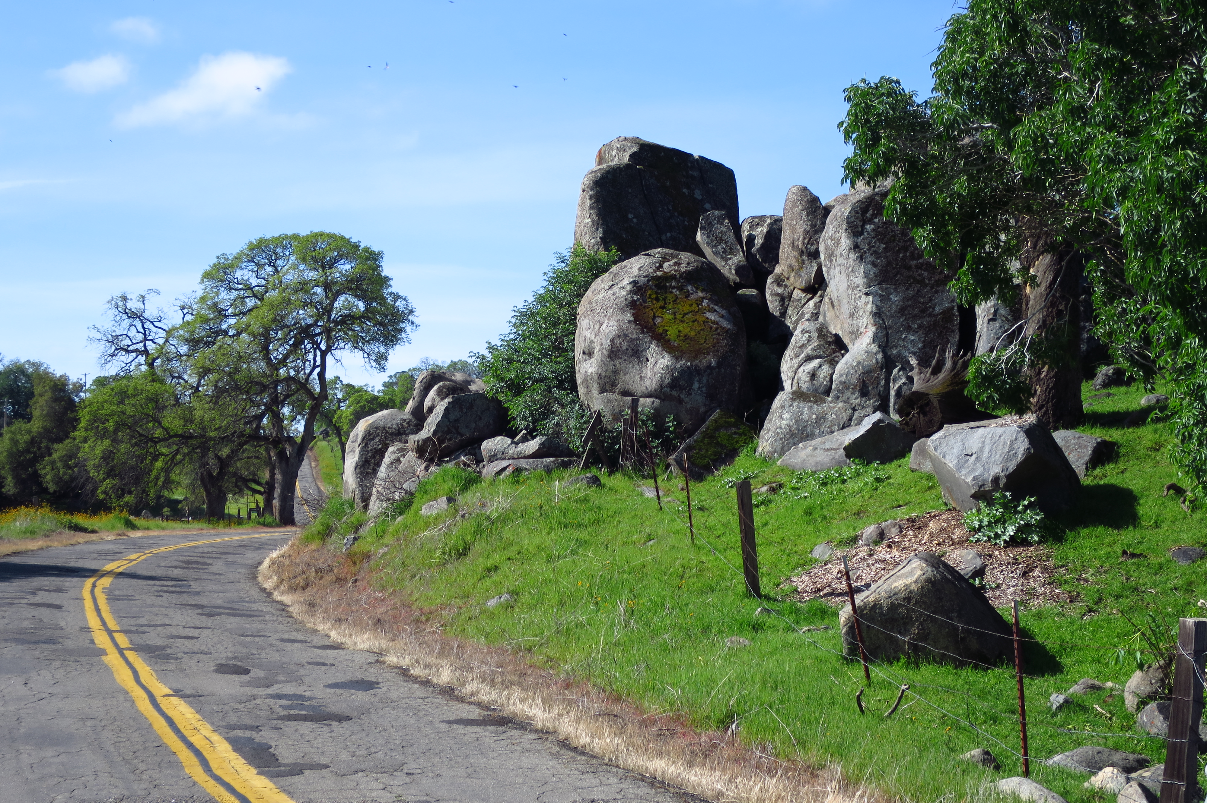
The road twists around granite boulders as you climb higher into the mountains.
Mariposa County
Finally, you arrive.
Downtown Mariposa, California along the “Central Yosemite Highway”
I remember coming up to Mariposa for the first time back in the 90s with my then-girlfriend. She pointed out that Mariposa means “butterfly” in Spanish. She knew of what she spoke.
Mariposa, California
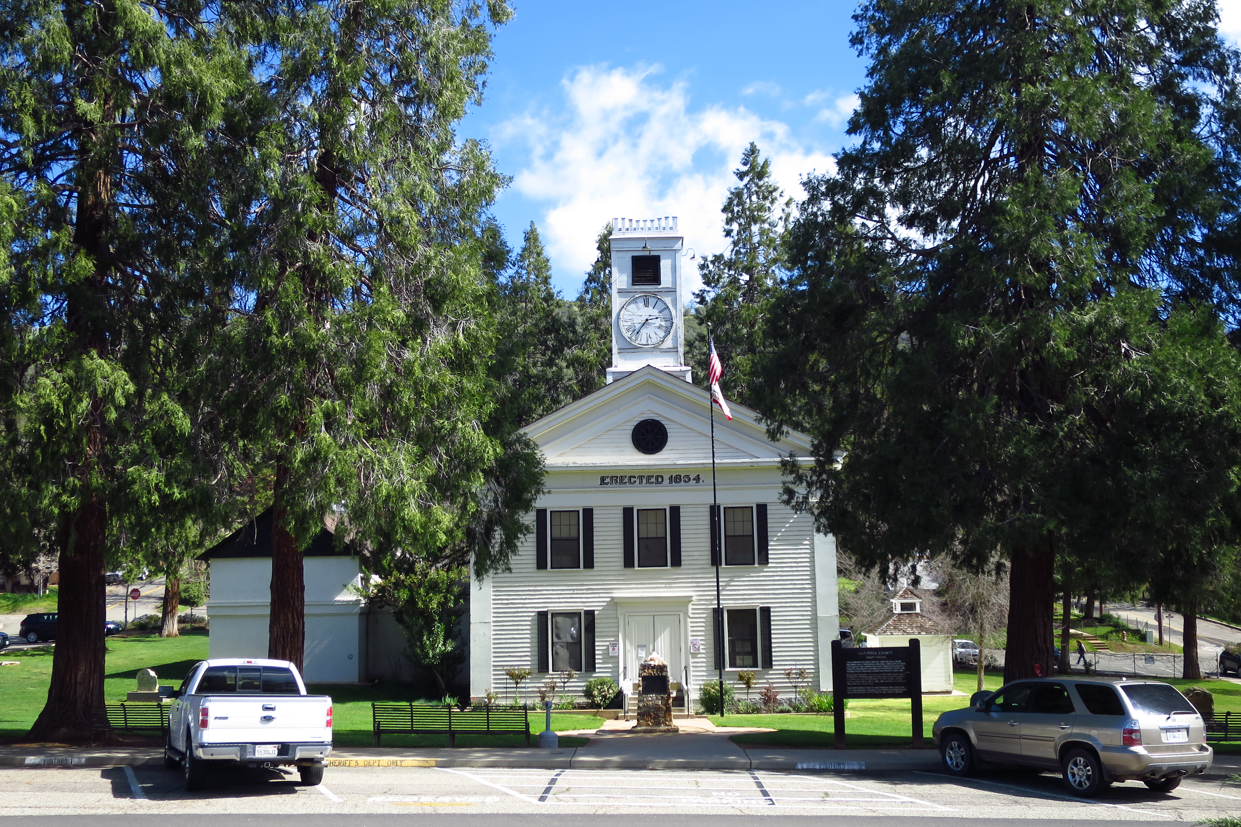
Mariposa is an old gold mining town and the seat of Mariposa County. The old courthouse was built in 1854, was the scene of some landmark mining cases, and is still in use today. It’s the oldest county courthouse in the state of California. It may be even older than the two Sequoia trees which guard the front entrance.
Mariposa County Courthouse.Mariposa County Courthouse
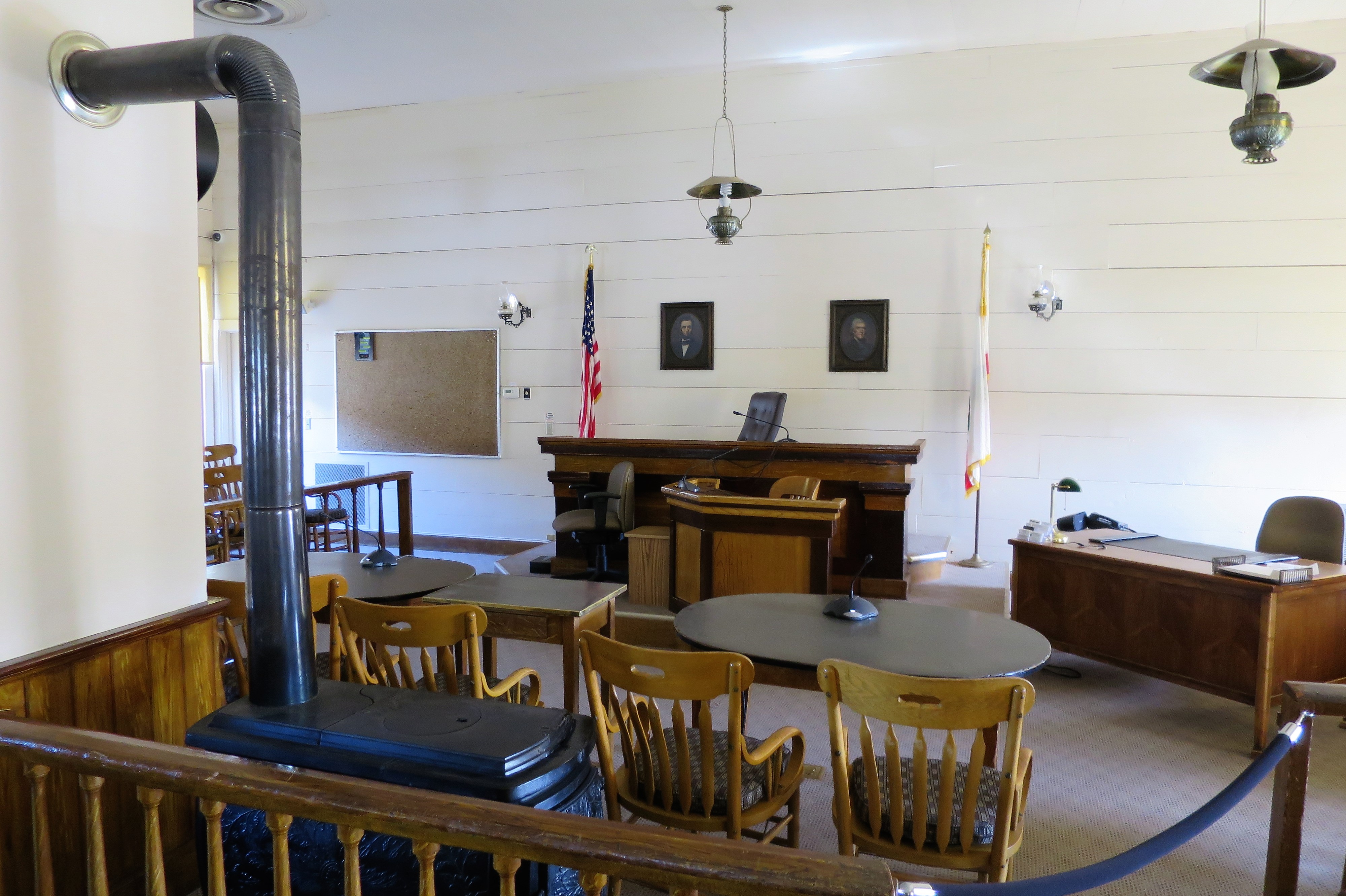
The courthouse has only one courtroom. Portraits of Lincoln and Jefferson are the only adornment on the wall behind the Judge’s seat, which is odd considering that judges, lawyers, and juries were meeting here before Abraham Lincoln was even elected President. I’m told that the old stove still provides primary heating for the courtroom.
Main courtroom, Mariposa County Courthouse
Mariposa County was once huge, covering most of central California but has since been carved into many other counties. Its namesake butterflies are actually only found in the San Joaquin Valley below the mountains, now part of other counties.
Want to stay in town? The 5th Street Inn looks nice.
5th Street Inn, Mariposa, CaliforniaChristian Science Church, Mariposa
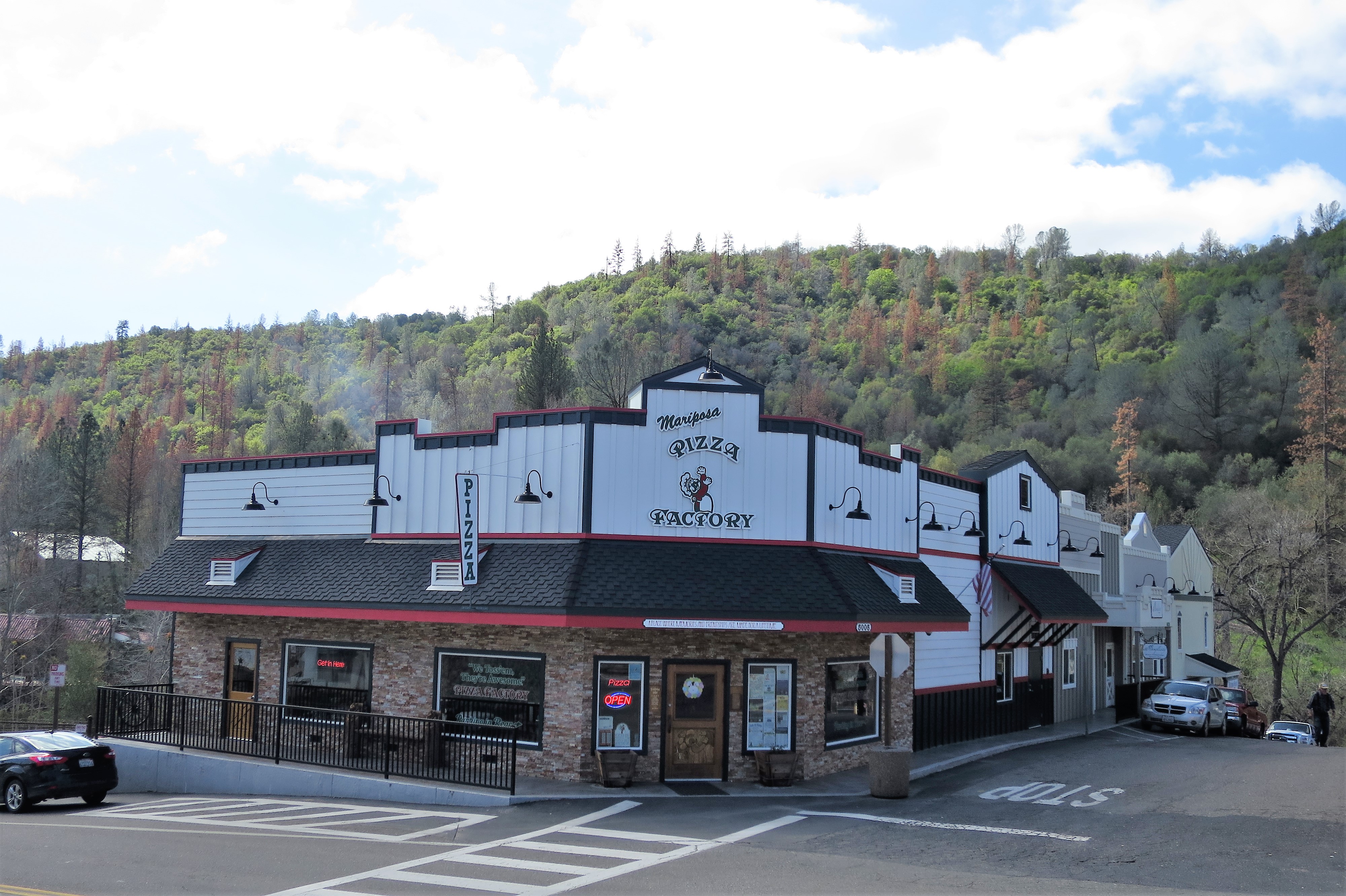
Here’s where the locals eat — the Pizza Factory. It was busy when I was there. Good food, spacious seating. Here policemen, firemen, and other local residents enjoy a respite from seasonal tourists.
(Mariposa) Pizza Factory
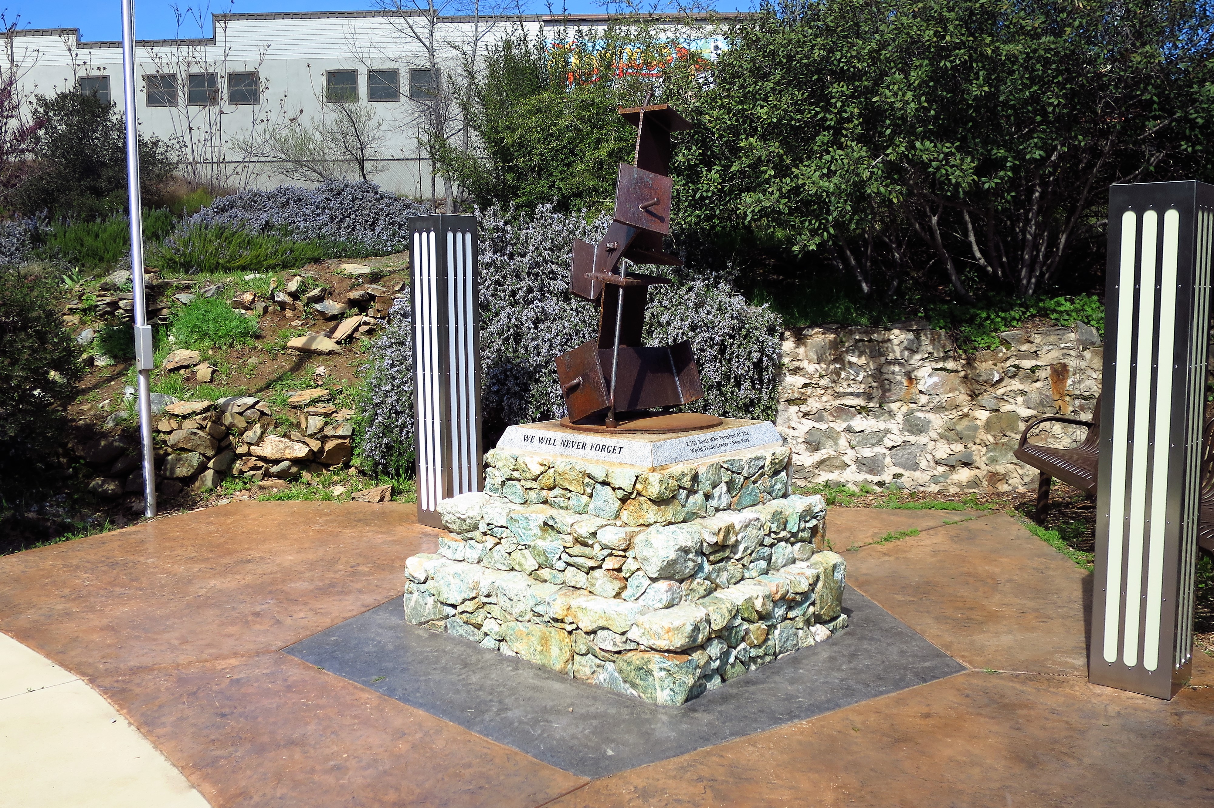
Just to remind you that you’re still in America, there’s this:
9-11 Memorial, Mariposa, California
All photos were taken by the author. Photos were taken in March 2016.
A list of all photo posts from the American County Seats series in TimManBlog can be found here.
I’m trying to travel to all of America’s county courthouses, and each month a post about my visit to the most interesting county seats. It’s only a hobby — but donations are greatly appreciated to help defer my costs. Thanks, Tim
Even though January has turned into February, it remains the year 2019 and so my 2019 New Years’ “Goals”, or Resolutions, still apply. One post per month I resolved — I wrote down the goal on paper and even worse, I posted my intentions on Facebook. Now that promise is forever on the internet, and there can be no excuses. So herewith is the February 2019 installment featuring an old friend — warm, sunny Kingman, Arizona.
Welcome to Kingman, Arizona
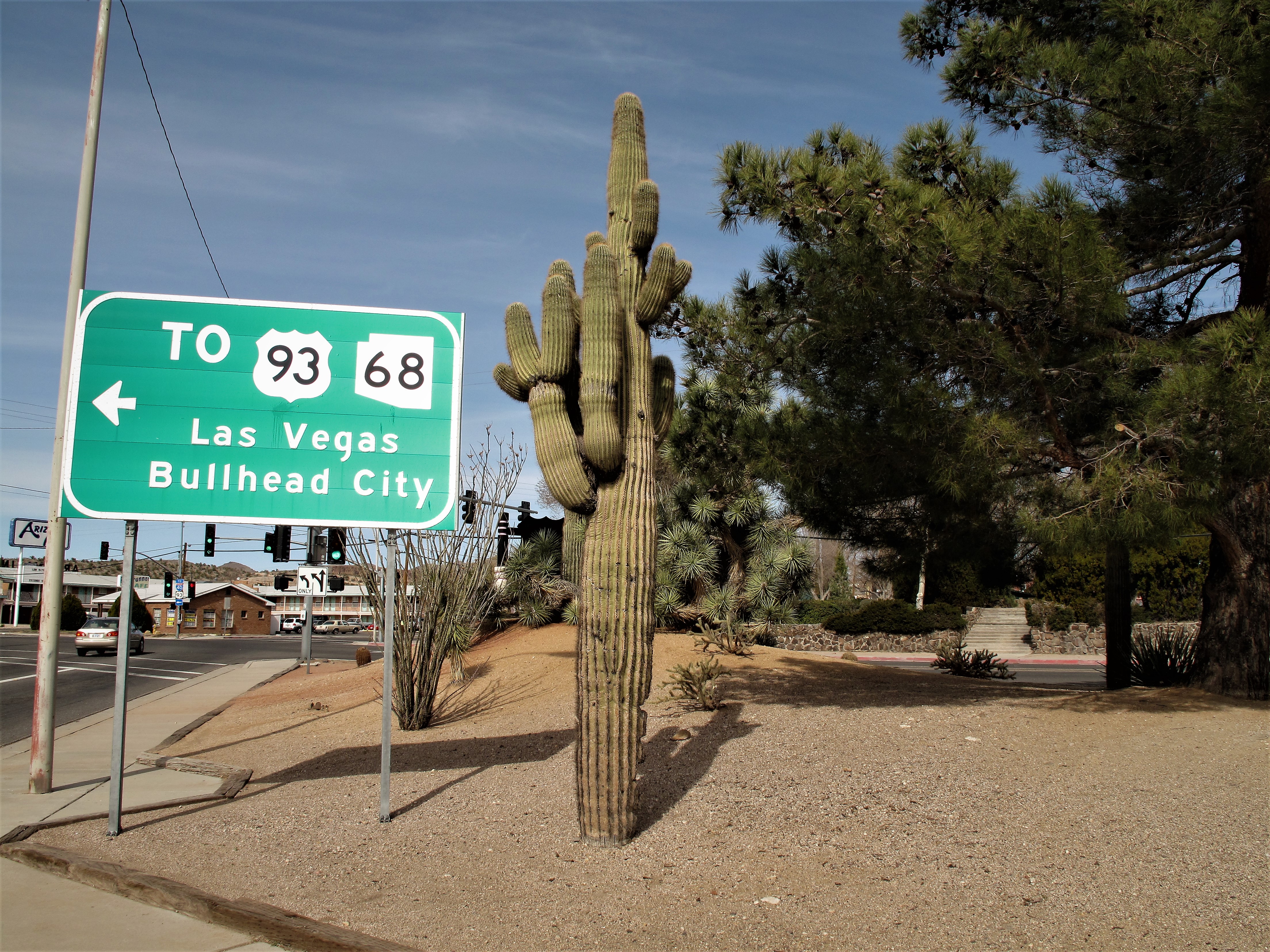
I’d seen Kingman several times before. Kingman is a crossroads. Looking eastward from Los Angeles (where I lived during the 1980s) Kingman is the gateway to the rest of the country. I drove through Kingman to get to the Grand Canyon, Amarillo, Kentucky, and to my parent’s home back in Pittsburgh. If you’re traveling north and south instead of east and west, the long desert highway that is US 93 intersects the I-40 in Kingman, about halfway between Las Vegas and Phoenix.
At first, I saw the town as a hot, dusty Arizona truck stop, but I wasn’t the first caravan to come through.
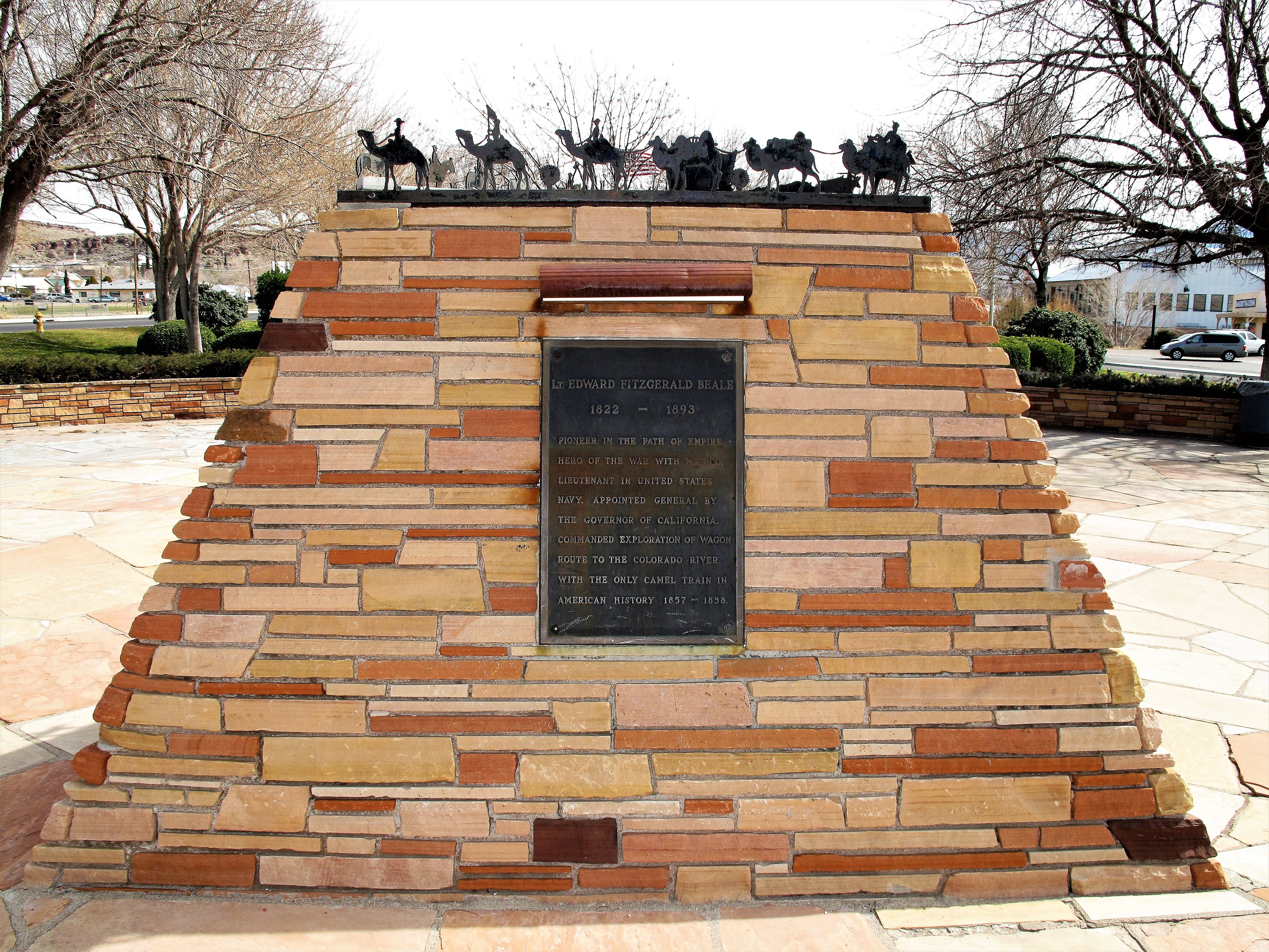
Lieutenant Edward Fitzgerald Beale, commanding a caravan of camels, blazed a wagon route through Northern Arizona Territory back in 1857-58. Beale Street in Kingman is named for him. (But apparently not Beale Street in Memphis. Wikipedia has Beale’s resume.)
Beale is remembered here:
Lt. Edward Fitzgerald Beale, 1822-1893. Pioneer in the Path of Empire. Hero of the War with Mexico. Lieutenant in the United States Navy. Appointed General by the Governor of California. Commanded exploration of wagon route to the Colorado River with the only camel train in American history, 1857-1858.
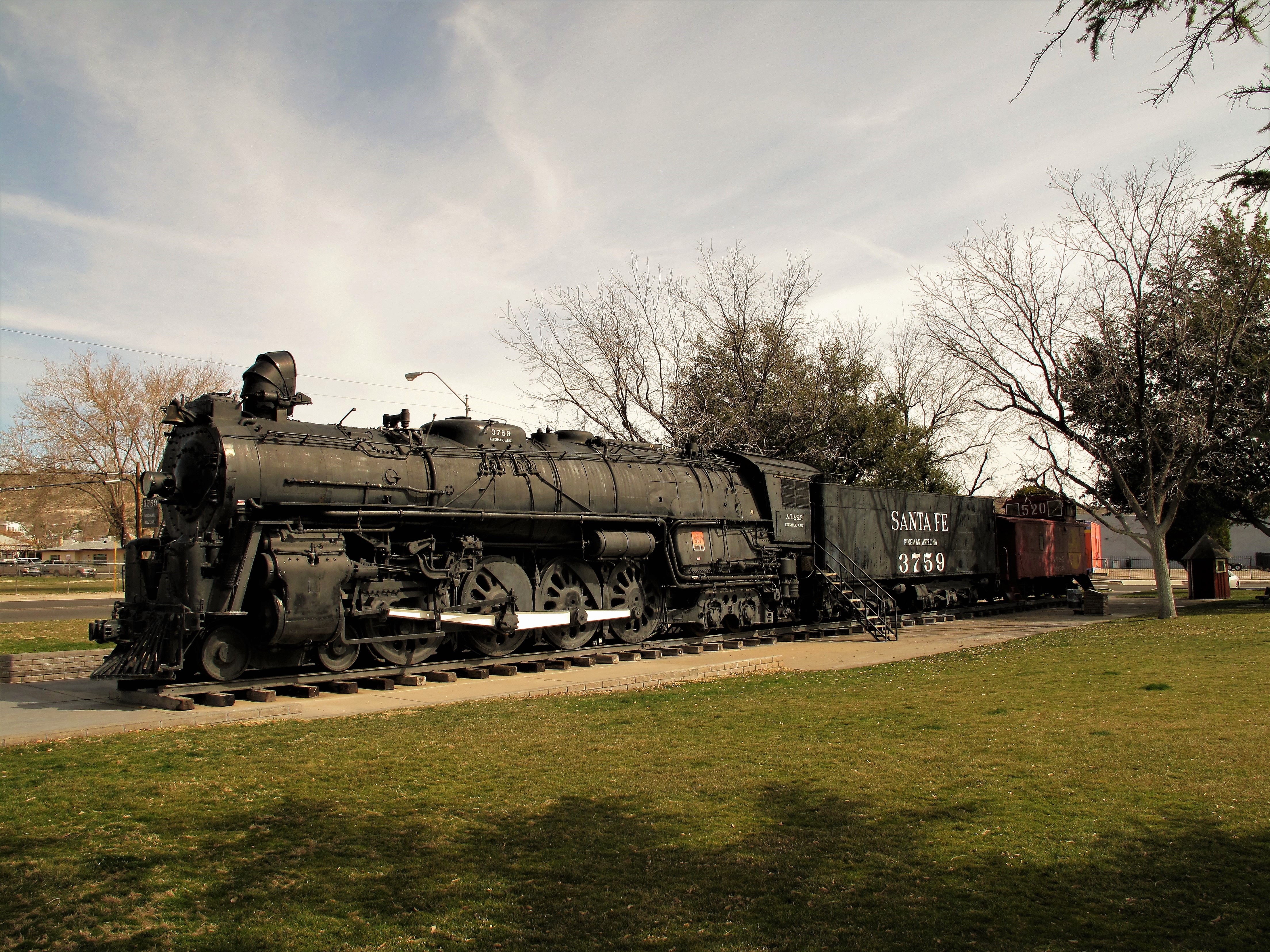
Beale’s wagon route soon became a railroad route. Mining sprang up in Kingman and then receded. As cars followed trains, Route 66 followed the railroad route, then Interstate 40 replaced US 66. Even with the mines gone, Kingman is forever a crossroads and will never disappear.
An old Santa Fe locomotive in town park
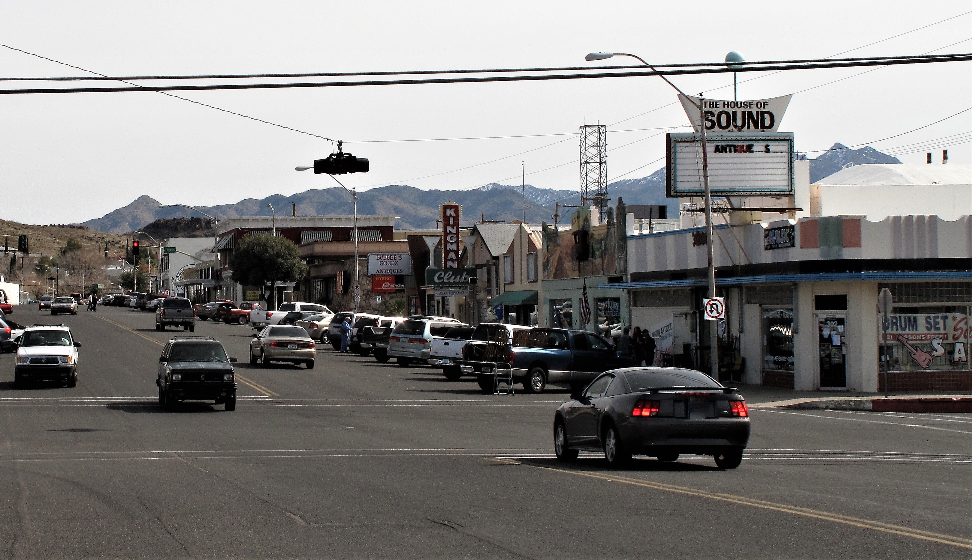
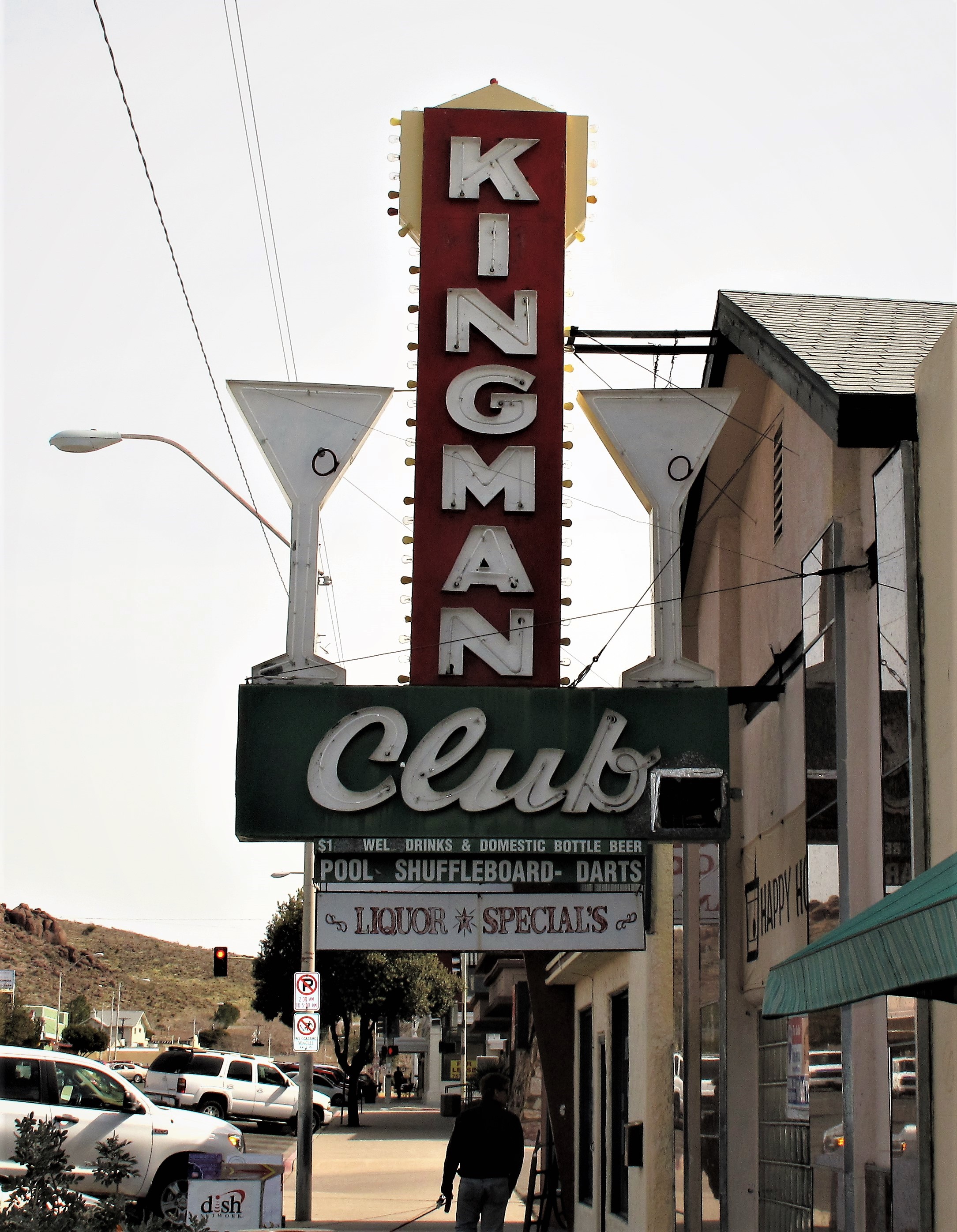
Unless you get off the Interstate you won’t notice the snow-covered rocky cliffs above the historic buildings along old Route 66. Kingman has a few nostalgic hotels here, some old bars, and so forth. The Beale Street Brews coffee house brings life to this street, along with the Red Neck Pit BBQ next door (now Floyd and Company Real Pit BBQ). Here are a few buildings and street scenes:
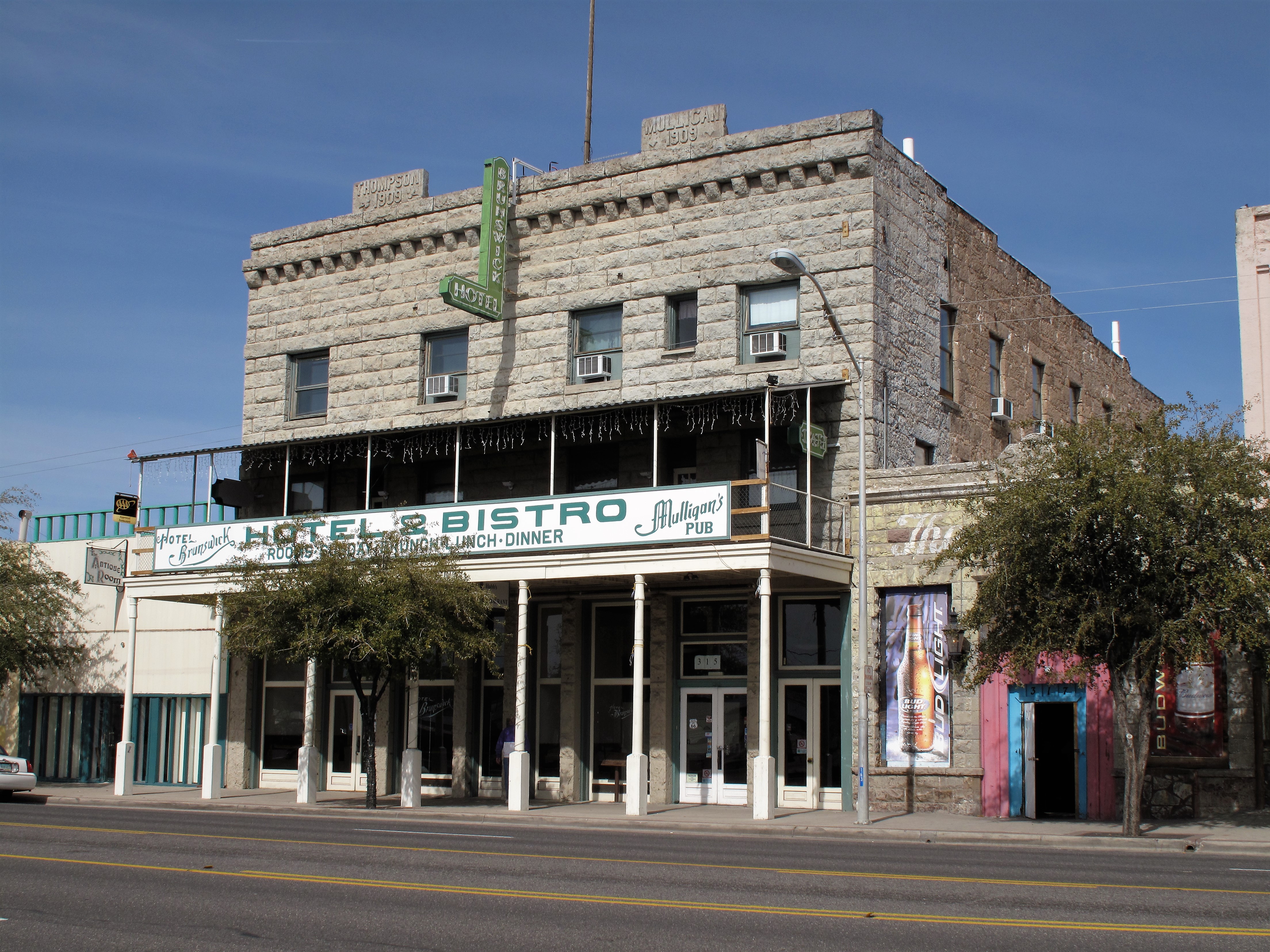
Snow-speckled mountains above old Route 66 in KingmanThe old Kingman Club (I wonder if Jack Kerouac drank here?)The old Brunswick Hotel (now “Hotel Brunswick Suites”) Route 66, Kingman
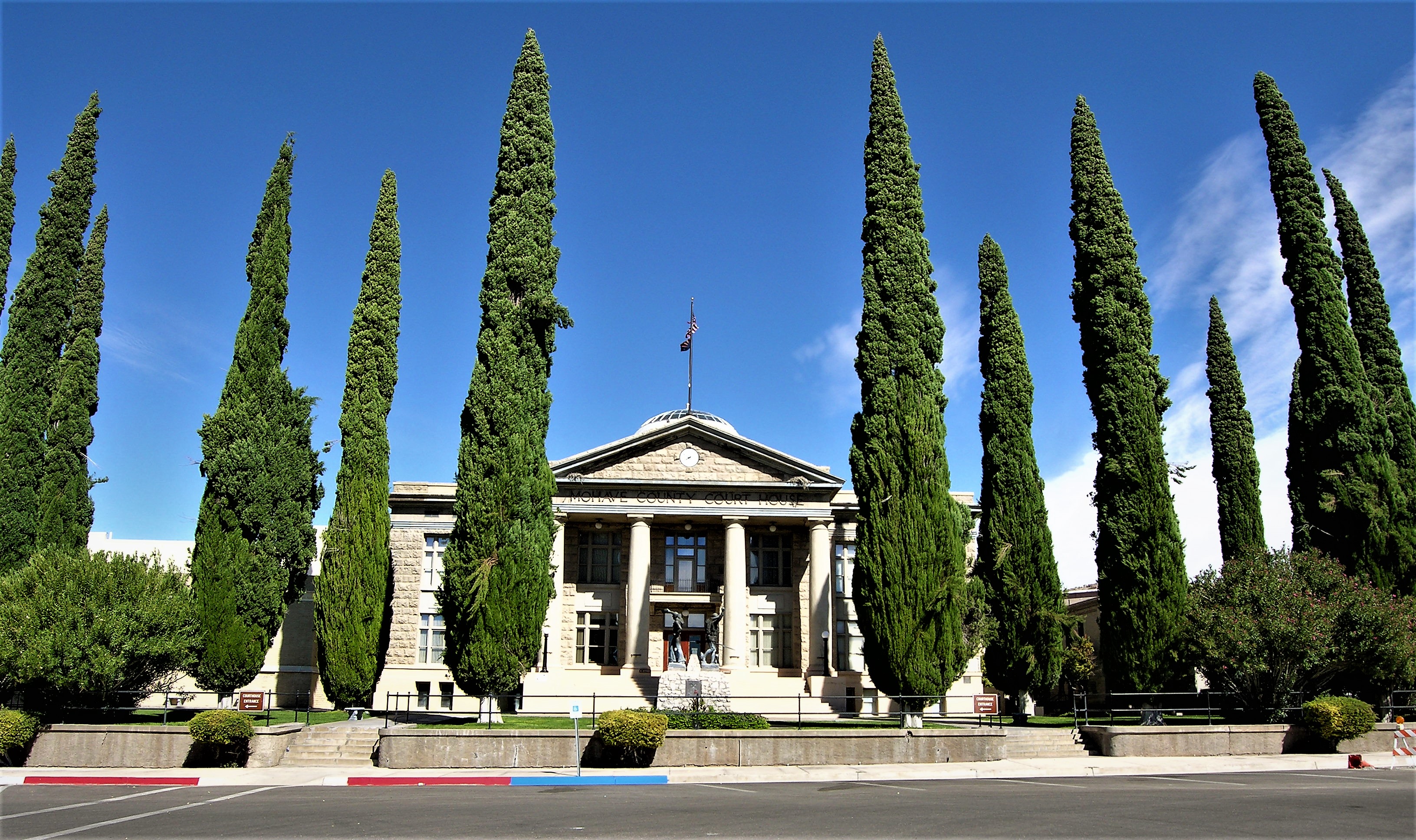
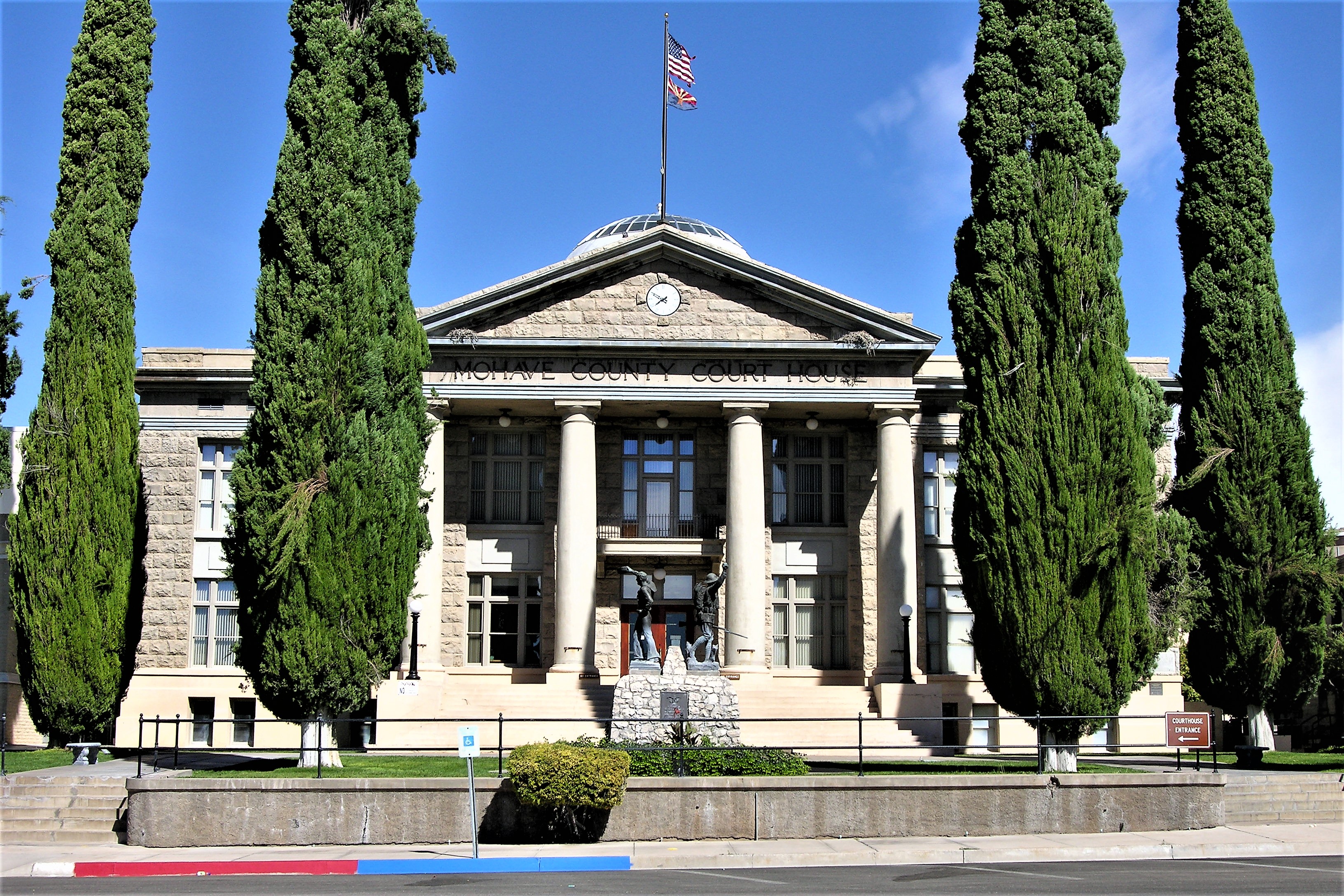
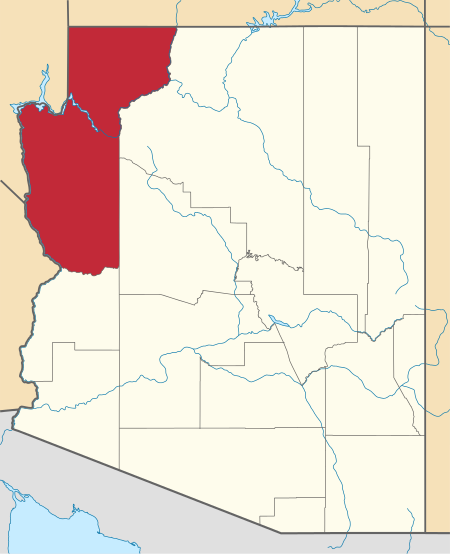
A few blocks off Beale Street the Mohave County Courthouse stands like a Roman temple above the forum. Built in 1914 of local gray stone, it emerges behind a line of tall, thick juniper trees. The trees are three stories high; the courthouse is only two, but the cupola adds maybe another story and a half. The building stands at the top of Fourth Street, looking down on Kingman from above – a good place from which to administer Justice.
Mohave County Superior Court, Kingman, Arizona
As the courthouse was built in 1914, the front statue was likely added a few years afterward, following the end of World War I. This particular design — a doughboy holding a hand grenade aloft in his right hand — is a common design for World War I memorials seen throughout the country.
World War I Memorial
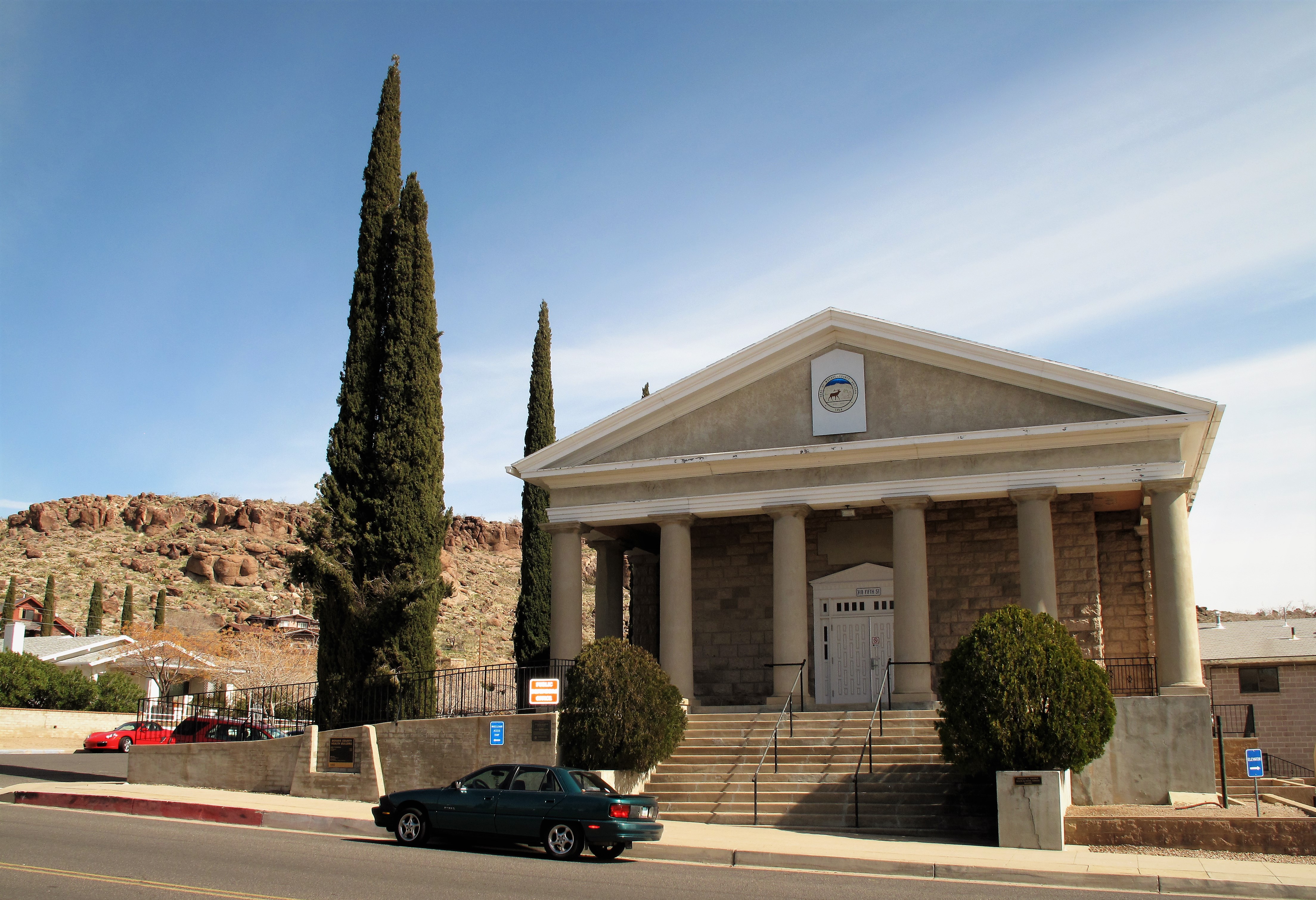
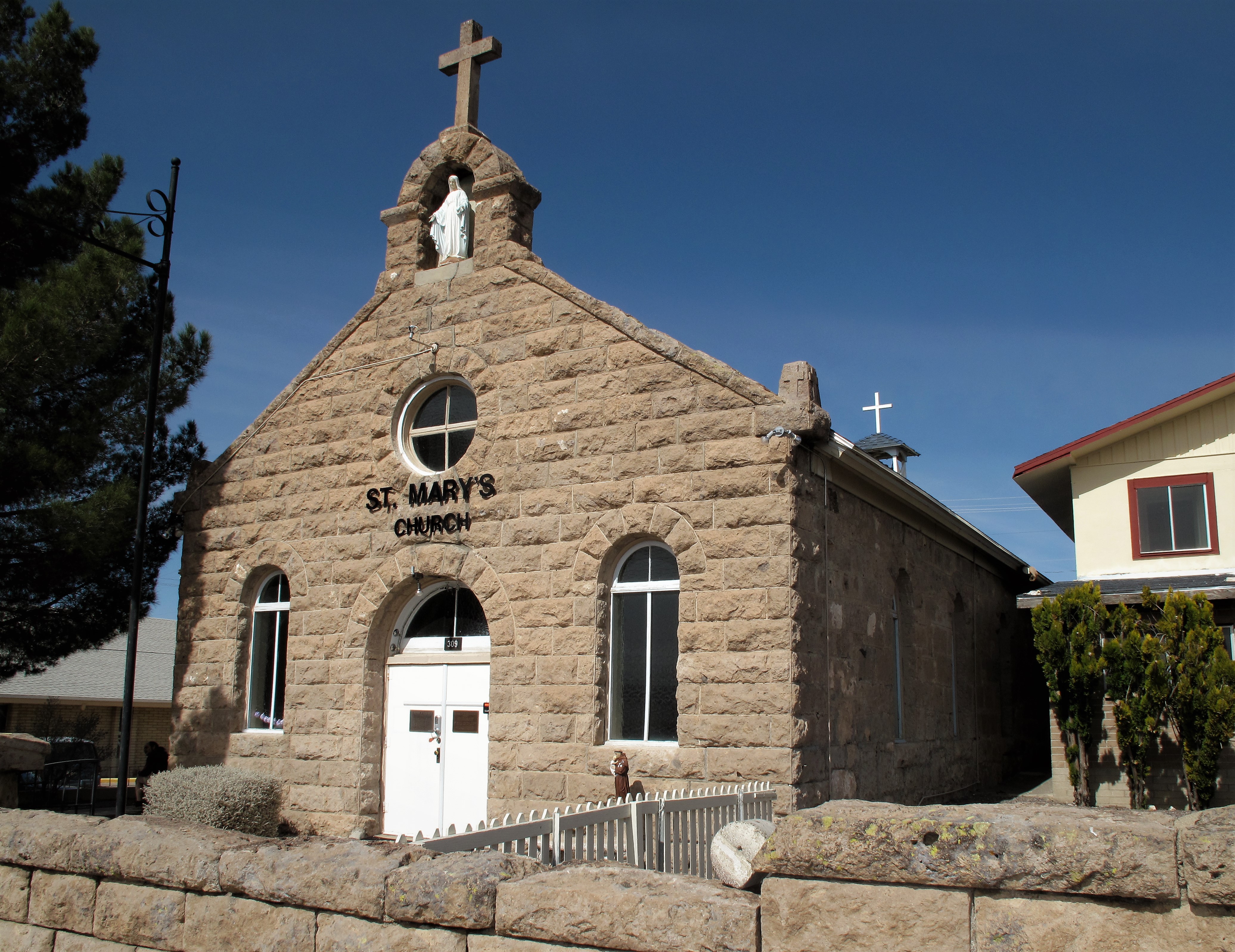
Finally, some more examples of old stone construction:
Mohave County Health Department (old building, scenic view)St. Mary’s Roman Catholic Church, Kingman
I hope you enjoyed Kingman and are enjoying your February. March is just around the corner…
Mohave County in the state of Arizona
All photos by the author. Photos were taken in February 2010, except for the courthouse photos which are from October 2005.
A list of all photo posts from the American County Seats series in TimManBlog can be found here.
I’m trying to travel to all of America’s county courthouses, and each month a post about my visit to the most interesting county seats. It’s only a hobby — but donations are greatly appreciated to help defer my costs. Thanks, Tim
One of my 2019 New Years’ “Goals”, or Resolutions, was to resurrect my old blog on which I haven’t posted since the summer of 2017. One post per month I resolved — and I wrote down the goal on paper and even worse, I posted the resolution on Facebook. Now the promise is on the internet which means it’s forever. No excuses anymore.
Since it’s the month of January why not some photos from the past January? Back in 2009 I was working on a consulting contract in Green Bay, Wisconsin, and spent my weekends traveling the frozen roads of the Badger State. I wandered into snow-covered Baraboo on Saturday, January 10, 2009. It’s a nice place. Check it out — I think you’ll like it.
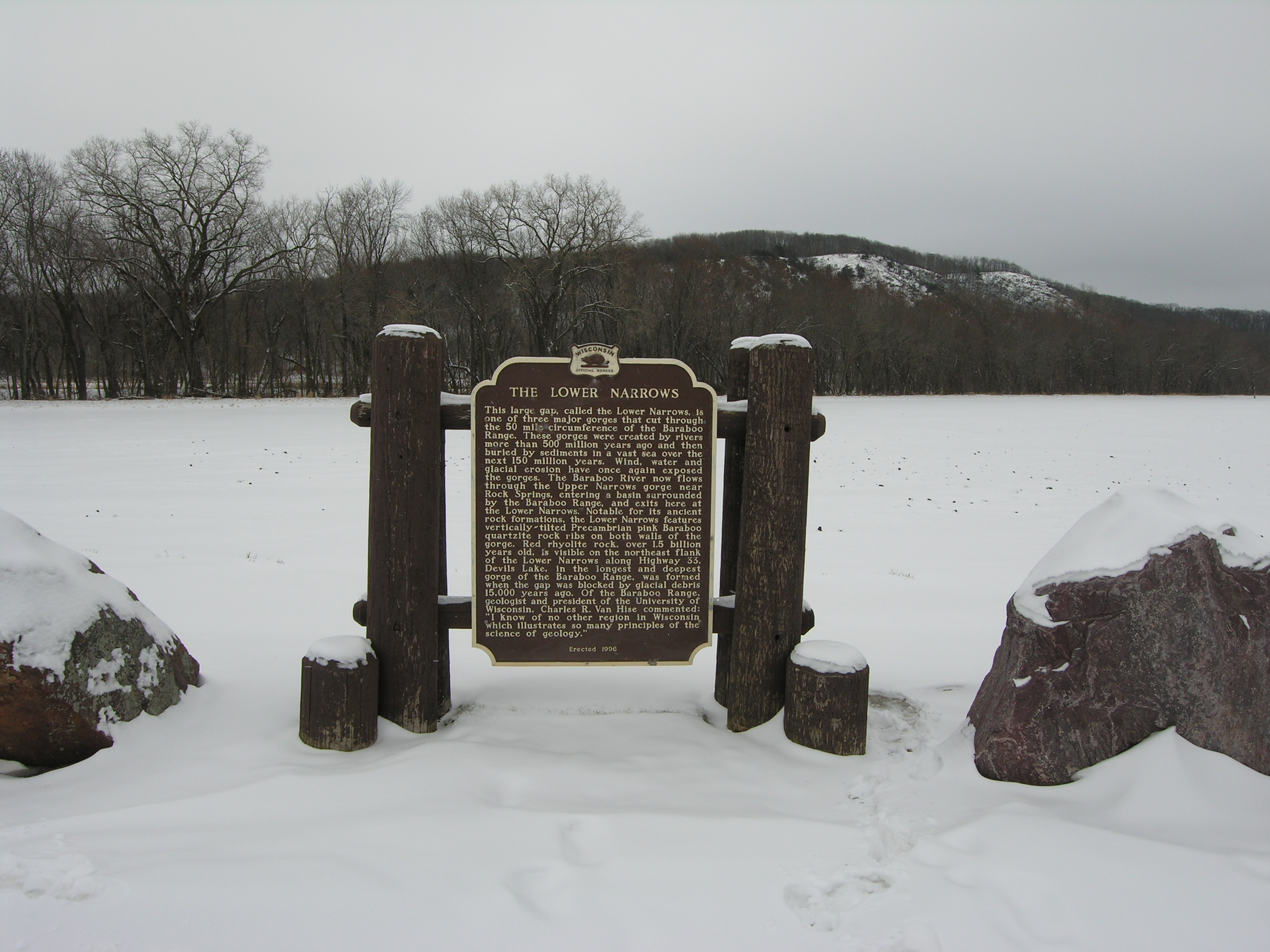
I approached Baraboo through a geologic feature called “The Narrows.” There are old glacial hills here next to the metamorphic rock, both of which seem far out of place in the dairy state.
The Narrows, granite rocks and hills beyond. Read the sign for some interesting geologic info.
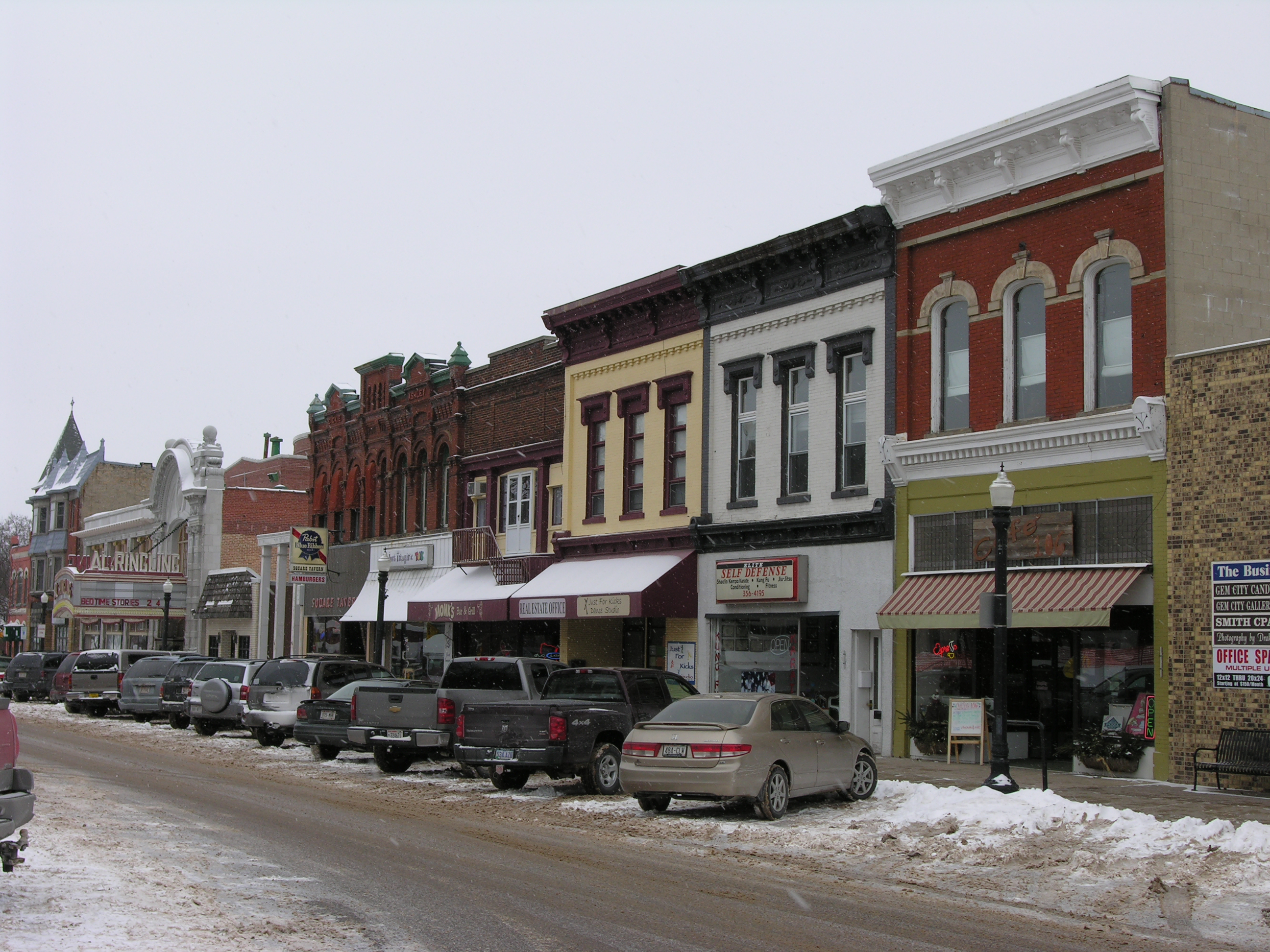
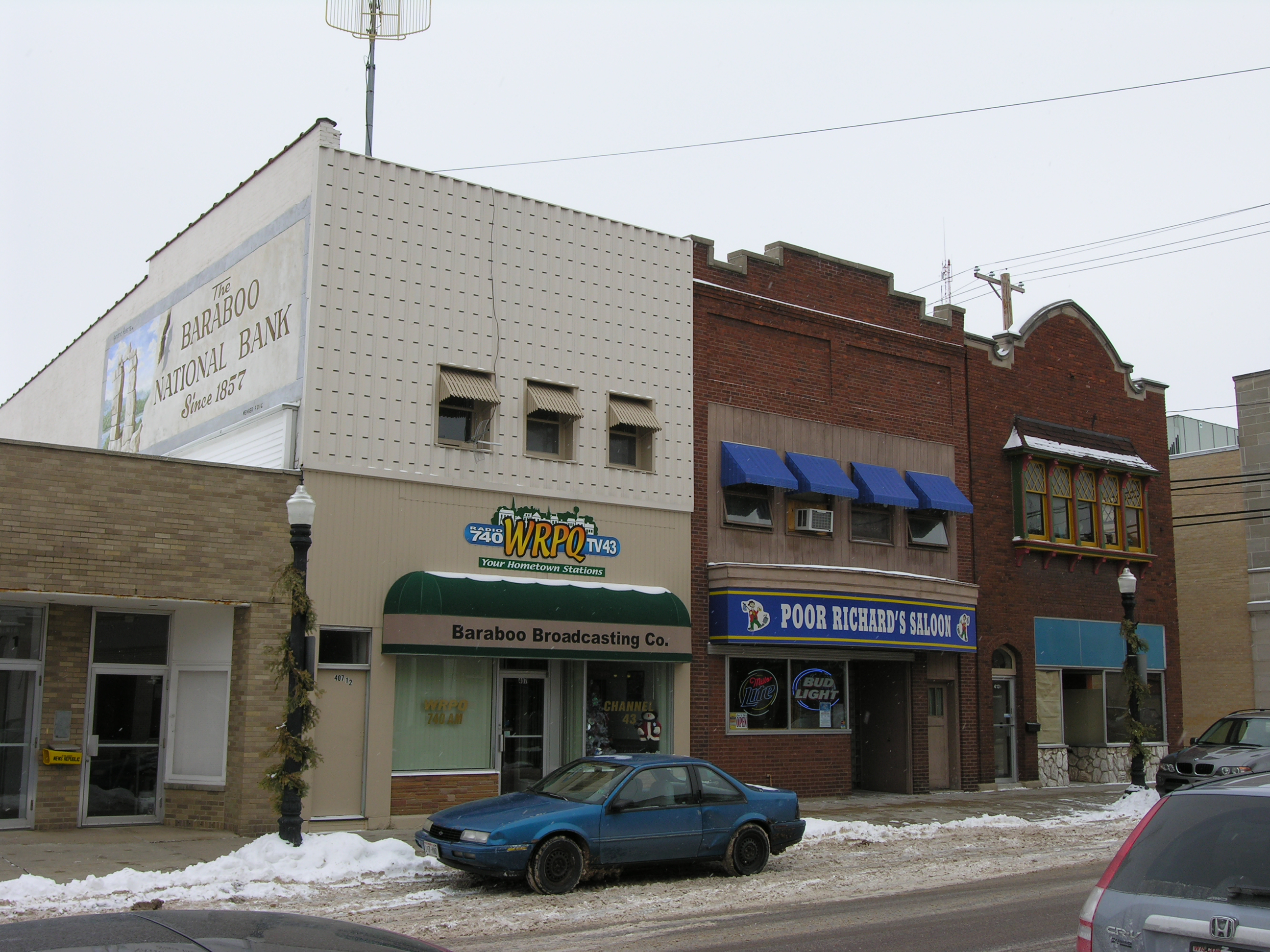
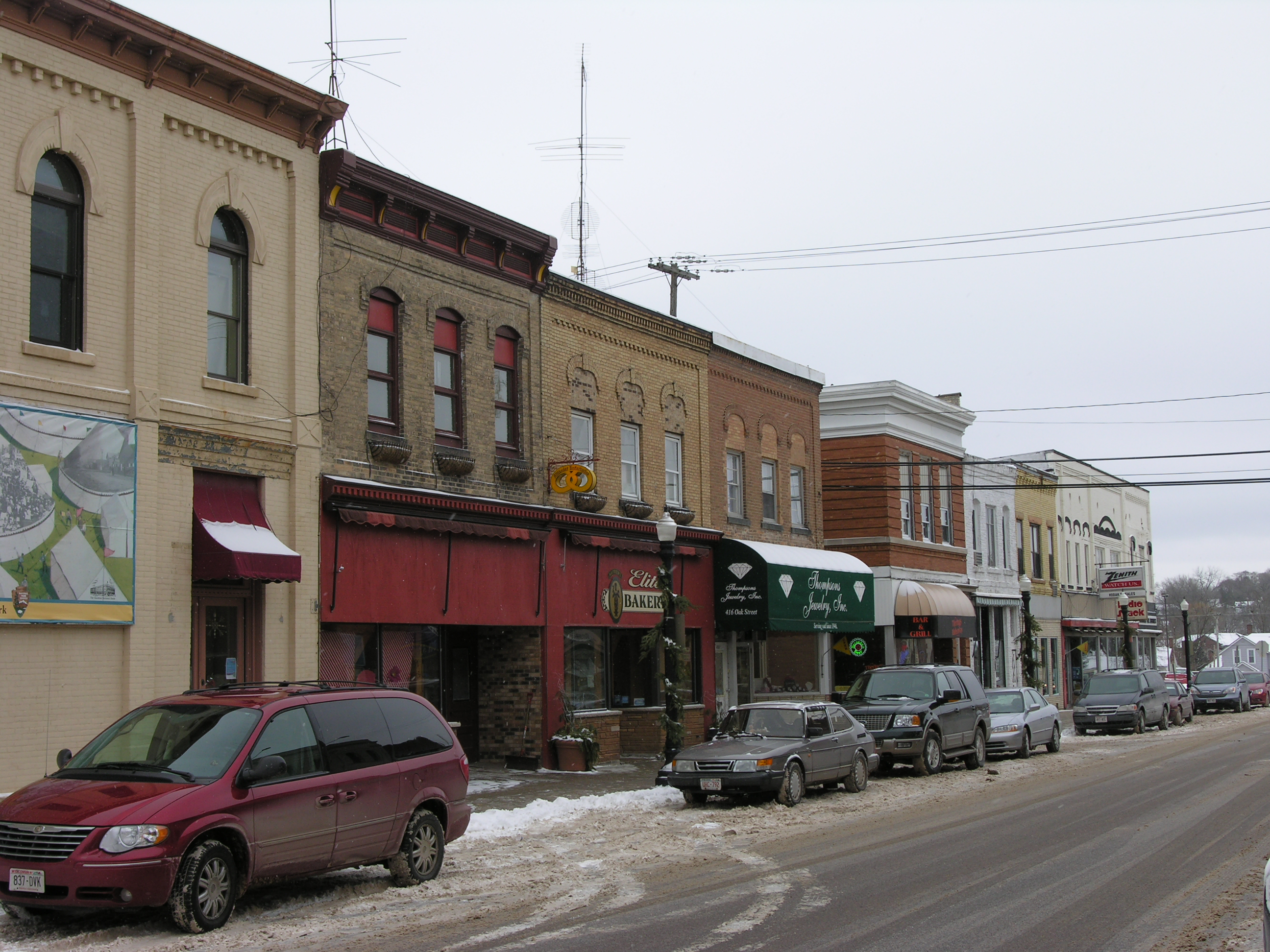
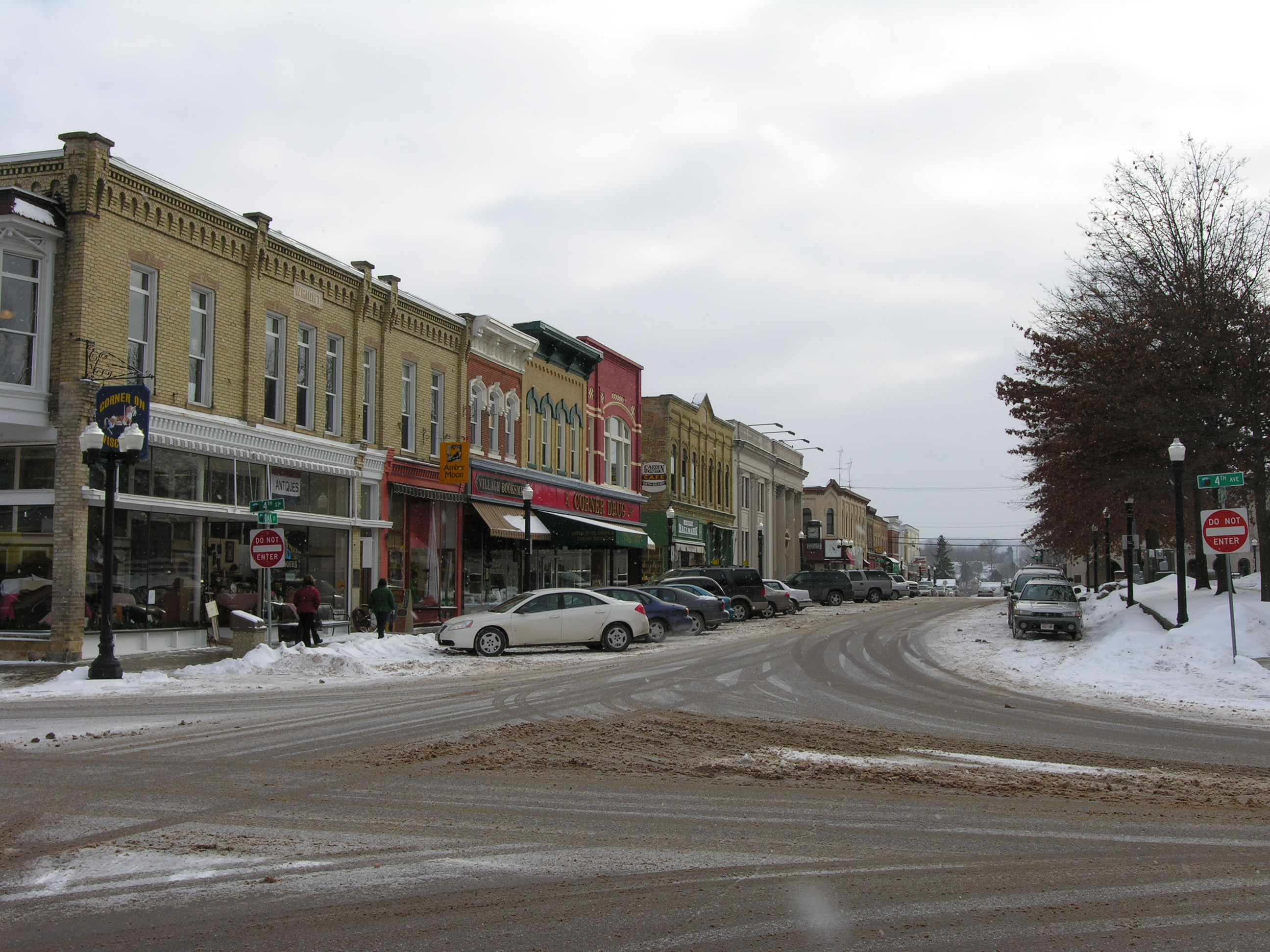
Once beyond the Narrows gateway, I found a busy downtown Saturday morning even though piles of snow banked the sidewalks and the temperature hovered in the upper teens. Parked cars took almost every space. Restaurants and coffee shops were busy. Even the galleries (whose mere existence demonstrates that the town attracts some tourist trade) saw traffic on a cold, post-Christmas day.
Saturday traffic in Baraboo, WisconsinCourthouse Square Tavern in the old Dickie and Ashley building, probably built in the 1880s More Baraboo Courthouse Square shops. The Al. Ringling Theatre is at the far left.
From Wikipedia:
“The city was the home of the Ringling Brothers. From 1884 to 1917 it was the headquarters of their circus and several others, leading to the nickname “Circus City”. Today Circus World Museum is located in Baraboo. A living history museum, it has a collection of circus wagons and other circus artifacts. It also has the largest library of circus information in the United States.”
The AL. Ringling Theatre, built by the Ringling Family
Baraboo was named for an 18th Century French voyageur Barabeauy. However, German influences are more apparent here than in French. Notice the names — Ploetz Furniture has a building in the square. Burkhalter Travel is next door, and the famous Ringling Brothers (originally Rüngling) were descendants of a harness maker from Hanover, Germany.
I ate lunch at the Garden Party Café above the “Corner Drug Store,” which locals said has been around since the mid 1800s. The Garden Party’s walls were covered with paintings for sale and decorative flower pots. Most of my fellow diners were weekend tourists like me.
The Corner Drug and environs, Baraboo, Wisconsin
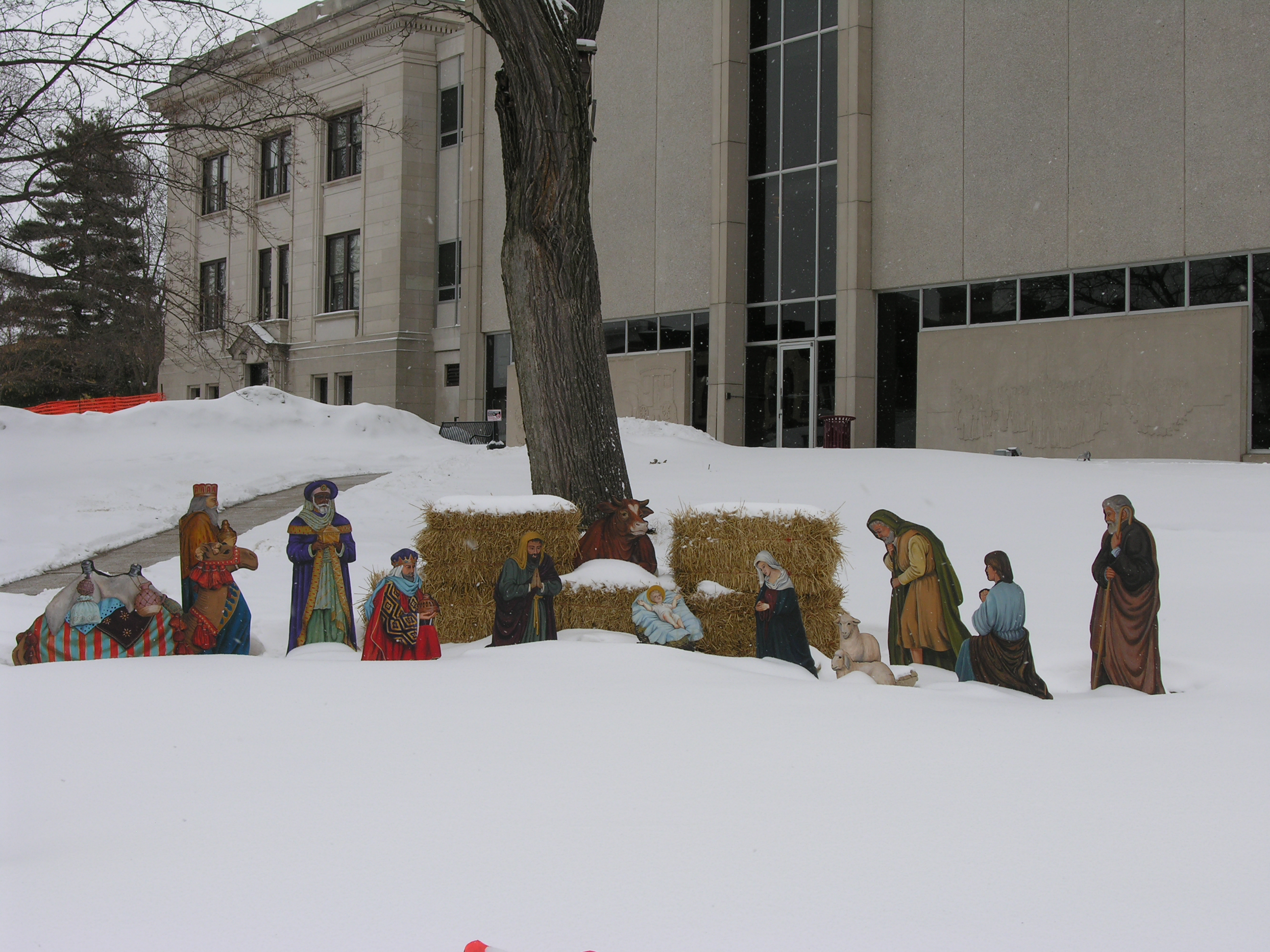
The Sauk County Courthouse is the centerpiece of this downtown scene. Out of sight of ACLU scrutiny, rural Wisconsinites decorate their courthouse grounds with Christmas Manger scenes, and they’re a little slow to take them down in frigid January.
Christmas Manger scene outside the Sauk County CourthouseSauk County Courthouse, Baraboo, Wisconsin
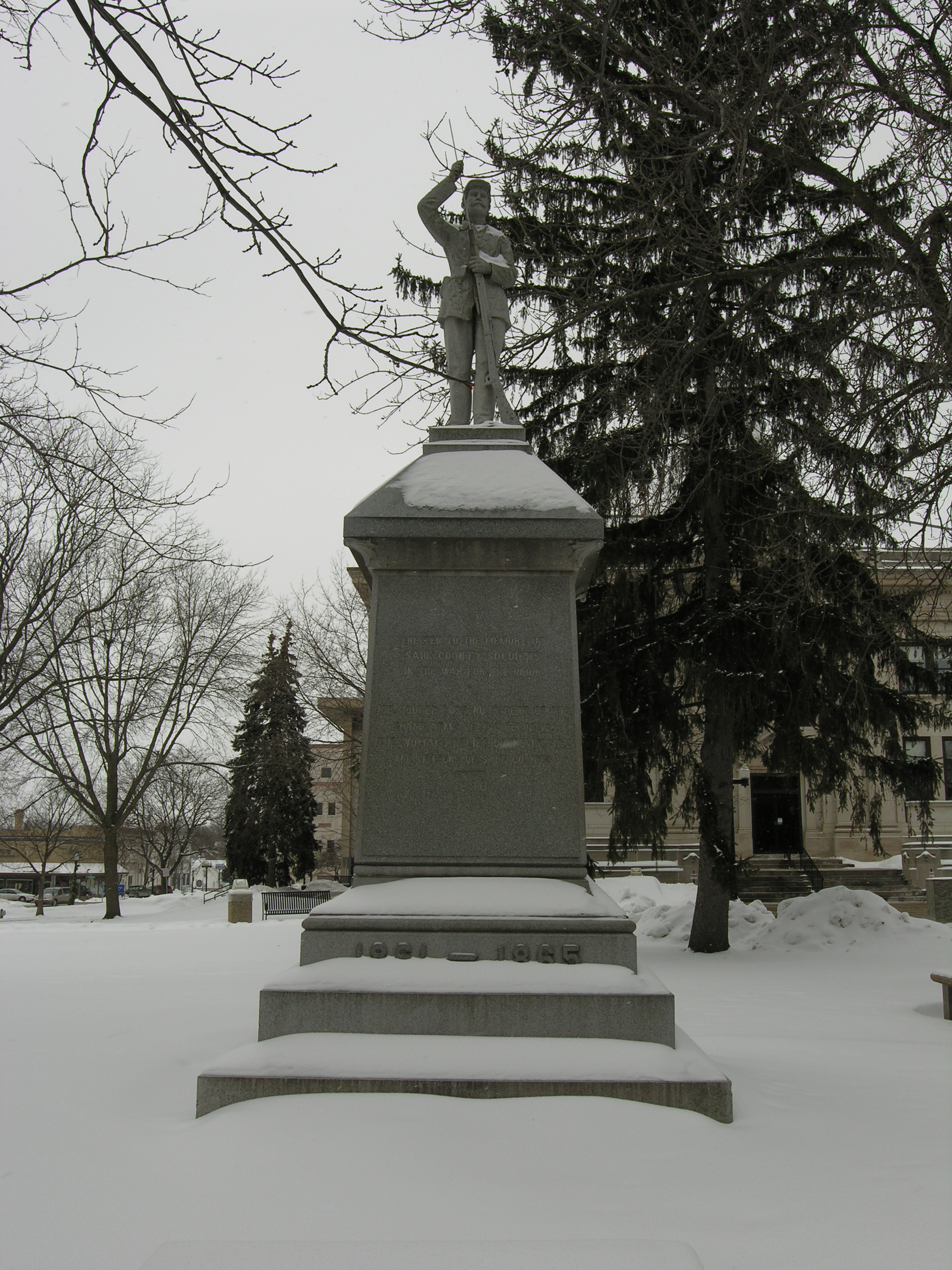
Sauk County was founded in 1846, Baraboo in 1852. Old enough to have Civil War memories: “Erected to the Memory of Sauk County soldiers in the War For the Union”
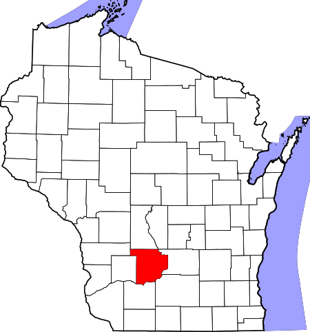
Union soldiers memorial, Sauk County CourthouseSauk County in the state of Wisconsin
Thanks for reliving old memories with me. Please excuse the dim photos taken on an overcast day — but Saturday is the best day of the week regardless of the weather, right? Here are a few extra snapshots to finish off:
A list of all photo posts from the American County Seats series in TimManBlog can be found here.
I’m trying to travel to all of America’s county courthouses, and each month a post about my visit to the most interesting county seats. It’s only a hobby — but donations are greatly appreciated to help defer my costs. Thanks, Tim
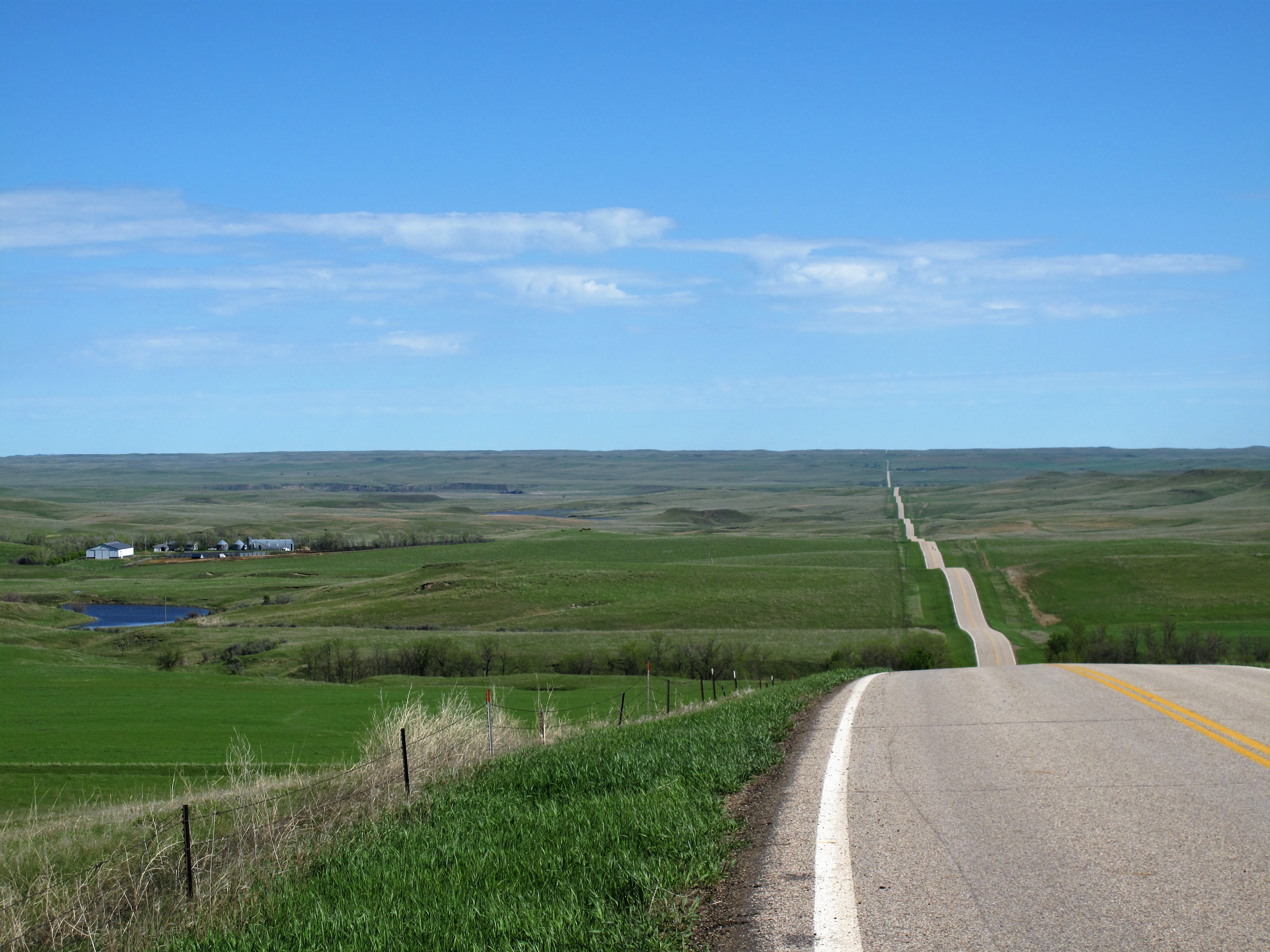
Such a grand vista. A long, straight, gently undulating highway, traversing seemingly endless beaver ponds and pastures to join the far horizon below a boundlessly pleasant summer sky.
The American prairie makes us look far.
Gazing ahead you foresee a great drive, maybe in a car or on a bicycle.
But suppose you were all alone and badly injured and had to crawl this road instead of driving it. Would you be able to keep calm, keep your head down, pull yourself elbow over elbow again and again until you’ve met the distant horizon, not knowing how far that might be?
Long ago a man did just that. He was a fur trapper and mountain man. The locals remember him to this day.
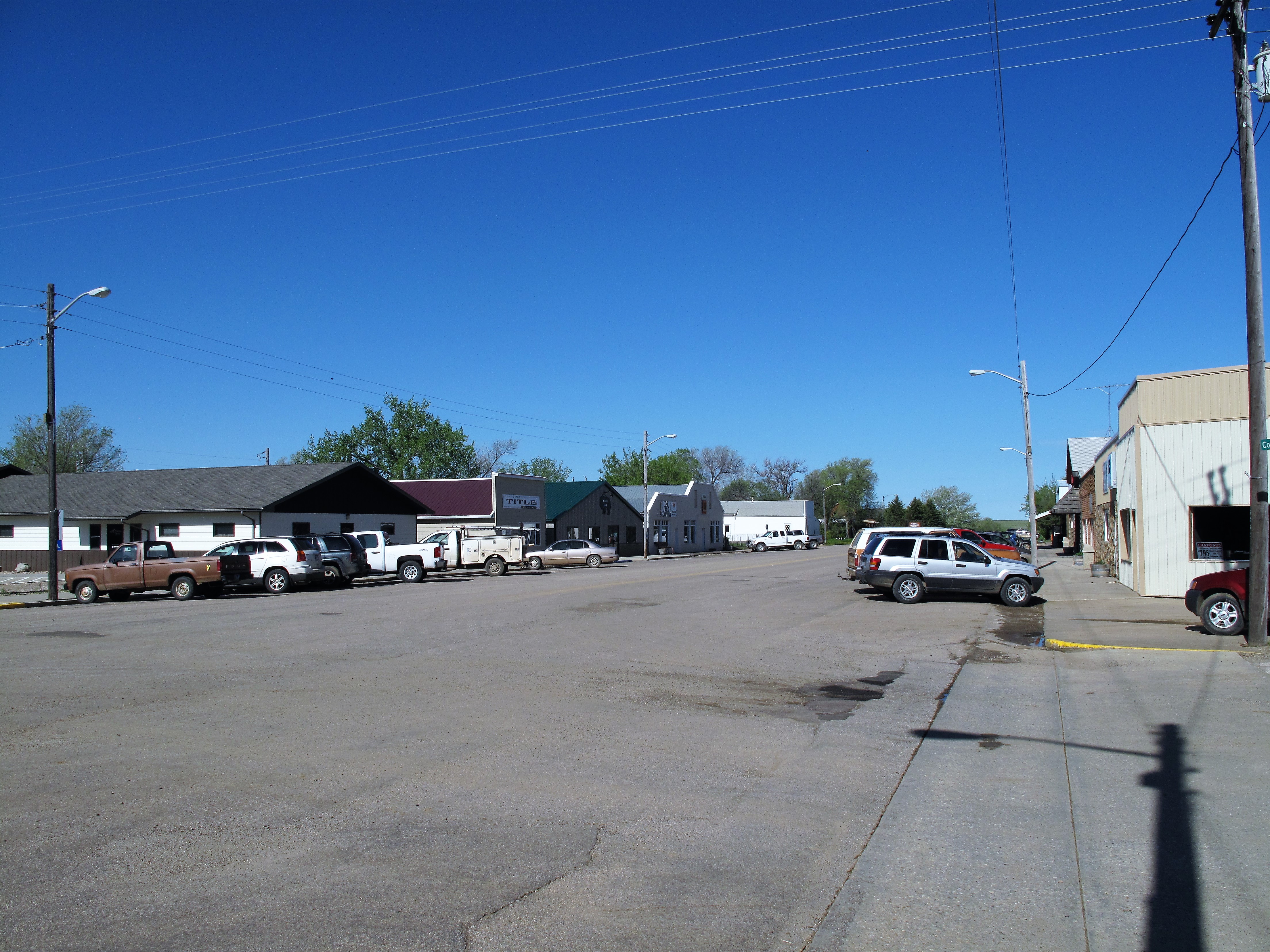
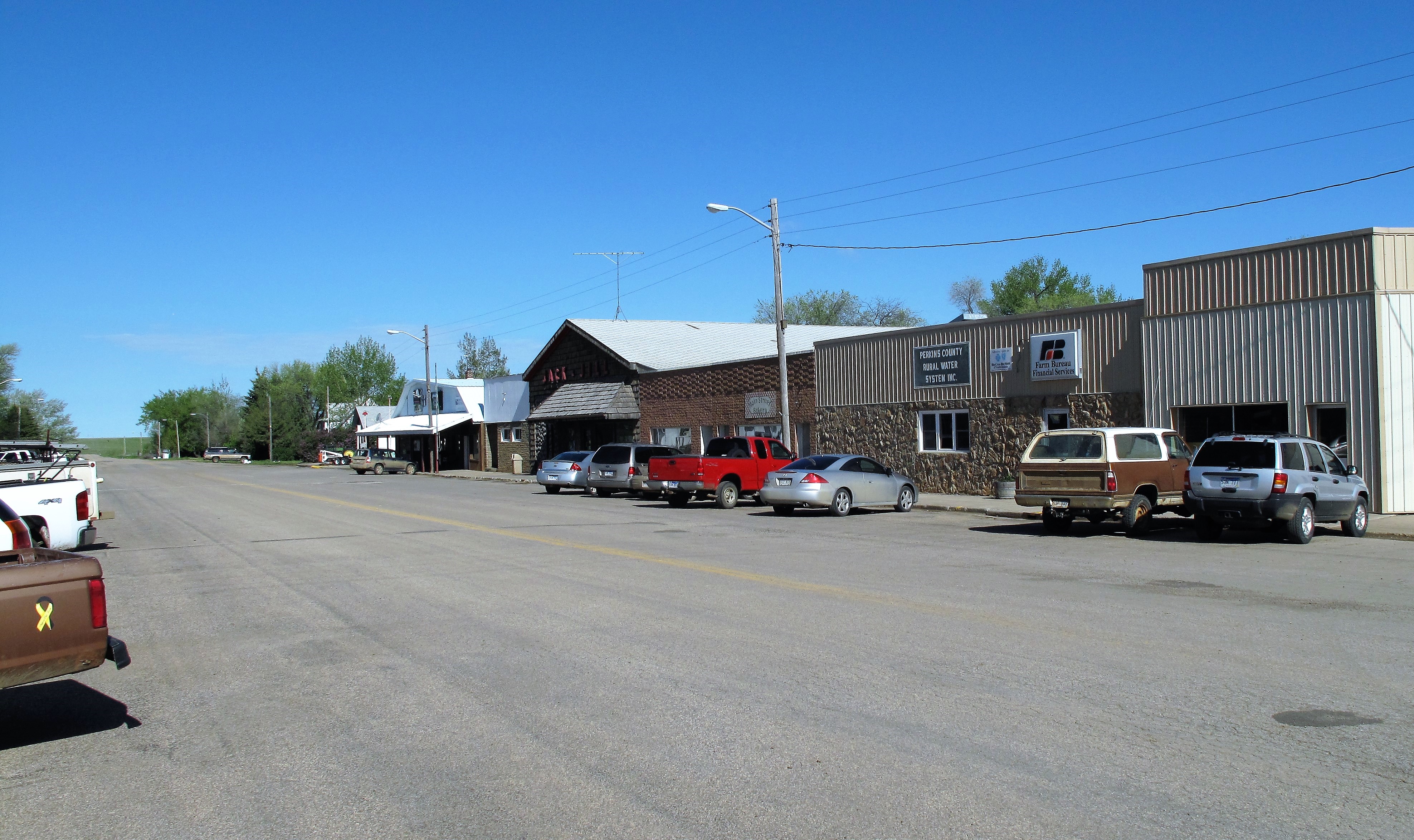
This is Bison, South Dakota, population 333.
Here are some of the principal town establishments: The Bison Bar, County Title office…
…the Bison Community Center, American Legion Post 255, the Bison Senior Citizens center. Structures (and people) are plain yet sturdy, built to withstand the strong winds and heavy snows of the Northern Plains.
The Jack and Jill grocery store dominates local commerce. I walked in at 10:00 on a Wednesday morning and noticed a handwritten sign posted on the front door. It said simply:
“We will be closed from 10:45 to 12:30 for the funeral.”
Whose funeral? Someone from the store? A prominent man-about-town? Who?
The sign didn’t say. Apparently, it didn’t have to; if you live in town, you will already know. They say that in small towns everyone knows your business. That may be true, but on the other hand, everyone misses you when you’re gone.
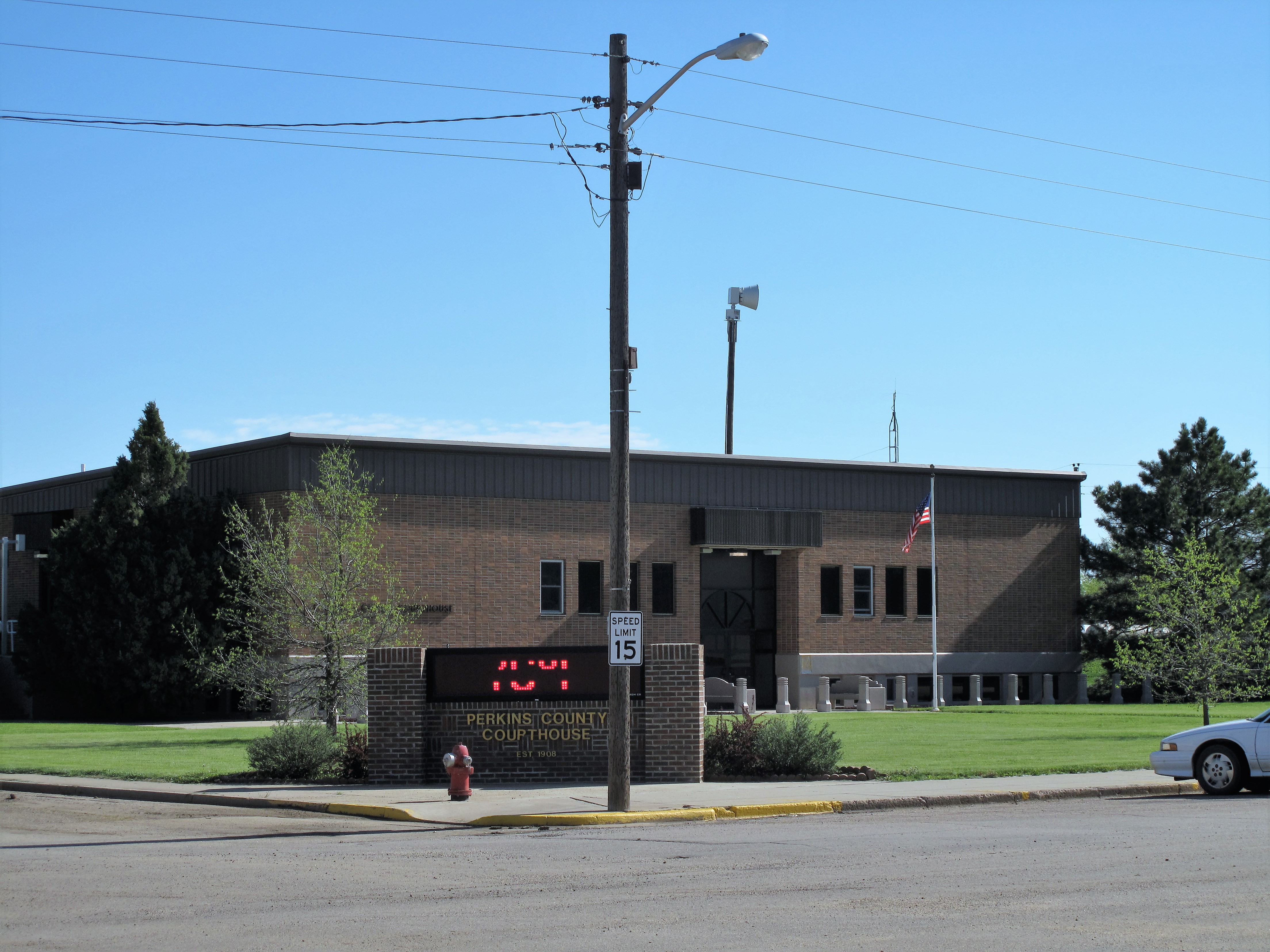
The Perkins County Courthouse occupies a prominent corner block on Bison’s Main Street. Perkins County boasts a total population of 2,982. Donald Trump won 83% of the vote here in 2016. Pretty good for a New Yorker.
Perkins County in the state of South Dakota
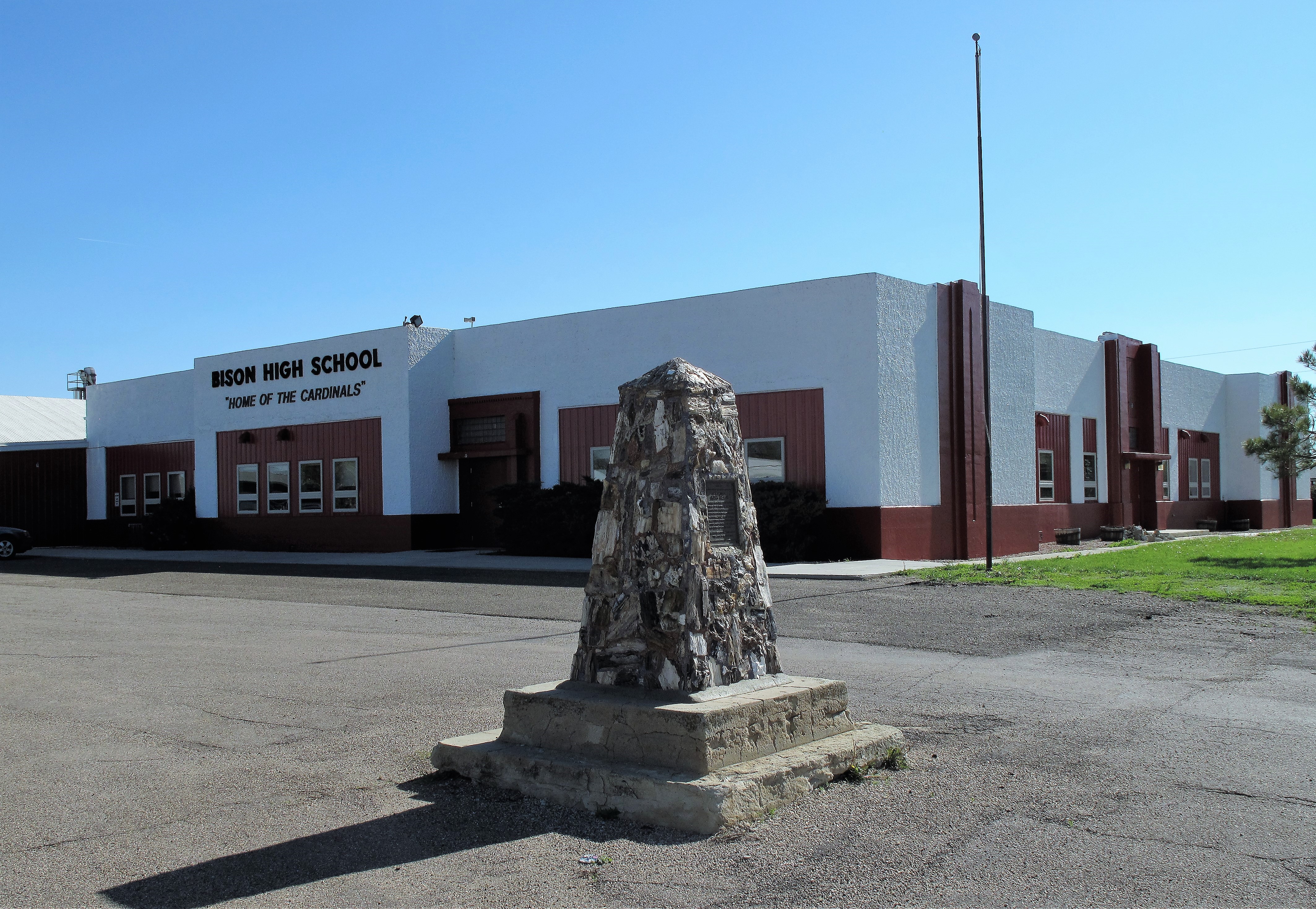
Bison High School: “Home of the Cardinals” — because the “Bison Buffaloes” would invite derision. While school mascot names are fun, the obelisk in front of the school teaches a serious lesson.
This is a monument to mountain man Hugh Glass, whom I mentioned at the beginning.
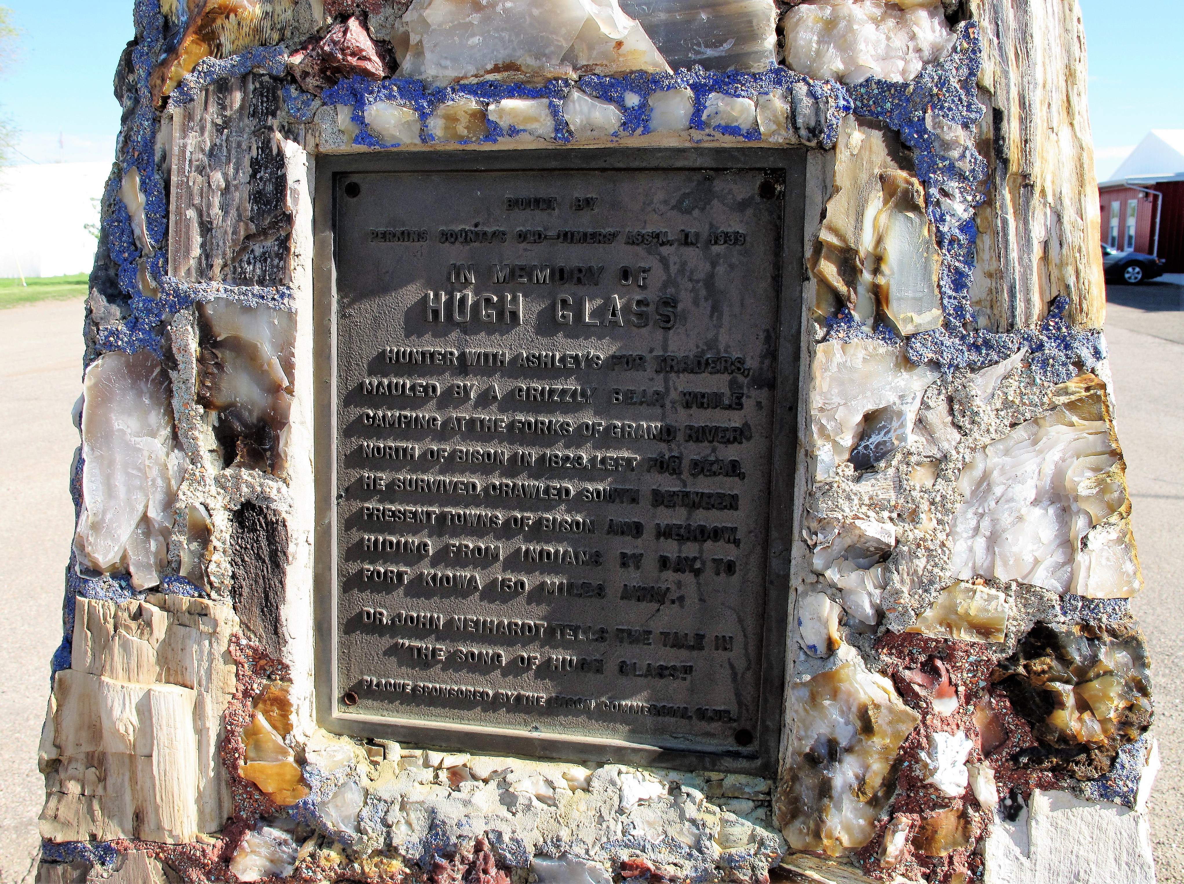
Here’s the text of the monument:
HughGlass. Hunter with Ashley’s fur traders, mauled by a grizzly bear while camping at the forks of Grand River north of Bison in 1823. Left for dead, he survived, crawled south between present towns of Bison and Meadow, hiding from Indians by day, to Fort Kiowa 150 miles away.Dr. John Neihardt tells the tale in “The Song of Hugh Glass.”
Keep calm and look far. Hugh Glass reached his destination after crawling on his elbows for 150 miles. If we must, we can do the same.
These are tumultuous times. Yet like Hugh Glass, we cannot stop here to re-suffer the past. America still has great places ahead of us and great achievements to offer mankind if we keep a level head “with firmness in the right, as God gives us to see the right.” Keep calm and look far — persistence will conquer distance.
(Note: Since visiting Bison I’ve learned that the Jack and Jill grocery store has apparently changed hands and been renamed the Bison Food Store.)
A list of all photo posts from the American County Seats series in TimManBlog can be found here.
I’m trying to travel to all of America’s county courthouses, and each month a post about my visit to the most interesting county seats. It’s only a hobby — but donations are greatly appreciated to help defer my costs. Thanks, Tim
This week the political media frenzy swirls through South Carolina like a transient storm. Last Saturday the GOP held its presidential primary here and this Saturday the Democrats hold theirs. As pundits dissect this state, wielding the scalpels of scientific polling and demographics, I thought it fitting and proper to provide a glimpse beneath the hullabaloo.
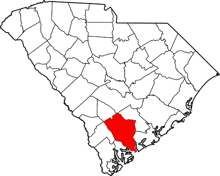
Colleton County in the state of South Carolina
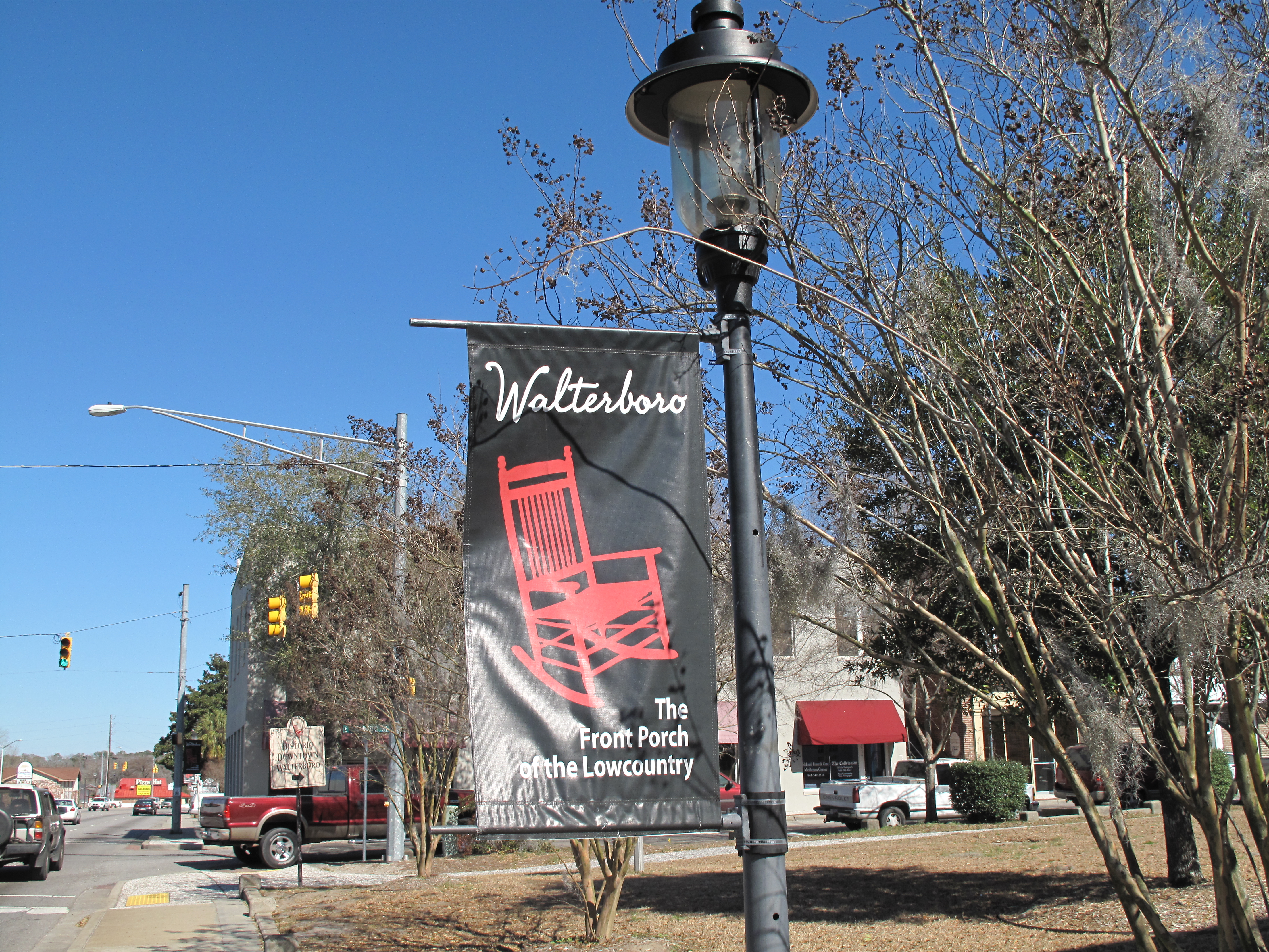
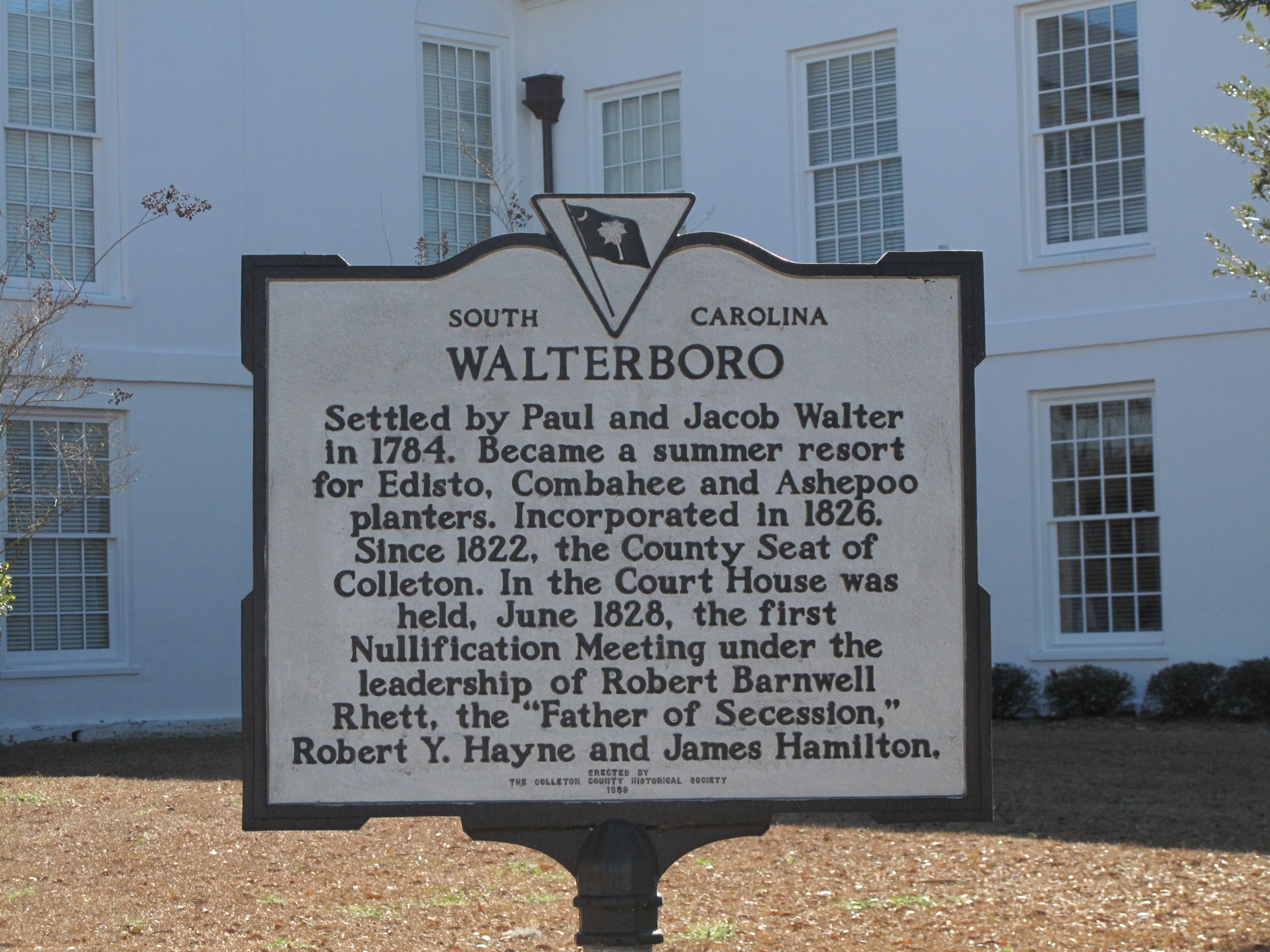
Along Washington Street in the small Palmetto State town of Walterboro, banners on the streetlamps proclaim it “The Front Porch of the Low Country.” Walterboro is 40 miles from the ocean, 50 miles from Charleston, and far, far away from northern climes shivering through February squalls. It seems peaceful here, very quiet, quiet enough to catch the slow creaking of an old red wood rocking chair.
Sidewalks in town are paved with a conglomerate made of white seashells over which I would not want to walk barefoot. (This may be purposeful — I doubt the local merchants want you to enter their shops in bare feet.)
Of course, you must smile and say hello to each and every one you pass by; they will certainly offer it to you expecting the same in return.
Even though some old storefronts have changed hands over the years, the general atmosphere feels familiar, and so the former Farmers and Merchants Bank is now the Old Bank Christmas and Gifts shop. The fixture clock was almost certainly the town meeting place back in the day.
Old Bank Christmas and Gift Shop
I had lunch at the counter of Hiott’s Pharmacy down the street. The Coca-Cola dispenser on the counter is a classic and probably worth some money as an antique but they don’t seem to know that — or perhaps they don’t care.
A few old-timers sat with me at the counter, and I enjoyed listening to them — accents uncorrupted by the standardized pronunciations one hears today on national newscasts. The Southern accent is strong here, but the formality of their manners is even stronger. Tags of “Yes Sir, No Sir, Yes Ma’am, and No Ma’am” punctuated their conversations like dance steps and created a kind of rhythm, a cadence, reminiscent of a high school marching band or a cheerleader squad’s holler-back routine.
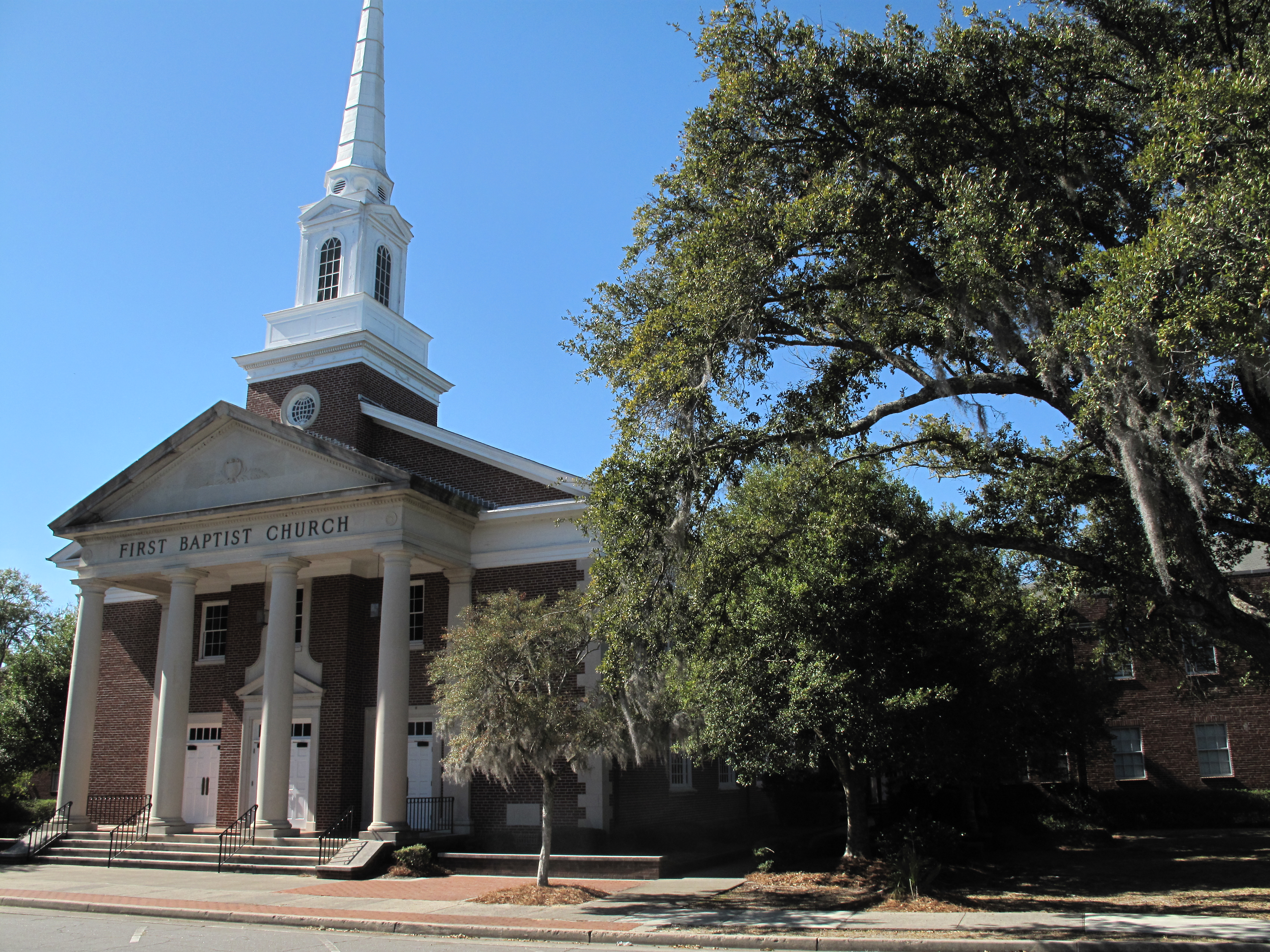
Just a peek around the corner leads to the First Baptist Church and its tall white steeple. Each rural South Carolina town must have one of these. If you’ve only seen such churches in photos, then you’ve missed the best effect — the majestic old oak tree covered in Spanish moss. Blue sky, white steeple, and green leaves are standard fare in these parts even in February, but wonderful to one visiting from the snowy Rocky Mountains.
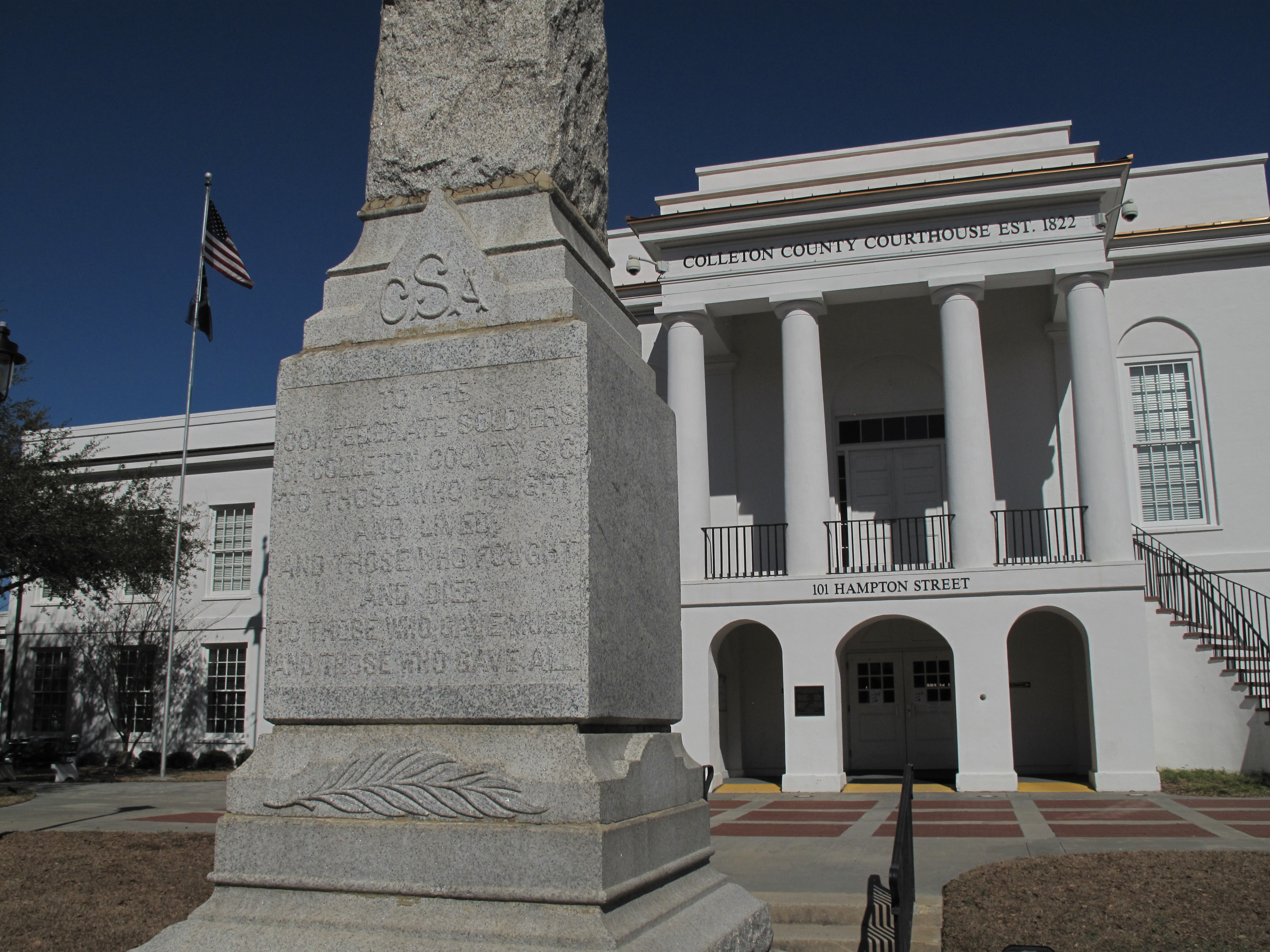
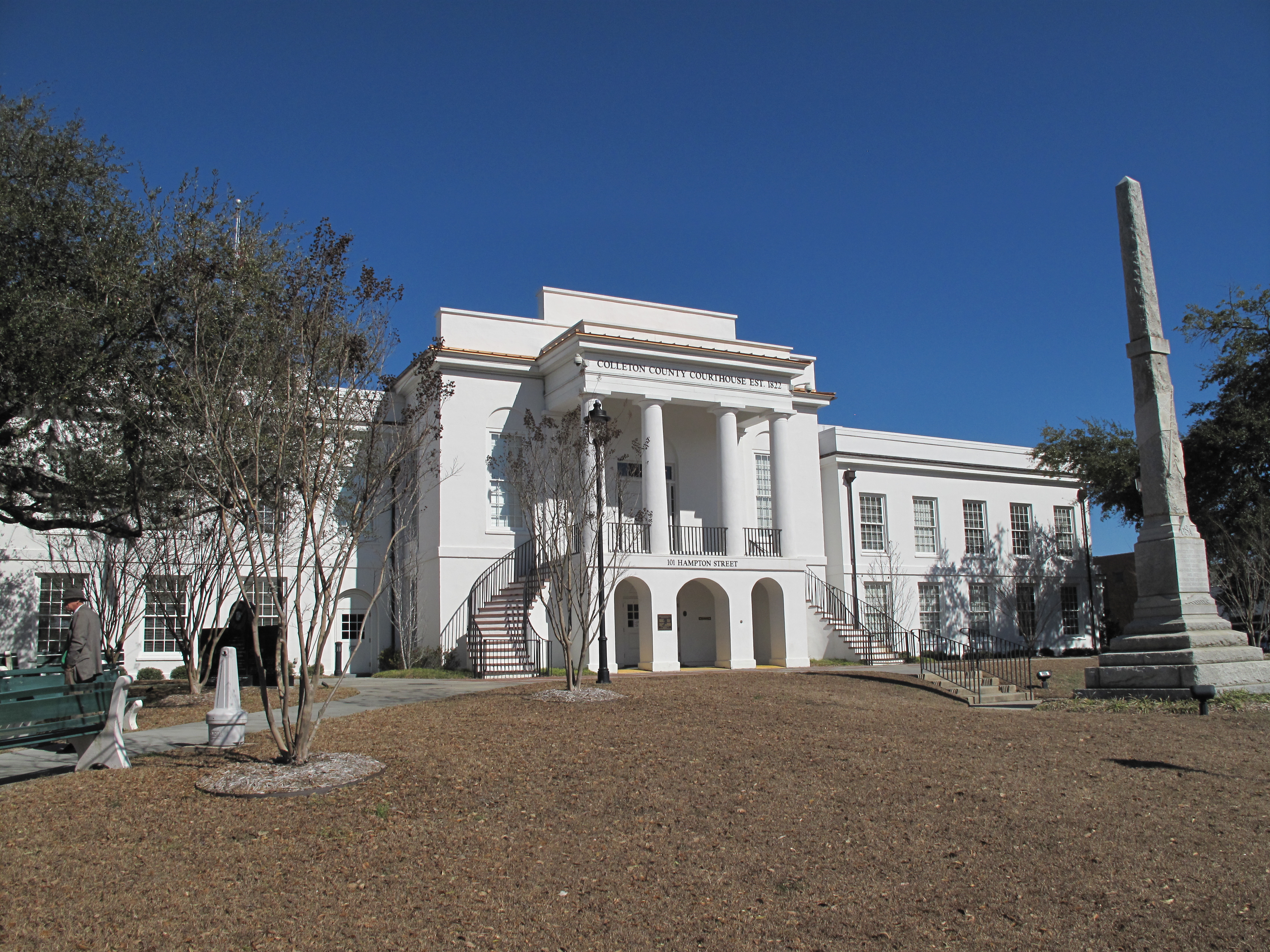
The Colleton County Courthouse complements the rest. This is a two-story whitewashed building with two half-spiral staircases at the main entrance. As with most Southern courthouses, a granite Confederate statue dominates the grounds. Live oak trees spread their wide branches on either side of the building.
Colleton County Courthouse. Walterboro, South CarolinaColleton County Courthouse
Beneath the small-town quiet, Colleton County has a combative history commensurate with its South Carolina heritage — the Nullification Crisis of 1832, and a hotbed of secession.
I chatted briefly with a few folks as I took photos of the courthouse. Around here, although people won’t ignore you, they’re not mistrustful. They do understand humor. Carrying my camera and cell phone in one hand, I asked the guard at the courthouse entrance if these items were allowed inside. He answered me with perfunctory precision:
“Prohibited items are knives and pistols and rifles. Do you have these?”
“Well…not all three,” I deadpanned.
He let out a belly laugh and let me pass through the metal detector as I held my camera and phone to one side for him to see. We’re all just folks.
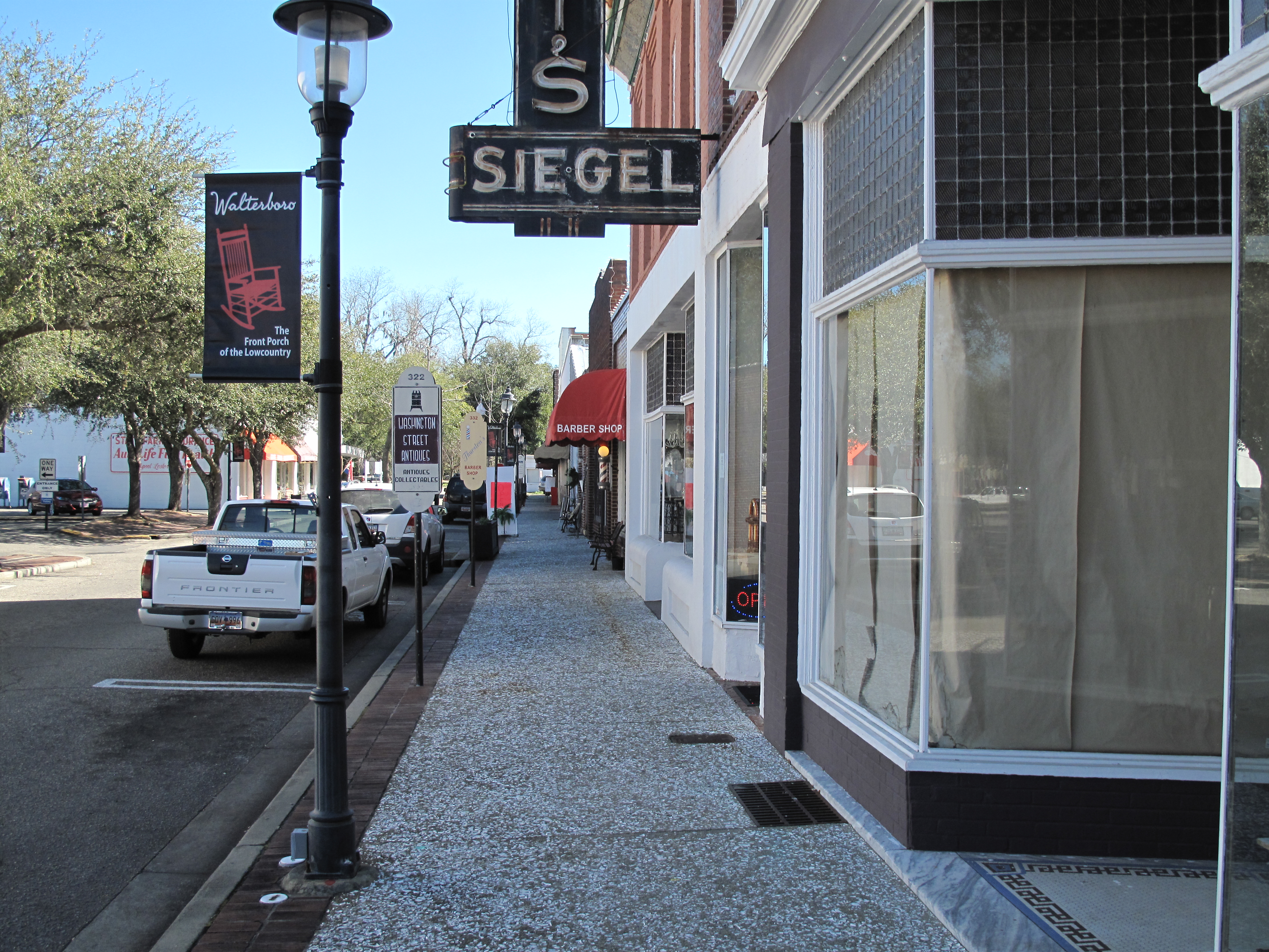
East Washington Street business district, Walterboro, South Carolina
A list of all photo posts from the American County Seats series in TimManBlog can be found here.
I’m trying to travel to all of America’s county courthouses, and each month a post about my visit to the most interesting county seats. It’s only a hobby — but donations are greatly appreciated to help defer my costs. Thanks, Tim
Friends and relatives have sent me year-end messages extending well-wishes and relating all their goings-on over the past year. Thank you all. Allow me to reciprocate with a collection of photos describing my past 12 months.
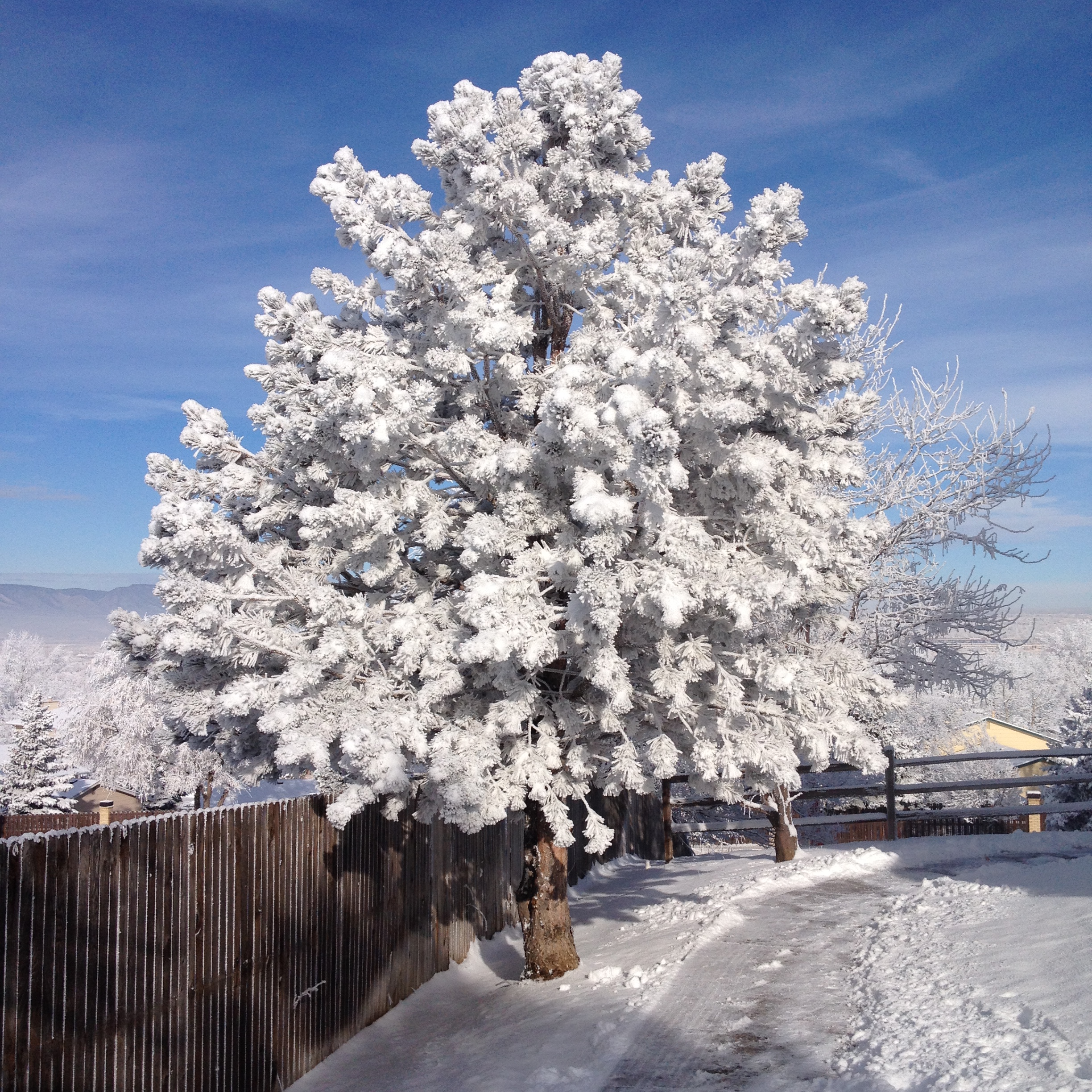
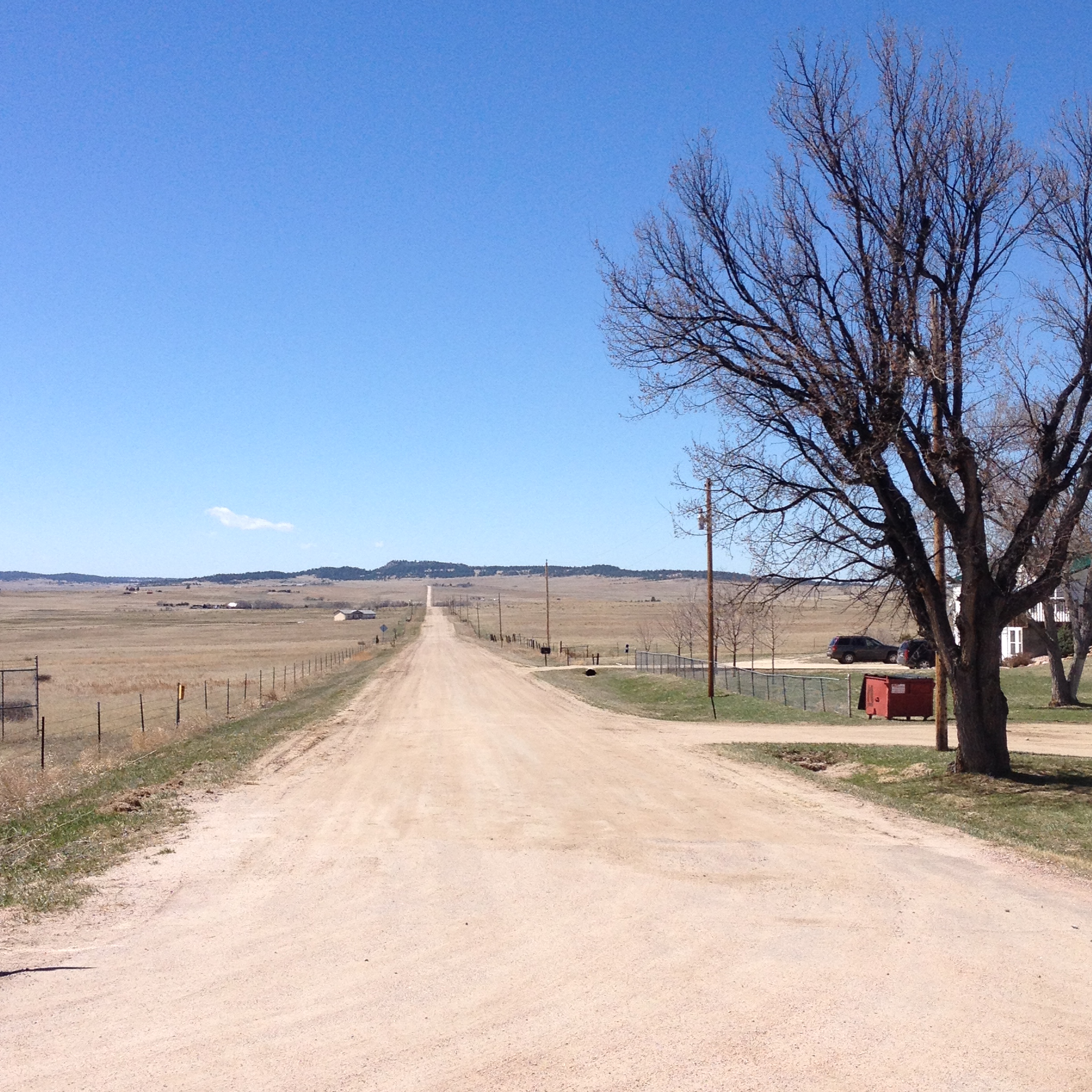
January 13th — Post-snowstorm Colorado Springs. Pikes Peak is in the background of the first photo; the second photo is an evergreen coated with ice crystals.
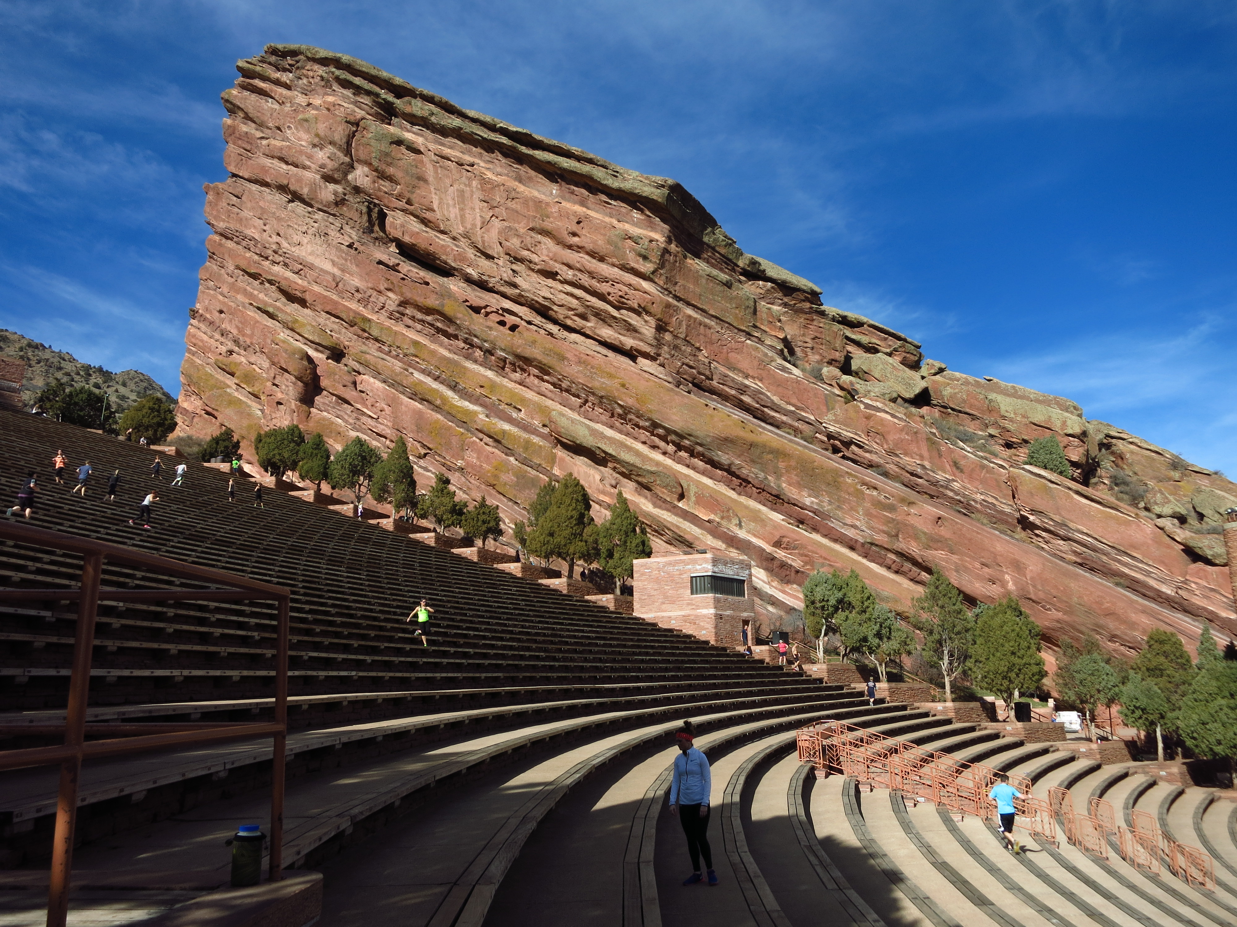
January 27th — Red Rocks Park and Amphitheatre on a very warm January day. The skyscrapers of downtown Denver are visible in the background of the first photo. In the Rockies we get a balmy day two weeks after a blizzard, and never an “average” day.
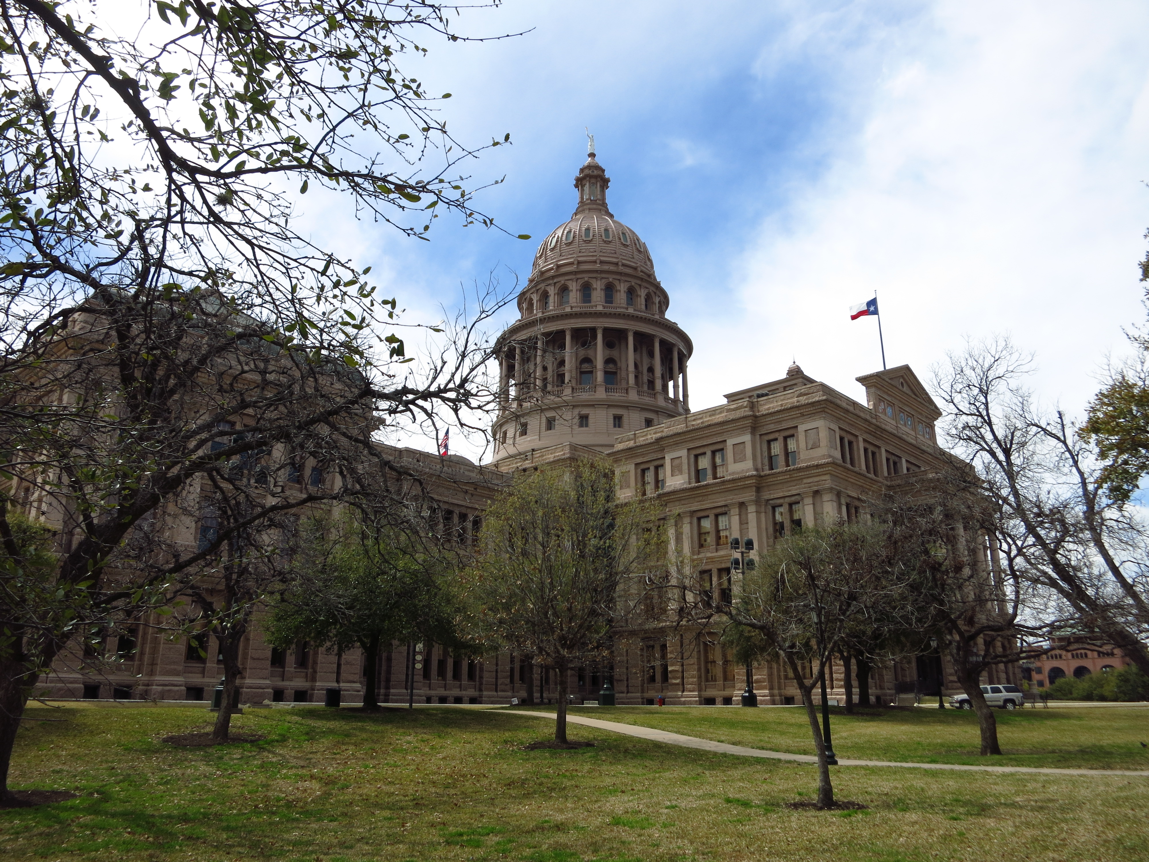
March 15th — a business opportunity brings me to Austin, Texas for 3 days. I toured the Texas Capitol on a Sunday.
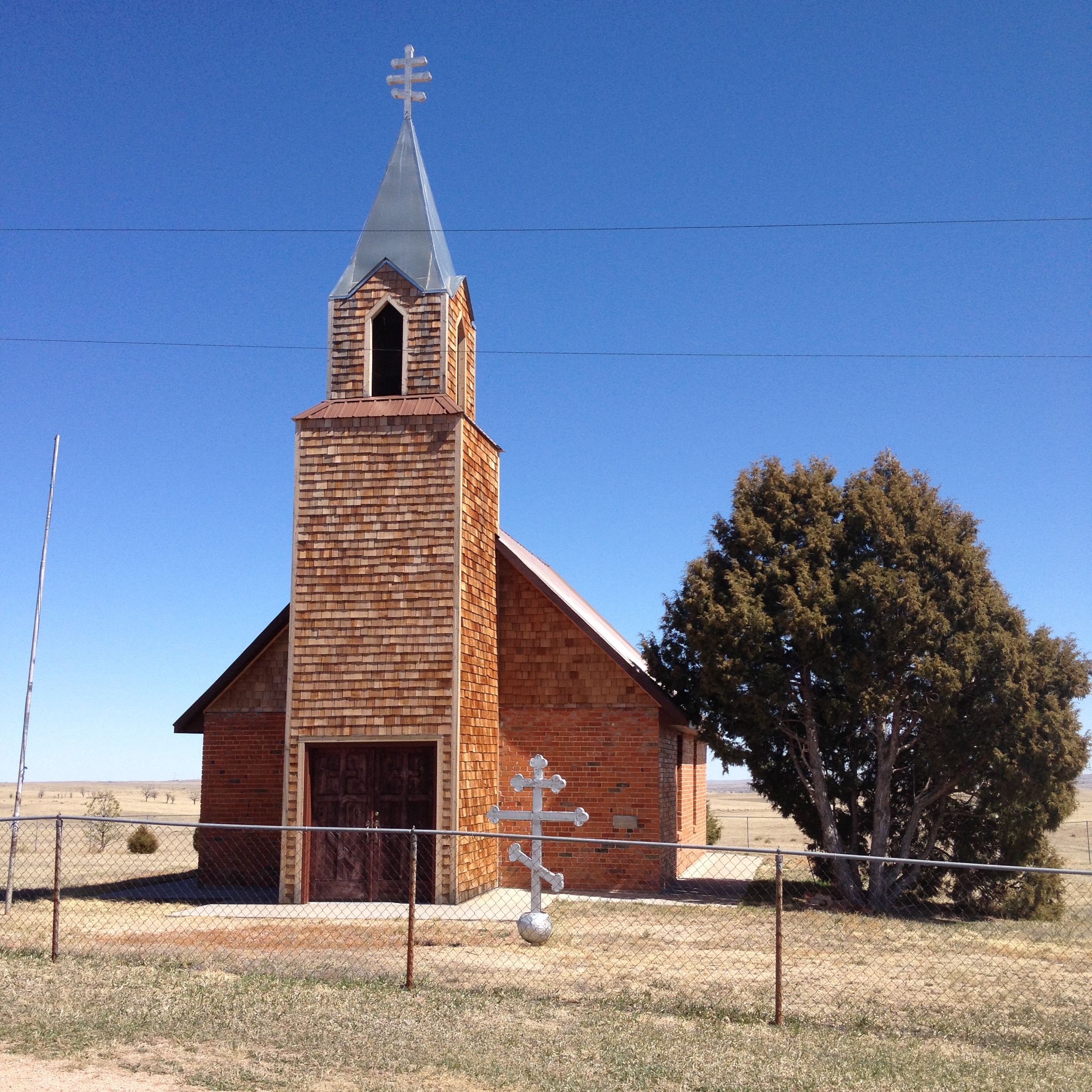
March 29th — On a quiet Sunday drive I came upon and old Orthodox Church standing isolated on a hilltop in Colorado’s Eastern Plains. Named St. Mary’s Holy Dormition and still in use today, it was built in 1905 near Calhan to serve Slovak immigrants who had left employment in the steel mills of Pennsylvania for the farming/ranching life of Colorado. The church has an interesting history (full story here), having been nearly destroyed by the ripples of the Bolshevik Revolution of 1917. The second photo below looks west from the church, over the high plains toward the Front Range.
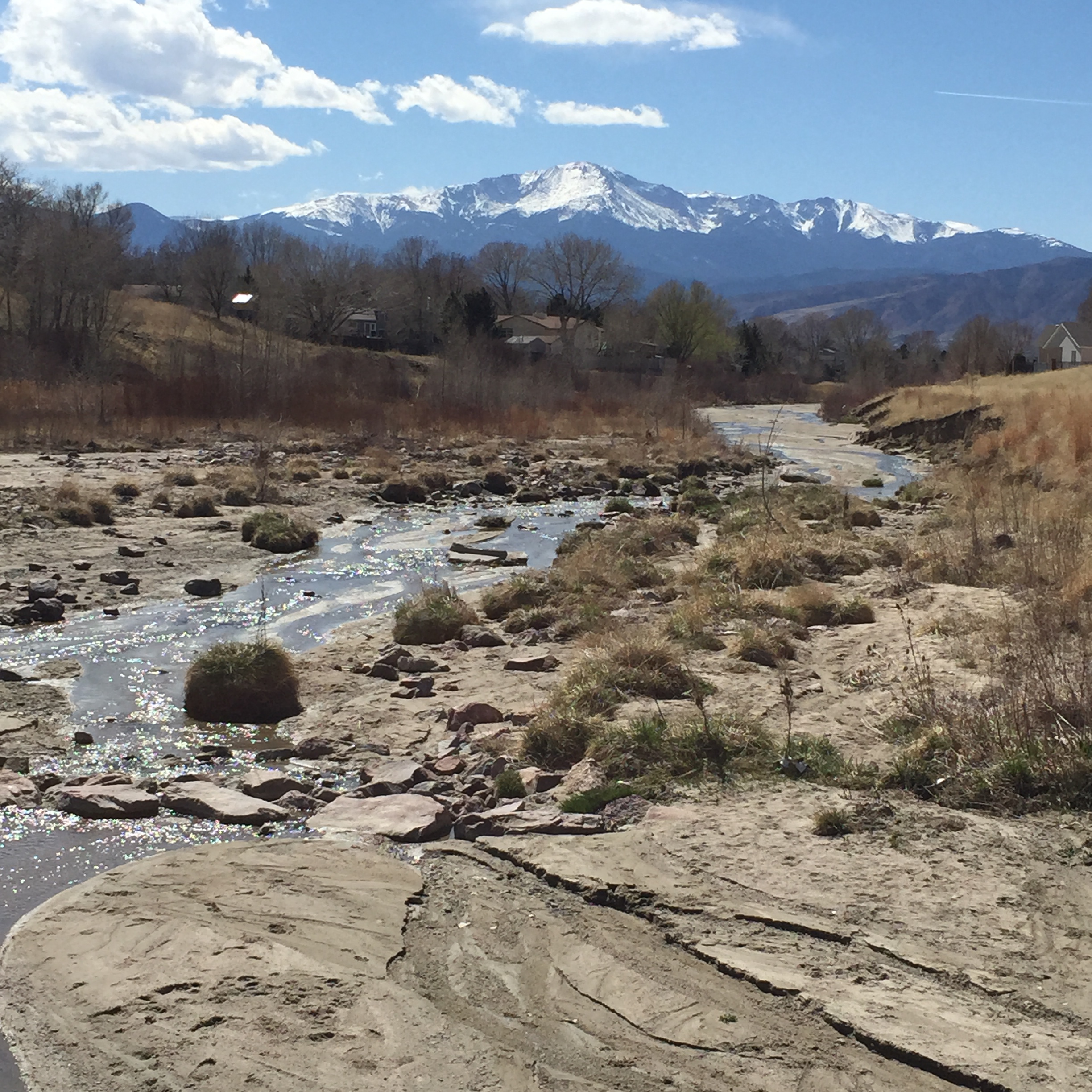
April 5th — An early spring view of Pikes Peak and Cottonwood Creek in Colorado Springs.
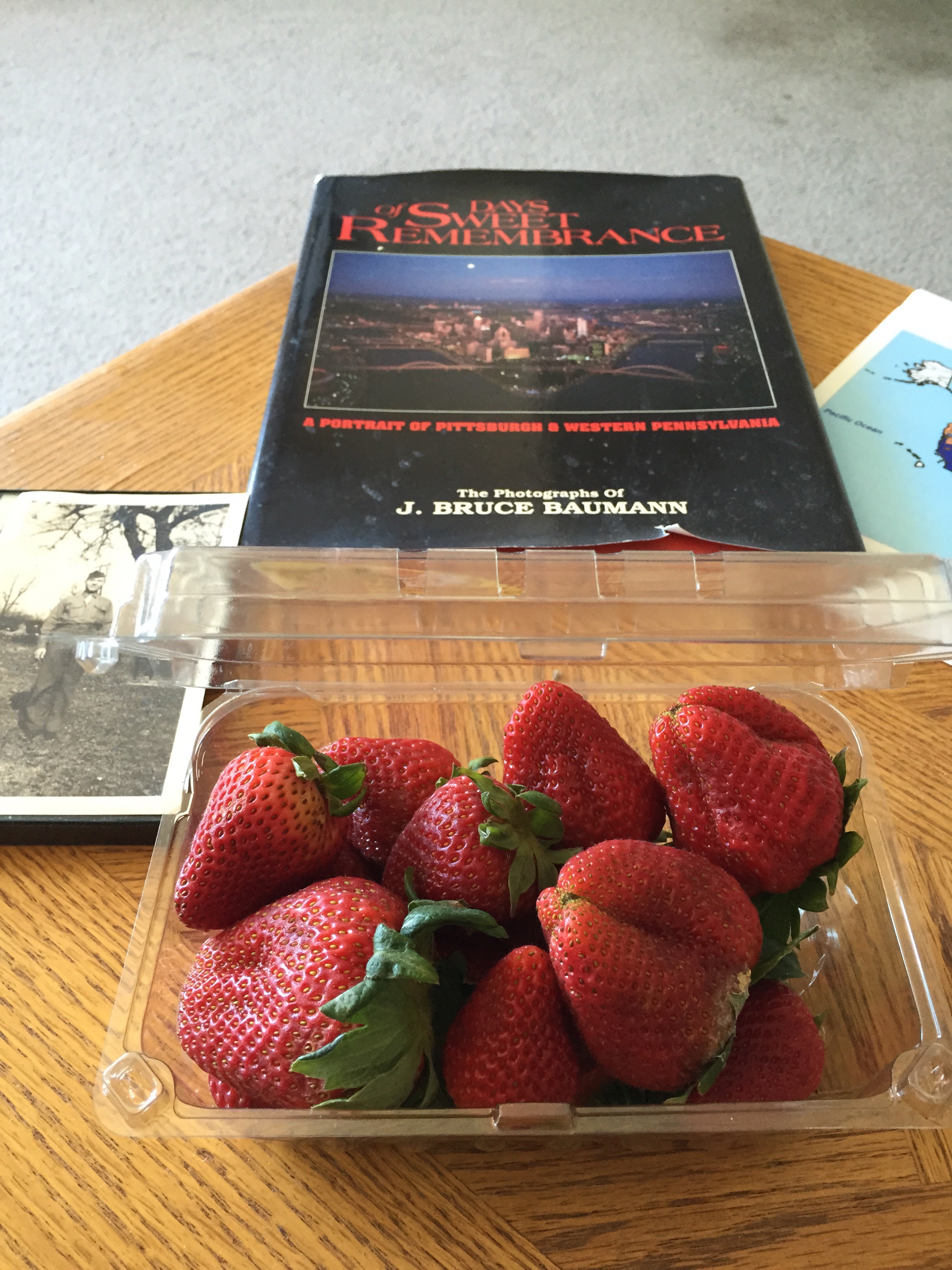
April 6th — A snack on my coffee table as I prepare to watch Opening Day of the 2015 baseball season (the real New Year’s Day).
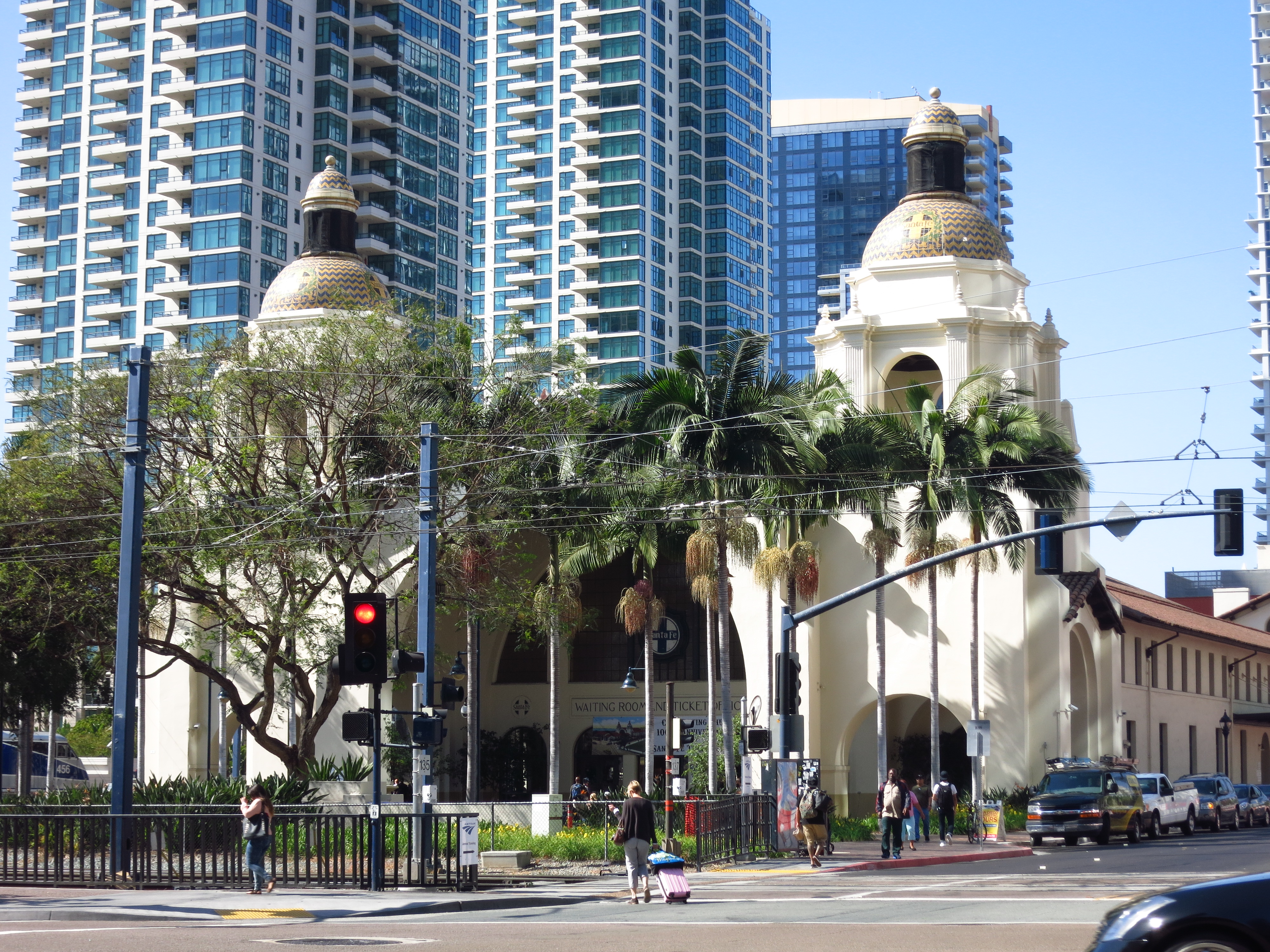
April 13th — A business opportunity (a conference) brings me to San Diego for 3 days. The first photo is the old Santa Fe railroad station downtown, the second shows sailboats in nearby Mission Bay.
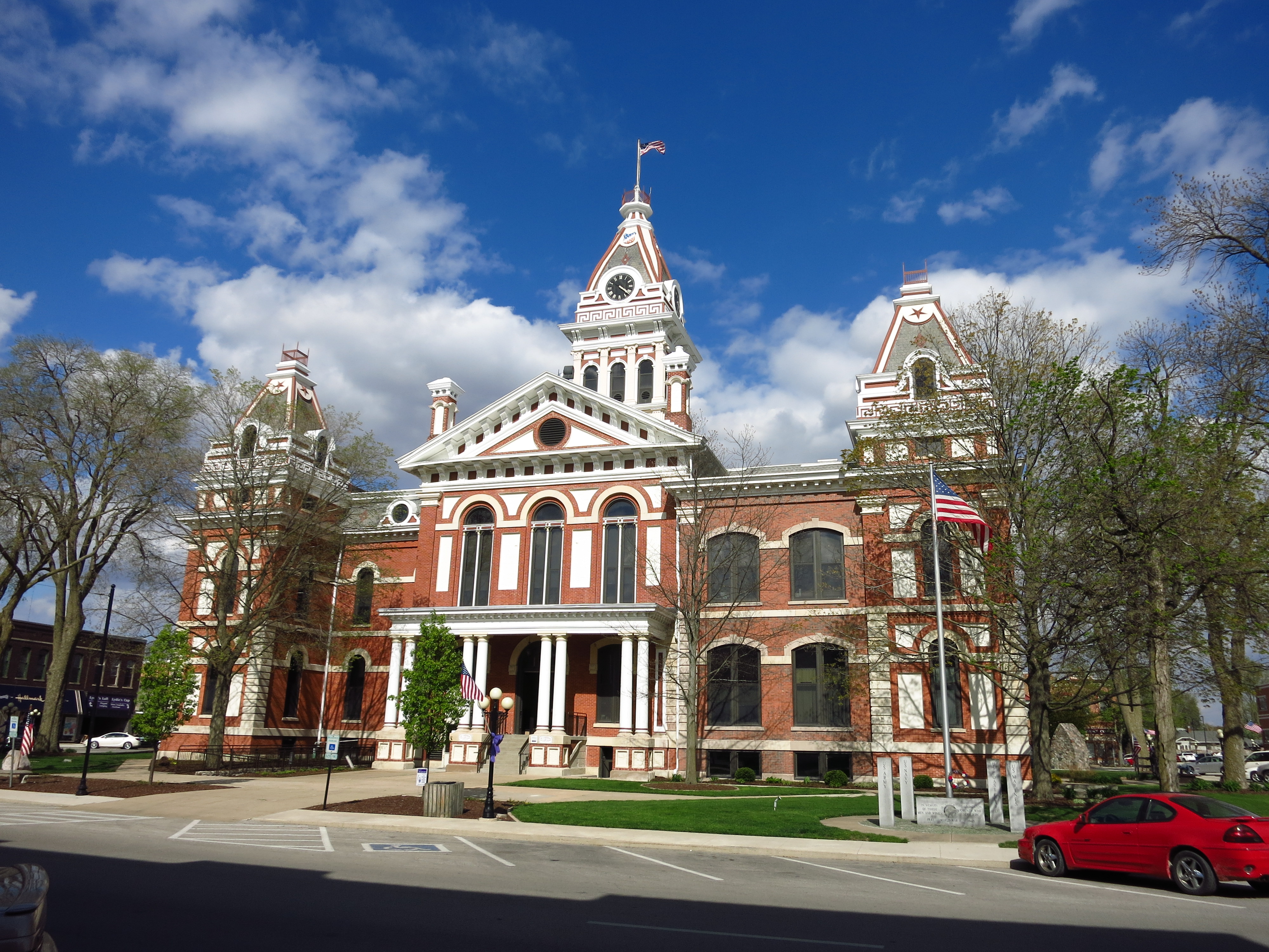
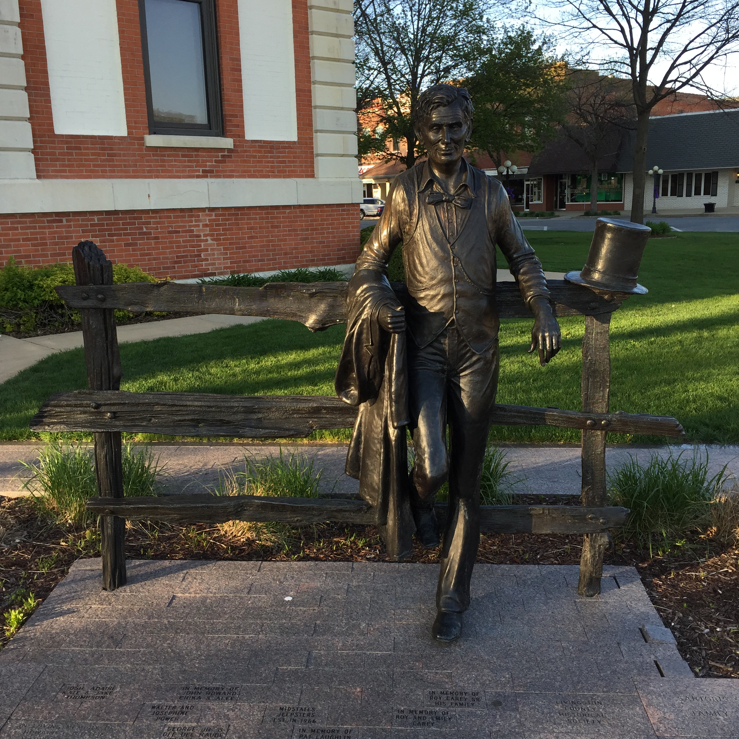
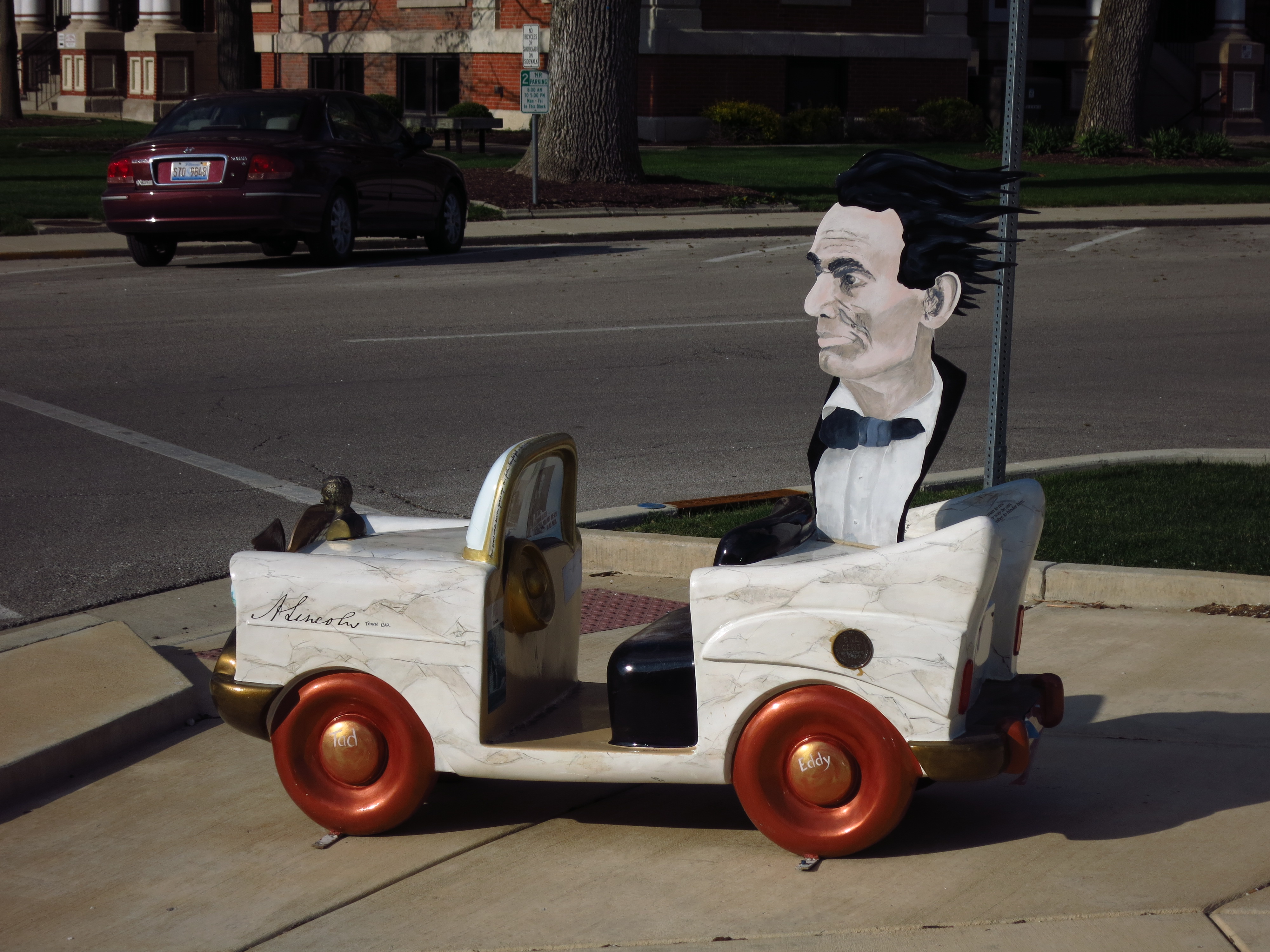
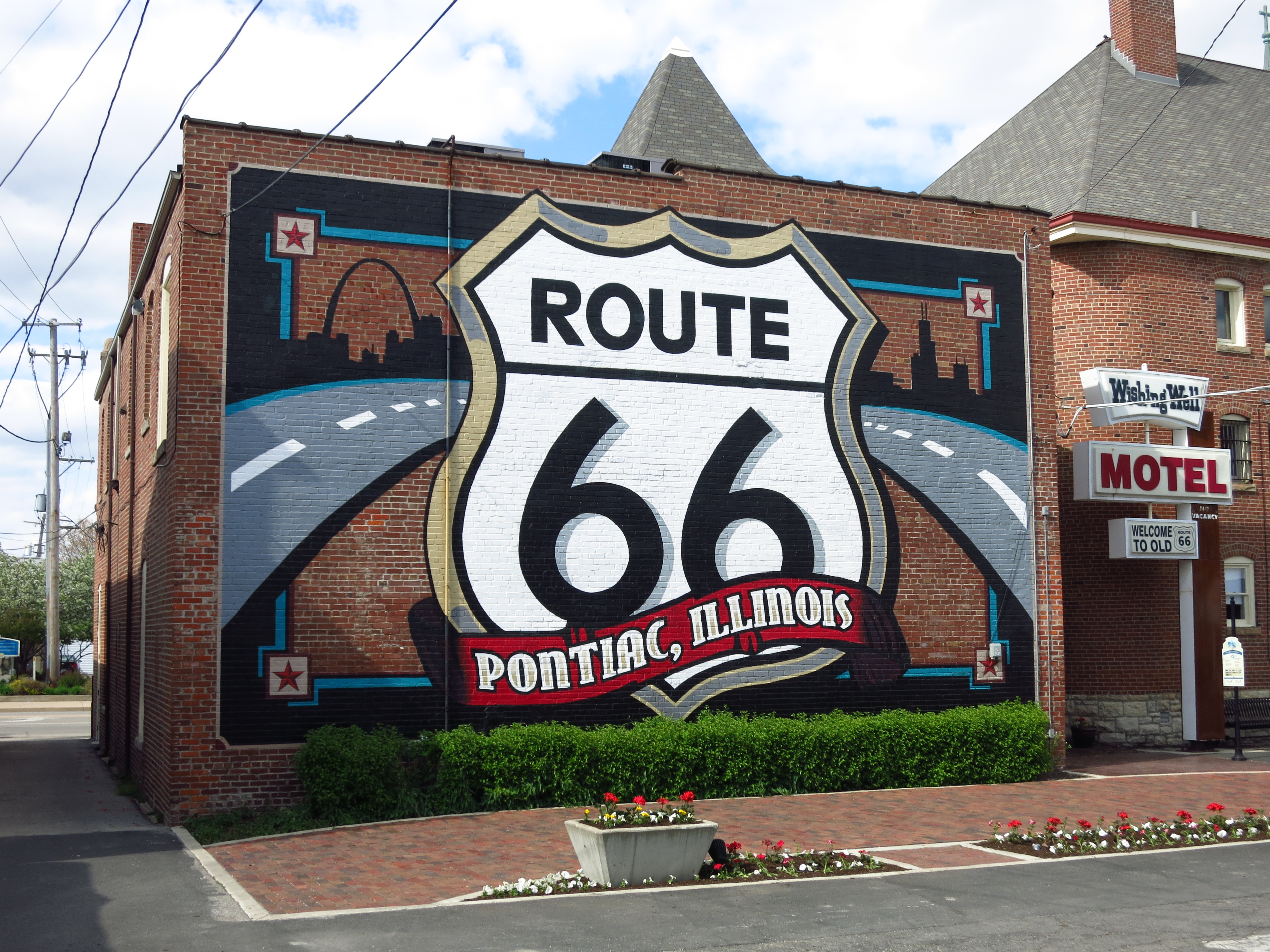
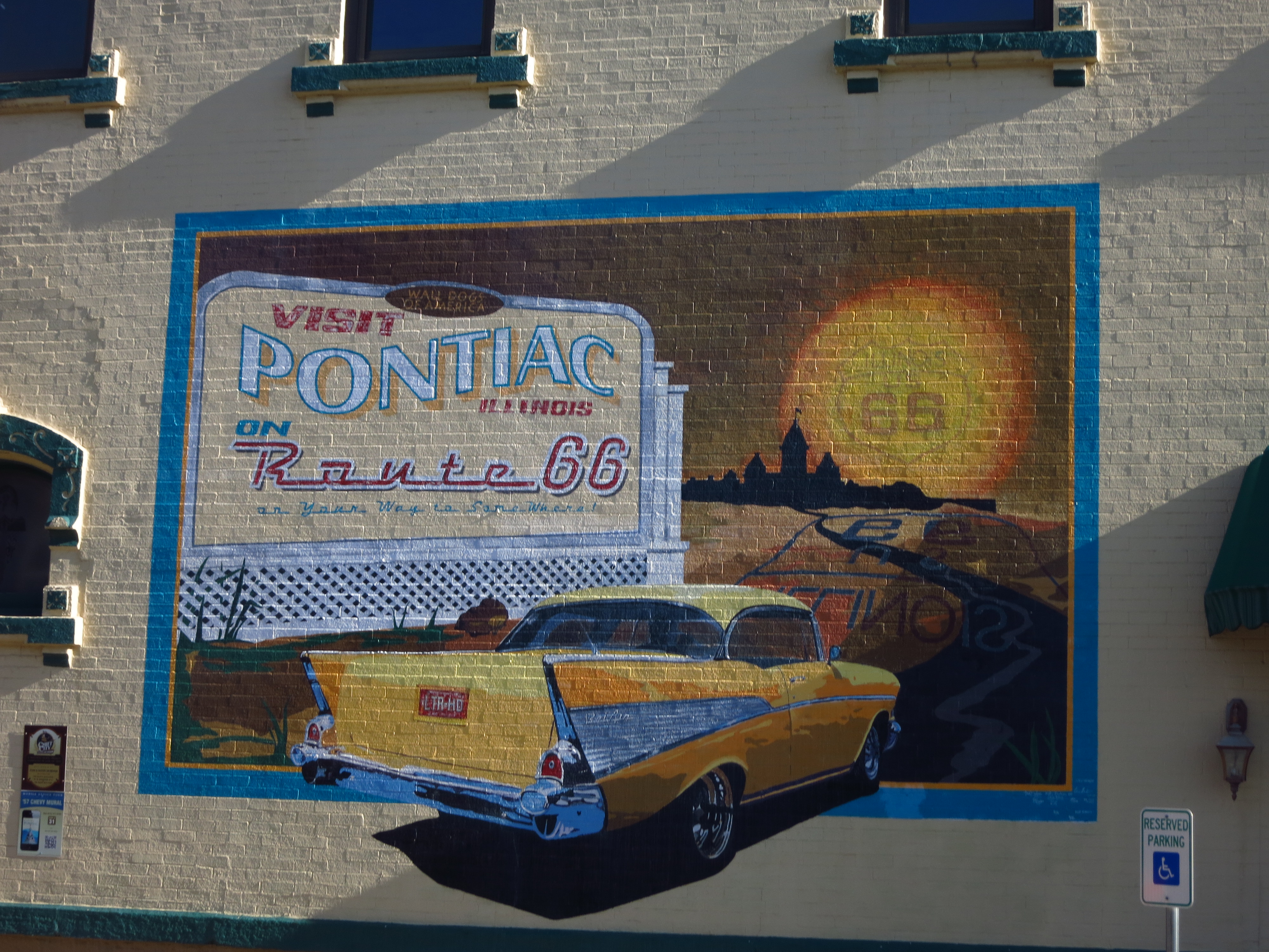
April 30th — Illinois claims two American icons: Abraham Lincoln and Route 66. The two themes meet in the touristy town of Pontiac. Lincoln practiced law here, participated in that county’s first jury trial, and in 1840 — as a precursor to destiny — Lincoln and Stephen Douglas held an impromptu debate in the streets of Pontiac. A life-size statue of Lincoln stands in front of the historic Livingston County Courthouse so that you can check your height against his. Various murals and fixtures ornament Pontiac’s place on old Route 66.
Livingston County Courthouse, Pontiac Illinois
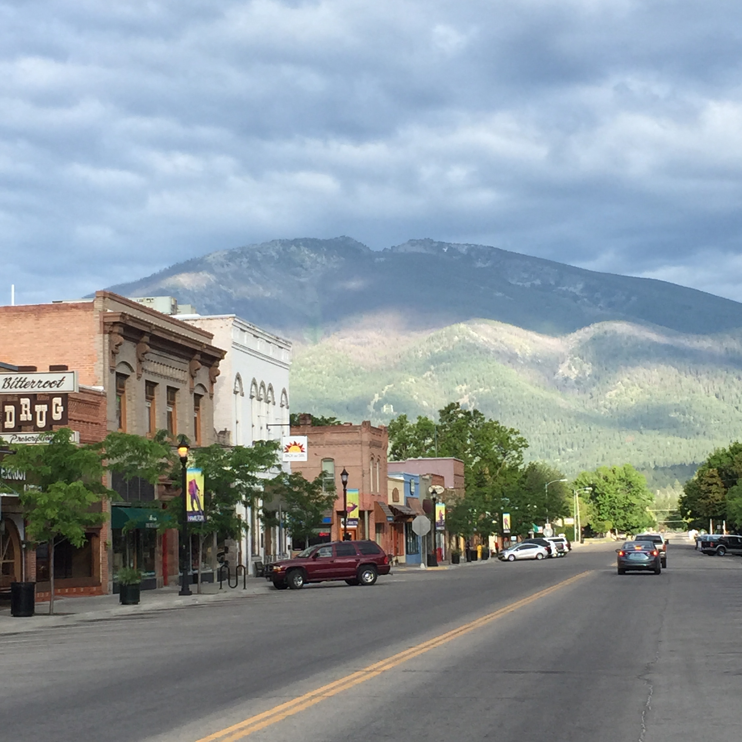
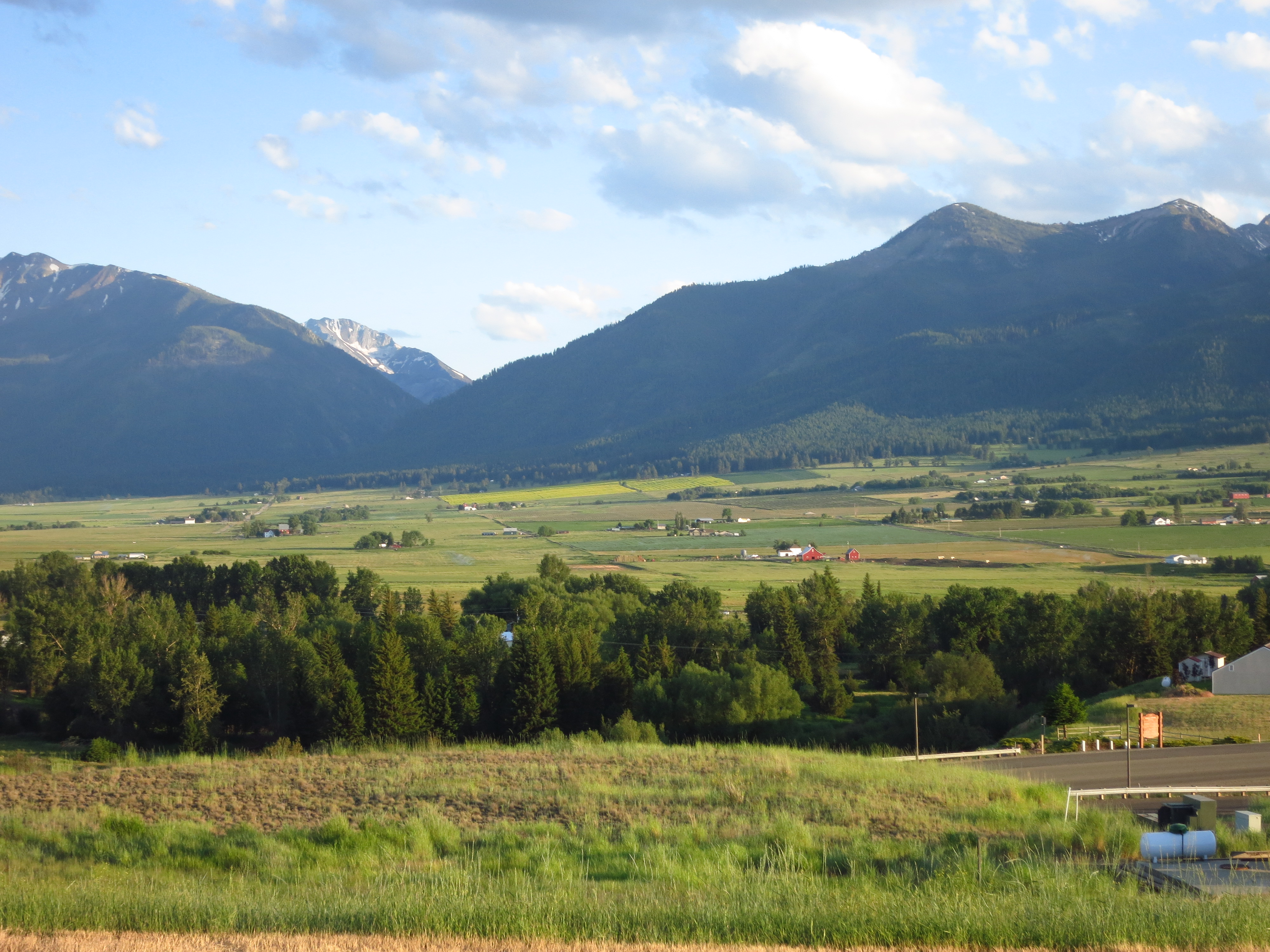
June 22nd — The Northwest is a fine place to be when summer reaches its solstice. This year’s longest day was my year’s longest drive as shown in the next 4 photos. The day started just after sun-up in Hamilton, Montana — an old western town nestled snugly between two high mountain ranges.
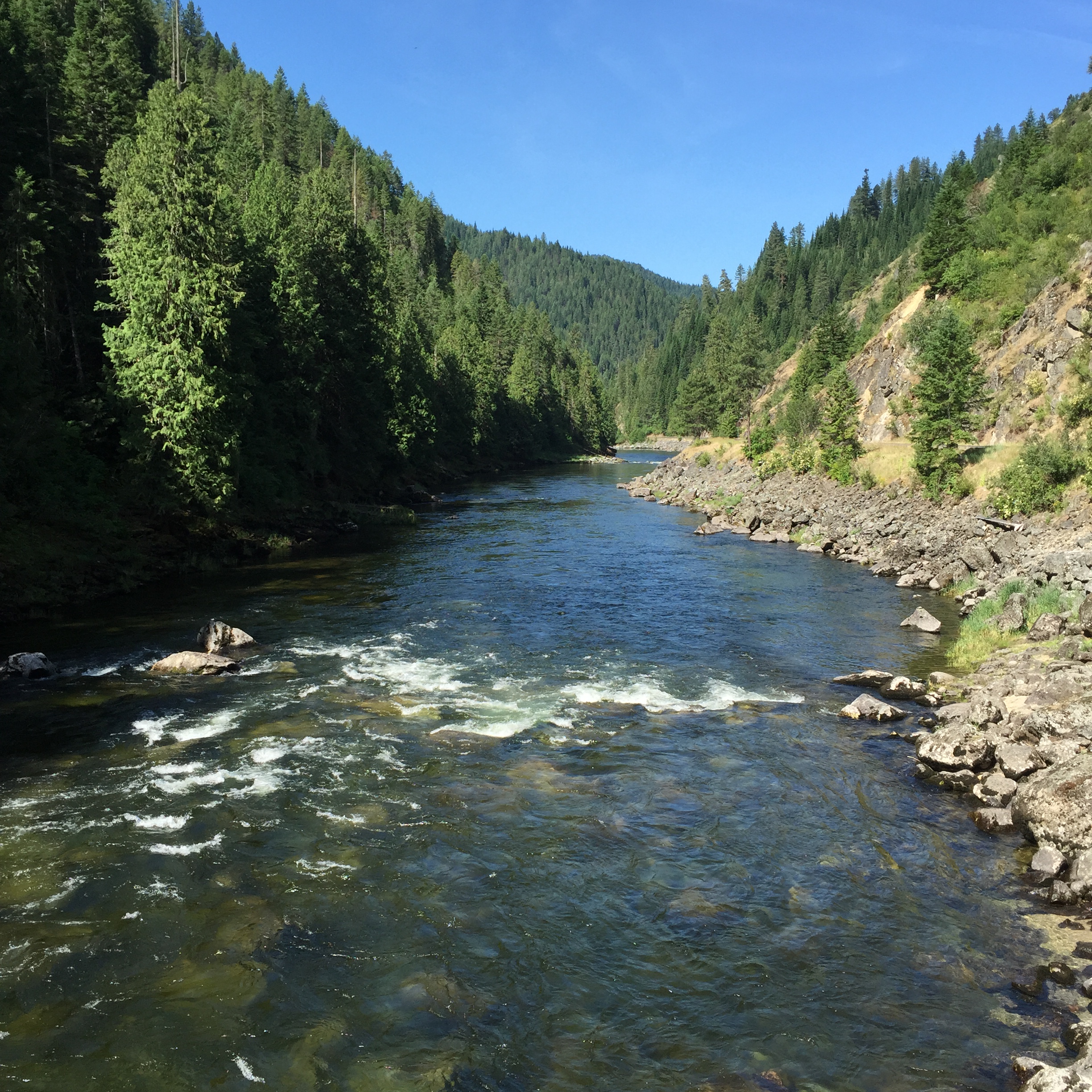
67 miles west at Lolo Pass, I crossed the Continental Divide, the Idaho State Line, and the Pacific Time Zone and headed downstream along the Lochsa River, paralleling the route taken by Lewis and Clark to the Pacific in 1805. I rode through 76 miles of scenery just like this below Lolo Pass before I ever saw a town. It’s mid-morning in the photo.
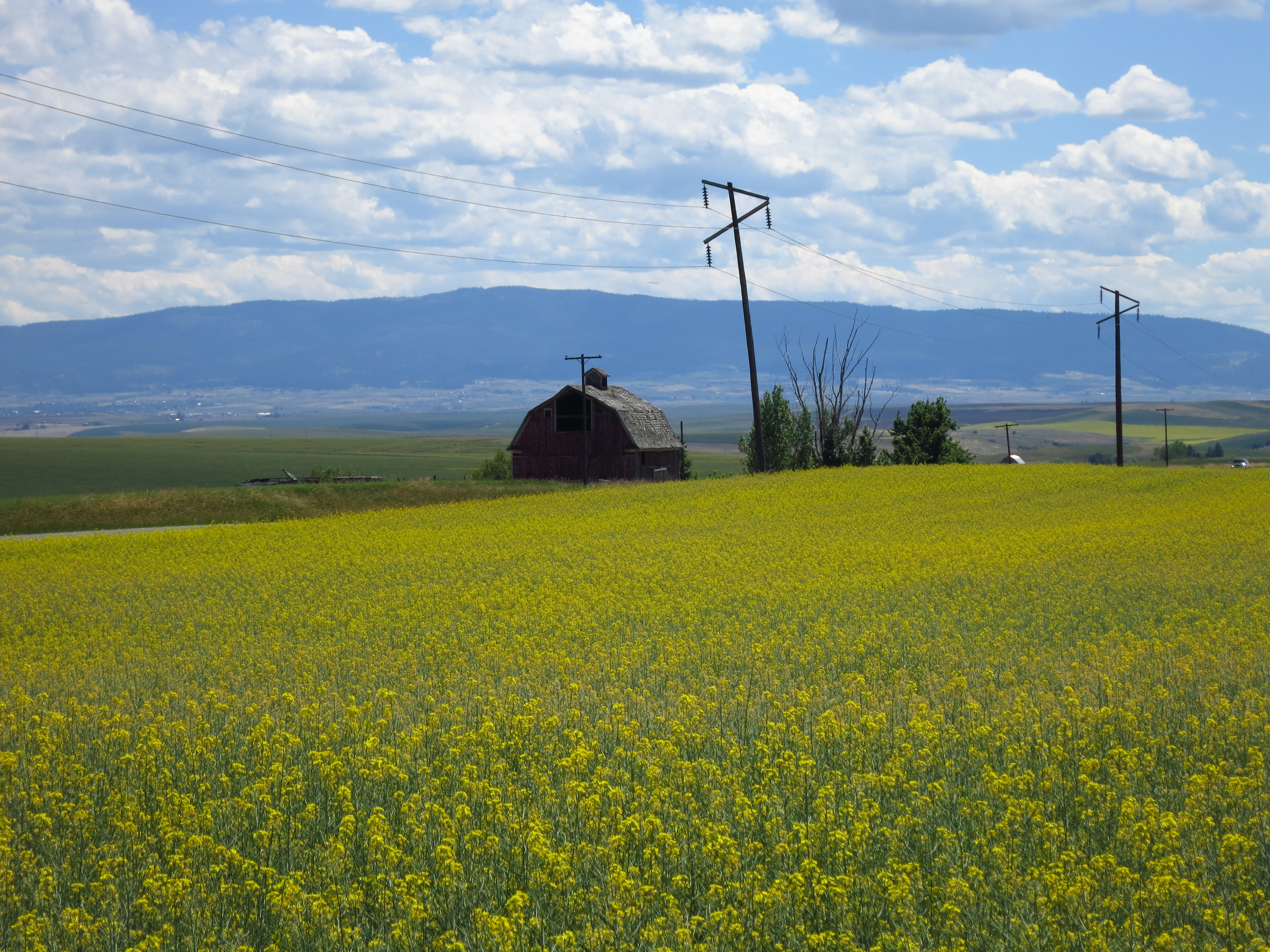
Travelling further west, I left the mountains near what the Nez Perce call the Camas Plains. Here are some canola fields in those plains, near Grangeville, Idaho in mid-afternoon.
The Wallowa Mountains near Enterprise, Oregon, 150 miles west of the Camas Plains of Idaho. I reached them near sunset on the longest day of the year.
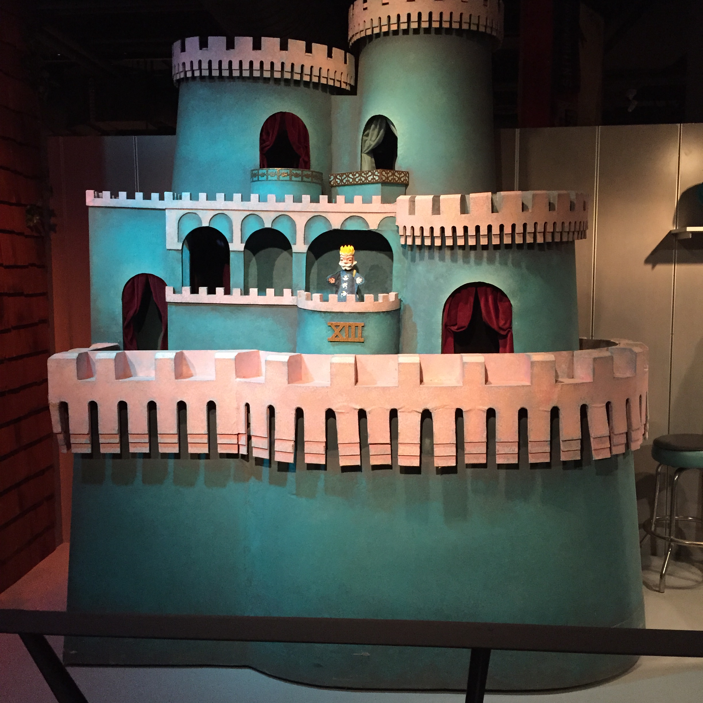
July 11th — Back to Pittsburgh to see family and old friends. Included was a trip to the Heinz History Center downtown. This was one of the exhibits. Remember it from Mr. Roger’s Neighborhood?
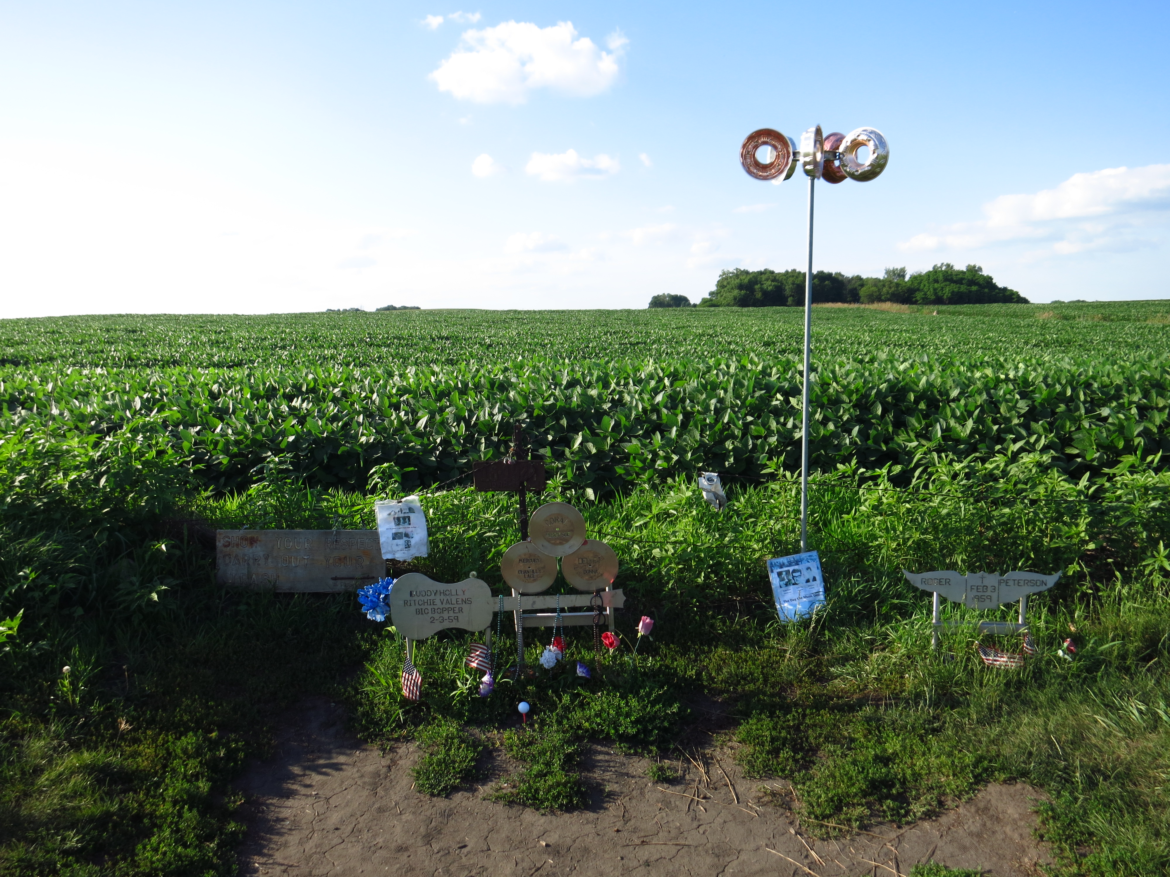
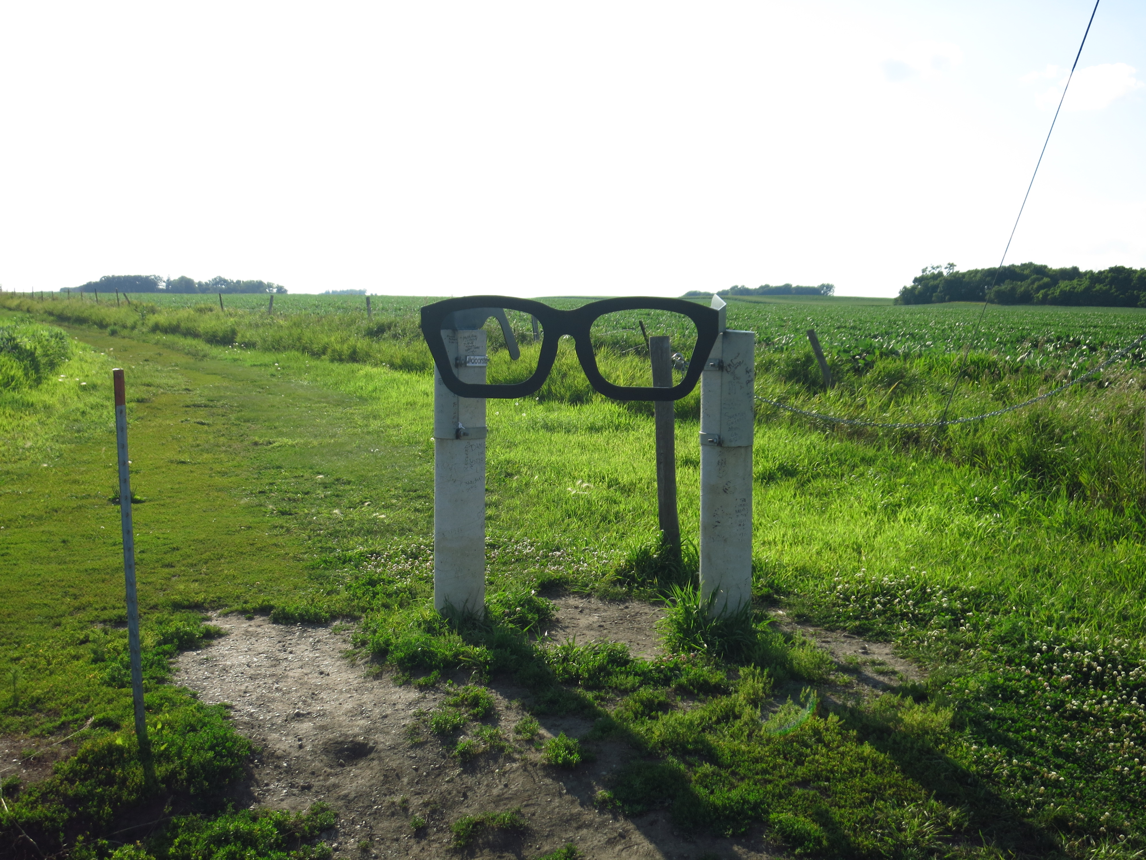
July 22nd — Clear Lake, Iowa. Iowa in the summertime lives up to all its clichés. I won’t add any more. Buddy Holly’s plane crashed in a field near town in February of 1959; the farmer who owns the field allows fans to maintain a memorial for the rock star amid his soybean crop. A signpost made of horn-rimmed glasses marks the entrance to the memorial. The third photo below is of Clear Lake at the exact moment of sunset. It’s my favorite.
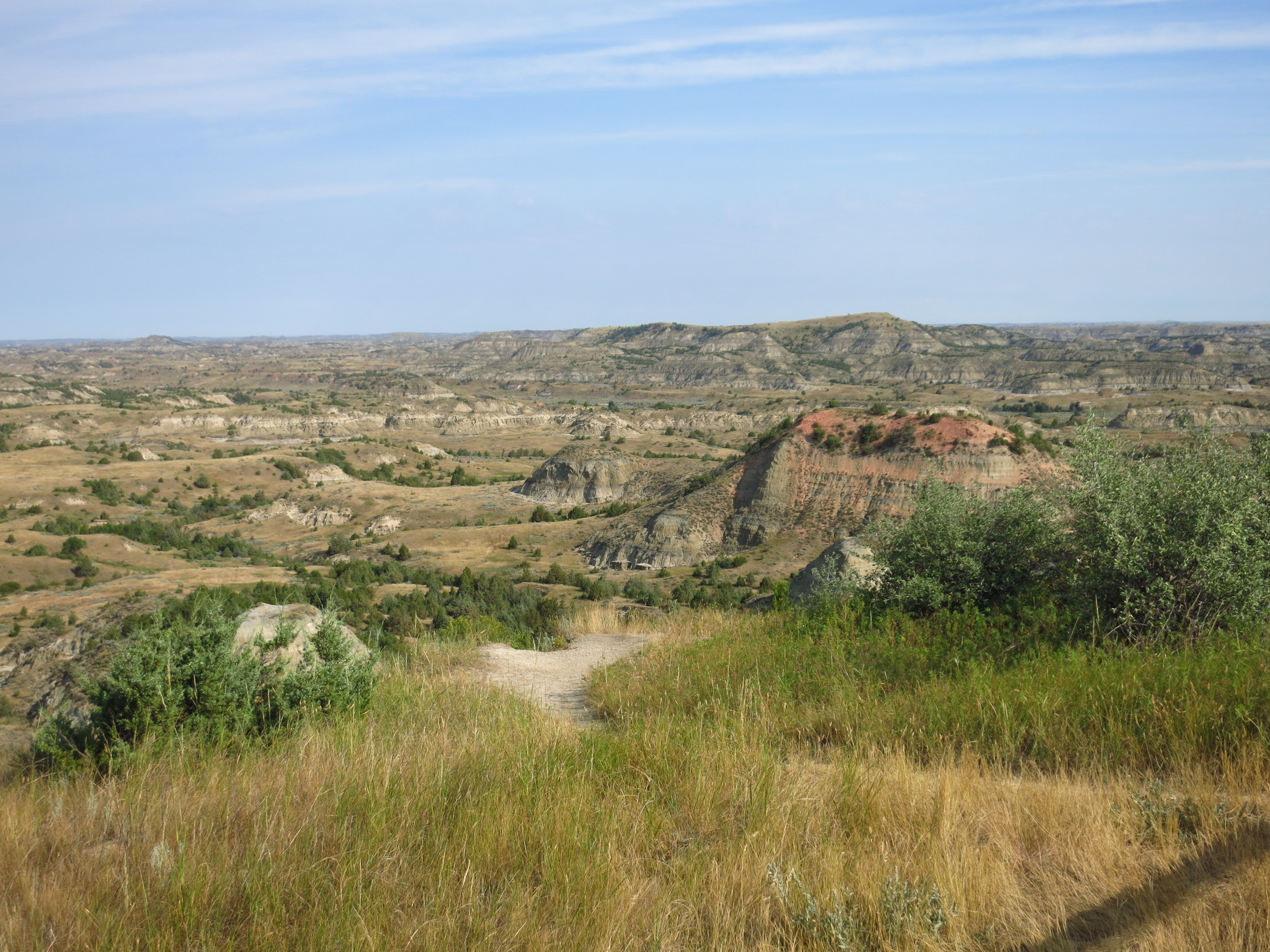
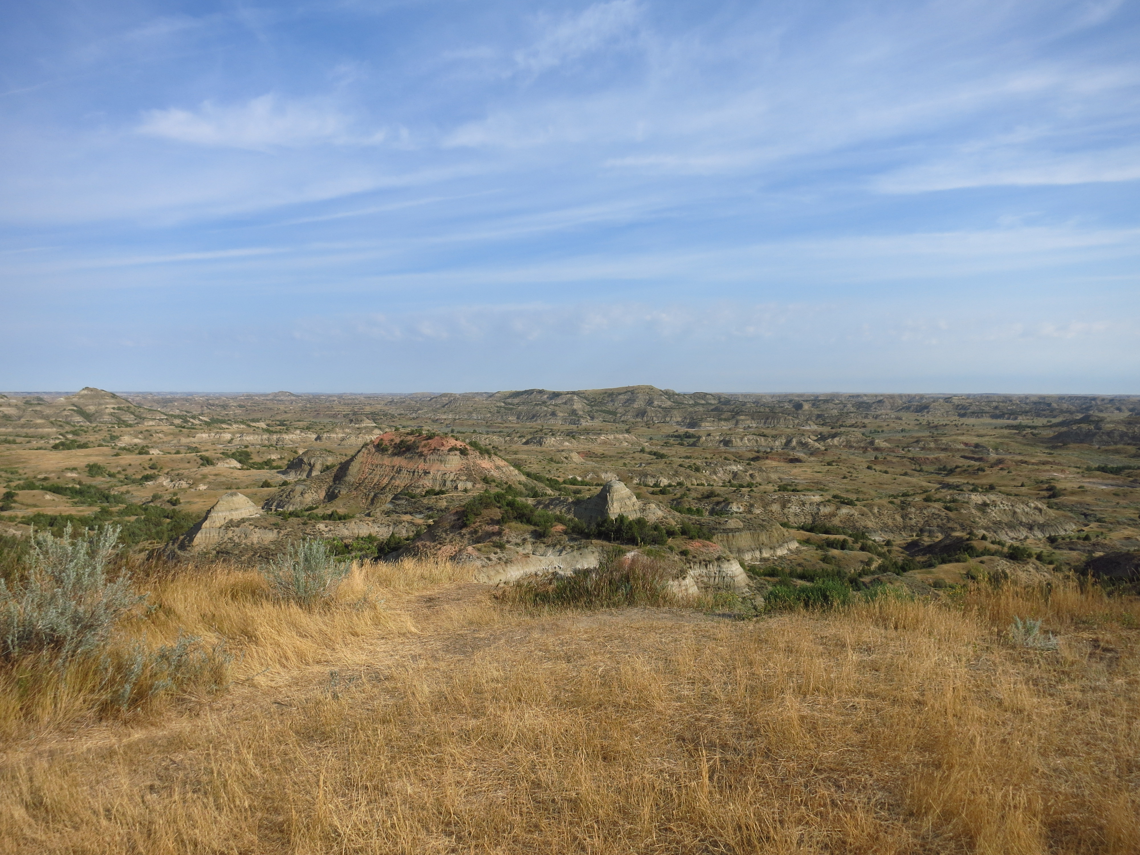
August 17th — The Badlands of North Dakota within Theodore Roosevelt National Park. Teddy owned a ranch here before becoming President; he deserves the credit for creating our National Park system.
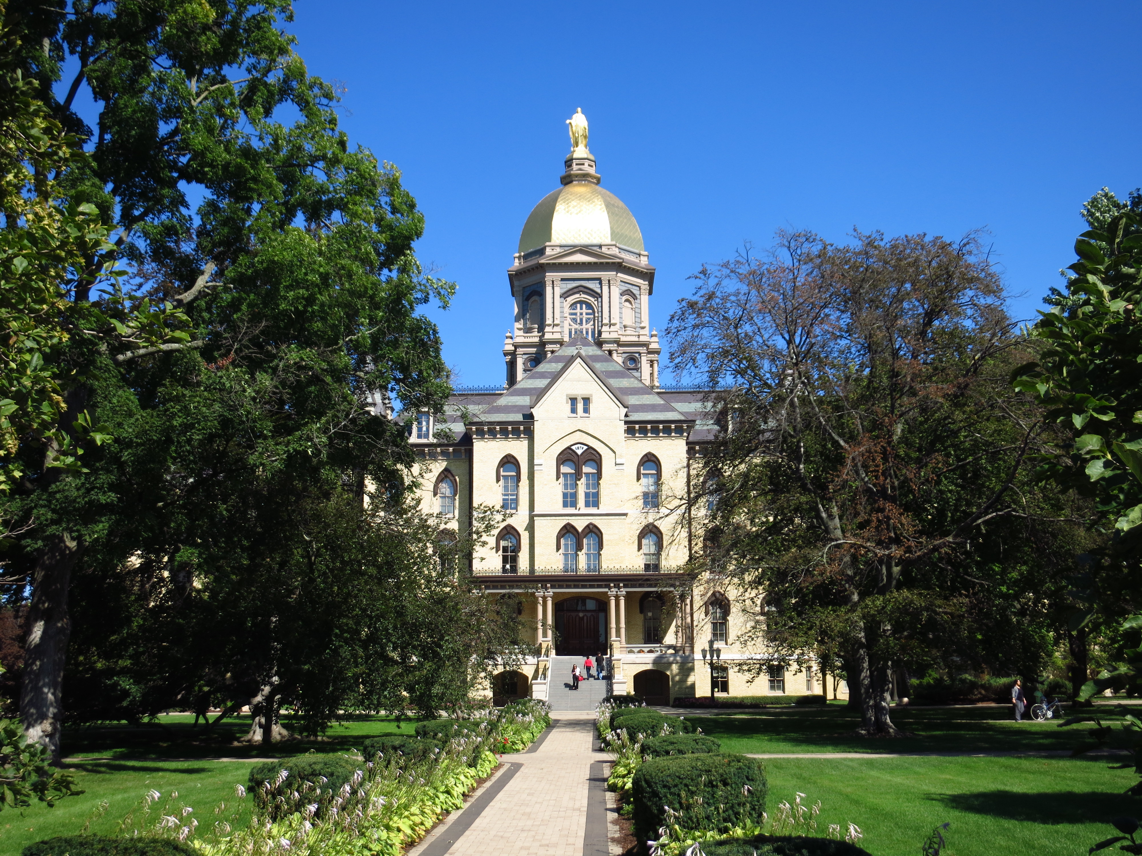
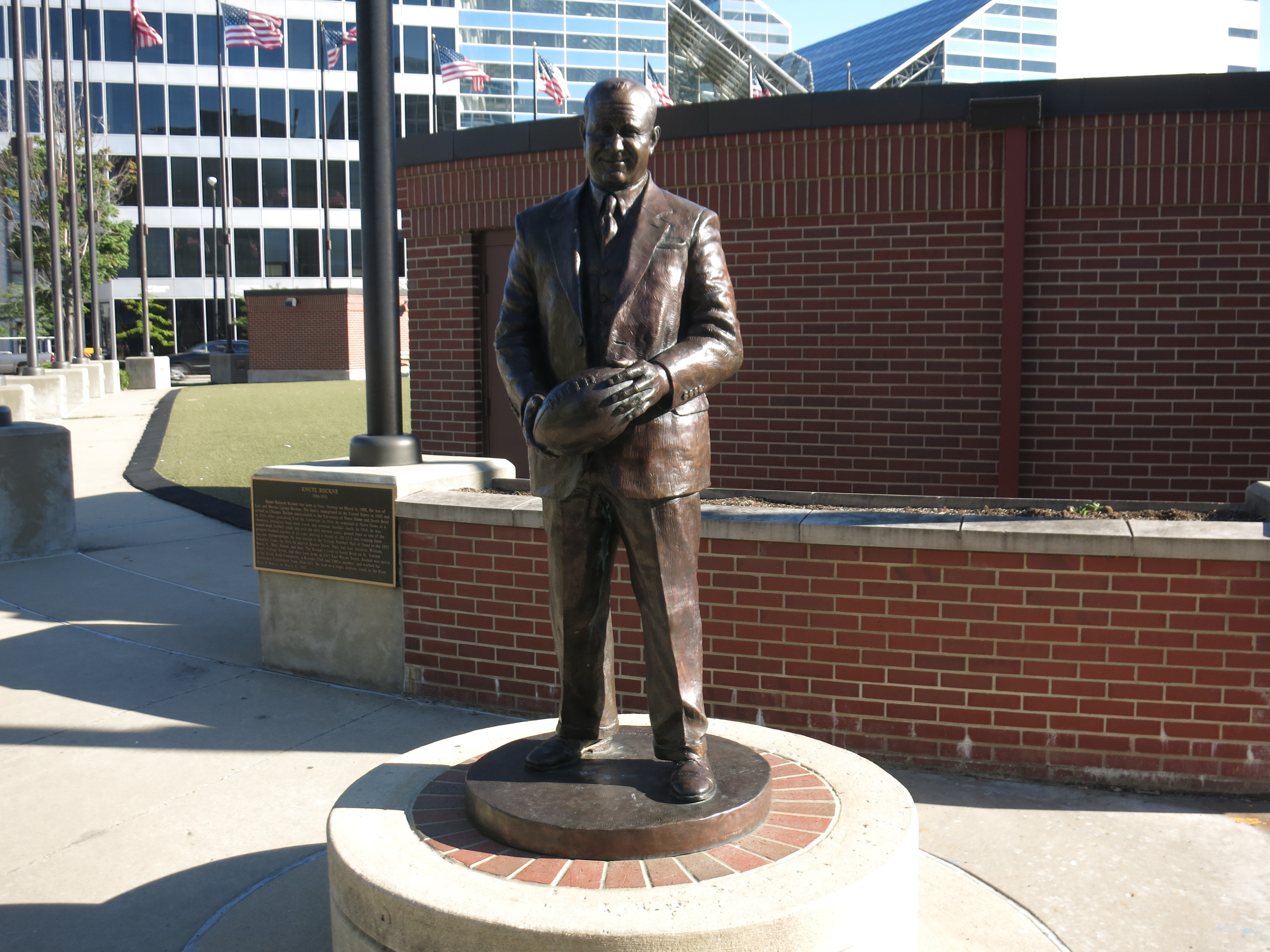
September 14th — South Bend, Indiana. I’d never been to Notre Dame before though I’d seen them play football on tv a thousand times. Here’s the Golden Dome, and then a statue of Knute Rockne found in a plaza in downtown South Bend.
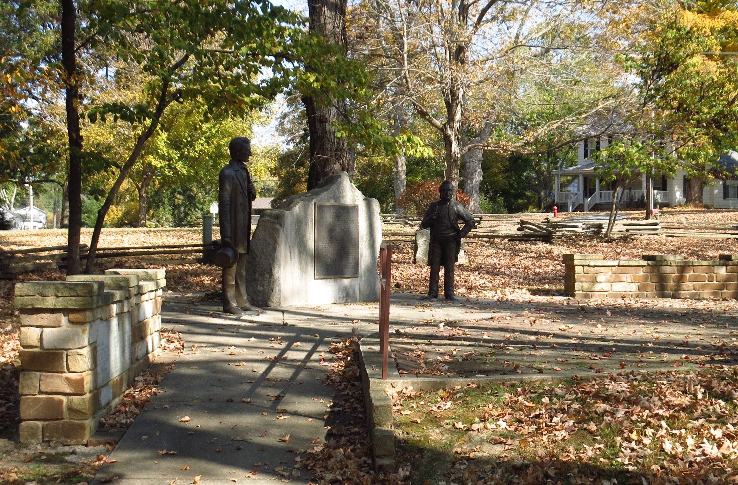
October 22 — Jonesboro, Illinois. This little southern Illinois town was the site of the third Lincoln-Douglas debate, held September 15th 1858. The debate was held in the county fairgrounds, a few blocks away from the main crossroads. Of the several Lincoln-Douglas memorials I’ve seen, most include life-size statues of the two men, and the height disparity between the two always gives me a chuckle. I’m sure many in the audience had the same reaction at the time.
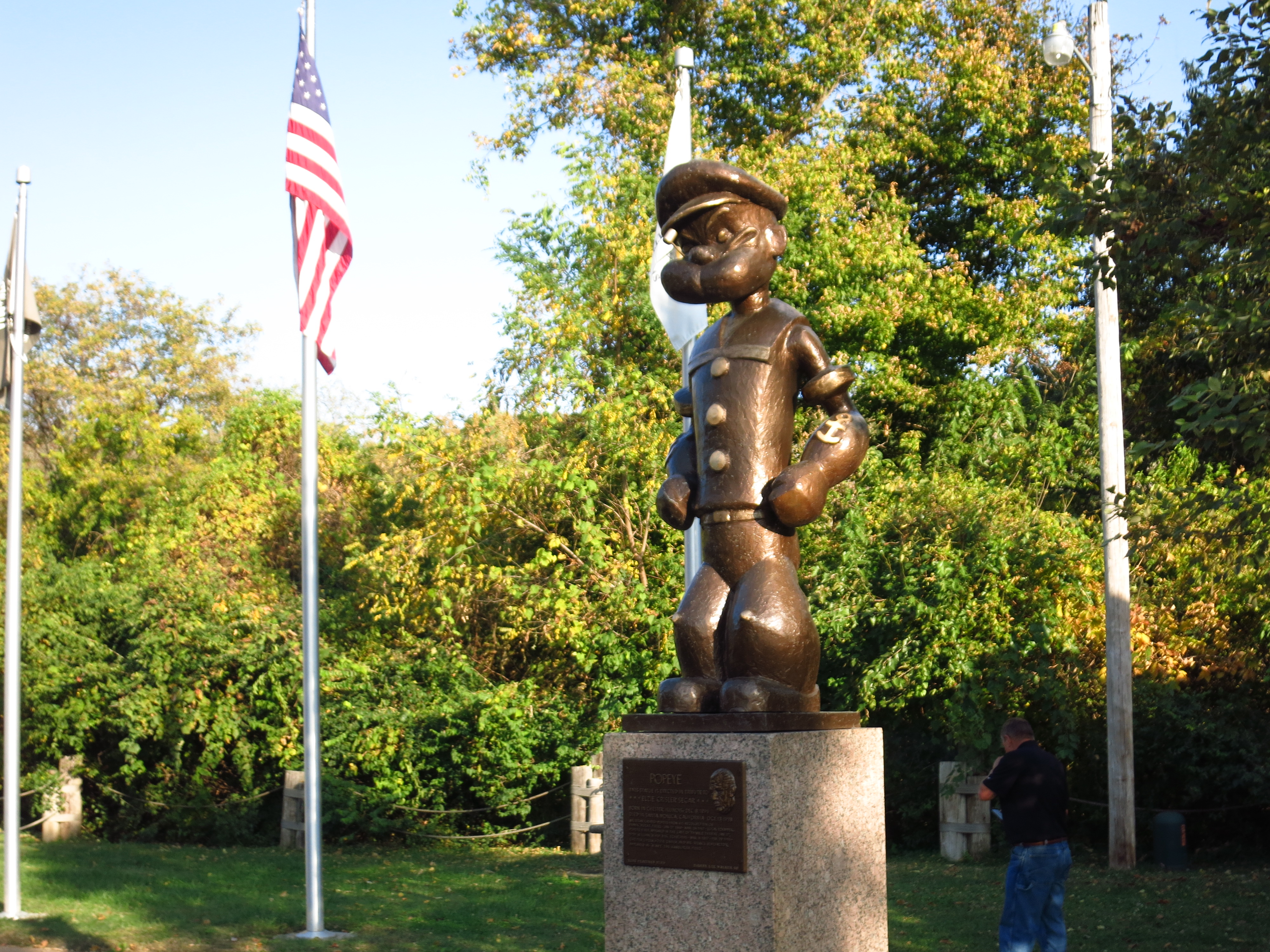
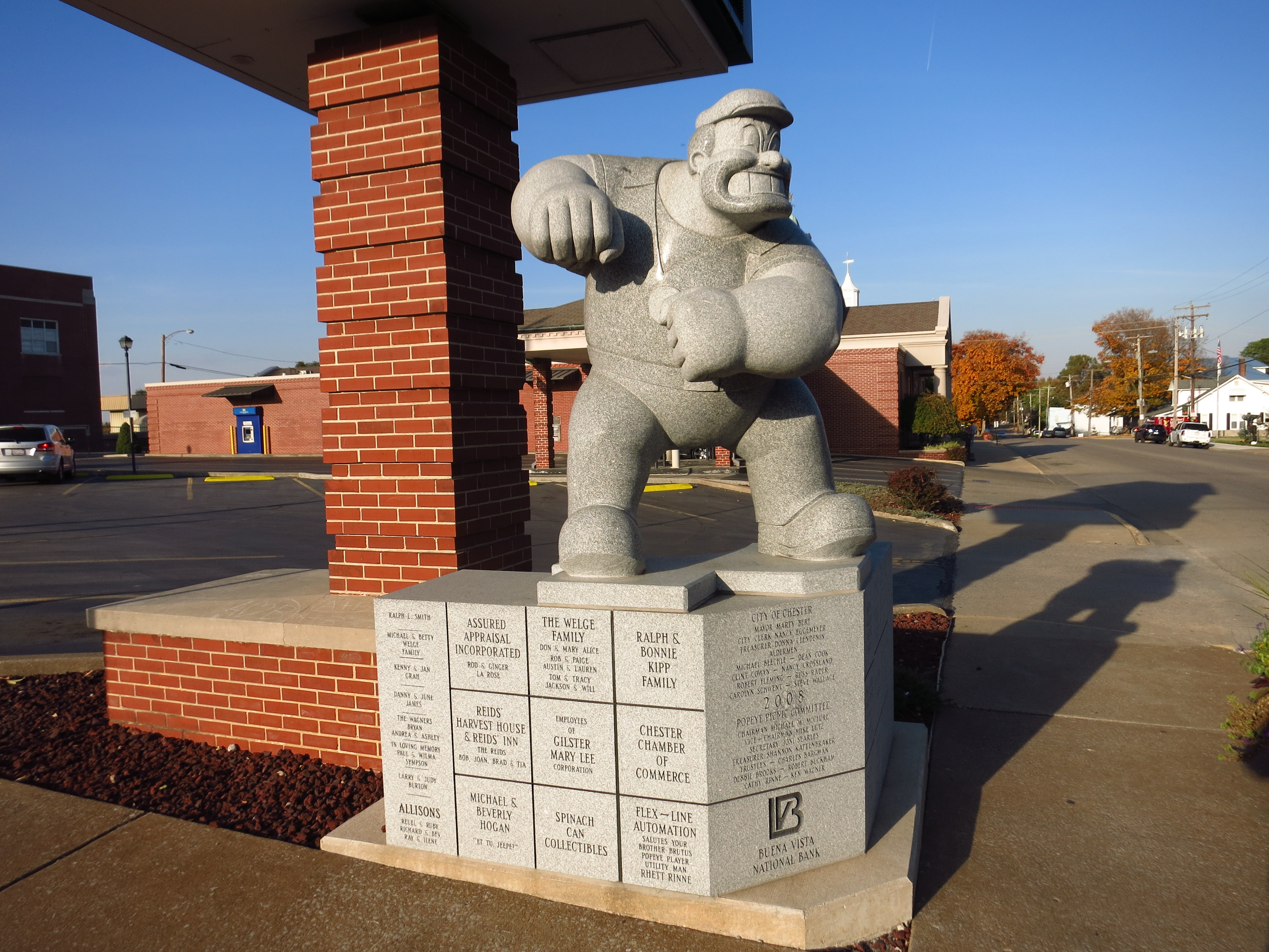
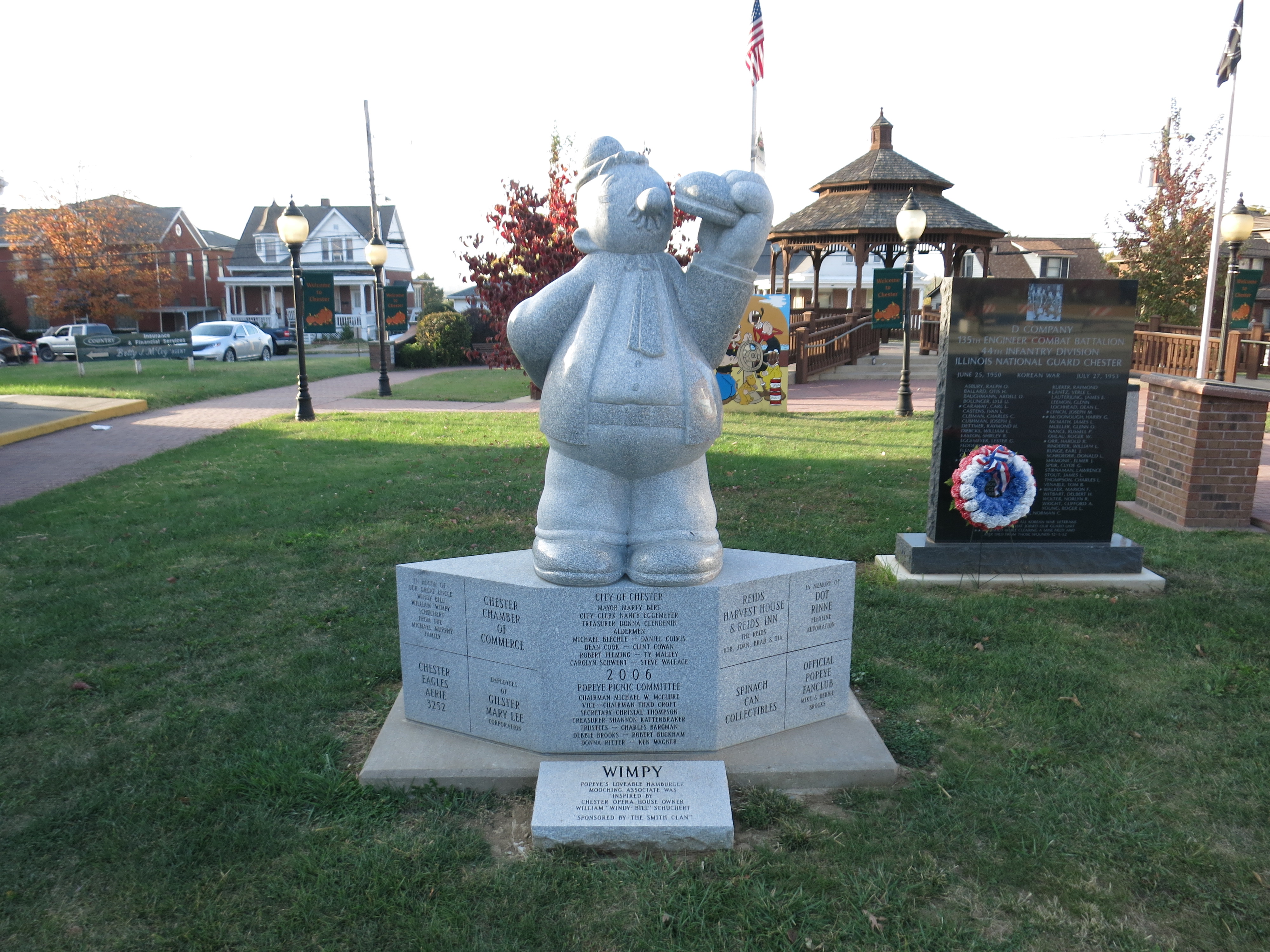
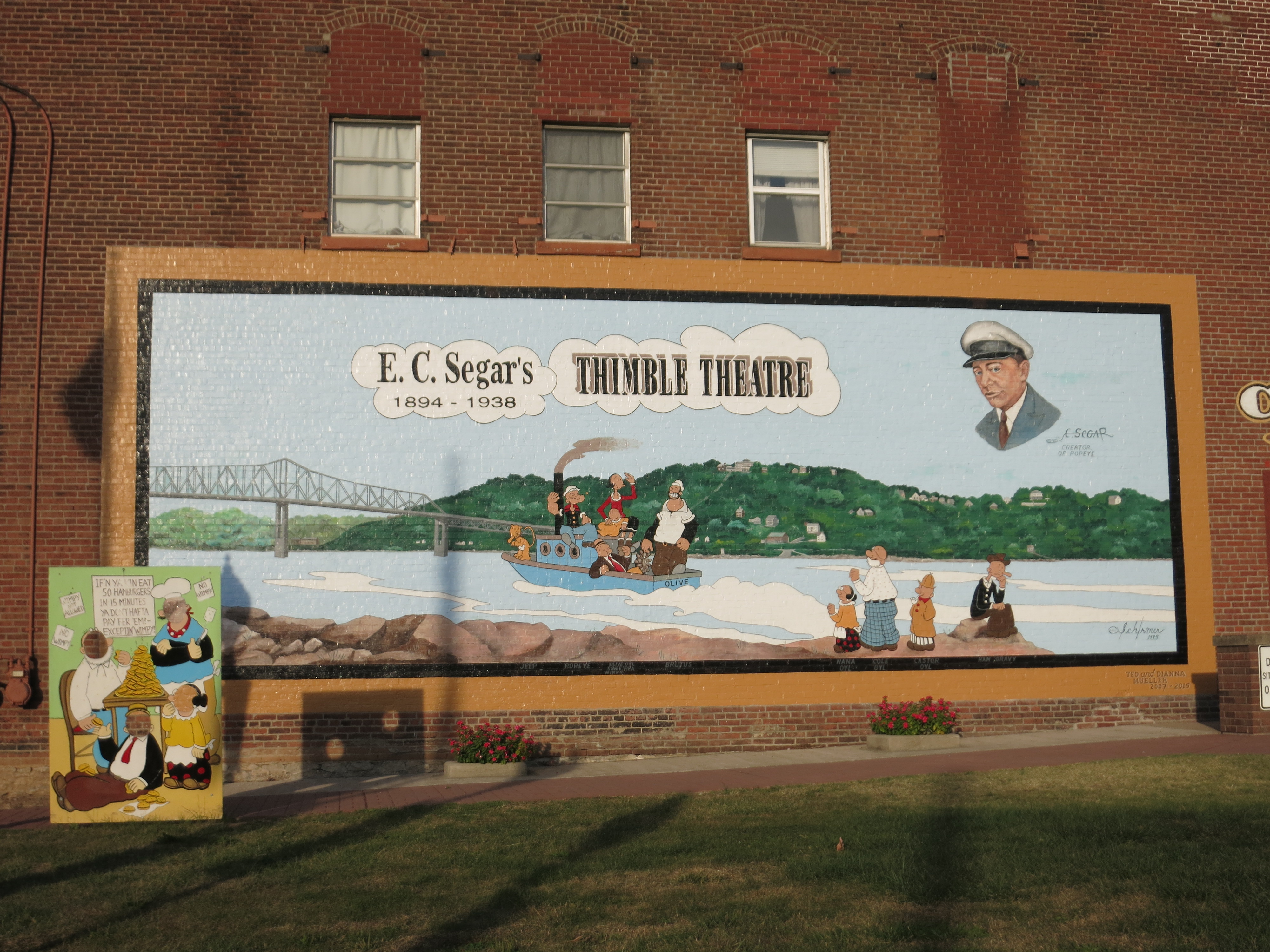
October 22 (later that same day) — I drove north along the Mississippi River to the small town of Chester, which is the hometown of E.C. Segar — creator of the comic strip character Popeye. Statues of Popeye and his gang can be found all over the small river town, which holds a “Popeye Picnic” each year on the weekend following Labor Day. More info here if you’d like to visit.
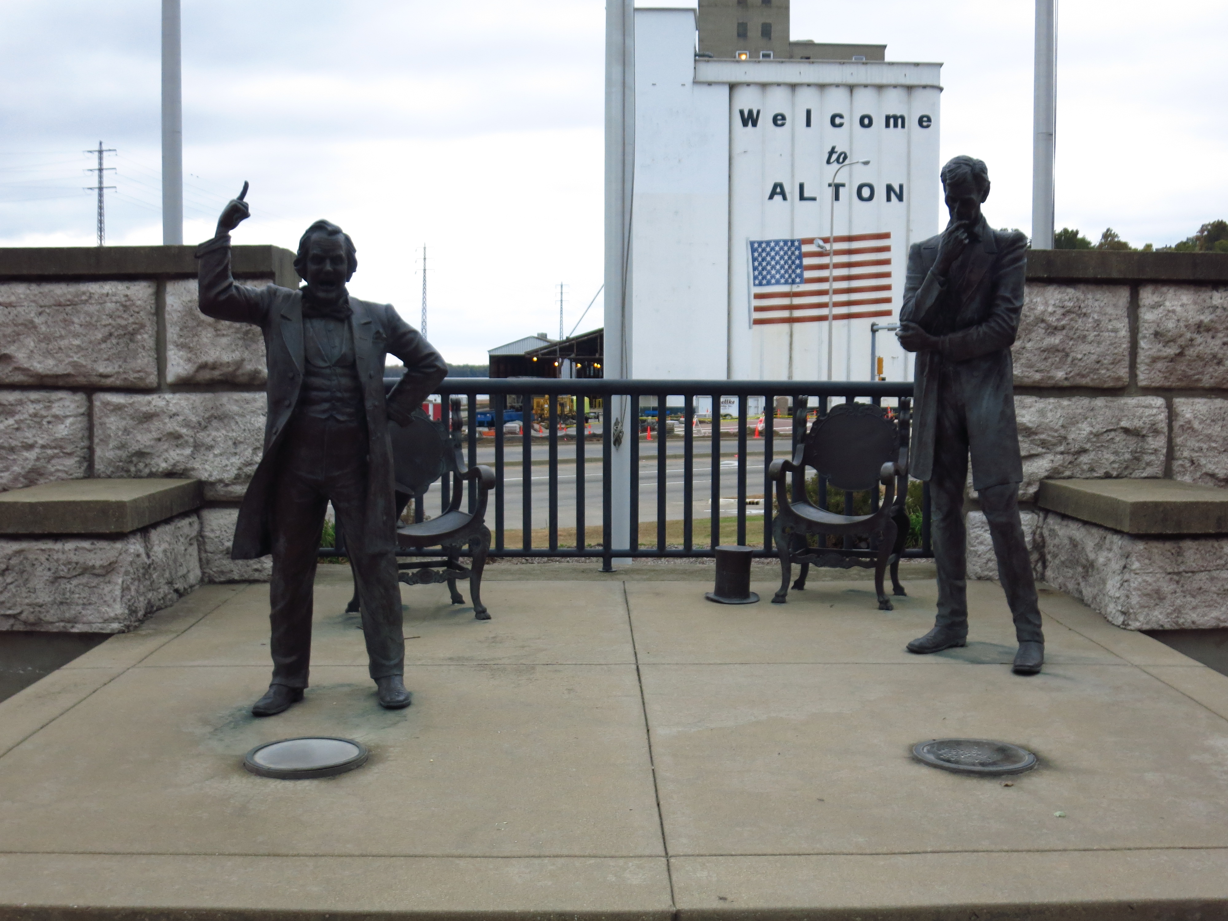
October 23rd — Alton, Illinois. The final debate of the Lincoln-Douglas was held in Alton. Again, life-size statues.
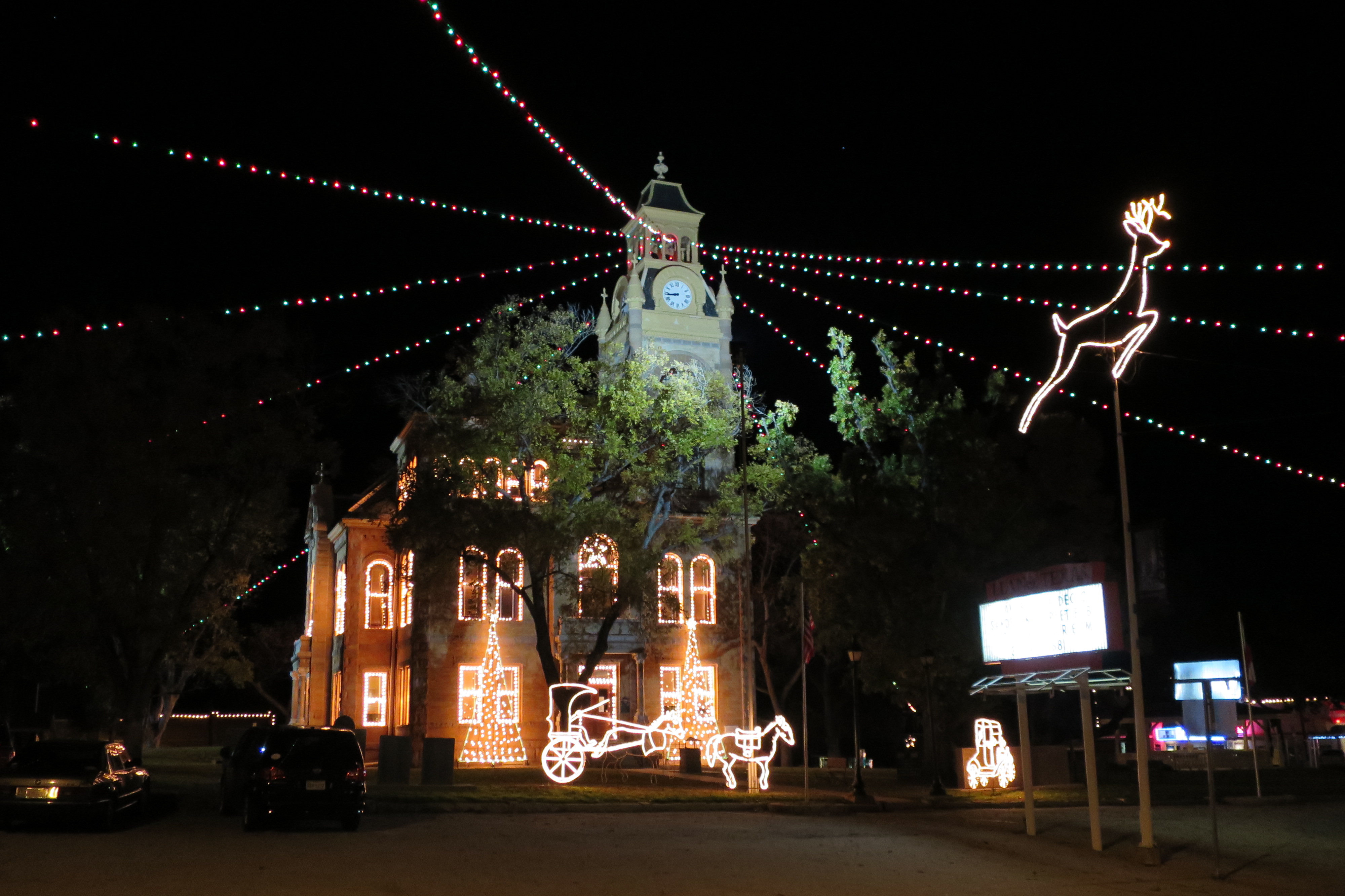
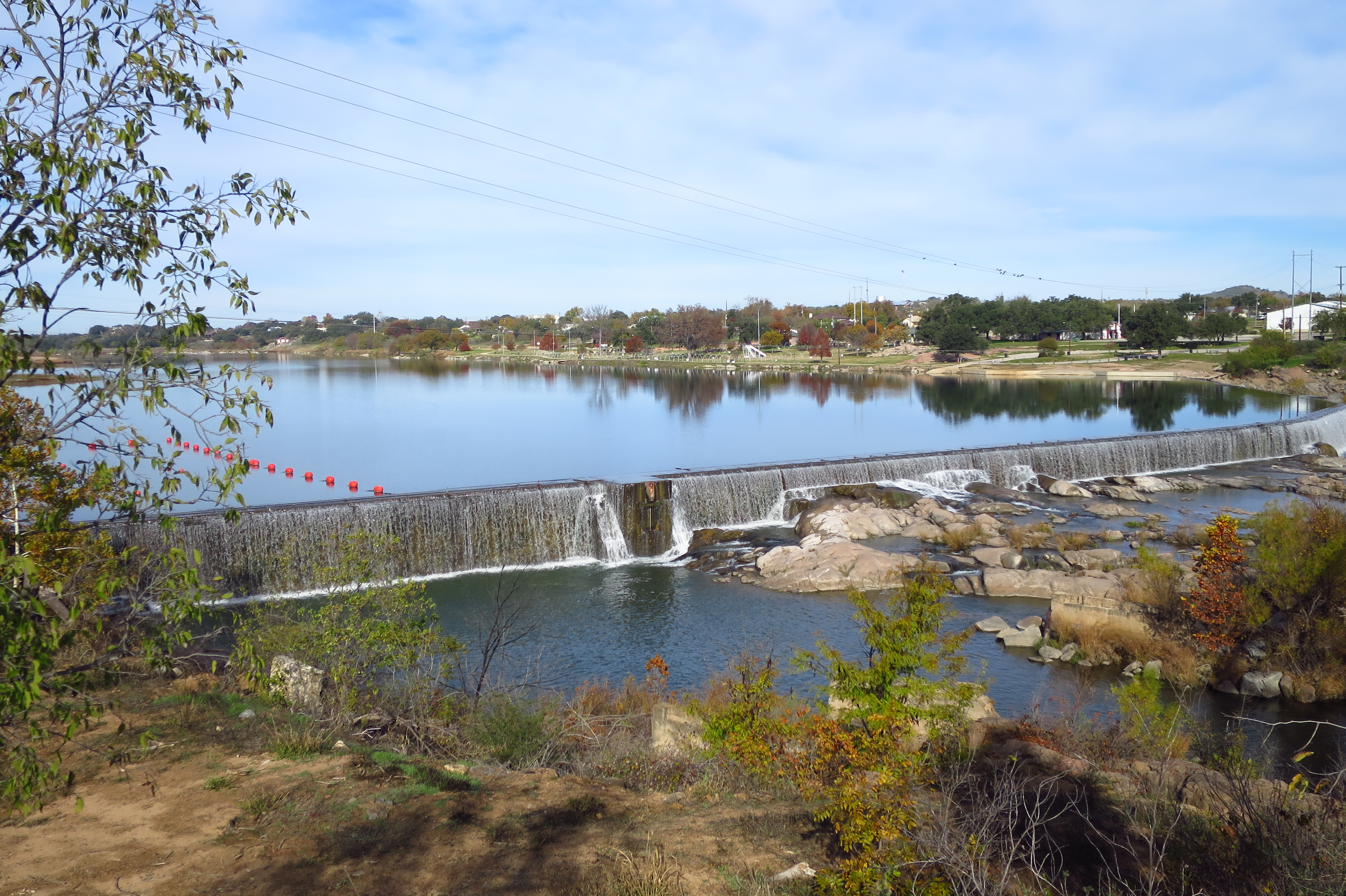
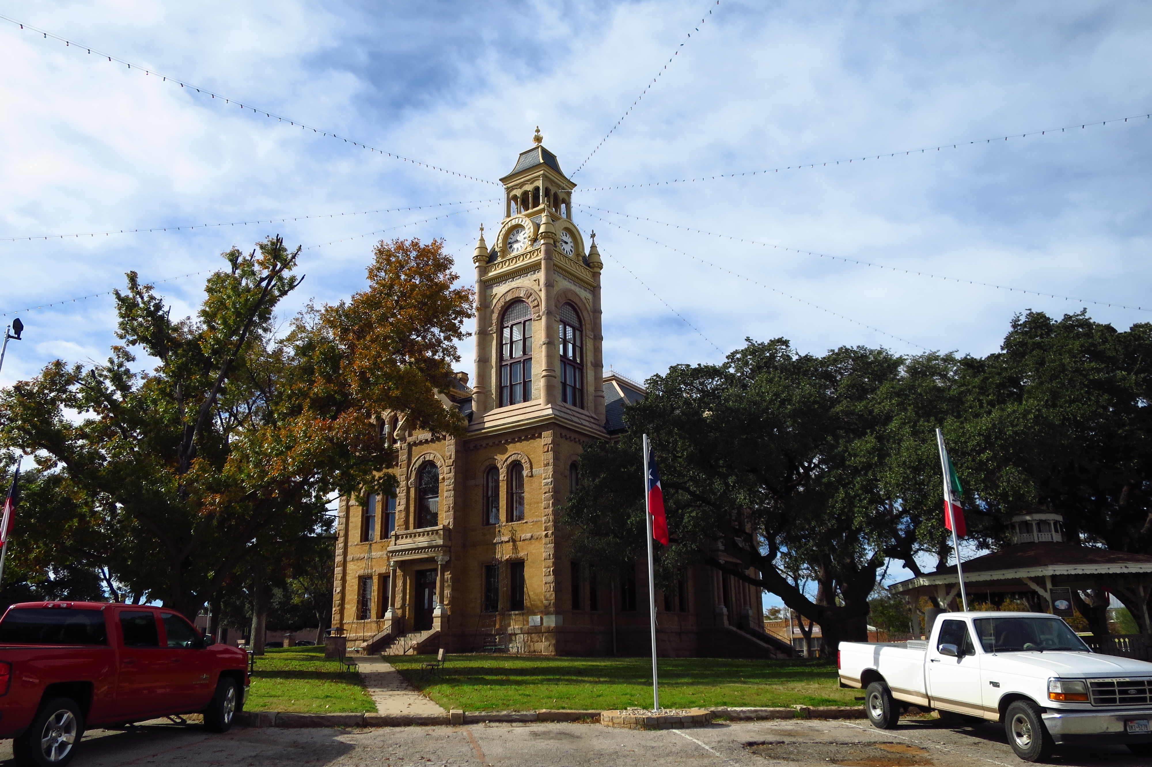
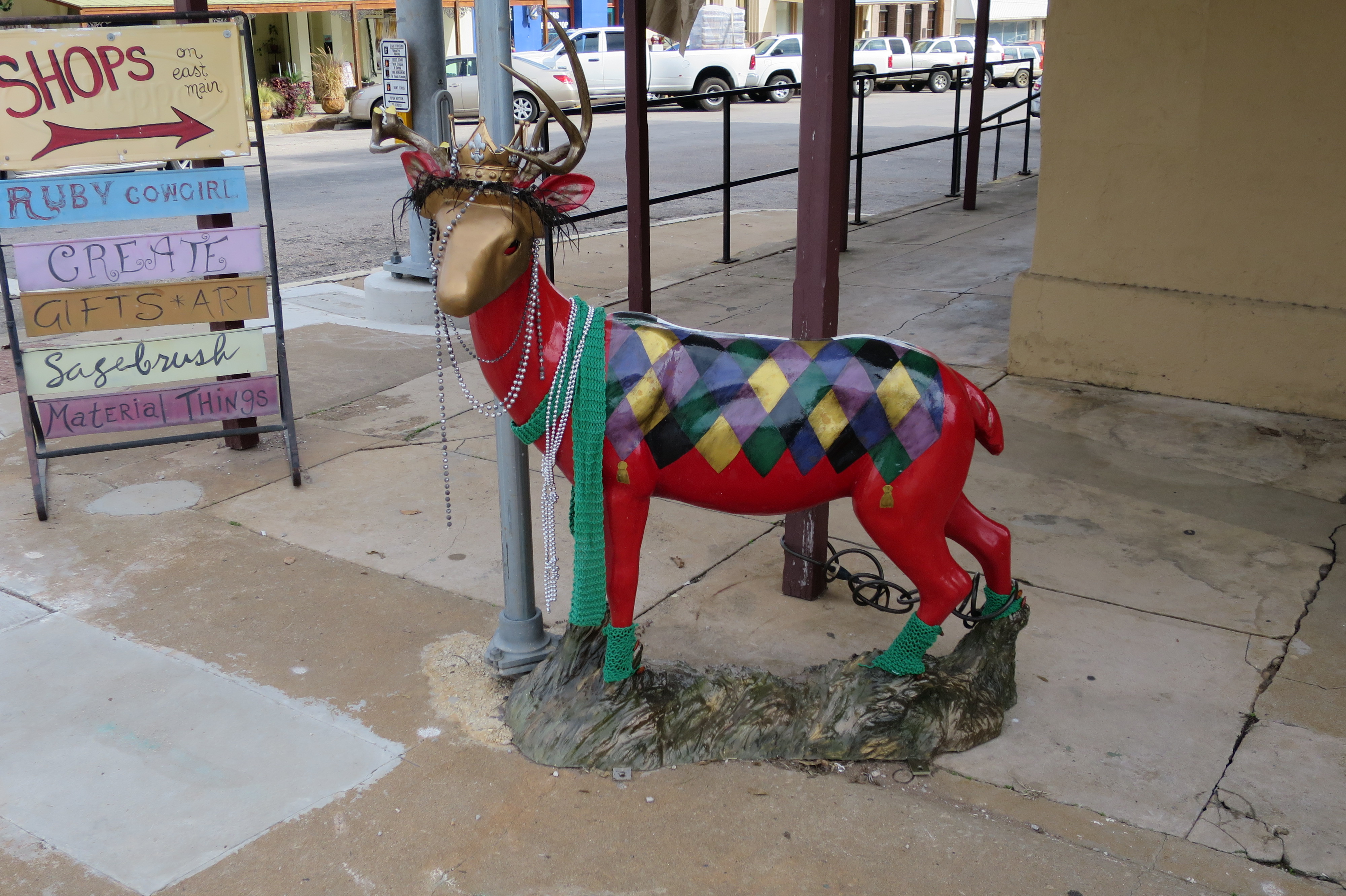
December 8th — Llano, Texas. Texans decorate for Christmas extravagantly, which should come as no surprise in a state that brags that “everything is bigger here.” Many towns assemble light shows and displays in their town parks, calling them “Christmas Parks”. See the way the Llano County Courthouse is decked out for the holiday season in this Hill Country town. The second photo is the Llano River and dam in daylight, followed by the courthouse in daylight, and then the town mascot (Llano is the deer capital of Texas), decorated for the season.
Today is the last day of September and therefore the final day that can possibly claim any pretense to still being summer, so I’ve pulled together a few photos to honor the occasion. Mostly photos in this post — the season’s political ads have made me tired me of words.
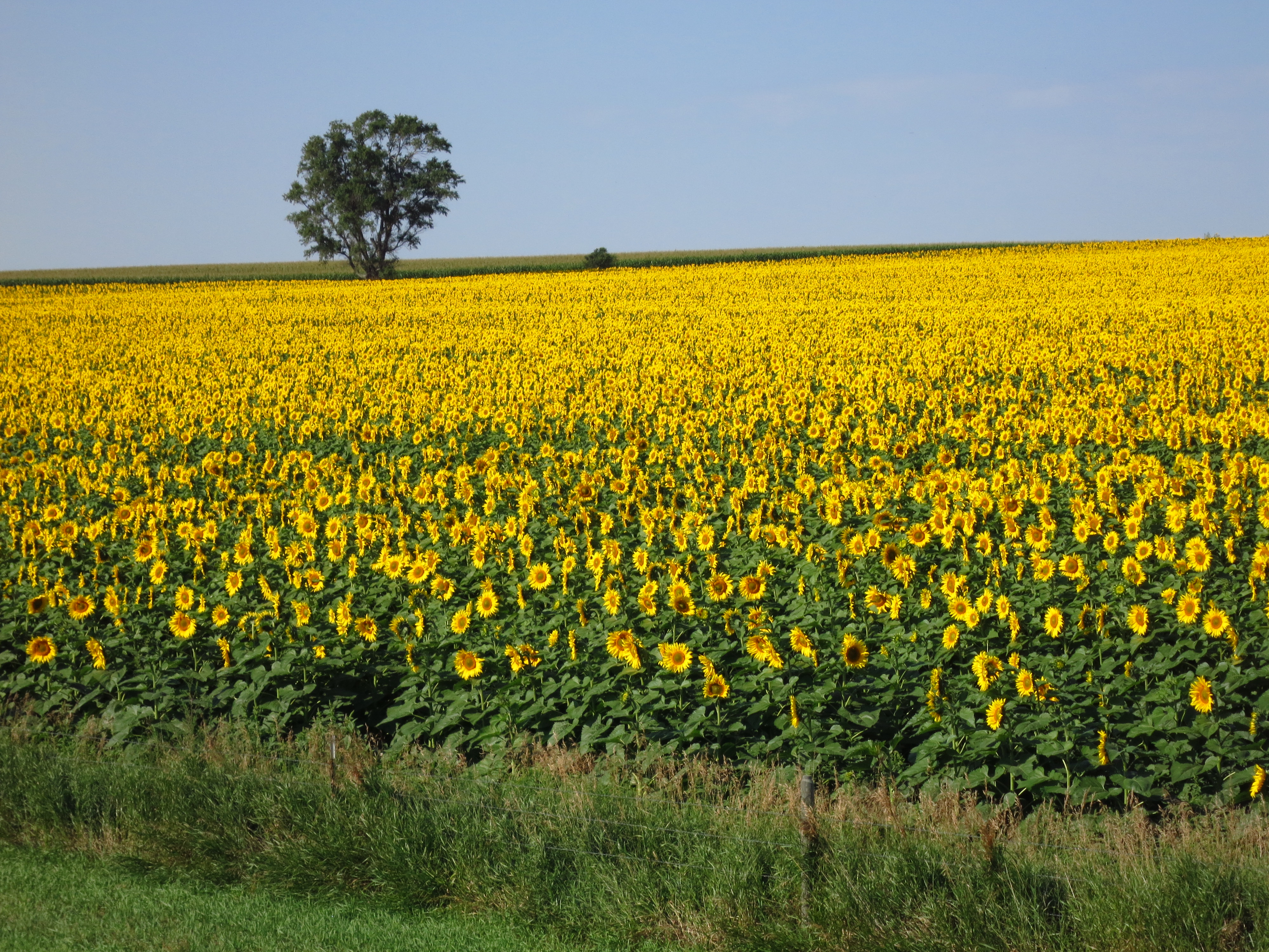
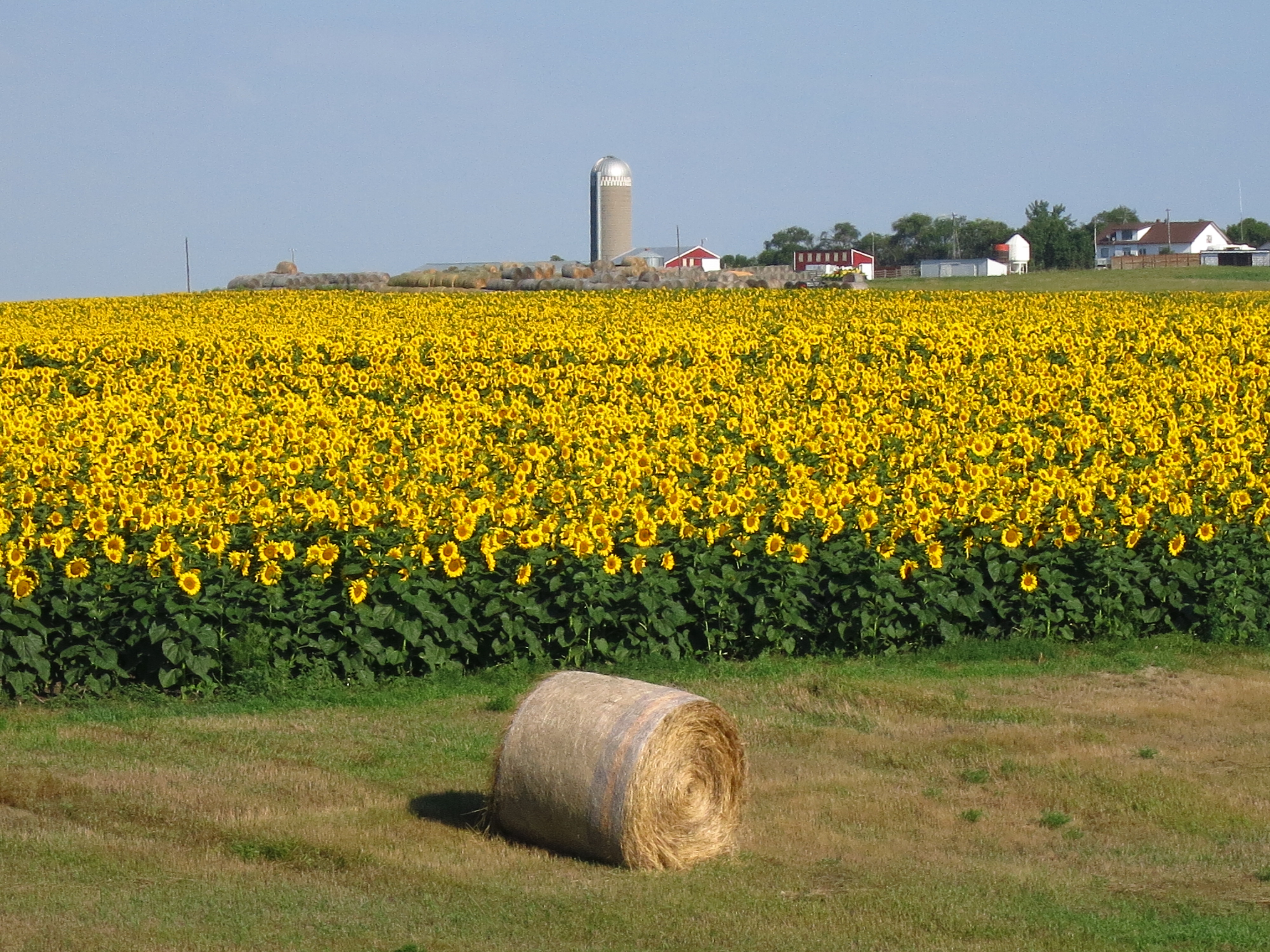
Sunflower Fields near Pollack, South Dakota: A lot of South Dakota sunflower fields were ripening in August. The farmer told me that prices were down but yields were up. Breaking even with last year. He’s probably already off to Arizona for the winter.
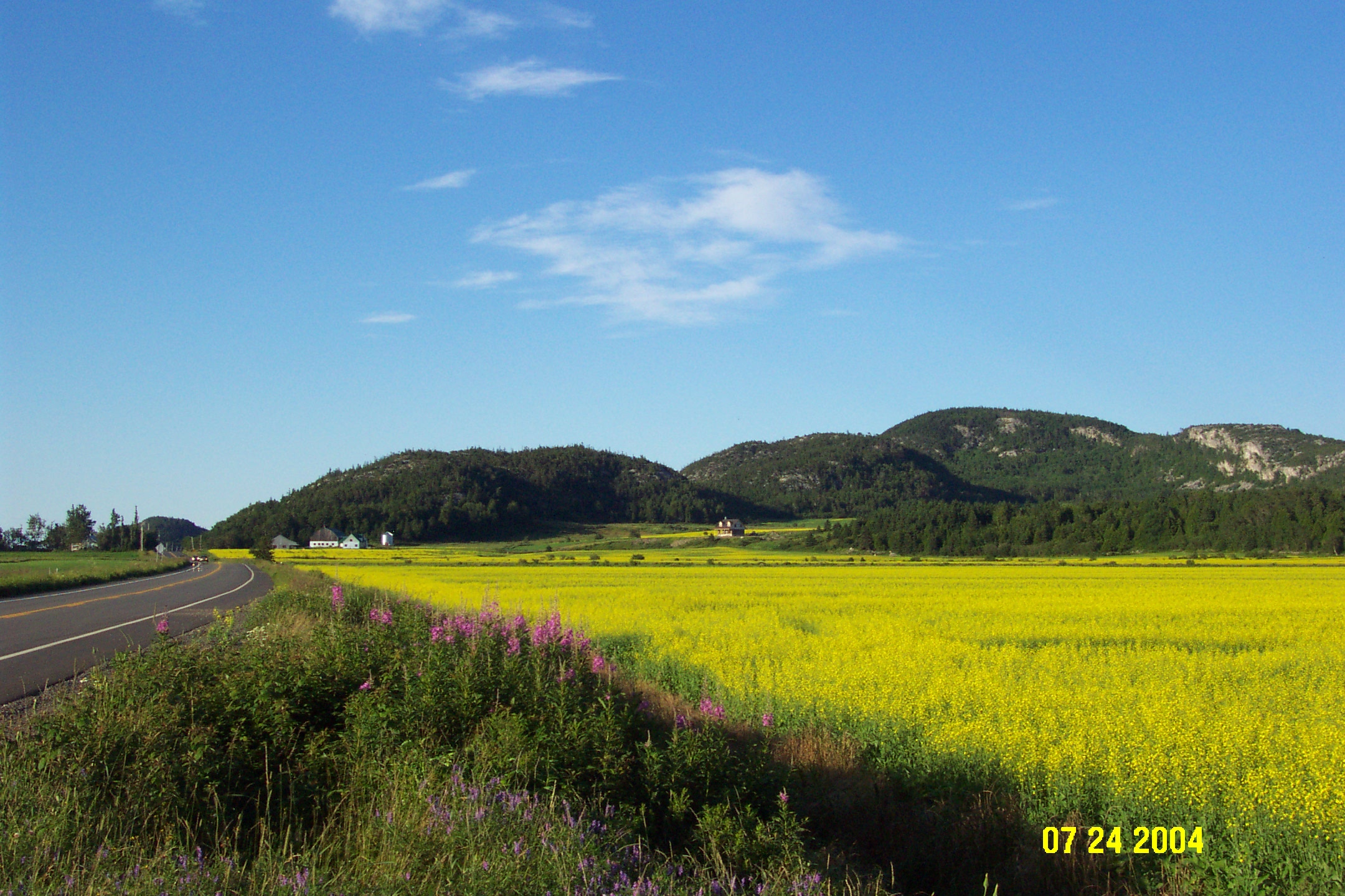
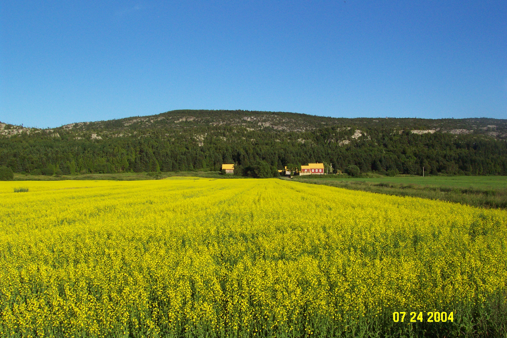
Canola Fields near St. Andre, Quebec, Canada: Bright yellow canola can turn a plain field into an impressionist landscape. Nice of them to add the purple flowers along the roadside, though I imagine the more stolid types would call those weeds. The rocky hills in the background are probably glacial deposits; they form the boundaries of the St. Lawrence River Valley.
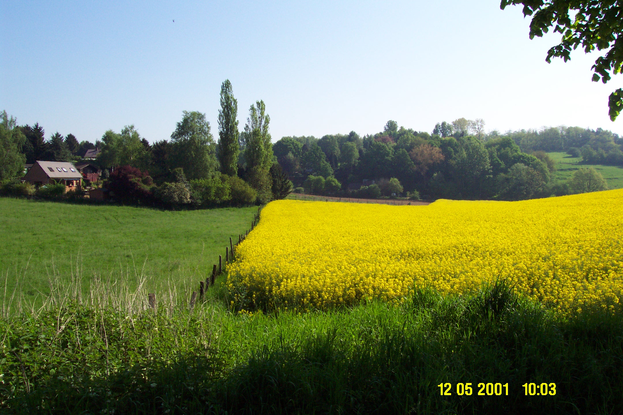
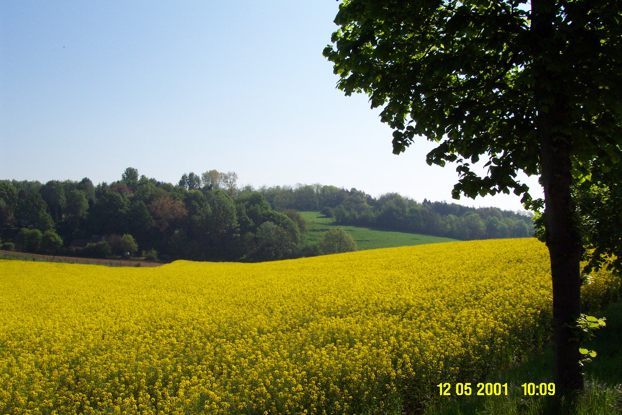
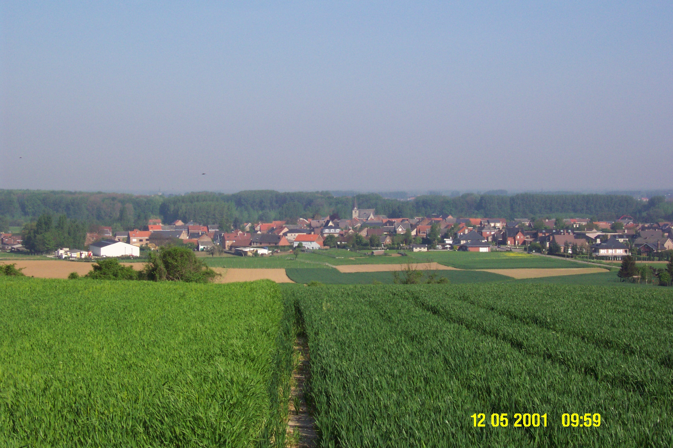
One More Bright Yellow Summer Field — Countryside near Leuven, Belgium: 2 photos of canola fields in Belgium plus a nearby farming village. These were taken in the month of May, but it sure looks like summertime to me.
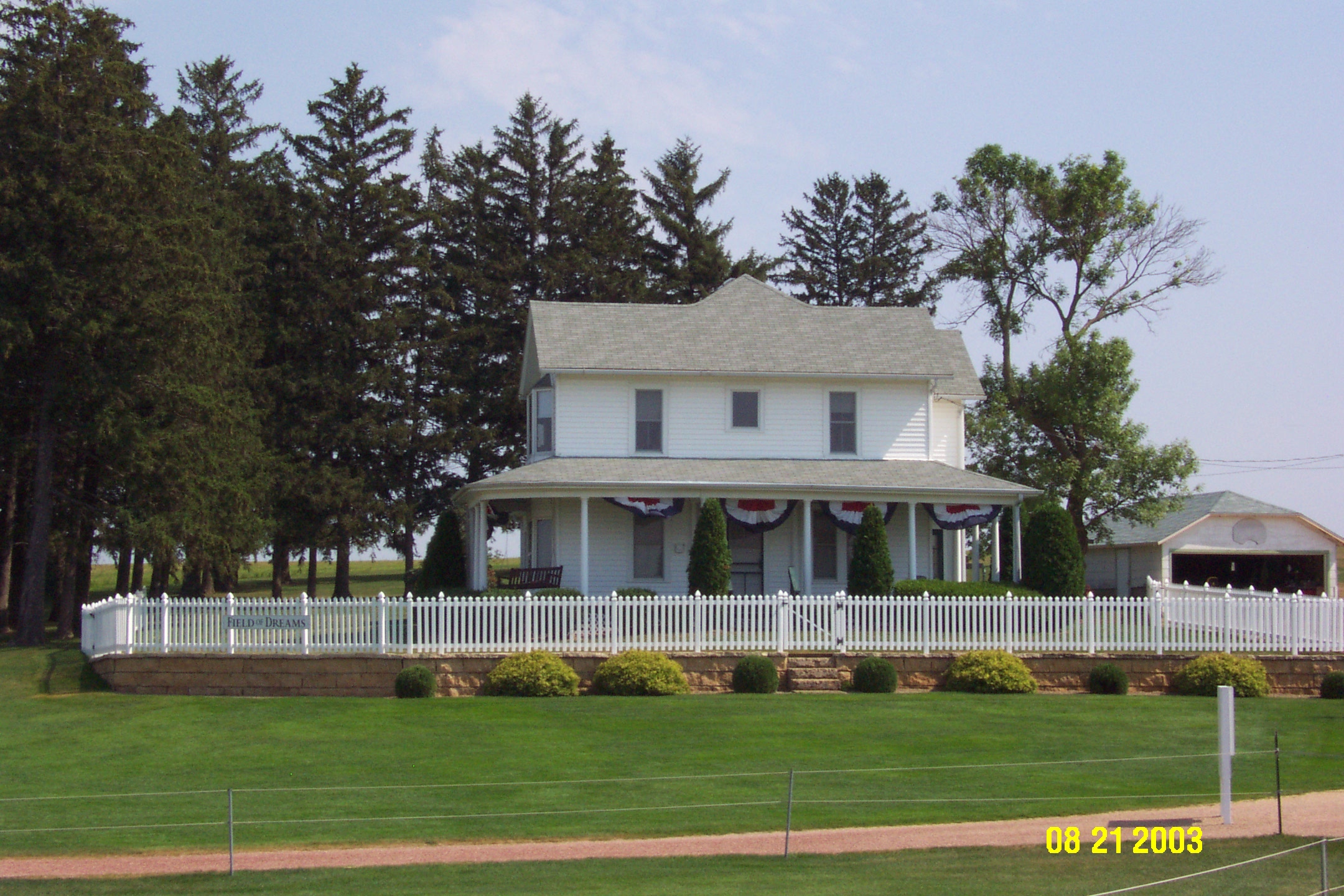
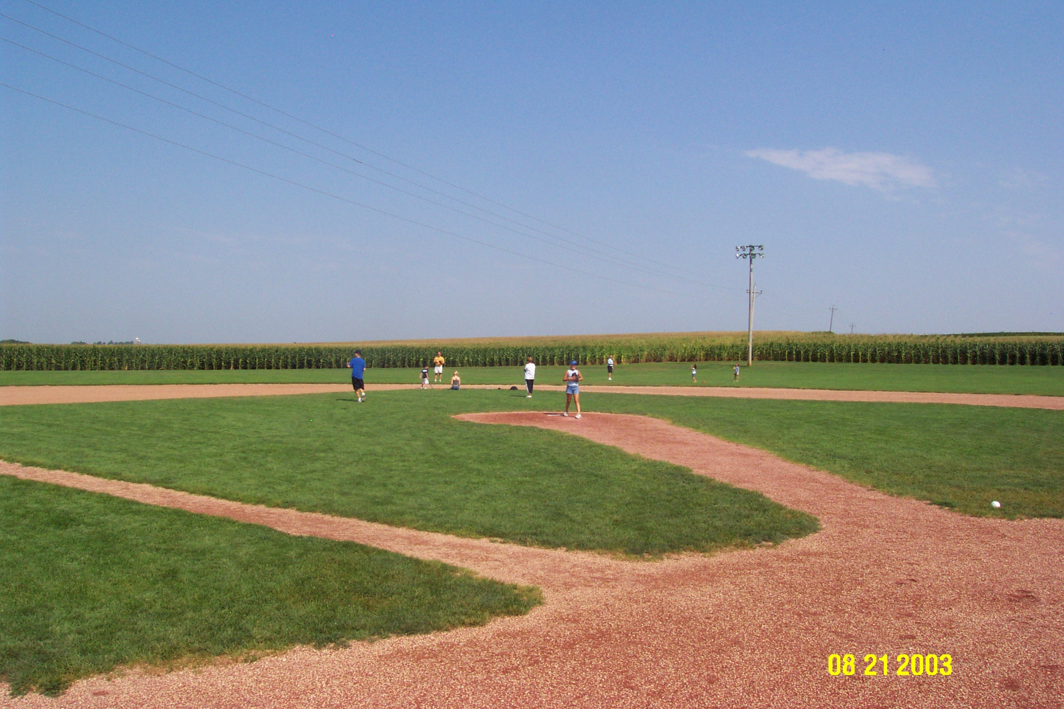
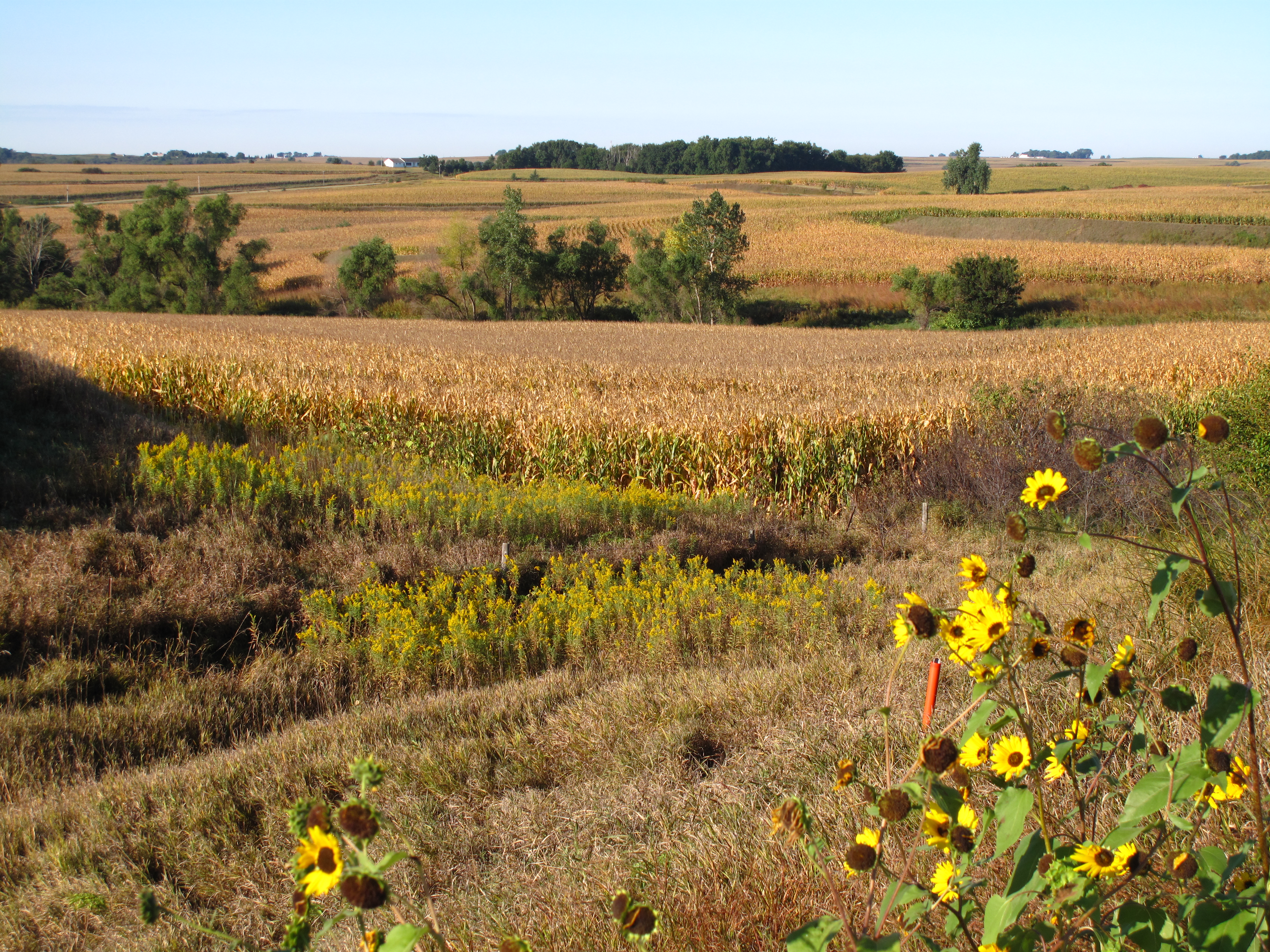
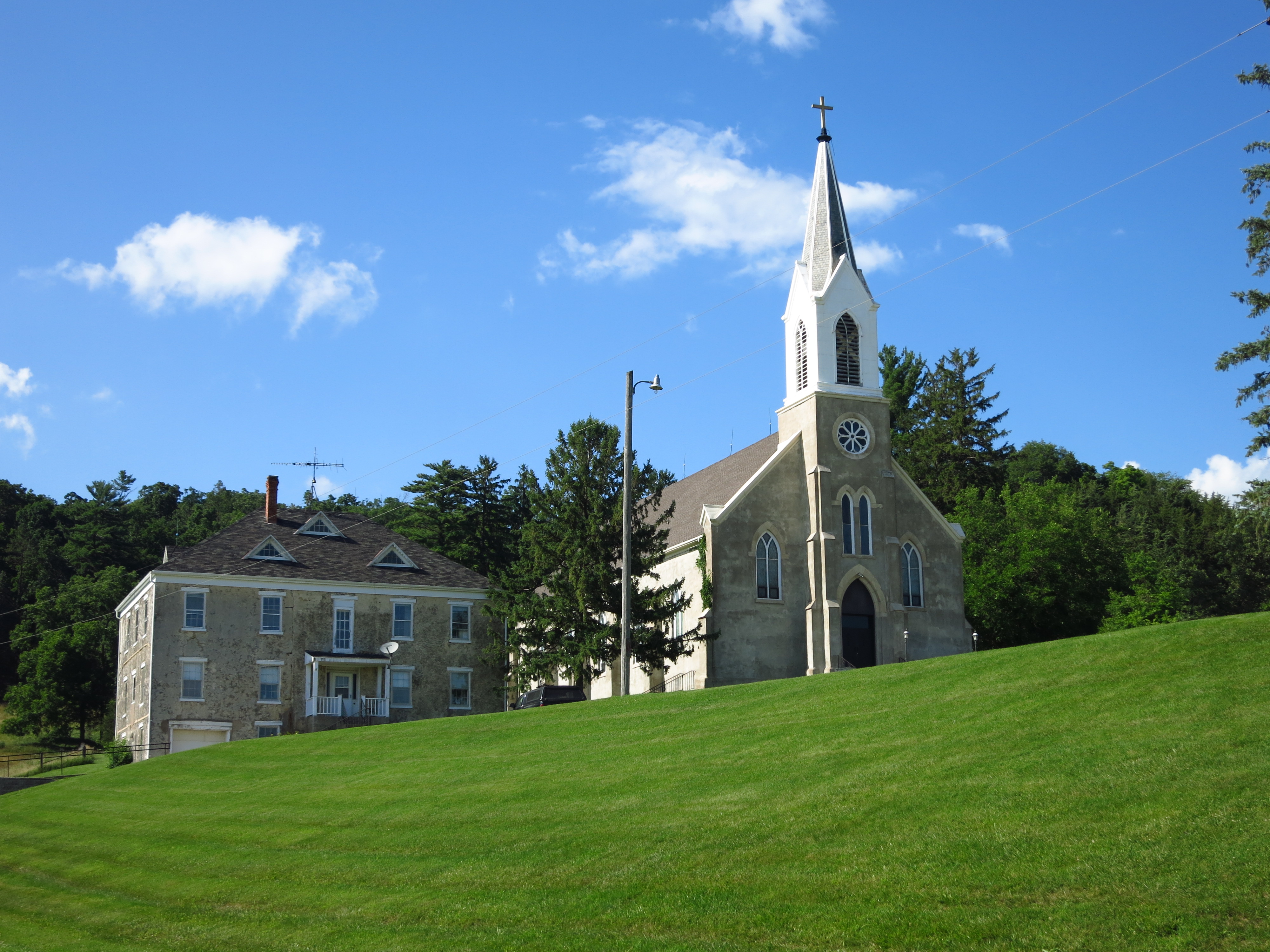
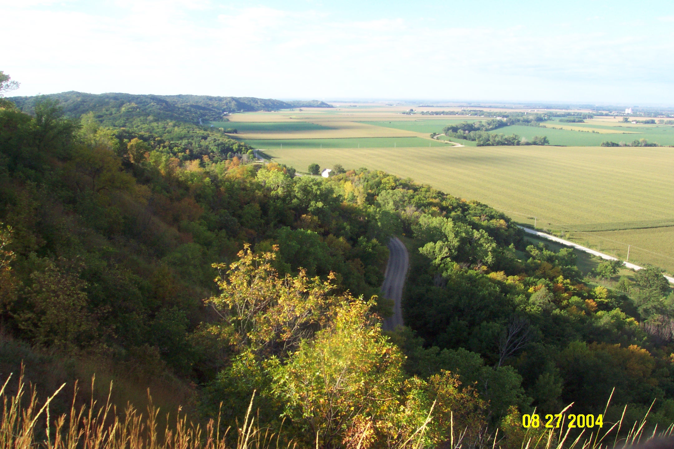
Iowa — Farmhouses, Baseball, Cornfields, Old Churches, and Loess Hills: The first two photos are from the Field of Dreams farm/set near Dyersville; the third shows late-summer cornfields outside Sioux City; the fourth is a view of the old St. Donatus church in July; the fifth shows a country road winding through the Loess Hills (yes, hills in Iowa!) along the eastern banks of the Missouri River floodplain. The Loess Hills are ancient accumulations of wind-borne glacial debris.
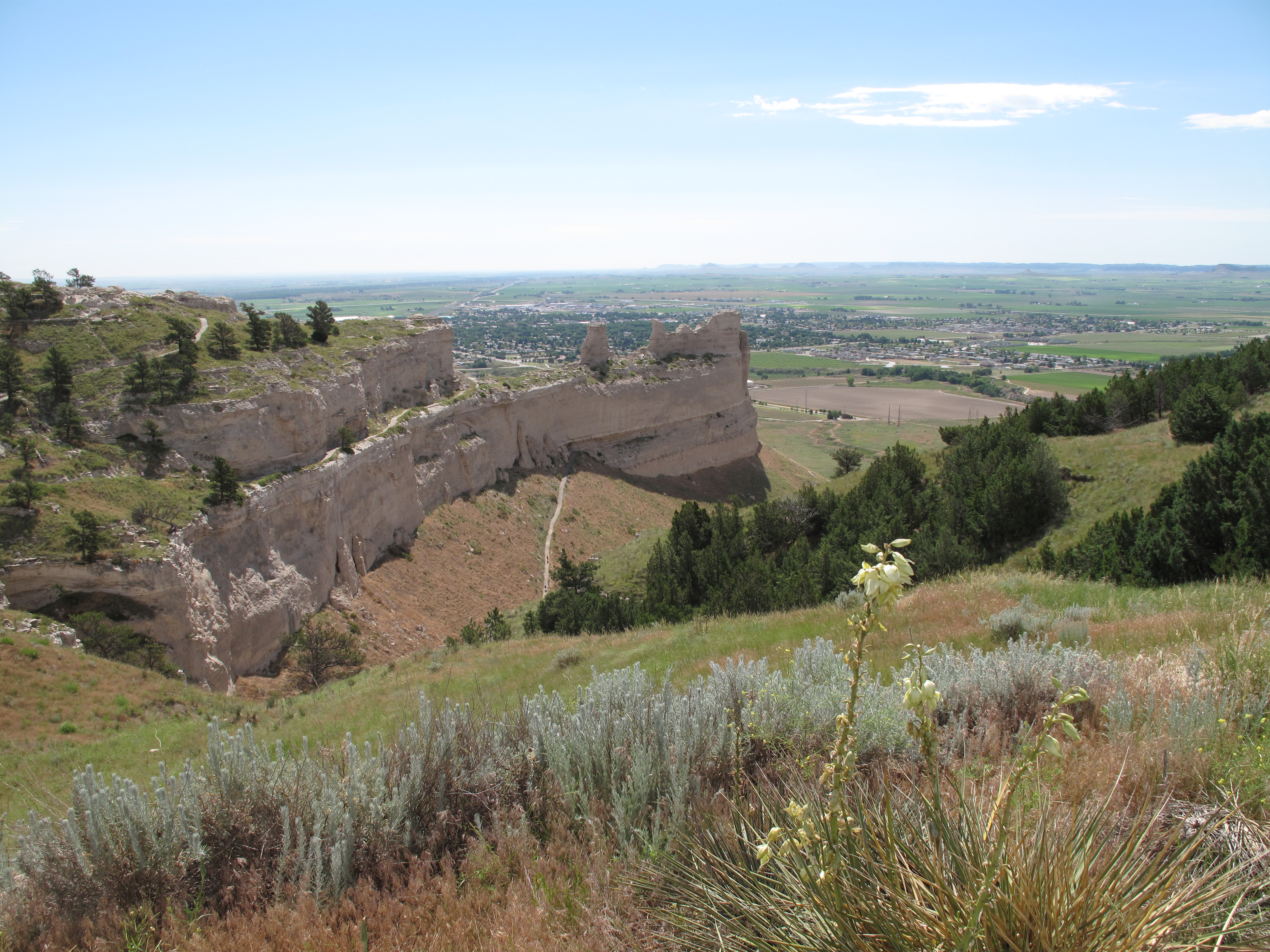
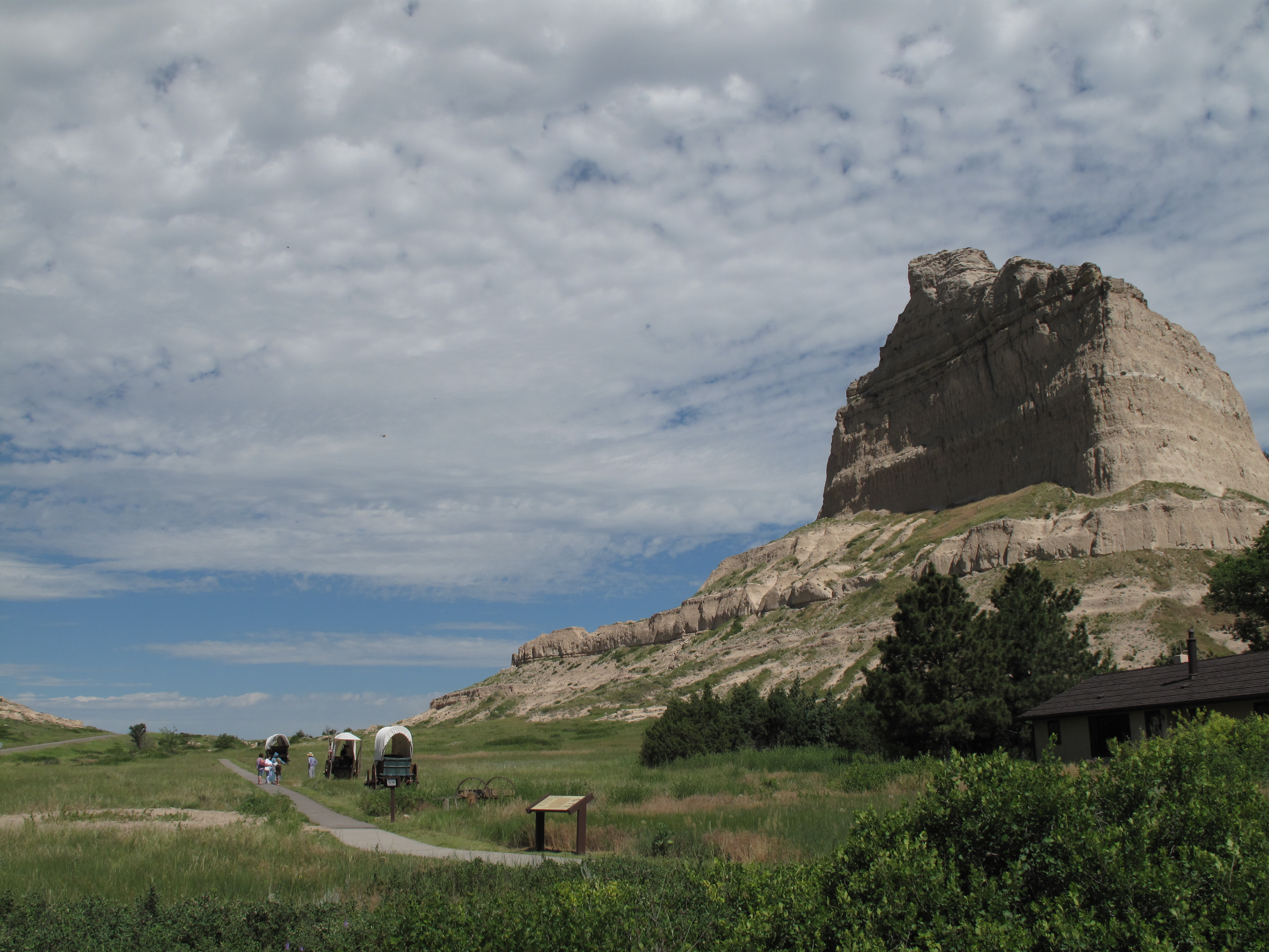
The Hot Summer Sun near Scottsbluff, Nebraska: Scotts Bluff was an important landmark along the Oregon Trail. It rose so suddenly out of the Nebraska prairie that Oregon-bound wagon trains could see the rock formations for days before reaching them. These photos to me epitomize the summer heat. Bugs, dust, sweat, sunburn, biting insects, and rattlesnakes enhanced the experience. In winter the bluffs are subject to blizzards and covered in snow.
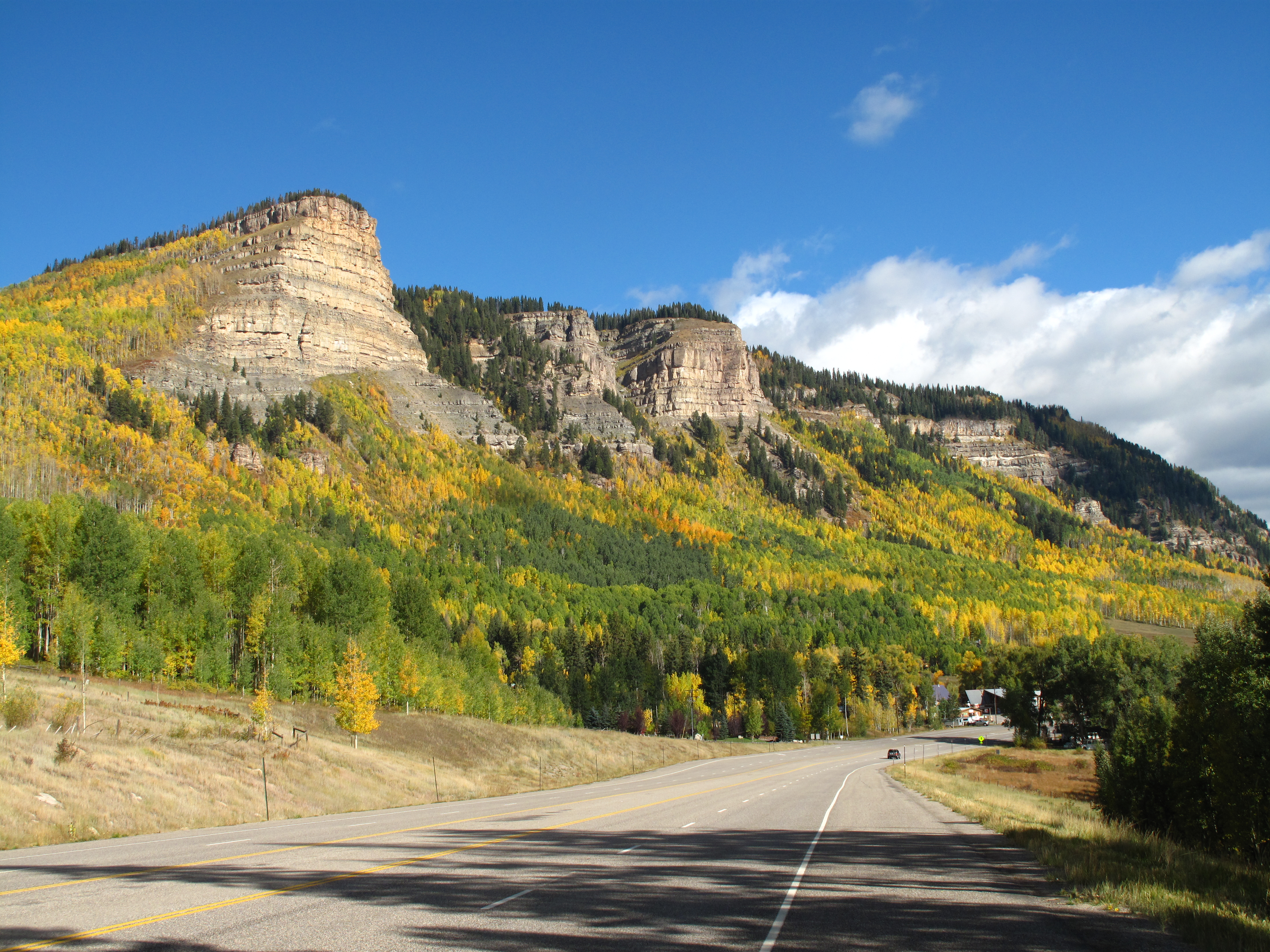
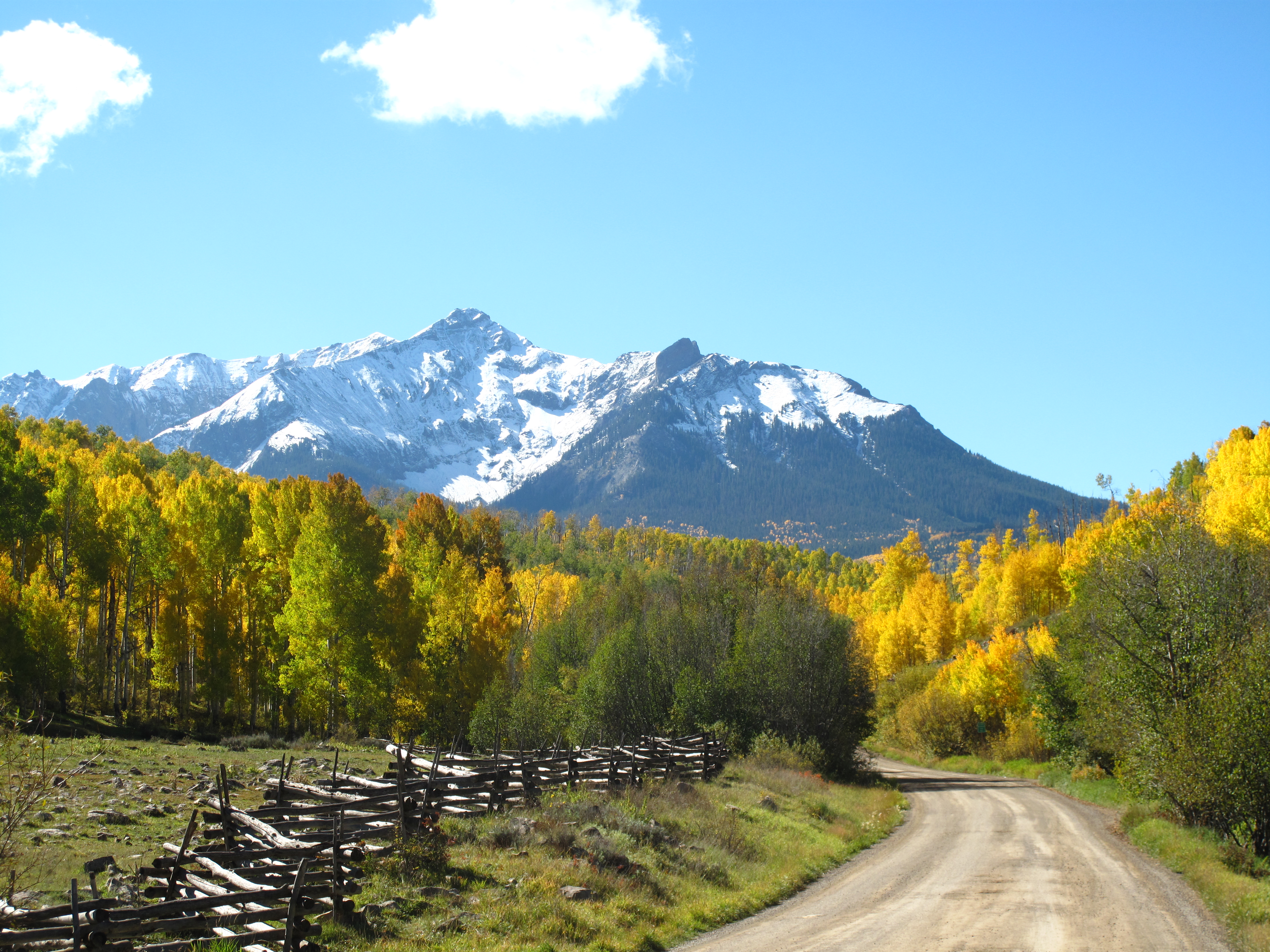
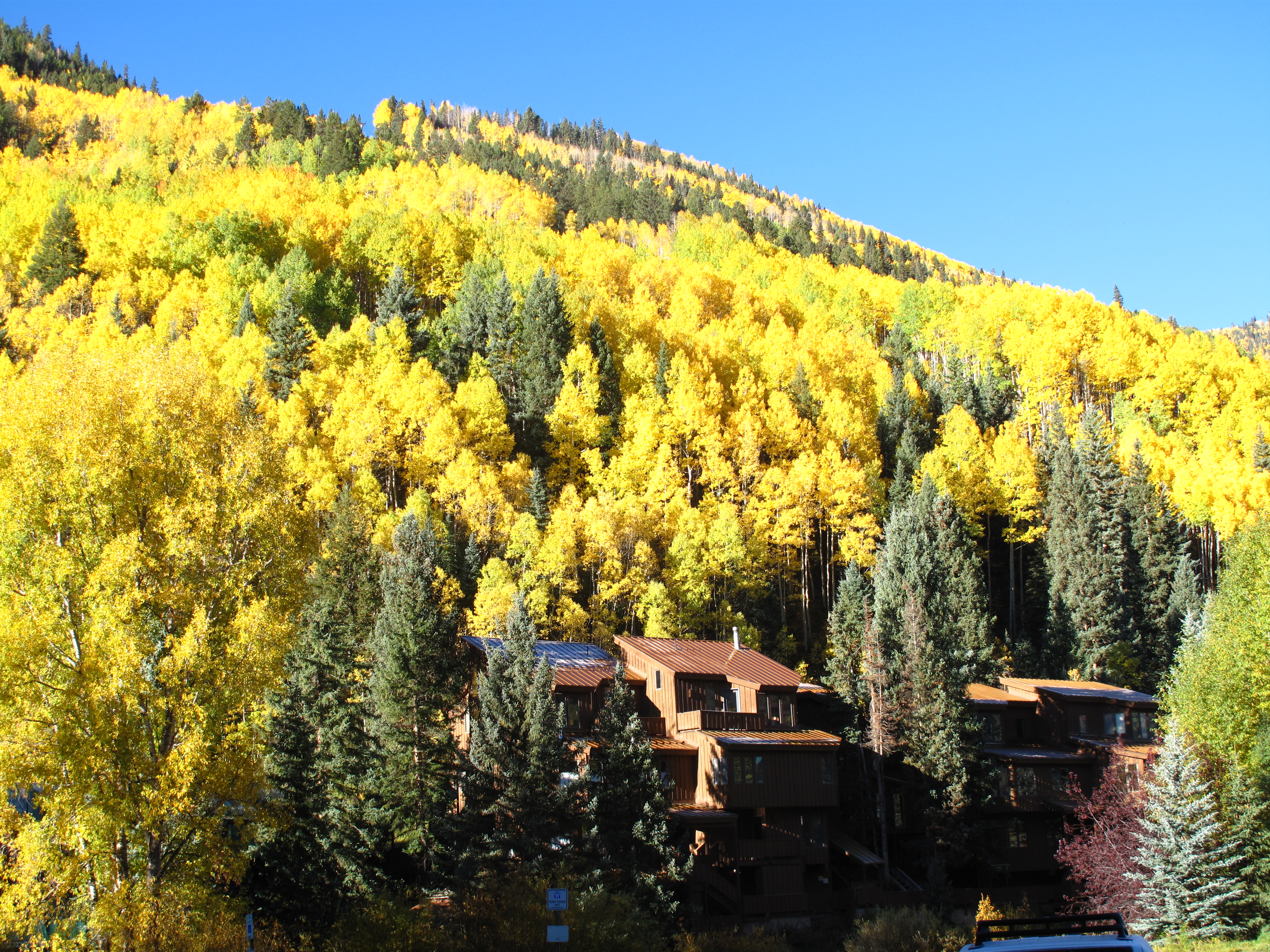
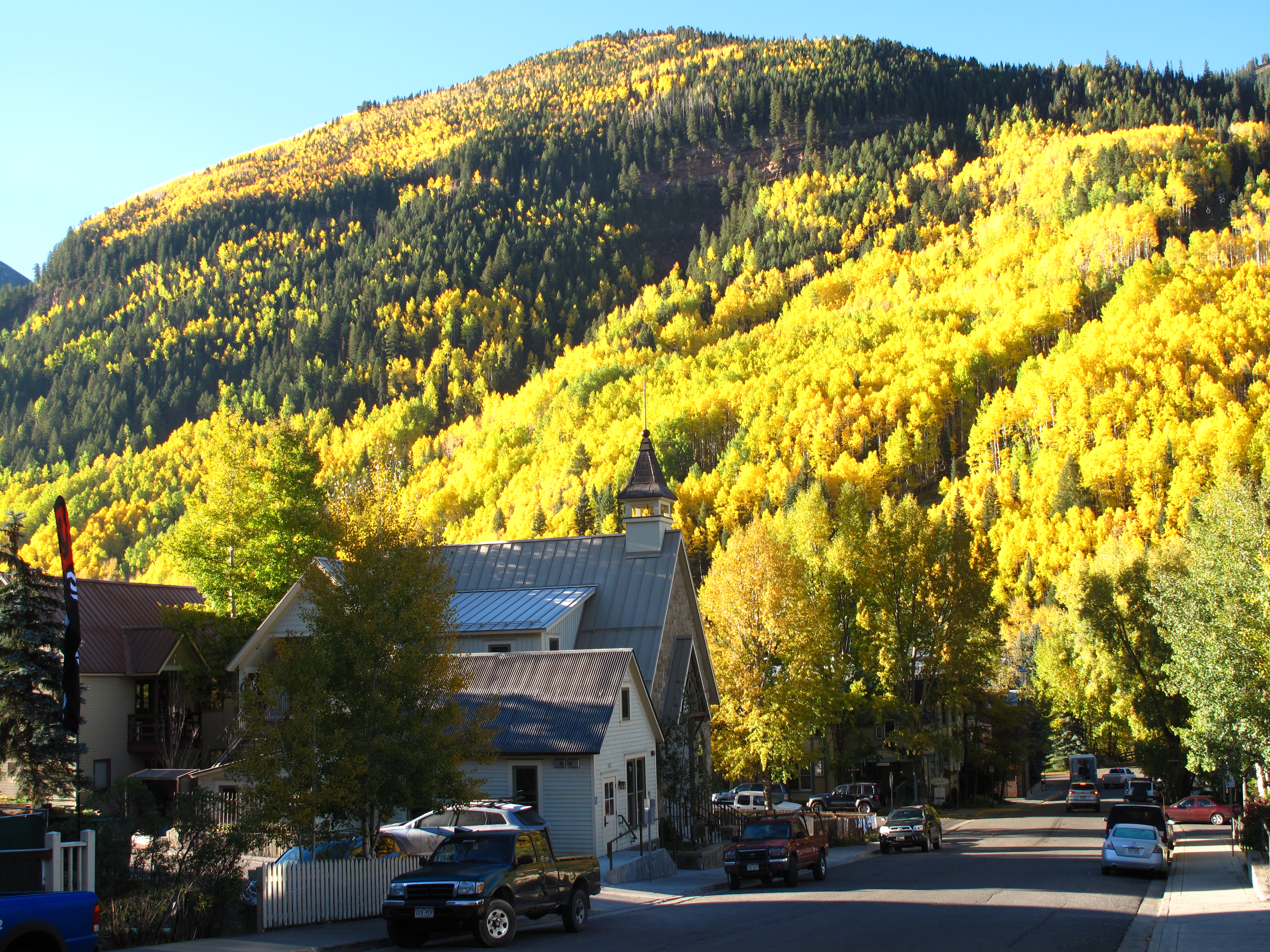
Finally, in the High Country Autumn Comes before September Ends — San Juan Mountains of Colorado: All these photos were taken in and around Durango and Telluride Colorado in late September, 2012.
There. Summer is done for another year as the Colorado aspens introduce autumn once again.
The month of October begins tomorrow. At the stroke of midnight you may buy your mega-bags of Halloween candy at Walmart without suffering social aspersions. Enjoy.
New Yorkers are funny; they always have me laughing, or at least shaking my head.
After landing at the Albany airport on a quiet, sunny Sunday afternoon I let the GPS direct me onto a backwoods route to my hotel. Nearing a rural roadside craft sale, held in a barn, I saw a sign warning to watch for pedestrians. Then I noticed a petite Asian woman on the side of the road ready to cross. Seeing no crosswalk but figuring that New York pedestrian right-of-way laws were very strict, I stopped my car completely and motioned for her to cross. She hesitantly approached the edge of the road, then set her feet and tilted her head at such an angle that she could both look down and sideways at me at the same time. I checked my mirrors; mine was the only car in sight in either direction. I waved my hand again. She tensed ever so slightly at the invitation, but finally declined and just stood there, motionless, looking down, refusing to place one foot on the asphalt. Apparently, New Yorkers are not a trusting breed. I conceded the stand-off to her and drove on by.
Welcome to New York.
The next morning in downtown Albany I saw a woman’s transmission fail in the middle of an uphill street. She was trying to climb the hill but each time she shifted into ‘Drive’ and hit the gas the car merely rolled further backward downhill. Wishing to help, my first instinct was to look around for someone who might have access to a payphone. (I must have very old instincts. People have cell phones now and can call their own tow trucks.) I noticed a middle-aged woman having a smoke outside the courthouse door and shouted to her, “Could you please call a tow truck?” She gaped at me, pointed at her chest, and mouthed indignantly, “ME? You want ME to call?” Apparently, I had broken the Sacred Law of the Street. Since the whole scene was comically absurd, I drifted away shaking my head and laughing.
Welcome to New York.
The previous bit of pseudo-drama took place outside the new Albany County Judicial Center, across the street from the old county courthouse. The new building is a four-story brick structure with an underground entrance for defendants and such. All sorts of suits stood outside, exiled to the sidewalk for needing to smoke.
Albany County Judicial Center
The old courthouse next door is more ornate and even has a special entrance for “G.A.R.” members. (The G.A.R. was the “Grand Army of the Republic”, an association of Union Civil War Veterans.)
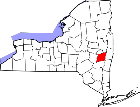
Albany County in the state of New York
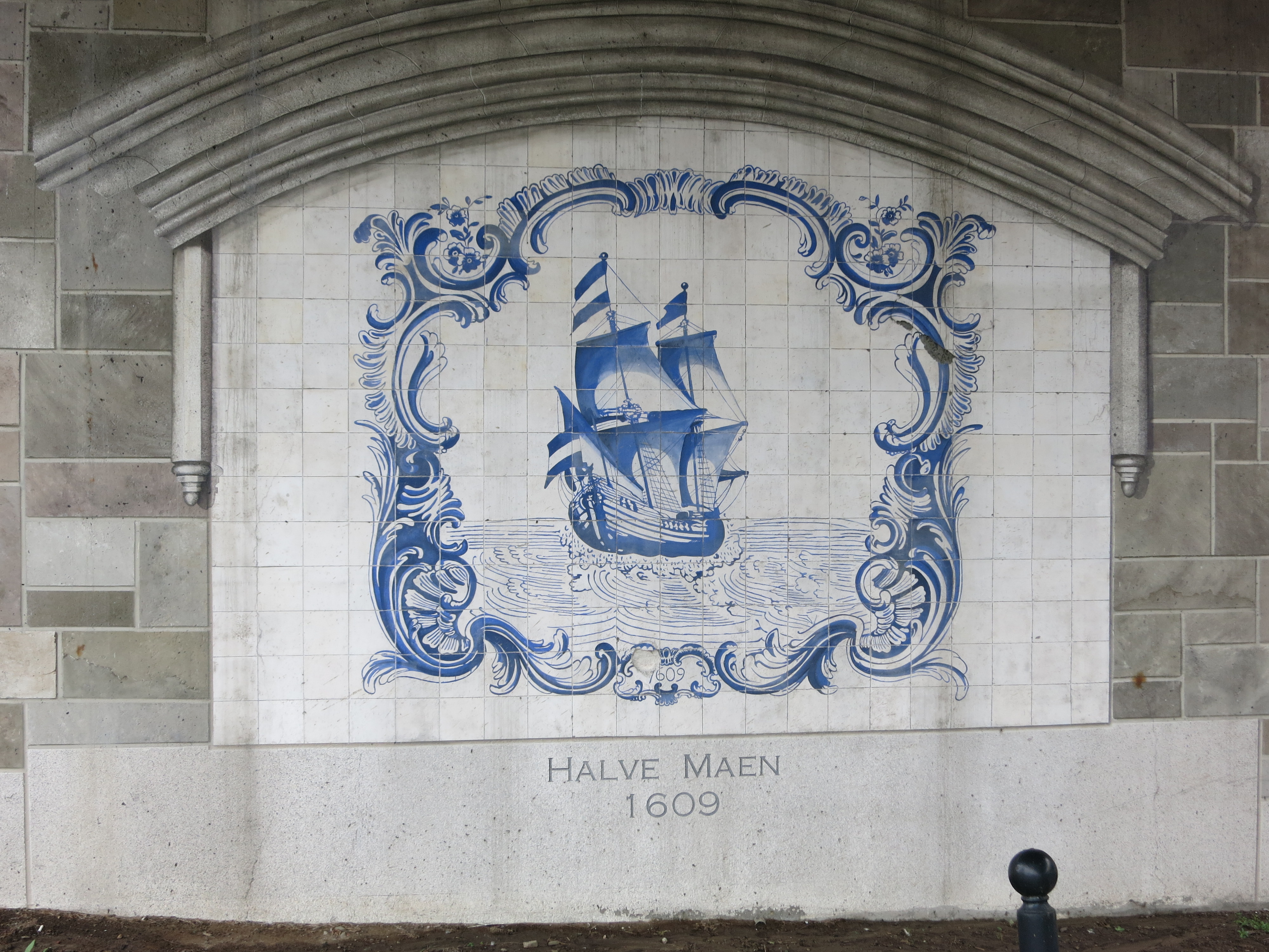
Albany has a long history. European settlement began with Henry Hudson’s 1609 voyage up the river which carries his name, looking for the fabled northwest passage to the Indies. It was at this point that the Hudson River became too narrow for him to continue and forced him to turn back downstream.
Memorial to Hudson’s ship the “Halve Maen” (the Half Moon), Albany, New York
That was four hundred years ago. Ages have gone by. Today Albany is a collection of distinct parts each associated with specific periods.
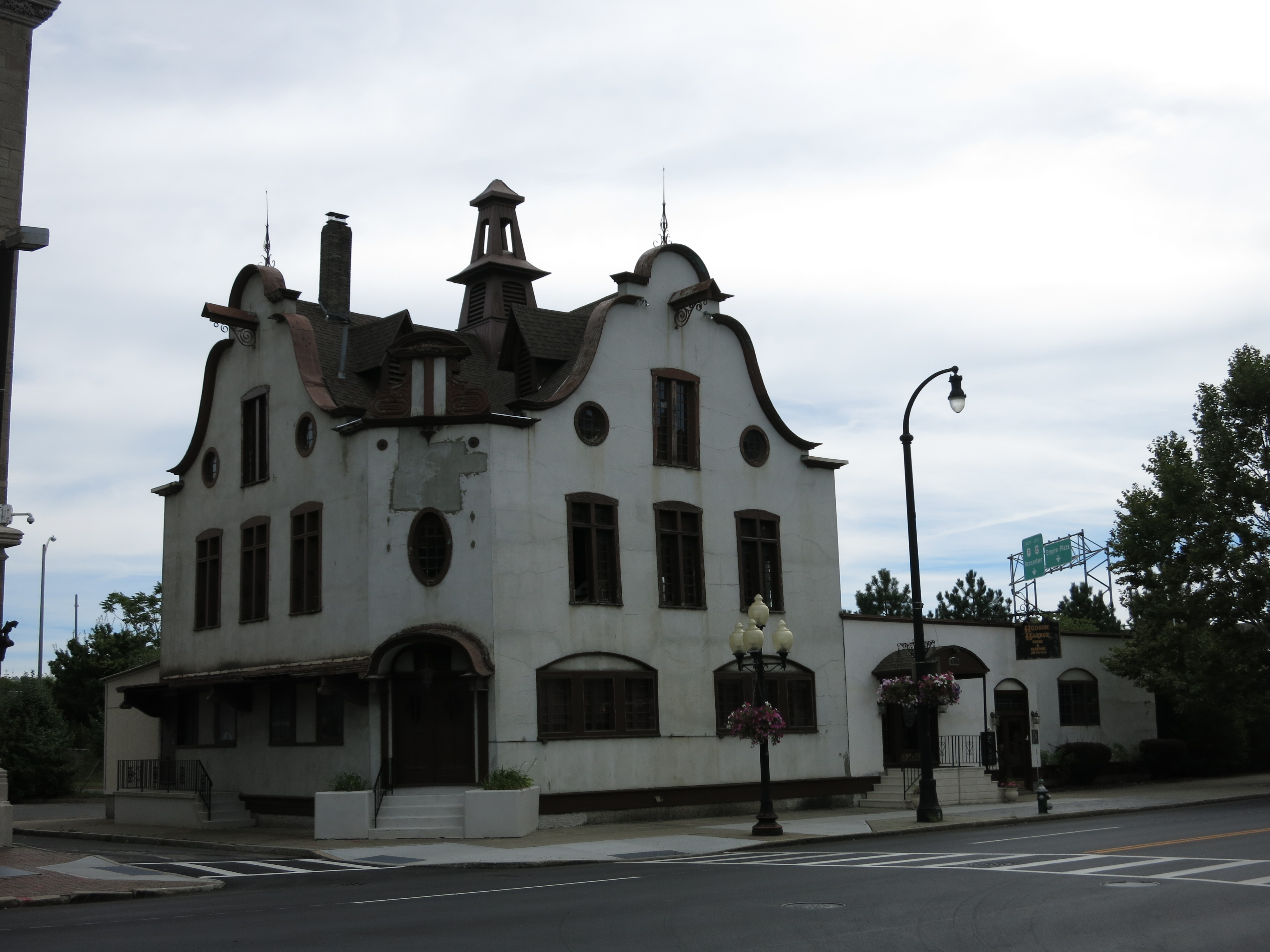
The oldest part of Albany is along the Hudson River where I found some Dutch architecture:
The Hudson Harbor Restaurant
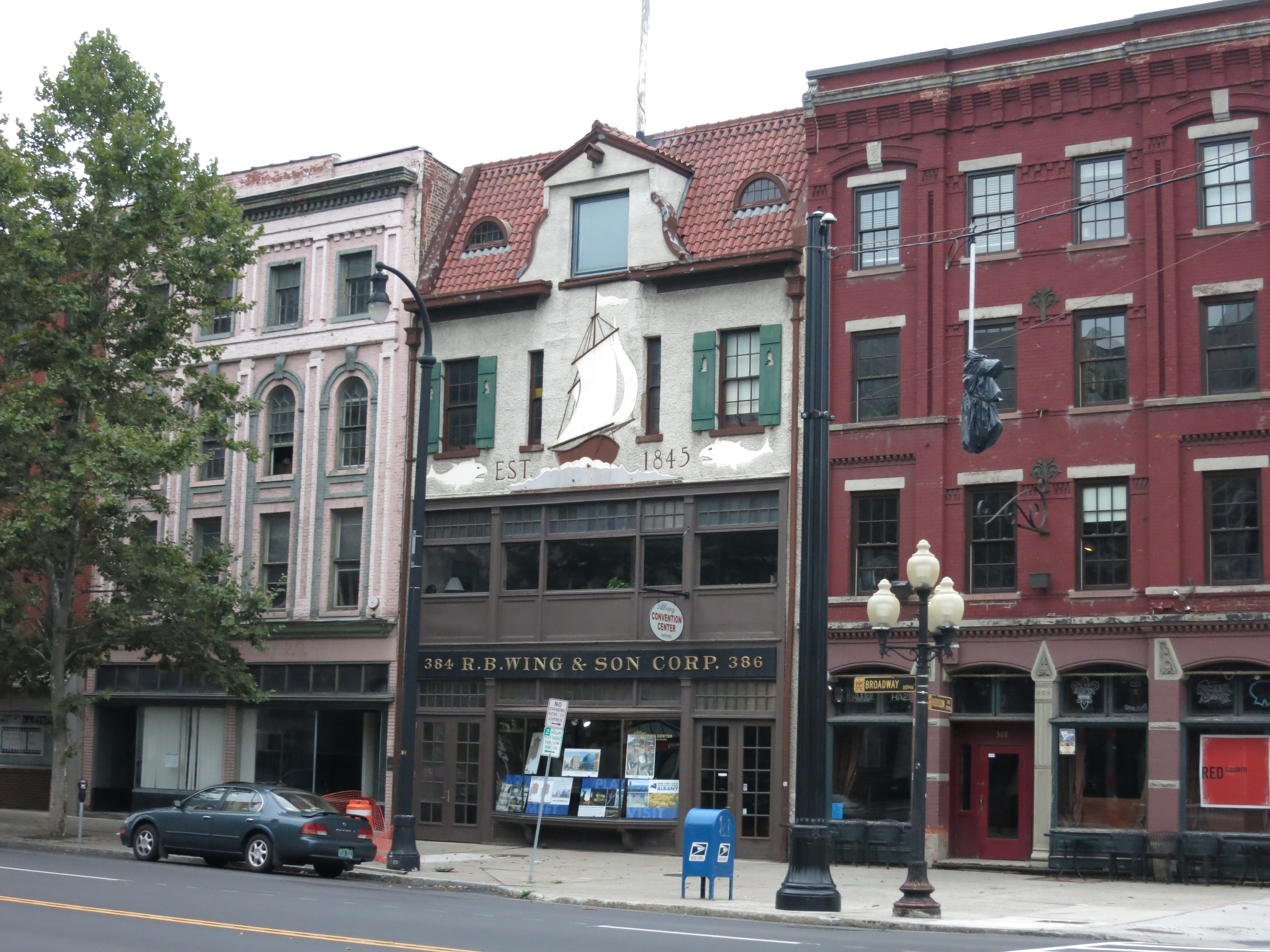
Old Business Block along Broadway, Albany, New York
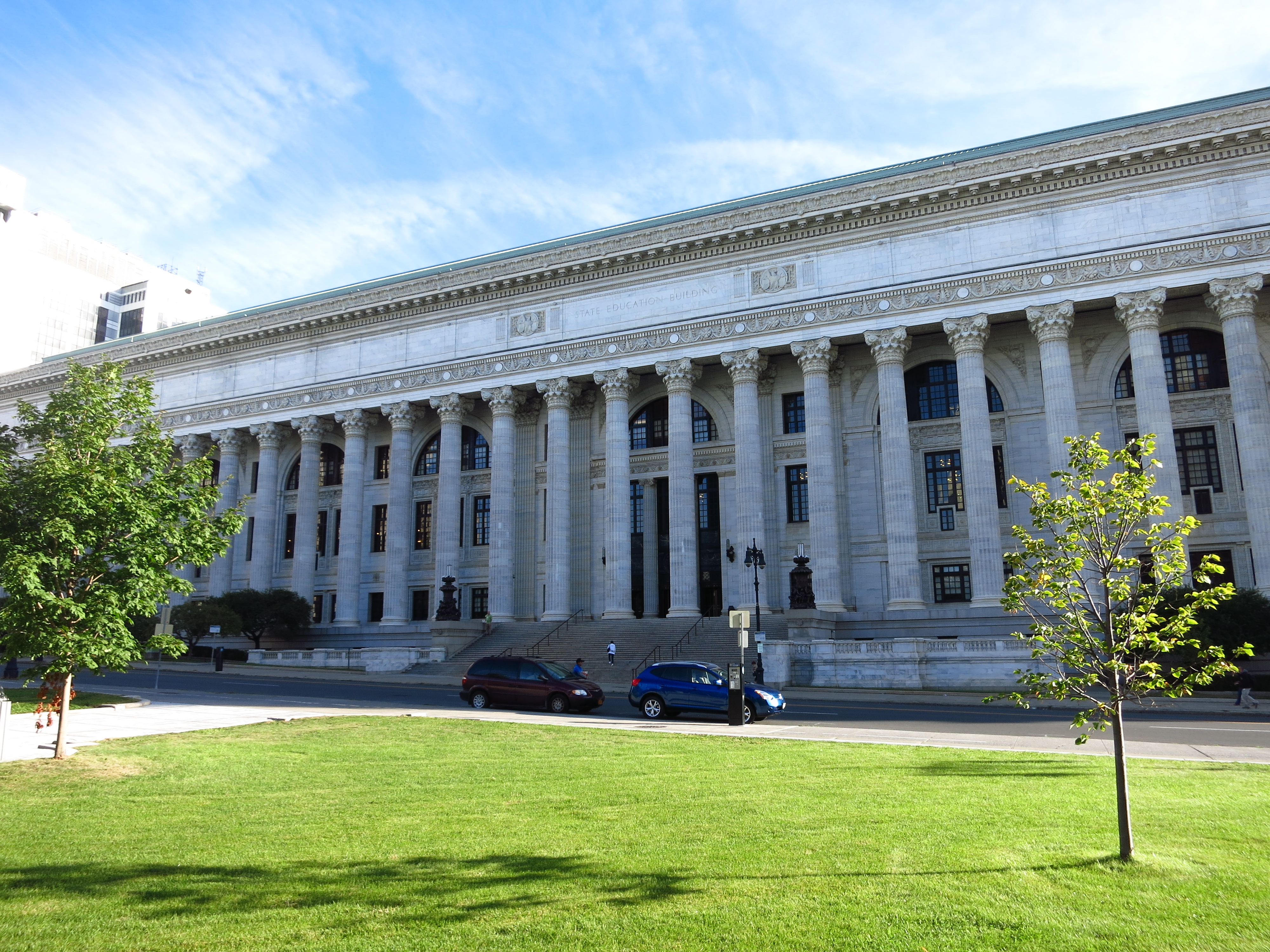
The state government buildings comprise the next part of town. Albany became the permanent New York State Capital in 1797. The Capitol building itself was completed in the 1870s and looks like a European palace. The statue in front is of Union Civil War hero (and Albany native) General Philip Sheridan.
New York State Capitol, Albany
The Classical columns on the building across the street from the Capitol make it look like a judicial building, but it’s not. This is the New York State Department of Education.
New York State Department of Education, Albany
The building’s classical columns suggest that New York Education occupies the place Justice occupied in classical thought. Considering that these are the offices of the bureaucracy, that’s a very scary thought.
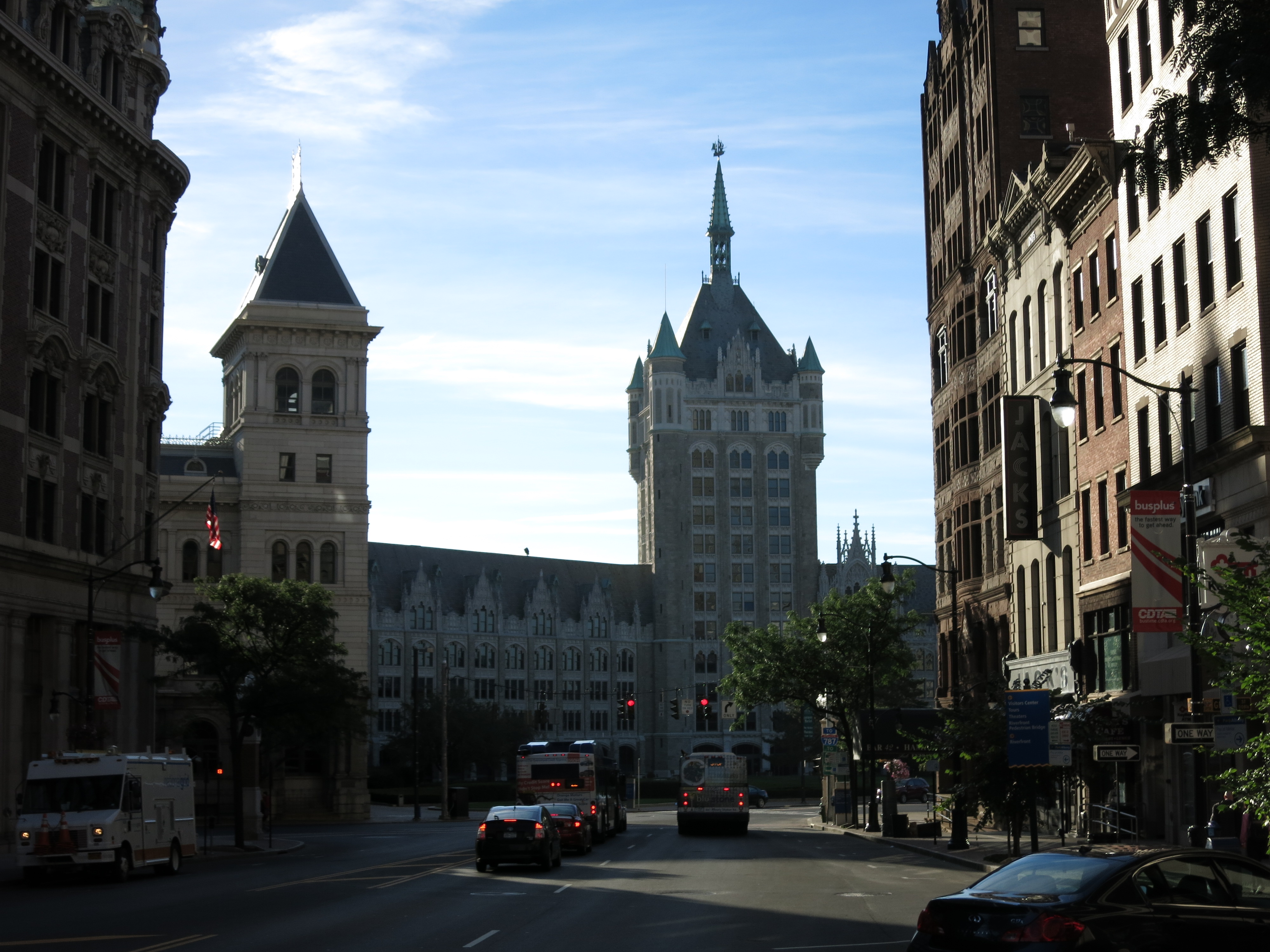
The administrative offices of SUNY (the State University of New York) are in an equally grandiose building at the foot of State Street. It’s too large to fit into one photograph. The Gothic towers are remarkable:
SUNY Administration Tower and Plaza, Albany
The word “education” is derived from Latin and means “to raise up from within.” By the two examples above it seems that the State of New York has built a grand central administration whose purpose can only be to “push down from above”, i.e., indoctrinate.
Moving on to the private sector, the next part of Albany is the Pearl Street commercial district. Many of these structures date from the Gilded Age of the late 1800s. Prominent towers and intricately carved red sandstone were the hallmarks of this age. The buildings were purposely ostentatious and opulent yet beautiful; they are still beautiful today.
Gilded Age building on North Pearl Street, Albany, New York
On the building below the corner, offices have alcoves jutting over the streets. That’s the Gilded Age’s way of saying, “let me be part of the city and as close as possible to it while still enjoying my comforts.” These days the Pearl Street Pub occupies the ground floor of this old block.
North Pearl Street and Pearl Street Pub, Albany, New York
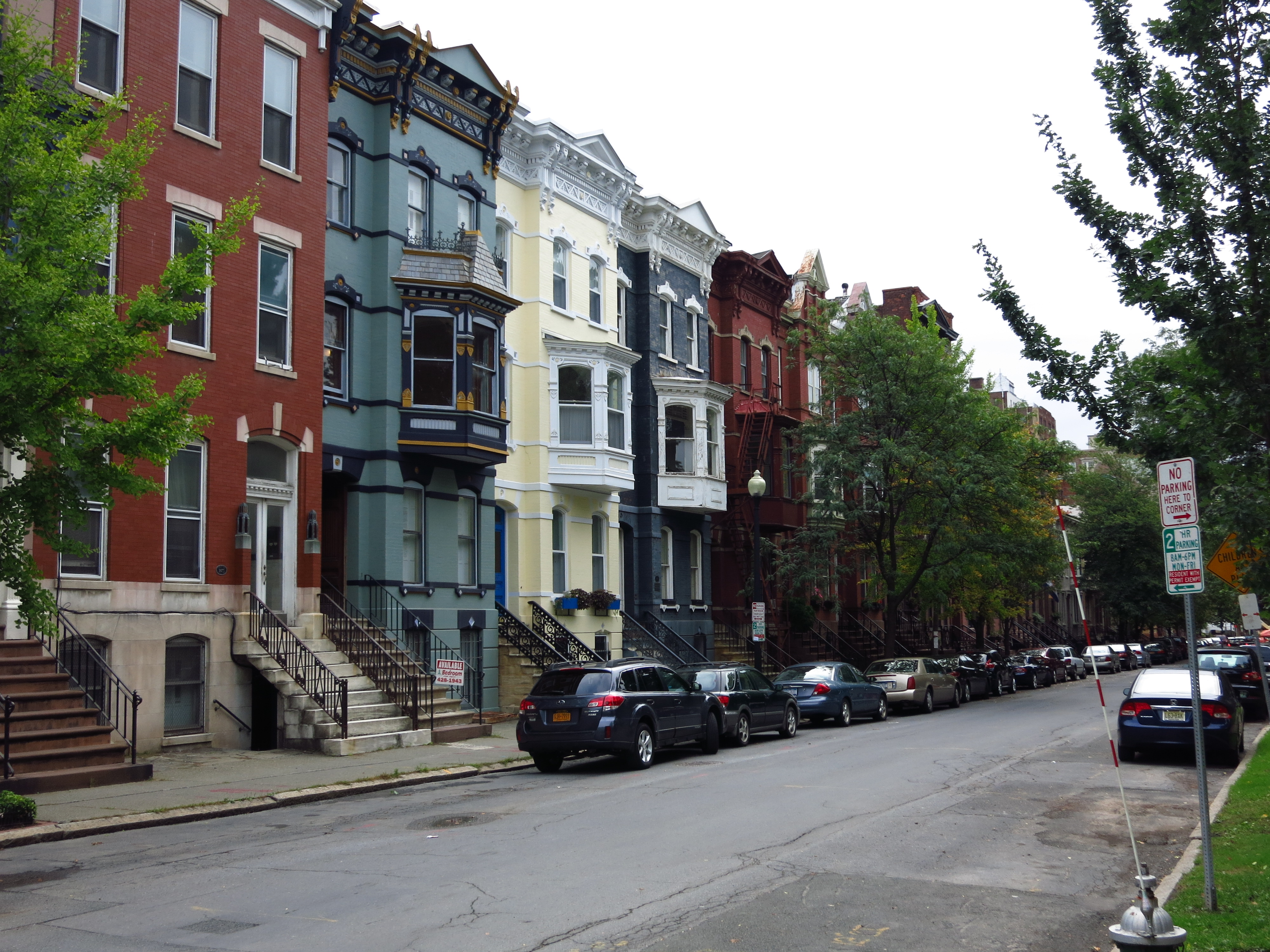
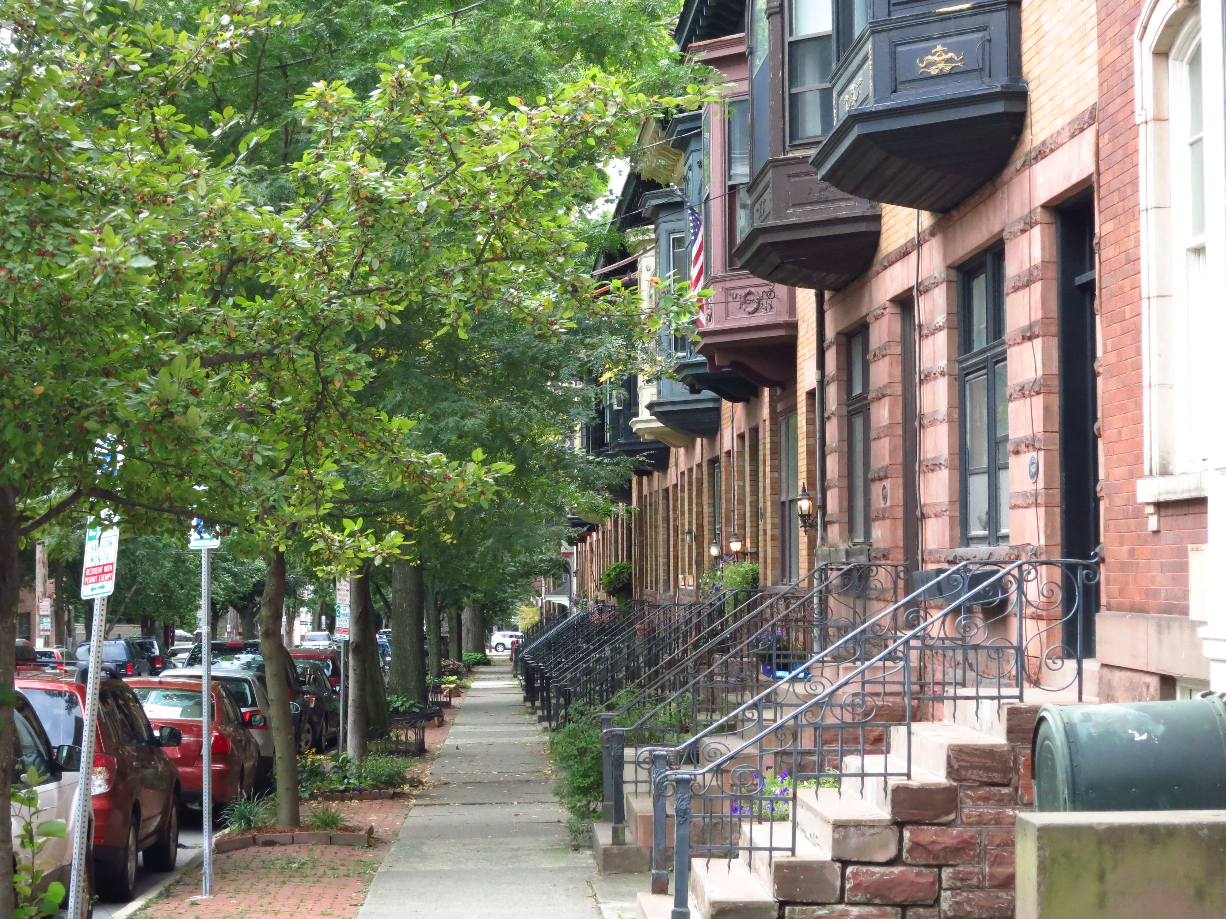
Next is an old residential area above the state Capitol, now occupied mainly by professionals. These are townhouses across from a city park. Many have intricately painted trim. Most have bay windows on the second floor:
Townhouses along State Street, Albany, New York
These townhouses could be mistaken for the Greenwich Village walk-ups found in Manhattan 150 miles downstream:
Walk-ups along State Street, Albany, New York
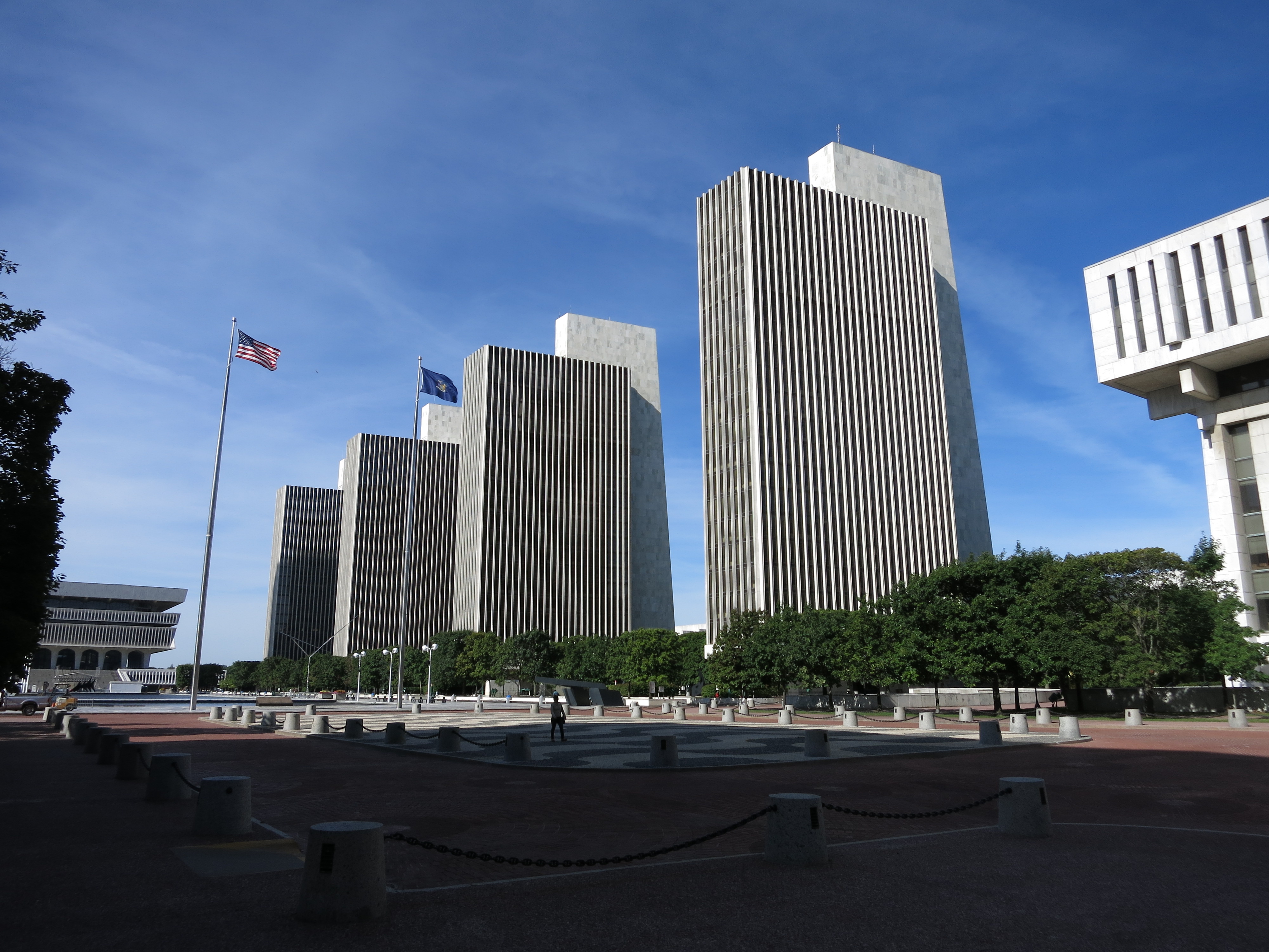
Finally, in some mistaken vision of the future, Albany shows you the Governor Nelson A. Rockefeller Empire State Plaza — a group of buildings that include four identical (and identically ugly) concrete towers, a tilted mushroom-type thing, and two stumpy 4-story buildings serving as bookends. The Plaza is integrated with the State Capitol across the street and houses various government agencies of the State of New York:
Governor Nelson A. Rockefeller Empire State Plaza, Albany, New York
Here’s the “tilted mushroom” building I mentioned, separated from the concrete towers by a wide pedestrian area. I didn’t bother to look up its real name or purpose. I don’t want to know.
The ’tilted mushroom’, Nelson A. Rockefeller Empire State Plaza, Albany, New York
The Plaza was the idea of Governor Nelson Rockefeller (Republican) who was served as New York Governor during the 1960s and U.S. Vice President under Gerald Ford in the mid-1970s. Rockefeller led the patrician wing of the Republican Party whose adherents at that time were known, unsurprisingly, as “Rockefeller Republicans.”
These days Rockefeller Republicans are called “RINOs”. No one likes them. In New York and elsewhere they are responsible for great government edifices just as domineering as those of the Education bureaucracy, which is dominated by the Democratic Party. The Rockefellers intend their efforts to be unique and inspiring, yet like the tilted mushroom they just leave me shaking my head.
A list of all photo posts from the American County Seats series in TimManBlog can be found here.
I’m trying to travel to all of America’s county courthouses, and each month a post about my visit to the most interesting county seats. It’s only a hobby — but donations are greatly appreciated to help defer my costs. Thanks, Tim